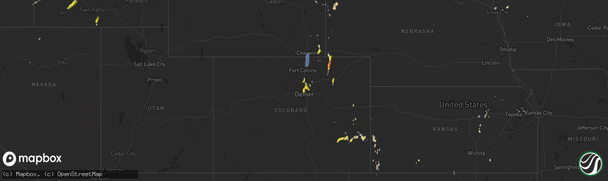
Hail Map on May 31, 2023
The weather event on May 31, 2023 includes Wind and Hail maps. 20 states and 339 cities were impacted and suffered possible damage. The total estimated number of properties impacted is 64,966.
Want more than just the map?
Turn this storm into a full workflow.
- Owner + property data so you know who to knock
- OnDemand branded weather history reports to win the "did we even have hail?" argument
- RoofTrace estimate so reps stop guessing numbers at the door
Bought this map? Upgrade within 7 days and we'll credit the $230. (10-15 min setup call)
Wind
Hail
64,966
Estimated number of impacted properties by a 1.00" hail or larger1,646
Estimated number of impacted properties by a 1.75" hail or larger1,401
Estimated number of impacted properties by a 2.50" hail or largerStates Impacted by Hail Map on May 31, 2023
Storm reports
South Dakota
| Date | Description |
|---|---|
| 05/31/20234:20 PM CDT | A local report indicates 1.75 inch wind near CUSTER |
| 05/31/20234:15 PM CDT | Mping report |
| 05/31/20234:15 PM CDT | A local report indicates 1.50 inch wind near CUSTER |
| 05/31/20234:13 PM CDT | Mping report |
| 05/31/20234:03 PM CDT | A local report indicates 1.25 inch wind near 1 ENE CUSTER |
| 05/31/20234:00 PM CDT | Hail breaking on impact. |
| 05/31/20233:50 PM CDT | Pea to quarter sized hail. |
| 05/31/20233:50 PM CDT | Mping report |
| 05/31/20233:43 PM CDT | A local report indicates 1.25 inch wind near CUSTER |
| 05/31/20231:51 PM CDT | Mesonet station 291 4n altamont |
Missouri
| Date | Description |
|---|---|
| 05/31/202312:45 PM CDT | Three trees down in mt zion north of ava on b highway. Time estimated via radar and fire department. |
Wisconsin
| Date | Description |
|---|---|
| 05/31/20234:17 PM CDT | A local report indicates 1.00 inch wind near 1 WSW Delafield |
| 05/31/20232:04 PM CDT | Public report relayed via wbay. |
New Mexico
| Date | Description |
|---|---|
| 05/31/20235:32 PM CDT | Lea county em reported barn flying into vehicle along highway 83 east of lovington. Exact location and time estimated by radar. |
| 05/31/20235:24 PM CDT | A local report indicates 1.00 inch wind near 2 N Chilili |
| 05/31/20235:22 PM CDT | Lea county em reports multiple downed power poles along arkansas junction and stiles rd south of lovington. Exact time estimated by radar. |
| 05/31/20235:19 PM CDT | A local report indicates 1.00 inch wind near 2 N Chilili |
| 05/31/20235:18 PM CDT | Lea county em reports multiple downed power poles along highway 18 in hobbs. Exact location and time estimated by radar. |
| 05/31/20235:12 PM CDT | A local report indicates 1.00 inch wind near 5 N Fort Sumner |
| 05/31/20235:10 PM CDT | Lea county em reports roof ripped off and downed powerline poles at hwy 62 and arkansas junction west of hobbs. Exact location and time estimated by radar. |
| 05/31/20234:42 PM CDT | Social media video of a tornado near the ghost town of lon... Nm along nm highway 247. Combination of radar and spotter reports show tornado likely lasted 5 to 10 more |
| 05/31/20234:30 PM CDT | Mesonet station fw9690 jal. |
| 05/31/20233:50 PM CDT | A local report indicates 1.00 inch wind near 2 E Midway |
| 05/31/20233:48 PM CDT | A local report indicates 1.25 inch wind near Dexter |
| 05/31/20233:41 PM CDT | Social media report of estimated quarter size hail on twitter at the roswell airport. |
| 05/30/20238:00 PM CDT | A local report indicates 1.50 inch wind near 20 SSE Mesa |
| 05/30/20237:48 PM CDT | A local report indicates 1.00 inch wind near 5 E Elida |
| 05/30/20237:47 PM CDT | A local report indicates 1.25 inch wind near 4 E Elida |
| 05/30/20237:12 PM CDT | Asos station kabq albuquerque intl sunport. Thunderstorm outflow producing a gap wind through the sandia/manzano mountains. |
Texas
| Date | Description |
|---|---|
| 05/31/20236:46 PM CDT | Corrects previous tstm wnd gst report from bootleg. Observed by wt mesonet. |
| 05/31/20236:46 PM CDT | Observed by wt mesonet. |
| 05/31/20234:17 PM CDT | A local report indicates 59 MPH wind near 9 NNE Sunray |
| 05/31/20234:16 PM CDT | A local report indicates 60 MPH wind near 3 SE Dumas |
| 05/31/20234:00 PM CDT | Mesonet station fw9691 mentone. |
| 05/31/20233:16 PM CDT | A local report indicates 60 MPH wind near 3 SW Dalhart |
| 05/30/20239:23 PM CDT | Corrects previous tstm wnd gst report from 2 wnw fritch. Measured at wt mesonet. |
| 05/30/20239:23 PM CDT | Measured at wt mesonet. |
| 05/30/20238:54 PM CDT | Observed at wt mesonet. |
| 05/30/20238:20 PM CDT | Observed at wt mesonet. |
| 05/30/20237:50 PM CDT | Observed by wt mesonet. |
Oklahoma
| Date | Description |
|---|---|
| 05/31/20236:10 PM CDT | A local report indicates 64 MPH wind near 7 W Hinton |
| 05/31/20236:05 PM CDT | A local report indicates 58 MPH wind near 7 W Hinton |
| 05/31/20236:00 PM CDT | A local report indicates 59 MPH wind near 7 W Hinton |
| 05/31/20234:55 PM CDT | A local report indicates 58 MPH wind near 2 E Goodwell |
Colorado
| Date | Description |
|---|---|
| 05/31/20235:27 PM CDT | Estimated 60+ mph wind gusts near windsor. Considerable blowing dust. |
| 05/31/20235:18 PM CDT | Trees and limbs down. Time approximated. |
| 05/31/20235:15 PM CDT | Report from mping: 3-inch tree limbs broken. |
| 05/31/20234:58 PM CDT | Update: numerous trees uprooted/knocked down across milliken. Several blocking roads. Heaviest damage on the west side of town near lola park. Large portion of tree dow |
| 05/31/20234:58 PM CDT | Large portion of tree down... Blocking southbound lane of alice ave. Numerous small limbs down in neighborhood. |
| 05/31/20234:55 PM CDT | Carport flipped over. Time estimated. Report from social media. |
| 05/31/20234:55 PM CDT | Asos station kgjt grand junction rgnl ap. |
| 05/31/20234:48 PM CDT | Report from mping: quarter |
| 05/31/20234:44 PM CDT | Report from mping: quarter |
| 05/31/20234:29 PM CDT | Report from mping: quarter |
| 05/31/20234:15 PM CDT | A local report indicates 1.50 inch wind near 2 SW Barr Lake |
| 05/31/20234:10 PM CDT | A local report indicates 1.00 inch wind near 1 WNW Northglenn |
| 05/30/20237:37 PM CDT | Report from mping: half dollar |
| 05/30/20237:23 PM CDT | A local report indicates 1.25 inch wind near 3 WNW Brush |
Wyoming
| Date | Description |
|---|---|
| 05/31/20236:34 PM CDT | A local report indicates 60 MPH wind near South Greeley High |
| 05/31/20236:28 PM CDT | Wydot mesonet station reported wind gust from thunderstorm outflow. |
| 05/31/20236:16 PM CDT | Mesonet station co128 us 85 wyoming border. |
Illinois
| Date | Description |
|---|---|
| 05/31/20233:53 PM CDT | A brief landspout tornado was visible in an open field based on two public photos... Including one from a drone. Exact location estimated from drone image. |
| 05/31/20233:45 PM CDT | Also approx 0.5 inch hail. |
| 05/31/20233:07 PM CDT | Pictures of large tree limbs downed at multiple locations near yorkville high school. Time estimated from radar. |
Cities Impacted by Hail Map on May 31, 2023
- Las Vegas, NM
- Clear Lake, SD
- Gary, SD
- Revillo, SD
- La Junta, CO
- McClave, CO
- Las Animas, CO
- Dexter, NM
- Roswell, NM
- Artesia, NM
- Custer, SD
- Denver, CO
- Thornton, CO
- Delafield, WI
- Commerce City, CO
- Brighton, CO
- Henderson, CO
- Westminster, CO
- Arvada, CO
- Fort Lupton, CO
- Broomfield, CO
- Elida, NM
- Maljamar, NM
- Darien, WI
- Delavan, WI
- Capitan, NM
- Hobbs, NM
- Fort Sumner, NM
- Taiban, NM
- Erie, CO
- Lovington, NM
- Corona, NM
- Frederick, CO
- Longmont, CO
- Firestone, CO
- Mead, CO
- Avalon, WI
- Edgewood, NM
- Tijeras, NM
- Hermosa, SD
- Santa Rosa, NM
- Platteville, CO
- Bruneau, ID
- Hydro, OK
- Lookeba, OK
- Hinton, OK
- King Hill, ID
- Cuervo, NM
- Denver City, TX
- Tatum, NM
- Plains, TX
- Pep, NM
- Nunn, CO
- Carr, CO
- Wellington, CO
- Fort Collins, CO
- Cheyenne, WY
- Barnesville, MN
- Long Prairie, MN
- Archer, IA
- Sheldon, IA
- Jordan Valley, OR
- Hartley, TX
- Channing, TX
- Wood Lake, MN
- Holly, CO
- Helenville, WI
- Sullivan, WI
- Douglas, OK
- Buffalo, WY
- Janesville, WI
- Clinton, WI
- Hasty, CO
- Astoria, SD
- Edinburgh, IN
- Franklin, IN
- Slayton, MN
- Chandler, MN
- Lake Wilson, MN
- Oconomowoc, WI
- Hospers, IA
- Glendive, MT
- Wabasso, MN
- Hinton, IA
- Lawton, IA
- Malone, WI
- Fond Du Lac, WI
- Abilene, KS
- Havre, MT
- Box Elder, MT
- Dalhart, TX
- Grass Range, MT
- Lewistown, MT
- Marietta, MN
- Madison, MN
- Canby, MN
- Cheraw, CO
- Jefferson, SD
- Marshall, MN
- Cottonwood, MN
- Rubicon, WI
- Hartford, WI
- Russell, MN
- Minneota, MN
- Lynd, MN
- Ghent, MN
- Irons, MI
- Waukesha, WI
- Yorkville, IL
- Strandburg, SD
- Goodwin, SD
- Glendale Heights, IL
- Wheaton, IL
- Carol Stream, IL
- White, SD
- Granite Falls, MN
- Echo, MN
- Maynard, MN
- Sacred Heart, MN
- Plano, IL
- Van Dyne, WI
- Okauchee, WI
- Dawson, MN
- Mentone, TX
- Junction City, KS
- Chapman, KS
- Great Falls, MT
- Dacono, CO
- De Pere, WI
- Ransom, IL
- Pewaukee, WI
- Meriden, KS
- Eunice, NM
- Lamar, CO
- Dousman, WI
- Hartland, WI
- Jal, NM
- Whiteland, IN
- Wiley, CO
- Eads, CO
- Benson, MN
- Elkhorn, WI
- Bison, OK
- Sheridan Lake, CO
- East Troy, WI
- Vanderbilt, MI
- Watertown, WI
- Starbuck, MN
- Lincoln, NM
- Hennessey, OK
- Vega, TX
- Boyd, MN
- Monee, IL
- Woodstock, IL
- Clara City, MN
- Haswell, CO
- Sergeant Bluff, IA
- Sioux City, IA
- Beaumont, TX
- Oelrichs, SD
- Kingsley, IA
- Remsen, IA
- Greenwood, IN
- Bargersville, IN
- Ixonia, WI
- Crawford, NE
- Brethren, MI
- Allenton, WI
- Mukwonago, WI
- Eagle, WI
- Wolverine, MI
- Iron Ridge, WI
- Neosho, WI
- Waynetown, IN
- North Prairie, WI
- Wales, WI
- Nashotah, WI
- Encino, NM
- Montevideo, MN
- Emington, IL
- Odell, IL
- Saunemin, IL
- Westfield, IA
- Lloyd, MT
- Chinook, MT
- Stanford, MT
- Denton, MT
- Milford, KS
- Jefferson, WI
- Deweyville, TX
- Texhoma, OK
- Manhattan, IL
- Peotone, IL
- Frankfort, IL
- Pyote, TX
- Barstow, TX
- Bliss, ID
- Scenic, SD
- Fairburn, SD
- Burns, WY
- Carpenter, WY
- Hereford, TX
- Friona, TX
- Adrian, TX
- Pine Bluffs, WY
- Buffalo Gap, SD
- Fort Morgan, CO
- Brush, CO
- Amarillo, TX
- Monahans, TX
- New Raymer, CO
- Wildorado, TX
- Bushnell, NE
- Canyon, TX
- Panhandle, TX
- Masterson, TX
- Fritch, TX
- Stinnett, TX
- Yeso, NM
- Kaukauna, WI
- Verndale, MN
- Tenstrike, MN
- Perry, KS
- Oskaloosa, KS
- Laporte, MN
- Bemidji, MN
- Flandreau, SD
- Gruver, TX
- Capitol, MT
- Ekalaka, MT
- Ribera, NM
- Harrison, NE
- Fairview, OK
- Syracuse, KS
- Brooks, MN
- Atlanta, KS
- Moorcroft, WY
- Nara Visa, NM
- Amistad, NM
- Johnson, KS
- Little Rock, IA
- Milnesand, NM
- Loma, MT
- Lame Deer, MT
- Ashland, MT
- Hammon, OK
- Lusk, WY
- Marshall, IL
- West Terre Haute, IN
- Lake George, MN
- Stanley, NM
- Sanborn, IA
- Ashton, IA
- Enterprise, AL
- Buna, TX
- Pine Ridge, SD
- Dumas, TX
- Spearman, TX
- Goodwell, OK
- Terre Haute, IN
- Merom, IN
- Fairbanks, IN
- Sullivan, IN
- Monon, IN
- Jonesboro, IN
- Fairmount, IN
- Osage, WY
- Newcastle, WY
- Lake View, IA
- Marion, IN
- Vona, CO
- Seibert, CO
- Moriarty, NM
- Kit Carson, CO
- Saint Xavier, MT
- Crow Agency, MT
- Waukomis, OK
- Crossroads, NM
- Richfield, KS
- Hope, KS
- Lodge Grass, MT
- Portales, NM
- Hawk Springs, WY
- Daleville, AL
- Chancellor, AL
- Plentywood, MT
- Riley, KS
- Tonganoxie, KS
- McLouth, KS
- Hillsboro, KS
- Buffalo, SD
- Tampa, KS
- Johnstown, CO
- Hudson, CO
- Birney, MT
- Albin, WY
- Turpin, OK
- Bovina, TX
- Texico, NM
- Wyola, MT
- Hines, MN
- Tyler, MN
- Onaga, KS
- Rolla, KS
- Leedey, OK
- Dover, OK
- Fairmont, OK
- Adrian, MN
- Farwell, TX
- Durham, KS
- Morgan City, LA
- Floyd, NM
- Melrose, NM
- Clovis, NM
- Big Falls, MN
- Higgins, TX
- Arnett, OK
- Follett, TX
- Miami, TX
- Taloga, OK
- Texhoma, TX
- Happy, TX
- Waldron, KS
- Minneola, KS
- Pampa, TX
- Sac City, IA
- Cheyenne, OK
- Grover, CO
- Brusett, MT
- Sayre, OK
- Canadian, TX
- Mitchell, NE
- Sunray, TX
- Mobeetie, TX
- Amorita, OK
- Perryton, TX
- Balko, OK
- Green Castle, MO
- Mcalister, NM