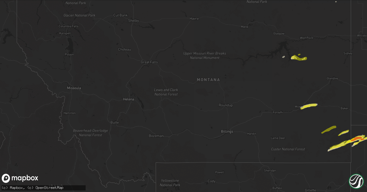
Hail Map in Montana on May 31, 2020
Get this storm
May 31 map
$229
one time, instant access
Download today. No call, no setup
Keep the $229
Bought the map and want the full workflow? Apply the entire $229 to a subscription within 7 days. None of it is wasted.
Every map, not just this one
This buys you this map. Subscription and you get every map we run, in the markets you choose from a few cities to whole states to nationwide. Plus real-time alerts the moment a storm fires.
Contact data
Name, contact info, occupancy, even credit band for addresses in the footprint. You go from where it hit to who to call.
Become the source they trust
Unlimited branding weather history reports on demand. You already have the documented answer ready for the property owner, and you are the one who showed up with it.
Property data and RoofTrace estimates
Pull up any address you have got, its value and the exact code rules for that jurisdiction, straight from One Click Code. Then RoofTrace estimates the squares, pitch, and roof value, priced the way you price.
Storm reports in Montana
Montana
| Date | Description |
|---|---|
| 05/31/20206:30 PM CDT | A local report indicates 1.00 inch wind near 13 E MILES CITY |
| 05/31/20206:20 PM CDT | Hail covered the ground. |
| 05/31/20206:06 PM CDT | A local report indicates 64 MPH wind near 3 WNW MILES CITY |
| 05/31/202011:09 AM CDT | Mesonet station cyfm8 hornet mountain. |
| 05/31/20209:45 AM CDT | Large healthy trees blown down across highway. Location is approximate. |
| 05/31/20209:30 AM CDT | Many large trees downed at lost johnny point campground. |
| 05/31/20209:25 AM CDT | Widespread damage occurred in the olney area from multiple trees falling down. Two homes were completely destroyed... Multiple power poles were brought down with a powe |
| 05/31/20209:25 AM CDT | Multiple trees fell over in the neighborhood. A residential roof was damaged in the process. |
| 05/31/20209:22 AM CDT | Asos station kgpi kalispell. |
| 05/31/20209:20 AM CDT | Falling trees damaged a truck and car in the happy valley area according to a facebook post. Location and time of lsr is approximate. |
| 05/31/20209:17 AM CDT | Very large pine tree fell over at a cemetary. |
| 05/31/20209:17 AM CDT | A power pole snapped in half... Causing power line to fall to the ground at the gas station at smiths. |
| 05/31/20209:17 AM CDT | A large pine tree fell on a house causing minor damage. |
| 05/31/20209:16 AM CDT | Trampoline flew across the yard and was damaged. Several other kids playhouses were damaged. |
| 05/31/20209:15 AM CDT | Public report of large... Healthy trees snapped off near base. |
| 05/31/20209:15 AM CDT | Sensor on top of mt sentinel at 5...026 ft. Winds were from the ssw. |
| 05/31/20209:15 AM CDT | Large pine tree blown over to the northeast direction at parkway dental. |
| 05/31/20209:11 AM CDT | Measured 78 mph wind gust with around 30 trees down and power is out. |
| 05/31/20209:10 AM CDT | Multiple trees down from the wind. Time is approximate. |
| 05/31/20209:00 AM CDT | Multiple trees down with some on power lines... Houses and vehicles. |
| 05/31/20209:00 AM CDT | Sensor on top of mt sentinel at 5...026 ft. Winds were from the ssw. |
| 05/31/20203:41 AM CDT | At 840 AM MDT, severe thunderstorms were located along a line extending from 22 miles southeast of Eureka to 12 miles southeast of West Glacier, moving northeast at 45 mph. HAZARD...60 mph wind gusts. SOURCE...Radar indicated. IMPACT...Expect damage to roofs, siding, and trees. Locations impacted include... West Glacier, Apgar, Stryker, Polebridge, Olney, Pinnacle, Lake McDonald, Radnor, Trailcreek, Martin City, Coram, Nyack and Hungry Horse. |
| 05/31/20203:14 AM CDT | At 813 AM MDT, severe thunderstorms were located along a line extending from 25 miles east of Libby to near Swan Lake, moving northeast at 55 mph. HAZARD...60 mph wind gusts. SOURCE...Radar indicated. IMPACT...Expect damage to roofs, siding, and trees. Locations impacted include... Kalispell, Evergreen, Whitefish, Columbia Falls, Woods Bay, Bigfork, Swan Lake, Somers, Blacktail, Stryker, Olney, Pinnacle, Radnor, Kila, Martin City, Coram, Lakeside, Creston, Lupfer and Essex. |
| 05/31/20202:24 AM CDT | At 723 PM MDT, a severe thunderstorm was located 8 miles east of Nelson Creek Rec Area, or 23 miles northwest of Circle, moving east at 25 mph. HAZARD...60 mph wind gusts and quarter size hail. SOURCE...Radar indicated. IMPACT...Hail damage to vehicles is expected. Expect wind damage to roofs, siding, and trees. Locations impacted include... Vida and Weldon. |
| 05/31/20201:58 AM CDT | At 658 PM MDT, a severe thunderstorm was located 7 miles east of Ridgeway, or 31 miles south of Ekalaka, moving east at 35 mph. HAZARD...60 mph wind gusts and quarter size hail. SOURCE...Radar indicated. IMPACT...Hail damage to vehicles is expected. Expect wind damage to roofs, siding, and trees. Locations impacted include... Ridgeway and Capitol. This replaces the warning previously in effect for this area. |
| 05/31/20201:44 AM CDT | At 643 PM MDT, a severe thunderstorm was located over Ekalaka, moving northeast at 40 mph. HAZARD...60 mph wind gusts and quarter size hail. SOURCE...Radar indicated. IMPACT...Hail damage to vehicles is expected. Expect wind damage to roofs, siding, and trees. Locations impacted include... Ekalaka, Belltower, Medicine Rocks State Park and Mill Iron. This replaces the warning previously in effect for this area. |
| 05/31/20201:31 AM CDT | At 630 PM MDT, a severe thunderstorm was located 12 miles west of Nelson Creek Rec Area, or 28 miles northeast of Jordan, moving east at 25 mph. HAZARD...60 mph wind gusts and quarter size hail. SOURCE...Radar indicated. IMPACT...Hail damage to vehicles is expected. Expect wind damage to roofs, siding, and trees. Locations impacted include... Nelson Creek Rec Area, Rock Creek Rec Area and Weldon. |
| 05/31/20201:18 AM CDT | At 617 PM MDT, a severe thunderstorm was located 17 miles southwest of Ridgeway, or 30 miles east of Broadus, moving east at 25 mph. HAZARD...60 mph wind gusts and quarter size hail. SOURCE...Radar indicated. IMPACT...Hail damage to vehicles is expected. Expect wind damage to roofs, siding, and trees. Locations impacted include... Ridgeway. |
| 05/31/20201:00 AM CDT | At 559 PM MDT, a severe thunderstorm was located 24 miles west of Ekalaka, moving east at 30 mph. HAZARD...60 mph wind gusts and quarter size hail. SOURCE...Radar indicated. IMPACT...Hail damage to vehicles is expected. Expect wind damage to roofs, siding, and trees. Locations impacted include... Ekalaka, Belltower and Powderville. |
| 05/31/202012:23 AM CDT | At 522 PM MDT, a severe thunderstorm was located 12 miles east of Miles City, moving northeast at 40 mph. HAZARD...60 mph wind gusts and quarter size hail. SOURCE...Radar indicated. IMPACT...Hail damage to vehicles is expected along I-94. Expect wind damage to roofs, siding, and trees. Locations impacted include... Terry, Fallon, Mildred and Zero. |
| 05/31/202012:10 AM CDT | At 508 PM MDT, a severe thunderstorm was located over Miles City, moving east at 40 mph. HAZARD...70 mph wind gusts and quarter size hail. SOURCE...Weather Station. A 55 kt gust was reported at the Miles City Airport. IMPACT...Hail damage to vehicles is expected. Expect considerable tree damage. Wind damage is also likely to mobile homes, roofs, and outbuildings. Locations impacted include... Miles City, Locate, Matthews Recreation Area and Strawberry Hill Recreation Area. |
| 05/30/20207:50 PM CDT | Reported at nelson creek recreation area. Time estimated by radar. |
| 05/30/20207:20 PM CDT | A local report indicates 1.00 inch wind near 8 NE HAMMOND |


