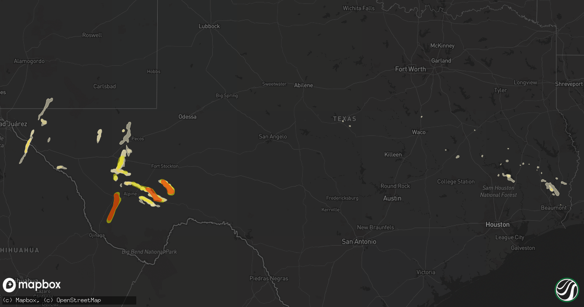
Hail Map in Texas on May 31, 2019
Get this storm
May 31 map
$229
one time, instant access
Download today. No call, no setup
Keep the $229
Bought the map and want the full workflow? Apply the entire $229 to a subscription within 7 days. None of it is wasted.
Every map, not just this one
This buys you this map. Subscription and you get every map we run, in the markets you choose from a few cities to whole states to nationwide. Plus real-time alerts the moment a storm fires.
Contact data
Name, contact info, occupancy, even credit band for addresses in the footprint. You go from where it hit to who to call.
Become the source they trust
Unlimited branding weather history reports on demand. You already have the documented answer ready for the property owner, and you are the one who showed up with it.
Property data and RoofTrace estimates
Pull up any address you have got, its value and the exact code rules for that jurisdiction, straight from One Click Code. Then RoofTrace estimates the squares, pitch, and roof value, priced the way you price.
Storm reports in Texas
Texas
| Date | Description |
|---|---|
| 05/31/20196:37 PM CDT | A local report indicates 1.00 inch wind near 13 NE FORT DAVIS |
| 05/31/20195:13 AM CDT | At 1013 PM CDT, a severe thunderstorm was located near Marfa, moving southeast at 25 mph. HAZARD...60 mph wind gusts and half dollar size hail. SOURCE...Radar indicated. IMPACT...Hail damage to vehicles is expected. Expect wind damage to roofs, siding, and trees. Locations impacted include... Marfa, Marfa Municipal Airport, Paisano Pass, Elephant Mountain Wildlife Management Area and Elephant Mountain. |
| 05/31/20194:22 AM CDT | At 922 PM CDT, a severe thunderstorm was located 12 miles north of Toyah, moving northeast at 25 mph. HAZARD...Ping pong ball size hail and 60 mph wind gusts. SOURCE...Radar indicated. IMPACT...People and animals outdoors will be injured. Expect hail damage to roofs, siding, windows, and vehicles. Expect wind damage to roofs, siding, and trees. Locations impacted include... Mentone and Slash Ranch. |
| 05/31/20194:12 AM CDT | At 912 PM CDT, a severe thunderstorm was located 11 miles south of Valentine, or 23 miles northeast of Candelaria, moving east at 25 mph. HAZARD...Golf ball size hail and 60 mph wind gusts. SOURCE...Radar indicated. IMPACT...People and animals outdoors will be injured. Expect hail damage to roofs, siding, windows, and vehicles. Expect wind damage to roofs, siding, and trees. Locations impacted include... Ryan, Marfa and Marfa Municipal Airport. |
| 05/31/20193:56 AM CDT | At 855 PM CDT, a severe thunderstorm was located 7 miles northwest of Toyah, moving northwest at 35 mph. HAZARD...60 mph wind gusts and half dollar size hail. SOURCE...Radar indicated. IMPACT...Hail damage to vehicles is expected. Expect wind damage to roofs, siding, and trees. Locations impacted include... Toyah.This includes Interstate 20 between mile markers 15 and 28. |
| 05/31/20193:28 AM CDT | At 828 PM CDT, a severe thunderstorm was located near Marathon, or 32 miles southeast of Alpine, moving southeast at 20 mph. HAZARD...Ping pong ball size hail and 60 mph wind gusts. SOURCE...Radar indicated. IMPACT...People and animals outdoors will be injured. Expect hail damage to roofs, siding, windows, and vehicles. Expect wind damage to roofs, siding, and trees. Locations impacted include... Sanderson and Marathon. |
| 05/31/20192:41 AM CDT | At 741 PM CDT, a severe thunderstorm was located 9 miles west of Balmorhea State Park, or 21 miles southeast of Kent, moving north at 20 mph. HAZARD...Golf ball size hail and 60 mph wind gusts. SOURCE...Radar indicated. IMPACT...People and animals outdoors will be injured. Expect hail damage to roofs, siding, windows, and vehicles. Expect wind damage to roofs, siding, and trees. Locations impacted include... Balmorhea, Balmorhea State Park and Toyahvale. This includes the following highways... Interstate 10 between mile markers 191 and 209. Interstate 20 between mile markers 7 and 20. |
| 05/31/20192:34 AM CDT | At 734 PM MDT, a severe thunderstorm was located 19 miles southeast of Cornudas, moving northeast at 25 mph. HAZARD...60 mph wind gusts and half dollar size hail. SOURCE...Radar indicated. IMPACT...Hail damage to vehicles is expected. Expect wind damage to roofs, siding, and trees. Locations impacted include... Cornudas, Highway 61-182 by Cornudas, Salt Flat and Sunset Ranches. |
| 05/31/20192:33 AM CDT | At 733 PM CDT, a severe thunderstorm was located 15 miles north of Valentine, or 24 miles southeast of Van Horn, moving north at 25 mph. HAZARD...Golf ball size hail and 60 mph wind gusts. SOURCE...Radar indicated. IMPACT...People and animals outdoors will be injured. Expect hail damage to roofs, siding, windows, and vehicles. Expect wind damage to roofs, siding, and trees. Locations impacted include... Plateau.This includes Interstate 10 between mile markers 149 and 175. |
| 05/31/20192:27 AM CDT | At 727 PM CDT, a severe thunderstorm was located 12 miles east of Marathon, or 36 miles east of Alpine, moving southeast at 10 mph. HAZARD...60 mph wind gusts and half dollar size hail. SOURCE...Radar indicated. IMPACT...Hail damage to vehicles is expected. Expect wind damage to roofs, siding, and trees. Locations impacted include... Marathon. |
| 05/31/20191:56 AM CDT | At 656 PM CDT, a severe thunderstorm was located near McDonald Observatory, or 10 miles west of Fort Davis, moving north at 35 mph. HAZARD...60 mph wind gusts and half dollar size hail. SOURCE...Radar indicated. IMPACT...Hail damage to vehicles is expected. Expect wind damage to roofs, siding, and trees. Locations impacted include... McDonald Observatory, Davis Mountains State Park, Buffalo Trail Scout Camp and Black Mountain. |
| 05/31/20191:31 AM CDT | At 630 PM CDT, a severe thunderstorm was located 12 miles north of Marathon, or 28 miles east of Alpine, moving southeast at 20 mph. HAZARD...60 mph wind gusts and quarter size hail. SOURCE...Radar indicated. IMPACT...Hail damage to vehicles is expected. Expect wind damage to roofs, siding, and trees. Locations impacted include... Marathon. |
| 05/31/20191:09 AM CDT | At 608 AM CDT, severe thunderstorms were located along a line extending from near Rowden to near Burkett to near Valera, moving southeast at 45 mph. HAZARD...60 mph wind gusts and quarter size hail. SOURCE...Radar indicated. IMPACT...Hail damage to vehicles is expected. Expect wind damage to roofs, siding, and trees. Severe thunderstorms will be near... Santa Anna and Burkett around 615 AM CDT. Grosvenor and Cross Cut around 625 AM CDT. Lake Brownwood State Park, Lake Brownwood, Byrds and Lake Brownwood Near Thrifty around 630 AM CDT. May around 640 AM CDT. Early around 645 AM CDT.Other locations impacted by these severe thunderstorms include Owens,Thrifty, Indian Creek, Us-283 Near The Coleman-Callahan County Line, Echo and Hords Creek Reservoir. |
| 05/31/201912:57 AM CDT | At 556 PM CDT, a severe thunderstorm was located 26 miles northwest of Sanderson, moving southeast at 20 mph. HAZARD...60 mph wind gusts and half dollar size hail. SOURCE...Radar indicated. IMPACT...Hail damage to vehicles is expected. Expect wind damage to roofs, siding, and trees. Locations impacted include... Sanderson. |
| 05/31/201912:40 AM CDT | At 540 PM CDT, a severe thunderstorm was located 19 miles south of Marfa, moving northeast at 35 mph. HAZARD...Ping pong ball size hail and 60 mph wind gusts. SOURCE...Radar indicated. IMPACT...People and animals outdoors will be injured. Expect hail damage to roofs, siding, windows, and vehicles. Expect wind damage to roofs, siding, and trees. Locations impacted include... Alpine, Marfa, Fort Davis, Camp Mitre Peak, Alpine-Casparis Municipal Airport, Marfa Municipal Airport and Paisano Pass. |
| 05/31/201912:28 AM CDT | At 527 PM CDT, a severe thunderstorm was located 17 miles northeast of Alpine, moving southeast at 20 mph. HAZARD...60 mph wind gusts and quarter size hail. SOURCE...Radar indicated. IMPACT...Hail damage to vehicles is expected. Expect wind damage to roofs, siding, and trees. Locations impacted include... Marathon. |
| 05/31/201912:07 AM CDT | At 506 PM MDT, a severe thunderstorm was located 9 miles southwest of Fort Hancock, moving northeast at 20 mph. HAZARD...60 mph wind gusts and quarter size hail. SOURCE...Radar indicated. IMPACT...Hail damage to vehicles is expected. Expect wind damage to roofs, siding, and trees. Locations impacted include... Fort Hancock, Acala and McNary. |
| 05/31/201912:01 AM CDT | At 500 PM CDT, a severe thunderstorm was located near Shafter. A second severe thunderstorm was located near Casa Piedra. Both storms were moving to the northeast at 30 mph. HAZARD...Golf ball size hail and 70 mph wind gusts. SOURCE...Radar indicated. IMPACT...People and animals outdoors will be injured. Expect hail damage to roofs, siding, windows, and vehicles. Expect considerable tree damage. Wind damage is also likely to mobile homes, roofs, and outbuildings. Locations impacted include... Shafter and Casa Piedra. |
| 05/31/201912:00 AM CDT | At 500 PM CDT, a severe thunderstorm was located 22 miles south of Fort Stockton, moving southeast at 10 mph. HAZARD...60 mph wind gusts and half dollar size hail. SOURCE...Radar indicated. IMPACT...Hail damage to vehicles is expected. Expect wind damage to roofs, siding, and trees. Locations impacted include... Sierra Madera. |
| 05/30/201911:41 PM CDT | At 440 AM CDT, a severe thunderstorm was located near View, or 15 miles southwest of Abilene, moving east at 35 mph. HAZARD...60 mph wind gusts. SOURCE...Radar indicated. IMPACT...Expect damage to roofs, siding, and trees. This severe thunderstorm will be near... Caps around 445 AM CDT. Wylie and Buffalo Gap around 450 AM CDT. Tuscola around 455 AM CDT. Dudley around 510 AM CDT. Eula around 515 AM CDT. Oplin around 520 AM CDT.Other locations impacted by this severe thunderstorm include LakeAbilene, Camp Tonkawa, Kirby Lake and Ovalo.This includes Interstate 20 between Mile Markers 271 and 296. |
| 05/30/201911:27 PM CDT | At 427 PM CDT, a severe thunderstorm was located 7 miles northeast of Camp Mitre Peak, or 9 miles east of Fort Davis, moving east at 15 mph. HAZARD...60 mph wind gusts and half dollar size hail. SOURCE...Radar indicated. IMPACT...Hail damage to vehicles is expected. Expect wind damage to roofs, siding, and trees. This severe thunderstorm will remain over mainly rural areas of west central Pecos, northwestern Brewster and southeastern Jeff Davis Counties. |
| 05/30/201911:13 PM CDT | At 412 PM CDT, a severe thunderstorm was located 7 miles southwest of Big Bend Ranch State Park, moving northeast at 20 mph. HAZARD...Ping pong ball size hail and 60 mph wind gusts. SOURCE...Radar indicated. IMPACT...People and animals outdoors will be injured. Expect hail damage to roofs, siding, windows, and vehicles. Expect wind damage to roofs, siding, and trees. Locations impacted include... Lajitas, Big Bend Ranch State Park, Casa Piedra, Redford and Barton Warnock Environmental Educational Center. |
| 05/30/201911:06 PM CDT | At 405 AM CDT, a severe thunderstorm was located near Trent, or 11 miles east of Sweetwater, moving east at 45 mph. HAZARD...60 to 65 mph wind gusts. SOURCE...Radar indicated. IMPACT...Expect damage to roofs, siding, and trees. This severe thunderstorm will be near... Trent around 410 AM CDT. Merkel around 420 AM CDT. Tye and View around 430 AM CDT. Buffalo Gap, Caps and Dyess Afb around 435 AM CDT. Wylie around 440 AM CDT.Other locations impacted by this severe thunderstorm include Hodges,Lake Abilene, Camp Tonkawa, Camp Butman, Stith, Truby, TheIntersection Of Highway 70 And Ranch Road 53, Lake Sweetwater andOvalo.This includes Interstate 20 between Mile Markers 245 and 283. |
| 05/30/201910:25 PM CDT | A local report indicates 1.00 inch wind near 4 SSW MARFA |
| 05/30/201910:20 PM CDT | At 319 AM CDT, a severe thunderstorm was located 7 miles northeast of Wastella, or 10 miles north of Roscoe, moving east at 35 mph. HAZARD...60 mph wind gusts. SOURCE...Radar indicated. IMPACT...Expect damage to roofs, siding, and trees. This severe thunderstorm will be near... Sweetwater and Longworth around 340 AM CDT.Other locations impacted by this severe thunderstorm include Gannon,Lake Sweetwater, Busby, Capitola, Us-180 Near The Fisher-Scurry County Line and Us-84 Near The Nolan-Fisher County Line.This includes Interstate 20 between Mile Markers 239 and 255. |
| 05/30/20198:17 PM CDT | At 116 AM CDT, a severe thunderstorm was located 17 miles south of Chupadera Ranch Airport, or 38 miles west of Encinal, moving east at 15 mph. HAZARD...60 mph wind gusts and half dollar size hail. SOURCE...Radar indicated. IMPACT...Hail damage to vehicles is expected. Expect wind damage to roofs, siding, and trees. This severe thunderstorm will remain over mainly rural areas of northwestern Webb County. |
| 05/30/20198:08 PM CDT | Structural damage with roof off on west side of town. |
| 05/30/20198:08 PM CDT | A local report indicates 1.75 inch wind near MARATHON |
| 05/30/20198:05 PM CDT | A local report indicates 1.00 inch wind near 1 E MARATHON |
| 05/30/20198:05 PM CDT | At least 4 power poles snapped off just above the ground along us 90. Active transformer fire. |
All States Impacted by Hail Map on May 31, 2019
Cities Impacted by Hail Map on May 31, 2019
- Black Hawk, SD
- Goldsboro, NC
- Clinton, NC
- Buna, TX
- Kannapolis, NC
- Whitakers, NC
- Rocky Mount, NC
- Battleboro, NC
- Nashville, NC
- Hyden, KY
- Thousandsticks, KY
- Holly Springs, NC
- Fuquay Varina, NC
- Fort Pierre, SD
- Saint Martinville, LA
- Charleston, WV
- Nitro, WV
- Poca, WV
- Free Soil, MI
- Loris, SC
- Rapid City, SD
- Hurt, VA
- Pinetops, NC
- Macclesfield, NC
- Marathon, TX
- Deep Run, NC
- Randleman, NC
- High Point, NC
- Lumberton, NC
- Bronson, IA
- Copeland, KS
- Plains, KS
- Meade, KS
- Sublette, KS
- Montezuma, KS
- Enfield, NC
- Hollister, NC
- Hobgood, NC
- Tarboro, NC
- Oak City, NC
- Fort Meade, SD
- Sturgis, SD
- Waupaca, WI
- Richmond, VA
- Chesterfield, VA
- Elkin, NC
- State Road, NC
- Mebane, NC
- Hillsborough, NC
- Efland, NC
- Sierra Blanca, TX
- Fort Davis, TX
- Ainsworth, NE
- Long Pine, NE
- Bassett, NE
- Fort Hancock, TX
- Williamston, NC
- Jamesville, NC
- Raleigh, NC
- Zebulon, NC
- Bunn, NC
- Louisburg, NC
- Spring Hope, NC
- Reidsville, NC
- Boonville, NC
- Jonesville, NC
- Albany, OH
- Wilkesville, OH
- Galivants Ferry, SC
- Nichols, SC
- South Charleston, WV
- Saint Albans, WV
- Dunbar, WV
- Danbury, NC
- Westfield, NC
- Murfreesboro, NC
- Como, NC
- Whitewood, SD
- Vale, SD
- Mineral, VA
- Montpelier, VA
- Beaverdam, VA
- Bumpass, VA
- Chapel Hill, NC
- Georgetown, OH
- Scranton, NC
- Fairfield, NC
- Columbia, NC
- Engelhard, NC
- Belhaven, NC
- Dover, NC
- Jenison, MI
- Myrtle Beach, SC
- Apex, NC
- Goldston, NC
- Siler City, NC
- Moncure, NC
- Sanford, NC
- Bear Creek, NC
- Livingston, TX
- Waves, NC
- Saint Paul, MN
- Stillwater, MN
- Marine On Saint Croix, MN
- Hugo, MN
- Glenwood City, WI
- Kill Devil Hills, NC
- Nags Head, NC
- Two Rivers, WI
- Zuni, VA
- Adrian, MN
- New Castle, VA
- Lane, SC
- Salters, SC
- Dequincy, LA
- Rosendale, WI
- Burgaw, NC
- Currie, NC
- Carrsville, VA
- Franklin, VA
- Courtland, VA
- Newsoms, VA
- Bladenboro, NC
- Madison, NC
- Mayodan, NC
- Ruffin, NC
- Blanch, NC
- Stoneville, NC
- Yanceyville, NC
- Pelham, NC
- Leasburg, NC
- Snow Hill, NC
- La Grange, NC
- Pikeville, NC
- Fremont, NC
- Walstonburg, NC
- Aurora, NC
- Hobucken, NC
- Kinston, NC
- Frisco, NC
- Edward, NC
- Grimesland, NC
- Wilson, NC
- Kenly, NC
- Grifton, NC
- Cove City, NC
- Lowland, NC
- Chocowinity, NC
- Buxton, NC
- Roper, NC
- Lucama, NC
- Washington, NC
- Swanquarter, NC
- Stantonsburg, NC
- Greenville, NC
- Farmville, NC
- Stokes, NC
- Winterville, NC
- Blounts Creek, NC
- Creswell, NC
- Plymouth, NC
- Ayden, NC
- Hookerton, NC
- Ernul, NC
- Bath, NC
- Vanceboro, NC
- Pantego, NC
- Bethel, NC
- Pinetown, NC
- Robersonville, NC
- Hatteras, NC
- Hamptonville, NC
- Yadkinville, NC
- Grand Junction, IA
- Rippey, IA
- Walnut Cove, NC
- Sandy Ridge, NC
- Malta, ID
- Castalia, NC
- Alcester, SD
- Ronda, NC
- Cary, NC
- Eagle Butte, SD
- Wood, SD
- Atlantic, IA
- Manitowoc, WI
- Vidor, TX
- Tabor City, NC
- Liberty, NC
- Roanoke, VA
- Mooresville, NC
- Davidson, NC
- Concord, NC
- Winston Salem, NC
- Kernersville, NC
- Colfax, NC
- Oak Ridge, NC
- Greensboro, NC
- Piedmont, SD
- Valders, WI
- Cleveland, WI
- Newton, WI
- Ponca, NE
- Jefferson, SD
- Savannah, GA
- Fort Stockton, TX
- Colome, SD
- Winner, SD
- Pittsboro, NC
- Garner, NC
- Burlington, NC
- Alpine, TX
- Siloam, NC
- Ararat, NC
- West Jefferson, OH
- Galloway, OH
- Hilliard, OH
- Mullin, TX
- Middlesex, NC
- Selma, NC
- Corolla, NC
- Jarvisburg, NC
- Kitty Hawk, NC
- Grandy, NC
- Aulander, NC
- Kelford, NC
- Rich Square, NC
- Roxobel, NC
- Lewiston Woodville, NC
- Scotland Neck, NC
- Birchwood, WI
- Madison, MN
- Elliston, VA
- Boones Mill, VA
- Salem, VA
- Blacksburg, VA
- Halifax, NC
- Stony Creek, VA
- McKenney, VA
- Hurdle Mills, NC
- Roxboro, NC
- Cadillac, MI
- Marion, MI
- McBain, MI
- Lake City, MI
- Saltville, VA
- Balmorhea, TX
- Supply, NC
- Gretna, VA
- De Smet, SD
- Woodland, NC
- East Bend, NC
- Pinnacle, NC
- Clio, SC
- Maxton, NC
- Dillon, SC
- Hamer, SC
- Blenheim, SC
- McColl, SC
- Little Rock, SC
- Rowland, NC
- Bennettsville, SC
- Edmore, MI
- Gays Creek, KY
- Buckhorn, KY
- Ramseur, NC
- Seagrove, NC
- Northport, MI
- Baldwin, MI
- Darlington, SC
- Society Hill, SC
- Silsbee, TX
- Clintonville, WI
- Bear Creek, WI
- Mishicot, WI
- Trinity, TX
- Newell, SD
- Ahoskie, NC
- Fountain, NC
- Conway, NC
- Flemingsburg, KY
- Maysville, KY
- Mayslick, KY
- Lincolnton, NC
- Port Orange, FL
- New Smyrna Beach, FL
- Hot Springs, VA
- Millboro, VA
- Warm Springs, VA
- Goshen, VA
- Campo, CO
- Normangee, TX
- White, SD
- Ludington, MI
- Manistee, MI
- Altavista, VA
- Lynch Station, VA
- Gladys, VA
- Pittsville, VA
- Long Island, VA
- Huddleston, VA
- Seven Springs, NC
- Thompsonville, MI
- Beulah, MI
- Wendover, UT
- Mosinee, WI
- Madrid, IA
- Keshena, WI
- Suring, WI
- Bonduel, WI
- Shiocton, WI
- Black Creek, WI
- Amherst, WI
- Conway, SC
- Saint Charles, MN
- Dover, MN
- Mount Airy, NC
- Pilot Mountain, NC
- Dobson, NC
- Morrisville, NC
- Henrico, VA
- Colonial Heights, VA
- Hopewell, VA
- Charles City, VA
- Chester, VA
- Denver, NC
- Luck, WI
- Arlington Heights, IL
- Buffalo Grove, IL
- Wheeling, IL
- North Myrtle Beach, SC
- Longs, SC
- West, TX
- Chester, TX
- Willow Spring, NC
- Callaway, VA
- Lakin, KS
- Lake View, SC
- Fairmont, NC
- Orrum, NC
- Whitelaw, WI
- Fountain City, WI
- Winona, MN
- Alma, MI
- Riverdale, MI
- Elwell, MI
- Blanchard, MI
- Vestaburg, MI
- Baltimore, OH
- Millersport, OH
- Roscoe, SD
- Columbia, VA
- Edenton, NC
- Bailey, NC
- Elm City, NC
- Wanblee, SD
- Andrews, SC
- Saint Stephen, SC
- Georgetown, SC
- Trenton, NC
- Angier, NC
- Lillington, NC
- Coats, NC
- Bolivia, NC
- Ivor, VA
- Swansboro, NC
- Newport, NC
- Emerald Isle, NC
- Smithfield, NC
- Clayton, NC
- Hartsville, SC
- Patrick, SC
- Long Lake, MN
- Firth, ID
- Pleasant Garden, NC
- Climax, NC
- Trinity, NC
- Snow Camp, NC
- Durham, NC
- Julian, NC
- Graham, NC
- Staley, NC
- Morristown, TN
- Van Dyne, WI
- Fond Du Lac, WI
- Deary, ID
- Troutman, NC
- Statesville, NC
- Catawba, NC
- Benson, NC
- Dunn, NC
- Roseboro, NC
- Copemish, MI
- Johnstown, NE
- Deadwood, SD
- Pollocksville, NC
- New Bern, NC
- Windsor, NC
- Canal Winchester, OH
- Atlantic Beach, NC
- Rocky Point, NC
- Jal, NM
- Pendleton, NC
- Jackson, NC
- Scott Depot, WV
- Winfield, WV
- Three Rivers, CA
- Lewis, IA
- Erwin, NC
- Lamont, FL
- Lake City, MN
- Witten, SD
- New Hill, NC
- Goodhue, MN
- Bogalusa, LA
- Poplarville, MS
- Carriere, MS
- Menomonie, WI
- Germanton, NC
- Marlinton, WV
- Luther, IA
- Kelley, IA
- Colerain, NC
- Vidalia, LA
- Monterey, LA
- Woodville, MS
- Fork, SC
- Latta, SC
- Mullins, SC
- Evergreen, NC
- Marion, SC
- Harris, MN
- Stockholm, WI
- Pepin, WI
- Nelson, WI
- Seymour, WI
- Sandston, VA
- Kings Mountain, NC
- Grantsboro, NC
- Havelock, NC
- Arapahoe, NC
- Godwin, NC
- Linden, NC
- Newton Grove, NC
- Wolsey, SD
- Shallotte, NC
- Summerfield, NC
- Lake City, SC
- Faribault, MN
- Beresford, SD
- Missouri Valley, IA
- Moneta, VA
- Hardy, VA
- Hamilton, NC
- Van Horn, TX
- Wendell, NC
- Paris, MI
- Richmond, MN
- Cold Spring, MN
- Spring Valley, WI
- Laurinburg, NC
- Clarkton, NC
- Elizabethtown, NC
- Fair Bluff, NC
- Augusta, KY
- Chamberlain, SD
- Bremond, TX
- Forest Lake, MN
- Charlottesville, VA
- North Garden, VA
- Ortonville, MN
- Fountain, MI
- Branch, MI
- Custer, MI
- Gregory, SD
- Ash, NC
- Bahama, NC
- Gibsonville, NC
- McLeansville, NC
- Stanwood, MI
- Big Rapids, MI
- Holly Ridge, NC
- Hubert, NC
- Camp Lejeune, NC
- Jacksonville, NC
- Sneads Ferry, NC
- White Springs, FL
- Lake City, FL
- China Grove, NC
- Rockwell, NC
- Cedar, MN
- Wyoming, MN
- Downing, WI
- Athens, WI
- Egg Harbor, WI
- Lawrenceville, VA
- Early, TX
- Taylor, NE
- Estelline, SD
- Anoka, MN
- Elk River, MN
- Willard, WI
- Black River Falls, WI
- Sedley, VA
- Warrens, WI
- Oakwood, TX
- Beaufort, NC
- McArthur, OH
- McClellanville, SC
- Isanti, MN
- Bethel, MN
- Stanton, MI
- Sutherland, VA
- Dinwiddie, VA
- Pomeroy, OH
- Tinnie, NM
- Picacho, NM
- San Patricio, NM
- Jamestown, SC
- Arpin, WI
- Selby, SD
- Boyd, WI
- Salisbury, NC
- Petersburg, VA
- Midway, TX
- Neillsville, WI
- Granton, WI
- Pound, WI
- Reed City, MI
- Irons, MI
- Ideal, SD
- Princeton, NC
- Groveton, TX
- Shelby, IA
- Green Sea, SC
- Ulysses, KS
- Oconto Falls, WI
- Adams Run, SC
- Ravenel, SC
- Cadott, WI
- Jim Falls, WI
- Bowdle, SD
- Dallas, SD
- Ashton, SD
- Ashland, VA
- Glen Allen, VA
- Springville, CA
- Loyal, WI
- Greenwood, WI
- White Sulphur Springs, WV
- Stacy, NC
- Fred, TX
- Warren, TX
- Wayzata, MN
- Peebles, OH
- Hamill, SD
- Watertown, SD
- South Shore, SD
- Trempealeau, WI
- Marshfield, WI
- Markesan, WI
- Windsor, VA
- Suffolk, VA
- Colfax, WI
- Elk Mound, WI
- Hertford, NC
- Merry Hill, NC
- Knapp, WI
- Milladore, WI
- Minneapolis, MN
- Doswell, VA
- Princeton, MN
- Zimmerman, MN
- Grandville, MI
- Wyoming, MI
- Grand Rapids, MI
- Pecos, TX
- New Iberia, LA
- Busy, KY
- Dayton, MN
- Dennison, MN
- Iroquois, SD
- Lake, MI
- Harrison, MI
- Farwell, MI
- Clare, MI
- Circle Pines, MN
- Kirbyville, TX
- Saint Louis, MI
- Louisa, VA
- Kenansville, NC
- Beulaville, NC
- Pink Hill, NC
- Cheraw, SC
- Augusta, WI
- Elon, NC
- Willow Lake, SD
- Four Oaks, NC
- Bennett, NC
- Rolesville, NC
- Youngsville, NC
- Knightdale, NC
- Wake Forest, NC
- Sims, NC
- Ivanhoe, MN
- La Grande, OR
- Long Valley, SD
- Roaring River, NC
- Marfa, TX
- North Branch, MN
- Stacy, MN
- Hanover, VA
- Wakefield, VA
- Arlington, SD
- Dell City, TX
- Oakhurst, TX
- Franklin, TX
- Lake Norden, SD
- Erwin, SD
- Springfield, OH
- Clear Lake, SD
- Moscow, TX
- Letart, WV
- Chippewa Falls, WI
- Holmen, WI
- Galesville, WI
- Sarona, WI
- Summerville, OR
- Wheatland, WY
- Hendricks, MN
- Shepherd, TX
- Goodrich, TX
- Lawsonville, NC
- Renick, WV
- Hillsboro, WV
- Vale, NC
- Webster, SD
- Emporia, VA
- Bloomingdale, GA
- Faber, VA
- Esmont, VA
- Schuyler, VA
- Boyceville, WI
- Wheeler, WI
- Waiteville, WV
- Pembroke, NC
- Coldspring, TX
- Little River, SC
- Dugway, UT
- Wilsall, MT
- Grundy Center, IA
- Woodville, TX
- Franklinton, NC
- Gillett, WI
- Dorchester, WI
- Revillo, SD
- New Canton, VA
- Bremo Bluff, VA
- Arvonia, VA
- Cades, SC
- Pointblank, TX
- Aynor, SC
- Yellow Springs, OH
- Appleton, MN
- Poplar Branch, NC
- Shiloh, NC
- Dawson, MN
- Pilot Mound, IA
- Cornelius, NC
- Columbus, OH
- Reynoldsburg, OH
- Interlochen, MI
- Cambridge, MN
- Chase, MI
- Idlewild, MI
- Owingsville, KY
- Shawboro, NC
- Cannon Falls, MN
- Blackfoot, ID
- Goodview, VA
- Vinton, VA
- Raphine, VA
- Jarratt, VA
- Mesick, MI
- Manton, MI
- Buckley, MI
- Spalding, NE
- Prospect Hill, NC
- Reinbeck, IA
- Call, TX
- Corrigan, TX
- Colmesneil, TX
- Cokato, MN
- Whitsett, NC
- Clarendon, NC
- Longwood, NC
- Ocean Isle Beach, NC
- Nakina, NC
- Mechanicsville, VA
- Creedmoor, NC
- Butner, NC
- London, OH
- Elkhart, KS
- Walsh, CO
- Cloudcroft, NM
- Nathalie, VA
- Burwell, NE
- Hampstead, NC
- Carrboro, NC
- Haw River, NC
- Edgewater, FL
- Nisland, SD


