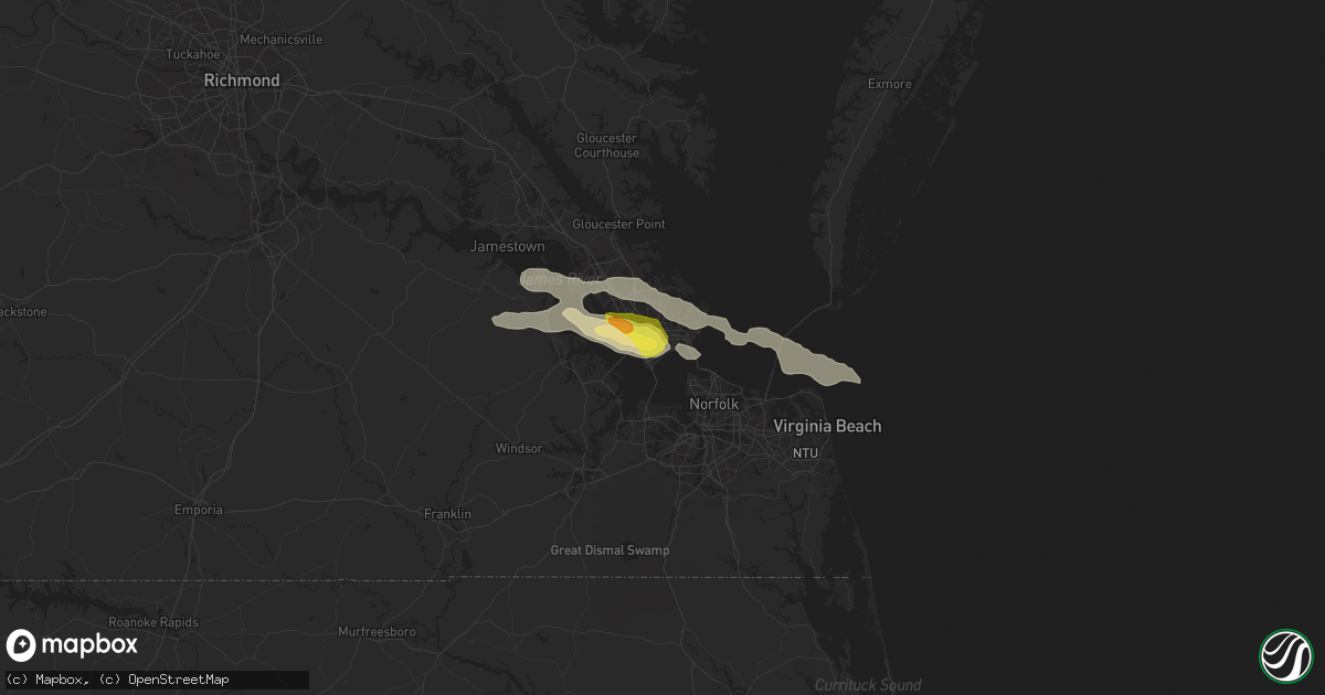
Hail Map in Hampton, VA on May 31, 2017
Get this storm
May 31 map
$229
one time, instant access
Download today. No call, no setup
Keep the $229
Bought the map and want the full workflow? Apply the entire $229 to a subscription within 7 days. None of it is wasted.
Every map, not just this one
This buys you this map. Subscription and you get every map we run, in the markets you choose from a few cities to whole states to nationwide. Plus real-time alerts the moment a storm fires.
Contact data
Name, contact info, occupancy, even credit band for addresses in the footprint. You go from where it hit to who to call.
Become the source they trust
Unlimited branding weather history reports on demand. You already have the documented answer ready for the property owner, and you are the one who showed up with it.
Property data and RoofTrace estimates
Pull up any address you have got, its value and the exact code rules for that jurisdiction, straight from One Click Code. Then RoofTrace estimates the squares, pitch, and roof value, priced the way you price.
Storm reports in Hampton, VA
Hampton, VA
| Date | Description |
|---|---|
| 05/31/20176:53 PM CDT | Tree knocked down. |
| 05/31/20176:52 PM CDT | A local report indicates 60 MPH wind near LANGLEY AFB |
| 05/31/20174:05 PM CDT | A local report indicates 1.00 inch wind near 5 W HAMPTON |
| 05/31/20173:59 PM CDT | A local report indicates 1.00 inch wind near 5 SW LANGLEY AFB |
| 05/30/20177:01 PM CDT | Numerous branches and large limbs down. |
All States Impacted by Hail Map on May 31, 2017
All Cities Impacted by Hail Map on May 31, 2017
- Schenectady, NY
- Quinter, KS
- Ransom, KS
- Arnold, KS
- Utica, KS
- Burlington, VT
- Colchester, VT
- Quenemo, KS
- Lyndon, KS
- Yuma, CO
- Qulin, MO
- Hobson, MT
- Independence, KS
- Highland, NY
- Leon, KS
- Latham, KS
- Somerville, NJ
- Dixon, MT
- Burlingame, KS
- Carbondale, KS
- Scranton, KS
- Cope, CO
- Stoneham, CO
- Floresville, TX
- Ossipee, NH
- Rexford, NY
- Latham, NY
- Surry, VA
- Newton, KS
- Van Etten, NY
- Newfield, NY
- Cayuta, NY
- Horseheads, NY
- Alpine, NY
- Callahan, FL
- Jacksonville, FL
- Grenola, KS
- Cedar Vale, KS
- Moline, KS
- Seligman, MO
- Garfield, AR
- Washburn, MO
- Haydenville, MA
- Williamsburg, MA
- Newport News, VA
- Hampton, VA
- Saint Francis, KS
- Oak Ridge, MO
- Wallace, KS
- Colby, KS
- Edson, KS
- Goodland, KS
- Winona, KS
- Madison, NC
- Pikeville, KY
- Poughkeepsie, NY
- Baldwin City, KS
- Paola, KS
- Amoret, MO
- Fontana, KS
- Wellsville, KS
- La Cygne, KS
- Amsterdam, MO
- Spring Hill, KS
- Foster, MO
- Pleasanton, KS
- Eudora, KS
- Edgerton, KS
- Butler, MO
- Alma, KS
- Neptune Beach, FL
- Atlantic Beach, FL
- Ponte Vedra Beach, FL
- Jacksonville Beach, FL
- Silver Lake, NH
- Walnut Cove, NC
- Reidsville, NC
- Sandy Ridge, NC
- Stoneville, NC
- Mayodan, NC
- Gibsonville, NC
- Browns Summit, NC
- Elon, NC
- Prescott, KS
- Blue Mound, KS
- Centerville, KS
- Mapleton, KS
- Fort Scott, KS
- Fulton, KS
- Mound City, KS
- Bushnell, NE
- Gardner, KS
- Richmond Hill, GA
- Ottawa, KS
- Haigler, NE
- Wray, CO
- Cambridge, KS
- Summerfield, NC
- Nahunta, GA
- Loving, NM
- Rosalia, KS
- Jal, NM
- Eureka, KS
- Autryville, NC
- Cameron, NC
- Vass, NC
- Spring Lake, NC
- Fort Bragg, NC
- Alcove, NY
- Ravena, NY
- Greenville, NY
- Hannacroix, NY
- Coeymans Hollow, NY
- Earlton, NY
- Surprise, NY
- Milton, VT
- Charlotte, NC
- Ashfield, MA
- Shelburne Falls, MA
- Plainfield, MA
- Olivebridge, NY
- Kerhonkson, NY
- Stockett, MT
- Conway, NH
- Freedom, NH
- Wonalancet, NH
- Tamworth, NH
- Chocorua, NH
- Madison, NH
- West Ossipee, NH
- Amsterdam, NY
- Ballston Lake, NY
- Galway, NY
- Ballston Spa, NY
- Andover, NH
- Salisbury, NH
- Overbrook, KS
- Okeechobee, FL
- Vero Beach, FL
- Granville, MA
- Melrose, NY
- Mechanicville, NY
- Schaghticoke, NY
- Erie, KS
- Parsons, KS
- Columbus, KS
- Saint Paul, KS
- McCune, KS
- Galesburg, KS
- Oswego, KS
- Sedan, KS
- Lehigh, KS
- Marion, KS
- Hillsboro, KS
- Turon, KS
- Stafford, KS
- Levant, KS
- Dublin, TX
- Gustine, TX
- Walton, KS
- New Raymer, CO
- Harrisburg, NE
- Pine Bluffs, WY
- Clayhole, KY
- Northampton, MA
- Granby, MA
- Easthampton, MA
- Florence, MA
- South Hadley, MA
- Holyoke, MA
- Ness City, KS
- Fellsmere, FL
- Coffeyville, KS
- Pleasanton, TX
- Poteet, TX
- Elmendorf, TX
- Whitewater, KS
- Halstead, KS
- Valley Center, KS
- Burrton, KS
- Hutchinson, KS
- Ithaca, NY
- Linden, NC
- Gove, KS
- Deer, AR
- Charlemont, MA
- Westfield, MA
- Southwick, MA
- New Paltz, NY
- Piedmont, KS
- Burns, KS
- Cassoday, KS
- Atlanta, KS
- Osawatomie, KS
- Fair Haven, VT
- Putnam Station, NY
- Orwell, VT
- Indiantown, FL
- Peabody, KS
- Osteen, FL
- Mims, FL
- Rich Hill, MO
- Wingdale, NY
- Wappingers Falls, NY
- Hopewell Junction, NY
- Lagrangeville, NY
- Poughquag, NY
- Pleasant Valley, NY
- Milton, NY
- Pawling, NY
- Dover Plains, NY
- Olathe, KS
- New Century, KS
- Richfield, NC
- Gold Hill, NC
- Sedgwick, KS
- Jackson, MO
- Ponte Vedra, FL
- Waynesville, GA
- White Oak, GA
- Campbell, MO
- Piggott, AR
- Louisburg, KS
- Snyder, TX
- Hardwick, VT
- San Antonio, TX
- Asherton, TX
- Parker, KS
- Lane, KS
- Greeley, KS
- Smithfield, VA
- Fort Eustis, VA
- Stockton, NJ
- Frenchtown, NJ
- Scandia, KS
- Junction City, KS
- Harveyville, KS
- Auburn, KS
- Eskridge, KS
- Saint Johns, FL
- Saint George, SC
- Dorchester, SC
- Rantoul, KS
- Pomona, KS
- Merino, CO
- Rockville, MO
- Orlando, FL
- Buhler, KS
- Brownfield, ME
- Denmark, ME
- Turkey, NC
- Clinton, NC
- Warsaw, NC
- Brewster, KS
- El Dorado, KS
- Kearney, NE
- Creedmoor, NC
- Butner, NC
- Stem, NC
- Altoona, KS
- Cleveland, AR
- Scotland, AR
- Fort Davis, TX
- Geneva, FL
- Clifton Park, NY
- Round Lake, NY
- Burnt Hills, NY
- Pollard, AR
- Salina, KS
- Lindsborg, KS
- New Providence, NJ
- South Orange, NJ
- Maplewood, NJ
- Summit, NJ
- Millburn, NJ
- Springfield, NJ
- Short Hills, NJ
- Charlotte, TX
- Jourdanton, TX
- Ulster Park, NY
- East Hardwick, VT
- Assaria, KS
- Fayetteville, NC
- Salemburg, NC
- Roseboro, NC
- Godwin, NC
- Cohoes, NY
- Alplaus, NY
- Troy, NY
- Watervliet, NY
- Waterford, NY
- Duanesburg, NY
- Feeding Hills, MA
- Prestonsburg, KY
- Belt, MT
- Stevensville, PA
- Laceyville, PA
- Sherman, CT
- Tivoli, NY
- Leeds, MA
- Springdale, AR
- Elberon, VA
- Lunenburg, VT
- Nashua, NH
- Adrian, MO
- Advance, NC
- Mocksville, NC
- Lexington, NC
- Bridgewater, NJ
- Basking Ridge, NJ
- Martinsville, NJ
- Warren, NJ
- Sawyer, KS
- Albin, WY
- Cibolo, TX
- New Braunfels, TX
- Marion, TX
- Sidney, KY
- Ravalli, MT
- Arlee, MT
- Glenallen, MO
- Princeton, KS
- Modena, NY
- Clintondale, NY
- Spring Grove, VA
- Polson, MT
- Ronan, MT
- Falun, KS
- Benton, KS
- West Springfield, MA
- Harleyville, SC
- Center Ossipee, NH
- Center Tuftonboro, NH
- New Bern, NC
- Virginia Beach, VA
- Norfolk, VA
- Justin, TX
- Varney, KY
- Towanda, KS
- El Dorado Springs, MO
- Garden City, TX
- Conway, MA
- Hatfield, MA
- Hadley, MA
- West Hatfield, MA
- North Hatfield, MA
- Goshen, MA
- South Deerfield, MA
- Sunderland, MA
- Garnett, KS
- Stanford, MT
- Hague, NY
- Grover, CO
- Fleming, GA
- North Pomfret, VT
- South Pomfret, VT
- White River Junction, VT
- Quechee, VT
- West Hartford, VT
- Woodstock, VT
- Milton Mills, NH
- Sanbornville, NH
- Fort Hancock, TX
- Fort Monroe, VA
- Thayer, KS
- Wade, NC
- Kenansville, NC
- Keeseville, NY
- Odessa, TX
- Goldsmith, TX
- Freehold, NY
- Coxsackie, NY
- Gardendale, TX
- Red Hook, NY
- Catskill, NY
- Glasco, NY
- Saugerties, NY
- Harwood, MO
- Schell City, MO
- Walker, MO
- Stuyvesant, NY
- Climax, NY
- West Coxsackie, NY
- Saint Johnsbury, VT
- Barnet, VT
- Center Conway, NH
- North Conway, NH
- Bonner, MT
- Glen Spey, NY
- Ticonderoga, NY
- Hartland, VT
- North Hartland, VT
- Plainfield, NH
- Tampa, KS
- Carrizo Springs, TX
- Arcadia, FL
- Whitehouse Station, NJ
- Neshanic Station, NJ
- Flemington, NJ
- Harts, WV
- Magnolia, NC
- Faison, NC
- Accord, NY
- Dixie, GA
- Sterling, CO
- Hamilton, TX
- Pottsville, TX
- Comanche, TX
- Stormville, NY
- Rhinebeck, NY
- Fernandina Beach, FL
- Carrollton, VA
- Hudson, NY
- Danbury, NC
- Wann, OK
- Torrington, WY
- North Sandwich, NH
- Tahlequah, OK
- Russell, MA
- Blandford, MA
- Agawam, MA
- Fort Gibson, OK
- Hulbert, OK
- Ringoes, NJ
- Elk City, KS
- Yorktown, VA
- Poquoson, VA
- Exeter, MO
- Fryeburg, ME
- Benedict, KS
- Norwich, VT
- Hanover, NH
- West Lebanon, NH
- Wilder, VT
- Montclair, NJ
- West Orange, NJ
- Gillette, NJ
- Orange, NJ
- East Orange, NJ
- Berkeley Heights, NJ
- Chatham, NJ
- Lebanon, NJ
- Stirling, NJ
- Millington, NJ
- Livingston, NJ
- Glen Ridge, NJ
- Pittstown, NJ
- Bedminster, NJ
- Pattersonville, NY
- Delanson, NY
- Westerlo, NY
- Spencer, NY
- Odessa, NY
- Bridgewater, CT
- New Milford, CT
- Roxbury, CT
- Potomac, MD
- Great Falls, VA
- Reston, VA
- Chantilly, VA
- Vienna, VA
- Sterling, VA
- Herndon, VA
- Baltimore, MD
- Halethorpe, MD
- Glen Burnie, MD
- Brooklyn, MD
- Linthicum Heights, MD
- Kermit, TX
- Wakarusa, KS
- Waverly, KS
- North Newton, KS
- Pratt, KS
- Salyersville, KY
- Brownell, KS


