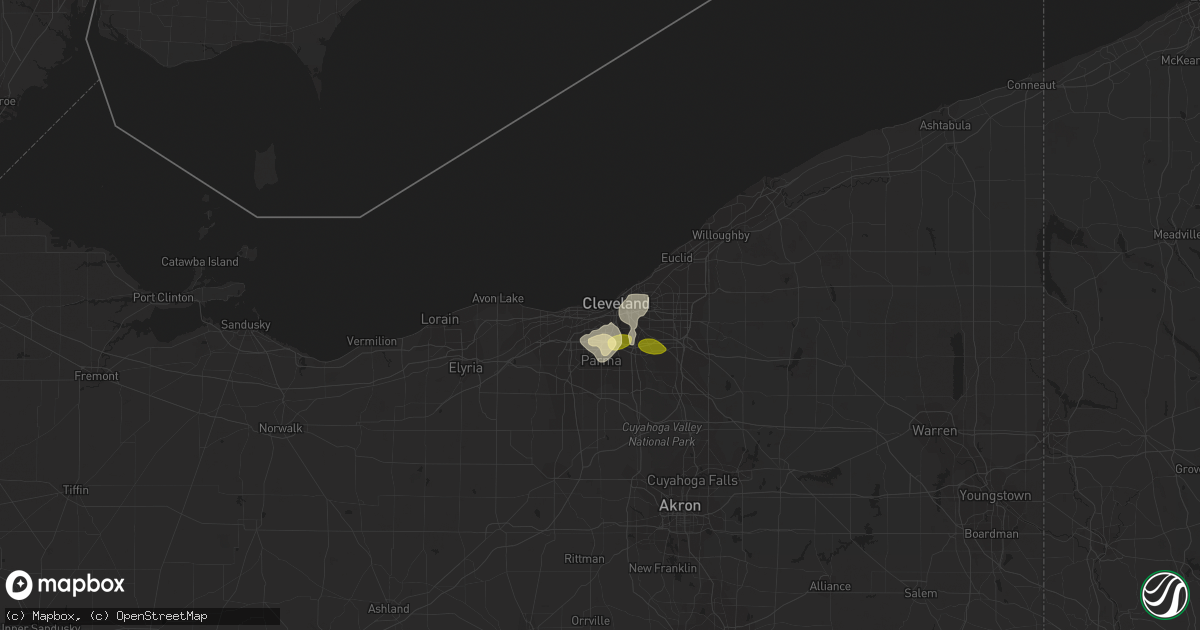
Hail Map in Cleveland, OH on May 30, 2015
Get this storm
May 30 map
$229
one time, instant access
Download today. No call, no setup
Keep the $229
Bought the map and want the full workflow? Apply the entire $229 to a subscription within 7 days. None of it is wasted.
Every map, not just this one
This buys you this map. Subscription and you get every map we run, in the markets you choose from a few cities to whole states to nationwide. Plus real-time alerts the moment a storm fires.
Contact data
Name, contact info, occupancy, even credit band for addresses in the footprint. You go from where it hit to who to call.
Become the source they trust
Unlimited branding weather history reports on demand. You already have the documented answer ready for the property owner, and you are the one who showed up with it.
Property data and RoofTrace estimates
Pull up any address you have got, its value and the exact code rules for that jurisdiction, straight from One Click Code. Then RoofTrace estimates the squares, pitch, and roof value, priced the way you price.
Storm reports in Cleveland, OH
Cleveland, OH
| Date | Description |
|---|---|
| 05/30/20156:05 PM CDT | Large tree down across fulton road |
| 05/30/20156:00 PM CDT | Social media report of a tree down on fairmount road in cleveland heights...time estimated by radar |
| 05/30/20155:59 PM CDT | A local report indicates 1.00 inch wind near GARFIELD HEIGHTS |
| 05/30/20155:25 PM CDT | Trees down |
| 05/30/20154:40 PM CDT | Snapped trees and building damage off of brookpark road...report via social media...time is radar estimated. |
| 05/30/20154:39 PM CDT | Large trees down across fulton road at archmere... Fulton road at northcliff... And w 58th street in old brooklyn... Report corrected for tree locations and time via social ( |
| 05/30/20154:25 PM CDT | A local report indicates 60 MPH wind near PARMA |
| 05/30/20154:25 PM CDT | Large trees down across fulton road at archmere... Fulton road at northcliff... And w 58th street in old brooklyn... Report corrected for tree locations and time via social ( |
| 05/30/20154:15 PM CDT | Time and location adjusted based on radar. |
| 05/30/20154:15 PM CDT | Trees down...time and location adjusted based on radar. |
| 05/29/20158:19 PM CDT | A local report indicates 60 MPH wind near PARMA |
All States Impacted by Hail Map on May 30, 2015
All Cities Impacted by Hail Map on May 30, 2015
- Garwood, TX
- Houston, TX
- San Marcos, TX
- Peninsula, OH
- Brecksville, OH
- Northfield, OH
- Sacramento, NM
- Cloudcroft, NM
- Sheridan, WY
- Ranchester, WY
- Burkeville, TX
- Willard, OH
- Bloomville, OH
- Attica, OH
- New Washington, OH
- Chatfield, OH
- Monroeville, OH
- Lettsworth, LA
- Danville, WA
- Curlew, WA
- Merigold, MS
- Cleveland, MS
- San Diego, TX
- Isola, MS
- Cleveland, TX
- Dayton, TX
- Rockwall, TX
- Royse City, TX
- Bandera, TX
- Metaline Falls, WA
- Ione, WA
- Needville, TX
- Rosenberg, TX
- Baton Rouge, LA
- Baker, LA
- Port Allen, LA
- Ocate, NM
- Rainsville, NM
- Guadalupita, NM
- Waelder, TX
- Church Point, LA
- Kenedy, TX
- Melville, LA
- Palmetto, LA
- Alleyton, TX
- Cat Spring, TX
- Brooksville, FL
- Northport, WA
- Colville, WA
- Kettle Falls, WA
- Pope, MS
- Courtland, MS
- Water Valley, MS
- Raymond, MS
- Mexico, NY
- Central Square, NY
- Fulton, NY
- Marion, IN
- Van Buren, IN
- Pittsboro, IN
- Whitestown, IN
- Lebanon, IN
- Brownsburg, IN
- Brookhaven, MS
- Sontag, MS
- Columbus, TX
- Las Vegas, NM
- Sapello, NM
- Buena Vista, NM
- Mora, NM
- Sulphur, LA
- Superior, MT
- Spring, TX
- Alamo, TX
- New Braunfels, TX
- Livingston, TX
- Huntsville, TX
- New Waverly, TX
- Oakhurst, TX
- Pointblank, TX
- Onalaska, TX
- Coldspring, TX
- Laredo, TX
- Roxie, MS
- Piqua, OH
- Houston, OH
- Bucyrus, OH
- Alice, TX
- Orange Grove, TX
- Cimarron, NM
- La Mesa, NM
- Annapolis, IL
- Oblong, IL
- Martinsville, IL
- Scott, LA
- San Augustine, TX
- Sumrall, MS
- Opelousas, LA
- Washington, LA
- Port Barre, LA
- Galena Park, TX
- Pasadena, TX
- Las Cruces, NM
- Naples, FL
- Port Neches, TX
- Sour Lake, TX
- Calliham, TX
- Tilden, TX
- Clayton, LA
- Ozona, TX
- Raton, NM
- Orange, TX
- Leesville, LA
- Anacoco, LA
- Hempstead, TX
- Navasota, TX
- Fairfield, MT
- Beeville, TX
- Encino, TX
- San Antonio, TX
- Mount Olive, MS
- Prentiss, MS
- Deridder, LA
- Robinson, IL
- Willis, TX
- Conroe, TX
- Chagrin Falls, OH
- Liberty, TX
- Zapata, TX
- Columbus, IN
- Louise, TX
- Goliad, TX
- Lillie, LA
- Spearsville, LA
- Guy, TX
- Greenup, IL
- Hidalgo, IL
- Montpelier, IN
- Jonesboro, IN
- Gas City, IN
- Warren, IN
- Hartford City, IN
- Swayzee, IN
- Sodus, NY
- Solon, OH
- Twinsburg, OH
- Bedford, OH
- Macedonia, OH
- Tutwiler, MS
- Sumner, MS
- Splendora, TX
- New Caney, TX
- Huffman, TX
- Newhebron, MS
- Batesville, MS
- East Bernard, TX
- Beasley, TX
- De Borgia, MT
- Apple Springs, TX
- Groveton, TX
- Wharton, TX
- Forest Hill, LA
- Brookshire, TX
- Brookpark, OH
- Cleveland, OH
- Independence, OH
- Canton, MS
- Collins, MS
- Bellville, TX
- Chappell Hill, TX
- Richards, TX
- Richfield, OH
- North Royalton, OH
- Hinckley, OH
- Aurora, OH
- Broadview Heights, OH
- New Ulm, TX
- Camden, MS
- Sonora, TX
- Mesilla Park, NM
- Martindale, TX
- Kingsbury, TX
- Luling, TX
- Lockhart, TX
- Seguin, TX
- Jackson, LA
- Zachary, LA
- Sallis, MS
- Inverness, MS
- Bryant, IN
- Roma, TX
- Spring Hill, FL
- Dade City, FL
- Land O'Lakes, FL
- Lutz, FL
- Harwood, TX
- Logansport, IN
- New Waverly, IN
- Peru, IN
- Hermitage, AR
- Anthony, NM
- Sunflower, MS
- Vergennes, VT
- Westport, NY
- Macy, IN
- Claypool, IN
- Roann, IN
- North Manchester, IN
- Silver Lake, IN
- Dry Creek, LA
- Upland, IN
- Fresno, TX
- Rosharon, TX
- Missouri City, TX
- South Houston, TX
- Pearland, TX
- Deer Park, TX
- Bellaire, TX
- Manvel, TX
- Greensburg, LA
- Canyon Lake, TX
- Sunset, LA
- Van Wert, OH
- Grover Hill, OH
- Scott, OH
- Humble, TX
- Cuero, TX
- Fishers, IN
- Fortville, IN
- Summit, MS
- Burton, OH
- Mittie, LA
- Kinder, LA
- Grafton, OH
- Lagrange, OH
- Porter, TX
- Hallettsville, TX
- West Terre Haute, IN
- Linn, TX
- Pierceton, IN
- Warsaw, IN
- Akron, IN
- Leesburg, IN
- Winona Lake, IN
- Sealy, TX
- Laurier, WA
- Portland, AR
- Wellington, OH
- Symsonia, KY
- Jonesville, LA
- Decker, MT
- Westpoint, IN
- Indianapolis, IN
- Noblesville, IN
- Mccordsville, IN
- Pendleton, IN
- Lapel, IN
- Monterey, LA
- Plains, MT
- Portland, IN
- Manilla, IN
- Rushville, IN
- Rio Grande City, TX
- Clinton, LA
- Troup, TX
- El Campo, TX
- San Juan, TX
- Mccomb, MS
- Magnolia, MS
- Sidney, OH
- Crawfordsville, IN
- Acme, LA
- Hamburg, AR
- Saint Regis, MT
- Richmond, TX
- Lobelville, TN
- Only, TN
- Centerville, TN
- Winnsboro, LA
- Helotes, TX
- Oakdale, LA
- Shepherd, TX
- Smithdale, MS
- Medina, TX
- Boling, TX
- Oak Ridge, LA
- Hebbronville, TX
- Guerra, TX
- Castor, LA
- Fort Myers Beach, FL
- Bonita Springs, FL
- Port Arthur, TX
- Nederland, TX
- Yorktown, TX
- Pipe Creek, TX
- Mico, TX
- Quinlan, TX
- Terrell, TX
- Victoria, TX
- Fountain Hill, AR
- Wilmar, AR
- Mayfield, KY
- Hickory, KY
- Robstown, TX
- Osyka, MS
- Yoakum, TX
- Moreauville, LA
- Cottonport, LA
- Wills Point, TX
- Dequincy, LA
- Utica, MS
- Plymouth, OH
- Del Rio, TX
- Edna, TX
- Livonia, LA
- Oscar, LA
- Reelsville, IN
- Greencastle, IN
- Lufkin, TX
- Union Church, MS
- McCall Creek, MS
- Inglis, FL
- Dunkirk, IN
- Nordman, ID
- Slaughter, LA
- Pride, LA
- Savannah, TN
- Middlebury, VT
- Fairmount, IN
- Pulaski, NY
- Zionsville, IN
- Ganado, TX
- Lake Village, AR
- Athens, TX
- Bassfield, MS
- Pennington, TX
- Port Henry, NY
- Fordoche, LA
- Holcomb, MS
- Oberlin, OH
- Dale, TX
- Lecanto, FL
- Kentwood, LA
- Atascosa, TX
- Sycamore, OH
- Mansfield, LA
- Wingo, KY
- Humboldt, TN
- Medina, TN
- Jackson, TN
- Maple Heights, OH


