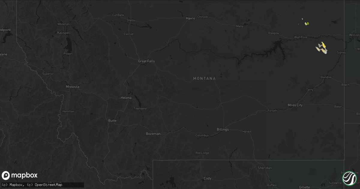
Hail Map in Montana on May 26, 2026
Get this storm
May 26 map
$229
one time, instant access
Download today. No call, no setup
Keep the $229
Bought the map and want the full workflow? Apply the entire $229 to a subscription within 7 days. None of it is wasted.
Every map, not just this one
This buys you this map. Subscription and you get every map we run, in the markets you choose from a few cities to whole states to nationwide. Plus real-time alerts the moment a storm fires.
Contact data
Name, contact info, occupancy, even credit band for addresses in the footprint. You go from where it hit to who to call.
Become the source they trust
Unlimited branding weather history reports on demand. You already have the documented answer ready for the property owner, and you are the one who showed up with it.
Property data and RoofTrace estimates
Pull up any address you have got, its value and the exact code rules for that jurisdiction, straight from One Click Code. Then RoofTrace estimates the squares, pitch, and roof value, priced the way you price.
Storm reports in Montana
Montana
| Date | Description |
|---|---|
| 05/26/20266:53 PM CDT | Asos station kolf wolf point airport. |
| 05/26/20266:45 PM CDT | Mesonet station mttos toston bridge us-287 mp 87.0. |
| 05/26/20265:30 PM CDT | Wind and lightning damaged trees. |
| 05/26/20264:30 PM CDT | Mesonet station mtlbt lambert mt-200 mp 45.0. |
| 05/26/202612:15 AM CDT | Awos station ksbx 2 nnw shelby. |
| 05/25/20267:54 PM CDT | Mesonet station ekhm8 elkhorn raws - 8 w townsend. |
All States Impacted by Hail Map on May 26, 2026
Cities Impacted by Hail Map on May 26, 2026
- Alpine, TX
- Fort Davis, TX
- Big Spring, TX
- Dryden, TX
- Silverton, TX
- Lockney, TX
- Crystal City, TX
- Richton, MS
- Tulia, TX
- Happy, TX
- Frankston, TX
- Palestine, TX
- Colorado City, TX
- Brackettville, TX
- Loraine, TX
- Uvalde, TX
- Bullard, TX
- Flint, TX
- Batesville, TX
- Roscoe, TX
- Quemado, TX
- Duncan, OK
- Comanche, OK
- Ellisville, MS
- Laurel, MS
- Comstock, TX
- Sonora, TX
- Canton, TX
- Athens, TX
- Mineola, TX
- Eustace, TX
- Waubun, MN
- Pearsall, TX
- Twin Valley, MN
- Barksdale, TX
- Camp Wood, TX
- Eldorado, TX
- Dubach, LA
- Jayton, TX
- Celina, TX
- Menard, TX
- Rocksprings, TX
- Del Rio, TX
- Kerrville, TX
- Hendrum, MN
- Junction, TX
- Dilley, TX
- Mason, TX
- Tetonia, ID
- Perley, MN
- Leakey, TX
- Whitesboro, TX
- Driggs, ID
- Pittsburg, TX
- Leesburg, TX
- Felt, ID
- Ashton, ID
- Harper, TX
- Bernice, LA
- Moose, WY
- Ulen, MN
- Hext, TX
- Brady, TX
- Comfort, TX
- Fredericksburg, TX
- Mountain Home, TX
- McGrath, MN
- Fredonia, TX
- Voca, TX
- Marietta, OK
- Melvin, TX
- Bonham, TX
- Ivanhoe, TX
- Pillager, MN
- Yellowstone National Park, WY
- Exeland, WI
- Loyal, OK
- Kingfisher, OK
- Brainerd, MN
- Merrifield, MN
- Wolf Point, MT
- Antigo, WI
- Finlayson, MN
- Danbury, WI
- Lambert, MT
- Brockton, MT
- Park Rapids, MN
- Ada, MN
- Mcgregor, MN
- Springbrook, WI
- Art, TX
- Neillsville, WI
- San Saba, TX
- Richland Springs, TX
- Staples, MN
- Motley, MN
- Pontotoc, TX
- Spooner, WI
- Tipton, OK
- Bigfoot, TX
- Moore, TX
- Carlsbad, NM
- Doss, TX
- Willow City, TX
- Boerne, TX
- Headrick, OK
- Hayward, WI
- Austin, MN
- Rose Creek, MN
- Stone Lake, WI
- Adams, MN
- Sandstone, MN
- Isle, MN
- Stonewall, TX
- Ringgold, TX
- Nocona, TX
- Llano, TX
- Omega, OK
- Elkton, MN
- Richey, MT
- Dexter, MN
- McIntyre, GA
- Gordon, GA
- Watonga, OK
- Morriston, FL
- Charlotte, TX
- Deerwood, MN
- Irwinton, GA
- Eagle Pass, TX
- Johnson City, TX
- Jourdanton, TX
- Aitkin, MN
- Garrison, MN
- Couderay, WI
- Saint Ansgar, IA
- La Pryor, TX
- Lyle, MN
- Sarona, WI
- Henrietta, TX
- Ryan, OK
- Salt Flat, TX
- Round Mountain, TX
- Stacyville, IA
- Marble Falls, TX
- Bertram, TX
- Burnet, TX
- Electra, TX
- Blanco, TX
- Osage, IA
- Emmons, MN
- Georgetown, TX
- Leander, TX
- Liberty Hill, TX
- Carrizo Springs, TX
- Big Wells, TX
- Bandera, TX
- Sabinal, TX
- Center Point, TX
- Florence, TX
- Horseshoe Bay, TX
- Pleasanton, TX
- Glenville, MN
- Hye, TX
- Clarks Grove, MN
- Albert Lea, MN
- Medina, TX
- Yancey, TX
- D Hanis, TX
- Balmorhea, TX
- Harrold, TX
- Davidson, OK
- Little Cedar, IA
- Cotulla, TX
- Gooding, ID
- Devine, TX
- Hondo, TX
- Punta Gorda, FL
- Pipe Creek, TX
- Hayward, MN
- Northwood, IA
- Alden, MN
- Encinal, TX
- Frederick, OK
- Bulverde, TX
- Lake Mills, IA
- Twin Lakes, MN
- Poteet, TX
- Monahans, TX
- Wink, TX
- Marquez, TX
- Bremond, TX
- Spring Branch, TX
- Franklin, TX
- Kosse, TX
- Laredo, TX
- Groesbeck, TX
- Scarville, IA
- Thompson, IA
- Jewett, TX
- Seguin, TX
- San Antonio, TX
- Schertz, TX
- La Vernia, TX
- Cibolo, TX
- Converse, TX
- Jbsa Ft Sam Houston, TX
- Adkins, TX
- Marion, TX
- Saint Hedwig, TX
- Kingsbury, TX
- Gonzales, TX
- Leesville, TX
- Nixon, TX
- Cost, TX
- Smiley, TX
- Wrightsboro, TX
- Luling, TX
- Harwood, TX
- Waelder, TX
- Donie, TX
- Fairmont, MN
- Shiner, TX
- Muldoon, TX
- Rosanky, TX
- Flatonia, TX
- Realitos, TX
- Goliad, TX
- Freer, TX
- Concepcion, TX
- Hallettsville, TX
- San Diego, TX
- Victoria, TX
- Tivoli, TX
- Alice, TX
- Refugio, TX
- Robstown, TX
- Bloomington, TX
- Port Lavaca, TX
- Bishop, TX
- Agua Dulce, TX
- Zapata, TX
- Warwick, ND
- Hebbronville, TX
- Benavides, TX
- Premont, TX
- Kingsville, TX
- Riviera, TX
- Sarita, TX
- Corpus Christi, TX
- Woodsboro, TX
- Beeville, TX


