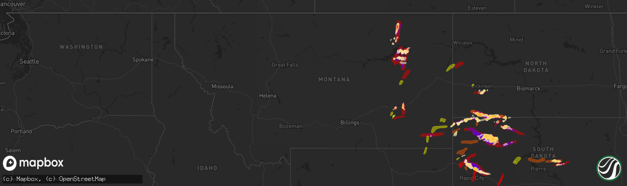
Hail Map in Montana on May 25, 2013
The weather event in Montana on May 25, 2013 includes Hail map. 9 states and 157 cities were impacted and suffered possible damage. The total estimated number of properties impacted is 1,118.
Want more than just the map?
Turn this storm into a full workflow.
- Owner + property data so you know who to knock
- OnDemand branded weather history reports to win the "did we even have hail?" argument
- RoofTrace estimate so reps stop guessing numbers at the door
Bought this map? Upgrade within 7 days and we'll credit the $230. (10-15 min setup call)
Hail
1,118
Estimated number of impacted properties by a 1.00" hail or larger1,164
Estimated number of impacted properties by a 1.75" hail or larger252
Estimated number of impacted properties by a 2.50" hail or largerStorm reports in Montana
Montana
| Date | Description |
|---|---|
| 05/25/20136:55 PM CDT | A local report indicates 1.50 inch wind near 5 E GLASGOW |
| 05/25/20136:54 PM CDT | A local report indicates 1.75 inch wind near 5 E BROADUS |
| 05/25/20136:33 PM CDT | Quarter to golfball size hail |
| 05/25/20136:30 PM CDT | A local report indicates 1.00 inch wind near 4 E FORT PECK |
| 05/25/20135:58 PM CDT | A local report indicates 1.00 inch wind near BELLTOWER |
| 05/25/20134:37 PM CDT | A local report indicates 1.00 inch wind near 17 SW EKALAKA |
| 05/25/20134:25 PM CDT | A local report indicates 1.00 inch wind near 24 SW EKALAKA |
| 05/25/201312:44 PM CDT | Quarter size hail in ekalaka |
| 05/25/20138:30 AM CDT | Pea to quarter size hail |
| 05/24/201310:02 PM CDT | A local report indicates 1.00 inch wind near 18 NE COLSTRIP |
| 05/24/20139:05 PM CDT | Also reported pea to penny sized hail |
| 05/24/20139:00 PM CDT | A local report indicates 1.00 inch wind near 2 N COLSTRIP |
| 05/24/20138:30 PM CDT | A few large hail stones estimated at 2 to 3 inches in diameter along i-94. |
| 05/24/20138:15 PM CDT | A local report indicates 1.75 inch wind near 13 SSW FRAZER |
| 05/24/20138:13 PM CDT | A local report indicates 1.25 inch wind near 13 ESE HELL CREEK REC A |
| 05/24/20138:00 PM CDT | A local report indicates 1.00 inch wind near 16 NNE GLASGOW |
| 05/24/20138:00 PM CDT | A local report indicates 1.75 inch wind near 35 NE JORDAN |
| 05/24/20137:45 PM CDT | Also received over an inch of rain |
| 05/24/20137:30 PM CDT | Relayed report from law enforcement |
| 05/24/20137:25 PM CDT | Dime size but up to quarter size hail |
| 05/24/20137:20 PM CDT | A local report indicates 2.50 inch wind near 14 ENE HAXBY |
All States Impacted by Hail Map on May 25, 2013
Cities Impacted by Hail Map on May 25, 2013
- Vale, SD
- Hettinger, ND
- Whitewood, SD
- Sturgis, SD
- Highmore, SD
- Holabird, SD
- Harrold, SD
- Ralph, SD
- McDonald, KS
- Max, NE
- Curtis, NE
- Maywood, NE
- Meadow, SD
- Bison, SD
- Callaway, NE
- Larslan, MT
- Richland, MT
- New England, ND
- Dickinson, ND
- Circle, MT
- Lodgepole, SD
- Lemmon, SD
- Fort Peck, MT
- Glasgow, MT
- Jordan, MT
- Reeder, ND
- Ludlow, SD
- New Underwood, SD
- Volborg, MT
- Hathaway, MT
- Rosebud, MT
- Van Horn, TX
- Hurley, SD
- Viborg, SD
- Freeman, SD
- Marion, SD
- Parker, SD
- Edson, KS
- Camp Crook, SD
- Buffalo, SD
- New Leipzig, ND
- Elgin, ND
- Scranton, ND
- Prairie City, SD
- McIntosh, SD
- Keldron, SD
- Gothenburg, NE
- Owanka, SD
- Goodland, KS
- Morristown, SD
- Audubon, IA
- Stratton, NE
- Atwood, KS
- Saint Lawrence, SD
- Forsyth, MT
- Reva, SD
- Faith, SD
- Mud Butte, SD
- Wolf Point, MT
- Maxwell, NE
- Isabel, SD
- Boyes, MT
- Pecos, TX
- Watauga, SD
- Bird City, KS
- Newell, SD
- Belle Fourche, SD
- Ekalaka, MT
- Midland, SD
- Carson, ND
- Raleigh, ND
- Nashua, MT
- Nisland, SD
- Eagle Butte, SD
- Dupree, SD
- Ree Heights, SD
- Chancellor, SD
- Saint Francis, KS
- McLaughlin, SD
- Wasta, SD
- Oconto, NE
- Cartwright, ND
- Cozad, NE
- Saint Marie, MT
- Onida, SD
- Hinsdale, MT
- Vandalia, MT
- Grassy Butte, ND
- Cherokee, IA
- Marcus, IA
- Meriden, IA
- Cleghorn, IA
- Perry, IA
- Rippey, IA
- Selfridge, ND
- Savage, MT
- Brady, NE
- Farnam, NE
- Gladstone, ND
- Hammond, MT
- Benkelman, NE
- Broken Bow, NE
- McCook, NE
- Hayes Center, NE
- Syracuse, KS
- Tribune, KS
- Holly, CO
- Sharon Springs, KS
- Custer, SD
- Hot Springs, SD
- Pringle, SD
- Edgemont, SD
- Oelrichs, SD
- Oral, SD
- Wanblee, SD
- Fort Meade, SD
- Spearfish, SD
- Saint Onge, SD
- Deadwood, SD
- Box Elder, SD
- Rapid City, SD
- Piedmont, SD
- Ellsworth Afb, SD
- Quinn, SD
- Philip, SD
- Kadoka, SD
- Wall, SD
- Hayes, SD
- Bowman, ND
- Belfield, ND
- South Heart, ND
- Timber Lake, SD
- Fort Pierre, SD
- Pierre, SD
- Blunt, SD
- Miller, SD
- Kimballton, IA
- Irwin, IA
- Manning, IA
- Manilla, IA
- Worthing, SD
- Canton, SD
- Irene, SD
- Menno, SD
- Humboldt, SD
- Hartford, SD
- Monroe, SD
- Canistota, SD
- Weston, WY
- Broadus, MT
- Biddle, MT
- Cohagen, MT
- Colstrip, MT
- Wibaux, MT
- Opheim, MT
- Brockway, MT
- Terry, MT


