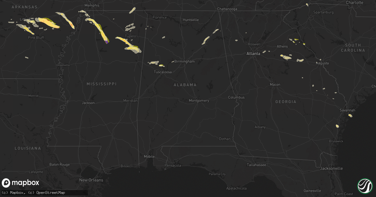
Hail Map in Alabama on May 24, 2024
Get this storm
May 24 map
$229
one time, instant access
Download today. No call, no setup
Keep the $229
Bought the map and want the full workflow? Apply the entire $229 to a subscription within 7 days. None of it is wasted.
Every map, not just this one
This buys you this map. Subscription and you get every map we run, in the markets you choose from a few cities to whole states to nationwide. Plus real-time alerts the moment a storm fires.
Contact data
Name, contact info, occupancy, even credit band for addresses in the footprint. You go from where it hit to who to call.
Become the source they trust
Unlimited branding weather history reports on demand. You already have the documented answer ready for the property owner, and you are the one who showed up with it.
Property data and RoofTrace estimates
Pull up any address you have got, its value and the exact code rules for that jurisdiction, straight from One Click Code. Then RoofTrace estimates the squares, pitch, and roof value, priced the way you price.
Storm reports in Alabama
Alabama
| Date | Description |
|---|---|
| 05/24/20243:38 PM CDT | Quarter size hail report via broadcast media. Time estimated from radar. |
| 05/24/20246:02 AM CDT | Madison county ema reported a tree partially blocking the roadway along ryland pike rd. |
| 05/24/20246:02 AM CDT | Public reported large tree and snapped powerline down on brandon steet in se huntsville. |
| 05/24/20246:01 AM CDT | Large tree branch down in the nws huntsville parking lot reported by nws employee. |
| 05/24/20246:01 AM CDT | Large tree branch down across bradford dr nw reported by nws employee. |
| 05/24/20246:01 AM CDT | Madison county ema reported a snapped utility pole with powerlines down on a house at the 800 block of brickell rd. |
| 05/24/20246:01 AM CDT | Large tree limb down on the southeast side of the intersection of research park blvd nw and us 72... Reported by nws employee. |
| 05/24/20246:01 AM CDT | Madison county ema reported trees on powerlines on tuxedo drive in north huntsville. |
| 05/24/20246:01 AM CDT | Madison county ema reported a tree down across burwell rd. |
| 05/24/20246:00 AM CDT | Madison county ema reported trees on powerlines on ne mccrary rd. |
| 05/24/20246:00 AM CDT | Madison county ema reported powerlines down on greenwood circle. |
| 05/24/20245:03 AM CDT | Tree downed on house. |
| 05/24/20245:03 AM CDT | Corrects previous tstm wnd dmg report from 7 se killen. Tree downed on house. Time estimated from radar. |
All States Impacted by Hail Map on May 24, 2024
Cities Impacted by Hail Map on May 24, 2024
- Hettinger, ND
- Murphy, NC
- Marble, NC
- Andrews, NC
- McCook, NE
- Indianola, NE
- Cambridge, NE
- Bartley, NE
- Moorefield, NE
- Stockville, NE
- Eustis, NE
- Holbrook, NE
- Arapahoe, NE
- North Liberty, IA
- Tipton, IA
- Coralville, IA
- Ely, IA
- Tiffin, IA
- Hills, IA
- Oxford, IA
- Mount Vernon, IA
- West Liberty, IA
- Solon, IA
- Columbus Junction, IA
- Swisher, IA
- Center Point, IA
- Riverside, IA
- West Branch, IA
- Ainsworth, IA
- Alburnett, IA
- Hiawatha, IA
- Nichols, IA
- Lone Tree, IA
- Cedar Rapids, IA
- Lisbon, IA
- Robins, IA
- Mount Pleasant, IA
- Toddville, IA
- Marion, IA
- Crawfordsville, IA
- Iowa City, IA
- Conesville, IA
- Washington, IA
- Winfield, IA
- Central City, IA
- Coggon, IA
- Walker, IA
- Martelle, IA
- Monticello, IA
- Anamosa, IA
- Springville, IA
- Prairieburg, IA
- Mechanicsville, IA
- Hopkinton, IA
- Wapello, IA
- Muscatine, IA
- Letts, IA
- Morning Sun, IA
- Columbus City, IA
- Morley, IA
- Grandview, IA
- Atalissa, IA
- Fruitland, IA
- Moscow, IA
- Olin, IA
- Maynard, AR
- Pocahontas, AR
- Corinth, MS
- Toone, TN
- Guntown, MS
- New Albany, MS
- Blue Springs, MS
- Winthrop, IA
- Doniphan, MO
- Gatewood, MO
- Walnut, MS
- Arlington, TN
- Whiteville, TN
- Langworthy, IA
- Stanwood, IA
- New Boston, IL
- Illinois City, IL
- Bennett, IA
- Oxford Junction, IA
- Clarence, IA
- Wyoming, IA
- Center Junction, IA
- Durant, IA
- Wilton, IA
- Ramer, TN
- Baldwyn, MS
- Jackson, TN
- Denmark, TN
- Mason, TN
- Medon, TN
- Mercer, TN
- Guys, TN
- Joy, IL
- Reynolds, IL
- Aledo, IL
- Taylor Ridge, IL
- Cascade, IA
- Onslow, IA
- Lowden, IA
- Worthington, IA
- Walcott, IA
- Davenport, IA
- New Liberty, IA
- Monmouth, IA
- Blue Grass, IA
- Wheatland, IA
- Stockton, IA
- Buffalo, IA
- Dixon, IA
- Andalusia, IL
- Calamus, IA
- Montpelier, IA
- Lost Nation, IA
- Dumas, MS
- Gates, TN
- Ripley, TN
- Humboldt, TN
- Gadsden, TN
- Dyersburg, TN
- Bells, TN
- Alamo, TN
- Selmer, TN
- Marmaduke, AR
- Lafe, AR
- Halls, TN
- Friendship, TN
- Matherville, IL
- Milan, IL
- Sherrard, IL
- Bernard, IA
- Donahue, IA
- Grand Mound, IA
- Baldwin, IA
- Maquoketa, IA
- Delmar, IA
- Rock Island, IL
- De Witt, IA
- Long Grove, IA
- Eldridge, IA
- Welton, IA
- Orion, IL
- Lynn Center, IL
- Coal Valley, IL
- Bettendorf, IA
- Moline, IL
- East Moline, IL
- Knobel, AR
- Rector, AR
- Fisk, MO
- Farley, IA
- Trenton, TN
- Le Claire, IA
- Hampton, IL
- Pleasant Valley, IA
- Carbon Cliff, IL
- Silvis, IL
- Osco, IL
- Colona, IL
- Cambridge, IL
- Rapids City, IL
- McCausland, IA
- Geneseo, IL
- Princeton, IA
- Camanche, IA
- Port Byron, IL
- Holcomb, MO
- Selbyville, DE
- Frankford, DE
- Bishopville, MD
- Newbern, TN
- Bellevue, IA
- La Motte, IA
- Trimble, TN
- Hillsdale, IL
- Cordova, IL
- Andover, IL
- New Windsor, IL
- Atkinson, IL
- Albany, IL
- Prophetstown, IL
- Erie, IL
- Kewanee, IL
- Annawan, IL
- Bernie, MO
- Dexter, MO
- Booneville, MS
- Saltillo, MS
- Ocean City, MD
- Edina, MO
- Dudley, MO
- Hooppole, IL
- Sheffield, IL
- Hanover, IL
- Essex, MO
- Hampton, AR
- Elizabeth, IL
- Colcord, OK
- Hickman, KY
- Union City, TN
- Brownsville, TN
- Neponset, IL
- Tampico, IL
- Mineral, IL
- Deer Grove, IL
- Walnut, IL
- Buda, IL
- New Bedford, IL
- Galva, IL
- Toulon, IL
- Princeton, IL
- Wyanet, IL
- Manlius, IL
- Holly Springs, MS
- Potts Camp, MS
- Novelty, MO
- Banks, AR
- East Prairie, MO
- Whaleyville, MD
- Hurdland, MO
- Stockton, IL
- Savanna, IL
- Mount Carroll, IL
- Troy, TN
- Clinton, KY
- Bardwell, KY
- Columbus, KY
- Charleston, MO
- Arlington, KY
- Tiptonville, TN
- Cairo, IL
- Leonard, MO
- Pulaski, IL
- Tamms, IL
- Keokuk, IA
- Montrose, IA
- Mound City, IL
- Mounds, IL
- Barlow, KY
- Wickliffe, KY
- Bethel, MO
- Shelbyville, MO
- Red Bay, AL
- Golden, MS
- Nauvoo, IL
- Niota, IL
- La Belle, MO
- Newark, MO
- Belknap, IL
- Vienna, IL
- Grantsburg, IL
- Russellville, AL
- Dallas City, IL
- Fort Atkinson, WI
- Milton, WI
- Whitewater, WI
- New London, IA
- Simpson, IL
- Raritan, IL
- La Harpe, IL
- Blandinsville, IL
- Lomax, IL
- Jefferson, WI
- Palmyra, WI
- Helenville, WI
- Roseville, IL
- Sciota, IL
- Smithshire, IL
- Media, IL
- Huntsville, AR
- Haleyville, AL
- Warsaw, IL
- Booneville, AR
- Newark, IL
- Zwingle, IA
- Yorkville, IL
- Morris, IL
- Hamilton, IL
- Minooka, IL
- Basco, IL
- Carthage, IL
- Houston, MS
- Okolona, MS
- Shorewood, IL
- Joliet, IL
- Channahon, IL
- Elwood, IL
- Havana, AR
- Aberdeen, MS
- Colchester, IL
- Danville, AR
- Waldron, AR
- Tennessee, IL
- Gallant, AL
- Attalla, AL
- New Lenox, IL
- Ryan, IA
- Seymour, IL
- White Heath, IL
- Berwick, IL
- Abingdon, IL
- Manhattan, IL
- Mahomet, IL
- Saybrook, IL
- Macomb, IL
- Bellflower, IL
- Altoona, AL
- Briggsville, AR
- Monmouth, IL
- Boaz, AL
- Amory, MS
- Monee, IL
- Pelham, NC
- Delhi, IA
- Manchester, IA
- Frankfort, IL
- Gibson City, IL
- Mansfield, IL
- Jerseyville, IL
- Champaign, IL
- Homer Glen, IL
- Medora, IL
- Palos Heights, IL
- Palos Park, IL
- Orland Park, IL
- Providence, NC
- Crete, IL
- University Park, IL
- Park Forest, IL
- Beecher, IL
- Hillview, IL
- Piasa, IL
- Bondville, IL
- Dolton, IL
- South Holland, IL
- Dyersville, IA
- Earlville, IA
- Worden, IL
- Bunker Hill, IL
- Wilsonville, IL
- Gillespie, IL
- Staunton, IL
- Hillsboro, IL
- Donnellson, IL
- Collinsville, AL
- Crossville, AL
- Foosland, IL
- Fisher, IL
- Greenwood Springs, MS
- Hamilton, MS
- Prairie, MS
- Oak Lawn, IL
- Alsip, IL
- Midlothian, IL
- Oak Forest, IL
- Chicago, IL
- Blue Island, IL
- Robbins, IL
- Worth, IL
- Posen, IL
- Crestwood, IL
- Riverdale, IL
- Loami, IL
- Chatham, IL
- Urbana, IL
- Litchfield, IL
- Mount Olive, IL
- Calumet City, IL
- New Douglas, IL
- Benld, IL
- Sawyerville, IL
- Roberts, IL
- Thawville, IL
- Buckley, IL
- Saint Louis, MO
- Yanceyville, NC
- Stoutsville, MO
- Pink Hill, NC
- Dewey, IL
- Deep Run, NC
- Walshville, IL
- Livingston, IL
- Coffeen, IL
- Watseka, IL
- Taylor Springs, IL
- Chesterfield, IL
- Carlinville, IL
- Gary, IN
- East Chicago, IN
- Fort Payne, AL
- Trenton, NC
- Hammond, IN
- New Berlin, IL
- Whiting, IN
- Kinston, NC
- Ivesdale, IL
- Monroe City, MO
- Shipman, IL
- Farmersville, IL
- Gaylesville, AL
- Unionville, MO
- Novinger, MO
- Davisboro, GA
- Sandersville, GA
- Springfield, IL
- Nebo, IL
- Columbia, IL
- Butler, IL
- Livonia, MO
- Clarksville, MO
- Donovan, IL
- Martinton, IL
- Edinburg, IL
- Taylorville, IL
- Potomac, IL
- Rantoul, IL
- Hoopeston, IL
- Pawnee, IL
- Glenwood, MO
- Glenarm, IL
- Auburn, IL
- Annada, MO
- Elsberry, MO
- Virden, IL
- Hot Springs Village, AR
- Kampsville, IL
- Pearl, IL
- Tolono, IL
- Whitwell, TN
- Moweaqua, IL
- Armstrong, IL
- Rossville, IL
- Henning, IL
- Alvin, IL
- Rankin, IL
- Williamsport, IN
- Pleasant Hill, IL
- Millport, AL
- Reform, AL
- Avon, IL
- Rochester, IL
- Bement, IL
- Signal Mountain, TN
- Dunlap, TN
- Sadorus, IL
- Greenfield, IL
- Roodhouse, IL
- Kincaid, IL
- Blue Mound, IL
- Mount Auburn, IL
- Stonington, IL
- Pittsfield, IL
- Hammond, IL
- Cerro Gordo, IL
- Bloomfield, IA
- Coatsville, MO
- Good Hope, IL
- Prairie City, IL
- Bushnell, IL
- Mt Zion, IL
- Argenta, IL
- Lovington, IL
- Decatur, IL
- Dalton City, IL
- Paron, AR
- Louisiana, MO
- Kingston, GA
- Taylorsville, GA
- Ambia, IN
- Fowler, IN
- Boswell, IN
- Kennedy, AL
- Gordo, AL
- Divernon, IL
- Rockport, IL
- Hettick, IL
- Oakland, IL
- Benton, AR
- Lonsdale, AR
- Palmyra, IL
- Cartersville, GA
- Midville, GA
- Sylvania, GA
- Millen, GA
- Bulpitt, IL
- Maysville, NC
- Oxford, IN
- Hico, TX
- Hamilton, TX
- Cranfills Gap, TX
- Milford, IL
- Lancaster, WI
- Rydal, GA
- New London, MO
- Hume, IL
- Sidell, IL
- Fayette, AL
- Newington, GA
- Potosi, WI
- Philo, IL
- Covington, TX
- White Hall, IL
- Newman, IL
- Brocton, IL
- Hannibal, MO
- Ennis, TX
- Brooklet, GA
- Statesboro, GA
- Alpha, IL
- Broadlands, IL
- Allerton, IL
- Iredell, TX
- Meridian, TX
- Clifton, TX
- Patterson, IL
- Hillsboro, TX
- Milford, TX
- Itasca, TX
- Winchester, IL
- Platteville, WI
- Rosser, TX
- Scurry, TX
- Montgomery City, MO
- Williamsburg, MO
- Woodhull, IL
- Murrayville, IL
- Sidney, IL
- Pesotum, IL
- La Place, IL
- Frankford, MO
- Pontotoc, MS
- Kenansville, NC
- Warsaw, NC
- Grandview, TX
- Metcalf, IL
- Randolph, MS
- Northport, AL
- Girard, IL
- State Line, IN
- Covington, IN
- Kaufman, TX
- Walnut Springs, TX
- Italy, TX
- Morgan, TX
- Valley Mills, TX
- South English, IA
- Indianola, IL
- Hamburg, IL
- Danville, IL
- Bismarck, IL
- Rosedale, IN
- Terre Haute, IN
- Kane, IL
- Attica, IN
- Elrod, AL
- Macon, IL
- Jefferson City, MO
- Homer, IL
- Fithian, IL
- Fairmount, IL
- Kinderhook, IL
- Hull, IL
- Atwood, IL
- Tuscola, IL
- Saint Joseph, IL
- Blooming Grove, TX
- Frost, TX
- Magnolia, NC
- Kopperl, TX
- Shannon, MS
- Blum, TX
- Mount Olive, NC
- Eldred, IL
- Carrollton, IL
- Veedersburg, IN
- Ridge Farm, IL
- Georgetown, IL
- Westville, IL
- Catlin, IL
- Norwood, GA
- Rockville, IN
- Villa Grove, IL
- Barry, IL
- Milton, IL
- Houlka, MS
- Thomasboro, IL
- Franklin, IL
- Michigan City, IN
- Beverly Shores, IN
- Jacksonville, IL
- Carbon, IN
- Brazil, IN
- Reelsville, IN
- Caledonia, MS
- Otterbein, IN
- Rose Hill, NC
- Iberia, MO
- Richland, MO
- Crocker, MO
- Barry, TX
- Rio Vista, TX
- Corsicana, TX
- Cotton Plant, AR
- Beulaville, NC
- Wallace, NC
- Griggsville, IL
- New Salem, IL
- New Canton, IL
- Fieldon, IL
- Marshall, IN
- Victoria, IL
- Altona, IL
- Coker, AL
- Bluffs, IL
- Linn, MO
- Loose Creek, MO
- Brumley, MO
- Greencastle, IN
- Waggoner, IL
- Perrysville, IN
- Cayuga, IN
- Baylis, IL
- Montezuma, IN
- Bloomingdale, IN
- Tupelo, MS
- Longview, IL
- Cuba, IL
- Lewistown, IL
- Canton, IL
- Kingman, IN
- Dixon, MO
- Freeburg, MO
- Chinquapin, NC
- Richlands, NC
- Scales Mound, IL
- Apple River, IL
- Nettleton, MS
- Waveland, IN
- Newtown, IN
- Wheatley, AR
- Brinkley, AR
- Rockbridge, IL
- Loganville, GA
- Bonnots Mill, MO
- Twin City, GA
- Little Rock, AR
- La Fayette, IL
- Thomson, GA
- Meredosia, IL
- Meta, MO
- Monroe, GA
- Eolia, MO
- Wrights, IL
- Brinktown, MO
- Venus, TX
- Maypearl, TX
- Alvarado, TX
- Powell, TX
- Kerens, TX
- Midlothian, TX
- Waxahachie, TX
- Bland, MO
- Alamo, IN
- Crawfordsville, IN
- Waynetown, IN
- Maquon, IL
- Bowling Green, MO
- Farmington, IL
- Trivoli, IL
- Elmwood, IL
- Snellville, GA
- New Ross, IN
- Moro, AR
- Ridgeland, SC
- Yemassee, SC
- Yates City, IL
- Gilson, IL
- Fillmore, IN
- Bainbridge, IN
- North Augusta, SC
- Augusta, GA
- Wingate, IN
- Hillsboro, IN
- Silex, MO
- Tebbetts, MO
- England, AR
- Scott, AR
- Zirconia, NC
- Ladoga, IN
- Russellville, IN
- Chamois, MO
- Rice, TX
- Grovetown, GA
- Santo, TX
- Mineral Wells, TX
- Argyle, MO
- Morrisonville, IL
- Grovespring, MO
- Darlington, IN
- Colfax, IN
- Savannah, GA
- Coatesville, IN
- Lebanon, MO
- Niangua, MO
- Millsap, TX
- Lipan, TX
- Weatherford, TX
- Jacksonville, NC
- New Richmond, IN
- Foley, MO
- Roachdale, IN
- Romney, IN
- Belle, MO
- Batchtown, IL
- Hughes, AR
- Saint Elizabeth, MO
- Curryville, MO
- Maple Hill, NC
- Palmer, TX
- Red Oak, TX
- Ferris, TX
- Lancaster, TX
- Hardin, IL
- Steedman, MO
- Mokane, MO
- Lafayette, IN
- Danville, IN
- Windsor, SC
- Madison, GA
- Watkinsville, GA
- Linden, IN
- Clarks Hill, IN
- Bowman, GA
- Comer, GA
- Harvel, IL
- Cleburne, TX
- Forreston, TX
- Rhineland, MO
- Thorntown, IN
- Keo, AR
- Marianna, AR
- Williston, SC
- Palo Pinto, TX
- Mertens, TX
- Vienna, MO
- Hubert, NC
- Newburg, MO
- Center, MO
- Vandalia, MO
- Wilmer, TX
- Seagoville, TX
- Crandall, TX
- Forney, TX
- Rhome, TX
- Boyd, TX
- Frankfort, IN
- Mount Sterling, MO
- Lebanon, IN
- Union Point, GA
- Stephens, GA
- Greensboro, GA
- Tunica, MS
- Mulberry, IN
- Nilwood, IL
- North Salem, IN
- Marietta, SC
- Falcon, MO
- Elberton, GA
- Springtown, TX
- Raymond, IL
- Dewy Rose, GA
- Coldwater, MS
- Springfield, SC
- Terrell, TX
- Lexa, AR
- Clayton, IN
- Crawfordville, GA
- Jamestown, IN
- Lizton, IN
- Hermann, MO
- Morrison, MO
- Decatur, TX
- Palmer, IL
- Rolla, MO
- Gainesville, TX
- Muenster, TX
- Krum, TX
- Ponder, TX
- Adger, AL
- Bessemer, AL
- Vichy, MO
- Zionsville, IN
- Poplar Grove, AR
- Sneads Ferry, NC
- Portland, MO
- Wilmington, NC
- Pittsboro, IN
- Humphrey, AR
- Justin, TX
- Plantersville, MS
- Quinlan, TX
- Wills Point, TX
- Brighton, IL
- Fidelity, IL
- Thackerville, OK
- Marietta, OK
- Hernando, MS
- Humnoke, AR
- Carlisle, AR
- West Helena, AR
- Saint Stephen, SC
- Rossville, IN
- Lonoke, AR
- Lake Cormorant, MS
- Helena, AR
- Stockton, MO
- Robinsonville, MS
- Palmyra, MO
- Newark, TX
- Denton, TX
- Royse City, TX
- Keene, TX
- Westfield, IN
- Sheridan, IN
- Dow, IL
- Mill Creek, OK
- Greenville, TX
- Lone Oak, TX
- Jamestown, SC
- Campbell, TX
- Indianapolis, IN
- Brownsburg, IN
- Carolina Beach, NC
- Senatobia, MS
- Sarah, MS
- Mannsville, OK
- Bonneau, SC
- Whitesboro, TX
- Westphalia, MO
- Haslet, TX
- Granbury, TX
- Afton, OK
- Hazen, AR
- Edwardsville, IL
- La Grange, NC
- Dunnegan, MO
- Hampstead, NC
- Tolar, TX
- Dorsey, IL
- Sorento, IL
- Cumby, TX
- Brashear, TX
- Irving, IL
- Fillmore, IL
- Fort Worth, TX
- Williamsfield, IL
- Seven Springs, NC
- Stuttgart, AR
- Ulm, AR
- Roanoke, TX
- Fair Play, MO
- Bolivar, MO
- Flora, IN
- Bringhurst, IN
- Fulton, MO
- Columbia, MO
- Chapin, IL
- Concord, IL
- Centertown, MO
- Galesburg, IL
- Ashland, MO
- Ardmore, OK
- Middletown, MO
- Georgetown, SC
- Fishers, IN
- Greenfield, MO
- De Valls Bluff, AR
- Moore, SC
- Roebuck, SC
- Clayton, IL
- Talco, TX
- Arenzville, IL
- Ashland, IL
- Plainville, IL
- Como, MS
- Sulphur Springs, TX
- Cedar Hill, TX
- Desoto, TX
- New Bloomfield, MO
- Hartsburg, MO
- Camp Point, IL
- Madill, OK
- Walnut Grove, MO
- Dadeville, MO
- Everton, MO
- Chambersburg, IL
- Warsaw, MO
- Argyle, TX
- Dike, TX
- Sulphur Bluff, TX
- Chatfield, TX
- Sardis, MS
- Dallas, TX
- Arlington, TX
- Duncanville, TX
- Grand Prairie, TX
- Saint Thomas, MO
- South Greenfield, MO
- Riceboro, GA
- Townsend, GA
- Roe, AR
- Virginia, IL
- Bingham, IL
- Ramsey, IL
- Flower Mound, TX
- Casscoe, AR
- Faison, NC
- Timewell, IL
- Roff, OK
- De Kalb, TX
- Bryant, AR
- Bauxite, AR
- Andrews, SC
- Kemp, TX
- Tishomingo, OK
- Laddonia, MO
- Mexico, MO
- Panama, IL
- Perry, MO
- Santa Fe, MO
- Jay, OK
- Mount Carmel, SC
- Almyra, AR
- Clarendon, AR
- Holly Grove, AR
- Tallula, IL
- Sheridan, AR
- Hensley, AR
- Alexander, AR
- Mabelvale, AR
- Batesville, MS
- Oxford, MS
- Taylor, MS
- Sherman, TX
- Pottsboro, TX
- Denison, TX
- Greenville, IL
- Blythewood, SC
- New Boston, TX
- Pattonville, TX
- Paris, TX
- Beech Grove, IN
- Holts Summit, MO
- Aldrich, MO
- Stonewall, OK
- Troy, MO
- Mulberry Grove, IL
- Mabank, TX
- Bogata, TX
- Deport, TX
- Winnsboro, SC
- Avon, IN
- Hutchins, TX
- Iva, SC
- Whitney, TX
- Ashdown, AR
- Redfield, AR
- North Little Rock, AR
- Tupelo, OK
- Lake Creek, TX
- Lockwood, MO
- Water Valley, MS
- Jefferson, AR
- Rock Falls, IL
- Sterling, IL
- Clarksville, TX
- Mesquite, TX
- Balch Springs, TX
- Ash Grove, MO
- White Hall, AR
- Allen, OK
- Calvin, OK
- Lockesburg, AR
- Payson, IL
- Quincy, IL
- Waverly, IL
- Modesto, IL
- Eustace, TX
- Bynum, TX
- Stuart, OK
- Mcalester, OK
- Rainbow, TX
- Wilton, AR
- Union, SC
- Colbert, OK
- Bath, IL
- Chandlerville, IL
- Smithboro, IL
- Liberty, IL
- Annona, TX
- Nashville, AR
- Avery, TX
- Mineral Springs, AR
- Bruce, MS
- Coffeeville, MS
- Oakford, IL
- Malone, TX
- Murfreesboro, AR
- Morrisville, MO
- Mount Calm, TX
- Crocketts Bluff, AR
- Hendrix, OK
- Tucker, AR
- Noblesville, IN
- Koeltztown, MO
- Middletown, IN
- Texarkana, TX
- Nash, TX
- Plymouth, IL
- Versailles, IL
- Mount Sterling, IL
- Willard, MO
- Axtell, TX
- Hubbard, TX
- Nemo, TX
- Tahlequah, OK
- Kilbourne, IL
- Canton, TX
- Banner, MS
- Big Creek, MS
- Calhoun City, MS
- De Witt, AR
- Petersburg, IL
- Beardstown, IL
- Bluffton, SC
- Rushville, IL
- Kirby, AR
- Delight, AR
- Humansville, MO
- Collins, MO
- Whitmire, SC
- Texarkana, AR
- Brighton, MO
- Flemington, MO
- Polk, MO
- Cookson, OK
- Park Hill, OK
- Vian, OK
- Bellflower, MO
- Wellsville, MO
- Pleasant Hope, MO
- Ravenna, TX
- Half Way, MO
- Dawson, TX
- Saint Charles, AR
- Ethel, AR
- Amity, AR
- Browning, IL
- Frederick, IL
- Clinton, MO
- Proctor, OK
- Westville, OK
- Stilwell, OK
- Welling, OK
- Klondike, TX
- Foreman, AR
- Coolidge, TX
- Porum, OK
- Owensville, MO
- Kinmundy, IL
- Saint Peter, IL
- Bunch, OK
- Sallisaw, OK
- Abbott, TX
- Mellwood, AR
- Siloam Springs, AR
- Summers, AR
- Watts, OK
- Elaine, AR
- Okolona, AR
- Penelope, TX
- Purdon, TX
- Athens, TX
- Ben Wheeler, TX
- Arkadelphia, AR
- Bentonville, AR
- Springfield, MO
- Hooks, TX
- Glenwood, AR
- Bonnerdale, AR
- Crumrod, AR
- Lewisville, AR
- Wabbaseka, AR
- Caddo, OK
- Springdale, AR
- Fayetteville, AR
- Mexia, TX
- Cuba, MO
- Bismarck, AR
- Durant, OK
- Hot Springs National Park, AR
- Malvern, AR
- Langley, AR
- Rogersville, MO
- Pearcy, AR
- Gore, OK
- Stigler, OK
- Royal, AR
- Haworth, OK
- Snow Lake, AR
- Garfield, AR
- Rogers, AR
- Sparta, MO
- Waco, TX
- Lowell, AR
- Priddy, TX
- Catawissa, MO
- Robertsville, MO
- Murchison, TX
- Bruner, MO
- Stamps, AR
- Zephyr, TX
- Astoria, IL
- Buckner, AR
- Due West, SC
- Honea Path, SC
- Spartanburg, SC
- Seymour, MO
- Muldrow, OK
- Brownsboro, TX
- Larue, TX
- Chandler, TX
- Eagle Rock, MO
- Dittmer, MO
- Hillsboro, MO
- Cedar Hill, MO
- Madison, IL
- Granite City, IL
- Venice, IL
- Steelville, MO
- Prairie Hill, TX
- Waterloo, IL
- Valmeyer, IL
- Galena, MO
- Oldfield, MO
- Pacific, MO
- Lane, SC
- Eureka Springs, AR
- Roland, OK
- Marthasville, MO
- Kingdom City, MO
- Auxvasse, MO
- Reeds Spring, MO
- Frankston, TX
- Jamestown, MO
- Farber, MO
- Waldo, AR
- Rush Hill, MO
- Groesbeck, TX
- Golden, MO
- Shell Knob, MO
- Branson, MO
- Cook Sta, MO
- Salem, MO
- Labadie, MO
- Washington, MO
- Augusta, MO
- Cherryville, MO
- Collinsville, IL
- Villa Ridge, MO
- Gray Summit, MO
- Festus, MO
- Carmi, IL
- Hollister, MO
- Blue Eye, MO
- Pleasant Plains, IL
- Norris City, IL
- New Haven, IL
- Bullard, TX
- Jacksonville, TX
- Sherrill, AR
- Davisville, MO
- Viburnum, MO
- Perryville, AR
- De Soto, MO
- Holy Cross, IA
- New Vienna, IA
- Guttenberg, IA
- Prescott, AR
- Cassville, WI
- Sherrill, IA
- Pine Bluff, AR
- Sherwood, AR
- Lovejoy, IL
- Camby, IN
- Galena, IL
- Flint, TX
- Palestine, TX
- Teague, TX
- Donie, TX
- Jewett, TX
- Fulton, AR
- Columbus, AR
- Washington, AR
- Saratoga, AR
- Boss, MO
- Bluff City, AR
- Rosston, AR
- East Saint Louis, IL
- Florissant, MO
- Hazelwood, MO
- Ward, AR
- Austin, AR
- Hartshorn, MO
- Potosi, MO
- Altheimer, AR
- Walnut Shade, MO
- Beebe, AR
- Searcy, AR
- Belleview, MO
- Gillett, AR
- Chidester, AR
- Bixby, MO
- Sturgis, KY
- Uniontown, KY
- Mount Vernon, IN
- Morganfield, KY
- Rockaway Beach, MO
- Troup, TX
- Grady, AR
- Eminence, MO
- Biscoe, AR
- Waverly, KY
- Griffithville, AR
- Camden, AR
- Des Arc, AR
- Wortham, TX
- Thornton, TX
- Clay, KY
- Black, MO
- Darien, GA
- Emmet, AR
- Harrison, AR
- Lesterville, MO
- Heavener, OK
- Arcadia, MO
- Ironton, MO
- Dixon, KY
- Middle Brook, MO
- Birch Tree, MO
- Stephens, AR
- Hodgen, OK
- Union, MO
- Saint Charles, MO
- Buffalo, TX
- Marquez, TX
- Winona, MO
- Caddo Gap, AR
- Annapolis, MO
- Fredericktown, MO
- Michie, TN
- Double Springs, AL
- Sebree, KY
- Providence, KY
- Marietta, MS
- Dennis, MS
- New Site, MS
- Centerville, TX
- Mena, AR
- Slaughters, KY
- Tuscaloosa, AL
- Smackover, AR
- Louann, AR
- Mount Holly, AR
- El Dorado, AR
- Nebo, KY
- Madisonville, KY
- Manitou, KY
- Hanson, KY
- Colt, AR
- Fremont, MO
- Van Buren, MO
- Scranton, AR
- Palestine, AR
- Pilot Knob, MO
- Alton, MO
- Campbell, MO
- Marquand, MO
- Nortonville, KY
- Pembroke, KY
- Villa Ridge, IL
- New Blaine, AR
- Bremen, KY
- Graham, KY
- Strong, AR
- Widener, AR
- Bois D Arc, MO
- White Plains, KY
- Mortons Gap, KY
- Delaware, AR
- Jersey, AR
- Marble Hill, MO
- Greenville, KY
- Travelers Rest, SC
- Patton, MO
- Hermitage, AR
- Olaton, KY
- Hartford, KY
- Oden, AR
- Dardanelle, AR
- Whitewater, MO
- Burfordville, MO
- La Porte, IN
- Rolling Prairie, IN
- Oxly, MO
- Huttig, AR
- Kosse, TX
- Advance, MO
- Oran, MO
- Naylor, MO
- Success, AR
- Corning, AR
- Chaffee, MO
- Dell, AR
- Manila, AR
- Zalma, MO
- Lebanon, TN
- Blytheville, AR
- Pottsville, AR
- Sikeston, MO
- Gallatin, TN
- Casa, AR
- Morrilton, AR
- Bell City, MO
- Peotone, IL
- Castalian Springs, TN
- Hartsville, TN
- Pocahontas, TN
- Riddleton, TN
- London, KY
- Adamsville, TN
- Bethel Springs, TN
- Carthage, TN
- Pinson, TN
- Vanleer, TN
- Dickson, TN
- Charlotte, TN
- Dixon Springs, TN
- Pleasant Shade, TN
- Burnsville, MS
- Beech Bluff, TN
- Elmwood, TN
- Ashland City, TN
- Clarksville, TN
- Pleasant View, TN
- Duck River, TN
- Reagan, TN
- Scotts Hill, TN
- Sardis, TN
- Decaturville, TN
- Savannah, TN
- Iuka, MS
- Chapmansboro, TN
- White Bluff, TN
- Saltillo, TN
- Olivehill, TN
- Centerville, TN
- Hendersonville, TN
- Mount Juliet, TN
- Lutts, TN
- Columbia, TN
- Joelton, TN
- Vina, AL
- Kingston Springs, TN
- Saint Joseph, TN
- Gurdon, AR
- Waynesboro, TN
- Clifton, TN
- Franklin, TN
- Fairview, TN
- Nashville, TN
- Hodges, AL
- Spruce Pine, AL
- Spring Hill, TN
- Goodlettsville, TN
- Whites Creek, TN
- Bath Springs, TN
- Lawrenceburg, TN
- Loretto, TN
- Westpoint, TN
- Muscle Shoals, AL
- Phil Campbell, AL
- Hackleburg, AL
- Thompsons Station, TN
- Iron City, TN
- Killen, AL
- New Johnsonville, TN
- Hurricane Mills, TN
- Eva, TN
- Camden, TN
- College Grove, TN
- Sparkman, AR
- Arrington, TN
- Estillfork, AL
- Florence, AL
- Rogersville, AL
- Town Creek, AL
- Moulton, AL
- Lynnville, TN
- Hillsboro, AL
- Shelbyville, TN
- Unionville, TN
- Lewisburg, TN
- Cornersville, TN
- Belfast, TN
- Petersburg, TN
- Ardmore, AL
- Frankewing, TN
- Trinity, AL
- Toney, AL
- Monticello, AR
- Cleveland, AL
- Hayden, AL
- Star City, AR
- Blountsville, AL
- Wilmar, AR
- Tillar, AR
- Fordsville, KY
- Whitesville, KY
- Oneonta, AL
- Carthage, AR
- Springville, AL
- Bryant, AL
- Jasper, TN
- Trenton, GA
- South Pittsburg, TN


