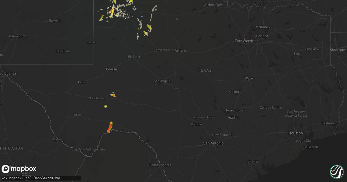
Hail Map in Texas on May 24, 2021
Get this storm
May 24 map
$229
one time, instant access
Download today. No call, no setup
Keep the $229
Bought the map and want the full workflow? Apply the entire $229 to a subscription within 7 days. None of it is wasted.
Every map, not just this one
This buys you this map. Subscription and you get every map we run, in the markets you choose from a few cities to whole states to nationwide. Plus real-time alerts the moment a storm fires.
Contact data
Name, contact info, occupancy, even credit band for addresses in the footprint. You go from where it hit to who to call.
Become the source they trust
Unlimited branding weather history reports on demand. You already have the documented answer ready for the property owner, and you are the one who showed up with it.
Property data and RoofTrace estimates
Pull up any address you have got, its value and the exact code rules for that jurisdiction, straight from One Click Code. Then RoofTrace estimates the squares, pitch, and roof value, priced the way you price.
Storm reports in Texas
Texas
| Date | Description |
|---|---|
| 05/24/20216:41 PM CDT | A local report indicates 1.00 inch wind near 1 E LEVELLAND |
| 05/24/20216:30 PM CDT | A local report indicates 1.00 inch wind near MORTON |
| 05/24/20216:08 PM CDT | Sparse golf ball sized hail reported by off-duty nws employee. |
| 05/24/20214:20 AM CDT | At 920 PM CDT, severe thunderstorms were located along a line extending from 8 miles southeast of Southland to 8 miles west of Girard, moving north at 25 mph. HAZARD...60 mph wind gusts and quarter size hail. SOURCE...Radar indicated. IMPACT...Hail damage to vehicles is expected. Expect wind damage to roofs, siding, and trees. Locations impacted include... Crosbyton, Spur, Dickens, White River Lake, Ralls, Kalgary, Caprock, Afton and Mcadoo. |
| 05/24/20214:09 AM CDT | At 909 PM CDT/809 PM MDT/, severe thunderstorms were located along a line extending from 19 miles west of Jal Airport to 10 miles southwest of Jal to 6 miles northeast of Mentone, moving east at 25 mph. HAZARD...70 mph wind gusts and quarter size hail. SOURCE...Radar indicated. IMPACT...Hail damage to vehicles is expected. Expect considerable tree damage. Wind damage is also likely to mobile homes, roofs, and outbuildings. Locations impacted include... Kermit, Jal, Wink, Mentone, Jal Airport, Bennett and Winkler County Airport. |
| 05/24/20214:09 AM CDT | At 908 PM CDT, a severe thunderstorm was located 8 miles northwest of Petersburg, or 12 miles southeast of Hale Center, moving east at 10 mph. HAZARD...Ping pong ball size hail and 60 mph wind gusts. SOURCE...Radar indicated. IMPACT...People and animals outdoors will be injured. Expect hail damage to roofs, siding, windows, and vehicles. Expect wind damage to roofs, siding, and trees. Locations impacted include... Floydada and Petersburg. |
| 05/24/20213:42 AM CDT | At 841 PM CDT, severe thunderstorms were located along a line extending from 9 miles southwest of Clairemont to 9 miles south of Post, moving north at 15 mph. HAZARD...60 mph wind gusts and quarter size hail. SOURCE...Radar indicated. IMPACT...Hail damage to vehicles is expected. Expect wind damage to roofs, siding, and trees. Locations impacted include... Post, Lake Alan Henry, Justiceburg and Clairemont. |
| 05/24/20213:14 AM CDT | At 814 PM CDT, a severe thunderstorm was located 14 miles southwest of Orla, or 26 miles west of Mentone, moving east at 20 mph. HAZARD...70 mph wind gusts and quarter size hail. SOURCE...Radar indicated. IMPACT...Hail damage to vehicles is expected. Expect considerable tree damage. Wind damage is also likely to mobile homes, roofs, and outbuildings. Locations impacted include... Mentone and Slash Ranch. |
| 05/24/20212:38 AM CDT | A local report indicates 58 MPH wind near 4 E VEGA |
| 05/24/20212:30 AM CDT | At 730 PM CDT, a severe thunderstorm was located 8 miles southeast of Lehman, or 13 miles south of Morton, moving northeast at 30 mph. HAZARD...60 mph wind gusts and quarter size hail. SOURCE...Radar indicated. IMPACT...Hail damage to vehicles is expected. Expect wind damage to roofs, siding, and trees. Locations impacted include... Whitharral, Pep and Whiteface. |
| 05/24/20212:28 AM CDT | At 728 PM CDT, a cluster of severe thunderstorms were located 6 miles south of Earth to near Tulia, moving northeast at 15 mph. HAZARD...60 mph wind gusts and quarter size hail. SOURCE...Radar indicated. IMPACT...Hail damage to vehicles is expected. Expect wind damage to roofs, siding, and trees. Locations impacted include... Plainview, Tulia, Hale Center, Olton, Hart, Earth, Sudan, Amherst, Kress, Cotton Center, Fieldton, Spade, Claytonville, Halfway, Mackenzie Reservoir, Seth Ward, Nazareth, Edmonson and Springlake. |
| 05/24/20211:55 AM CDT | At 655 PM CDT, a severe thunderstorm was located 5 miles east of Pep, or 11 miles southwest of Littlefield, moving northeast at 25 mph. HAZARD...60 mph wind gusts and half dollar size hail. SOURCE...Radar indicated. IMPACT...Hail damage to vehicles is expected. Expect wind damage to roofs, siding, and trees. Locations impacted include... Littlefield, Anton, Amherst, Fieldton, Spade and Whitharral. |
| 05/24/20211:44 AM CDT | West texas mesonet |
| 05/24/20211:44 AM CDT | At 644 PM CDT, a severe thunderstorm was located 13 miles southeast of Fort Stockton, moving northeast at 10 mph. HAZARD...60 mph wind gusts and half dollar size hail. SOURCE...Radar indicated. IMPACT...Hail damage to vehicles is expected. Expect wind damage to roofs, siding, and trees. This severe thunderstorm will remain over mainly rural areas of central Pecos County.This includes Interstate 10 between mile markers 270 and 280. |
| 05/24/20211:41 AM CDT | At 641 PM CDT, a severe thunderstorm was located 29 miles southeast of Fort Stockton, moving southeast at 10 mph. HAZARD...Golf ball size hail and 60 mph wind gusts. SOURCE...Radar indicated. IMPACT...People and animals outdoors will be injured. Expect hail damage to roofs, siding, windows, and vehicles. Expect wind damage to roofs, siding, and trees. This severe thunderstorm will remain over mainly rural areas of central Pecos and north central Terrell Counties. |
| 05/24/20211:38 AM CDT | At 637 PM CDT, a severe thunderstorm was located over Fieldton, or 10 miles northeast of Littlefield, moving north at 25 mph. HAZARD...Ping pong ball size hail and 60 mph wind gusts. SOURCE...Trained weather spotters reported quarter sized hail. IMPACT...People and animals outdoors will be injured. Expect hail damage to roofs, siding, windows, and vehicles. Expect wind damage to roofs, siding, and trees. Locations impacted include... Olton, Fieldton, Spade, Halfway and Edmonson. |
| 05/24/20211:38 AM CDT | At 638 PM CDT, a severe thunderstorm was located 22 miles southwest of McCamey, moving northeast at 20 mph. HAZARD...Ping pong ball size hail and 60 mph wind gusts. SOURCE...Radar indicated. IMPACT...People and animals outdoors will be injured. Expect hail damage to roofs, siding, windows, and vehicles. Expect wind damage to roofs, siding, and trees. Locations impacted include... Bakersfield.This includes Interstate 10 between mile markers 284 and 307. |
| 05/24/20211:36 AM CDT | At 636 PM CDT, a severe thunderstorm was located over Levelland, moving northeast at 30 mph. HAZARD...60 mph wind gusts and half dollar size hail. SOURCE...Radar indicated. IMPACT...Hail damage to vehicles is expected. Expect wind damage to roofs, siding, and trees. Locations impacted include... Levelland, Anton, Whitharral, Smyer and Opdyke West. |
| 05/24/20211:24 AM CDT | At 623 PM CDT, a cluster of severe thunderstorms were located 10 miles northeast of Earth, moving northeast at 15 mph. HAZARD...60 mph wind gusts and quarter size hail. SOURCE...Radar indicated. IMPACT...Hail damage to vehicles is expected. Expect wind damage to roofs, siding, and trees. Locations impacted include... Dimmitt, Olton, Hart, Earth, Nazareth and Springlake. |
| 05/24/202112:54 AM CDT | At 554 PM CDT, a severe thunderstorm was located 4 miles north of Levelland, moving northeast at 20 mph. HAZARD...60 mph wind gusts and half dollar size hail. SOURCE...Radar indicated. IMPACT...Hail damage to vehicles is expected. Expect wind damage to roofs, siding, and trees. Locations impacted include... Littlefield, Anton, Spade, Whitharral and Opdyke West. |
| 05/24/202112:42 AM CDT | Mesonet station 59 3nw knox city. |
| 05/24/202112:06 AM CDT | At 505 PM CDT, a severe thunderstorm was located 8 miles south of Sanderson, moving north at 20 mph. HAZARD...Ping pong ball size hail and 60 mph wind gusts. SOURCE...Radar indicated. IMPACT...People and animals outdoors will be injured. Expect hail damage to roofs, siding, windows, and vehicles. Expect wind damage to roofs, siding, and trees. Locations impacted include... Sanderson. |
| 05/24/202112:06 AM CDT | A local report indicates 1.00 inch wind near 1 SW LUBBOCK |
| 05/23/202111:34 PM CDT | West texas mesonet |
| 05/23/202111:24 PM CDT | At 424 PM CDT, a severe thunderstorm was located 22 miles south of Sanderson, moving north at 15 mph. HAZARD...Ping pong ball size hail and 60 mph wind gusts. SOURCE...Radar indicated. IMPACT...People and animals outdoors will be injured. Expect hail damage to roofs, siding, windows, and vehicles. Expect wind damage to roofs, siding, and trees. This severe thunderstorm will remain over mainly rural areas of east central Brewster and southwestern Terrell Counties. |
| 05/23/202110:45 PM CDT | West texas mesonet report |
| 05/23/20219:48 PM CDT | A local report indicates 1.00 inch wind near SPUR |
All States Impacted by Hail Map on May 24, 2021
Cities Impacted by Hail Map on May 24, 2021
- Levelland, TX
- Littlefield, TX
- Selden, KS
- Colby, KS
- Mcadoo, TX
- Texico, NM
- Clovis, NM
- Cimarron, KS
- Eau Claire, WI
- Lubbock, TX
- Anton, TX
- Atwood, KS
- Garden City, KS
- Slaton, TX
- Syracuse, KS
- Deerfield, KS
- Lakin, KS
- Pierceville, KS
- Holcomb, KS
- Ingalls, KS
- Kendall, KS
- Fieldton, TX
- Cannon Afb, NM
- Grove City, MN
- Farwell, TX
- Petersburg, TX
- Plainview, TX
- Hale Center, TX
- Sudan, TX
- Ensign, KS
- Dodge City, KS
- Copeland, KS
- Ulysses, KS
- Satanta, KS
- Ropesville, TX
- Leoti, KS
- Gail, TX
- Fluvanna, TX
- Jennings, KS
- Dresden, KS
- Sublette, KS
- Ralls, TX
- Elk Mound, WI
- Shallowater, TX
- Morland, KS
- Lorenzo, TX
- Snyder, TX
- Abernathy, TX
- Justiceburg, TX
- Morton, TX
- Dryden, TX
- Post, TX
- Spur, TX
- Burlington, CO
- Marathon, TX
- Muleshoe, TX
- Earth, TX
- Fort Stockton, TX
- Springlake, TX
- Holly, CO
- Montezuma, KS
- Oberlin, KS
- Olton, TX
- Amherst, TX
- Scott City, KS
- Winona, KS
- Meadow, TX
- Afton, TX
- Hoxie, KS
- Oakley, KS
- Floydada, TX
- Ozona, TX
- Hart, TX
- Dickens, TX
- Collyer, KS
- Dimmitt, TX
- Whiteface, TX
- Iraan, TX
- Smyer, TX
- Crosbyton, TX
- Knox City, TX
- Friona, TX
- Healy, KS
- Grinnell, KS
- Johnson, KS
- Phillipsburg, KS
- Naponee, NE
- Agra, KS
- Kensington, KS
- Franklin, NE
- Bloomington, NE


