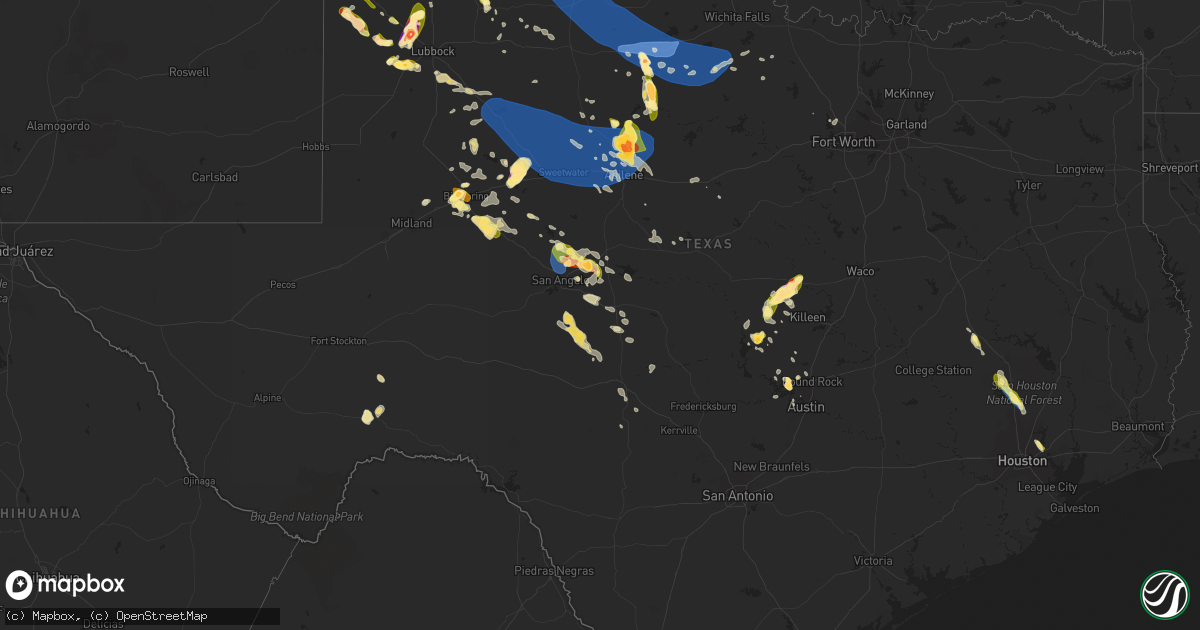
Hail Map in Texas on May 23, 2023
Get this storm
May 23 map
$229
one time, instant access
Download today. No call, no setup
Keep the $229
Bought the map and want the full workflow? Apply the entire $229 to a subscription within 7 days. None of it is wasted.
Every map, not just this one
This buys you this map. Subscription and you get every map we run, in the markets you choose from a few cities to whole states to nationwide. Plus real-time alerts the moment a storm fires.
Contact data
Name, contact info, occupancy, even credit band for addresses in the footprint. You go from where it hit to who to call.
Become the source they trust
Unlimited branding weather history reports on demand. You already have the documented answer ready for the property owner, and you are the one who showed up with it.
Property data and RoofTrace estimates
Pull up any address you have got, its value and the exact code rules for that jurisdiction, straight from One Click Code. Then RoofTrace estimates the squares, pitch, and roof value, priced the way you price.
Storm reports in Texas
Texas
| Date | Description |
|---|---|
| 05/23/20236:55 PM CDT | A local report indicates 1.75 inch wind near SSW ROUNDUP |
| 05/23/20236:50 PM CDT | A local report indicates 1.75 inch wind near 5 E SPADE |
| 05/23/20236:36 PM CDT | A local report indicates 1.50 inch wind near 7 NE ANTON |
| 05/23/20236:31 PM CDT | A local report indicates 1.50 inch wind near 1 WNW LARIAT |
| 05/23/20236:31 PM CDT | A local report indicates 1.00 inch wind near 5 SSW WHITHARRAL |
| 05/23/20236:26 PM CDT | Report from mping: quarter |
| 05/23/20236:23 PM CDT | A local report indicates 1.00 inch wind near 4 N SHALLOWATER |
| 05/23/20236:21 PM CDT | A local report indicates 1.50 inch wind near 2 NW ROPESVILLE |
| 05/23/20236:20 PM CDT | Possibly larger hail near this location. |
| 05/23/20236:20 PM CDT | Reports of multiple vehicles damaged... Possibly larger hail than 2.75 inch |
| 05/23/20236:20 PM CDT | Reports of multiple vehicles damaged... Possibly larger hail than 2.75 inch. |
| 05/23/20236:15 PM CDT | 2 inch hail report from public via twitter. |
| 05/23/20236:01 PM CDT | A local report indicates 1.25 inch wind near BOVINA |
| 05/23/20235:58 PM CDT | Cocorahs report of ping pong size hail. |
| 05/23/20235:37 PM CDT | A local report indicates 1.00 inch wind near 1 S SUDAN |
| 05/23/20234:00 PM CDT | Large trees and tree debris fallen in the road and blocking traffic. |
| 05/23/20233:51 PM CDT | Quarter size hail reported near mcdade park. |
| 05/23/20233:48 PM CDT | Powerlines snapped. |
| 05/23/20233:40 PM CDT | Report from mping: 1-inch tree limbs broken; shingles blown off. |
| 05/23/20233:34 PM CDT | *** 2 fatal... 7 inj *** two were killed and seven injured at a home construction site when the structure under construction collapsed. Time estimated by radar. |
| 05/23/20233:22 PM CDT | Report and photos from fire department personnel of trees down in various points of panorama village. Time estimated from radar. |
| 05/23/20233:13 PM CDT | Trees down along jamaica drive. Time estimated by radar. |
| 05/23/20232:32 PM CDT | Social media pictures of multiple trees and large tree branches down along crosstimbers drive in huntsville. Time estimated by radar. |
| 05/23/20232:32 PM CDT | Tree snapped and fell onto an apartment complex causing roof damage. Time estimated by radar. |
| 05/22/202311:20 PM CDT | West texas mesonet. |
| 05/22/202311:18 PM CDT | A local report indicates 1.75 inch wind near MILES |
| 05/22/202311:15 PM CDT | West texas mesonet. Corrected for earlier time. |
| 05/22/202311:14 PM CDT | A local report indicates 1.00 inch wind near MILES |
| 05/22/202311:10 PM CDT | West texas mesonet. |
| 05/22/202311:10 PM CDT | Major residential damage as well as a missing sea container storage building. |
| 05/22/202310:12 PM CDT | A local report indicates 70 MPH wind near 2 SSE HACKBERRY |
| 05/22/20239:50 PM CDT | Power lines down along highway 180 roughly 1/2 mile east of fm600. |
| 05/22/20239:32 PM CDT | A local report indicates 1.00 inch wind near STAMFORD |
| 05/22/20239:20 PM CDT | A local report indicates 2.50 inch wind near 2 NW NUGENT |
| 05/22/20239:17 PM CDT | A local report indicates 60 MPH wind near 1 S NORTHFIELD |
| 05/22/20239:15 PM CDT | A local report indicates 60 MPH wind near 4 W SWEETWATER |
| 05/22/20239:15 PM CDT | Short-lived tornado. |
| 05/22/20239:10 PM CDT | Tree blown into power lines. |
| 05/22/20238:50 PM CDT | Broadcast media relayed a report of approximately ping pong ball size hail in big spring. Time estimated by radar. |
| 05/22/20238:50 PM CDT | Ping pong ball sized hail reported in arnett. |
| 05/22/20238:35 PM CDT | Ping ping ball to dime size hail on the sterling-glasscock county line on us-87. Reported by county sheriff. |
| 05/22/20238:35 PM CDT | Trained spotter measured 1.9 inch hailstone near colorado city airport. |
| 05/22/20238:27 PM CDT | 2- 2.25 inch hail just east of irby. |
| 05/22/20238:25 PM CDT | 2 inch diameter hail 6.5 miles west of pidcoke on star ln. |
| 05/22/20238:22 PM CDT | A local report indicates 58 MPH wind near 1 S PLAINVIEW |
| 05/22/20237:28 PM CDT | Relayed report of hail in goree. |
| 05/22/20237:28 PM CDT | Mesonet station 31 fluvanna 3w. |
| 05/22/20237:15 PM CDT | A local report indicates 1.50 inch wind near 6 N PLAINVIEW |
All States Impacted by Hail Map on May 23, 2023
Cities Impacted by Hail Map on May 23, 2023
- Des Moines, NM
- Madisonville, TX
- Bedias, TX
- Huntsville, TX
- Wewahitchka, FL
- Crestview, FL
- Waynesboro, MS
- New Waverly, TX
- Willis, TX
- Montgomery, TX
- Molino, FL
- Cantonment, FL
- Riverview, FL
- Conroe, TX
- Tucumcari, NM
- Chiefland, FL
- Mosquero, NM
- Clovis, NM
- Houston, TX
- Grady, NM
- Texico, NM
- San Jon, NM
- Logan, NM
- Broadview, NM
- Levelland, TX
- Ropesville, TX
- Lubbock, TX
- Sudan, TX
- Amherst, TX
- Shallowater, TX
- Anton, TX
- Gladstone, NM
- Larose, LA
- Cut Off, LA
- Lockport, LA
- Galliano, LA
- Dulac, LA
- Clayton, NM
- Fort Stockton, TX
- American Falls, ID
- McDavid, FL
- Century, FL
- Eureka, NV
- Alva, FL
- Oviedo, FL
- Kaycee, WY
- Humble, TX
- Muleshoe, TX
- Moorcroft, WY
- Okeechobee, FL
- North Fort Myers, FL
- Punta Gorda, FL
- Farwell, TX
- Bovina, TX
- Wolfforth, TX
- Abernathy, TX
- Friona, TX
- Leander, TX
- Hale Center, TX
- Littlefield, TX
- Earth, TX
- Enochs, TX
- Kress, TX
- Plainview, TX
- Morton, TX
- Goree, TX
- Seymour, TX
- Springlake, TX
- Justiceburg, TX
- Fluvanna, TX
- Snyder, TX
- Post, TX
- Pep, TX
- Weinert, TX
- Floydada, TX
- Throckmorton, TX
- Haskell, TX
- Rotan, TX
- Jayton, TX
- Hermleigh, TX
- Lueders, TX
- Avoca, TX
- Albany, TX
- Lampasas, TX
- Copperas Cove, TX
- Kempner, TX
- Gatesville, TX
- Sweetwater, TX
- Roby, TX
- Hamlin, TX
- McCaulley, TX
- Sylvester, TX
- Anson, TX
- Big Spring, TX
- Garden City, TX
- Westbrook, TX
- Colorado City, TX
- Sterling City, TX
- Turkey, TX
- Childress, TX
- Purmela, TX
- Abilene, TX
- Stamford, TX
- Portland, ND
- Pocatello, ID
- Firth, ID
- Blackfoot, ID
- Hawley, TX
- Merkel, TX
- Lakeview, TX
- Quitaque, TX
- Silverton, TX
- Clarendon, TX
- Tell, TX
- Matador, TX
- Paducah, TX
- Cee Vee, TX
- Loraine, TX
- Roscoe, TX
- Trent, TX
- Tye, TX
- Nolan, TX
- Dyess Afb, TX
- Shelley, ID
- Idaho Falls, ID
- Bronte, TX
- Robert Lee, TX
- San Angelo, TX
- Crowell, TX
- Steele, ND
- Benjamin, TX
- Pingree, ND
- Bridger, MT
- Ira, TX
- Hannaford, ND
- Wimbledon, ND
- Dazey, ND
- Volborg, MT
- Dryden, TX
- Shields, ND
- Woodworth, ND
- Hope, ND
- Ismay, MT
- New Leipzig, ND
- Carson, ND
- Liberty Hill, TX
- Cooperstown, ND
- Buffalo, WY
- Model, CO
- Georgetown, TX
- Florence, TX
- Austin, TX
- Spicewood, TX
- Buchanan, ND
- Gail, TX
- Hereford, TX
- Canyon, TX
- Wildorado, TX
- Crosbyton, TX
- Big Timber, MT
- Amarillo, TX
- Burnet, TX
- Wilson, TX
- Tulia, TX
- Brandon, FL
- Coahoma, TX
- Miles City, MT
- Summersville, MO
- Eunice, MO
- Myakka City, FL
- Stanton, TX
- Moore Haven, FL
- Branson, CO
- Olton, TX
- McLeod, MT
- Cedar Park, TX
- Courtenay, ND
- Brockton, MT
- Claude, TX
- Braddock, ND
- Milton, FL
- Lockney, TX
- Groveland, FL
- Poplar, MT
- Selfridge, ND
- Hammond, MT
- Panhandle, TX
- Happy, TX
- Labelle, FL
- Flomaton, AL
- Munday, TX
- Miles, TX
- Ballinger, TX
- Rowena, TX
- Mereta, TX
- Paint Rock, TX
- Holliday, TX
- Newcastle, TX
- Olney, TX
- Scotland, TX
- Archer City, TX
- Windthorst, TX
- Afton, TX
- Memphis, TX
- Kensal, ND
- Otter, MT
- Lakehead, CA
- Knox City, TX
- Vancourt, TX
- Eden, TX
- Duke, OK
- Canon City, CO
- Cotopaxi, CO
- Mandan, ND
- White Deer, TX
- Reeder, ND
- Hettinger, ND
- Brownwood, TX
- Eastland, TX
- Aspermont, TX
- Bellevue, TX
- Old Glory, TX
- Millersview, TX
- Cohagen, MT
- Christoval, TX
- Fort McKavett, TX
- Eldorado, TX
- Cisco, TX
- Penrose, CO
- Coleman, TX
- Santa Anna, TX
- Driscoll, ND
- Dawson, ND
- Hedley, TX
- Girard, TX
- Hart, TX
- Roaring Springs, TX
- Menard, TX
- Quail, TX
- Odonnell, TX
- New Salem, ND
- Cleveland, ND
- Rosebud, MT
- Redding, CA
- Bangs, TX
- Slaton, TX
- Jacksboro, TX
- Knott, TX
- Dickens, TX
- Gorman, TX
- Baird, TX
- Clyde, TX
- Colorado Springs, CO
- Tahoka, TX
- Junction, TX
- Fort Worth, TX
- Round Rock, TX
- Mason, TX
- Leakey, TX
- Rocksprings, TX
- Eola, TX
- Marble Falls, TX
- Henrietta, TX
- Haslet, TX
- Springtown, TX
- Boyd, TX
- Tuscola, TX


