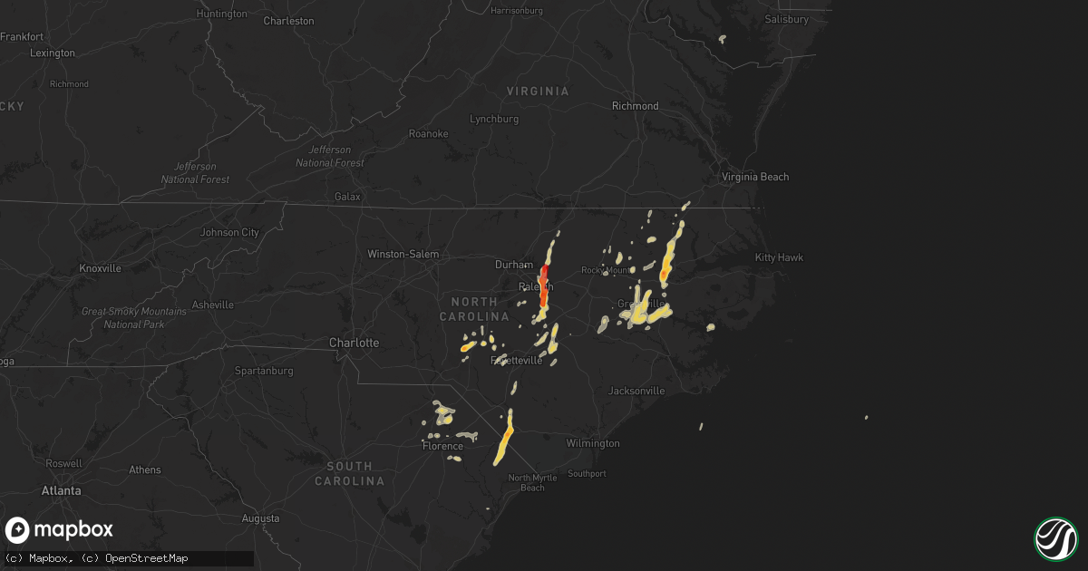
Hail Map on May 23, 2012
Get this storm
May 23 map
$229
one time, instant access
Download today. No call, no setup
Keep the $229
Bought the map and want the full workflow? Apply the entire $229 to a subscription within 7 days. None of it is wasted.
Every map, not just this one
This buys you this map. Subscription and you get every map we run, in the markets you choose from a few cities to whole states to nationwide. Plus real-time alerts the moment a storm fires.
Contact data
Name, contact info, occupancy, even credit band for addresses in the footprint. You go from where it hit to who to call.
Become the source they trust
Unlimited branding weather history reports on demand. You already have the documented answer ready for the property owner, and you are the one who showed up with it.
Property data and RoofTrace estimates
Pull up any address you have got, its value and the exact code rules for that jurisdiction, straight from One Click Code. Then RoofTrace estimates the squares, pitch, and roof value, priced the way you price.
States Impacted by Hail Map on May 23, 2012
Storm reports
Nebraska
| Date | Description |
|---|---|
| 05/23/20126:36 PM CDT | A local report indicates 1.00 inch wind near 1 E UTICA |
| 05/23/20125:30 PM CDT | A local report indicates 1.00 inch wind near 8 NNW NORTH BEND |
| 05/23/201212:46 AM CDT | Quarter-size hail accompanied by wind gusts of 40-50 mph on the south side of grand island. |
| 05/23/201212:45 AM CDT | Delayed report. Hail lasted approximately 5-10 minutes and covered the ground with quarter sized stones near the intersection of highway 34/281. |
| 05/23/201212:21 AM CDT | Estimated 65-70 mph wind gust just west of prosser at 1221 am cdt. |
| 05/23/201212:13 AM CDT | Quarter-size hail ongoing in edison...accompanied by sustained wind of 40 mph. |
| 05/23/201212:00 AM CDT | Ping pong ball size hail ongoing one mile west of kearney. |
| 05/22/201211:57 PM CDT | 50 mph wind gust also estimated. |
| 05/22/201211:45 PM CDT | 65-70 mph wind gust estimated 3 miles west of kearney. |
| 05/22/201211:37 PM CDT | Quarter-size hail ongoing at elm creek. |
| 05/22/20129:47 PM CDT | A local report indicates 1.00 inch wind near OSMOND |
| 05/22/20129:31 PM CDT | A local report indicates 1.25 inch wind near 6 N BARTLETT |
| 05/22/20129:12 PM CDT | A local report indicates 1.00 inch wind near 7 NW BARTLETT |
| 05/22/20128:21 PM CDT | A local report indicates 1.25 inch wind near 1 ENE VALLEY |
| 05/22/20128:13 PM CDT | A local report indicates 60 MPH wind near 1 NW VALLEY |
| 05/22/20128:12 PM CDT | 52 knot wind also. |
| 05/22/20127:48 PM CDT | A local report indicates 68 MPH wind near WAHOO |
| 05/22/20127:16 PM CDT | A local report indicates 1.50 inch wind near 2 ESE DWIGHT |
| 05/22/20127:10 PM CDT | Trees and power lines blown down nar county road 21 and roads p and u. |
| 05/22/20127:00 PM CDT | A local report indicates 1.00 inch wind near 2 ENE DWIGHT |
Louisiana
| Date | Description |
|---|---|
| 05/23/20125:30 PM CDT | Few trees uprooted...funnel cloud sighted briefly by deputies...1.75 inches of rainfall measured at the eoc. |
| 05/23/20123:07 PM CDT | Seven to eight houses had minor damage in community of arabi in saint bernard parish. Carport destroyed. Time based on radar |
North Carolina
| Date | Description |
|---|---|
| 05/23/20126:55 PM CDT | Quarter size hail reported by the public along the hertford/bertie county line. |
| 05/23/20126:53 PM CDT | Post office reported quarter sized hail in speed |
| 05/23/20126:05 PM CDT | Golfball to hen egg size hail reported by the public. |
| 05/23/20126:04 PM CDT | A local report indicates 1.00 inch wind near GREENVILLE |
| 05/23/20126:01 PM CDT | A local report indicates 1.00 inch wind near GREENVILLE |
| 05/23/20125:59 PM CDT | A local report indicates 1.00 inch wind near GREENVILLE |
| 05/23/20125:55 PM CDT | A local report indicates 1.00 inch wind near WINTERVILLE |
| 05/23/20125:49 PM CDT | A local report indicates 1.00 inch wind near 3 N WILLIAMSTON |
| 05/23/20125:35 PM CDT | A couple of trees down at mile marker 152.5 and i-95. |
| 05/23/20125:35 PM CDT | Light poles leaning at 45 degree angle |
| 05/23/20125:25 PM CDT | A local report indicates 1.00 inch wind near GREENVILLE |
| 05/23/20125:21 PM CDT | Nickels to quarter size on willow run drive |
| 05/23/20125:15 PM CDT | Quarter size hail at the sheriff office |
| 05/23/20124:45 PM CDT | Quarter size hail on buffalo mill road |
| 05/23/20124:20 PM CDT | Dime to quarter size hail with estimated winds greater than 50 mph |
| 05/23/20124:14 PM CDT | Nickel to quarter size hail |
| 05/23/20124:10 PM CDT | Half dollar hail |
| 05/23/20124:05 PM CDT | Tree down and other objects in road at hwy 1 and jenkins rd. |
| 05/23/20124:05 PM CDT | Quarter size hail reported on hwy 211. |
| 05/23/20124:03 PM CDT | Quarter sized hail at highway 98 and u.s. One |
| 05/23/20123:45 PM CDT | Quarter size hail |
| 05/23/20123:42 PM CDT | Flag pole bent in half at capital blvd and burlington mills road... Time based on radar |
| 05/23/20123:40 PM CDT | Nickel to quarter size hail along buffaloe road |
| 05/23/20123:38 PM CDT | Quarter size hail at fox road |
| 05/23/20123:30 PM CDT | Quarter to near golf ball size hail on hayes lennon rd. |
| 05/23/20123:30 PM CDT | Golfball size hail fell for 6-7 minutes on porters swamp road. |
| 05/23/20123:26 PM CDT | Quarter to golfball size hail reported in fair bluff. |
| 05/23/20123:15 PM CDT | Tree downed by wind covered both lanes of aiken road |
| 05/23/20123:14 PM CDT | 1 inch hail near southern pines |
| 05/23/20123:10 PM CDT | Fell from 400 pm to 410 pm at the intersection of us hwy 70 and raynor rd. |
| 05/23/20123:08 PM CDT | Linden road at chicken plant road |
| 05/23/20123:05 PM CDT | Clemmons state forest |
| 05/23/20123:02 PM CDT | Business 70 at jog road |
| 05/23/20123:00 PM CDT | Some hail approaching golf ball size |
| 05/23/20122:58 PM CDT | Tower road at guy road |
| 05/23/20122:50 PM CDT | 1.75 inch hail reported in johnston county denting vehicles |
| 05/23/20122:50 PM CDT | Lasted 5-7 minutes... Hail covered deck. |
| 05/23/20122:40 PM CDT | Quarter size hail near i40 at exit 319 |
| 05/23/20122:37 PM CDT | Nickel to quarter size hail ongoing at mckoy town road and chatman lane |
| 05/23/20121:58 PM CDT | 1 inch hail |
| 05/23/20121:45 PM CDT | Quarter size hail at tdm farm |
| 05/22/20127:30 PM CDT | Quarter size hail reported by public. |
Iowa
| Date | Description |
|---|---|
| 05/23/20126:45 PM CDT | A local report indicates 1.00 inch wind near 2 S ONAWA |
| 05/23/20126:34 PM CDT | A local report indicates 1.00 inch wind near BLENCOE |
| 05/22/20129:20 PM CDT | Hail lasted until 925 pm |
| 05/22/20128:40 PM CDT | Measured by weather station. 1/2 mile north of location boat dealership had damage. Delayed report. |
| 05/22/20128:32 PM CDT | Thirteen large power poles snapped along a mile long stretch of perkins ave. One third of the roof of a hog confinement building ripped off half a mile up the road. Ano |
| 05/22/20128:30 PM CDT | A local report indicates 1.00 inch wind near 5 E ODEBOLT |
| 05/22/20128:30 PM CDT | Damage from near east of odebolt to near early to the east side of lake view. Numerous power poles down...roofs blown off of outbuildings and turkey and hog confinement |
| 05/22/20127:40 PM CDT | Quarter hail with strong winds |
| 05/22/20127:20 PM CDT | Large branches down |
| 05/22/20127:10 PM CDT | A number of trees in a nearby grove either downed or lost large limbs. Likely gustnado also observed. Winds were estimated at 60 to 65 mph. Time estimated from radar. |
| 05/22/20127:00 PM CDT | Trees downed. |
Minnesota
| Date | Description |
|---|---|
| 05/23/20126:05 PM CDT | Also had heavy rain with greater than 2 inch per hour rates. |
| 05/23/20124:58 PM CDT | Power lines down near county road 1. |
| 05/23/20124:53 PM CDT | Measured at the new ulm airport. |
| 05/23/201212:36 PM CDT | A local report indicates 1.00 inch wind near 2 W LOWRY |
| 05/22/20128:35 PM CDT | A local report indicates 1.00 inch wind near 2 W ROUND LAKE |
| 05/22/20128:28 PM CDT | A local report indicates 59 MPH wind near 2 SW PRIOR LAKE |
| 05/22/20128:14 PM CDT | Measured by mndot equipment along highway 19 west of new prague. |
| 05/22/20127:57 PM CDT | A local report indicates 1.00 inch wind near 4 W LAKEFIELD |
| 05/22/20127:30 PM CDT | Mn hwy 112 and cr 15 sheds and debris blocking road. Numerous large trees snapped off...late report. |
| 05/22/20127:17 PM CDT | A local report indicates 1.00 inch wind near 6 S RUSHMORE |
South Carolina
| Date | Description |
|---|---|
| 05/23/20123:15 PM CDT | Quarter size hail in darlington. |
| 05/23/20123:05 PM CDT | Dime to quarter size hail reported on hwy 76. |
| 05/23/20123:00 PM CDT | Quarter size hail in green sea. |
| 05/23/20122:55 PM CDT | Quarter size hail fell for 5 minutes. |
| 05/23/20122:20 PM CDT | Slightly larger than quarter size hail fell for approximately 10 minutes. |
| 05/23/20121:58 PM CDT | Dime to quarter size hail on hwy 9 north of downtown bennettsville. |
| 05/23/20121:16 PM CDT | Public report of nickel to quarter sized hail |
Kansas
| Date | Description |
|---|---|
| 05/23/201212:10 AM CDT | A local report indicates 61 MPH wind near 2 SE LENORA |
| 05/23/201212:00 AM CDT | Strong thunderstorm outflow winds broke 50-60 utility poles across central and northern graham county. Six irrigation pivots were overturned...two outbuildings were dam |
| 05/22/201211:50 PM CDT | A local report indicates 1.25 inch wind near 12 NE HOXIE |
| 05/22/201211:20 PM CDT | A local report indicates 1.00 inch wind near 11 S HERNDON |
| 05/22/201210:55 PM CDT | A local report indicates 1.00 inch wind near COLBY |
| 05/22/201210:52 PM CDT | A local report indicates 1.00 inch wind near 4 N COLBY |
| 05/22/201210:45 PM CDT | A local report indicates 1.00 inch wind near 13 NW LEVANT |
Colorado
| Date | Description |
|---|---|
| 05/22/201210:26 PM CDT | A local report indicates 1.00 inch wind near 2 ENE HARTMAN |
| 05/22/201210:06 PM CDT | A local report indicates 1.00 inch wind near 5 ENE LAMAR |
| 05/22/20129:50 PM CDT | A local report indicates 1.75 inch wind near LAMAR |
| 05/22/20129:30 PM CDT | A local report indicates 1.00 inch wind near 6 W KARVAL |
| 05/22/20128:46 PM CDT | Crowley county dispatch |
| 05/22/20128:45 PM CDT | A local report indicates 1.00 inch wind near 6 W KARVAL |
Cities Impacted by Hail Map on May 23, 2012
- Cameron, NC
- Carthage, NC
- Sanford, NC
- Greenville, NC
- Hudson, SD
- Fairview, SD
- Ordway, CO
- Rich Square, NC
- Vass, NC
- Monroe, NE
- Selden, KS
- Sheldon, IA
- Worthington, MN
- Sibley, IA
- Matlock, IA
- Lake Park, IA
- Ocheyedan, IA
- Boyden, IA
- George, IA
- Heron Lake, MN
- Okabena, MN
- Ashton, IA
- Lakefield, MN
- Bigelow, MN
- Round Lake, MN
- Brewster, MN
- Harris, IA
- North Bend, NE
- Dodge, NE
- Eads, CO
- Wiley, CO
- Lamar, CO
- Plainview, NE
- Creighton, NE
- Brunswick, NE
- Neligh, NE
- Sanborn, IA
- Hospers, IA
- Archer, IA
- Gates, NC
- Tarboro, NC
- Garland, NE
- Milford, NE
- Brainard, NE
- Raymond, NE
- Fremont, NE
- Omaha, NE
- Arlington, NE
- Ulysses, NE
- Staplehurst, NE
- Kennard, NE
- Ashland, NE
- Valparaiso, NE
- Ithaca, NE
- Seward, NE
- Malcolm, NE
- Elkhorn, NE
- David City, NE
- Yutan, NE
- Ceresco, NE
- Wahoo, NE
- Dwight, NE
- Weston, NE
- Waterloo, NE
- Bruno, NE
- Colon, NE
- Beaver Crossing, NE
- Mead, NE
- Valley, NE
- Bennington, NE
- Washington, NE
- Bee, NE
- Pleasant Dale, NE
- Utica, NE
- Davey, NE
- Mclean, NE
- Osmond, NE
- Lucan, MN
- Vesta, MN
- Pinehurst, NC
- Aberdeen, NC
- Southern Pines, NC
- Nelson, MN
- Ravenna, NE
- Loup City, NE
- Hazard, NE
- Ashton, NE
- Rockville, NE
- Magnolia, MN
- Holly, CO
- Ahoskie, NC
- Cofield, NC
- Youngsville, NC
- Benson, NC
- Clayton, NC
- Raleigh, NC
- Coats, NC
- Knightdale, NC
- Garner, NC
- Angier, NC
- Four Oaks, NC
- Franklinton, NC
- Wake Forest, NC
- Willow Spring, NC
- Gibbon, NE
- Wood River, NE
- Shelton, NE
- Herndon, KS
- Winnetoon, NE
- Aulander, NC
- Windsor, NC
- Lincoln, NE
- Bennettsville, SC
- Yoder, CO
- Rush, CO
- Suffolk, VA
- Colby, KS
- McDonald, KS
- Jackson, MN
- Tracy, MN
- Edison, NE
- Atwood, KS
- Eustis, NE
- Cambridge, NE
- Holbrook, NE
- North Loup, NE
- Farwell, NE
- Saint Paul, NE
- Elm Creek, NE
- Scotia, NE
- Wolbach, NE
- Boelus, NE
- Elba, NE
- Greeley, NE
- Pleasanton, NE
- Amherst, NE
- Miller, NE
- Williamston, NC
- Sac City, IA
- Odebolt, IA
- Wall Lake, IA
- Lake View, IA
- Kiron, IA
- West End, NC
- Fair Bluff, NC
- Evergreen, NC
- Galivants Ferry, SC
- Nichols, SC
- Orrum, NC
- Aynor, SC
- Cerro Gordo, NC
- Chadbourn, NC
- Green Sea, SC
- Loris, SC
- Lumberton, NC
- Tekamah, NE
- Decatur, NE
- Stokes, NC
- Ord, NE
- Fulda, MN
- Reading, MN
- Palmer, NE
- Axtell, NE
- Webb, IA
- Alda, NE
- Doniphan, NE
- Grand Island, NE
- Darlington, SC
- Hancock, MN
- Phillipsburg, KS
- Arapahoe, NE
- Cyrus, MN
- Alexandria, MN
- Lowry, MN
- Starbuck, MN
- Hartsville, SC
- Humphrey, NE
- Genoa, NE
- Columbus, NE
- Platte Center, NE
- Schuyler, NE
- Cedar Rapids, NE
- Saint Edward, NE
- Lindsay, NE
- Belgrade, NE
- Clarkson, NE
- Creston, NE
- Leigh, NE
- Fullerton, NE
- Elwood, NE
- Winterville, NC
- Pikeville, NC
- Goldsboro, NC
- La Grange, NC
- Snow Hill, NC
- Sleepy Eye, MN
- Ayden, NC
- Grimesland, NC
- Chocowinity, NC
- Washington, NC
- Scribner, NE
- Whitakers, NC
- Burbank, SD
- Vermillion, SD
- Hastings, NE
- Inland, NE
- Gayville, SD
- Sugar City, CO
- Pamplico, SC
- Effingham, SC
- Florence, SC
- Schleswig, IA
- Ute, IA
- Blencoe, IA
- West Point, NE
- Danbury, IA
- Hooper, NE
- Onawa, IA
- Battle Creek, IA
- Oakland, NE
- Charter Oak, IA
- Arthur, IA
- Craig, NE
- Ida Grove, IA
- Soldier, IA
- Castana, IA
- Early, IA
- Mapleton, IA
- Pipestone, MN
- Edgerton, MN
- Jasper, MN
- Gary, SD
- Marietta, MN
- Enfield, NC
- Grainfield, KS
- Grinnell, KS
- Society Hill, SC
- Cheraw, SC
- Blenheim, SC
- Randolph, NE
- Lake Wilson, MN
- Georgetown, SC
- Holly Springs, NC
- Pendleton, NC
- Margarettsville, NC
- Woodstock, MN
- Hardwick, MN
- Cedar Bluffs, NE
- Nickerson, NE
- Silver Creek, NE
- Raeford, NC
- Fayetteville, NC
- Fort Bragg, NC
- Hobgood, NC
- Denver, CO
- Garvin, MN
- Slayton, MN
- Inwood, IA
- Bartlett, NE
- Ericson, NE
- Ewing, NE
- Scranton, NC
- Balaton, MN
- Walnut Grove, MN
- Milroy, MN
- Gramercy, LA
- Paulina, LA
- Vanceboro, NC
- Grifton, NC
- Roseboro, NC
- Salemburg, NC
- Autryville, NC
- Godwin, NC
- Titonka, IA
- Burt, IA
- Darfur, MN
- New Ulm, MN
- Hanska, MN
- Saint James, MN
- Comfrey, MN
- Dresden, KS
- Midland, VA
- Jennings, KS
- Morland, KS
- Clayton, KS
- Rexford, KS
- Hoxie, KS
- Oberlin, KS
- Olivia, MN
- Funk, NE
- Newton Grove, NC
- Clinton, NC
- Blair, NE
- Scotland Neck, NC
- York, NE
- Hendley, NE
- Wilsonville, NE
- Lafayette, MN
- Fort Calhoun, NE
- Appleton, MN
- Rock Valley, IA
- Hull, IA
- Sioux Center, IA
- Kearney, NE
- Marion, SC
- Latta, SC
- Dillon, SC
- Sellers, SC
- Beresford, SD
- Chambers, NE
- Adrian, MN
- Waverly, NE
- McCool Junction, NE
- Exeter, NE
- Waco, NE
- Luverne, MN
- New Orleans, LA
- Wausa, NE
- Dunn, NC
- Lamberton, MN
- Morton, MN
- Redwood Falls, MN
- Defiance, IA
- Minden, NE
- Kittrell, NC
- Morris, MN
- Correll, MN
- Bellingham, MN
- Ortonville, MN
- Odessa, MN
- Windom, MN
- Alton, IA
- Hartley, IA
- Orange City, IA
- Primghar, IA
- Granville, IA
- Fordyce, NE
- Saint Helena, NE
- Sauk Centre, MN
- Lu Verne, IA
- Bird Island, MN
- Ellsworth, MN
- Rock Rapids, IA
- Little Rock, IA
- Rushmore, MN
- Woodland, NC
- Kelford, NC
- Roxobel, NC
- Olney Springs, CO
- Greenwell Springs, LA
- Eure, NC
- Fuquay Varina, NC
- Hector, MN
- Mountain Lake, MN
- Doon, IA
- Bogalusa, LA
- Monument, KS
- Lyons, NE
- Denison, IA
- Linwood, NE
- Breda, IA
- Deloit, IA
- Rogers, NE
- Vail, IA
- Lytton, IA
- Ricketts, IA
- Uehling, NE
- Beaver Creek, MN
- Ireton, IA
- Belview, MN
- Wabasso, MN
- Seaforth, MN
- Saint Pauls, NC
- Beaver City, NE
- Algona, IA
- Kenneth, MN
- Central City, NE
- Clarks, NE
- Glenvil, NE
- Ayr, NE
- Blue Hill, NE
- Whiting, IA
- Macy, NE
- Holdrege, NE
- Franklin, MN
- Holloway, MN
- Alberta, MN
- Farwell, MN
- Chokio, MN
- Pinebluff, NC
- Melvin, IA
- Cary, NC
- Ruthton, MN
- Currie, MN
- Chandler, MN
- Revere, MN
- Leota, MN
- Sorrento, LA
- Dannebrog, NE
- Cairo, NE
- Hoffman, NC
- Metairie, LA
- Prague, NE
- Morse Bluff, NE
- Ames, NE
- Giltner, NE
- Saint Inigoes, MD
- Dameron, MD
- Ridge, MD
- Lexington Park, MD
- Fairmont, NE
- Winton, NC
- Lewiston Woodville, NC
- Colerain, NC
- Orleans, NE
- Oxford, NE
- Moose Lake, MN
- Barnum, MN
- Hugo, CO
- Karval, CO
- Bode, IA
- Timmonsville, SC
- Garretson, SD
- Bruce, SD
- Toronto, SD
- Brookings, SD
- Brandt, SD
- Hornick, IA
- Rocky Mount, NC
- Halifax, NC
- Madison, MN
- Wilcox, NE
- Oak City, NC
- Hamilton, NC
- Henderson, NC
- Pensacola, FL
- Overton, NE
- Lexington, NE
- Loomis, NE
- Bertrand, NE
- Smithfield, NE
- Elgin, NE
- Farmville, NC
- Friend, NE
- Granite Falls, MN
- Syracuse, KS
- Howells, NE
- Alvord, IA
- Clearwater, NE
- Danube, MN
- Fairmont, NC
- Litchfield, NE
- Ludell, KS
- Greenwood, NE
- Westfield, IA
- Smithland, IA
- Conway, NC
- Iona, MN
- Wilmont, MN
- Franklinton, LA
- Odessa, NE
- Aurora, NE
- Polk, NE
- Marquette, NE
- Riverdale, NE
- Hordville, NE
- Phillips, NE
- Chapman, NE
- Bethel, NC
- Hookerton, NC
- Kinston, NC
- Glenwood, MN
- Oakdale, NE
- Levant, KS
- Lenora, KS
- Norton, KS
- Norcatur, KS
- Smithfield, NC
- Royal, NE
- Orchard, NE
- Bingham Lake, MN
- Ruthven, IA
- Ayrshire, IA
- Clear Lake, SD
- Alpha, MN
- Montevideo, MN
- Malmo, NE
- Herman, NE
- Little Sioux, IA
- Pisgah, IA
- Mondamin, IA
- Butterfield, MN
- Manson, IA
- Verdigre, NE
- Kanaranzi, MN
- Burwell, NE
- Holstein, IA
- Alta, IA
- Galva, IA
- Schaller, IA
- Cushing, IA
- Storm Lake, IA
- Courtland, MN
- Palmer, IA
- Saint Bernard, LA
- Lillington, NC
- Oakley, KS
- Crofton, NE
- Jackson, NC
- Wesley, IA
- Corwith, IA
- Revillo, SD
- Byron, NE
- Osceola, NE
- Madison, NE
- Heartwell, NE
- Hampton, NE
- Durham, NC
- Boone, CO