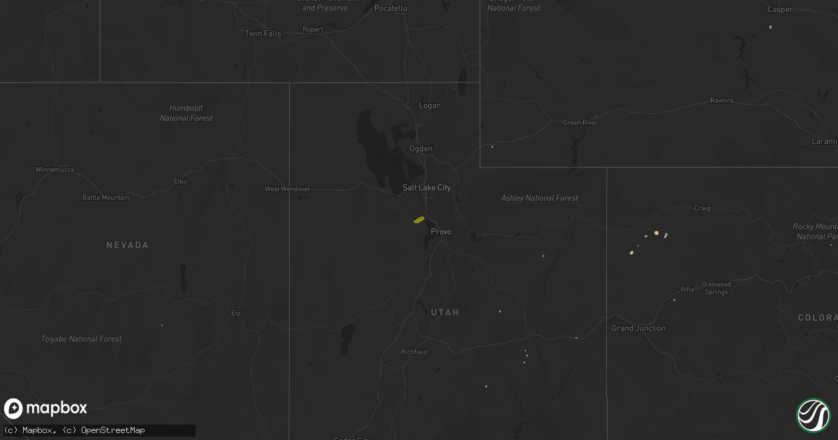
Hail Map on May 23, 2011
Get this storm
May 23 map
$229
one time, instant access
Download today. No call, no setup
Keep the $229
Bought the map and want the full workflow? Apply the entire $229 to a subscription within 7 days. None of it is wasted.
Every map, not just this one
This buys you this map. Subscription and you get every map we run, in the markets you choose from a few cities to whole states to nationwide. Plus real-time alerts the moment a storm fires.
Contact data
Name, contact info, occupancy, even credit band for addresses in the footprint. You go from where it hit to who to call.
Become the source they trust
Unlimited branding weather history reports on demand. You already have the documented answer ready for the property owner, and you are the one who showed up with it.
Property data and RoofTrace estimates
Pull up any address you have got, its value and the exact code rules for that jurisdiction, straight from One Click Code. Then RoofTrace estimates the squares, pitch, and roof value, priced the way you price.
States Impacted by Hail Map on May 23, 2011
Storm reports
Missouri
| Date | Description |
|---|---|
| 05/23/20114:25 PM CDT | Billboards and signs blown down between exits 61 and 67 on interstate 55 between sikeston and matthews. |
| 05/23/20114:00 PM CDT | From new wells to the perry county line...numerous trees down...3 to 4 barns with roofs blown off...shingles off a few houses |
| 05/23/20113:18 PM CDT | Large tree across highway m |
| 05/23/20112:12 PM CDT | Quarter-sized hail |
| 05/23/20111:45 PM CDT | An ef-0 tornado touched down 4 miles east norhteast of moody missouri. Damage in the area consisted of many large limbs broken out of trees...a home with minor roof dam |
| 05/23/20111:41 PM CDT | Metal carport blown onto road |
| 05/23/20111:12 PM CDT | Multiple large trees and power lines down with almost every road closed at st. Albans. Smaller trees down in gray summit. Estimated wind gust at 65 mph. |
| 05/23/201112:50 PM CDT | Shingles and debris blown about along with a pushed in garage door. |
| 05/23/201112:48 PM CDT | Several 4-6 inch branches down in the area of st. Louis university hospital. |
| 05/23/201112:45 PM CDT | Numerous trees... Branches... And power outages throughout the city from ksdk channel 5. |
| 05/23/201112:45 PM CDT | 3-inch diameter trees down at intersection of des peres road and wild deer road. 8-inch limb blocking warson woods drive near timberlake drive. |
| 05/23/201112:44 PM CDT | Three-inch tree down at 367 and parker intersection |
| 05/23/201112:40 PM CDT | Large tree uprooted onto home in tower grove. |
| 05/23/201112:35 PM CDT | 20 inch diameter tree down blocking traffic at arsenal and brannon. |
| 05/23/201112:35 PM CDT | 30 inch tree blocking road at hillsdale and normandy road. |
| 05/23/201112:32 PM CDT | 1 mile west of intersection of big bend and 141. |
| 05/23/201112:31 PM CDT | From the tower. |
| 05/23/201112:30 PM CDT | 12 inch branches down |
| 05/23/201112:29 PM CDT | Large limbs and trees down at 141 and big bend. One lane of southbound 141 blocked. |
| 05/23/201112:27 PM CDT | 3 9-18 inch trees down at meadowbrook country club near clayton and kerrs mill road. |
| 05/23/201112:23 PM CDT | Report is from the st. Albans area...trees up to 1 foot in diameter snapped |
| 05/23/201112:22 PM CDT | Numerous trees and at least one power line down in town. |
| 05/23/201112:16 PM CDT | Numerous finger to thumb size diameter branches down. |
| 05/23/201112:12 PM CDT | 50 to 60 mph gust at wentzville parkway at west meyer. |
| 05/23/201112:11 PM CDT | 55 to 60 mph winds estimated with 9-inch diameter trees bent over at a 90 degree angle. Winds lasted about 30 seconds. |
| 05/23/201112:06 PM CDT | Hall brothers lumber has roofing blown off. |
| 05/23/201112:05 PM CDT | A local report indicates 68 MPH wind near 2 N WASHINGTON |
| 05/23/201112:04 PM CDT | Small tree limbs down. Estimated winds of 40 to 50 mph. |
| 05/23/201112:02 PM CDT | Trees down along independence street in downtown union... Relayed by amateur radio. |
| 05/23/201112:00 PM CDT | Roof off a mobile home. Late report probably took place around noon. |
| 05/23/201112:00 PM CDT | Trees and power lines down throughout the county... Including along holt road in the south end... Hwy 100 in the north end... And live lines down in owensville. |
| 05/23/201111:59 AM CDT | 6 to 10 inch diameter limbs down...pea size hail |
| 05/23/201111:55 AM CDT | A few shingles blown off of some roofs. |
| 05/23/201111:50 AM CDT | Power out in the berger area along with pea size hail |
| 05/23/201111:42 AM CDT | Pea-size hail fell with this storm as well. No damage visible in the immediate area. |
| 05/23/201111:39 AM CDT | Tin sheets off of roofs and limbs down everywhere in town. |
| 05/23/201111:30 AM CDT | Three foot diameter tree uprooted near residence. Many other trees uprooted and limbs broken off near observer location. |
| 05/23/201111:30 AM CDT | Several trees uprooted. One tree was 2 feet in diameter. |
| 05/23/201111:30 AM CDT | Three foot diameter tree uprooted near residence. Many other trees uprooted and limbs broken off near observer location. |
| 05/23/201111:22 AM CDT | Dime to quarter sized hail reported near state route b/county road 1060 intersection. |
| 05/23/201110:55 AM CDT | Tree down across state route e just north of the route e/route a intersection. |
| 05/23/201110:43 AM CDT | Three foot diameter tree down in eldon. |
| 05/23/20119:35 AM CDT | A local report indicates 60 MPH wind near 5 S WHEATLAND |
| 05/23/20118:56 AM CDT | 60 to 70 mph wind gust and pea hail relayed by spotter |
| 05/23/20118:48 AM CDT | A local report indicates 1.00 inch wind near 1 W WEBB CITY |
| 05/23/20111:30 AM CDT | A national weather service storm survey team determined that an ef-1 tornado touched down one mile southwest of dogwood and tracked to the northeast for 9 miles lifing |
| 05/22/20118:01 PM CDT | A local report indicates 1.00 inch wind near NORBORNE |
Pennsylvania
| Date | Description |
|---|---|
| 05/23/20116:36 PM CDT | Trees down... Funnels sighted also. |
| 05/23/20116:30 PM CDT | Trees down and also roof damage |
| 05/23/20116:25 PM CDT | Confirmed ef-0 tornado... One structure experienced significant damage... Numerous trees down and snapped... Other structures suffered minor damage |
| 05/23/20116:22 PM CDT | Trees down |
| 05/23/20115:45 PM CDT | Widespread trees and wires down in tamaqua |
| 05/23/20115:35 PM CDT | Ef1 tornado touched down one mile south of brockton in schuylkill county around 6...35 pm and traveled east for one quarter mile |
| 05/23/20114:45 PM CDT | Emergency manager on the scene of possible tornado damage |
| 05/23/20114:45 PM CDT | Widespread trees and wires down along route 15 |
| 05/23/20114:40 PM CDT | Damage to homes along route 147 |
| 05/23/20114:35 PM CDT | Ef1 tornado touched down near winfield in union county around 5...35 pm and traveled east across the susquehanna river into northumberland county where it lifted near r |
| 05/23/20114:35 PM CDT | Widespread treees and wires down |
| 05/23/20114:25 PM CDT | Several barns damaged |
| 05/23/20114:20 PM CDT | Ef2 tornado touched down near kellerville juniata county around 5...20 pm and traveled east for six miles and lifted at 5...30 pm. |
| 05/23/20114:20 PM CDT | Widespread trees and wires down |
| 05/23/20113:55 PM CDT | Tress and wires down |
| 05/22/20118:10 PM CDT | Several trees down in shenango twp |
| 05/22/20118:05 PM CDT | A local report indicates 1.00 inch wind near TRANSFER |
| 05/22/20117:20 PM CDT | A local report indicates 68 MPH wind near FORKS TWP |
| 05/22/20117:08 PM CDT | 2 trees down in erie. Numerous branches down. |
Maryland
| Date | Description |
|---|---|
| 05/23/20115:10 PM CDT | A local report indicates 1.00 inch wind near 2 S POOLESVILLE |
| 05/23/20115:00 PM CDT | A local report indicates 1.00 inch wind near 2 S POOLESVILLE |
| 05/22/20117:10 PM CDT | A local report indicates 1.75 inch wind near GREENSBORO |
New York
| Date | Description |
|---|---|
| 05/22/20118:08 PM CDT | Multiple trees and power lines down |
| 05/22/20118:00 PM CDT | Multiple trees abd power lines down |
| 05/22/20117:48 PM CDT | Multiple trees and power lines down |
| 05/22/20117:43 PM CDT | Multiple trees and power lines down |
New Jersey
| Date | Description |
|---|---|
| 05/22/20117:55 PM CDT | Trees down in southeastern warren county... Mainly in washington twp. |
Oklahoma
| Date | Description |
|---|---|
| 05/23/20116:58 PM CDT | A local report indicates 1.75 inch wind near FAIRVIEW |
| 05/23/20116:44 PM CDT | A local report indicates 1.75 inch wind near 10 W APACHE |
| 05/23/20116:31 PM CDT | A local report indicates 1.75 inch wind near 11 N CALUMET |
| 05/23/20116:30 PM CDT | A local report indicates 1.00 inch wind near 5 S CARNEGIE |
| 05/23/20116:30 PM CDT | A local report indicates 3.20 inch wind near 5 WNW APACHE |
| 05/23/20116:26 PM CDT | A local report indicates 1.75 inch wind near CARNEGIE |
| 05/23/20116:23 PM CDT | A local report indicates 1.75 inch wind near INDIAHOMA |
| 05/23/20116:13 PM CDT | A local report indicates 2.50 inch wind near 1 SW OKARCHE |
| 05/23/20116:12 PM CDT | A local report indicates 1.75 inch wind near 8 W OKARCHE |
| 05/23/20116:11 PM CDT | A local report indicates 1.00 inch wind near 8 WSW KINGFISHER |
| 05/23/20116:07 PM CDT | A local report indicates 1.00 inch wind near 8 W OKARCHE |
| 05/23/20116:00 PM CDT | A local report indicates 1.00 inch wind near CARNEGIE |
| 05/23/20115:52 PM CDT | A local report indicates 3.01 inch wind near 2 SE GOTEBO |
| 05/23/20115:52 PM CDT | Osage county sheriffs office reported a brief tornado touchdown near fairfax. |
| 05/23/20115:45 PM CDT | A local report indicates 2.00 inch wind near GREENFIELD |
| 05/23/20115:45 PM CDT | A local report indicates 1.75 inch wind near MOUNTAIN VIEW |
| 05/23/20115:40 PM CDT | At manitou |
| 05/23/20115:29 PM CDT | At manitou |
| 05/23/20115:24 PM CDT | A local report indicates 3.51 inch wind near 2 S GOTEBO |
| 05/23/20115:21 PM CDT | A local report indicates 1.25 inch wind near 1 NNE RENFROW |
| 05/23/20115:19 PM CDT | A local report indicates 1.00 inch wind near ENID |
| 05/23/20115:18 PM CDT | A local report indicates 1.75 inch wind near ENE GOTEBO |
| 05/23/20115:18 PM CDT | A local report indicates 2.50 inch wind near 1 E GOTEBO |
| 05/23/20115:13 PM CDT | A local report indicates 1.00 inch wind near 1 E GOTEBO |
| 05/23/20115:10 PM CDT | A local report indicates 1.00 inch wind near TIPTON |
| 05/23/20115:01 PM CDT | A local report indicates 60 MPH wind near 4 WSW PONCA CITY |
| 05/23/20114:54 PM CDT | A local report indicates 1.75 inch wind near ENID |
| 05/23/20114:46 PM CDT | A local report indicates 1.00 inch wind near ELMER |
| 05/23/20114:45 PM CDT | A local report indicates 1.75 inch wind near 1 N SENTINEL |
| 05/23/20114:37 PM CDT | A local report indicates 2.00 inch wind near 5 W BRAMAN |
| 05/23/20114:35 PM CDT | A local report indicates 1.75 inch wind near BRAMAN |
| 05/23/20114:33 PM CDT | A local report indicates 1.75 inch wind near 2 W ROCKY |
| 05/23/20114:33 PM CDT | A local report indicates 1.75 inch wind near SENTINEL |
| 05/23/20114:29 PM CDT | Report relayed via off duty wfo hastings employee. |
| 05/23/20114:26 PM CDT | A local report indicates a tornado near CANTON LAKE |
| 05/23/20114:24 PM CDT | Report via off duty wfo hastings employee. |
| 05/23/20114:24 PM CDT | A local report indicates 1.75 inch wind near 6 NE RINGWOOD |
| 05/23/20114:24 PM CDT | A local report indicates 1.00 inch wind near 3 E SENTINEL |
| 05/23/20114:20 PM CDT | A local report indicates 2.50 inch wind near 4 N RINGWOOD |
| 05/23/20114:05 PM CDT | A local report indicates 1.00 inch wind near 8 SE SEILING |
| 05/23/20114:05 PM CDT | A local report indicates 1.00 inch wind near 2 S OAKWOOD |
| 05/23/20113:55 PM CDT | A local report indicates 1.00 inch wind near 8 SE SEILING |
| 05/23/20113:55 PM CDT | A local report indicates 1.00 inch wind near 3 S FAIRVIEW |
| 05/23/20111:56 PM CDT | Mostly dime sized but a few as big as a quarter. |
| 05/23/20118:30 AM CDT | A local report indicates 1.00 inch wind near 6 W WELCH |
| 05/23/20118:15 AM CDT | A local report indicates 60 MPH wind near LENAPAH |
| 05/23/20118:10 AM CDT | A local report indicates 1.00 inch wind near 3 W HOLLOW |
| 05/23/20117:30 AM CDT | Tree blown down |
| 05/22/201111:05 PM CDT | I-35 exit 136 near turner turnpike exit |
| 05/22/201110:59 PM CDT | At memorial and coltrane roads |
| 05/22/201110:55 PM CDT | A local report indicates 1.00 inch wind near 3 E EDMOND |
| 05/22/201110:45 PM CDT | Near penn square mall |
| 05/22/201110:45 PM CDT | A local report indicates 2.50 inch wind near 4 NNW BETHANY |
| 05/22/201110:31 PM CDT | Portland and 166th |
| 05/22/201110:27 PM CDT | A local report indicates 2.00 inch wind near 4 SE PIEDMONT |
| 05/22/201110:20 PM CDT | A local report indicates 2.00 inch wind near 3 SSE PIEDMONT |
| 05/22/20119:44 PM CDT | A local report indicates 2.50 inch wind near N OKARCHE |
| 05/22/20119:44 PM CDT | A local report indicates 3.10 inch wind near 1 N OKARCHE |
| 05/22/20119:43 PM CDT | A local report indicates 1.75 inch wind near N OKARCHE |
| 05/22/20119:40 PM CDT | A local report indicates 1.50 inch wind near N OKARCHE |
| 05/22/20119:34 PM CDT | A local report indicates 60 MPH wind near PANAMA |
| 05/22/20119:33 PM CDT | Large tree down...multiple power lines down...some property damage. |
| 05/22/20119:28 PM CDT | Power lines down |
| 05/22/20119:25 PM CDT | Numerous power lines down |
| 05/22/20118:46 PM CDT | A local report indicates 66 MPH wind near 3 NW STILLWATER |
| 05/22/20118:31 PM CDT | A local report indicates 2.00 inch wind near 3 E KINGFISHER |
| 05/22/20118:25 PM CDT | A local report indicates 2.00 inch wind near 5 E KINGFISHER |
| 05/22/20118:24 PM CDT | A local report indicates 65 MPH wind near 6 N STILWELL |
| 05/22/20118:22 PM CDT | A local report indicates 1.75 inch wind near 2 E KINGFISHER |
| 05/22/20118:17 PM CDT | A local report indicates 1.75 inch wind near KINGFISHER |
| 05/22/20118:12 PM CDT | Several trees and a few power lines blown down |
| 05/22/20118:09 PM CDT | A local report indicates 1.00 inch wind near 2 NW KINGFISHER |
| 05/22/20117:35 PM CDT | A local report indicates 1.25 inch wind near 5 S OKEENE |
| 05/22/20117:30 PM CDT | A local report indicates 1.00 inch wind near 2 S OKEENE |
| 05/22/20117:23 PM CDT | A local report indicates 1.75 inch wind near 4 NE CRESCENT |
| 05/22/20117:20 PM CDT | Reports of several trees blown down in the vicinity of kenwood. |
| 05/22/20117:10 PM CDT | A local report indicates 1.75 inch wind near 1 NE DUNDEE |
| 05/22/20117:07 PM CDT | A local report indicates 60 MPH wind near 3 SW MULHALL |
| 05/22/20117:02 PM CDT | A local report indicates 1.75 inch wind near 2 E DUNDEE |
Michigan
| Date | Description |
|---|---|
| 05/23/20115:30 PM CDT | Trees down |
| 05/23/20115:30 PM CDT | Trees down |
| 05/23/20115:27 PM CDT | Trees down |
| 05/23/20115:19 PM CDT | A local report indicates 1.50 inch wind near 6 N ADRIAN |
| 05/23/20114:58 PM CDT | Eight inch diameter limb down and damage to a church |
| 05/23/20114:50 PM CDT | Three inch diameter limbs down |
| 05/23/20114:17 PM CDT | 3-4 inch diameter limbs down. Pea size hail also reported. |
| 05/23/20113:20 PM CDT | Trees down |
| 05/23/20113:15 PM CDT | Tree limbs down |
| 05/23/20113:15 PM CDT | Numerous large limbs down |
| 05/23/20113:15 PM CDT | Large tree down on powerlines |
| 05/23/20113:07 PM CDT | Large tree down |
| 05/23/20112:56 PM CDT | Powerlines and 3-4 inch diameter limbs down |
| 05/23/20112:56 PM CDT | Several six inch diameter limbs down |
| 05/23/20112:54 PM CDT | 30 inch diameter tree down |
| 05/23/20112:40 PM CDT | Numerous four inch diameter limbs down |
| 05/23/201111:56 AM CDT | Six inch diameter limbs down and several trees |
| 05/22/20117:17 PM CDT | Numerous trees down in the community |
| 05/22/20117:04 PM CDT | A local report indicates 1.00 inch wind near 4 N MAYBEE |
Tennessee
| Date | Description |
|---|---|
| 05/23/20116:56 PM CDT | *** 2 inj *** a national weather service survey team has confirmed that the damage that occurred in the big rock area in northeast stewart county yesterday evening was |
| 05/23/20116:15 PM CDT | Majority of the hail falling was pea size...however a few quarter size stones were mixed in. Reported just north of i-40. |
| 05/23/20116:00 PM CDT | Wind gust to 66 mph at sheriffs office in dresden. |
| 05/23/20115:00 PM CDT | Trained spotter reported that his personal weather station recorded a wind gust of 62 mph. |
| 05/23/20115:45 AM CDT | Trees down county-wide |
| 05/23/20115:20 AM CDT | Trees down county-wide |
| 05/23/20115:00 AM CDT | Trees down in madison |
| 05/23/20114:57 AM CDT | Strong winds knocked down about a dozen trees near hadley middle school and the old hickory golf club. |
| 05/23/20114:55 AM CDT | Near opry mills |
| 05/23/20114:55 AM CDT | Near opry mills |
| 05/23/20114:50 AM CDT | East nashville...40+ trees down. Numerous powerpoles down. |
| 05/22/20117:35 PM CDT | A local report indicates 1.00 inch wind near 7 SW DECATURVILLE |
| 05/22/20117:08 PM CDT | Sheriffs office rpts tree down on house on earl coppage road in the town of big rock. |
| 05/22/20117:00 PM CDT | Sheriffs office rpts tree down on house at 400 block of north hancock road in the town of big rock. |
Virginia
| Date | Description |
|---|---|
| 05/23/20115:50 PM CDT | Quarter size hail reported on deerfield drive. |
| 05/23/20115:12 PM CDT | Tree down across road |
| 05/22/20117:20 PM CDT | Hail covering ground |
West Virginia
| Date | Description |
|---|---|
| 05/22/201110:06 PM CDT | Numerous trees and power lines down across the huntington area |
| 05/22/20119:59 PM CDT | Numerous trees and power lines down across the huntington area |
| 05/22/20119:16 PM CDT | Power lines down |
| 05/22/20119:16 PM CDT | Power line down on woodstone road |
| 05/22/20118:14 PM CDT | Tree down on mount olive road and tree down morgan road both in macarthur |
Texas
| Date | Description |
|---|---|
| 05/23/20115:45 PM CDT | A local report indicates 2.75 inch wind near 17 NE SEYMOUR |
| 05/23/20115:43 PM CDT | A local report indicates 2.50 inch wind near 15 SE VERNON |
| 05/23/201111:40 AM CDT | Shady shores and interstate 35 |
| 05/23/201110:39 AM CDT | A local report indicates 1.00 inch wind near 4 N FORT WORTH |
| 05/23/201110:34 AM CDT | Intersection of fossil creek blvd and sandshell dr. |
| 05/23/201110:32 AM CDT | Nickel to quarter size hail 2 miles se of river oaks |
| 05/23/201110:25 AM CDT | Quarter size hail fell for 10 minutes starting at 1015 am at jacksboro highway and confederate parkway |
| 05/23/201110:25 AM CDT | Berry st. And interstate 35w |
| 05/23/201110:19 AM CDT | A local report indicates 1.00 inch wind near 1 NW WHITE SETTLEMENT |
| 05/23/201110:16 AM CDT | North of white settlement rd. |
| 05/22/20117:08 PM CDT | A local report indicates 1.00 inch wind near 2 NW ARCHER CITY |
Arkansas
| Date | Description |
|---|---|
| 05/23/20114:05 PM CDT | A tree and possibly a few power lines are down in marked tree at the intersection of railroad and frisco street. |
| 05/23/20113:55 PM CDT | A shed was blown down. |
| 05/23/20113:24 PM CDT | A powerline or two was knocked down at the intersection of cr 224 and hwy 141 near the town of beech grove. |
| 05/23/20113:00 PM CDT | Possible tornado. A narrow line of several trees down in a rural area between upper and lower james creek roads. |
| 05/23/20112:48 PM CDT | A few trees down in the town of warm springs. A powerline was down in middlebrook...which is just southeast of warm springs. |
| 05/23/20112:27 PM CDT | Possible tornado. A narrow line of several trees down in a rural area between upper and lower james creek roads. |
| 05/23/20112:27 PM CDT | A local report indicates 1.00 inch wind near 5 E OZARK ACRES |
| 05/23/20112:06 PM CDT | A roof was blown off a health food store at hwy 62 and hwy 412 on pontiac dr. |
| 05/23/20112:05 PM CDT | Trees and power lines down between ash flat and wirth. |
| 05/23/20112:04 PM CDT | A local report indicates 1.00 inch wind near ASH FLAT |
| 05/23/20111:56 PM CDT | Large trees were uprooted. |
| 05/23/201112:55 PM CDT | A local report indicates 1.00 inch wind near GASSVILLE |
| 05/22/201110:45 PM CDT | A local report indicates 1.00 inch wind near BELLEVILLE |
| 05/22/201110:45 PM CDT | Numerous trees and power lines were blown down. A tree was blown down on to a car...trapping the occupant. |
| 05/22/201110:25 PM CDT | Svr364 trees and powerlines downed in the denning area. |
| 05/22/201110:15 PM CDT | Svr363 roof damage. Estimated 70 miles an hour. |
| 05/22/201110:15 PM CDT | Numerous trees and power lines were blown down around booneville and throughout logan county. |
| 05/22/201110:15 PM CDT | Svr363 |
| 05/22/201110:10 PM CDT | Numerous trees down |
| 05/22/201110:05 PM CDT | Numerous trees down |
| 05/22/201110:00 PM CDT | Roof damage to a home |
| 05/22/20119:55 PM CDT | A local report indicates 70 MPH wind near MULBERRY |
| 05/22/20119:48 PM CDT | Power lines down |
| 05/22/20119:45 PM CDT | A local report indicates 60 MPH wind near FORT SMITH |
| 05/22/20119:45 PM CDT | Reported in south fort smith |
| 05/22/20119:35 PM CDT | Tree down in fort smith |
| 05/22/20119:30 PM CDT | Power line down |
| 05/22/20119:25 PM CDT | Broken power pole |
| 05/22/20119:24 PM CDT | Power lines down |
| 05/22/20119:23 PM CDT | A local report indicates 60 MPH wind near VAN BUREN |
| 05/22/20119:22 PM CDT | Several mobile homes damaged |
North Carolina
| Date | Description |
|---|---|
| 05/23/20116:21 PM CDT | A local report indicates 1.25 inch wind near 2 E CONWAY |
| 05/23/20115:40 PM CDT | A local report indicates 1.75 inch wind near 3 N JACKSON |
| 05/23/20115:18 PM CDT | Quarter sized hail in roanoke rapids |
| 05/23/20115:15 PM CDT | Newspaper reported quarter sized hail at the chockeyotte ball fields |
| 05/23/20114:20 PM CDT | Raleigh weather office relayed report of tennis ball sized hail just off interstate 40 west of mocksville. |
| 05/23/20114:20 PM CDT | A few hail stones may have been larger |
| 05/23/20114:08 PM CDT | Half dollar sized hail. |
| 05/23/20114:05 PM CDT | Nickel to quarter sized hail falling in sheffield. |
| 05/23/20114:02 PM CDT | Dime to quarter sized hail. |
| 05/23/20113:52 PM CDT | A local report indicates 1.75 inch wind near 3 N HARMONY |
| 05/23/20113:50 PM CDT | A local report indicates 1.00 inch wind near 6 NE FOREST CITY |
| 05/23/20113:45 PM CDT | A local report indicates 1.75 inch wind near UNION GROVE |
| 05/23/20113:41 PM CDT | Hail up to quarter sized near the county border of rutherford and cleveland...on the rutherford side not far from ellenboro. |
| 05/23/20113:27 PM CDT | A local report indicates 1.75 inch wind near NORTH WILKESBORO |
| 05/23/20113:21 PM CDT | Hail fell for about 4 minutes in town |
| 05/23/20113:18 PM CDT | A local report indicates 1.00 inch wind near 1 S MOUNTAIN PARK |
| 05/23/20113:12 PM CDT | A local report indicates 1.00 inch wind near CLINGMAN |
| 05/23/20113:10 PM CDT | Two large trees down |
| 05/23/20113:07 PM CDT | Exit 276 at hwy 421 |
| 05/23/20113:01 PM CDT | At least six pine trees down near the intersection of pads road and boone trail |
| 05/23/20113:01 PM CDT | Occurred near the intersection of pads road and boone trail |
| 05/23/20113:00 PM CDT | Several trees down |
| 05/23/20112:57 PM CDT | Occurred on fishing creek road |
| 05/23/20112:55 PM CDT | Many large trees down |
| 05/23/20112:53 PM CDT | Tree down on highway 268 near johnson road |
| 05/23/20112:50 PM CDT | Occurred in the town of roaring river |
| 05/23/20112:37 PM CDT | A few trees down in the bills creek area reported by the shingle hollow fire department. |
| 05/22/20117:58 PM CDT | A local report indicates 1.00 inch wind near 4 NW SPEED |
| 05/22/20117:22 PM CDT | Tree down across road |
Indiana
| Date | Description |
|---|---|
| 05/23/20116:05 PM CDT | Small trees down...blocked road but are now cleared. Small boat on a trailer was pushed into a truck...minor damage. |
| 05/23/20116:02 PM CDT | Numerous trees down across richmond. |
| 05/23/20116:01 PM CDT | A garage was significantly damaged. Siding and window damage done to a house. |
| 05/23/20115:59 PM CDT | One tree downed on pitts road. |
| 05/23/20115:57 PM CDT | Barn damaged and trees knocked down near indiana 44 at 9 mile rd. |
| 05/23/20115:55 PM CDT | Trees/large limbs downed |
| 05/23/20115:53 PM CDT | Tree downed on south fourth street. |
| 05/23/20115:52 PM CDT | Tree downed on george early road. |
| 05/23/20115:51 PM CDT | Trees down along state route 1. Wind gust estimated. |
| 05/23/20115:48 PM CDT | One tree downed on olive branch road. |
| 05/23/20115:47 PM CDT | Time estimated from radar and nearby asos. |
| 05/23/20115:45 PM CDT | Trees down. |
| 05/23/20115:43 PM CDT | Confirmed by nws storm survey. Ef0 tornado with wind speeds approximately 80 mph. |
| 05/23/20115:40 PM CDT | Trailers overturned. |
| 05/23/20115:34 PM CDT | A local report indicates 70 MPH wind near 8 WNW MUNCIE |
| 05/23/20115:34 PM CDT | Barn destroyed. Numerous trees down across the county. |
| 05/23/20115:30 PM CDT | An eight inch diameter tree branch was reported down on a car. |
| 05/23/20115:30 PM CDT | A local report indicates 1.00 inch wind near HOLTON |
| 05/23/20115:24 PM CDT | Large trees down...roof damage...steeple blown off a church...outbuilding destroyed |
| 05/23/20115:21 PM CDT | A local report indicates 60 MPH wind near JEFFERSONVILLE |
| 05/23/20115:20 PM CDT | A local report indicates 60 MPH wind near KNIGHTSTOWN |
| 05/23/20115:20 PM CDT | A large pine tree was reported down as well. |
| 05/23/20115:18 PM CDT | Three grain bins were blown over near the intersection of s cr 350w and w cr 850s. |
| 05/23/20115:15 PM CDT | A barn was reported to be destroyed near the intersection of state route 3 and cr 700 west. |
| 05/23/20115:14 PM CDT | Roof damage in cobblers crossing subdivision |
| 05/23/20115:10 PM CDT | A local report indicates 70 MPH wind near NEW ALBANY |
| 05/23/20115:08 PM CDT | A local report indicates 63 MPH wind near 2 N COLUMBUS |
| 05/23/20115:07 PM CDT | A local report indicates 1.00 inch wind near RAMSEY |
| 05/23/20115:05 PM CDT | A six inch diameter tree limb was reported down. |
| 05/23/20115:00 PM CDT | Large limbs and small trees reported down. |
| 05/23/20115:00 PM CDT | Two foot diameter live trees and power lines were reported downed near north main and adams streets. |
| 05/23/20114:59 PM CDT | A local report indicates 1.00 inch wind near 2 E MARKLE |
| 05/23/20114:54 PM CDT | Golf ball size hail and 60 mile an hour winds |
| 05/23/20114:50 PM CDT | Report of a poultry barn destroyed near cortland. |
| 05/23/20114:45 PM CDT | A barn was destroyed. |
| 05/23/20114:45 PM CDT | Two foot diameter tree downed. |
| 05/23/20114:38 PM CDT | Trees and power lines down in the marengo area |
| 05/23/20114:35 PM CDT | Multiple trees down on county road 625 east...one mile south of hwy 47. |
| 05/23/20114:34 PM CDT | A local report indicates 58 MPH wind near 5 SW FORT WAYNE |
| 05/23/20114:34 PM CDT | Trees and power lines down in the campbellsburg area |
| 05/23/20114:32 PM CDT | Crossing sr 9 at 200 s |
| 05/23/20114:32 PM CDT | Tree damage and minor house damage with shingles blown off |
| 05/23/20114:30 PM CDT | Multiple trees down across bloomington...especially at 3rd and hawthorn as well as in windsor park. |
| 05/23/20114:28 PM CDT | A barn roof was reported to be blown off...a well as multiple trees down including a fourteen inch diameter tree. |
| 05/23/20114:28 PM CDT | A local report indicates a tornado near 7 SE BEDFORD |
| 05/23/20114:27 PM CDT | A local report indicates 60 MPH wind near ANDREWS |
| 05/23/20114:27 PM CDT | Trees reported down. |
| 05/23/20114:27 PM CDT | Trained spotter reported quarter size hail at iupui campus. |
| 05/23/20114:26 PM CDT | One half inch hail also reported. |
| 05/23/20114:26 PM CDT | Four inch diameter tree branch down at 10th and walnut. |
| 05/23/20114:26 PM CDT | A local report indicates 63 MPH wind near INDIANAPOLIS INT'L AIRP |
| 05/23/20114:24 PM CDT | A local report indicates 1.00 inch wind near 1 S INDIANAPOLIS INT'L |
| 05/23/20114:23 PM CDT | A local report indicates 1.00 inch wind near 7 S FRENCH LICK |
| 05/23/20114:23 PM CDT | Trees down in the orleans area |
| 05/23/20114:23 PM CDT | A local report indicates 60 MPH wind near 2 SW BLOOMINGTON |
| 05/23/20114:22 PM CDT | A local report indicates 60 MPH wind near BIRDSEYE |
| 05/23/20114:18 PM CDT | Wind gusts estimated at 70 to 80 mph in bloomington. Much debris noted as well. |
| 05/23/20114:07 PM CDT | A local report indicates 1.00 inch wind near FERDINAND |
| 05/23/20114:00 PM CDT | A local report indicates 1.75 inch wind near HUNTINGBURG |
| 05/23/20114:00 PM CDT | Trees down in jasper along with 60 mile an hour winds |
| 05/23/20113:57 PM CDT | A local report indicates 1.00 inch wind near EVANSVILLE |
| 05/23/20113:47 PM CDT | Half a hog barn was removed at county road 100 south and 350 east. |
| 05/23/20113:47 PM CDT | A local report indicates 1.25 inch wind near OAKLAND CITY |
| 05/23/20113:45 PM CDT | Numerous reports of trees down and power outages in terre haute. |
| 05/23/20113:45 PM CDT | Winds estimated to be at least 65 to 70 mph...with a possible wall cloud. |
| 05/23/20113:44 PM CDT | Tree blocking the road in terre haute at 19th and maple. Numerous other tree limbs down. |
| 05/23/20113:36 PM CDT | Shingles pulled off several houses in the spring hill area of terre haute. |
| 05/23/20113:35 PM CDT | A local report indicates 1.00 inch wind near PRINCETON |
| 05/23/20113:34 PM CDT | A local report indicates 63 MPH wind near 3 S TERRE HAUTE |
| 05/23/20113:33 PM CDT | A local report indicates 1.00 inch wind near GARRETT |
| 05/23/20113:32 PM CDT | Trees down in the roann area...time estimated from radar |
| 05/23/20113:29 PM CDT | A local report indicates 60 MPH wind near 5 E VINCENNES |
| 05/23/20113:29 PM CDT | Power outages reported in decker...with telephone and electric lines down at 4th and church st. |
| 05/23/20113:28 PM CDT | Trees reported down around vincennes. |
| 05/23/20113:28 PM CDT | A local report indicates 60 MPH wind near PRINCETON |
| 05/23/20113:24 PM CDT | A local report indicates 60 MPH wind near 1 SE PAXTON |
| 05/23/20113:23 PM CDT | Pea sized hail also reported. |
| 05/23/20113:20 PM CDT | Several tree limbs were reported down as well. |
| 05/23/20113:10 PM CDT | A local report indicates 1.00 inch wind near MACY |
| 05/23/20113:08 PM CDT | 1 inch to a little bigger |
Nebraska
| Date | Description |
|---|---|
| 05/23/20116:46 PM CDT | A local report indicates 1.00 inch wind near 14 N ATWOOD |
| 05/22/20118:00 PM CDT | A local report indicates 1.00 inch wind near 4 W IMPERIAL |
| 05/22/20117:45 PM CDT | Pea to marble size hail reported covering ground...largest hail size of a quarter. |
| 05/22/20117:25 PM CDT | Report was relayed via sheriffs office...time was estimated. |
| 05/22/20117:23 PM CDT | A local report indicates 1.00 inch wind near 7 SSE TRENTON |
Ohio
| Date | Description |
|---|---|
| 05/23/20116:59 PM CDT | Nws office |
| 05/23/20116:59 PM CDT | Fence blown down. |
| 05/23/20116:59 PM CDT | Tree down/partial roof damage to garage |
| 05/23/20116:58 PM CDT | Roof partially removed from a bowling alley north of georgetown. |
| 05/23/20116:58 PM CDT | Roof damage to chicken house |
| 05/23/20116:56 PM CDT | Multiple trees downed along dayton yellow springs road near the greene country club. |
| 05/23/20116:56 PM CDT | Trees downed. |
| 05/23/20116:55 PM CDT | Numerous trees snapped and uprooted. Ef1 tornado with wind speeds approximately 90 mph. |
| 05/23/20116:54 PM CDT | A tree was downed on east market street. |
| 05/23/20116:54 PM CDT | Tree downed/power poles leaning |
| 05/23/20116:50 PM CDT | A roof was blown off of a barn. |
| 05/23/20116:50 PM CDT | Honda plant |
| 05/23/20116:46 PM CDT | Multiple trees snapped or uprooted. One tree fell onto a house and another tree fell onto powerlines. |
| 05/23/20116:46 PM CDT | Tree downed on a car. |
| 05/23/20116:45 PM CDT | A local report indicates 1.00 inch wind near TWINSBURG |
| 05/23/20116:43 PM CDT | Nws survey confirmed a high end ef0 tornado. Damage included 2 high voltage towers blown down and a wood framed metal barn destroyed along taylor pike road. |
| 05/23/20116:42 PM CDT | Several trees downed |
| 05/23/20116:41 PM CDT | Numerous trees down and damage to a dairy farm along rench road. Possible tornado reported in area of damage. |
| 05/23/20116:41 PM CDT | Numerous trees down and damage to a dairy farm along rench road. Examination from law enforcement...in collaboration with national weather service meteorologists...indi |
| 05/23/20116:38 PM CDT | Panels were ripped off a barn. |
| 05/23/20116:38 PM CDT | Wind gusts of 60 to 70 mph |
| 05/23/20116:38 PM CDT | A local report indicates 63 MPH wind near 5 N SHARONVILLE |
| 05/23/20116:38 PM CDT | Several trees down near amelia high school |
| 05/23/20116:38 PM CDT | A local report indicates 63 MPH wind near 2 SW WETHERINGTON |
| 05/23/20116:37 PM CDT | Tree down across road. |
| 05/23/20116:37 PM CDT | Numerous trees downed in parts of englewood and clayton. |
| 05/23/20116:35 PM CDT | Tree downed |
| 05/23/20116:34 PM CDT | One large tree down at a school |
| 05/23/20116:34 PM CDT | Large tree down |
| 05/23/20116:33 PM CDT | A local report indicates 1.00 inch wind near NORTH ROYALTON |
| 05/23/20116:30 PM CDT | A local report indicates 1.25 inch wind near PARMA |
| 05/23/20116:29 PM CDT | Trees down |
| 05/23/20116:29 PM CDT | Barn destroyed/power lines downed/roof of barn damaged |
| 05/23/20116:29 PM CDT | The metal roof of a house was peeled off. |
| 05/23/20116:29 PM CDT | A local report indicates 61 MPH wind near KLUK LUNKEN AIRPORT |
| 05/23/20116:28 PM CDT | A local report indicates 63 MPH wind near KI23 WASHINGTON CH APT |
| 05/23/20116:28 PM CDT | A barn was significantly damaged with the roof removed. |
| 05/23/20116:25 PM CDT | A local report indicates 1.75 inch wind near MIDDLEBURG HEIGHTS |
| 05/23/20116:22 PM CDT | Tree downed. |
| 05/23/20116:21 PM CDT | A local report indicates 1.25 inch wind near PARMA HEIGHTS |
| 05/23/20116:20 PM CDT | A local report indicates 1.00 inch wind near PARMA HEIGHTS |
| 05/23/20116:20 PM CDT | Butler county regional airport. |
| 05/23/20116:19 PM CDT | A tree was downed on a car. |
| 05/23/20116:17 PM CDT | A semi trailer was overturned on us route 35. |
| 05/23/20116:16 PM CDT | Trees downed across springfield pike. |
| 05/23/20116:15 PM CDT | Several branches down |
| 05/23/20116:15 PM CDT | Trees downed |
| 05/23/20116:15 PM CDT | A local report indicates 1.75 inch wind near NORTH OLMSTED |
| 05/23/20116:14 PM CDT | Tornado reported on the ground on the north side of delphos. |
| 05/23/20116:13 PM CDT | Roof collapsed at great northern mall food court new addition construction. |
| 05/23/20116:13 PM CDT | A local report indicates 1.25 inch wind near 3 SW NORTH RIDGEVILLE |
| 05/23/20116:13 PM CDT | A local report indicates 1.00 inch wind near NORTH OLMSTED |
| 05/23/20116:12 PM CDT | A local report indicates 65 MPH wind near BRIDGETOWN |
| 05/23/20116:12 PM CDT | A local report indicates 70 MPH wind near 3 N CHEVIOT |
| 05/23/20116:11 PM CDT | Twenty poles snapped/minor damage to house/minor damage to apartments/barn blown off foundation |
| 05/23/20116:10 PM CDT | Large tree limbs snapped. |
| 05/23/20116:08 PM CDT | 5 power poles down just south of st henry. Corrected event type. |
| 05/23/20116:06 PM CDT | A local report indicates 1.75 inch wind near NORTH RIDGEVILLE |
| 05/23/20116:06 PM CDT | Power pole down |
| 05/23/20116:05 PM CDT | A local report indicates 1.25 inch wind near 1 E ELYRIA |
| 05/23/20116:04 PM CDT | A local report indicates 1.00 inch wind near NORTH RIDGEVILLE |
| 05/23/20116:04 PM CDT | A local report indicates 1.00 inch wind near 2 NE GRAFTON |
| 05/23/20116:02 PM CDT | Tornado reported on the ground now 5 e of ohio city |
| 05/23/20116:00 PM CDT | A local report indicates 1.75 inch wind near NORTH RIDGEVILLE |
| 05/23/20116:00 PM CDT | A local report indicates 1.00 inch wind near ELYRIA |
| 05/23/20116:00 PM CDT | Fire chief reported barn destroyed near walnut grove church road between burris and dull robinson roads. Trees also down in ohio city along highway 118. |
| 05/23/20115:59 PM CDT | A local report indicates 1.25 inch wind near NORTH RIDGEVILLE |
| 05/23/20115:59 PM CDT | Several trees and telephone poles down on center ridge road. |
| 05/23/20115:56 PM CDT | Tornado reported on the ground just west of ohio city |
| 05/23/20115:55 PM CDT | A local report indicates 1.00 inch wind near ELYRIA |
| 05/23/20115:50 PM CDT | A local report indicates 1.00 inch wind near ELYRIA |
| 05/23/20115:33 PM CDT | 60 mph wind gust. |
| 05/23/20114:20 PM CDT | One large tree down in town. |
| 05/23/20114:13 PM CDT | 65 mph wind gust. |
| 05/23/20114:11 PM CDT | 60 mph wind gust. |
| 05/23/20113:56 PM CDT | 6-10 inch diameter tree down in city park. |
| 05/23/20113:55 PM CDT | Several large trees down. |
| 05/23/20113:41 PM CDT | Several large limbs down. |
| 05/22/20119:05 PM CDT | Numerous trees and power lines down on chestnut st. |
| 05/22/20119:00 PM CDT | Several trees and large branches down in the northeast portion of the county. |
| 05/22/20119:00 PM CDT | Power lines down. |
| 05/22/20118:52 PM CDT | Tree down on state route 37 near malta |
| 05/22/20118:51 PM CDT | Tree down on county road 9 near mcconnelsville |
| 05/22/20118:35 PM CDT | Numerous trees down |
| 05/22/20118:30 PM CDT | Numerous trees down |
| 05/22/20118:29 PM CDT | Tree down on county road 21 near ironton |
| 05/22/20118:28 PM CDT | Numerous trees down |
| 05/22/20118:28 PM CDT | Tree down on state route 160 near wilkesville |
| 05/22/20118:27 PM CDT | Numerous trees down |
| 05/22/20118:26 PM CDT | Trees and power lines are down across the county...beginning at 9...26pm |
| 05/22/20118:25 PM CDT | A half dozen trees down in southern part of county including bellville. |
| 05/22/20118:21 PM CDT | Several trees down blocking roads in town. |
| 05/22/20118:15 PM CDT | A local report indicates 58 MPH wind near 1 NE LANCASTER |
| 05/22/20118:10 PM CDT | 4-6 inch limbs down mainly north of memorial dr. Corrected time of event. |
| 05/22/20118:03 PM CDT | Several trees down on 5 houses across the northern portion of the county. |
| 05/22/20118:03 PM CDT | Two large trees down. |
| 05/22/20118:01 PM CDT | A local report indicates 60 MPH wind near 2 N PORTSMOUTH |
| 05/22/20118:01 PM CDT | A local report indicates 1.00 inch wind near YOUNGSTOWN |
| 05/22/20118:01 PM CDT | A semi trailer was blown over on us route 33 near bixby road. |
| 05/22/20118:01 PM CDT | Hail at yng airport. |
| 05/22/20118:00 PM CDT | Tree down. |
| 05/22/20118:00 PM CDT | Tree downed on main street in reynoldsburg. |
| 05/22/20118:00 PM CDT | A local report indicates 70 MPH wind near PORTSMOUTH |
| 05/22/20118:00 PM CDT | Power lines fell onto a tree in portsmouth. The tree then caught fire. Peak wind gust was 51 miles per hour. |
| 05/22/20117:59 PM CDT | Large pole barn destroyed on sr 138. |
| 05/22/20117:55 PM CDT | Intersection of high st and lane ave nr osu |
| 05/22/20117:55 PM CDT | Intersection of high st and lane ave nr osu. Corrected lat-lon location. |
| 05/22/20117:53 PM CDT | A local report indicates 64 MPH wind near OBETZ |
| 05/22/20117:50 PM CDT | A local report indicates 58 MPH wind near KOSU OSU AIRPORT |
| 05/22/20117:48 PM CDT | A local report indicates 1.75 inch wind near VIENNA |
| 05/22/20117:47 PM CDT | A local report indicates 60 MPH wind near 2 SW UPPER ARLINGTON |
| 05/22/20117:47 PM CDT | Tree down. |
| 05/22/20117:43 PM CDT | A local report indicates 60 MPH wind near KMRT MARYSVILLE APT |
| 05/22/20117:42 PM CDT | A local report indicates 1.00 inch wind near MADISON |
| 05/22/20117:40 PM CDT | Barn under construction had posts knocked out of the ground on hinton-mill rd |
| 05/22/20117:40 PM CDT | Several power poles and trees down |
| 05/22/20117:39 PM CDT | A large trailer was blown over. |
| 05/22/20117:36 PM CDT | Tree downed. |
| 05/22/20117:34 PM CDT | 18 inch healthy tree snapped off at ground level. Camper pushed and rolled out into a field and heavily damaged. |
| 05/22/20117:30 PM CDT | Quarter to golfball size hail in braceville. |
| 05/22/20117:30 PM CDT | Numerous trees down |
| 05/22/20117:30 PM CDT | Trees downed countywide |
| 05/22/20117:28 PM CDT | Corrected time of event. |
| 05/22/20117:15 PM CDT | Trees down in parkman and auburn township. |
| 05/22/20117:15 PM CDT | Svrl utility poles down nr bosart rd and sr 4 |
| 05/22/20117:14 PM CDT | Large tree down on a house. |
| 05/22/20117:11 PM CDT | Twenty poles snapped/minor damage to house/minor damage to apartments/barn blown off foundation. Corrected time of event. |
| 05/22/20117:11 PM CDT | Trees downed |
| 05/22/20117:10 PM CDT | 4-6 inch limbs down mainly north of memorial dr |
| 05/22/20117:10 PM CDT | Ef1 tornado confirmed nne of springfield ohio. Power poles downed and home damage reported. |
| 05/22/20117:10 PM CDT | A local report indicates 58 MPH wind near KEDJ BELLEFONTAINE APT |
| 05/22/20117:09 PM CDT | Roof collapsed at great northern mall food court. |
| 05/22/20117:07 PM CDT | A local report indicates 60 MPH wind near LEWISTOWN |
| 05/22/20117:05 PM CDT | House damaged. Time estimated from radar. |
| 05/22/20117:04 PM CDT | Tree downed. |
| 05/22/20117:03 PM CDT | A local report indicates 58 MPH wind near KILN WILMINGTON APT |
| 05/22/20117:02 PM CDT | Lg tree uprooted wind gust e60 mph |
| 05/22/20117:02 PM CDT | A local report indicates 70 MPH wind near PIQUA |
| 05/22/20117:01 PM CDT | On cherrybend rd. Barn had roof taken off. Several large trees up rooted along with large limbs broken |
| 05/22/20117:00 PM CDT | Tree down in newbury township |
Kentucky
| Date | Description |
|---|---|
| 05/23/20116:55 PM CDT | A local report indicates 1.00 inch wind near LINTON |
| 05/23/20116:50 PM CDT | Trees down |
| 05/23/20116:40 PM CDT | Trees down |
| 05/23/20116:27 PM CDT | A local report indicates 60 MPH wind near CRESCENT SPRINGS |
| 05/23/20116:20 PM CDT | Trees down. |
| 05/23/20116:17 PM CDT | Barn damaged |
| 05/23/20116:14 PM CDT | A large tree limb was downed on a house. |
| 05/23/20115:51 PM CDT | Trees down |
| 05/23/20115:47 PM CDT | Large trees down along with 65 mile an hour wind gusts |
| 05/23/20115:26 PM CDT | A local report indicates 60 MPH wind near BALLARDSVILLE |
| 05/23/20115:24 PM CDT | Several trees down along river road |
| 05/23/20115:18 PM CDT | 70 mile an hour wind gusts in downtown louisville |
| 05/23/20118:28 AM CDT | High winds moved a triaxle rv trailer approximately 2 to 3 feet. Winds also ripped awning apart. Limbs approximately 2 inches in diameter were broken off of trees and a |
| 05/23/20118:22 AM CDT | Trees down between highway 460 and 40. |
| 05/23/20118:14 AM CDT | Trees down in foraker along highway 30. |
| 05/23/20118:14 AM CDT | A local report indicates 1.75 inch wind near SEILTZ |
| 05/23/20118:07 AM CDT | Tree down on hwy 30 est. |
| 05/23/20118:01 AM CDT | Tree down near south fork. |
| 05/23/20116:54 AM CDT | Trees...power lines...and limbs were blown down in the towns of zula and number one. |
| 05/23/20116:45 AM CDT | Trees were downed near dale hollow lake. |
| 05/23/20116:39 AM CDT | Trees down in albany. At 0745 am edt...a 51mph gust was measured near albany. |
| 05/23/20116:23 AM CDT | Tree blown on to a power line on highway 449. |
| 05/22/201111:18 PM CDT | Trees down along hwy 1277. Time est from radar. |
| 05/22/201111:18 PM CDT | Trees down along hwy 699 near mm10/11. Time est from radar. |
| 05/22/20118:41 PM CDT | Lines down in lowmansville |
| 05/22/20118:33 PM CDT | A local report indicates 2.00 inch wind near 2 S FLATGAP |
| 05/22/20118:32 PM CDT | Quarter sized hail near junction of route 172 and patterson creek road |
| 05/22/20118:22 PM CDT | Trees down between highway 460 and 40. |
| 05/22/20118:07 PM CDT | Two trees down in the load area...exact roads unknown |
| 05/22/20118:05 PM CDT | A local report indicates 1.00 inch wind near 12 NW BROWNSVILLE |
| 05/22/20117:30 PM CDT | Tree down |
| 05/22/20117:30 PM CDT | Tree down |
| 05/22/20117:28 PM CDT | Several trees down across lexington including two near brian station and johnston roads. |
| 05/22/20117:10 PM CDT | Several downed trees blocking roads across the city |
Colorado
| Date | Description |
|---|---|
| 05/23/20115:49 PM CDT | A local report indicates 1.00 inch wind near 10 S FORT MORGAN |
| 05/23/20113:40 PM CDT | No damage. |
| 05/23/20113:13 PM CDT | A local report indicates 1.00 inch wind near 4 E AURORA |
| 05/23/20111:30 PM CDT | No damage. |
Illinois
| Date | Description |
|---|---|
| 05/23/20115:30 PM CDT | Late report...time estimated. Em reported damage countywide. Several barns damaged with numerous trees snapped or down. 2 main areas...near the community of ridgway and |
| 05/23/20115:25 PM CDT | Several power poles down |
| 05/23/20115:22 PM CDT | Late report...time correccted. Em reported damage countywide. Several barns damaged with two homes moved off of foundation...numerous trees snapped or down. 2 main area |
| 05/23/20113:40 PM CDT | A local report indicates 60 MPH wind near 1 W GEORGETOWN |
| 05/23/20113:39 PM CDT | Three foot diameter tree blown down |
| 05/23/20113:21 PM CDT | Utility pole blown down |
| 05/23/20113:21 PM CDT | Nickel to quarter size hail |
| 05/23/20113:18 PM CDT | Tree limbs coming down |
| 05/23/20113:15 PM CDT | A local report indicates 58 MPH wind near 4 NE LAWRENCEVILLE |
| 05/23/20112:58 PM CDT | Tree down on a house. Time estimated. |
| 05/23/20112:53 PM CDT | Powerlines down. Winds estimated at 60 mph. |
| 05/23/20112:47 PM CDT | On the north side of town |
| 05/23/20112:47 PM CDT | Tree limbs and powerlines down across town |
| 05/23/20112:41 PM CDT | Roof off building at 23rd and washington avenue... Multiple reports of up to 36-inch diameter trees down throughout city. |
| 05/23/20112:34 PM CDT | Trees blown down |
| 05/23/20112:30 PM CDT | Tree down and powerlines down |
| 05/23/20112:30 PM CDT | Tree down across main street. Time estimated. |
| 05/23/20112:28 PM CDT | A local report indicates 60 MPH wind near 1 N EFFINGHAM |
| 05/23/20112:25 PM CDT | Tree limbs up to 6 inches in diameter down...along with vinyl fencing and powerlines down on the northeast side of flora. Time estimated. Relayed by weht. |
| 05/23/20112:24 PM CDT | A local report indicates 60 MPH wind near 1 S FLORA |
| 05/23/20112:24 PM CDT | Tree limbs down |
| 05/23/20112:10 PM CDT | Large tree limbs down. Time estimated. |
| 05/23/20112:04 PM CDT | Powerlines down |
| 05/23/20111:54 PM CDT | Six inch diameter branches down |
| 05/23/20111:30 PM CDT | A local report indicates 1.00 inch wind near 2 S SALEM |
| 05/23/20111:26 PM CDT | 30-inch tree snapped 6 feet off the ground. |
| 05/23/20111:02 PM CDT | 12 inch diameter tree down on clay street in troy... Il. |
| 05/23/201112:55 PM CDT | 3-inch tree limbs blown down with power out in parts of wood river. |
| 05/23/201112:53 PM CDT | Chimney damaged near the intersection of hwy 203 and 20th st |
| 05/23/201112:51 PM CDT | 2 to 3 inch diameter trees at numerous locations around glen carbon. |
| 05/23/201112:48 PM CDT | Relayed via the tower chief |
Kansas
| Date | Description |
|---|---|
| 05/23/20116:39 PM CDT | A local report indicates 1.75 inch wind near 11 N ATWOOD |
| 05/23/20116:22 PM CDT | A local report indicates 1.00 inch wind near 6 N ATWOOD |
| 05/23/20114:46 PM CDT | Report was located at highway 160 and interstate 35. |
| 05/23/20114:42 PM CDT | A local report indicates 1.00 inch wind near 1 S WELLINGTON |
| 05/23/20114:33 PM CDT | A local report indicates 2.75 inch wind near 8 S WELLINGTON |
| 05/23/20118:12 AM CDT | Reported at sw 90th street and highway 166. |
| 05/23/20117:48 AM CDT | A local report indicates 60 MPH wind near 1 WSW BARTLETT |
| 05/23/20117:31 AM CDT | A local report indicates 1.00 inch wind near CANEY |
| 05/23/20117:25 AM CDT | A local report indicates 60 MPH wind near PARSONS |
| 05/23/20117:11 AM CDT | A local report indicates 62 MPH wind near COFFEYVILLE AIRPORT |
| 05/23/20116:46 AM CDT | The ground was white with hail stones varying from the size of peas to the size of quarters. |
| 05/23/20116:45 AM CDT | The hail broke holes in fiberglass roof panels on a shed. |
| 05/23/20115:40 AM CDT | A local report indicates 1.75 inch wind near 7 SSW UTICA |
| 05/23/20115:30 AM CDT | A local report indicates 1.00 inch wind near 6 WSW PENDENNIS |
| 05/23/20114:46 AM CDT | A local report indicates 1.00 inch wind near 3 NW HEALY |
| 05/23/20113:55 AM CDT | A local report indicates 1.00 inch wind near 4 NW MANNING |
| 05/22/20117:38 PM CDT | A local report indicates 1.00 inch wind near MONUMENT |
| 05/22/20117:16 PM CDT | A local report indicates 1.75 inch wind near 6 N WINONA |
Florida
| Date | Description |
|---|---|
| 05/23/20115:10 PM CDT | Pine tree reported down blocking road near intersection of west highway 326 and nw highway 27. Time of event based on radar imagery. |
| 05/23/20115:00 PM CDT | Several trees were reported down near nw 115th avenue. |
Cities Impacted by Hail Map on May 23, 2011
- Corydon, IN
- Independence, OH
- Cleveland, OH
- Bedford, OH
- Brecksville, OH
- Braggs, OK
- Muskogee, OK
- Chelsea, OK
- Claremore, OK
- Hagarville, AR
- Ozone, AR
- Deer, AR
- Oark, AR
- Jonesboro, IL
- Wolf Lake, IL
- Huntington, IN
- Stroud, OK
- Cushing, OK
- Merino, CO
- Booneville, AR
- Magazine, AR
- Akron, IN
- Rochester, IN
- Rudy, AR
- Harrodsburg, KY
- Okarche, OK
- Liberty, KS
- Wann, OK
- Altamont, KS
- Lenapah, OK
- Bartlett, KS
- Independence, KS
- Carl Junction, MO
- Webb City, MO
- Nowata, OK
- Mound Valley, KS
- Columbus, KS
- Tyro, KS
- Galena, KS
- Bartlesville, OK
- Baxter Springs, KS
- Niotaze, KS
- Coffeyville, KS
- Commerce, OK
- Miami, OK
- Havana, KS
- Cherryvale, KS
- Pittsburg, KS
- Vinita, OK
- Bluejacket, OK
- S Coffeyville, OK
- Welch, OK
- Quapaw, OK
- Joplin, MO
- Chetopa, KS
- North Miami, OK
- Delaware, OK
- Picher, OK
- Treece, KS
- Caney, KS
- Edna, KS
- Copan, OK
- Riverton, KS
- Oswego, KS
- Winona, KS
- Leoti, KS
- Taylorsville, KY
- Richfield, PA
- Cocolamus, PA
- McAlisterville, PA
- Millerstown, PA
- Mentor, OH
- Newkirk, OK
- Braman, OK
- Blackwell, OK
- Carnegie, OK
- Apache, OK
- Eminence, MO
- Birch Tree, MO
- Havana, AR
- Ballwin, MO
- Eureka, MO
- Pacific, MO
- Frankfort, KY
- Shelbyville, KY
- Dill City, OK
- Rocky, OK
- Hobart, OK
- Sentinel, OK
- Mountain View, OK
- Cordell, OK
- Gotebo, OK
- Dukedom, TN
- Martin, TN
- Dresden, TN
- Union Grove, NC
- North Wilkesboro, NC
- Branch, AR
- Charleston, AR
- Oneida, KY
- Booneville, KY
- Ricetown, KY
- Sextons Creek, KY
- Manchester, KY
- Wellington, KS
- Henryetta, OK
- Okmulgee, OK
- Okemah, OK
- Three Rivers, MI
- Constantine, MI
- Centreville, MI
- Mulberry, AR
- Bronson, MI
- Burr Oak, MI
- Atwood, KS
- Halifax, NC
- Jackson, NC
- Jackson, KY
- Bays, KY
- Flatgap, KY
- Campton, KY
- Sitka, KY
- Blaine, KY
- Louisa, KY
- Rousseau, KY
- Vancleve, KY
- Salyersville, KY
- Staffordsville, KY
- Stambaugh, KY
- Oil Springs, KY
- Ahoskie, NC
- Conway, NC
- Roanoke Rapids, NC
- Weldon, NC
- Margarettsville, NC
- Woodland, NC
- Seaboard, NC
- Garysburg, NC
- Shady Point, OK
- Wister, OK
- Hickory Ridge, AR
- Cherry Valley, AR
- North East, PA
- Findley Lake, NY
- Sherman, NY
- Clymer, NY
- Dobson, NC
- Elkin, NC
- State Road, NC
- Mount Airy, NC
- Markle, IN
- Hermitage, PA
- Lindon, CO
- Eddyville, IL
- Stonefort, IL
- Stockton, KS
- Glade, KS
- Phillipsburg, KS
- Logan, KS
- Logansport, IN
- Paoli, IN
- Hardinsburg, IN
- Utica, KS
- Ness City, KS
- Quinter, KS
- Dighton, KS
- Arnold, KS
- Beeler, KS
- Ransom, KS
- Bazine, KS
- McDonald, KS
- Twelve Mile, IN
- Milan, MI
- Britton, MI
- Huntsville, AR
- Wesley, AR
- Wagoner, OK
- Saint Elmo, IL
- Indiahoma, OK
- Frederick, OK
- Loveland, OK
- Hackett, AR
- Greenwood, AR
- Bon Aqua, TN
- Burns, TN
- Hurricane Mills, TN
- Nunnelly, TN
- Dickson, TN
- White Bluff, TN
- Lobelville, TN
- Only, TN
- McEwen, TN
- Tarboro, NC
- Whitakers, NC
- Bluffton, IN
- Colby, KS
- Edson, KS
- Princeton, IN
- Patoka, IN
- Fort Worth, TX
- Aledo, TX
- Mulhall, OK
- Coyle, OK
- Guthrie, OK
- Crescent, OK
- Memphis, TN
- Olive Branch, MS
- Marshall, OK
- Burghill, OH
- Masury, OH
- Brookfield, OH
- Fowler, OH
- Vienna, OH
- Chandler, IN
- Elberfeld, IN
- Bethlehem, PA
- Northampton, PA
- Schnecksville, PA
- Nazareth, PA
- Coplay, PA
- Bath, PA
- Slatington, PA
- Laurys Station, PA
- Whitehall, PA
- Rolla, MO
- Lawrenceburg, KY
- Hartsville, TN
- Castalian Springs, TN
- Lebanon, TN
- Puryear, TN
- Hazel, KY
- Spavinaw, OK
- Salina, OK
- Saint Louis, MO
- New Raymer, CO
- Padroni, CO
- Diamond, MO
- Granby, MO
- Neosho, MO
- Sarcoxie, MO
- Pierce City, MO
- Flat Rock, MI
- Carleton, MI
- Lamar, AR
- Scranton, AR
- New Blaine, AR
- Knoxville, AR
- Adrian, MI
- Tecumseh, MI
- Tipton, MI
- Onsted, MI
- Manitou Beach, MI
- Finchville, KY
- Simpsonville, KY
- Fisherville, KY
- Louisville, KY
- Salem, AR
- Viola, AR
- Madison, OH
- Perry, OH
- Harts, WV
- Dundee, MI
- Howe, OK
- Heavener, OK
- Hodgen, OK
- Depauw, IN
- Ramsey, IN
- New Salisbury, IN
- Vermilion, OH
- Stratton, CO
- Vona, CO
- Tahlequah, OK
- Millsap, TX
- Weatherford, TX
- New Haven, MO
- Washington, MO
- Roaring River, NC
- Wilkesboro, NC
- Hamilton, NC
- Waterford, PA
- Wattsburg, PA
- Union City, PA
- Erie, PA
- Imperial, NE
- Ponca City, OK
- Fairfax, OK
- Ralston, OK
- Marland, OK
- Gerald, MO
- Rosebud, MO
- Calumet, OK
- Saint James, MO
- South Haven, KS
- Willis, MI
- Belleville, MI
- Flora, IL
- Hominy, OK
- Skiatook, OK
- Pettigrew, AR
- Ozark, AR
- Hobgood, NC
- Covington, OK
- Fairmont, OK
- Wallace, KS
- Tribune, KS
- Sharon Springs, KS
- Enid, OK
- Nashville, TN
- Oakley, KS
- Monument, KS
- Huntingburg, IN
- Jasper, IN
- Laconia, IN
- Versailles, KY
- Bethune, CO
- Burlington, CO
- Scotland Neck, NC
- Oak City, NC
- Holliday, TX
- Seymour, TX
- Limon, CO
- Fayetteville, AR
- Argyle, TX
- Justin, TX
- Roanoke, TX
- Durant, OK
- Calera, OK
- Trenton, NE
- Culbertson, NE
- Plainville, KS
- Rock Creek, OH
- Painesville, OH
- Thompson, OH
- Geneva, OH
- Grand River, OH
- Sturgis, MI
- Pleasant Hill, NC
- North Manchester, IN
- Vienna, MO
- Vichy, MO
- Owensville, IN
- Garrettsville, OH
- Hiram, OH
- Mantua, OH
- Williston, TN
- Collierville, TN
- Rossville, TN
- Oakland, TN
- Denton, MD
- Ridgely, MD
- Greensboro, MD
- Hillsboro, MD
- McCook, NE
- Maywood, NE
- Santo, TX
- Lipan, TX
- Mocksville, NC
- Perry, OK
- Noble, IL
- Somerville, TN
- Bagdad, KY
- Flagler, CO
- Seibert, CO
- Quinton, OK
- Healy, KS
- Murphysboro, IL
- Imboden, AR
- Suffolk, VA
- Carrollton, VA
- Crowell, TX
- Idalia, CO
- Winona, MO
- Ellington, MO
- Washington, NC
- Ossian, IN
- Uniondale, IN
- Andrews, IN
- Lagro, IN
- Keenes, IL
- Fort Branch, IN
- Haubstadt, IN
- Hermann, MO
- Eucha, OK
- Eufaula, OK
- Kingfisher, OK
- Carterville, IL
- Carbondale, IL
- De Soto, IL
- Perkins, OK
- Savannah, TN
- Sandoval, IL
- Odin, IL
- Salem, IL
- Marked Tree, AR
- Trumann, AR
- Mount Vernon, IN
- Villa Ridge, MO
- Gray Summit, MO
- Labadie, MO
- Corinth, KY
- Berry, KY
- Boynton, OK
- Barlow, KY
- Wickliffe, KY
- Sizerock, KY
- Hyden, KY
- Bear Branch, KY
- Buckhorn, KY
- Dallas, TX
- Irving, TX
- Colleyville, TX
- Bedford, TX
- Euless, TX
- Herndon, PA
- Port Trevorton, PA
- Bradford, PA
- Stillwater, OK
- Amherst, VA
- Harmony, NC
- Hamptonville, NC
- Olin, NC
- Weskan, KS
- Georgetown, KY
- Owensville, MO
- Rushsylvania, OH
- Woodrow, CO
- Genoa, CO
- Fremont, OH
- Vickery, OH
- Lewisville, TX
- Lake Dallas, TX
- Flower Mound, TX
- Denton, TX
- Ponder, TX
- Pottsville, AR
- Russellville, AR
- Mounds, OK
- Sapulpa, OK
- Saint Marys, OH
- Scotts Hill, TN
- Reagan, TN
- Newburgh, IN
- Wyandotte, OK
- Moss, TN
- Red Boiling Springs, TN
- Hoxie, KS
- Mount Pleasant Mills, PA
- McClure, PA
- Beaver Springs, PA
- Mifflintown, PA
- Pocahontas, AR
- Carrier Mills, IL
- Harrisburg, IL
- Ripley, NY
- Ashville, NY
- Fairview, PA
- Corry, PA
- Girard, PA
- Lake City, PA
- McKean, PA
- Jamestown, NY
- Panama, NY
- Harborcreek, PA
- Pinetops, NC
- Rocky Mount, NC
- Elm City, NC
- Elyria, OH
- Grafton, OH
- Columbia Station, OH
- Avon, OH
- Strongsville, OH
- North Royalton, OH
- North Olmsted, OH
- Berea, OH
- Olmsted Falls, OH
- North Ridgeville, OH
- Brookpark, OH
- High Ridge, MO
- Windham, OH
- New Haven, KY
- Birdseye, IN
- Holland, IN
- Schnellville, IN
- Saint Anthony, IN
- Dale, IN
- Ferdinand, IN
- Clayton, IN
- De Graff, OH
- Quincy, OH
- Longdale, OK
- Ringwood, OK
- Meno, OK
- Helena, OK
- Buncombe, IL
- Anna, IL
- Foreman, AR
- Haworth, OK
- Carlisle, KY
- Sharpsburg, KY
- Noel, MO
- Purlear, NC
- Stanton, TN
- Douglas, OK
- Orlando, OK
- Bison, OK
- Hennessey, OK
- Waldron, AR
- Lexington, KY
- Wakeeney, KS
- Loyal, OK
- Canton, OK
- Belleville, AR
- Danville, AR
- Ola, AR
- Addison, TX
- Grapevine, TX
- Carrollton, TX
- Coppell, TX
- Centralia, IL
- Kell, IL
- Williamston, NC
- Robersonville, NC
- Kirk, CO
- Oakwood, OK
- Vevay, IN
- Bennington, IN
- Zeigler, IL
- Millers Creek, NC
- Elizabeth, IN
- New Middletown, IN
- Manchester, MI
- Maybee, MI
- Monroe, MI
- Brooklyn, MI
- Napoleon, MI
- Grass Lake, MI
- Norvell, MI
- Jackson, MI
- Elkins, AR
- Canal Winchester, OH
- Mason, IL
- Altamont, IL
- Electra, TX
- Julian, WV
- Spurlockville, WV
- Alkol, WV
- Danville, WV
- Tryon, OK
- Scott City, KS
- Watonga, OK
- Grand Prairie, TX
- Dalmatia, PA
- Lykens, PA
- Elizabethville, PA
- Pillow, PA
- Bells, TN
- Brownsville, TN
- Jackson, TN
- Denmark, TN
- Gadsden, TN
- Decaturville, TN
- Webbers Falls, OK
- Lahoma, OK
- Prue, OK
- Tipton, OK
- Snyder, CO
- Wapakoneta, OH
- Puxico, MO
- Wappapello, MO
- Kelford, NC
- Equality, IL
- Halls, TN
- Trenton, TN
- Newbern, TN
- Dyersburg, TN
- Stilwell, OK
- Welling, OK
- Oblong, IL
- Annapolis, IL
- Milan, TN
- Olney, IL
- Sullivan, MO
- Leslie, MO
- Harrisburg, AR
- Edmond, OK
- Ohio City, OH
- Willshire, OH
- Decatur, IN
- Warner, OK
- Porum, OK
- Tyronza, AR
- Gilmore, AR
- Bay, AR
- Turrell, AR
- Lake City, AR
- Earle, AR
- Joiner, AR
- Roanoke, IN
- Airville, PA
- Bristow, IN
- Chesterfield, MO
- Winslow, AR
- West Fork, AR
- Prairie Grove, AR
- Farmington, AR
- Lincoln, AR
- Bogue, KS
- Clay City, IL
- Mount Washington, KY
- Coxs Creek, KY
- Lebanon Junction, KY
- Clermont, KY
- Shepherdsville, KY
- Whiteville, TN
- Combs, AR
- Brandenburg, KY
- Beaufort, MO
- Union, MO
- Lewiston Woodville, NC
- Windsor, NC
- Mammoth Spring, AR
- Ash Flat, AR
- Hardy, AR
- Cherokee Village, AR
- Chrisney, IN
- Rockport, IN
- Witter, AR
- Saint Paul, AR
- Vernon, IL
- Saint Peter, IL
- Shobonier, IL
- Alma, IL
- Patoka, IL
- Kinmundy, IL
- Vandalia, IL
- Springdale, AR
- Paris, AR
- Battletown, KY
- Mauckport, IN
- Central, IN
- Mountainburg, AR
- Shoshoni, WY
- Marion, IL
- Meeker, CO
- Forest, OH
- Inola, OK
- Coweta, OK
- Porter, OK
- Drumright, OK
- Bristow, OK
- Depew, OK
- Winchester, KY
- Richmond, KY
- Solon, OH
- Twinsburg, OH
- Valliant, OK
- Azle, TX
- Saint Jacob, IL
- Yadkinville, NC
- Klingerstown, PA
- Valley View, PA
- Hegins, PA
- Sacramento, PA
- Pitman, PA
- Traphill, NC
- Locust Grove, OK
- Saint Clair, MO
- Stockton, MO
- Indianapolis, IN
- Dundas, IL
- Ovid, CO
- Sedgwick, CO
- Macedonia, OH
- Van Alstyne, TX
- Converse, IN
- Peru, IN
- La Fontaine, IN
- Warren, IN
- Van Buren, IN
- Amboy, IN
- Marion, IN
- Greenville, MO
- Silva, MO
- Arapahoe, CO
- Waddy, KY
- Macedonia, IL
- Thompsonville, IL
- Piedmont, OK
- Yukon, OK
- Marthasville, MO
- Warrenton, MO
- Champion, NE
- Morris, OK
- Vian, OK
- Oktaha, OK
- Council Hill, OK
- Checotah, OK
- Gore, OK
- Stigler, OK
- Mountain Home, AR
- Mount Carmel, IL
- Aviston, IL
- Pocahontas, IL
- Carlyle, IL
- Highland, IL
- Breese, IL
- Colcord, OK
- Watts, OK
- Siloam Springs, AR
- Piedmont, MO
- Terrell, TX
- Mena, AR
- Mount Sterling, KY
- Piqua, OH
- Sidney, OH
- Fort Monroe, VA
- Newport News, VA
- Hampton, VA
- Norfolk, VA
- Farmdale, OH
- Cortland, OH
- Humboldt, TN
- Omega, OK
- Ames, OK
- Cashion, OK
- Jones, OK
- Cleo Springs, OK
- Dover, OK
- Southard, OK
- Goltry, OK
- Seiling, OK
- Hitchcock, OK
- Oklahoma City, OK
- El Reno, OK
- Isabella, OK
- Okeene, OK
- Luther, OK
- Fairview, OK
- Fenton, MO
- Willow Hill, IL
- Yale, IL
- French Lick, IN
- Milltown, IN
- Crandall, IN
- Arlington, TX
- Haltom City, TX
- Foster, WV
- Agate, CO
- New Washington, IN
- Canehill, AR
- Caulfield, MO
- Bakersfield, MO
- Medford, OK
- Warren, OH
- Caldwell, KS
- Robertsville, MO
- Catawissa, MO
- Sharpsville, PA
- Mercer, PA
- Warrensburg, MO
- Wynne, AR
- Denver, IN
- Roann, IN
- Newton Falls, OH
- Southington, OH
- Leavittsburg, OH
- Skippers, VA
- Emporia, VA
- Garrett, IN
- Auburn, IN
- Roland, OK
- Muldrow, OK
- Van Buren, AR
- Spiro, OK
- Arkoma, OK
- Fort Smith, AR
- Noblesville, IN
- Winfield, KS
- Richland, IN
- Dunnellon, FL
- Ocala, FL
- Cadiz, KY
- Bumpus Mills, TN
- Big Rock, TN
- Pleasant Shade, TN
- Lafayette, TN
- Hoyleton, IL
- Okawville, IL
- Annapolis, MO
- Bradner, OH
- Risingsun, OH
- Boulder, CO
- Salamanca, NY
- Limestone, NY
- Haslet, TX
- Flippin, AR
- Gassville, AR
- Yellville, AR
- Cotter, AR
- Gamaliel, AR
- Saint Francis, KS
- Kanorado, KS
- Bloomfield, KY
- Bardstown, KY
- Mooresville, IN
- Plainfield, IN
- Chagrin Falls, OH
- Aurora, OH
- Chaffee, MO
- Whitewater, MO
- Cape Girardeau, MO
- Advance, MO
- Smithton, MO
- Sedalia, MO
- Otterville, MO
- Collyer, KS
- Jonesville, NC
- Ronda, NC
- Geuda Springs, KS
- Lanesville, IN
- McLeansboro, IL
- New Albany, IN
- Georgetown, IN
- Floyds Knobs, IN
- Clarksville, IN
- Celestine, IN
- Dubois, IN
- Hays, KS
- Bristolville, OH
- Dongola, IL
- Shoals, IN
- Bokchito, OK
- North Vernon, IN
- Bellefontaine, OH
- Monticello, KY
- Rising Sun, IN
- Vincennes, IN
- Felton, DE
- Harrington, DE
- Pryor, OK
- Henderson, TN
- Finger, TN
- Elk City, KS
- Sedan, KS
- Celina, TN
- Brownell, KS
- Kingston, AR
- Ponca, AR
- Waukomis, OK
- Burton, OH
- Liberty Center, IN
- Kaw City, OK
- Falmouth, KY
- Sunman, IN
- Branchville, VA
- Boykins, VA
- Belle Plaine, KS
- Fairfield, KY
- Claremont, IL
- Celeste, TX
- Cope, CO
- Flat Rock, IN
- Edinburgh, IN
- Anton, CO
- Henderson, KY
- Houston, OH
- Russia, OH
- Kansas, OK
- Hartsburg, MO
- Centertown, MO
- Jefferson City, MO
- Ewing, IL
- Dahlgren, IL
- Belle Rive, IL
- Fort Gibson, OK
- Rexford, KS
- Alpha, KY
- Albany, KY
- House Springs, MO
- Rattan, OK
- Fort Towson, OK
- Osage, OK
- Pleasant Hill, OH
- Ludlow Falls, OH
- Laura, OH
- Francisco, IN
- Winslow, IN
- Lynnville, IN
- Petersburg, IN
- Evansville, IN
- Oakland City, IN
- Hestand, KY
- O'Fallon, IL
- Dyer, TN
- Garber, OK
- Dunnegan, MO
- Bolivar, MO
- Raymondville, MO
- Houston, MO
- Jetson, KY
- Roundhill, KY
- Blytheville, AR
- Northfield, OH
- Maple Heights, OH
- Columbia, MO
- Ashland, MO
- Summers, AR
- Craigville, IN
- Luxora, AR
- Bellevue, OH
- Julesburg, CO
- Pawhuska, OK
- Selinsgrove, PA
- Spring Glen, PA
- Morrilton, AR
- Opdyke, IL
- Mount Vernon, IL
- Ina, IL
- Paris, KY
- West Liberty, IL
- Augusta, MO
- Sevierville, TN
- Beggs, OK
- Cambridge, KS
- Subiaco, AR
- Queen Anne, MD
- Cordova, MD
- Amherst, OH
- Lorain, OH
- Ellis, KS
- Plano, TX
- Allen, TX
- Boston, KY
- Ellenboro, NC
- Murfreesboro, NC
- Aulander, NC
- Pendleton, NC
- Brownsville, KY
- Sweeden, KY
- Keller, TX
- Lavaca, AR
- Newburg, MO
- Kingston Springs, TN
- Norborne, MO
- Defiance, MO
- Fairfield, IL
- Barnhill, IL
- Grove City, OH
- Knobel, AR
- Pineville, AR
- Wideman, AR
- Dolph, AR
- Boonville, IN
- Hermitage, MO
- Clarksville, AR
- Stamping Ground, KY
- Urbana, IN
- Lepanto, AR
- Holden, MO
- Alma, AR
- Seneca, MO
- Little Elm, TX
- Nesbit, MS
- Southaven, MS
- Poseyville, IN
- Bexar, AR
- Jay, OK
- Ratcliff, AR
- Arcadia, OK
- Drummond, OK
- Spencer, OK
- Carrier, OK
- West Liberty, KY
- Des Arc, MO
- Pinckneyville, IL
- Darden, TN
- Mechanicsburg, OH
- Woodstock, OH
- Cable, OH
- Fort Cobb, OK
- Fort Morgan, CO
- Williston, FL
- Morriston, FL
- Browns, IL
- Ellery, IL
- Albion, IL
- Blue Mountain, AR
- Dardanelle, AR
- London, AR
- Coal Hill, AR
- Mansfield, AR
- Rover, AR
- Hartman, AR
- Altus, AR
- Delaware, AR
- Ravenden, AR
- Franklin, AR
- Camp, AR
- Calico Rock, AR
- Oxford, AR
- Glencoe, AR
- Brockwell, AR
- Elizabeth, AR
- Horseshoe Bend, AR
- Wiseman, AR
- Sturkie, AR
- Williford, AR
- Lawton, OK
- Cache, OK
- Hindsville, AR
- Paris, IL
- Advance, NC
- Arthur, NE
- Murray, KY
- West Farmington, OH
- Bargersville, IN
- Franklin, IN
- Urbana, OH
- Friendship, TN
- Wildwood, MO
- Valley Park, MO
- Martinsville, IN
- Greenwood, IN
- West Mansfield, OH
- Ridgeway, OH
- East Saint Louis, IL
- Salvisa, KY
- Bloomington, IN
- Sikeston, MO
- Nash, OK
- Fort Wayne, IN
- La Grange, KY
- Goshen, KY
- Crestwood, KY
- Goodland, KS
- Crofton, KY
- Cambria, IL
- Mccurtain, OK
- Cameron, OK
- Poteau, OK
- Red Oak, OK
- Cecil, AR
- Bokoshe, OK
- Pocola, OK
- Barling, AR
- Dover, AR
- Boles, AR
- Huntington, AR
- Plainview, AR
- Du Quoin, IL
- Rich Square, NC
- Roxobel, NC
- Colerain, NC
- Levant, KS
- Owenton, KY
- South Whitley, IN
- Kaufman, TX
- Chocowinity, NC
- Wellington, CO
- Fort Collins, CO
- Berryville, AR
- Sharon, PA
- Hulbert, OK
- Goodlettsville, TN
- Deer Trail, CO
- Wills Point, TX
- Marble Hill, MO
- Benton, IL
- Mulkeytown, IL
- West Frankfort, IL
- Royalton, IL
- Centerville, TN
- Hohenwald, TN
- Duck River, TN
- Westville, OK
- Tamaroa, IL
- Galveston, IN
- Kokomo, IN
- Aubrey, TX
- Prosper, TX
- Frisco, TX
- Rosedale, IN
- Centerview, MO
- Gates, TN
- Midway, KY
- Willisburg, KY
- Chaplin, KY
- Mount Eden, KY
- Grinnell, KS
- Fort Loramie, OH
- Minster, OH
- Columbus, OH
- Broadview Heights, OH
- Westlake, OH
- Deckerville, MI
- New Boston, MI
- Arnold, MO
- Smithfield, VA
- Seymour, IN
- Brownstown, IN
- Holladay, TN
- Wildersville, TN
- Gleason, TN
- Bunker Hill, IN
- Vernon, TX
- Morral, OH
- New Bloomington, OH
- Spencerville, OH
- Atlanta, IN
- Anderson, IN
- Arcadia, IN
- Cicero, IN
- Frewsburg, NY
- Sellersburg, IN
- Berger, MO
- Chandler, OK
- Talala, OK
- Oklaunion, TX
- Palestine, IL
- Robinson, IL
- Flat Rock, IL
- Fairland, OK
- Peru, KS
- Afton, OK
- Carterville, MO
- Dewey, OK
- Dearing, KS
- Aurora, CO
- Arriba, CO
- Carthage, MO
- Velpen, IN
- Windsor, VA
- Portsmouth, VA
- Saline, MI
- Ann Arbor, MI
- Enfield, NC
- Sesser, IL
- Columbia City, IN
- Churubusco, IN
- Creal Springs, IL
- Stoneham, CO
- Broken Bow, OK
- Hughesville, MO
- Liverpool, PA
- Brazil, IN
- Wabash, IN
- Macy, IN
- Upper Sandusky, OH
- Glenallen, MO
- Lowndes, MO
- Gipsy, MO
- Laotto, IN
- Yale, OK
- Pond Creek, OK
- Lamont, OK
- Macclesfield, NC
- Brush, CO
- Proctor, OK
- Franklin, VA
- Gove, KS
- Thomas, OK
- Taloga, OK
- Akron, CO
- Holyoke, CO
- Warsaw, IN
- Claypool, IN
- Pierceton, IN
- The Colony, TX
- Burkesville, KY
- Oak Ridge, MO
- Jackson, MO
- Union, KY
- Weir, KS
- Scammon, KS
- Dennis, KS
- Oronogo, MO
- McCune, KS
- Parsons, KS
- Chautauqua, KS
- Asbury, MO
- Oxford, KS
- Conway, MO
- Phillipsburg, MO
- Parks, AR
- New Albany, OH
- Johnstown, OH
- Sidell, IL
- Natoma, KS
- Troy, MO
- Golden Gate, IL
- Palmersville, TN
- Greenville, PA
- Kinsman, OH
- Wadesville, IN
- Sullivan, IN
- Merom, IN
- Avilla, IN
- Kendallville, IN
- Broadlands, IL
- Allerton, IL
- Hendersonville, TN
- Danville, IN
- Jerico Springs, MO
- El Dorado Springs, MO
- Steele, MO
- Hornersville, MO
- Delphos, OH
- Fort Jennings, OH
- Royal Center, IN
- Laketon, IN
- Lucerne, IN
- Redford, MO
- Lawrenceville, VA
- Valentines, VA
- Vulcan, MO
- Saint Joe, AR
- Dexter, KY
- Almo, KY
- Monroe, IN
- Rockford, OH
- Wren, OH
- Poneto, IN
- Van Wert, OH
- Servia, IN
- Burnettsville, IN
- Hoagland, IN
- Berne, IN
- Mexico, IN
- Liberty Mills, IN
- Yoder, IN
- Convoy, OH
- Pickerington, OH
- Irvington, KY
- Henderson, AR
- Summit, AR
- Canton, MI
- Wayne, MI
- Romulus, MI
- Patterson, MO
- Parthenon, AR
- Compton, AR
- Jasper, AR
- Chouteau, OK
- Wayne City, IL
- Bone Gap, IL
- West Salem, IL
- Harned, KY
- Garfield, KY
- Greenville, NC
- Enders, NE
- Owensboro, KY
- Hermitage, TN
- Herod, IL
- Golconda, IL
- North Bloomfield, OH
- Lohman, MO
- Monroeville, IN
- Cuba, MO
- Elkland, MO
- Marion, OH
- Prospect, OH
- La Rue, OH
- Richwood, OH
- Dora, MO
- Columbia, IL
- Millstadt, IL
- Burbank, OK
- Moscow Mills, MO
- Old Monroe, MO
- Winfield, MO
- Ferguson, NC
- Kennedale, TX
- Hurst, TX
- Naval Air Station Jrb, TX
- Cresson, TX
- Crowley, TX
- North Richland Hills, TX
- Bennington, OK
- Lamar, MO
- Jasper, MO
- Evansville, AR
- Morrow, AR
- Bunch, OK
- Chester, AR
- Red Bud, IL
- New Athens, IL
- Covington, OH
- Neodesha, KS
- Columbus Grove, OH
- Ottawa, OH
- West Plains, MO
- Raleigh, IL
- Galatia, IL
- Eldorado, IL
- Jet, OK
- Jefferson, OH
- Austinburg, OH
- Corydon, KY
- Robards, KY
- Sedgewickville, MO
- California, MO
- Chamois, MO
- Linn, MO
- Bland, MO
- Mount Sterling, MO
- Hazel Green, KY
- Belle Center, OH
- Huntsville, OH
- Brownstown, IL
- Byrdstown, TN
- Sandy Hook, KY
- Verona, KY
- Anderson, MO
- Dixon, MO
- Benedict, KS
- Latham, MO
- Clarksburg, MO
- Fairland, IN
- Peetz, CO
- Casper, WY
- English, IN
- Eckerty, IN
- Tennyson, IN
- Saint Croix, IN
- Saint Meinrad, IN
- Lincoln City, IN
- Gentryville, IN
- Fairdale, KY
- Ypsilanti, MI
- Zalma, MO
- Harrisonville, MO
- Garden City, MO
- Leavenworth, IN
- Charlestown, IN
- Belle, MO
- Sheldon, MO
- Waverly, TN
- Reed, KY
- Sterling, CO
- Stendal, IN
- Owasso, OK
- Sperry, OK
- Collinsville, OK
- Louisville, IL
- Logan, IL
- Bloomfield, IN
- Wynona, OK
- Bluford, IL
- Buffalo, MO
- Louisburg, MO
- Dayton, OH
- Sharon, TN
- Rives, TN
- Ringold, OK
- Capron, VA
- Drewryville, VA
- Preston, MO
- Harrod, OH
- Bluffton, OH
- Ada, OH
- Morgantown, IN
- Litchfield, MI
- Jonesville, MI
- Barnsdall, OK
- Cannel City, KY
- Fremont, IN
- Omaha, IL
- Norris City, IL
- Holton, IN
- Butlerville, IN
- Salem, IN
- Campbellsburg, IN
- Xenia, IL
- Lonsdale, AR
- Glenpool, OK
- Jenks, OK
- Marissa, IL
- Hardinsburg, KY
- Fulton, MO
- Clarklake, MI
- Dunkirk, OH
- Carlisle, IN
- Gravois Mills, MO
- Barnett, MO
- Rocky Mount, MO
- Niangua, MO
- Watson, IL
- Effingham, IL
- Yorktown, VA
- Lima, OH
- Jamesville, NC
- Maple City, KS
- Harrah, OK
- Meridian, OK
- Marquand, MO
- Strang, OK
- Adair, OK
- Alamo, TN
- Memphis, IN
- West Point, KY
- Jeffersonville, IN
- Guston, KY
- Ekron, KY
- Payneville, KY
- Borden, IN
- Hudson, MI
- Clayton, MI
- Humansville, MO
- Palco, KS
- Wilburton, OK
- Waynesboro, TN
- Mendon, OH
- Bartelso, IL
- New Baden, IL
- Albers, IL
- Germantown, IL
- Detroit, MI
- Lucien, OK
- Port Jefferson, OH
- Oden, AR
- Sims, AR
- Mount Ida, AR
- Pencil Bluff, AR
- Pleasureville, KY
- Eminence, KY
- Greenfield, TN
- Allons, TN
- Ripley, OK
- Park Hill, OK
- Ulysses, KY
- Paintsville, KY
- River, KY
- Linn Creek, MO
- Gentry, AR
- Fairview Heights, IL
- Perryville, AR
- New Concord, KY
- Long Lane, MO
- Grovespring, MO
- Spottsville, KY
- Falcon, MO
- Hazleton, IN
- Roach, MO
- Monrovia, IN
- Stilesville, IN
- Patton, MO
- Thousandsticks, KY
- Busy, KY
- Krypton, KY
- Dyess, AR
- Etowah, AR
- Osceola, AR
- Florissant, MO
- Joes, CO
- Franklin, TN
- Saint Francisville, IL
- Allendale, IL
- McCrory, AR
- Collinwood, TN
- Olivehill, TN
- Oran, MO
- Kellyville, OK
- Mount Juliet, TN
- Gallatin, TN
- Old Hickory, TN
- Cape Charles, VA
- Gepp, AR
- Moody, MO
- Clark, PA
- Sheffield Lake, OH
- Streetsboro, OH
- Ravenna, OH
- Newbury, OH
- Farrell, PA
- Pine Bluffs, WY
- Williamsville, MO
- Hill City, KS
- Ogallah, KS
- Versailles, MO
- Ezel, KY
- Orleans, IN
- Morrison, MO
- Kiefer, OK
- Bella Vista, CA
- Branchville, IN
- Leopold, IN
- Scott City, MO
- Brookston, IN
- Delphi, IN
- Mansfield, TX
- Marmaduke, AR
- Broseley, MO
- Radnor, OH
- Antlers, OK
- Telephone, TX
- Ivanhoe, TX
- Lyons, IN
- Hoffman, IL
- Walnut Hill, IL
- Iuka, IL
- Qulin, MO
- Dornsife, PA
- Rebuck, PA
- Flemington, MO
- Chesapeake, VA
- Pittsburg, IL
- Silver Lake, IN
- McCracken, KS
- Morland, KS
- Sallisaw, OK
- Harpster, OH
- Lenzburg, IL
- Mascoutah, IL
- Kenton, TN
- Trimble, TN
- Hugo, OK
- Bradford, OH
- Westland, MI
- Inkster, MI
- Horatio, AR
- Kuttawa, KY
- Gandeeville, WV
- Sardis, TN
- Bath Springs, TN
- Bee Spring, KY
- Mammoth Cave, KY
- Bethel, NC
- Delaplaine, AR
- Nashville, IL
- Conifer, CO
- Gravette, AR
- Catharine, KS
- Sulphur Springs, AR
- Altoona, KS
- Fredonia, KS
- Altenburg, MO
- Grand Tower, IL
- Plymouth, NC
- Lexington, TN
- Peach Orchard, AR
- Newsoms, VA
- Gates, NC
- Como, NC
- Enville, TN
- Hanover, IN
- Milton, KY
- Lexington, IN
- Buckner, IL
- Orient, IL
- Hurst, IL
- Mistletoe, KY
- Big Cabin, OK
- Ripley, TN
- Oakdale, IL
- Mannford, OK
- Cardwell, MO
- Clinton, MO
- Whites Creek, TN
- McClure, IL
- Grove, OK
- Addieville, IL
- Rose, OK
- Alton, IL
- Cottage Hills, IL
- Bethalto, IL
- Saint Paris, OH
- Baltimore, OH
- Hebron, OH
- Pataskala, OH
- Millersport, OH
- Walnutport, PA
- Allentown, PA
- Wakita, OK
- Poolesville, MD
- Dickerson, MD
- Clifton, TN
- Shelburn, IN
- Allegany, NY
- Polk, MO
- Seagoville, TX
- New Palestine, IN
- Macks Creek, MO
- Gratz, PA
- Tower City, PA
- Ashland, PA
- Isonville, KY
- Elkville, IL
- Vergennes, IL
- Celina, OH
- Wheatland, MO
- Whitleyville, TN
- Tompkinsville, KY
- Dixon Springs, TN
- Oakland Mills, PA
- Lone Wolf, OK
- Larwill, IN
- Stokes, NC
- Germantown, MD
- Goldsboro, MD
- Saratoga Springs, UT
- Eagle Mountain, UT
- Cedar Valley, UT