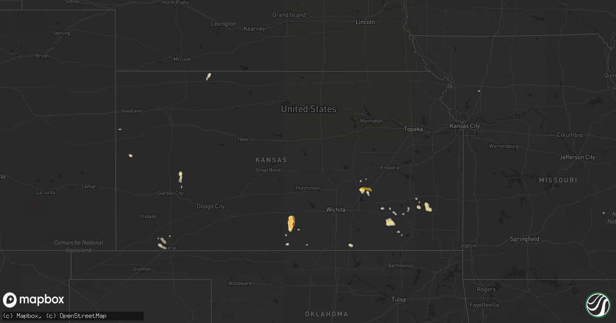
Hail Map in Kansas on May 22, 2014
Get this storm
May 22 map
$229
one time, instant access
Download today. No call, no setup
Keep the $229
Bought the map and want the full workflow? Apply the entire $229 to a subscription within 7 days. None of it is wasted.
Every map, not just this one
This buys you this map. Subscription and you get every map we run, in the markets you choose from a few cities to whole states to nationwide. Plus real-time alerts the moment a storm fires.
Contact data
Name, contact info, occupancy, even credit band for addresses in the footprint. You go from where it hit to who to call.
Become the source they trust
Unlimited branding weather history reports on demand. You already have the documented answer ready for the property owner, and you are the one who showed up with it.
Property data and RoofTrace estimates
Pull up any address you have got, its value and the exact code rules for that jurisdiction, straight from One Click Code. Then RoofTrace estimates the squares, pitch, and roof value, priced the way you price.
Storm reports in Kansas
Kansas
| Date | Description |
|---|---|
| 05/22/20143:05 PM CDT | Relayed by greenwood em |
| 05/22/20142:40 PM CDT | Multiple reports of rope tornado by public. Relayed by em via 800 mhz |
| 05/22/20142:25 PM CDT | A local report indicates 1.75 inch wind near CASSODAY |
| 05/21/20147:49 PM CDT | A local report indicates 1.00 inch wind near 5 S WOODS |
| 05/21/20147:48 PM CDT | 58 mph wind gust was measured by the amos at elkhart. |
| 05/21/20147:46 PM CDT | Trained spotter reports quarter to hen egg sized hail which covered the ground and 60 to 70 mph winds. |
| 05/21/20147:46 PM CDT | Trained spotter had hen egg size hail and estimated 60 to 70 mph winds. |
| 05/21/20147:30 PM CDT | A local report indicates 1.75 inch wind near 2 SSW ZENDA |
| 05/21/20147:15 PM CDT | A local report indicates 60 MPH wind near 6 NNE ELKHART |
All States Impacted by Hail Map on May 22, 2014
Cities Impacted by Hail Map on May 22, 2014
- Howard, KS
- Longton, KS
- Walton, NY
- Coplay, PA
- Catasauqua, PA
- Whitehall, PA
- Allentown, PA
- Northampton, PA
- Bloomsburg, PA
- Danville, PA
- Milton, PA
- Turbotville, PA
- Muncy, PA
- York, PA
- Perryville, MO
- Bishopville, MD
- Selbyville, DE
- Frankford, DE
- South New Berlin, NY
- Unadilla, NY
- Morris, NY
- Gilbertsville, NY
- Otego, NY
- Greene, NY
- Nara Visa, NM
- Woodstown, NJ
- Pedricktown, NJ
- Swedesboro, NJ
- Attica, KS
- Spivey, KS
- Zenda, KS
- Tucumcari, NM
- Conchas Dam, NM
- Fairview, OK
- Leoti, KS
- Mayfield, NY
- Johnstown, NY
- Pattersonville, NY
- Schenectady, NY
- Duanesburg, NY
- Amsterdam, NY
- Esperance, NY
- Fort Johnson, NY
- Gloversville, NY
- Rotterdam Junction, NY
- Broadalbin, NY
- Delanson, NY
- Hagaman, NY
- Aurora, CO
- Auburn, PA
- Pottsville, PA
- Schuylkill Haven, PA
- Cressona, PA
- Hopkinsville, KY
- Elkton, KY
- Tappahannock, VA
- Dunnsville, VA
- Bruington, VA
- Saint Stephens Church, VA
- Northville, NY
- Newkirk, NM
- Red Boiling Springs, TN
- Whitleyville, TN
- Ellendale, DE
- Millsboro, DE
- Georgetown, DE
- Milton, DE
- Dagsboro, DE
- Dalhart, TX
- Bowling Green, KY
- Oakland, KY
- Scottsville, KY
- Cope, CO
- Moscow, PA
- Balmorhea, TX
- Dundee, NY
- Odessa, NY
- Hector, NY
- Burdett, NY
- Trumansburg, NY
- Lovington, NM
- Port Elizabeth, NJ
- Millville, NJ
- Bridgeton, NJ
- Fort Sumner, NM
- Jim Thorpe, PA
- Lake Harmony, PA
- White Haven, PA
- Fallon, NV
- Palmerton, PA
- Kunkletown, PA
- Danielsville, PA
- Hulett, WY
- Cuervo, NM
- Garita, NM
- Mercersburg, PA
- Hagerstown, MD
- Clear Spring, MD
- Greencastle, PA
- Red Feather Lakes, CO
- Mullica Hill, NJ
- Dawson Springs, KY
- Princeton, KY
- Fredonia, KY
- Marion, KY
- Boonville, NY
- Catawissa, PA
- Mount Carmel, PA
- Wilburton, PA
- Elysburg, PA
- Childress, TX
- Fabius, NY
- Arkansas City, KS
- Fonda, NY
- Fultonville, NY
- Wildorado, TX
- Amarillo, TX
- Conowingo, MD
- Peach Bottom, PA
- East Stroudsburg, PA
- Chenango Forks, NY
- Constableville, NY
- Elverson, PA
- Downingtown, PA
- Pottstown, PA
- Glenmoore, PA
- Exton, PA
- Chester Springs, PA
- Woodbine, MD
- Clarksville, MD
- Dayton, MD
- Brookeville, MD
- Gaithersburg, MD
- Mount Airy, MD
- Damascus, MD
- Glenelg, MD
- Lancaster, VA
- Ijamsville, MD
- Highland, MD
- Brinklow, MD
- Monrovia, MD
- Ocate, NM
- Mohrsville, PA
- Bernville, PA
- Leesport, PA
- Strasburg, CO
- Bennett, CO
- Leonardtown, MD
- Loveville, MD
- Clements, MD
- Hollywood, MD
- Mechanicsville, MD
- Wakefield, VA
- Ivor, VA
- Sedley, VA
- Denver, CO
- Warsaw, VA
- Fredericksburg, VA
- Walkerton, VA
- Aylett, VA
- Sundance, WY
- Alva, WY
- Westmoreland, TN
- Brownsville, KY
- Yeso, NM
- Newfield, NY
- Spencer, NY
- Franklin, VA
- Beulah, WY
- Otis, CO
- Akron, CO
- Santa Rosa, NM
- Lead, SD
- Joes, CO
- Blackwell, OK
- Roswell, NM
- Hartly, DE
- Walsenburg, CO
- Strawberry Plains, TN
- Kim, CO
- Port Crane, NY
- Harpursville, NY
- San Jon, NM
- Trementina, NM
- Claude, TX
- Hopewell, VA
- Chester, VA
- Liberal, KS
- Hugoton, KS
- Funkstown, MD
- Channing, TX
- Apalachin, NY
- Owego, NY
- Artesia, NM
- Lake Arthur, NM
- Amistad, NM
- Lafayette, TN
- Fountain Run, KY
- Gamaliel, KY
- Crook, CO
- Henrico, VA
- Cherokee, OK
- Remsen, NY
- Hartley, TX
- Marcus Hook, PA
- Flagler, CO
- Anton, CO
- Glen Allen, VA
- Chacon, NM
- Mora, NM
- Disputanta, VA
- Shady Side, MD
- Churchton, MD
- Vona, CO
- Vineland, NJ
- Providence, KY
- Burns, KS
- Cassoday, KS
- Bumpass, VA
- Mineral, VA
- Louisa, VA
- Miami, TX
- Harbeson, DE
- Whaleyville, MD
- Berlin, MD
- Showell, MD
- Mobeetie, TX
- Wray, CO
- Crossville, TN
- Monterey, TN
- Lusby, MD
- Lexington Park, MD
- Patuxent River, MD
- Dowell, MD
- Solomons, MD
- Great Mills, MD
- California, MD
- Harwood, MD
- Edgewater, MD
- Fort Davis, TX
- Alpine, TX
- Greentown, PA
- Weskan, KS
- El Dorado, KS
- Roy, NM
- Golconda, IL
- Healy, KS
- Hazelton, KS
- Jamestown, TN
- Lincoln, DE
- Houston, DE
- Viola, DE
- Milford, DE
- Felton, DE
- Clayton, DE
- Harrington, DE
- Camden Wyoming, DE
- Greenwood, DE
- Dover, DE
- Moss, TN
- Yates Center, KS
- Benedict, KS
- Chanute, KS
- Maryville, TN
- Albany, KY
- Vega, TX
- Saint Mary, MO
- Elizabeth, CO
- North East, MD
- Chesapeake City, MD
- Cunningham, KS
- Kingman, KS
- Morton, TX
- Sevierville, TN
- Chaptico, MD
- King George, VA
- Nanjemoy, MD
- Charles City, VA
- Bard, NM
- Hamden, NY
- Tompkinsville, KY
- Muncy Valley, PA
- Delmont, NJ
- Grand Tower, IL
- White Pine, TN
- Sidney Center, NY
- Mosquero, NM
- Russellville, TN
- Hawley, PA
- Carbondale, PA
- Lakeville, PA
- Lake Ariel, PA
- Waymart, PA
- Okeene, OK
- Hitchcock, OK
- Southard, OK
- Watonga, OK
- Makanda, IL
- Cobden, IL
- Wrightsville, PA
- New Columbia, PA
- Chadds Ford, PA
- Wilmington, DE
- Kennett Square, PA
- Hockessin, DE
- Prince George, VA
- Colonial Heights, VA
- Spring Grove, VA
- Waverly, VA
- Richmond, VA
- Norton, KS
- Tilghman, MD
- Louisville, TN
- Kodak, TN
- New Market, TN
- Texhoma, OK
- Lysite, WY
- Little Meadows, PA
- Friendsville, PA
- Turin, NY
- Piqua, KS
- Candor, NY
- Kit Carson, CO
- Deer Lodge, TN
- Sunbright, TN
- Canton, OK
- Lewisburg, KY
- Midlothian, VA
- Chesterfield, VA
- Pall Mall, TN
- Woodford, VA
- Port Royal, VA
- Bowling Green, VA
- Delancey, NY
- Delhi, NY
- New Woodstock, NY
- East Earl, PA
- Rome, PA
- Elmer, NJ
- Rutledge, TN
- Lodi, NY
- Dandridge, TN
- Ellenville, NY
- House, NM
- Niota, TN
- Humboldt, KS
- Erie, KS
- Waynesboro, PA
- Pomona, IL
- Montoursville, PA
- Montgomery, PA
- Dover, PA
- York Haven, PA
- Lewisberry, PA
- Tribune, KS
- Milford, VA
- Model, CO
- Wartburg, TN
- Stevensville, VA
- Newtown, VA
- King And Queen Court House, VA
- Del Rio, TN
- Hartford, TN
- Williamsport, PA
- Masonville, NY
- Forksville, PA
- Ten Mile, TN
- Franklin, NY
- Salem, MO
- Parrottsville, TN
- Mosheim, TN
- Greeneville, TN
- Bybee, TN
- Newark Valley, NY
- Arnett, OK
- Voorheesville, NY
- Hooker, OK
- Ewing, VA
- Wheeler, TX
- Philadelphia, TN
- Sweetwater, TN
- Colonial Beach, VA
- Stratton, CO
- Woodrow, CO
- Zuni, VA
- Carrsville, VA
- Alpine, NY
- Mount Upton, NY
- Grandview, TN
- Chester, PA
- Claymont, DE
- Glen Mills, PA
- Garnet Valley, PA
- Aston, PA
- Easton, PA
- Pine Grove, PA
- Benton, PA
- Briscoe, TX
- Walnutport, PA
- Laurys Station, PA
- Goodwell, OK
- Logan, NM
- Rapid City, SD
- Glasgow, KY
- Monroeville, NJ
- Penns Grove, NJ
- Oneida, TN
- Port Deposit, MD
- Warwick, MD
- Perryville, MD
- Elkton, MD
- Earleville, MD
- Charlestown, MD
- Colora, MD
- Celina, TN
- Etoile, KY
- Mount Hermon, KY
- Austin, KY
- Gainesboro, TN
- Holland, KY
- Englewood, CO
- Reydon, OK
- Cookeville, TN
- Loudon, TN
- Lenoir City, TN
- Wurtsboro, NY
- Livingston, TN
- Garden City, KS
- Raton, NM
- Mascot, VA
- Mattaponi, VA
- Little Plymouth, VA
- Shacklefords, VA
- Holland Patent, NY
- Rome, NY
- Elk City, KS
- Bainbridge, NY
- Sidney, NY
- Dexter, NM
- Mutual, OK
- Himrod, NY
- Buena Vista, NM
- Spotsylvania, VA
- Fort Morgan, CO
- Gloucester, VA
- Hayes, VA
- Crofton, KY
- Pembroke, KY
- Ashland, PA
- Carbondale, IL
- Goreville, IL
- Greenback, TN
- Hagerman, NM
- Wells, NY
- Oak Ridge, TN
- Oliver Springs, TN
- Clinton, TN
- Nemo, SD
- Meeteetse, WY
- Huntsville, TN
- Smiths Grove, KY
- Upper Black Eddy, PA
- Ottsville, PA
- Kintnersville, PA
- Fredonia, KS
- Buffalo, KS
- Orwigsburg, PA
- Hamburg, PA
- Port Clinton, PA
- Dumas, TX
- Woodside, DE
- Ocean City, MD
- Magnolia, DE
- Millville, DE
- Ocean View, DE
- Sweet Valley, PA
- Andes, NY
- Jefferson City, TN
- Talbott, TN
- Fall River, KS
- Bethel, PA
- Reading, PA
- Cheyenne Wells, CO
- Norcatur, KS
- Newkirk, OK
- Port Norris, NJ
- Birdsboro, PA
- Monroe, TN
- Briceville, TN
- Knoxville, TN
- Frohna, MO
- Altenburg, MO
- Dendron, VA
- Russellville, KY
- Littlerock, CA
- Wagon Mound, NM
- Friendsville, TN
- Farragut, TN
- Cimarron, NM
- Sunray, TX
- Watkins, CO
- Branson, CO
- Interlaken, NY
- Vernon, CO
- Cresco, PA
- Canadensis, PA
- Havre De Grace, MD
- Prompton, PA
- Shavertown, PA
- Dallas, PA
- Tremont, PA
- Shamokin, PA
- Hegins, PA
- Branchdale, PA
- Pitman, PA
- Warren Center, PA
- Le Raysville, PA
- Robbins, TN
- Yuma, CO
- Dingmans Ferry, PA
- Lucas, KY
- Gillette, WY
- Ozark, IL
- New Burnside, IL
- Bath, PA
- Nazareth, PA
- Canyon, TX
- Columbia, NJ
- Chester, OK
- Seiling, OK
- Lake Pleasant, NY
- Canadian, TX
- Piedmont, KS
- Eureka, KS
- Harper, KS
- Downsville, NY
- Penn Yan, NY
- Cameron, MO
- Malaga, NJ
- Newfield, NJ
- Franklinville, NJ
- Bushkill, PA
- Glenwood, MD
- Farnham, VA
- Jamaica, VA
- Water View, VA
- Nortonville, KY
- Bethlehem, PA
- Center Valley, PA
- Hellertown, PA
- Fort Hunter, NY
- Tribes Hill, NY
- Kempton, PA
- Waldron, KS
- Black, MO
- Lancing, TN
- Davidsonville, MD
- Sherwood, MD
- Cosby, TN
- Stearns, KY
- Monticello, KY
- Sharon, KS
- East Berlin, PA
- New Oxford, PA
- Rosiclare, IL
- Tallassee, TN
- Mohnton, PA
- Champlain, VA
- Springer, NM
- Deadwood, SD
- Allons, TN
- Hilham, TN
- Olmstead, KY
- Allensville, KY
- Parks, NE
- Fredericktown, MO
- Capitan, NM
- Oakwood, OK
- Spring City, TN
- Rockwood, TN
- Pine Bush, NY
- Dixon Springs, TN
- Hasty, CO
- Coal Township, PA
- Midway, TN
- Aberdeen, MD
- Aberdeen Proving Ground, MD
- Mohawk, TN
- West Chester, PA
- Wilkes Barre, PA
- Mountain Top, PA
- Bluff City, KS
- La Fayette, NY
- Cedar Point, KS
- Cape Charles, VA
- Annapolis, MO
- Thorn Hill, TN
- Mooresburg, TN
- Harriman, TN
- Severy, KS
- Altamont, NY
- East Berne, NY
- Nashville, KS
- Rockville, VA
- Montpelier, VA
- Laurel, MD
- Savage, MD
- Columbia, MD
- Odenton, MD
- Bowie, MD
- Jessup, MD
- Fort George G Meade, MD
- Annapolis Junction, MD
- Fulton, MD
- Crofton, MD
- Gambrills, MD
- Windsor, PA
- Maugansville, MD
- Stafford, VA
- Cherryville, PA
- Cheyney, PA
- Thornton, PA
- Morgantown, PA
- Douglassville, PA
- Chester Heights, PA
- Brookhaven, PA
- Temple, PA
- Malvern, PA
- Media, PA
- Shartlesville, PA
- Newtown Square, PA
- Immaculata, PA
- Bridgeport, NJ
- Grantsburg, IN
- Sulphur, IN
- English, IN
- Leavenworth, IN
- Ekron, KY
- Payneville, KY
- Brandenburg, KY
- Guston, KY
- Webster, KY
- Hodgenville, KY
- Elizabethtown, KY
- Rineyville, KY
- Battletown, KY
- Corydon, IN
- Taswell, IN


