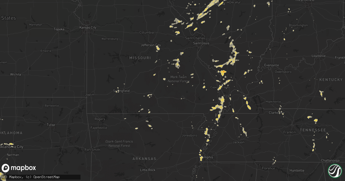
Hail Map on May 20, 2012
Get this storm
May 20 map
$229
one time, instant access
Download today. No call, no setup
Keep the $229
Bought the map and want the full workflow? Apply the entire $229 to a subscription within 7 days. None of it is wasted.
Every map, not just this one
This buys you this map. Subscription and you get every map we run, in the markets you choose from a few cities to whole states to nationwide. Plus real-time alerts the moment a storm fires.
Contact data
Name, contact info, occupancy, even credit band for addresses in the footprint. You go from where it hit to who to call.
Become the source they trust
Unlimited branding weather history reports on demand. You already have the documented answer ready for the property owner, and you are the one who showed up with it.
Property data and RoofTrace estimates
Pull up any address you have got, its value and the exact code rules for that jurisdiction, straight from One Click Code. Then RoofTrace estimates the squares, pitch, and roof value, priced the way you price.
States Impacted by Hail Map on May 20, 2012
Storm reports
Missouri
| Date | Description |
|---|---|
| 05/20/20126:45 PM CDT | Largest hailstone found was the size of a quarter. |
Mississippi
| Date | Description |
|---|---|
| 05/20/20124:15 PM CDT | A couple trees were down near the savanna st. Exit |
Michigan
| Date | Description |
|---|---|
| 05/20/20124:34 PM CDT | Trees down across highway m-95 along the marquette/dickinson county line. |
| 05/20/20124:30 PM CDT | 24 inch white pine tree knocked over. Estimated winds of 60mph. |
| 05/20/201212:45 PM CDT | A local report indicates 1.00 inch wind near CALUMET |
| 05/20/201212:17 PM CDT | A local report indicates 1.00 inch wind near 2 E REDRIDGE |
| 05/19/20129:52 PM CDT | Time estimated from radar. |
| 05/19/20129:33 PM CDT | Mostly quarter sized or less...a few half dollar hailstones |
| 05/19/20129:33 PM CDT | Some slightly larger than quarter size also observed. |
Indiana
| Date | Description |
|---|---|
| 05/19/201210:45 PM CDT | Numerous trees down |
| 05/19/201210:42 PM CDT | County dispatch reported a metal roof blown off an outbuilding onto top of a home near 450 e and fort wayne road. Some windows broken on home. |
| 05/19/20127:57 PM CDT | Extension of the damage path from cleveland street...likely microburst over south side of gary. Tree snapped and powerlines downed in this area. |
| 05/19/20127:55 PM CDT | In un-incorporated gary - lake ridge or between gary and merillville. Est 40 to 50 mph. Partial wall collapse. Roof torn off. |
| 05/19/20127:35 PM CDT | Tree fell on chain link fence |
| 05/19/20127:19 PM CDT | Extension of the damage path from cleveland street...likely microburst over south side of gary. Tree snapped and powerlines downed in this area. Corrected time of occur |
| 05/19/20127:18 PM CDT | In un-incorporated gary - lake ridge or between gary and merillville. Est 40 to 50 mph. Partial wall collapse. Roof torn off. Corrected time of occurance. |
Florida
| Date | Description |
|---|---|
| 05/20/20126:35 PM CDT | Tree branches of 3 to 4 inches in diameter were downed near the intersection of nw 67th avenue and the palmetto expressway in miami lakes. |
Wisconsin
| Date | Description |
|---|---|
| 05/20/20125:46 PM CDT | Trees and power lines down |
| 05/20/20125:42 PM CDT | A local report indicates 1.00 inch wind near AMBERG |
| 05/20/20125:42 PM CDT | Trees and power lines down |
| 05/20/20124:42 PM CDT | Wires down |
| 05/20/20124:42 PM CDT | Wires down. |
| 05/20/20124:42 PM CDT | Tree down |
| 05/20/20124:37 PM CDT | Tree down in bloomfield which is in the pell lake area. |
| 05/20/20124:37 PM CDT | A tree and powerline reported down in the lyons area...northeast of lake geneva. |
| 05/20/20124:05 PM CDT | Trees and power lines down |
| 05/20/20123:55 PM CDT | Trees and power lines down |
| 05/20/20123:15 PM CDT | Trees and power lines down along highway 45...courtesy of wsaw. |
| 05/20/20123:00 PM CDT | On hwy 17. |
| 05/20/20122:41 PM CDT | A local report indicates 1.00 inch wind near 3 N SUGAR CAMP |
| 05/20/20122:30 PM CDT | Delayed report from wsaw tv-7. |
| 05/20/20122:15 PM CDT | Trees down along highway 8 |
| 05/20/20122:05 PM CDT | A local report indicates 1.00 inch wind near 5 SW PHILLIPS |
| 05/20/20122:00 PM CDT | Roof blown off an older building along county hwy a near the taylor and marathon county line |
| 05/20/20121:48 PM CDT | A local report indicates 1.75 inch wind near LAC DU FLAMBEAU |
| 05/20/20121:39 PM CDT | A lot of penny to nickel hail size hail stones...along with a few quarter size. |
| 05/20/20121:22 PM CDT | Hail lasted about 5 minutes and covered the ground. |
| 05/20/20121:16 PM CDT | A local report indicates 1.00 inch wind near 15 E PHILLIPS |
| 05/20/201212:50 PM CDT | A local report indicates 1.00 inch wind near 4 NNE CORNELL |
| 05/20/201212:50 PM CDT | A local report indicates 1.00 inch wind near NNE CORNELL |
| 05/20/201212:45 PM CDT | A local report indicates 1.00 inch wind near 4 E STETSONVILLE |
| 05/20/201212:39 PM CDT | Tree branches down |
| 05/20/201212:39 PM CDT | 8 inch diameter tree branches down |
| 05/20/201212:00 PM CDT | A local report indicates 1.00 inch wind near 1 NE MELLEN |
Illinois
| Date | Description |
|---|---|
| 05/20/20126:54 PM CDT | A few trees down and roofing blown off. |
| 05/20/20126:45 PM CDT | Trees and power lines down. |
| 05/20/20126:42 PM CDT | A local report indicates 1.00 inch wind near 1 WSW DWIGHT |
| 05/20/20126:36 PM CDT | Quarter hail in harrisburg. Increased in size from pea size about 10 min ago. |
| 05/20/20126:24 PM CDT | Hail slightly bigger than quarter size falling on the south side of fairfield. |
| 05/20/20126:21 PM CDT | Quarter hail in fairfield. |
| 05/20/20126:09 PM CDT | Union and rt 6 |
| 05/20/20125:45 PM CDT | Quarter hail in mt vernon. |
| 05/20/20125:45 PM CDT | Marble to quarter sized. |
| 05/20/20125:40 PM CDT | One power pole down and 2 trees damaged. Information from logan county ema and wics-tv. |
| 05/20/20125:25 PM CDT | Tree broken off on vacant house. |
| 05/20/20125:08 PM CDT | Power lines down with lines on a car. |
| 05/20/20124:43 PM CDT | A local report indicates 1.00 inch wind near 4 NW MURPHYSBORO |
| 05/20/20124:35 PM CDT | Several trees down. Front of a car garage pulled out. Ripped roof off of outbuildings. |
| 05/20/20124:23 PM CDT | Us 14 and kishwaukee rd. Relayed by wrex |
| 05/20/20124:15 PM CDT | Alden rd. Relayed by wrex. |
| 05/20/20124:10 PM CDT | A local report indicates 1.00 inch wind near MARENGO |
| 05/20/20124:10 PM CDT | A local report indicates 58 MPH wind near MARENGO |
| 05/20/20124:00 PM CDT | Also encountered penny size hail |
| 05/20/20123:55 PM CDT | A local report indicates 1.00 inch wind near PAW PAW |
| 05/19/20127:25 PM CDT | Multiple tree limbs down - some were 3 to 4 inches in diameter. Delayed report. |
| 05/19/20127:06 PM CDT | State line rd and 10500n. Also half inch hail. |
Colorado
| Date | Description |
|---|---|
| 05/19/20129:55 PM CDT | At koaa |
| 05/19/20128:07 PM CDT | A local report indicates 1.00 inch wind near 1 E REIRADON HILL |
Arkansas
| Date | Description |
|---|---|
| 05/20/20125:37 PM CDT | A local report indicates 1.00 inch wind near CALICO ROCK |
Kentucky
| Date | Description |
|---|---|
| 05/19/20129:55 PM CDT | Tree fell on house. Not sure if it was wind or lightning caused. |
Louisiana
| Date | Description |
|---|---|
| 05/19/20127:51 PM CDT | Trees and lines down |
Texas
| Date | Description |
|---|---|
| 05/20/20126:00 PM CDT | A local report indicates 2.50 inch wind near 5 S GUTHRIE |
| 05/20/20125:53 PM CDT | A local report indicates 1.75 inch wind near 4 S GUTHRIE |
| 05/20/20125:03 PM CDT | A local report indicates 1.00 inch wind near 4 N ELECTRA |
| 05/20/20124:26 PM CDT | A local report indicates 1.00 inch wind near 3 S DAVIDSON |
Georgia
| Date | Description |
|---|---|
| 05/20/20126:40 PM CDT | Dekalb county 911 relayed a report of a tree downed on montreal road. Radar estimated time between 1940 edt and 1945 edt. |
| 05/20/20126:20 PM CDT | Marble to quarter size hail was reported by the media on langford parkway south of downtown atlanta |
| 05/20/20125:40 PM CDT | Dekalb county 911 relayed a report of a tree downed on montreal road. Radar estimated time between 1840 edt and 1845 edt. |
Alabama
| Date | Description |
|---|---|
| 05/20/20125:43 PM CDT | One tree down along hatley-detroit road...and another tree down near the fire dept on hwy 17. Numerous power outages in and around detroit...including areas west and so |
| 05/20/20125:25 PM CDT | Numerous trees down along county road 16 from henson springs to detroit |
| 05/20/20125:25 PM CDT | Numerous trees down along county road 16 from henson springs to detroit. Corrected for location. |
Cities Impacted by Hail Map on May 20, 2012
- Clay, KY
- Central Lake, MI
- Bellaire, MI
- Kampsville, IL
- Eldred, IL
- White Hall, IL
- Mendota, IL
- Crystal Falls, MI
- Compton, IL
- West Brooklyn, IL
- Paw Paw, IL
- Sparta, IL
- Gilman, IL
- Ashkum, IL
- Danforth, IL
- Vulcan, MI
- Foster City, MI
- Felch, MI
- Springfield, IL
- Hillsboro, TN
- Bourbon, MO
- Marengo, IL
- Harvard, IL
- Amboy, IL
- Ohio, IL
- Harmon, IL
- Walnut, IL
- Deer Grove, IL
- Tampico, IL
- Tomahawk, WI
- Stetsonville, WI
- Dorchester, WI
- Abbotsford, WI
- Rib Lake, WI
- Merrill, WI
- Ogema, WI
- Medford, WI
- Petersburg, IL
- Spencer, TN
- Clarksville, TN
- Adams, TN
- Cedar Hill, TN
- Phillips, WI
- Thomasboro, IL
- Gifford, IL
- Urbana, IL
- Saint Joseph, IL
- Emden, IL
- Hartsburg, IL
- San Jose, IL
- Mason City, IL
- New Holland, IL
- Portageville, MO
- Hayti, MO
- Eland, WI
- Wittenberg, WI
- Birnamwood, WI
- Jonesboro, IL
- Anna, IL
- Cobden, IL
- Easton, IL
- Greenview, IL
- Osseo, WI
- Salem, MO
- Cedar Grove, TN
- Sturgis, KY
- Batchtown, IL
- Elsberry, MO
- Hardin, IL
- Foley, MO
- Boulder Junction, WI
- Woodruff, WI
- Hardyville, KY
- Center, KY
- Fulton, KY
- Duncan, OK
- Calico Rock, AR
- Watersmeet, MI
- Scheller, IL
- Tamaroa, IL
- Du Quoin, IL
- Sesser, IL
- Glidden, WI
- Franklin, IL
- Winter, WI
- Forest City, IL
- Manito, IL
- Green Valley, IL
- Electra, TX
- Atlanta, GA
- Lake City, MI
- Owen, WI
- Curtiss, WI
- Fairbury, IL
- Pontiac, IL
- Marlow, OK
- Eldorado, IL
- Athens, IL
- Edmonton, KY
- Bowling Green, MO
- Clarksville, MO
- Eolia, MO
- Gwinn, MI
- Montgomery, IN
- Hornersville, MO
- Blytheville, AR
- Manila, AR
- Leachville, AR
- Dell, AR
- Kirksey, KY
- Comanche, OK
- Saint Joe, AR
- Yukon, OK
- El Reno, OK
- Rochester, IL
- Dawson, IL
- Riverton, IL
- Bonnots Mill, MO
- Loose Creek, MO
- Linn, MO
- San Jon, NM
- Bard, NM
- Crawfordsville, AR
- Marion, AR
- Helena, OK
- Ringwood, OK
- Cleo Springs, OK
- Aline, OK
- Bloomfield, IN
- Springville, IN
- Lake Linden, MI
- Marenisco, MI
- Ontonagon, MI
- Ewen, MI
- Conover, WI
- Phelps, WI
- Eagle River, WI
- Gleason, WI
- Irma, WI
- Bertrand, MO
- Charleston, MO
- Toivola, MI
- Harrisburg, IL
- Greencastle, IN
- Reelsville, IN
- Republic, MO
- Springfield, MO
- Negaunee, MI
- Sonora, KY
- Sheldon, WI
- Middletown, MO
- Cutler, IL
- Walsh, IL
- Baldwin, IL
- New Berlin, IL
- Pleasant Plains, IL
- Mount Vernon, IL
- Hamilton, AL
- Hackleburg, AL
- Gainesville, MO
- Hawk Point, MO
- Troy, MO
- Belzoni, MS
- Itta Bena, MS
- Buckley, IL
- Loda, IL
- Roberts, IL
- Bingham, IL
- Loyal, WI
- Chapin, IL
- Meredosia, IL
- Bluffs, IL
- Chandlerville, IL
- Tallula, IL
- Ashland, IL
- Channing, MI
- Champion, MI
- Ishpeming, MI
- Odell, IL
- Land O'Lakes, WI
- Trout Creek, MI
- Dyer, IN
- Davidson, OK
- Harrold, TX
- Osceola, AR
- Gorham, IL
- Charlevoix, MI
- Roodhouse, IL
- Murrayville, IL
- Morris, IL
- Hurley, WI
- Ironwood, MI
- Tutwiler, MS
- Clarksdale, MS
- Buffalo, IL
- Marble Hill, MO
- Glenallen, MO
- Latham, IL
- Mount Pulaski, IL
- Upson, WI
- Freeburg, MO
- Vega, TX
- Saxon, WI
- Odin, IL
- Sandoval, IL
- Ridgway, IL
- Omaha, IL
- Willard, MO
- Wakefield, MI
- Mcminnville, TN
- Woodbury, TN
- Parma, MO
- Catron, MO
- New Madrid, MO
- Sikeston, MO
- East Prairie, MO
- Matthews, MO
- Westboro, WI
- Jackson, MO
- Fieldon, IL
- Hereford, TX
- Hitchcock, OK
- Watonga, OK
- Clinton, KY
- Mellen, WI
- Mechanicsburg, IL
- Minocqua, WI
- Lac Du Flambeau, WI
- Fleming, CO
- Otis, CO
- Dwight, IL
- Washington Island, WI
- Morrison, TN
- Butler, IL
- Raymond, IL
- Irving, IL
- Smithboro, IL
- Greenville, IL
- Pueblo, CO
- Shelburn, IN
- Noble, MO
- Paragould, AR
- Rolling Fork, MS
- Anguilla, MS
- Yazoo City, MS
- Louise, MS
- Centralia, IL
- Walnut Hill, IL
- Ironton, MO
- Murphysboro, IL
- Altamont, IL
- Norway, MI
- Chrisman, IL
- Mass City, MI
- Bruce Crossing, MI
- Willow, OK
- Woodlawn, IL
- Bath, IL
- Kilbourne, IL
- Holliday, TX
- Alexander, IL
- Cantrall, IL
- Garden Prairie, IL
- Woodstock, IL
- Patoka, IL
- Salem, IL
- Carbondale, IL
- Pomona, IL
- Alto Pass, IL
- Turrell, AR
- Gilmore, AR
- Rochelle, IL
- Thawville, IL
- Paducah, KY
- Boaz, KY
- Symsonia, KY
- Butternut, WI
- Antigo, WI
- Aniwa, WI
- Vina, AL
- Detroit, AL
- Beaverton, AL
- Sulligent, AL
- Vanzant, MO
- Hanna City, IL
- Trivoli, IL
- Saint Clair, MO
- Palmyra, IL
- Modesto, IL
- Wrights, IL
- Greenfield, IL
- Martin, TN
- Elmwood, TN
- Carthage, TN
- Ava, IL
- Grand Tower, IL
- Jacob, IL
- Rockwood, IL
- Rumsey, KY
- Medora, IL
- Rockbridge, IL
- Chesterfield, IL
- Seymour, TX
- Williamsville, IL
- Sherman, IL
- Elkhart, IL
- Middletown, IL
- Dixon, MO
- Avondale, CO
- Daggett, MI
- Gilman, WI
- Jerseyville, IL
- Grafton, IL
- Townsend, WI
- White Lake, WI
- Marion, KY
- Mountain Home, AR
- Mayfield, KY
- Hickory, KY
- Benton, KY
- Taylorville, IL
- Edinburg, IL
- Lambert, MS
- Jacksonville, IL
- Benton, IL
- Waltonville, IL
- Bonnie, IL
- Greenfield, TN
- Hancock, MI
- Scott City, MO
- Cape Girardeau, MO
- McClure, IL
- Chaffee, MO
- Dix, IL
- Hickman, KY
- Tiptonville, TN
- Waukomis, OK
- Deerton, MI
- Lincoln, IL
- Martinton, IL
- Mineral, IL
- Annawan, IL
- Vance, MS
- Pleasant Shade, TN
- Granville, TN
- Gainesboro, TN
- Doe Run, MO
- Bismarck, MO
- Brantwood, WI
- Catawba, WI
- Tripoli, WI
- Prentice, WI
- Withee, WI
- Udall, MO
- Caulfield, MO
- Bakersfield, MO
- Earlville, IL
- Loco, OK
- Mangum, OK
- Vinson, OK
- Laona, WI
- Wabeno, WI
- Luxora, AR
- Granton, WI
- Wausaukee, WI
- Crivitz, WI
- Atlantic Mine, MI
- Marquand, MO
- Proctor, AR
- Watseka, IL
- Oklahoma City, OK
- Pembine, WI
- Hartsville, TN
- Delavan, IL
- Armington, IL
- Hopedale, IL
- Skandia, MI
- Trenary, MI
- Meno, OK
- Lahoma, OK
- Plainville, IN
- Poplar Grove, IL
- Capron, IL
- Park Falls, WI
- Coleman, WI
- Oconto Falls, WI
- Suring, WI
- Pound, WI
- Lena, WI
- Armstrong Creek, WI
- Florence, WI
- Fence, WI
- Gardner, IL
- Lexington, TN
- Manchester, TN
- Ewing, IL
- Ina, IL
- Carrollton, AL
- Isabella, MO
- Gosport, IN
- Hawkins, WI
- Vernon, TX
- Oklaunion, TX
- Dowelltown, TN
- Liberty, TN
- Keshena, WI
- Neopit, WI
- Nokomis, IL
- Franklin, IN
- Mulkeytown, IL
- Franklin Grove, IL
- Mountain Grove, MO
- Westcliffe, CO
- Williamsburg, MI
- Alden, MI
- Rapid City, MI
- Traverse City, MI
- Ellsworth, MI
- East Jordan, MI
- Walters, OK
- Lawton, OK
- Almo, KY
- Murray, KY
- Dundee, MS
- West Memphis, AR
- Kennan, WI
- Truxton, MO
- Warrenton, MO
- Waverly, IL
- Medina, TN
- De Witt, AR
- Sparta, TN
- Calhoun, KY
- Aliceville, AL
- Union City, OK
- Fairmount, IL
- Crown Point, IN
- Lowell, IN
- Oakford, IL
- Worthington, IN
- Lindenwood, IL
- Athelstane, WI
- Genoa, IL
- Kingston, IL
- Belvidere, IL
- Saint James, MO
- Cuba, MO
- Girard, IL
- Sault Sainte Marie, MI
- Fairfield, IL
- Lyons, IN
- Loretto, TN
- Blanchard, OK
- Steelville, MO
- Erick, OK
- Hamburg, IL
- Arbyrd, MO
- Tuscola, IL
- Whitehall, WI
- Hixton, WI
- Crenshaw, MS
- Tremont, IL
- Kingsley, MI
- Caruthersville, MO
- Hermann, MO
- Killen, AL
- Lexington, AL
- Gary, IN
- Lake Station, IN
- Bark River, MI
- Stephenson, MI
- Pleasant View, TN
- Chapmansboro, TN
- West Bend, WI
- Niagara, WI
- Dunbar, WI
- Fithian, IL
- Homer, IL
- Elizabethtown, IL
- Duke, MO
- Campbell Hill, IL
- Pinckneyville, IL
- Republic, MI
- Trilla, IL
- Trenton, KY
- Guthrie, KY
- Shobonier, IL
- Vernon, IL
- Vandalia, IL
- Sugar Grove, IL
- Pittsfield, IL
- Pearl, IL
- Ashland, WI
- Ojibwa, WI
- Silex, MO
- Bellflower, MO
- Wilson, AR
- Nara Visa, NM
- Ramsey, IL
- Hillview, IL
- Tolono, IL
- Enid, OK
- Argonne, WI
- Lake Village, IN
- Demotte, IN
- Thayer, IN
- Marquette, MI
- Rhinelander, WI
- Calumet, OK
- Geary, OK
- Rochester, IN
- Arcola, IL
- Chatham, MI
- Horse Cave, KY
- Greensburg, KY
- Holcombe, WI
- Ladysmith, WI
- Trezevant, TN
- Atwood, TN
- Amberg, WI
- Berger, MO
- Milan, TN
- Bethany, OK
- Lavinia, TN
- Huntingdon, TN
- Paxton, IL
- Mazon, IL
- Coal City, IL
- Wilmington, IL
- Braceville, IL
- Cornell, WI
- Harshaw, WI
- Hazelhurst, WI
- Virden, IL
- Amasa, MI
- Marks, MS
- Rockland, MI
- Patton, MO
- Glen Flora, WI
- Steele, MO
- Minier, IL
- Saint Elmo, IL
- Annapolis, MO
- Chassell, MI
- Ogden, IL
- Peachtree Corners, GA
- Roswell, NM
- Mackinaw, IL
- Carrollton, IL
- Atlanta, IL
- Kewadin, MI
- Leroy, MI
- La Moille, IL
- Arlington, IL
- Malden, IL
- Watton, MI
- Big Clifty, KY
- Kennett, MO
- Rush Springs, OK
- Bruce, WI
- Sheffield, IL
- Whittington, IL
- Huntingburg, IN
- Momence, IL
- Three Lakes, WI
- Hinton, OK
- Yuma, CO
- Rossville, IL
- Sublette, IL
- Harrison, AR
- Omaha, AR
- Kell, IL
- Alpharetta, GA
- Cumming, GA
- Dana, IN
- Ridge Farm, IL
- Vichy, MO
- Logansport, IN
- Griggsville, IL
- Chambersburg, IL
- Lookeba, OK
- Clay City, IL
- Exeland, WI
- Sullivan, MO
- Paw Paw, MI
- Gobles, MI
- Rapid River, MI
- Dora, MO
- Hartland, WI
- Fillmore, IL
- Mancelona, MI
- Cadott, WI
- Chippewa Falls, WI
- Tecumseh, MO
- Edinburgh, IN
- Pointe Aux Pins, MI
- Greenup, IL
- Brookline, MO
- Grant Park, IL
- Beecher, IL
- Buncombe, IL
- Dodgeville, MI
- Houghton, MI
- South Range, MI
- Painesdale, MI
- Dale, IN
- New Salem, IL
- Au Train, MI
- Geff, IL
- Sims, IL
- South Boardman, MI
- Iron River, MI
- Slinger, WI
- Summit Lake, WI
- Ashley, IL
- Steeleville, IL
- Bluford, IL
- Christopher, IL
- Chester, IL
- Percy, IL
- Buckner, IL
- Texico, IL
- Covington, MI
- Tustin, MI
- Cherry, IL
- Princeton, IL
- Harbor Springs, MI
- Chana, IL
- Knox, IN
- Steward, IL
- Lakewood, WI
- Patoka, IN
- Decker, IN
- Crandon, WI
- New Auburn, WI
- Cascade, WI
- Adell, WI
- Dixon, IL
- Kirkland, IL
- Cherry Valley, IL
- Monroe Center, IL
- Hebron, IL
- Iliff, CO
- Padroni, CO
- Hebron, IN
- Wheatfield, IN
- Ringle, WI
- Binger, OK
- Minco, OK
- Rock, MI
- Pocasset, OK
- Frohna, MO
- Hermansville, MI
- Delaplaine, AR
- Makanda, IL
- Island, KY
- Sacramento, KY
- Kewanna, IN
- Lucerne, IN
- Twelve Mile, IN
- Tremont, MS
- Drury, MO
- Norwood, MO
- Caledonia, IL
- Wolf Lake, IL
- Lone Wolf, OK
- Granite, OK
- Newark, IL
- Van Buren, MO
- Malta, IL
- Athens, WI
- Saint Anne, IL
- Lafayette, TN
- Philo, IL
- Savoy, IL
- Carrier Mills, IL
- Long Lake, WI
- Metropolis, IL
- Deerbrook, WI
- Lake Tomahawk, WI
- Sayner, WI
- Saint Germain, WI
- Annada, MO
- Star Lake, WI
- Decatur, GA
- Calumet, MI
- Illiopolis, IL
- Dongola, IL
- Boyd, WI
- Michigamme, MI
- Rensselaer, IN
- Gillett, WI
- Brohman, MI
- White Cloud, MI
- Kalkaska, MI
- Onarga, IL
- Altamont, TN
- Presque Isle, WI
- Unity, WI
- Spencer, WI
- Anadarko, OK
- Melvin, IL
- Mohawk, MI
- Van Orin, IL
- Colby, WI
- Fair Grove, MO
- Mill Shoals, IL
- Sussex, WI
- Minooka, IL
- Byron Center, MI
- Beech Grove, AR
- Dixon Springs, TN
- Leland, IL
- Sandwich, IL
- Somonauk, IL
- Lenzburg, IL
- Pearson, WI
- Pickerel, WI
- Iron City, TN
- Saint Joseph, TN
- Strum, WI
- Leasburg, MO
- Potosi, MO
- Saint John, IN
- Schneider, IN
- Schererville, IN
- Griffith, IN
- Pembroke Township, IL
- Merrillville, IN
- Cedar Lake, IN
- Cabool, MO
- Bell City, MO
- Essex, MO
- Pekin, IL
- Batesville, MS