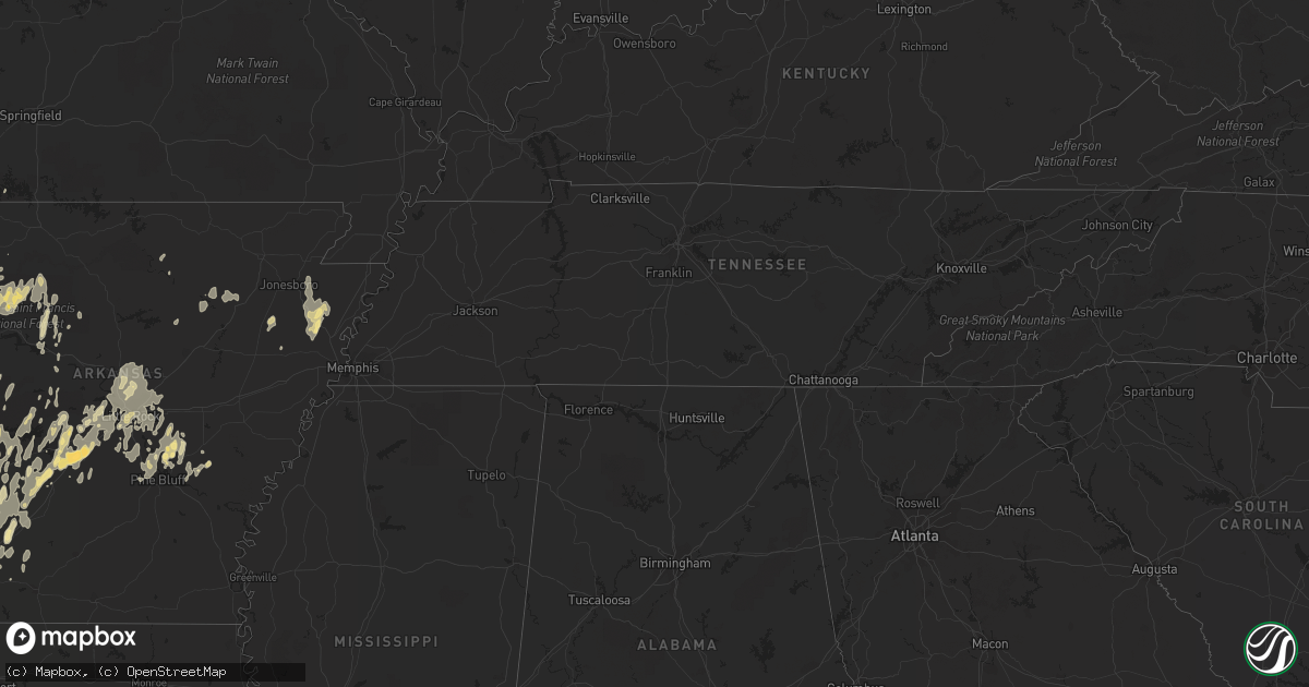
Hail Map in Texas on May 20, 2011
Get this storm
May 20 map
$229
one time, instant access
Download today. No call, no setup
Keep the $229
Bought the map and want the full workflow? Apply the entire $229 to a subscription within 7 days. None of it is wasted.
Every map, not just this one
This buys you this map. Subscription and you get every map we run, in the markets you choose from a few cities to whole states to nationwide. Plus real-time alerts the moment a storm fires.
Contact data
Name, contact info, occupancy, even credit band for addresses in the footprint. You go from where it hit to who to call.
Become the source they trust
Unlimited branding weather history reports on demand. You already have the documented answer ready for the property owner, and you are the one who showed up with it.
Property data and RoofTrace estimates
Pull up any address you have got, its value and the exact code rules for that jurisdiction, straight from One Click Code. Then RoofTrace estimates the squares, pitch, and roof value, priced the way you price.
Storm reports in Texas
Texas
| Date | Description |
|---|---|
| 05/20/20116:45 PM CDT | 2 structures damaged and numerous trees down near ne 1060 and ne 1040. Estimated 60-70 mph wind. 1 home lost roof. |
| 05/20/20116:38 PM CDT | An ef0 tornado first touched down northeast of hallsville along young road just north of old hwy. 80. The storm then crossed noonday road snapping and or uprooting a fe |
| 05/20/20116:20 PM CDT | One inch hail reported on the eastern side of longview just in harrison county. |
| 05/20/20116:20 PM CDT | A local report indicates 1.75 inch wind near HALLSVILLE |
| 05/20/20116:05 PM CDT | A local report indicates 1.00 inch wind near 9 E LEONA |
| 05/20/20115:45 PM CDT | A local report indicates 1.00 inch wind near 1 S WACO |
| 05/20/20115:36 PM CDT | A ef0 tornado briefly touched down northeast of manchester texas along fm 195 knocking down a few small trees and snapping large branches. The weak tornado was on the g |
| 05/20/20115:30 PM CDT | At high and 4th streets... Roof blown off old rose dry goods bldg... Power lines down as well |
| 05/20/20115:14 PM CDT | A local report indicates 1.00 inch wind near DETROIT |
| 05/20/20114:58 PM CDT | A local report indicates 1.50 inch wind near LUCAS |
| 05/20/20114:01 PM CDT | A local report indicates 60 MPH wind near FLOWER MOUND |
| 05/20/20113:42 PM CDT | A local report indicates 1.00 inch wind near 2 SW FORT WORTH |
| 05/20/20113:30 PM CDT | Half inch hail to near 1 inch hail reported near the greenwoon creek ranch. |
| 05/20/20113:30 PM CDT | Half inch hail to near 1 inch hail reported near the greenwoon creek ranch. |
| 05/20/20113:05 PM CDT | A local report indicates 1.00 inch wind near EVANT |
| 05/20/20112:30 PM CDT | Quarter size hail in addison just off of the tollway |
| 05/20/20112:25 PM CDT | Quarter to half dollar size hail near frankford and midway |
| 05/20/20112:25 PM CDT | Quarter to half dollar size hail near frankford and midway |
| 05/20/20112:18 PM CDT | Reported in gainesville |
| 05/20/20111:25 PM CDT | Golfballs reported in goldthwaite |
| 05/20/20116:15 AM CDT | A local report indicates 1.00 inch wind near ZAVALLA |
| 05/19/201110:50 PM CDT | A local report indicates 1.00 inch wind near 1 NW LOCKHART |
| 05/19/201110:32 PM CDT | Pea to quarter size hail. |
| 05/19/201110:17 PM CDT | Hail at legend oaks drive and highway 21 in cedar creek. |
| 05/19/201110:15 PM CDT | A large pine tree fell on a home northeast of hallsville. There were no injuries with this event. |
| 05/19/20119:25 PM CDT | A local report indicates 1.00 inch wind near 4 SSE ELGIN |
| 05/19/20119:17 PM CDT | A local report indicates 1.00 inch wind near 1 WSW ELGIN |
| 05/19/20119:15 PM CDT | Golfball size hail southeast of elgin just east of highway 95 |
| 05/19/20118:40 PM CDT | Hail up to the size of quarters fell near hwy 79 halfway between jewett and buffalo. |
| 05/19/20118:32 PM CDT | Pea to quarter size hail along with an inch of rainfall in less than an hour. |
| 05/19/20118:20 PM CDT | Nickel to quarter size hail |
| 05/19/20118:20 PM CDT | Pea to quarter size hail near dripping springs. |
| 05/19/20118:18 PM CDT | Pea to quarter size hail along with an inch of rainfall in less than an hour. |
| 05/19/20118:10 PM CDT | Media relayed report from public of tree damage in the allendale neighborhood. |
| 05/19/20118:05 PM CDT | Dime to golf ball size hail reported. |
| 05/19/20117:55 PM CDT | A local report indicates 1.00 inch wind near 2 W DRIFTWOOD |
| 05/19/20117:30 PM CDT | Down power lines reported in southwest brooks county by law enforcement. |
| 05/19/20117:12 PM CDT | Quarter size hail reported by law enforcement in falfurrias. |
All States Impacted by Hail Map on May 20, 2011
Cities Impacted by Hail Map on May 20, 2011
- Madisonville, TX
- North Zulch, TX
- Hubbard, TX
- Dawson, TX
- Coolidge, TX
- Selman City, TX
- Longview, TX
- Hallsville, TX
- Harleton, TX
- Diana, TX
- Troup, TX
- Overton, TX
- Marshall, TX
- Henderson, TX
- Laneville, TX
- Kilgore, TX
- Ravenna, TX
- Bonham, TX
- Carrollton, TX
- Addison, TX
- Dallas, TX
- Shell Knob, MO
- Greenville, TX
- Alma, AR
- Fairfield, TX
- Havana, AR
- Emmet, AR
- Hope, AR
- Buda, TX
- Wimberley, TX
- Dripping Springs, TX
- Driftwood, TX
- Smithville, OK
- Hebbronville, TX
- Encino, TX
- Hagarville, AR
- Mount Judea, AR
- Vendor, AR
- Deer, AR
- Pelsor, AR
- Parthenon, AR
- Bennington, OK
- Cushing, TX
- Coleman, TX
- Voss, TX
- Valera, TX
- Riesel, TX
- Garvin, OK
- Valliant, OK
- Fort Worth, TX
- Elkins, AR
- Mountainburg, AR
- West Fork, AR
- Fayetteville, AR
- Winslow, AR
- Lipan, TX
- Mineral Wells, TX
- Santo, TX
- Witter, AR
- Pettigrew, AR
- Groesbeck, TX
- Hamilton, KS
- Mcalester, OK
- Malvern, AR
- Lockwood, MO
- Gainesville, TX
- Valley View, TX
- Dover, AR
- Texarkana, TX
- Tyler, TX
- Wolfe City, TX
- Bagwell, TX
- De Kalb, TX
- Avery, TX
- Celina, TX
- Ozark, AR
- Mulberry, AR
- Dyer, AR
- Llano, TX
- Lockhart, TX
- Maxwell, TX
- Killeen, TX
- Salado, TX
- Briggs, TX
- Bedias, TX
- Benton, AR
- Bunch, OK
- Orwell, VT
- Shoreham, VT
- Jonesboro, TX
- Purmela, TX
- Gatesville, TX
- Evant, TX
- Combs, AR
- Saint Paul, AR
- Dublin, TX
- Stephenville, TX
- Lepanto, AR
- Marked Tree, AR
- Finley, OK
- Antlers, OK
- Rattan, OK
- Frost, TX
- Thrall, TX
- Thorndale, TX
- Millsap, TX
- Fort Hood, TX
- Sanger, TX
- Krum, TX
- Decatur, TX
- Boyd, TX
- Rhome, TX
- Era, TX
- Lindsay, TX
- Muenster, TX
- Ashdown, AR
- Clarksville, AR
- Copperas Cove, TX
- Leonard, TX
- Seagoville, TX
- Sheldon, MO
- Lamar, MO
- Kemp, TX
- Kaufman, TX
- Scurry, TX
- Ennis, TX
- Rice, TX
- Howe, TX
- Sherman, TX
- San Saba, TX
- Forney, TX
- Whitewright, TX
- Jewett, TX
- Marquez, TX
- Liberal, MO
- Moore Haven, FL
- Danville, AR
- Briggsville, AR
- Manor, TX
- Austin, TX
- Normangee, TX
- Oakwood, TX
- Tucker, AR
- Sherrill, AR
- Altheimer, AR
- Weatherford, TX
- Seneca, MO
- Cunningham, KS
- Falfurrias, TX
- Riviera, TX
- Ballinger, TX
- Prosper, TX
- Huntsville, AR
- Hindsville, AR
- Wortham, TX
- Lometa, TX
- Immokalee, FL
- Cresson, TX
- Godley, TX
- Kempner, TX
- Arcadia, FL
- Bismarck, AR
- Arkadelphia, AR
- New Boston, TX
- Simms, TX
- Goldthwaite, TX
- Mullin, TX
- Richland Springs, TX
- Ogden, AR
- Arkoma, OK
- Fort Smith, AR
- Pocola, OK
- Spiro, OK
- Fall River, KS
- Pratt, KS
- Thornton, TX
- Del Rio, TX
- Justin, TX
- Springtown, TX
- Stuttgart, AR
- Caddo Mills, TX
- Branch, AR
- Chilton, TX
- Lorena, TX
- Eddy, TX
- Detroit, TX
- Quinlan, TX
- Wills Point, TX
- Canton, TX
- Mabank, TX
- Bryan, TX
- Charleston, AR
- Turon, KS
- Talco, TX
- Cave Springs, AR
- Springdale, AR
- Lowell, AR
- Annona, TX
- North Little Rock, AR
- Mayflower, AR
- Sherwood, AR
- Conway, AR
- Jacksonville, AR
- Vilonia, AR
- Haltom City, TX
- Kennedale, TX
- Arlington, TX
- North Richland Hills, TX
- Hurst, TX
- Bedford, TX
- Labelle, FL
- Rochelle, TX
- Royse City, TX
- Nevada, TX
- San Marcos, TX
- Pflugerville, TX
- McDade, TX
- Paige, TX
- Taylor, TX
- Elgin, TX
- Del Valle, TX
- Dale, TX
- Lexington, TX
- Hutto, TX
- Red Rock, TX
- Cedar Creek, TX
- Bastrop, TX
- Martindale, TX
- Coupland, TX
- Linden, TX
- Honey Grove, TX
- Sumner, TX
- Lonsdale, AR
- Forreston, TX
- Waxahachie, TX
- Blooming Grove, TX
- Barry, TX
- Apple Springs, TX
- Rockwall, TX
- Petty, TX
- Coleman, OK
- Atoka, OK
- Aubrey, TX
- Haviland, KS
- Washington, AR
- Downs, KS
- Portis, KS
- Little Rock, AR
- Mabelvale, AR
- Pottsboro, TX
- Poolville, TX
- Whitesboro, TX
- Sawyer, OK
- Fort Towson, OK
- Hugo, OK
- Texarkana, AR
- Naples, TX
- Jasper, MO
- Oronogo, MO
- Okolona, AR
- Ardmore, OK
- Yates Center, KS
- Lampasas, TX
- Burnet, TX
- Eustace, TX
- Trinidad, TX
- Heavener, OK
- Marlin, TX
- Woodston, KS
- Atlanta, TX
- Queen City, TX
- Mansfield, TX
- Grand Prairie, TX
- Dike, TX
- Sulphur Springs, TX
- Lewisville, TX
- Centerville, TX
- Leona, TX
- Midway, TX
- Kerens, TX
- Kenefic, OK
- Mount Pleasant, TX
- Amity, AR
- Gentry, AR
- Wheaton, MO
- Purdy, MO
- Washburn, MO
- Exeter, MO
- Grapeland, TX
- Nashville, AR
- Granbury, TX
- England, AR
- Humnoke, AR
- Sadler, TX
- Rosser, TX
- Terrell, TX
- Chatfield, TX
- Crandall, TX
- Jessieville, AR
- Hot Springs Village, AR
- Franklin, TX
- Crockett, TX
- Donie, TX
- Iola, TX
- Buffalo, TX
- Stringtown, OK
- Iuka, KS
- Azle, TX
- Richardson, TX
- Waldron, AR
- Poteau, OK
- Hartford, AR
- Hackett, AR
- Van Buren, AR
- Cedarville, AR
- Wylie, TX
- Plano, TX
- Garland, TX
- Rowlett, TX
- Allen, TX
- Sachse, TX
- Mckinney, TX
- Doddridge, AR
- Caddo Gap, AR
- Norman, AR
- Jasper, TX
- Zavalla, TX
- Brookeland, TX
- Mount Pleasant, AR
- Sallisaw, OK
- Anderson, MO
- Oark, AR
- Girard, KS
- Kingston, OK
- Campbell, TX
- Lone Oak, TX
- Bowie, TX
- Gouldbusk, TX
- Santa Anna, TX
- Huntington, TX
- Greenfield, MO
- Arcola, MO
- Paris, TX
- Golden City, MO
- Ector, TX
- Ivanhoe, TX
- Trenton, TX
- Randolph, TX
- Kyle, TX
- Melbourne, AR
- Bogata, TX
- Clarksville, TX
- Langley, AR
- Umpire, AR
- Nashoba, OK
- Palestine, TX
- Alexander, AR
- Gore, OK
- Webbers Falls, OK
- Vian, OK
- Porum, OK
- Galena, KS
- Argyle, TX
- Keller, TX
- Weiner, AR
- Fisher, AR
- Cherry Valley, AR
- Harrisburg, AR
- Frisco, TX
- Farmersville, TX
- Celeste, TX
- Paris, AR
- Jefferson, TX
- Pontotoc, TX
- Bluff Dale, TX
- Anna, TX
- Van Alstyne, TX
- Kinta, OK
- Quinton, OK
- Sulphur Rock, AR
- Quapaw, OK
- Sarcoxie, MO
- Maud, TX
- Nash, TX
- Douglassville, TX
- Hooks, TX
- Princeton, TX
- Scott, AR
- Lonoke, AR
- Italy, TX
- Richland, TX
- Mexia, TX
- Streetman, TX
- Luling, TX
- Delight, AR
- Baxter Springs, KS
- Columbus, KS
- Riverton, KS
- Cleburne, TX
- Hughes Springs, TX
- Prescott, AR
- Stigler, OK
- Hector, AR
- Russellville, AR
- Almyra, AR
- Como, TX
- Pickton, TX
- Spencerville, OK
- Avinger, TX
- Denton, TX
- Ponder, TX
- Perryville, AR
- Fairland, OK
- Rosston, AR
- Star, TX
- Hamilton, TX
- Roanoke, TX
- Flower Mound, TX
- Mena, AR
- Quitman, TX
- Yantis, TX
- Collins, MO
- Osceola, MO
- Paint Rock, TX
- Bridgeport, TX
- Paradise, TX
- Telephone, TX
- Brookston, TX
- Hendrix, OK
- Ladonia, TX
- Commerce, TX
- Powderly, TX
- Arthur City, TX
- Roxton, TX
- Boswell, OK
- Ferris, TX
- Cumby, TX
- Savoy, TX
- Pecan Gap, TX
- Lavon, TX
- Cooper, TX
- Point, TX
- Dodd City, TX
- Windom, TX
- Klondike, TX
- Ben Franklin, TX
- Murfreesboro, AR
- Rosanky, TX
- Waelder, TX
- Glenwood, AR
- Story, AR
- Sims, AR
- Kirby, AR
- Bonnerdale, AR
- Mount Ida, AR
- Royal, AR
- Caney, OK
- Caddo, OK
- Kinderhook, NY
- Hudson, NY
- Ghent, NY
- Tyronza, AR
- Jacksonville, TX
- Hot Springs National Park, AR
- Mertens, TX
- Bynum, TX
- Malone, TX
- Jay, OK
- Gravette, AR
- Maysville, AR
- Noel, MO
- Pearcy, AR
- Oden, AR
- Aledo, TX
- Melissa, TX
- Saline, LA
- Bienville, LA
- Jonesboro, LA
- Webb City, MO
- Weir, KS
- Wyandotte, OK
- Picher, OK
- Treece, KS
- Joplin, MO
- Pittsburg, KS
- Miami, OK
- Commerce, OK
- North Miami, OK
- Carl Junction, MO
- Anderson, TX
- Millersview, TX
- Mineral Springs, AR
- Plainview, AR
- Paron, AR
- Bangs, TX
- Isabel, KS
- Humphrey, AR
- Wabbaseka, AR
- Coppell, TX
- Grapevine, TX
- Keota, OK
- Ozone, AR
- Center, TX
- Alva, FL
- Whitehouse, TX
- Marietta, TX
- Springer, OK
- Karnack, TX
- Bivins, TX
- Whitefield, OK
- Wilburton, OK
- Elkhart, TX
- Lamar, AR
- Howe, OK
- Wister, OK
- San Augustine, TX
- Shelbyville, TX
- Chelsea, OK
- Traskwood, AR
- Donaldson, AR
- Mead, OK
- Cabot, AR
- Malakoff, TX
- Cameron, OK
- Rusk, TX
- Alto, TX
- Mineola, TX
- Hawkins, TX
- Hearne, TX
- Teague, TX
- Saltillo, TX
- Ringling, OK
- Talpa, TX
- Blue Ridge, TX
- Rosie, AR
- Batesville, AR
- Pleasant Plains, AR
- White Hall, AR
- Pine Bluff, AR
- Toronto, KS
- Hensley, AR
- Bokoshe, OK
- Muldrow, OK
- Park Hill, OK
- Stilwell, OK
- Welling, OK
- Cookson, OK
- Gans, OK
- Jefferson, AR
- Wynne, AR
- Watson, OK
- Idabel, OK
- Sikes, LA
- Olla, LA
- Newark, AR
- Trumann, AR
- Moody, TX
- Talihina, OK
- Whitesboro, OK
- Rowena, TX
- Montague, TX
- Saint Jo, TX
- Fulton, AR
- Prairie Grove, AR
- Casa, AR
- Pottsville, AR
- Dardanelle, AR
- Morrilton, AR
- Chico, TX
- Alvord, TX
- Giddings, TX
- Crowley, TX
- Joshua, TX
- Bauxite, AR
- Sheridan, AR
- Cherokee, TX
- Loving, TX
- Olney, TX
- Graham, TX
- Hewitt, TX
- Waco, TX
- Redfield, AR
- Mart, TX
- Nacogdoches, TX
- London, AR
- The Colony, TX
- Joaquin, TX
- Mesquite, TX
- Piedmont, KS
- Tuckerman, AR
- Newport, AR
- Broaddus, TX
- Bronson, TX
- Jacksboro, TX
- Deport, TX
- Jerusalem, AR
- Irving, TX
- Magazine, AR
- Booneville, AR
- Ratcliff, AR
- Broken Bow, OK
- Fairfax, VT
- East Fairfield, VT
- West, TX
- Roland, AR
- Chester, AR
- Rudy, AR
- Milburn, OK
- Collinsville, TX
- Earle, AR
- Jonesboro, AR
- Lake City, AR
- Caraway, AR
- Bay, AR
- Huntsville, TX
- Gordonville, TX
- Euless, TX
- Rosston, TX
- Little Elm, TX
- Durant, OK
- Tioga, TX
- Haslet, TX
- Bells, TX
- Newark, TX
- Gordon, TX
- Desdemona, TX
- Cartwright, OK
- Burleson, TX
- Gunter, TX
- Forestburg, TX
- Thackerville, OK
- Lane, OK
- Tom Bean, TX
- Calera, OK
- Colleyville, TX
- Madill, OK
- Tolar, TX
- Naval Air Station Jrb, TX
- Alvarado, TX
- Pilot Point, TX
- Lake Dallas, TX
- Southlake, TX
- Emory, TX
- Denison, TX
- Tupelo, OK
- Neosho Falls, KS
- Buffalo, KS
- Fredonia, KS
- Benedict, KS
- Le Roy, KS
- Woodway, TX
- Garrison, TX
- Sulphur Bluff, TX
- Jarrell, TX
- Lufkin, TX
- Henrietta, TX
- Asbury, MO
- Ochopee, FL
- Kingsbury, TX
- Foreman, AR
- Altus, AR
- Roland, OK
- Shady Point, OK
- Cecil, AR
- Wesley, AR
- Greenwood, AR
- Hartman, AR
- Lavaca, AR
- Poyen, AR
- Bartlett, TX
- Brashear, TX
- Tatum, TX
- Rogers, AR
- Snow, OK
- Bryant, AR
- Stark City, MO
- Pierce City, MO
- Wentworth, MO
- Manchaca, TX
- Punta Gorda, FL
- Honobia, OK
- Argyle, NY
- Salem, NY
- Fairfield, VT
- Mount Calm, TX
- Axtell, TX
- Prairie Hill, TX
- Stamps, AR
- Bartlett, KS
- Stuyvesant Falls, NY
- Valatie, NY
- Stuyvesant, NY
- Buckner, AR
- Bruceville, TX
- Milo, MO
- Bloomburg, TX
- Kirbyville, TX
- Blossom, TX
- Lake Creek, TX
- Pattonville, TX
- Grant, OK
- Hodgen, OK
- Mountain Pine, AR
- Little Rock Air Force Base, AR
- Maumelle, AR
- Boles, AR
- Chetopa, KS
- Oswego, KS
- Newton, TX
- Antoine, AR
- Blevins, AR
- McCaskill, AR
- Ozan, AR
- Iola, KS
- Colony, KS
- Piqua, KS
- Humboldt, KS
- Lincoln, AR
- Saratoga, AR
- Okeechobee, FL
- Colbert, OK
- Elm Mott, TX
- Montalba, TX
- Enosburg Falls, VT
- Wilburn, AR
- Pangburn, AR
- Floral, AR
- Albany, TX
- Wright City, OK
- Farmington, AR
- Byers, KS
- Sunset, TX
- Goldonna, LA
- Fouke, AR
- Opolis, KS
- Siloam Springs, AR
- Soper, OK
- Coalgate, OK
- Westphalia, KS
- Miller, MO
- Columbus, AR
- Stafford, KS
- Lewisville, AR
- Chireno, TX
- Temple, TX
- Monett, MO
- Verona, MO
- Atkins, AR
- La Harpe, KS
- Moran, KS
- Lincoln, TX
- Jerico Springs, MO
- Goodman, MO
- Keo, AR
- Lindale, TX
- Haskell, OK
- Coweta, OK
- Neosho, MO
- Mount Vernon, TX
- Comanche, TX


