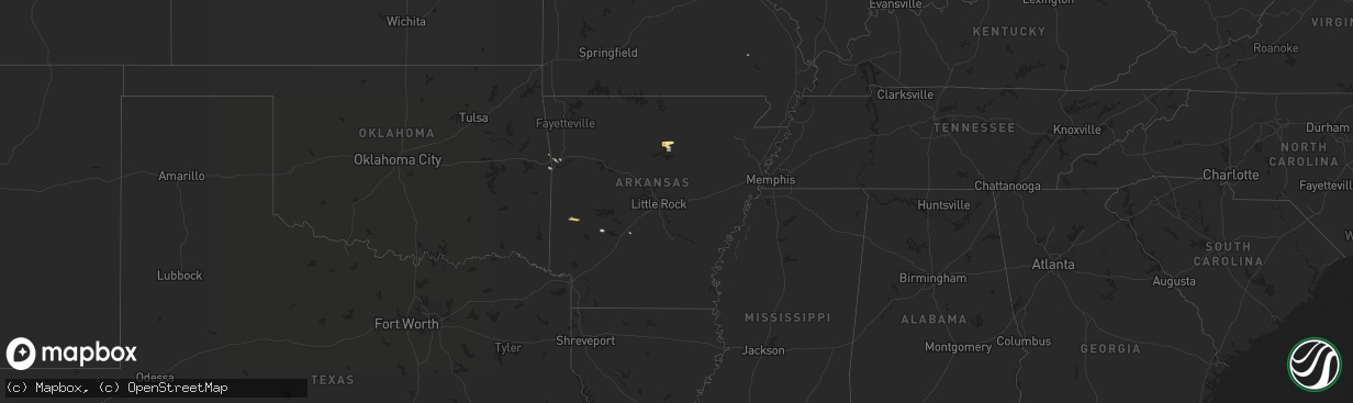
Hail Map in Arkansas on May 15, 2014
The weather event in Arkansas on May 15, 2014 includes Hail map. 4 states and 28 cities were impacted and suffered possible damage. The total estimated number of properties impacted is 99.
Want more than just the map?
Turn this storm into a full workflow.
- Owner + property data so you know who to knock
- OnDemand branded weather history reports to win the "did we even have hail?" argument
- RoofTrace estimate so reps stop guessing numbers at the door
Bought this map? Upgrade within 7 days and we'll credit the $230. (10-15 min setup call)
Hail
99
Estimated number of impacted properties by a 1.00" hail or larger2
Estimated number of impacted properties by a 1.75" hail or larger0
Estimated number of impacted properties by a 2.50" hail or largerStorm reports in Arkansas
Arkansas
| Date | Description |
|---|---|
| 05/15/20145:47 PM CDT | Measured thunderstorm wind gust by spotter |
| 05/15/20145:44 PM CDT | Jenny lind road and i-540 |
| 05/15/20144:47 PM CDT | A local report indicates 1.75 inch wind near 2 N PRIM |
| 05/15/20144:47 PM CDT | A local report indicates 1.75 inch wind near 6 N PRIM |
| 05/15/20142:51 PM CDT | A local report indicates 1.75 inch wind near 4 NNE WELSH |
| 05/15/20142:05 PM CDT | A local report indicates 1.00 inch wind near BIG FORK |
Cities Impacted by Hail Map on May 15, 2014
- Mountain View, AR
- Cascade, MT
- Great Falls, MT
- Sun River, MT
- Alma, AR
- Choteau, MT
- Norman, AR
- Edgemont, AR
- Shirley, AR
- Prim, AR
- Amity, AR
- Van Buren, AR
- Fairfield, MT
- Drasco, AR
- Mena, AR
- Ulm, MT
- Pocola, OK
- Arkoma, OK
- Higden, AR
- Fort Smith, AR
- Patterson, MO
- Fort Shaw, MT
- Muldrow, OK
- Vaughn, MT
- Stockett, MT
- Power, MT
- White Sulphur Springs, MT
- Malvern, AR


