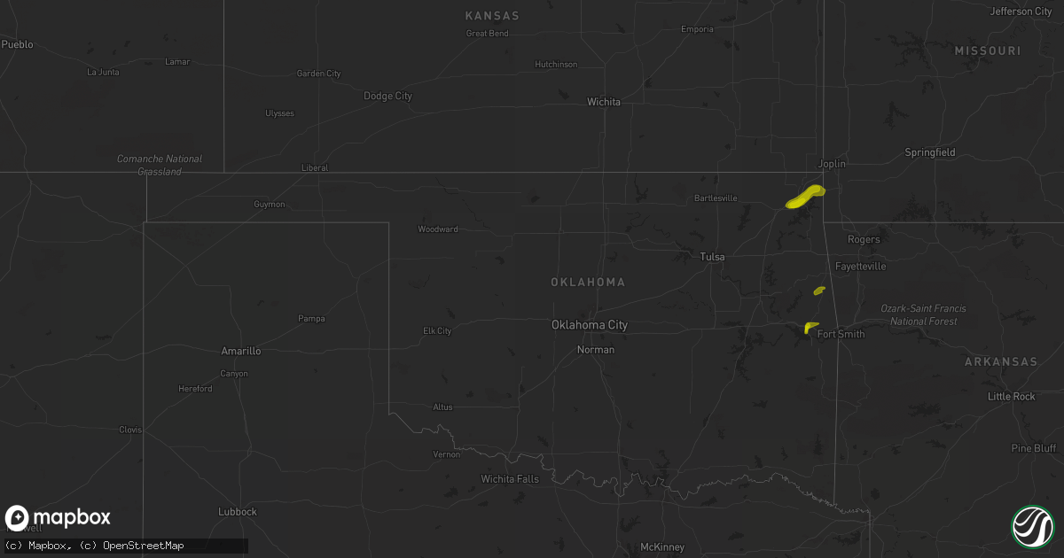
Hail Map in Georgia on May 14, 2011
Get this storm
May 14 map
$229
one time, instant access
Download today. No call, no setup
Keep the $229
Bought the map and want the full workflow? Apply the entire $229 to a subscription within 7 days. None of it is wasted.
Every map, not just this one
This buys you this map. Subscription and you get every map we run, in the markets you choose from a few cities to whole states to nationwide. Plus real-time alerts the moment a storm fires.
Contact data
Name, contact info, occupancy, even credit band for addresses in the footprint. You go from where it hit to who to call.
Become the source they trust
Unlimited branding weather history reports on demand. You already have the documented answer ready for the property owner, and you are the one who showed up with it.
Property data and RoofTrace estimates
Pull up any address you have got, its value and the exact code rules for that jurisdiction, straight from One Click Code. Then RoofTrace estimates the squares, pitch, and roof value, priced the way you price.
Storm reports in Georgia
Georgia
| Date | Description |
|---|---|
| 05/14/20116:09 PM CDT | Wilcox county emergency management relayed reports 2 downed trees just south of abbeville. |
| 05/14/20115:57 PM CDT | Middle georgia emc reported power outages along connor road due to several downed powerlines. |
| 05/14/20115:57 PM CDT | Middle georgia emc reports power out along antioch church road due to downed powerlines and blown transformer. |
| 05/14/20115:40 PM CDT | 911 call center confirmed several reports of trees down along highway 221 between denton and hazlehurst. |
| 05/14/20115:20 PM CDT | The 911 center received reports of trees down along adams avenue and also along douglas highway near denton. The time given was based on radar. |
| 05/14/20114:55 PM CDT | The sheriffs office reported trees down along highways 129 and 135 south. |
| 05/14/20114:55 PM CDT | The sheriffs office reported quarter sized hail. |
| 05/14/20113:35 PM CDT | Jefferson county 911 relayed a report of a tree downed onto a powerline in bartow. |
| 05/14/20113:10 PM CDT | Johnson county emergency management estimated winds gusting to 60 mph in wrightsville. |
| 05/14/20113:08 PM CDT | Public reports power out briefly due to the storm. |
| 05/14/20113:04 PM CDT | Johnson county emergency management estimated winds gusting to 60 mph in wrightsville. |
| 05/14/20113:02 PM CDT | Washington county 911 relayed a report of a downed tree on new tennille road. |
| 05/14/20112:57 PM CDT | Laurens county 911 relayed a report of a downed tree on crestview dr and powell dr. |
| 05/14/20112:48 PM CDT | Laurens county 911 relayed reports of a downed tree in the northern end of the county and a small storage building being blown across the road in dublin. |
| 05/14/20112:39 PM CDT | Laurens county 911 relayed a report of a downed tree at elmwood road and whispering pines lane. |
| 05/14/20112:27 PM CDT | Wilkinson county 911 reported several downed trees between toomsboro and nicklesville. |
| 05/14/201112:14 PM CDT | The 911 call center received a report of an awning blown off a home and a powerline down. |
| 05/14/201111:45 AM CDT | St marys fire department reported a tree down on new point peter road. |
| 05/14/201111:40 AM CDT | Public report of penny to quarter size hail and several small limbs down at the folkston country club. |
| 05/14/201110:50 AM CDT | Nws employee reported an awning tipped over at a gas station and a railroad track gate was snapped in fargo. Plenty of branches and large limbs down in fargo as well. |
All States Impacted by Hail Map on May 14, 2011
Cities Impacted by Hail Map on May 14, 2011
- Lehigh Acres, FL
- Mayo, FL
- Chauncey, GA
- Eastman, GA
- Abbeville, GA
- Rochelle, GA
- Rhine, GA
- Mount Vernon, GA
- Lake City, FL
- Cairo, GA
- Ochlocknee, GA
- Greenville, FL
- Lamont, FL
- Norman Park, GA
- Inverness, FL
- Hernando, FL
- Waynesboro, GA
- Pelham, GA
- Meigs, GA
- York, SC
- Zolfo Springs, FL
- Durham, NC
- Lumberton, NC
- Monticello, FL
- Lake Panasoffkee, FL
- Brinson, GA
- Colquitt, GA
- Disputanta, VA
- Myrtle Beach, SC
- High Springs, FL
- Archer, FL
- Trenton, FL
- Gainesville, FL
- Alachua, FL
- Newberry, FL
- Chiefland, FL
- Bronson, FL
- Loxahatchee, FL
- Loris, SC
- Galivants Ferry, SC
- Micanopy, FL
- Hawthorne, FL
- Belle Glade, FL
- East Dublin, GA
- Adrian, GA
- Madison, FL
- Ocilla, GA
- Rebecca, GA
- Fitzgerald, GA
- Heppner, OR
- Sylvester, GA
- Lecanto, FL
- Homosassa, FL
- Elko, GA
- Unadilla, GA
- Danville, GA
- Jeffersonville, GA
- Warsaw, NC
- Conway, SC
- Georgetown, SC
- Murrells Inlet, SC
- Rockledge, GA
- Naples, FL
- Bartow, GA
- Wadley, GA
- Macon, GA
- Perry, FL
- Saint Matthews, SC
- Earleton, FL
- Kenansville, NC
- Magnolia, NC
- London, KY
- Amelia Court House, VA
- Willacoochee, GA
- Wrightsville, GA
- Swainsboro, GA
- Midville, GA
- Lake Placid, FL
- Sycamore, GA
- Garland, NC
- Pendleton, OR
- Echo, OR
- Helix, OR
- Robersonville, NC
- Bethel, NC
- Moore Haven, FL
- Clarksville, VA
- Buffalo Junction, VA
- Tallahassee, FL
- Tiffin, OH
- New Riegel, OH
- Okeechobee, FL
- Homerville, GA
- Thomasville, GA
- Summerfield, FL
- Ocala, FL
- Tifton, GA
- Punta Gorda, FL
- Waldo, FL
- Quitman, GA
- Burns, OR
- Bonita Springs, FL
- Estero, FL
- Spring Grove, VA
- Soperton, GA
- Glenwood, GA
- Dublin, GA
- Jasper, FL
- Fargo, GA
- Pilot Rock, OR
- Lake Park, GA
- Waverly, VA
- Tarrytown, GA
- Ailey, GA
- Newton, GA
- Baconton, GA
- Albany, GA
- Valdosta, GA
- Skipwith, VA
- Dunnellon, FL
- Raeford, NC
- Chapel Hill, NC
- Alamo, GA
- Enigma, GA
- Hilliard, FL
- Callahan, FL
- Wheeling, WV
- Leesburg, FL
- Kings Bay, GA
- Saint Marys, GA
- Nashville, GA
- Lakeland, GA
- Bainbridge, GA
- Baxley, GA
- Hazlehurst, GA
- Maxton, NC
- Red Springs, NC
- Port Saint Joe, FL
- Aiken, SC
- Canal Point, FL
- Sanderson, FL
- Melrose, FL
- Keystone Heights, FL
- Boons Camp, KY
- Meally, KY
- Tomahawk, KY
- Bell, FL
- Crystal River, FL
- Lexington, OR
- White Springs, FL
- Lumber City, GA
- Haddock, GA
- Eatonton, GA
- Milledgeville, GA
- Lima, OH
- Pearson, GA
- Kennewick, WA
- Jacksonville, FL
- Macclenny, FL
- Labelle, FL
- Pineview, GA
- Moultrie, GA
- Berlin, GA
- Pavo, GA
- Nelson, VA
- Bullock, NC
- Green Sea, SC
- Ashburn, GA
- Paintsville, KY
- Oxford, NC
- Kenansville, FL
- Clarks Hill, SC
- Vero Beach, FL
- Toomsboro, GA
- Tennille, GA
- Tampa, FL
- Thonotosassa, FL
- Fort Lauderdale, FL
- Wray, GA
- Broxton, GA
- Starke, FL
- Hampton, FL
- East Bernstadt, KY
- Stuart, FL
- Hobe Sound, FL
- Rentz, GA
- Tabor City, NC
- Fairmont, NC
- Orrum, NC
- Axson, GA
- North Augusta, SC
- Glen Saint Mary, FL
- Greensboro, GA
- White Plains, GA
- Boydton, VA
- Bracey, VA
- Littleton, NC
- Brodnax, VA
- La Crosse, VA
- Ebony, VA
- Macon, NC
- Clinton, NC
- Chester, VA
- Ray City, GA
- Florahome, FL
- McRae Helena, GA
- Milan, GA
- Live Oak, FL
- Day, FL
- Augusta, GA
- Henrico, VA
- Mulberry, FL
- Folkston, GA
- Letart, WV
- Auxier, KY
- East Point, KY
- Hagerhill, KY
- Van Lear, KY
- Prestonsburg, KY
- West Palm Beach, FL
- Sebastian, FL
- Palm City, FL
- Indiantown, FL
- Petersburg, VA
- Reddick, FL
- Morriston, FL
- Citra, FL
- Gotha, FL
- Windermere, FL
- Orlando, FL
- Ocoee, FL
- Winter Garden, FL
- Iron City, GA
- Donalsonville, GA
- Logan, OH
- New Straitsville, OH
- Saint George, GA
- Byron, GA
- Waycross, GA
- Jacksonville, GA
- Millen, GA
- Wauchula, FL
- Uvalda, GA
- Dudley, GA
- Evergreen, NC
- Hermiston, OR
- New Lexington, OH
- Shawnee, OH
- Camilla, GA
- Pitts, GA
- Cadwell, GA
- Hopewell, VA
- Turkey, NC
- Roseboro, NC
- Greenville, NC
- Umatilla, FL
- Douglas, GA
- Ambrose, GA
- Kingsland, GA
- Johnston, SC
- Sopchoppy, FL
- Leesville, SC
- Salley, SC
- Swansea, SC
- Wagener, SC
- Pelion, SC
- Aynor, SC
- Barnwell, SC
- Williston, SC
- Sebring, FL
- Hahira, GA
- Ponte Vedra Beach, FL
- Saint Augustine, FL
- Marco Island, FL
- Emporia, VA
- Eagle Lake, FL
- Brooksville, FL
- Blackstone, VA
- Venus, FL
- Groveland, FL
- Louisville, GA
- Dinwiddie, VA
- Jackson, KY
- Gunlock, KY
- Webster, FL
- Dade City, FL
- Harrison, GA
- Colonial Heights, VA
- The Villages, FL
- Wildwood, FL
- Wayne, WV
- Saint Petersburg, FL
- Williamsport, KY
- Tar Heel, NC
- Saint Pauls, NC
- Matthews, GA
- Blythe, GA
- Clewiston, FL
- Branford, FL
- Avon Park, FL
- Sneads, FL
- Grand Ridge, FL
- Rose Hill, NC
- Lake Butler, FL
- Raiford, FL
- Crawfordville, FL
- Lawtey, FL
- Brooker, FL
- Fort White, FL
- Bryceville, FL
- Fort McCoy, FL
- Denton, GA
- Chula, GA
- Green Cove Springs, FL
- Myakka City, FL
- Williamsburg, VA
- Vidalia, GA
- La Grande, OR
- Cove, OR
- Dendron, VA
- Elberon, VA
- Wakefield, VA
- Fair Bluff, NC
- Mount Blanchard, OH
- Forest, OH
- Arlington, OH
- Monticello, KY
- Sumner, GA
- Warner Robins, GA
- Dry Branch, GA
- Doerun, GA
- Laurens, SC
- Seffner, FL
- Plant City, FL
- Dover, FL
- Brandon, FL
- Reidsville, GA
- Hemingway, SC
- Climax, GA
- Havana, FL
- Attapulgus, GA
- Whigham, GA
- Chesterfield, VA
- Moody Afb, GA
- Martin, SC
- Yulee, FL
- Pembroke, NC
- Rowland, NC
- McAlpin, FL
- Palm Beach Gardens, FL
- Jupiter, FL
- Nichols, SC
- Irwinton, GA
- Pinetta, FL
- Newton Grove, NC
- Davisboro, GA
- Wrens, GA
- Omega, GA
- Union, OR
- O'Brien, FL
- Stony Creek, VA
- Albertson, NC
- Lyons, GA
- North Myrtle Beach, SC
- Longs, SC
- Burkeville, VA
- Jennings, FL
- Hiltons, VA
- Bristol, VA
- Williston, FL
- Seven Springs, NC
- Mount Olive, NC
- Faison, NC
- Alapaha, GA
- Cordele, GA
- Bushnell, FL
- Warrenville, SC
- Graniteville, SC
- Lulu, FL
- Mabton, WA
- Prosser, WA
- Rougemont, NC
- Ney, OH
- Bryan, OH
- Capron, VA
- Marshville, NC
- Cape Coral, FL
- Fort Myers, FL
- Claysville, PA
- West Alexander, PA
- Mountville, SC
- Waterloo, SC
- Cerro Gordo, NC
- Chadbourn, NC
- Whiteville, NC
- Midlothian, VA
- Nahunta, GA
- Lee, FL
- Nicholls, GA
- Alma, GA
- Du Pont, GA
- Norway, SC
- Blackville, SC
- Neeses, SC
- Springfield, SC
- Sandersville, GA
- Poulan, GA
- Chattahoochee, FL
- Inglis, FL
- Winter Springs, FL
- Winter Park, FL
- Casselberry, FL
- Maitland, FL
- Adel, GA
- Charles City, VA
- Wellborn, FL
- Bronston, KY
- Vale, NC
- Lincolnton, NC
- Kite, GA
- Manor, GA
- Gray, GA
- Fellsmere, FL
- Morven, NC
- Statenville, GA
- Rockingham, NC
- Barney, GA
- Greenwood, FL
- Quincy, FL
- Bascom, FL
- Warwick, GA
- Lake View, SC
- Vienna, GA
- Monroe, NC
- Pageland, SC
- Bladenboro, NC
- Clarkton, NC
- Wewahitchka, FL
- Adams, OR
- Boston, GA
- Abbeville, SC
- Iva, SC
- Pinehurst, GA
- Cross City, FL
- Old Town, FL
- Whitakers, NC
- Drewryville, VA
- Boykins, VA
- Arcadia, FL
- Shannon, NC
- North, SC
- Stilwell, OK
- Bunch, OK
- Afton, OK
- Wyandotte, OK
- Vinita, OK
- Miami, OK
- Fairland, OK
- Sallisaw, OK
- Seneca, MO


