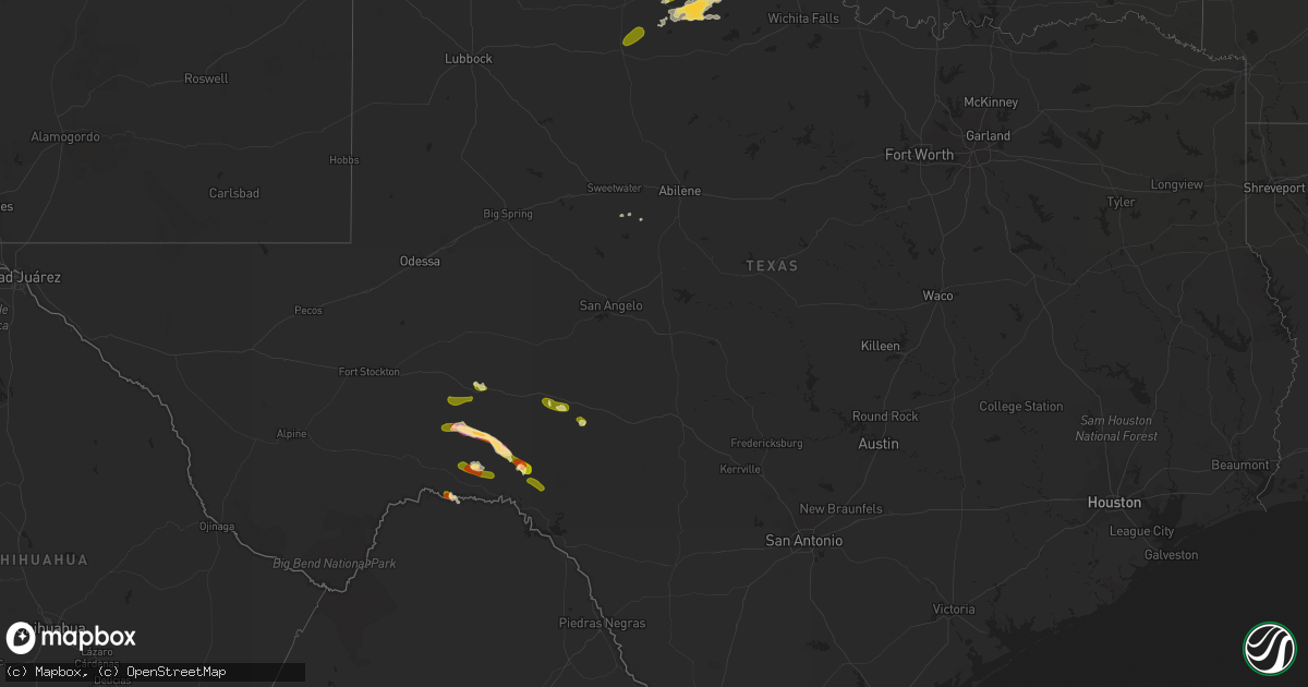
Hail Map in Texas on May 13, 2015
Get this storm
May 13 map
$229
one time, instant access
Download today. No call, no setup
Keep the $229
Bought the map and want the full workflow? Apply the entire $229 to a subscription within 7 days. None of it is wasted.
Every map, not just this one
This buys you this map. Subscription and you get every map we run, in the markets you choose from a few cities to whole states to nationwide. Plus real-time alerts the moment a storm fires.
Contact data
Name, contact info, occupancy, even credit band for addresses in the footprint. You go from where it hit to who to call.
Become the source they trust
Unlimited branding weather history reports on demand. You already have the documented answer ready for the property owner, and you are the one who showed up with it.
Property data and RoofTrace estimates
Pull up any address you have got, its value and the exact code rules for that jurisdiction, straight from One Click Code. Then RoofTrace estimates the squares, pitch, and roof value, priced the way you price.
Storm reports in Texas
Texas
| Date | Description |
|---|---|
| 05/13/20156:50 PM CDT | Delayed report of nickel to quarter sized hail. Time estimated from radar. |
| 05/13/20156:26 PM CDT | Brief touchdown...but base is still rotating |
| 05/13/20155:57 PM CDT | Multiple reports and documentation of a touchdown near the four sixes ranch. |
| 05/13/20154:20 PM CDT | A local report indicates 60 MPH wind near OZONA |
| 05/13/20154:12 PM CDT | A local report indicates 1.00 inch wind near THE TERRELL GAS PLANT |
| 05/13/20154:10 PM CDT | A local report indicates 1.00 inch wind near THE TERRELL GAS PLANT |
| 05/13/201512:33 PM CDT | Wind gusts estimated at 30mph broke off small tree branches |
| 05/13/201511:00 AM CDT | Wind gusts blew down some small trees...size unknown |
| 05/13/201510:22 AM CDT | Wind gusts tore off a large tree limb...chainsaw had to be used to clear the branch from the roadway |
| 05/12/20158:35 PM CDT | Delayed report of hail along highway 70 between crowell and thalia. Time estimated from radar. |
All States Impacted by Hail Map on May 13, 2015
Cities Impacted by Hail Map on May 13, 2015
- Crowell, TX
- Quanah, TX
- Comstock, TX
- Eunice, NM
- Ozona, TX
- Kanab, UT
- Wingate, TX
- Tuscola, TX
- Vernon, TX
- Hedley, TX
- Dryden, TX
- Balmorhea, TX
- Laredo, TX
- Seagraves, TX
- Mentone, TX
- Pecos, TX
- Vaughn, NM
- Ben Wheeler, TX
- Sudan, TX
- Sonora, TX
- Chillicothe, TX
- Blackwell, TX
- Morton, TX
- Shoshoni, WY
- Tyler, TX
- Hobbs, NM
- Hunter, OK
- Monahans, TX
- Clarendon, TX
- Del Rio, TX
- Sheffield, TX
- Paducah, TX


