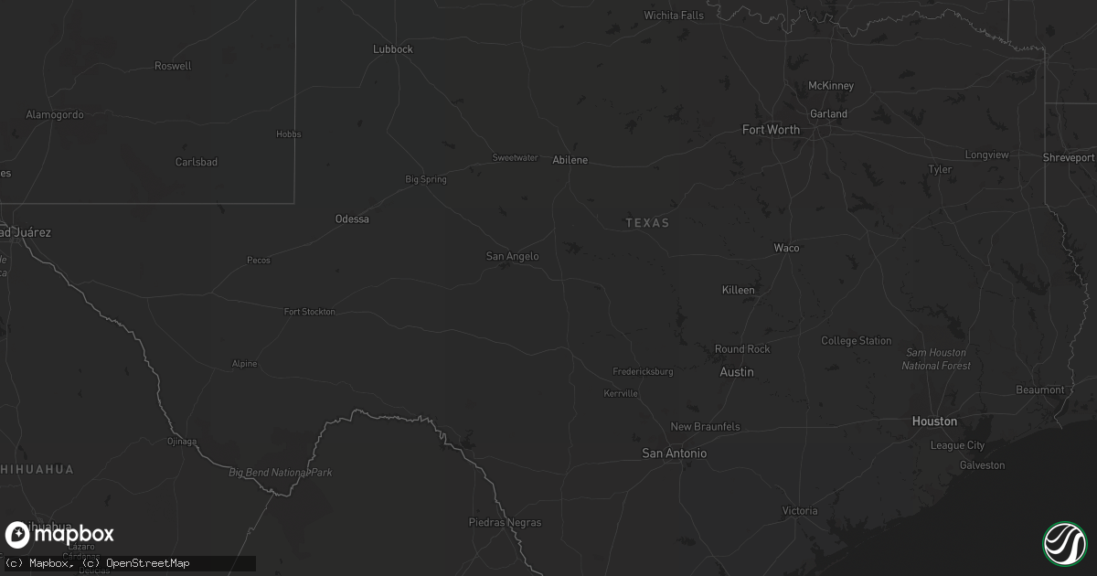
Hail Map in Texas on May 11, 2022
Get this storm
May 11 map
$229
one time, instant access
Download today. No call, no setup
Keep the $229
Bought the map and want the full workflow? Apply the entire $229 to a subscription within 7 days. None of it is wasted.
Every map, not just this one
This buys you this map. Subscription and you get every map we run, in the markets you choose from a few cities to whole states to nationwide. Plus real-time alerts the moment a storm fires.
Contact data
Name, contact info, occupancy, even credit band for addresses in the footprint. You go from where it hit to who to call.
Become the source they trust
Unlimited branding weather history reports on demand. You already have the documented answer ready for the property owner, and you are the one who showed up with it.
Property data and RoofTrace estimates
Pull up any address you have got, its value and the exact code rules for that jurisdiction, straight from One Click Code. Then RoofTrace estimates the squares, pitch, and roof value, priced the way you price.
Storm reports in Texas
Texas
| Date | Description |
|---|---|
| 05/11/20225:36 PM CDT | A local report indicates 1.50 inch wind near DALHART |
| 05/11/20225:32 PM CDT | A local report indicates 1.00 inch wind near DALHART |
| 05/11/20225:30 PM CDT | A local report indicates 1.25 inch wind near 2 SSE DALHART |
| 05/11/20225:27 PM CDT | A local report indicates 76 MPH wind near 3 SW DALHART |
| 05/11/20223:07 AM CDT | At 807 PM CDT, a severe thunderstorm was located 10 miles northwest of Persimmon Gap, or 32 miles north of Panther Junction, moving southeast at 20 mph. HAZARD...60 mph wind gusts and quarter size hail. SOURCE...Radar indicated. IMPACT...Hail damage to vehicles is expected. Expect wind damage to roofs, siding, and trees. Locations impacted include... Persimmon Gap and Santiago Peak. |
| 05/11/20222:44 AM CDT | At 744 PM CDT, a severe thunderstorm was located 4 miles north of Easter, or 7 miles south of Hereford, moving northeast at 15 mph. HAZARD...60 mph wind gusts and quarter size hail. SOURCE...Radar indicated. IMPACT...Hail damage to vehicles is expected. Expect wind damage to roofs, siding, and trees. This severe thunderstorm will remain over mainly rural areas of north central Castro County. |
| 05/11/20222:40 AM CDT | At 740 PM CDT, a severe thunderstorm was located 5 miles north of Easter, or 7 miles south of Hereford, moving northeast at 10 mph. HAZARD...60 mph wind gusts and quarter size hail. SOURCE...Radar indicated. IMPACT...Minor damage to roofs, siding, and trees is possible. Hail damage to vehicles is expected. Locations impacted include... Hereford. |
| 05/11/20222:22 AM CDT | At 721 PM CDT, a severe thunderstorm was located 17 miles north of Boquillas Canyon, or 19 miles northeast of Panther Junction, moving east at 45 mph. HAZARD...70 mph wind gusts and quarter size hail. SOURCE...Radar indicated. IMPACT...Hail damage to vehicles is expected. Expect considerable tree damage. Wind damage is also likely to mobile homes, roofs, and outbuildings. This severe thunderstorm will remain over mainly rural areas of southeastern Brewster County. |
| 05/11/20221:44 AM CDT | At 643 PM CDT, a severe thunderstorm was located 5 miles south of Black, or 6 miles southeast of Friona, moving northeast at 20 mph. HAZARD...Golf ball size hail and 60 mph wind gusts. SOURCE...Radar indicated. IMPACT...People and animals outdoors will be injured. Expect hail damage to roofs, siding, windows, and vehicles. Expect wind damage to roofs, siding, and trees. Locations impacted include... Summerfield and Black. |
| 05/11/20221:34 AM CDT | At 634 PM CDT, a severe thunderstorm was located 9 miles northwest of Panther Junction, moving east at 15 mph. HAZARD...70 mph wind gusts and quarter size hail. SOURCE...Radar indicated. IMPACT...Hail damage to vehicles is expected. Expect considerable tree damage. Wind damage is also likely to mobile homes, roofs, and outbuildings. Locations impacted include... Panther Junction, Big Bend National Park, Terlingua Ranch Airport and Terlingua Ranch Lodge. |
| 05/11/20221:01 AM CDT | At 601 PM CDT, a severe thunderstorm was located 13 miles northwest of Conlen, or 17 miles west of Stratford, moving north at 35 mph. HAZARD...70 mph wind gusts and ping pong ball size hail. SOURCE...Radar indicated. IMPACT...Expect some tree damage. Damage is likely to mobile homes, roofs, and outbuildings. People and animals outdoors will be injured. Expect hail damage to roofs, siding, windows, and vehicles. Locations impacted include... Griggs and Conlen. |
| 05/11/20221:00 AM CDT | At 559 PM CDT, a severe thunderstorm was located 13 miles northwest of Conlen, or 17 miles west of Stratford, moving north at 35 mph. HAZARD...60 mph wind gusts and quarter size hail. SOURCE...Radar indicated. IMPACT...Minor damage to roofs, siding, and trees is possible. Hail damage to vehicles is expected. Locations impacted include... Griggs and Conlen. |
| 05/11/202212:45 AM CDT | At 545 PM CDT, a severe thunderstorm was located over Oklahoma Lane, or 10 miles northwest of Muleshoe, moving northeast at 30 mph. HAZARD...60 mph wind gusts and quarter size hail. SOURCE...Radar indicated. IMPACT...Hail damage to vehicles is expected. Expect wind damage to roofs, siding, and trees. Locations impacted include... Friona, Bovina, Summerfield, Lazbuddie, Oklahoma Lane and Black. |
| 05/11/202212:16 AM CDT | At 515 PM CDT, a severe thunderstorm was located 11 miles west of Hartley, or 12 miles south of Dalhart, moving north at 45 mph. HAZARD...60 mph wind gusts and quarter size hail. SOURCE...Radar indicated. IMPACT...Minor damage to roofs, siding, and trees is possible. Hail damage to vehicles is expected. Locations impacted include... Dalhart, Hartley, Ware and Conlen. |
| 05/10/202211:53 PM CDT | At 453 PM CDT, a severe thunderstorm was located 7 miles west of Adrian, or 20 miles west of Vega, moving north at 25 mph. HAZARD...60 mph wind gusts and quarter size hail. SOURCE...Radar indicated. IMPACT...Minor damage to roofs, siding, and trees is possible. Hail damage to vehicles is expected. Locations impacted include... Adrian. |
| 05/10/20228:04 PM CDT | Reported via nws chat |
| 05/10/20227:59 PM CDT | A local report indicates 1.25 inch wind near 6 SE HEREFORD |
| 05/10/20227:50 PM CDT | A local report indicates 1.00 inch wind near 4 SE HEREFORD |
All States Impacted by Hail Map on May 11, 2022
Cities Impacted by Hail Map on May 11, 2022
- Shell Lake, WI
- Milaca, MN
- Ogilvie, MN
- Manistique, MI
- Gulliver, MI
- Argonne, WI
- Pelican Lake, WI
- Correll, MN
- Appleton, MN
- Balsam Lake, WI
- Turtle Lake, WI
- Comstock, WI
- Cornell, MI
- Escanaba, MI
- Stephenson, MI
- Vulcan, MI
- Little Lake, MI
- Daggett, MI
- Hermansville, MI
- Carney, MI
- Wilson, MI
- Perronville, MI
- Nadeau, MI
- Bark River, MI
- Powers, MI
- Spalding, MI
- Rock, MI
- Cushing, WI
- Luck, WI
- Frederic, WI
- Fish Creek, WI
- Minong, WI
- Solon Springs, WI
- Rapid River, MI
- Nahma, MI
- Fife Lake, MI
- Chisago City, MN
- Stacy, MN
- North Branch, MN
- Center City, MN
- Lindstrom, MN
- Harris, MN
- Elcho, WI
- Starbuck, MN
- Amery, WI
- Osceola, WI
- Star Prairie, WI
- Aniwa, WI
- Detroit Lakes, MN
- Vergas, MN
- Pelican Rapids, MN
- Phillips, WI
- Clinton, MN
- Ortonville, MN
- Selby, SD
- Spooner, WI
- Sarona, WI
- Barronett, WI
- Brule, WI
- Shingleton, MI
- Sterling, MI
- Hale, MI
- Lupton, MI
- Twining, MI
- Whittemore, MI
- Rose City, MI
- Prescott, MI
- Omer, MI
- Letcher, SD
- Bellingham, MN
- Three Lakes, WI
- Olivia, MN
- White, SD
- Elkton, SD
- Hendricks, MN
- Brookings, SD
- Aurora, SD
- Lake Benton, MN
- Flandreau, SD
- Lena, WI
- Atwater, MN
- Grove City, MN
- Hazel, SD
- Watertown, SD
- Fort Pierre, SD
- Hayes, SD
- Eagle Butte, SD
- Florence, SD
- Henry, SD
- Menomonie, WI
- Eau Galle, WI
- Erhard, MN
- Rothsay, MN
- Boon, MI
- Harrietta, MI
- Carlos, MN
- Alexandria, MN
- Miltona, MN
- Nelson, MN
- Kimball, SD
- Gordon, WI
- Ojibwa, WI
- Winter, WI
- Rhinelander, WI
- Saint Croix Falls, WI
- Centuria, WI
- Fence, WI
- Wabeno, WI
- Laona, WI
- Bryant, WI
- White Lake, WI
- Pickerel, WI
- Armstrong Creek, WI
- Goodman, WI
- Faith, SD
- Mayer, MN
- Waconia, MN
- Clark, SD
- Carpenter, SD
- Willow Lake, SD
- Vienna, SD
- Tomahawk, WI
- Durand, WI
- Pipestone, MN
- Houghton Lake, MI
- Munising, MI
- Wallace, MI
- Gladstone, MI
- Chatham, MI
- Trenary, MI
- Perkins, MI
- Wells, MI
- Wetmore, MI
- Menominee, MI
- Buffalo, MN
- Java, SD
- Pearson, WI
- Harshaw, WI
- Webster, WI
- Ridgeview, SD
- Lublin, WI
- Cadott, WI
- Boyd, WI
- Stanley, WI
- Medford, WI
- Dorchester, WI
- Withee, WI
- Cornell, WI
- Curtiss, WI
- Owen, WI
- Thorp, WI
- Chippewa Falls, WI
- Estelline, SD
- Castlewood, SD
- Bruce, SD
- Montevideo, MN
- Hayti, SD
- Virgil, SD
- Pennock, MN
- Huron, SD
- Goodwin, SD
- Iroquois, SD
- Woonsocket, SD
- Milan, MN
- Wessington Springs, SD
- Brandt, SD
- Murdock, MN
- Wessington, SD
- Benson, MN
- Strandburg, SD
- Belgrade, MN
- Brooten, MN
- New London, MN
- Cavour, SD
- Erwin, SD
- Danvers, MN
- Alpena, SD
- Watson, MN
- Canby, MN
- De Smet, SD
- Glenwood, MN
- Wolsey, SD
- Toronto, SD
- Lake Norden, SD
- Clear Lake, SD
- Dawson, MN
- Artesian, SD
- Kerkhoven, MN
- White Lake, SD
- Gary, SD
- Bryant, SD
- Arlington, SD
- Lake Preston, SD
- Madison, MN
- Marietta, MN
- Sunburg, MN
- Badger, SD
- Carthage, SD
- Melrose, MN
- Revillo, SD
- Milltown, WI
- Eland, WI
- Iona, MN
- Ruthton, MN
- Chandler, MN
- Garvin, MN
- Wilmont, MN
- Holland, MN
- Slayton, MN
- Balaton, MN
- Edgerton, MN
- Woodstock, MN
- Lake Wilson, MN
- Alpena, MI
- Presque Isle, MI
- Somerset, WI
- New Richmond, WI
- Merrill, WI
- Wausau, WI
- Athens, WI
- Elk Mound, WI
- Highmore, SD
- Elmwood, WI
- Park Falls, WI
- Stone Lake, WI
- Birchwood, WI
- Iron River, MI
- Gaastra, MI
- Caspian, MI
- Long Lake, WI
- Cooks, MI
- Wyoming, MN
- Shafer, MN
- Dresser, WI
- Scandia, MN
- Forest Lake, MN
- Marine On Saint Croix, MN
- Stanchfield, MN
- Princeton, MN
- Monticello, MN
- Pine City, MN
- Cambridge, MN
- Becker, MN
- Dalbo, MN
- Grandy, MN
- Rush City, MN
- Braham, MN
- Big Lake, MN
- Zimmerman, MN
- Mora, MN
- Rockford, MN
- Ringle, WI
- Hatley, WI
- Gleason, WI
- Irma, WI
- McLaughlin, SD
- McIntosh, SD
- Mobridge, SD
- Strasburg, ND
- Isabel, SD
- White Owl, SD
- Enning, SD
- Hague, ND
- Glencross, SD
- Mound City, SD
- Timber Lake, SD
- Trail City, SD
- Wakpala, SD
- Lantry, SD
- Mud Butte, SD
- Pollock, SD
- New Underwood, SD
- Howes, SD
- Sturgis, SD
- Meadow, SD
- Dupree, SD
- Union Center, SD
- Abrams, WI
- Rochester, MN
- Newton, WI
- Cleveland, WI
- Rapid City, SD
- Piedmont, SD
- Jasper, MN
- Westbrook, MN
- Walnut Grove, MN
- Revere, MN
- Owatonna, MN
- Manitowoc, WI
- Alma, WI
- Sanborn, MN
- Eagle River, WI
- Danbury, WI
- Howard Lake, MN
- Winsted, MN
- Waverly, MN
- Blunt, SD
- Pierre, SD
- Maple Plain, MN
- Delano, MN
- Onaka, SD
- Fulda, MN
- Marshall, MN
- Big Stone City, SD
- Sheboygan, WI
- Two Rivers, WI
- Mishicot, WI
- Saint Michael, MN
- Albertville, MN
- Elk River, MN
- Magnolia, MN
- Steen, MN
- Luverne, MN
- Kanaranzi, MN
- Ellsworth, MN
- Antigo, WI
- Birnamwood, WI
- Fairfax, MN
- Bird Island, MN
- Hector, MN
- Rhodes, MI
- Miller, SD
- Saint Lawrence, SD
- Chamberlain, SD
- Clintonville, WI
- Shawano, WI
- South Branch, MI
- Hastings, MN
- Pukwana, SD
- Fort Thompson, SD
- Edgemont, SD
- Custer, SD
- Newcastle, WY
- Worthington, MN
- Reading, MN
- Remus, MI
- Mecosta, MI
- Streator, IL
- Wenona, IL
- Janesville, MN
- Geddes, SD
- Rock Rapids, IA
- Trent, SD
- Shawnee, WY
- Orange City, IA
- Sioux Center, IA
- Albion, NE
- Petersburg, NE
- Newman Grove, NE
- Long Lake, MN
- Hamel, MN
- Hartland, MN
- Clarks Grove, MN
- Rushmore, MN
- Adrian, MN
- Winner, SD
- Ideal, SD
- Witten, SD
- Medford, MN
- Wells, MN
- Big Rapids, MI
- Tabor, SD
- Crofton, NE
- Yankton, SD
- Bingham Lake, MN
- Mountain Lake, MN
- Windom, MN
- Dalhart, TX
- Winnebago, MN
- Delavan, MN
- Hereford, TX
- Davis, IL
- Goodhue, MN
- Vermillion, SD
- Volin, SD
- Gayville, SD
- Irene, SD
- Northfield, MN
- Winona, KS
- Minneapolis, MN
- Henderson, MN
- Lafayette, MN
- Norwood Young America, MN
- Belle Plaine, MN
- Gaylord, MN
- New Prague, MN
- Hamburg, MN
- Arlington, MN
- Winthrop, MN
- Glencoe, MN
- Jordan, MN
- Carver, MN
- Gibbon, MN
- Shakopee, MN
- Cologne, MN
- Green Isle, MN
- Oacoma, SD
- Farwell, TX
- Kennebec, SD
- Chester, SD
- Wentworth, SD
- Lake Lillian, MN
- Millville, MN
- Kellogg, MN
- Elgin, MN
- Plainview, MN
- Eau Claire, WI
- Milford, IA
- Hesperia, MI
- Bitely, MI
- Fairmont, MN
- Colman, SD
- Dell Rapids, SD
- Egan, SD
- Salem, SD
- Ivanhoe, MN
- Pepin, WI
- Saint James, MN
- Blue Earth, MN
- Bricelyn, MN
- Easton, MN
- Leota, MN
- Paris, MI
- Wynot, NE
- Neligh, NE
- Pine Island, MN
- Eden Valley, MN
- Lake City, MN
- Cannon Falls, MN
- Welch, MN
- Red Wing, MN
- Inwood, IA
- Colby, KS
- Menno, SD
- Danube, MN
- Blomkest, MN
- Merritt, MI
- Lake City, MI
- Ghent, MN
- Minneota, MN
- Lynd, MN
- Leroy, MI
- Tustin, MI
- Echo, MN
- Wood Lake, MN
- Andover, MN
- Saint Paul, MN
- Circle Pines, MN
- Holabird, SD
- Harrold, SD
- Chaska, MN
- Okabena, MN
- Lakefield, MN
- Round Lake, MN
- Wakonda, SD
- Coleman, MI
- Gladwin, MI
- Rosebush, MI
- Beaverton, MI
- Mount Pleasant, MI
- Farwell, MI
- Clare, MI
- Heron Lake, MN
- Plymouth, WI
- Sheboygan Falls, WI
- Albert Lea, MN
- Alden, MN
- Wayzata, MN
- Hardwick, MN
- Mazeppa, MN
- Oronoco, MN
- Zumbro Falls, MN
- Ringsted, IA
- Wallingford, IA
- Dickens, IA
- Graettinger, IA
- Spencer, IA
- Estherville, IA
- Ruthven, IA
- Terril, IA
- Viborg, SD
- Utica, SD
- Zumbrota, MN
- Brohman, MI
- Walkerville, MI
- White Cloud, MI
- Fremont, MI
- Avoca, MN
- Dennison, MN
- Midland, SD
- Milesville, SD
- Brewster, MN
- Dovray, MN
- Tracy, MN
- Currie, MN
- West Concord, MN
- Trimont, MN
- Truman, MN
- Ormsby, MN
- Crooks, SD
- Colton, SD
- Baltic, SD
- Claremont, MN
- Dodge Center, MN
- Hopkins, MN
- Minnetonka, MN
- Adrian, TX
- Eden Prairie, MN
- Cedar, MN
- Marathon, WI
- Everly, IA
- Fostoria, IA
- Arnolds Park, IA
- Eleva, WI
- Fall Creek, WI
- Ocheyedan, IA
- Butterfield, MN
- Reliance, SD
- Hamill, SD
- Lower Brule, SD
- Gregory, SD
- Colome, SD
- Melvin, IA
- Harris, IA
- Afton, MN
- Lakeland, MN
- Lake Park, IA
- Spirit Lake, IA
- Hartley, IA
- Harrison, MI
- Rutland, SD
- Hill City, SD
- Lismore, MN
- Alpha, MN
- Jackson, MN
- Black Hawk, SD
- Friona, TX
- Marion, SD
- New Era, MI
- Rothbury, MI
- Shelby, MI
- Pembine, WI
- Dunbar, WI
- Campbell, MN
- Foxhome, MN
- Cottonwood, MN
- Ellison Bay, WI
- Garden, MI
- Washington Island, WI
- Faulkton, SD
- Rockham, SD
- Mio, MI
- Morgan, MN
- Gann Valley, SD
- Springbrook, WI
- Tripoli, WI
- Ashton, SD
- Saint Cloud, MN
- Glenham, SD
- Tyler, MN
- Algoma, WI
- Sturgeon Bay, WI
- Branch, MI
- Weidman, MI
- Barryton, MI
- Madison, SD
- Bridgewater, SD
- Canistota, SD
- Montrose, SD
- Montague, MI
- Marinette, WI
- Crandon, WI
- Onida, SD
- Montrose, MN
- Lance Creek, WY
- Arco, MN
- Taunton, MN
- Porter, MN
- Russell, MN
- Willard, WI
- Winfred, SD
- Canova, SD
- Le Center, MN
- Montgomery, MN
- Lewisville, MN
- Madelia, MN
- Faribault, MN
- Dimmitt, TX
- Valentine, NE
- Leoti, KS
- Belview, MN
- Lake, MI
- Humboldt, SD
- Monument, KS
- Freeman, SD
- Mission Hill, SD
- Saint Helena, NE
- Dassel, MN
- Kimball, MN
- Cosmos, MN
- Franklin, MN
- Lamberton, MN
- Nunda, SD
- Hartford, SD
- Lyons, SD
- Rosemount, MN
- Litchfield, MN
- River Falls, WI
- Hudson, WI
- Saint Peter, MN
- Le Sueur, MN
- Armstrong, IA
- Neillsville, WI
- Fairchild, WI
- Greenwood, WI
- Augusta, WI
- Strum, WI
- Osseo, WI
- Hudson, SD
- Beresford, SD
- Dalzell, IL
- Spring Valley, IL
- Granville, IL
- Mount Vernon, SD
- Plankinton, SD
- Scotland, SD
- Olivet, SD
- Rodney, MI
- Springfield, MN
- Granite Falls, MN
- Redwood Falls, MN
- Clements, MN
- Milroy, MN
- Vesta, MN
- Sacred Heart, MN
- Renville, MN
- Hanley Falls, MN
- Bethel, MN
- Boyden, IA
- Hull, IA
- Maurice, IA
- Beldenville, WI
- Ellsworth, WI
- Spring Valley, WI
- Kilkenny, MN
- Bovina, TX
- Muleshoe, TX
- Welcome, MN
- Dunnell, MN
- Sherburn, MN
- Savage, MN
- Stockholm, WI
- Reads Landing, MN
- Webster, MN
- Lakeville, MN
- Maiden Rock, WI
- South Saint Paul, MN
- Burnsville, MN
- Farmington, MN
- Prior Lake, MN
- Hager City, WI
- Newport, MN
- Plum City, WI
- Nelson, WI
- Cottage Grove, MN
- Elko New Market, MN
- Wabasha, MN
- Mantorville, MN
- Randolph, MN
- Arkansaw, WI
- Inver Grove Heights, MN
- Frontenac, MN
- Hampton, MN
- Mondovi, WI
- Saint Paul Park, MN
- Bay City, WI
- Kenyon, MN
- Pentwater, MI
- Champlin, MN
- Osseo, MN
- Plato, MN
- Kasson, MN
- Blooming Prairie, MN
- Young America, MN
- Wanamingo, MN
- Brownton, MN
- Stillwater, MN
- Excelsior, MN
- Anoka, MN
- Mendota, MN
- Lake Elmo, MN
- Lester Prairie, MN
- Chanhassen, MN
- Vermillion, MN
- Ceylon, MN
- Waseca, MN
- Dolliver, IA
- Minnesota Lake, MN
- Granada, MN
- Frost, MN
- Elmore, MN
- Ledyard, IA
- Swea City, IA
- Okoboji, IA
- South Haven, MN
- Annandale, MN
- Boise City, OK
- Keyes, OK
- Texhoma, OK
- Goodwell, OK
- Forestville, WI
- Cadillac, MI
- Mesick, MI
- Manton, MI
- Orient, SD
- Lennox, SD
- Springview, NE
- Agar, SD
- Lexington, IL
- Chenoa, IL
- Wittenberg, WI
- Tigerton, WI
- Marion, MI
- McBain, MI
- Falmouth, MI
- Mission, SD
- Garretson, SD
- Tribune, KS
- Buffalo Lake, MN
- Isanti, MN
- Hart, MI
- Fordyce, NE
- Hurley, SD
- Hartington, NE
- Oakley, KS
- Parker, SD
- Monroe, SD
- Baldwin, WI
- Roberts, WI
- Hammond, WI
- Wabasso, MN
- Eagle Lake, MN
- Spring Park, MN
- Seaforth, MN
- Saint Francis, MN
- Maple Grove, MN
- Cokato, MN
- Freeborn, MN
- Greenville, IA
- Pemberton, MN
- Silver Lake, MN
- Amboy, MN
- Raymond, MN
- Ellendale, MN
- Bayport, MN
- Sanborn, IA
- Superior, IA
- Primghar, IA
- Watkins, MN
- Comfrey, MN
- Madison Lake, MN
- Lucan, MN
- Stewart, MN
- Darwin, MN
- Mapleton, MN
- Mound, MN
- Waldorf, MN
- Prescott, WI
- Sutherland, IA
- Dundas, MN
- Loretto, MN
- Rogers, MN
- Elysian, MN
- New Richland, MN
- New Auburn, MN
- Nerstrand, MN
- Richmond, MN
- Saint Bonifacius, MN
- Vernon Center, MN
- New Ulm, MN
- Hugo, MN
- Geneva, MN
- Hollandale, MN
- Lonsdale, MN
- Jeffers, MN
- Victoria, MN
- Byron, MN
- Hutchinson, MN
- Royal, IA
- Willmar, MN
- Sleepy Eye, MN
- Independence, WI
- Altura, MN
- New Germany, MN
- Mankato, MN
- Saint Clair, MN
- Good Thunder, MN
- Peterson, IA
- Deer Park, WI
- Warsaw, MN
- Morristown, MN
- Sheldon, IA
- Hospers, IA
- Lowry, MN
- Herreid, SD
- Bowdle, SD
- Hosmer, SD
- Seneca, SD
- Wasta, SD
- Mill Creek, OK
- Roff, OK
- Renner, SD
- Peru, IL
- Box Elder, SD
- Ellsworth Afb, SD
- Cold Spring, MN
- Watertown, MN
- Clear Lake, MN
- Clearwater, MN
- Kandiyohi, MN
- Sioux Falls, SD
- Emery, SD
- Whitehorse, SD
- Elkhart, KS
- Summerfield, TX
- Morton, MN
- Storden, MN
- Nicollet, MN
- Taylors Falls, MN
- Kasota, MN
- Courtland, MN
- Willernie, MN
- Darfur, MN
- Cleveland, MN
- Hanska, MN
- Lake Crystal, MN
- Odin, MN
- Maple Lake, MN


