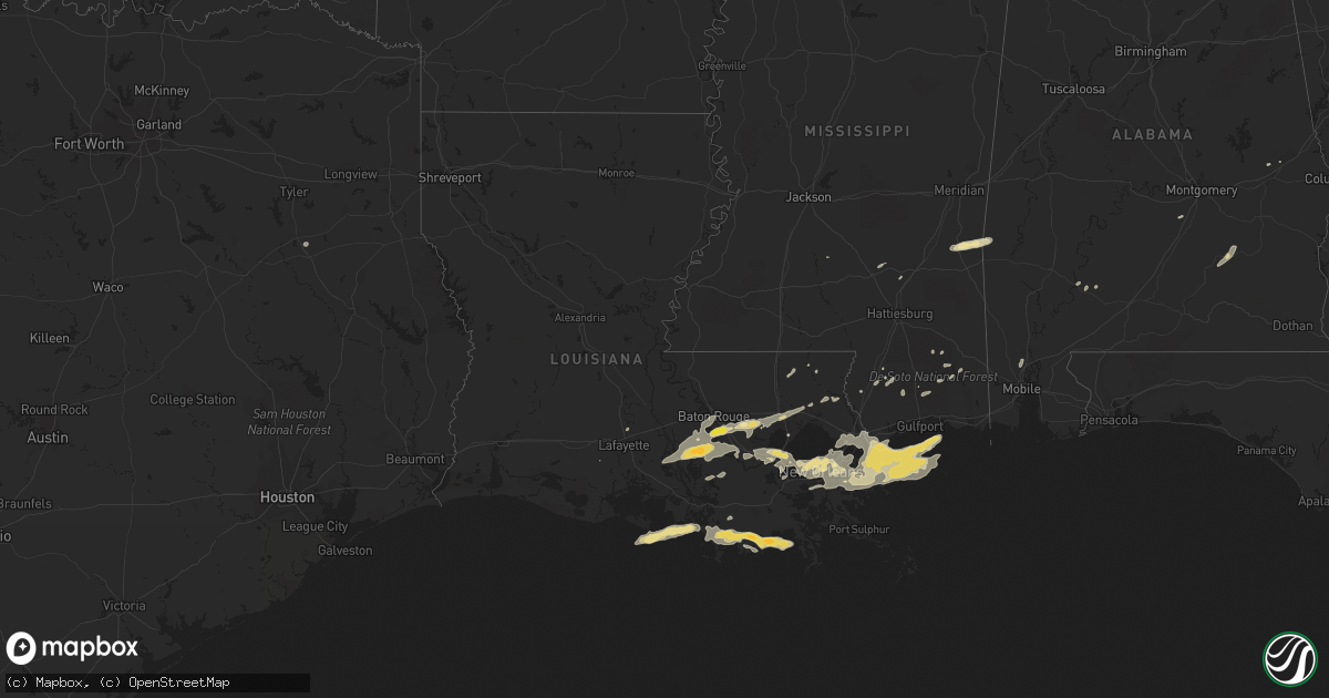
Hail Map in Louisiana on May 11, 2019
Get this storm
May 11 map
$229
one time, instant access
Download today. No call, no setup
Keep the $229
Bought the map and want the full workflow? Apply the entire $229 to a subscription within 7 days. None of it is wasted.
Every map, not just this one
This buys you this map. Subscription and you get every map we run, in the markets you choose from a few cities to whole states to nationwide. Plus real-time alerts the moment a storm fires.
Contact data
Name, contact info, occupancy, even credit band for addresses in the footprint. You go from where it hit to who to call.
Become the source they trust
Unlimited branding weather history reports on demand. You already have the documented answer ready for the property owner, and you are the one who showed up with it.
Property data and RoofTrace estimates
Pull up any address you have got, its value and the exact code rules for that jurisdiction, straight from One Click Code. Then RoofTrace estimates the squares, pitch, and roof value, priced the way you price.
Storm reports in Louisiana
Louisiana
| Date | Description |
|---|---|
| 05/11/20191:12 PM CDT | Large tree down across from old hammond highway park in baton rouge. Relayed via social media. Time estimated from radar. |
| 05/11/20195:54 AM CDT | At 1053 PM CDT, a severe thunderstorm was located over Convent, or 9 miles southeast of Donaldsonville, moving northeast at 30 mph. HAZARD...60 mph wind gusts and quarter size hail. SOURCE...Radar indicated. IMPACT...Hail damage to vehicles is expected. Expect wind damage to roofs, siding, and trees. Locations impacted include... Donaldsonville, Napoleonville, Sorrento, Supreme, Paincourtville, Convent, North Vacherie, Belle Rose and South Vacherie. |
| 05/11/20194:38 AM CDT | St charles parish eoc reported power outages on the east bank... Destrehan and norco areas. Event time estimated based on radar. |
| 05/10/20199:29 PM CDT | At 228 PM CDT, a severe thunderstorm was located over Franklinton, moving northeast at 15 mph. HAZARD...60 mph wind gusts. SOURCE...Radar indicated. IMPACT...Expect damage to roofs, siding, and trees. Locations impacted include... Franklinton. |
| 05/10/20199:10 PM CDT | At 209 AM CDT, a severe thunderstorm was located 7 miles south of Lafitte, or 13 miles east of Cut Off, moving northeast at 20 mph. HAZARD...Ping pong ball size hail and 60 mph wind gusts. SOURCE...Radar indicated. IMPACT...People and animals outdoors will be injured. Expect hail damage to roofs, siding, windows, and vehicles. Expect wind damage to roofs, siding, and trees. Locations impacted include... Myrtle Grove and Lafitte. |
| 05/10/20198:08 PM CDT | At 108 PM CDT, a severe thunderstorm was located 8 miles north of Mount Herman, or 14 miles southeast of Mccomb, moving northeast at 5 mph. HAZARD...60 mph wind gusts. SOURCE...Radar indicated. IMPACT...Expect damage to roofs, siding, and trees. This severe thunderstorm will remain over mainly rural areas of west central Walthall and southeastern Pike Counties. |
| 05/10/20198:03 PM CDT | At 102 PM CDT, a severe thunderstorm was located over Westminster, or over Baton Rouge, moving northeast at 15 mph. HAZARD...60 mph wind gusts and quarter size hail. Tornado development possible. SOURCE...Radar indicated. IMPACT...Hail damage to vehicles is expected. Expect wind damage to roofs, siding, and trees. Locations impacted include... Baton Rouge, Westminster, Merrydale, Inniswold and Brownfields. |
All States Impacted by Hail Map on May 11, 2019
Cities Impacted by Hail Map on May 11, 2019
- Gibson, LA
- Galliano, LA
- Chauvin, LA
- Houma, LA
- Theriot, LA
- Montegut, LA
- Dulac, LA
- Bishop, GA
- Watkinsville, GA
- Ponchatoula, LA
- Paulina, LA
- Baton Rouge, LA
- Prairieville, LA
- Sunshine, LA
- Saint Gabriel, LA
- Soperton, GA
- Kissimmee, FL
- Perkinston, MS
- Auburn University, AL
- Auburn, AL
- Notasulga, AL
- Shubuta, MS
- Waynesboro, MS
- French Settlement, LA
- Denham Springs, LA
- Livingston, LA
- Dry Branch, GA
- Melvin, AL
- Quitman, MS
- Gilbertown, AL
- Newton, GA
- Leary, GA
- Needham, AL
- Poplarville, MS
- Pierson, FL
- Taylorsville, MS
- Warthen, GA
- Sparta, GA
- Sandersville, GA
- Wadesboro, NC
- Oakboro, NC
- Polkton, NC
- Norwood, NC
- Marshville, NC
- White Castle, LA
- Saint Martinville, LA
- Plaquemine, LA
- New Orleans, LA
- Camilla, GA
- Metairie, LA
- Chalmette, LA
- Kenner, LA
- Meraux, LA
- Goshen, AL
- Troy, AL
- Rock Hill, SC
- La Place, LA
- Reserve, LA
- Garyville, LA
- Hope Hull, AL
- Letohatchee, AL
- Hayneville, AL
- Sumner, GA
- Ty Ty, GA
- Brooklyn, MS
- Wiggins, MS
- Apple Valley, CA
- Patterson, LA
- Gretna, LA
- Mount Gilead, NC
- Intercession City, FL
- Pinola, MS
- Midland, NC
- Concord, NC
- Harrisburg, NC
- Napoleonville, LA
- Danville, GA
- Irwinton, GA
- Poulan, GA
- Rusk, TX
- Jacksonville, TX
- Locust, NC
- Carville, LA
- Bushnell, FL
- Biloxi, MS
- Suffolk, VA
- Frisco City, AL
- Carencro, LA
- Lucedale, MS
- Cochran, GA
- Slidell, LA
- Saint Bernard, LA
- Charlotte, NC
- Stanfield, NC
- Springfield, LA
- Bay Saint Louis, MS
- Amite, LA
- Kentwood, LA
- Saraland, AL
- Fort Mill, SC
- Elberton, GA
- Tignall, GA
- Baconton, GA
- Albany, GA
- Hawkinsville, GA
- Eastman, GA
- Saucier, MS
- Collins, MS
- Folsom, LA
- Covington, LA
- Vredenburgh, AL
- Franklin, AL
- Norco, LA
- Ellisville, MS
- McHenry, MS
- De Leon Springs, FL
- Robert, LA
- Geismar, LA
- Addis, LA
- Maurepas, LA
- Grosse Tete, LA
- Loranger, LA
- Hammond, LA
- Gonzales, LA
- Darrow, LA
- Jeanerette, LA
- Donaldsonville, LA
- Holden, LA
- Port Allen, LA
- Sorrento, LA
- Convent, LA
- Brusly, LA
- Saint Amant, LA
- Carriere, MS
- Arlington, GA
- Braithwaite, LA
- Pearlington, MS
- Violet, LA
- Marrero, LA
- Belle Chasse, LA
- Harvey, LA
- Gramercy, LA
- Saint Rose, LA
- Arabi, LA
- Hahnville, LA
- Mount Airy, LA
- Edgard, LA
- Westwego, LA
- Ama, LA
- Macon, GA
- Jeffersonville, GA
- Omega, GA
- Orlando, FL
- Fayetteville, NC
- Bush, LA
- Pierre Part, LA
- Winterville, GA
- Arnoldsville, GA
- Crawford, GA
- Colbert, GA
- Monroeville, AL
- Kaplan, LA
- Franklinton, LA
- Tarrytown, GA
- Mount Vernon, GA
- Hampton, NE
- Sylvester, GA
- Luling, LA
- Comer, GA


