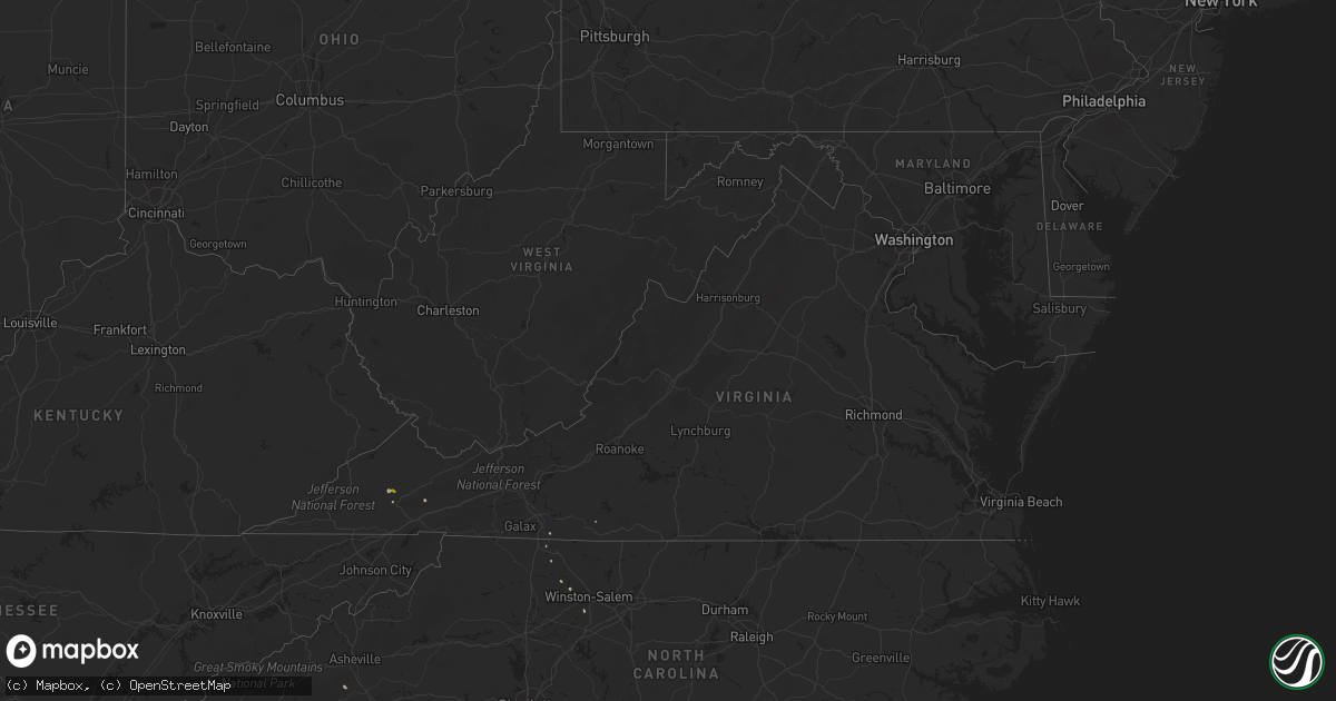
Hail Map in Virginia on May 11, 2018
Get this storm
May 11 map
$229
one time, instant access
Download today. No call, no setup
Keep the $229
Bought the map and want the full workflow? Apply the entire $229 to a subscription within 7 days. None of it is wasted.
Every map, not just this one
This buys you this map. Subscription and you get every map we run, in the markets you choose from a few cities to whole states to nationwide. Plus real-time alerts the moment a storm fires.
Contact data
Name, contact info, occupancy, even credit band for addresses in the footprint. You go from where it hit to who to call.
Become the source they trust
Unlimited branding weather history reports on demand. You already have the documented answer ready for the property owner, and you are the one who showed up with it.
Property data and RoofTrace estimates
Pull up any address you have got, its value and the exact code rules for that jurisdiction, straight from One Click Code. Then RoofTrace estimates the squares, pitch, and roof value, priced the way you price.
Storm reports in Virginia
Virginia
| Date | Description |
|---|---|
| 05/11/20181:42 PM CDT | Quarter size hail |
| 05/10/20189:30 PM CDT | At 230 PM EDT, a severe thunderstorm was located over Cleveland Va, or near Lebanon, moving southeast at 5 mph. HAZARD...60 mph wind gusts and quarter size hail. SOURCE...Radar indicated. IMPACT...Hail damage to vehicles is expected. Expect wind damage to roofs, siding, and trees. Locations impacted include... Lebanon, Cleveland Va, Honaker, St. Paul, Castlewood, Holston, Hansonville and Rosedale. |
All States Impacted by Hail Map on May 11, 2018
Cities Impacted by Hail Map on May 11, 2018
- Ault, CO
- East Bend, NC
- Hayesville, IA
- Ollie, IA
- Sigourney, IA
- Stuart, IA
- Dexter, IA
- Earlham, IA
- Keota, IA
- Juniata, NE
- Roseland, NE
- Hastings, NE
- Holstein, NE
- Kearney, NE
- Wheatland, IA
- Magnolia, IL
- Pleasant Hill, IA
- Mitchellville, IA
- Runnells, IA
- South English, IA
- Sinclair, WY
- Rawlins, WY
- Wamsutter, WY
- Hanna, WY
- Ainsworth, IA
- Columbus Junction, IA
- Wheeler, TX
- Shamrock, TX
- Menlo, IA
- Winterset, IA
- Greenfield, IA
- Casey, IA
- Mobeetie, TX
- Briscoe, TX
- North Liberty, IA
- Clarinda, IA
- Cheyenne, WY
- Colfax, IA
- Prairie City, IA
- Newton, IA
- Fairfield, IA
- Richland, IA
- Packwood, IA
- Patterson, IA
- Indianola, IA
- Saint Marys, IA
- Saint Charles, IA
- Prole, IA
- Mount Ayr, IA
- Hatfield, MO
- Bedford, IA
- Redding, IA
- Eagleville, MO
- Kellerton, IA
- Blockton, IA
- Benton, IA
- Anamosa, IA
- Coin, IA
- Northboro, IA
- Shenandoah, IA
- Yorktown, IA
- New Market, IA
- Coal Valley, IL
- Osco, IL
- Geneseo, IL
- Orion, IL
- Eaton, CO
- Elk Horn, IA
- Exira, IA
- Audubon, IA
- Medicine Bow, WY
- Cumming, IA
- Van Meter, IA
- Carlisle, IA
- Hartford, IA
- Ayr, NE
- Bladen, NE
- Patrick Springs, VA
- Hancock, IA
- Minden, IA
- Neola, IA
- Adair, IA
- Otley, IA
- Pella, IA
- Stapleton, NE
- Cheyenne, OK
- Hamlin, IA
- Kimballton, IA
- Brayton, IA
- Leighton, IA
- Webster, IA
- Castlewood, VA
- Lebanon, VA
- Gibson, IA
- Winfield, IA
- Lagrange, WY
- Monroe, IA
- Swan, IA
- Solon, IA
- Beacon, IA
- Oskaloosa, IA
- Tryon, NE
- Anita, IA
- Tonica, IL
- McNabb, IL
- Peru, IL
- Granville, IL
- Saltville, VA
- Fontanelle, IA
- Lenox, IA
- Heartwell, NE
- Kenesaw, NE
- Minden, NE
- Clay Center, NE
- Saronville, NE
- Nehawka, NE
- Weeping Water, NE
- Bennett, IA
- Loup City, NE
- Harvard, NE
- Adel, IA
- Calamus, IA
- Donahue, IA
- Plainfield, IL
- Miller, NE
- Sumner, NE
- Pfafftown, NC
- Gibbon, NE
- Brighton, IA
- Horse Shoe, NC
- Mills River, NC
- Oakland, IA
- Grinnell, IA
- Ararat, NC
- Mount Airy, NC
- Guthrie Center, IA
- Harper, IA
- Buda, IL
- Neponset, IL
- Kewanee, IL
- Sheffield, IL
- Murray, NE
- Winston Salem, NC
- Clemmons, NC
- Lexington, NC
- Galesburg, IL
- Ord, NE
- Oconto, NE
- Dixon, IA
- Marshalltown, IA
- Cana, VA
- Ararat, VA
- Exeter, NE
- Pisgah Forest, NC
- Plattsmouth, NE
- Cambridge, IL
- Atkinson, IL
- Sterling, IL
- Morrison, IL
- Wayland, IA
- Yorkville, IL
- Washington, IA
- Fairmont, NE
- Geneva, NE
- Mason City, NE
- Honey Creek, IA
- Underwood, IA
- Missouri Valley, IA
- Toulon, IL
- Glenvil, NE
- Milan, IL
- Marathon, TX
- Clinton, IA
- Campbell, NE
- Sutton, NE
- Barnes City, IA
- New Sharon, IA
- Aledo, IL
- Mclean, TX
- New London, IA
- Mount Pleasant, IA
- Comstock, NE
- Fremont, IA
- Cedar, IA
- Delta, IA
- Hedrick, IA
- Rose Hill, IA
- Randolph, IA
- West Chester, IA
- What Cheer, IA
- Keswick, IA
- Wellman, IA
- Avoca, IA
- Cleveland, VA


