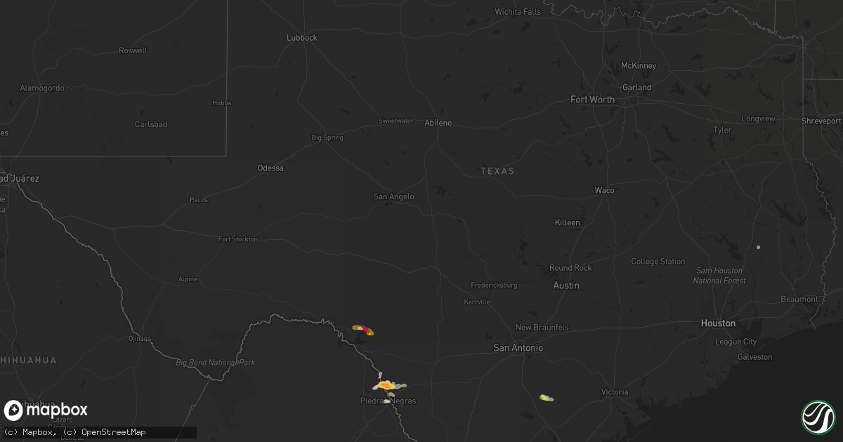
Hail Map in Texas on May 11, 2015
Get this storm
May 11 map
$229
one time, instant access
Download today. No call, no setup
Keep the $229
Bought the map and want the full workflow? Apply the entire $229 to a subscription within 7 days. None of it is wasted.
Every map, not just this one
This buys you this map. Subscription and you get every map we run, in the markets you choose from a few cities to whole states to nationwide. Plus real-time alerts the moment a storm fires.
Contact data
Name, contact info, occupancy, even credit band for addresses in the footprint. You go from where it hit to who to call.
Become the source they trust
Unlimited branding weather history reports on demand. You already have the documented answer ready for the property owner, and you are the one who showed up with it.
Property data and RoofTrace estimates
Pull up any address you have got, its value and the exact code rules for that jurisdiction, straight from One Click Code. Then RoofTrace estimates the squares, pitch, and roof value, priced the way you price.
Storm reports in Texas
Texas
| Date | Description |
|---|---|
| 05/11/20156:28 PM CDT | A local report indicates 1.00 inch wind near QUEMADO |
| 05/11/20151:05 PM CDT | A resident reported tree damage on his property as well as adjacent properties off private road 1271. |
| 05/11/20153:31 AM CDT | 66 mph wind gust at nas cc |
| 05/11/20153:12 AM CDT | Power poles snapped on everhart near bonner. |
| 05/11/20152:52 AM CDT | Nws storm survey identified an 8 1/2 mile path of straight line wind damage extending from riviera to the port alto public beach. Peak wind gusts were estimated at 70-8 |
| 05/11/20152:09 AM CDT | A local report indicates 59 MPH wind near N CORPUS CHRISTI |
| 05/11/20152:07 AM CDT | 59 mph wind gust at corpus christi international airport. |
| 05/11/20151:55 AM CDT | Mercedes police department reports window blown out at outlet mall. Also palm tree blown down on dawson street. |
| 05/11/20151:40 AM CDT | Employee at sugar mill in santa rosa reports utility pole leaning heavily on fm 1425 due to thunderstorm winds. Event time estimated from radar imagery. |
| 05/11/20151:40 AM CDT | La feria police department reports utility pole leaning heavily on palm tree due to thunderstorm wind gusts at intersection of the frontage road and solis road. Also tr |
| 05/11/20151:40 AM CDT | Elsa police department reports tree blown down by thunderstorm winds on north fannin in elsa. |
| 05/11/20151:30 AM CDT | Edcouch police department reports 4 to 5 trees blown down at the intersection of west 107 and south industrial. |
| 05/11/20151:20 AM CDT | Hidalgo county emergency manager reports widespread damage in la villa. Shingled roofs peeled back. Large metal canopy for rv bent. Multiple trees down. Small wooden an |
| 05/11/20151:20 AM CDT | Social media reports and hidalgo county emergency manager confirms multiple metal walls of prefabricated building peeled back and blown out 1 mile north of la villa at |
| 05/11/20151:10 AM CDT | Progreso police department reports tree blown down onto vehicle at residence on watts street in progreso. |
| 05/11/201512:05 AM CDT | Facebook user reports over 60 acres of corn leveled by straight-line winds at the corner of fm 493 and fm 2812. Event time estimated from radar imagery. |
| 05/10/201511:50 PM CDT | Starr county sheriffs office reports shingles blown off roof and damage to walls of structure in colonia. |
| 05/10/201510:25 PM CDT | Starr county sheriffs office reports quarter size hail at the intersection of fm 3167 and eisenhower road. |
| 05/10/201510:00 PM CDT | Sheriff office reported quarter size hail on the west side of rio grande city. |
| 05/10/20158:23 PM CDT | Report of 50-60 mph winds at the motel in study butte |
| 05/10/20157:30 PM CDT | Power poles bent over along county road 229 and highway 285. |
| 05/10/20157:10 PM CDT | Trees down in ramirez. |
| 05/10/20157:10 PM CDT | Power poles blown down near fm 1329 and cr 236 |
| 05/10/20157:00 PM CDT | Estimated 55 to 60 mph gusts |
| 05/10/20157:00 PM CDT | A local report indicates 2.50 inch wind near LAUGHLIN AFB AUX FIELD |
All States Impacted by Hail Map on May 11, 2015
Cities Impacted by Hail Map on May 11, 2015
- Realitos, TX
- Monroe, VA
- Amherst, VA
- Lexington, VA
- Glasgow, VA
- Buena Vista, VA
- Marfa, TX
- Lynchburg, VA
- Eagle Pass, TX
- Concepcion, TX
- Rio Grande City, TX
- Concord, VA
- Spout Spring, VA
- Appomattox, VA
- Blowing Rock, NC
- Livingston, TX
- Robbins, TN
- Quemado, TX
- Roseland, VA
- Lakeview, OR
- Elizabethton, TN
- Albemarle, NC
- Simpsonville, SC
- Sherwood, OH
- Cecil, OH
- Mark Center, OH
- Hicksville, OH
- Antwerp, OH
- Brookhaven, MS
- Forest, VA
- Alpine, TX
- Stryker, OH
- Bryan, OH
- Three Rivers, TX
- Karnes City, TX
- Kenedy, TX
- Logan, OH
- Falfurrias, TX
- Roan Mountain, TN
- Bakersville, NC
- Greenville, SC
- Fountain Inn, SC
- Tampa, FL
- Jamestown, TN
- Boone, NC
- Banner Elk, NC
- Lucasville, OH
- Tickfaw, LA
- Del Rio, TX
- Woodburn, IN
- New Haven, IN
- Madison Heights, VA
- Pelzer, SC
- Oneida, TN
- Black Mountain, NC
- Hendersonville, NC
- Fairview, NC
- Independence, LA
- Amite, LA
- Pamplin, VA
- Dunnellon, FL
- Piedmont, SC
- Gerton, NC
- Albany, LA
- Holden, LA
- Hillsboro, KY
- Flemingsburg, KY
- Crawford, WV
- French Creek, WV
- Pall Mall, TN
- Tyro, VA
- Edinburg, TX
- Elk Park, NC
- Morriston, FL
- Delmita, TX
- Linn, TX
- Fletcher, NC
- Hammond, LA
- Cope, SC
- Marathon, TX
- San Isidro, TX
- Creston, NC
- Rockport, WV
- McCall Creek, MS
- Smithdale, MS
- Bogue Chitto, MS
- Owingsville, KY
- Monroeville, IN
- Paulding, OH
- Oakboro, NC
- Summit, MS
- Liberty, MS
- Waverly, OH
- Crossville, TN
- Gaston, SC
- Lexington, SC
- Branchville, SC
- Rowesville, SC
- Cordova, SC


