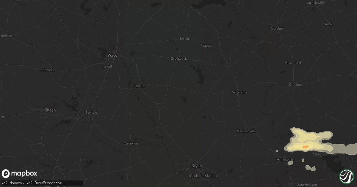
Hail Map in Houston, TX on May 11, 2012
Get this storm
May 11 map
$229
one time, instant access
Download today. No call, no setup
Keep the $229
Bought the map and want the full workflow? Apply the entire $229 to a subscription within 7 days. None of it is wasted.
Every map, not just this one
This buys you this map. Subscription and you get every map we run, in the markets you choose from a few cities to whole states to nationwide. Plus real-time alerts the moment a storm fires.
Contact data
Name, contact info, occupancy, even credit band for addresses in the footprint. You go from where it hit to who to call.
Become the source they trust
Unlimited branding weather history reports on demand. You already have the documented answer ready for the property owner, and you are the one who showed up with it.
Property data and RoofTrace estimates
Pull up any address you have got, its value and the exact code rules for that jurisdiction, straight from One Click Code. Then RoofTrace estimates the squares, pitch, and roof value, priced the way you price.
Storm reports in Houston, TX
Houston, TX
| Date | Description |
|---|---|
| 05/10/20128:36 PM CDT | Quarter sized hail at beechnut and state highway 6 in southwest harris county. |
| 05/10/20128:30 PM CDT | Quarter sized hail on interstate 10 from wilcrest to kirkwood along with torrential rain and strong winds. |
All States Impacted by Hail Map on May 11, 2012
All Cities Impacted by Hail Map on May 11, 2012
- Fort Hancock, TX
- El Paso, TX
- Houston, TX
- Hebbronville, TX
- Lovelady, TX
- Haslet, TX
- Fort Worth, TX
- Azle, TX
- Sealy, TX
- Cloudcroft, NM
- Alamogordo, NM
- Keller, TX
- North Zulch, TX
- Bedias, TX
- Bryan, TX
- Iola, TX
- Fulshear, TX
- Katy, TX
- Brookshire, TX
- Richmond, TX
- Wallis, TX
- Oakhurst, TX
- Huntsville, TX
- Leona, TX
- Midway, TX
- Quinlan, TX
- Greenville, TX
- Poolville, TX
- Cypress, TX
- Hockley, TX
- Bowie, TX
- Jacksboro, TX
- Tularosa, NM
- Zapata, TX
- Laredo, TX
- San Ygnacio, TX
- Encino, TX
- Oakwood, TX
- Waller, TX
- Buffalo, TX
- Cumby, TX
- Lone Oak, TX
- Campbell, TX
- Trinity, TX
- Pointblank, TX
- San Antonio, TX
- Onalaska, TX
- Groveton, TX
- Bellaire, TX
- Woodville, TX
- Livingston, TX
- Falfurrias, TX
- Premont, TX
- Teague, TX
- Streetman, TX
- Fort Bliss, TX
- Missouri City, TX
- Palestine, TX
- Frankston, TX
- Jacksonville, TX
- Woodson, TX
- Bellville, TX
- Chappell Hill, TX
- Kennedale, TX
- Grapeland, TX
- Victoria, TX
- Carrizozo, NM
- Navasota, TX
- Socorro, NM
- Cat Spring, TX
- Alleyton, TX
- Holloman Air Force Base, NM
- Pearland, TX
- Stafford, TX
- Sugar Land, TX
- Plantersville, TX
- Eagle Lake, TX
- Klondike, TX
- Commerce, TX
- Tijeras, NM
- Springtown, TX
- El Campo, TX
- Anahuac, TX
- Baytown, TX
- Naval Air Station Jrb, TX
- New Waverly, TX
- Anderson, TX
- Hempstead, TX
- Pasadena, TX
- Seabrook, TX
- Port Bolivar, TX
- La Porte, TX
- Tiffin, IA
- Bay City, TX
- Van Vleck, TX
- Throckmorton, TX
- White Sands Missile Range, NM
- Alexandria, LA
- Pineville, LA
- Bent, NM
- North Richland Hills, TX
- Hallettsville, TX
- Boyd, TX
- Port Isabel, TX
- Los Fresnos, TX
- Fairfield, TX
- Paradise, TX
- Lecompte, LA
- Fresno, TX
- Rosharon, TX
- Wolfe City, TX
- Weatherford, TX
- Needville, TX
- Louise, TX
- Corrales, NM
- Albuquerque, NM
- Albany, MN
- Saint Cloud, MN
- Saint Joseph, MN
- Sauk Rapids, MN
- Melrose, MN
- Foley, MN
- Sauk Centre, MN
- Sartell, MN
- Waite Park, MN
- Avon, MN
- Freeport, MN


