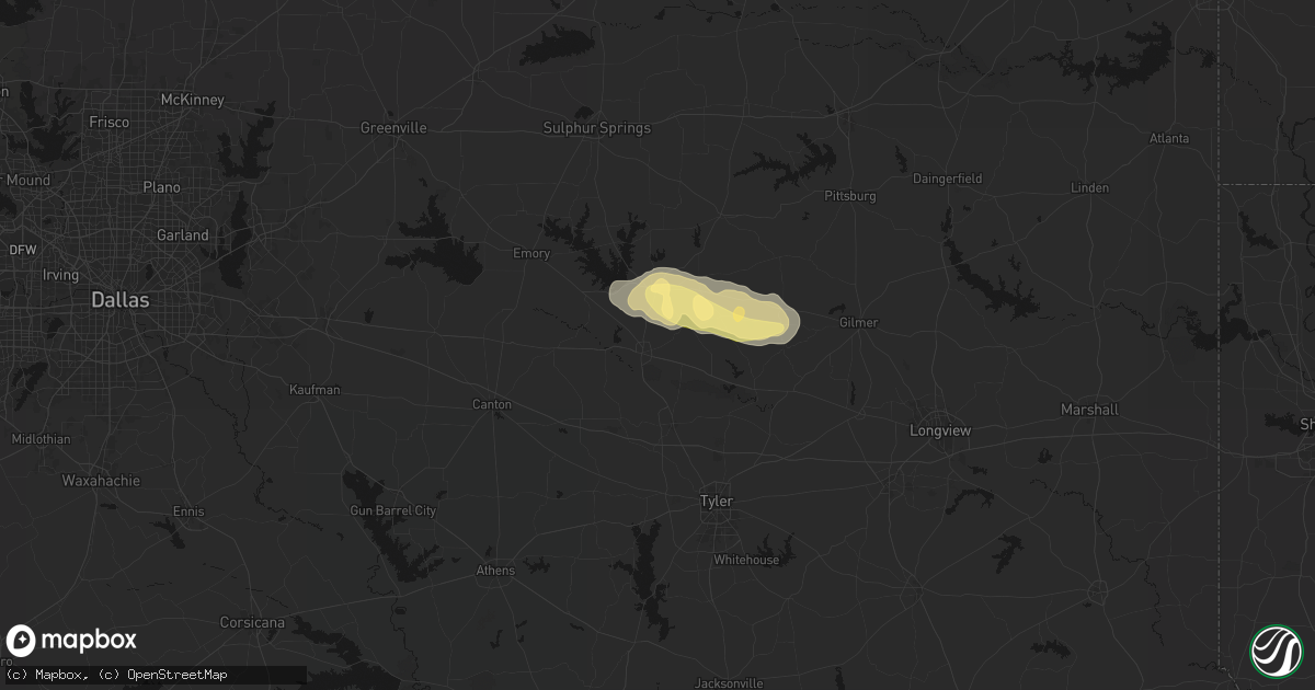
Hail Map in Mineola, TX on May 10, 2026
Get this storm
May 10 map
$229
one time, instant access
Download today. No call, no setup
Keep the $229
Bought the map and want the full workflow? Apply the entire $229 to a subscription within 7 days. None of it is wasted.
Every map, not just this one
This buys you this map. Subscription and you get every map we run, in the markets you choose from a few cities to whole states to nationwide. Plus real-time alerts the moment a storm fires.
Contact data
Name, contact info, occupancy, even credit band for addresses in the footprint. You go from where it hit to who to call.
Become the source they trust
Unlimited branding weather history reports on demand. You already have the documented answer ready for the property owner, and you are the one who showed up with it.
Property data and RoofTrace estimates
Pull up any address you have got, its value and the exact code rules for that jurisdiction, straight from One Click Code. Then RoofTrace estimates the squares, pitch, and roof value, priced the way you price.
Storm reports in Mineola, TX
Mineola, TX
| Date | Description |
|---|---|
| 05/10/20261:56 PM CDT | Social media report of trees down near 180 county road 3269. |
| 05/10/20261:56 PM CDT | A chicken truck was blown over in hainesville. |
All Cities Impacted by Hail Map on May 10, 2026
- Follett, TX
- Darrouzett, TX
- Sulphur, OK
- Roff, OK
- Wynnewood, OK
- Pauls Valley, OK
- Davis, OK
- Ardmore, OK
- Waurika, OK
- Paducah, TX
- Lone Oak, TX
- Point, TX
- Seymour, TX
- Holliday, TX
- Colorado City, TX
- Westbrook, TX
- Quitman, TX
- Alba, TX
- Mineola, TX
- Ackerly, TX
- Lamesa, TX
- Ira, TX
- Hawkins, TX
- Albany, TX
- Snyder, TX
- Winnsboro, TX
- Hector, AR
- Jerusalem, AR
- Coahoma, TX
- Dickens, TX
- Scotland, AR
- Gail, TX
- Big Sandy, TX
- Port Orange, FL
- Daytona Beach, FL
- Mayflower, AR
- Loraine, TX
- Gilmer, TX
- Big Spring, TX
- Ranger, TX
- Breckenridge, TX
- Cisco, TX
- Cleveland, AR
- Moran, TX
- Center Ridge, AR
- Hattieville, AR
- New Smyrna Beach, FL
- Eastland, TX
- Damascus, AR
- Greenbrier, AR
- Converse, LA
- Roscoe, TX
- Desdemona, TX
- Pleasant Hill, LA
- Maryneal, TX
- Sebastian, FL
- Vero Beach, FL
- De Leon, TX
- Gorman, TX
- Silverton, TX
- Enola, AR
- Mcadoo, TX
- Robert Lee, TX
- Fluvanna, TX
- Blackwell, TX
- Mingus, TX
- Carrollton, TX
- Dublin, TX
- Vaiden, MS
- Big Lake, TX
- Romance, AR
- Mount Vernon, AR
- Banks, AR
- Belmont, LA
- Stephenville, TX
- Bronte, TX
- Marthaville, LA
- Dryden, TX
- Justiceburg, TX
- Munday, TX
- Wingate, TX
- Many, LA
- Robeline, LA
- Weinert, TX
- Spur, TX
- Mims, FL
- Throckmorton, TX
- Marion, LA
- Haskell, TX
- Midkiff, TX
- Winters, TX
- Natchitoches, LA
- Goree, TX
- Rising Star, TX
- Carbon, TX
- Strawn, TX
- Carlton, TX
- Carlsbad, TX
- Norton, TX
- Hico, TX
- Sterlington, LA
- Farmerville, LA
- Comstock, TX
- Comanche, TX
- Ethel, MS
- Ballinger, TX
- San Angelo, TX
- McCool, MS
- Talpa, TX
- Goodfellow Afb, TX
- Miles, TX
- West Monroe, LA
- Woodson, TX
- Monroe, LA
- Scott, AR
- Ozona, TX
- Columbia, LA
- Barnhart, TX
- Patrick Afb, FL
- Hamilton, TX
- Gustine, TX
- Preston, MS
- Philadelphia, MS
- Graham, TX
- Newcastle, TX
- Lonoke, AR
- Voss, TX
- Jacksboro, TX
- Perrin, TX
- England, AR
- Humnoke, AR
- Mereta, TX
- Coleman, TX
- Rowena, TX
- Paint Rock, TX
- Valera, TX
- Millersview, TX
- Wall, TX
- Gouldbusk, TX
- Eola, TX
- Eden, TX
- Woodway, TX
- Waco, TX
- Cleveland, TX
- Humphrey, AR
- Wabbaseka, AR
- Pottsville, TX
- Bryson, TX
- Doole, TX
- Melvin, TX
- Lohn, TX
- Rockwood, TX
- Winnsboro, LA
- Jonesboro, TX
- Fort Necessity, LA
- Graford, TX
- Mullin, TX
- Christoval, TX
- Goldthwaite, TX
- Kilmichael, MS
- Kosciusko, MS
- Cameron, TX
- Santa Anna, TX
- Brady, TX
- Rochelle, TX
- Purmela, TX
- Harrisonburg, LA
- Sierra Blanca, TX
- Carencro, LA
- Sunset, LA
- Church Point, LA
- Mertzon, TX
- Saline, LA
- Opelousas, LA
- Gatesville, TX
- Shepherd, TX
- Livingston, TX
- Rio Grande City, TX
- Sullivan City, TX
- Grulla, TX
- Enterprise, LA
- Valley Mills, TX
- Menard, TX
- Rosebud, TX
- Montgomery, TX
- Brookesmith, TX
- Decatur, MS
- Chunky, MS
- Hickory, MS
- Richland Springs, TX
- Mission, TX
- Evant, TX
- Eldorado, TX
- Lampasas, TX
- Louisville, MS
- San Saba, TX
- Mason, TX
- Fredonia, TX
- Voca, TX
- Meridian, MS
- Hext, TX
- Oglesby, TX
- Lott, TX
- Brenham, TX
- Lometa, TX
- Troy, TX
- Cherokee, TX
- Pontotoc, TX
- Art, TX
- Valley Spring, TX
- Edinburg, TX
- Eddy, TX
- Chilton, TX
- Richards, TX
- Enterprise, MS
- London, TX
- Copperas Cove, TX
- Sonora, TX
- Moody, TX
- Llano, TX
- Castell, TX
- McGregor, TX
- Bruceville, TX
- Huntsville, TX
- Junction, TX
- Lorena, TX
- Jasper, TX
- Tow, TX
- Bluffton, TX
- Bedias, TX
- Buchanan Dam, TX
- Hebbronville, TX
- Fort Hood, TX
- Holland, TX
- Chester, TX
- Quitman, MS
- Kempner, TX
- Rocksprings, TX
- Salado, TX
- Corrigan, TX
- Kaplan, LA
- Crawford, TX
- Burnet, TX
- Bertram, TX
- Florence, TX
- Georgetown, TX
- Belton, TX
- Burton, TX
- Midway, TX
- Madisonville, TX
- Sidon, MS
- Greenwood, MS
- Quemado, TX
- Liberty Hill, TX
- Kingsland, TX
- Rogers, TX
- Stonewall, MS
- Hunt, TX
- Temple, TX
- Goodrich, TX
- Mountain Home, TX
- Uvalde, TX
- Ledbetter, TX
- North Zulch, TX
- Lincoln, TX
- Doddsville, MS
- Giddings, TX
- Sunflower, MS
- Bartlett, TX
- Anderson, TX
- Blanco, TX
- Granger, TX
- Paige, TX
- Normangee, TX
- Lexington, TX
- Sabinal, TX
- Schlater, MS
- Buckholts, TX
- La Pryor, TX
- Hondo, TX
- Centerville, TX
- Leona, TX
- Crystal City, TX
- Knippa, TX
- Taylor, TX
- Bandera, TX
- Thorndale, TX
- Itta Bena, MS
- Austin, TX
- Del Valle, TX
- Navasota, TX
- Winona, MS
- Rockdale, TX
- Manor, TX
- Batesville, TX
- Elgin, TX
- San Antonio, TX
- Deridder, LA
- Leesville, LA
- Davilla, TX
- Smithville, TX
- Eagle Pass, TX
- Carmine, TX
- Pitkin, LA
- El Indio, TX
- Big Wells, TX
- Carrizo Springs, TX
- Dilley, TX
- Cotulla, TX
- Asherton, TX
- Ackerman, MS
- Bleiblerville, TX
- Bellville, TX
- Chappell Hill, TX
- Mount Olive, MS
- Collins, MS
- George West, TX
- Beeville, TX
- Karnes City, TX
- Skidmore, TX
- Falls City, TX
- Tynan, TX
- Kenedy, TX
- Whitsett, TX
- Campbellton, TX
- Odem, TX
- Hobson, TX
- Three Rivers, TX
- Goliad, TX
- Sinton, TX
- Mathis, TX
- Woodsboro, TX
- Washington, TX
- Lovelady, TX
- Iola, TX
- Tivoli, TX
- Rockport, TX
- Aransas Pass, TX
- Ingleside, TX
- Port Aransas, TX
- Taft, TX
- Bayside, TX
- Gregory, TX
- Corpus Christi, TX
- Portland, TX
- Fulton, TX
- Conroe, TX
- Port O'Connor, TX
- Matagorda, TX
- Downsville, LA
- Choudrant, LA
- D Hanis, TX
- Cedar Creek, TX
- Pflugerville, TX
- Thrall, TX
- Round Rock, TX
- McDade, TX
- Jarrell, TX
- Coupland, TX
- Hutto, TX
- Bastrop, TX


