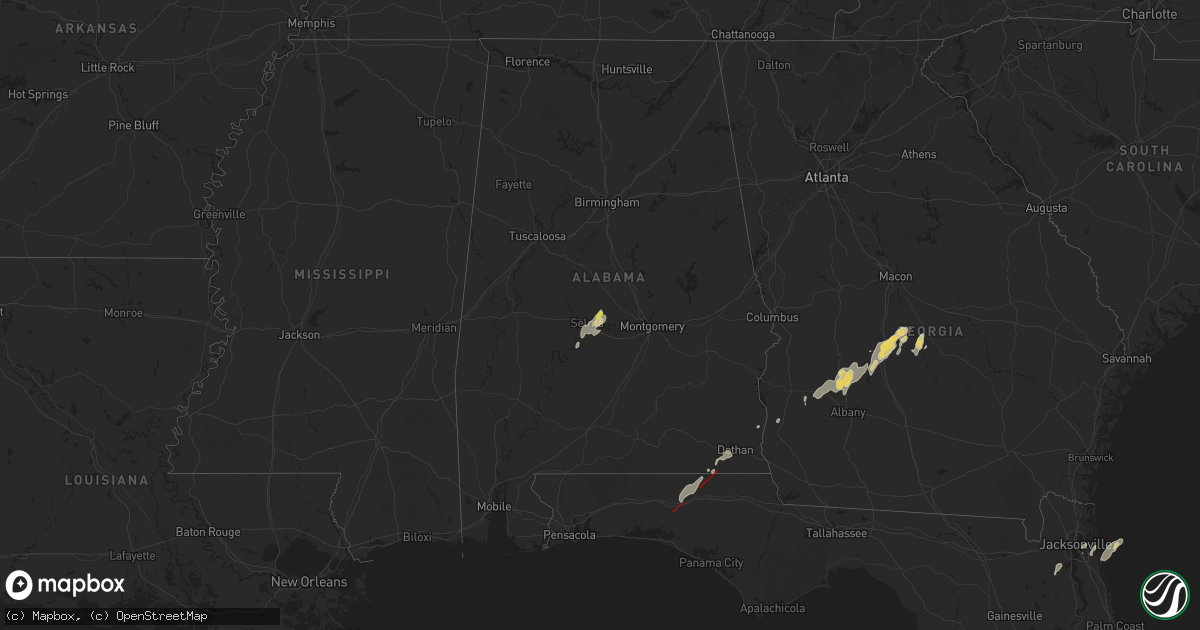
Hail Map on May 10, 2025
Get this storm
May 10 map
$229
one time, instant access
Download today. No call, no setup
Keep the $229
Bought the map and want the full workflow? Apply the entire $229 to a subscription within 7 days. None of it is wasted.
Every map, not just this one
This buys you this map. Subscription and you get every map we run, in the markets you choose from a few cities to whole states to nationwide. Plus real-time alerts the moment a storm fires.
Contact data
Name, contact info, occupancy, even credit band for addresses in the footprint. You go from where it hit to who to call.
Become the source they trust
Unlimited branding weather history reports on demand. You already have the documented answer ready for the property owner, and you are the one who showed up with it.
Property data and RoofTrace estimates
Pull up any address you have got, its value and the exact code rules for that jurisdiction, straight from One Click Code. Then RoofTrace estimates the squares, pitch, and roof value, priced the way you price.
Storm reports
Idaho
| Date | Description |
|---|---|
| 05/10/20256:50 PM CDT | Mesonet station pc371 medicine lodge. |
| 05/10/20256:30 PM CDT | Mesonet station mon 6 n monteview. |
| 05/10/20256:10 PM CDT | Mesonet station lof inl specific manufacturing. |
| 05/10/20256:00 PM CDT | Mesonet station itde3 d6 camas i-15. |
| 05/10/20255:50 PM CDT | Mesonet station nrf inl naval reactors facility. |
| 05/10/20255:41 PM CDT | Large power outage near and just southeast of mud lake with a nearby thunderstorm wind gust measured at 57 mph measured 9 minutes later. |
| 05/10/20255:25 PM CDT | Mesonet station lof inl specific manufacturing. |
| 05/10/20255:25 PM CDT | Mesonet station san 12 e howe. |
| 05/10/20254:55 PM CDT | Mesonet station bas base of howe peak. |
| 05/10/20254:50 PM CDT | Mesonet station dea dead man canyon. |
| 05/10/20254:45 PM CDT | Mesonet station tab 3 w taber. |
| 05/10/20254:35 PM CDT | Lemhi county sheriffs office reports downed tree across a powerline causing 1412 customers to lose power. |
| 05/10/20254:26 PM CDT | Large power outage across the richfield area. |
| 05/10/20254:20 PM CDT | Mesonet station rwm inl radioactive waste mgmt. |
| 05/10/20253:50 PM CDT | A local report indicates 58 MPH wind near Challis |
| 05/10/202512:50 AM CDT | Mesonet station tt636 s-c portable no. 3. |
| 05/10/202512:30 AM CDT | Mesonet station pc374 reno gulch. |
| 05/09/202511:55 PM CDT | Mesonet station bas base of howe peak. |
| 05/09/202511:25 PM CDT | Mesonet station cra. |
| 05/09/202511:15 PM CDT | Mesonet station 3021 d6 tom cat summit us-20. |
| 05/09/202510:45 PM CDT | Mesonet station rov. |
| 05/09/202510:40 PM CDT | Mesonet station 690 inl central facilities. |
| 05/09/202510:19 PM CDT | Power outages across the dietrich area. Public reports of strong winds. |
| 05/09/20259:45 PM CDT | Mesonet station tra inl reactor tech complex. |
| 05/09/20259:45 PM CDT | Mesonet station 3699 d6 inl puzzle us-20/us-26. |
| 05/09/20259:45 PM CDT | Mesonet station gri inl intec/grid 3. |
| 05/09/20259:40 PM CDT | Mesonet station los lost river rest area. |
| 05/09/20259:40 PM CDT | Mesonet station 690 inl central facilities. |
| 05/09/20259:20 PM CDT | Mesonet station crii1 cotton ridge. |
| 05/09/20259:20 PM CDT | Mesonet station sum big southern butte. |
| 05/09/20259:10 PM CDT | Reported via social media. Measured near the intersection of e 1300 n and n 3300 e. No hail or damage reported. |
| 05/09/20259:00 PM CDT | Mesonet station 3699 d6 inl puzzle us-20/us-26. |
| 05/09/20258:05 PM CDT | Thunderstorm winds resulted in power outages just northwest of minidoka. |
| 05/09/20258:00 PM CDT | Measured near the intersection of n 1100 w and w 500 n. |
| 05/09/20257:30 PM CDT | Mesonet station cra. |
Alabama
| Date | Description |
|---|---|
| 05/10/20255:30 PM CDT | Picture on social media of approx 1 inch hail in burnsville. Time estimated by radar. |
| 05/10/20251:18 PM CDT | Trees reported down at cr431 and cr10. |
| 05/10/202512:42 PM CDT | Trees reported down at cr22 and cr13. |
| 05/10/202512:42 PM CDT | Trees reported down at cr22 and cr20. |
| 05/10/202512:30 PM CDT | Trees reported down on hopkins rd. |
| 05/10/202512:20 PM CDT | Power lines reported down in dothan. |
| 05/10/202511:42 AM CDT | Trees reported down on cr 91. |
| 05/10/202511:36 AM CDT | Trees reported down on s cr 9. |
Montana
| Date | Description |
|---|---|
| 05/10/20256:50 PM CDT | Montana mesonet station woodhawk |
| 05/10/20256:41 PM CDT | Ambient sensor hilltop0 measured a 66 mph gust. |
| 05/10/20256:22 PM CDT | Ambient weather station dbr hq measured a 63 mph gust. (tfx |
| 05/10/20256:22 PM CDT | Ambient weather station dbr hq measured a 63 mph gust. |
| 05/10/20256:15 PM CDT | Mt dot sensor east of denton |
| 05/10/20256:00 PM CDT | Montana mesonet station big sandy se |
| 05/10/20256:00 PM CDT | Mesonet station mtm83 toston sw2. |
| 05/10/20255:35 PM CDT | Mesonet station ginm8 ginger raws. Time estimated using radar given the station reports once per hour. |
| 05/10/20254:51 PM CDT | 61 mph gust at helena airport. |
| 05/10/20254:35 PM CDT | Asos station khln helena airport. |
| 05/10/20254:20 PM CDT | 65 mph gust at ambient weather station on west side of great falls. |
| 05/10/20254:17 PM CDT | 63 mph wind gust at ambient weather station on nw side of great falls. |
| 05/09/202511:45 PM CDT | Asos station kggw glasgow airport |
| 05/09/20259:05 PM CDT | Mosby nw |
| 05/09/20258:50 PM CDT | Saco s |
| 05/09/20258:30 PM CDT | Mt dot sensor bohemian corner |
| 05/09/20258:27 PM CDT | Asos station khvr havre airport. |
| 05/09/20258:15 PM CDT | Awos station k1om oscar. |
| 05/09/20258:15 PM CDT | Loring sw |
| 05/09/20258:00 PM CDT | Montana mesonet station forestgrove n |
| 05/09/20258:00 PM CDT | Mesonet station mtmal 11.3 sw phillips |
| 05/09/20258:00 PM CDT | Malta south mt dot. |
| 05/09/20257:58 PM CDT | Mesonet station jpkm8 judith peak raws. Time of gust estimated given station reports once per hour. |
Florida
| Date | Description |
|---|---|
| 05/10/20252:10 PM CDT | Fisheating creek campsite reported quarter size hail from a thunderstorm. |
| 05/10/202511:15 AM CDT | All lanes on sr-79 near sr-2 reported closed due to debris on the roadway. |
| 05/10/202511:12 AM CDT | Reports of trees down and structure damage on cr177. |
| 05/10/202510:30 AM CDT | Numerous trees and powerlines reported down near argyle. |
| 05/10/202510:30 AM CDT | Tree reported down on i-10 e blocking traffic near mile marker 93. |
| 05/10/202510:15 AM CDT | Numerous trees and powerlines reported down on us-331 south of i-10. |
| 05/10/20259:07 AM CDT | Multiple videos and photos of damage from ema and fire/rescue in destin that coincides with a tds on kevx radar. Several businesses and vehicles damaged along with tree |
| 05/10/20258:40 AM CDT | Photo via social media of a large branch down near smullian trail near san jose. Time estimated via radar. |
| 05/10/20258:15 AM CDT | Photo via social media of a large branch down in italia. Time estimated via radar. |
| 05/10/20257:20 AM CDT | Weatherstem station 0325w 5.4 e oriole beach |
Utah
| Date | Description |
|---|---|
| 05/10/20254:30 AM CDT | Wind gust at snowville |
| 05/10/20253:51 AM CDT | Wind gust at klgu asos. |
Nevada
| Date | Description |
|---|---|
| 05/09/20258:46 PM CDT | Peak outflow gust at mesonet station up983 1.4 w mill city |
Georgia
| Date | Description |
|---|---|
| 05/10/20252:28 PM CDT | Several trees and a powerline were reported down in shellman. |
| 05/10/20252:28 PM CDT | Several trees and a powerline were reported down in shellman. |
| 05/10/20251:36 PM CDT | Several trees and power lines reported down in early county. |
| 05/10/202511:30 AM CDT | Chatham county emergency management reported several trees and large limbs down on burnside island. |
| 05/10/20259:53 AM CDT | Chatham county emergency management relayed report of tree down on the 300 block of sullivan street. |
| 05/10/20259:53 AM CDT | Chatham county emergency management reported several trees and large limbs down on burnside island. |
Cities Impacted by Hail Map on May 10, 2025
- Middleburg, FL
- Orange Park, FL
- Jacksonville, FL
- Jacksonville Beach, FL
- Ponte Vedra Beach, FL
- Defuniak Springs, FL
- Ponce De Leon, FL
- Westville, FL
- Bonifay, FL
- Slocomb, AL
- Hartford, AL
- Dothan, AL
- Arcadia, FL
- Wimauma, FL
- Bowling Green, FL
- Zolfo Springs, FL
- Parrish, FL
- Fort Meade, FL
- Mulberry, FL
- Riverview, FL
- Columbia, AL
- Blakely, GA
- Moore Haven, FL
- Bluffton, GA
- Palmdale, FL
- Lake Placid, FL
- Venus, FL
- Wauchula, FL
- Shellman, GA
- Alva, FL
- Austin, TX
- Bartow, FL
- Dawson, GA
- Floral City, FL
- Labelle, FL
- Bronwood, GA
- Inverness, FL
- Brooksville, FL
- Spring Hill, FL
- Smithville, GA
- Leesburg, GA
- Americus, GA
- Leslie, GA
- Minter, AL
- Orrville, AL
- Ocala, FL
- Homosassa, FL
- De Soto, GA
- Morriston, FL
- Reddick, FL
- Vienna, GA
- Webster, FL
- Cobb, GA
- Sardis, AL
- Dunnellon, FL
- Okeechobee, FL
- Cordele, GA
- Selma, AL
- Immokalee, FL
- Pinehurst, GA
- Unadilla, GA
- Clewiston, FL
- Jones, AL
- Hawkinsville, GA
- Elko, GA
- Tyler, AL
- Sun City Center, FL
- Abbeville, GA
- Eastman, GA
- Pineview, GA
- Cochran, GA