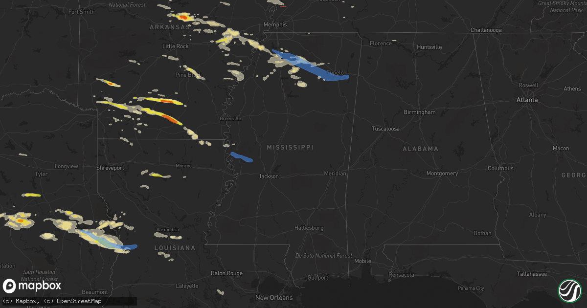
Hail Map in Mississippi on May 9, 2021
Get this storm
May 9 map
$229
one time, instant access
Download today. No call, no setup
Keep the $229
Bought the map and want the full workflow? Apply the entire $229 to a subscription within 7 days. None of it is wasted.
Every map, not just this one
This buys you this map. Subscription and you get every map we run, in the markets you choose from a few cities to whole states to nationwide. Plus real-time alerts the moment a storm fires.
Contact data
Name, contact info, occupancy, even credit band for addresses in the footprint. You go from where it hit to who to call.
Become the source they trust
Unlimited branding weather history reports on demand. You already have the documented answer ready for the property owner, and you are the one who showed up with it.
Property data and RoofTrace estimates
Pull up any address you have got, its value and the exact code rules for that jurisdiction, straight from One Click Code. Then RoofTrace estimates the squares, pitch, and roof value, priced the way you price.
Storm reports in Mississippi
Mississippi
| Date | Description |
|---|---|
| 05/09/20216:50 PM CDT | Trees down on power lines. |
| 05/09/20216:35 PM CDT | Trees and power lines down across abbeville. |
| 05/09/20216:02 PM CDT | Multiple trees down and 2 structures damaged in new town area mainly along rose road. |
| 05/09/20215:53 PM CDT | Numerous trees down and minor damage to home. |
| 05/09/20215:41 PM CDT | A large tree fell on house on kenny hill rd and hickory lane. |
| 05/09/20217:55 AM CDT | Numerous trees down in the evergreen area. |
| 05/09/20215:38 AM CDT | At 1036 PM CDT, a severe thunderstorm was located over Phoenix, or 18 miles northeast of Redwood, moving east at 40 mph. HAZARD...70 mph wind gusts and penny size hail. SOURCE...Radar indicated. IMPACT...Expect considerable tree damage. Damage is likely to mobile homes, roofs, and outbuildings. This severe thunderstorm will be near... Flora around 1055 PM CDT. Pocahontas around 1100 PM CDT. Annandale around 1105 PM CDT. Madison, Canton and Gluckstadt around 1115 PM CDT. Goshen Springs and Fannin around 1130 PM CDT. Pisgah around 1135 PM CDT. Leesburg around 1145 PM CDT. |
| 05/09/20215:16 AM CDT | At 1016 PM CDT, a severe thunderstorm was located near Midnight, or 13 miles southwest of Belzoni, moving northeast at 20 mph. HAZARD...60 mph wind gusts and penny size hail. SOURCE...Radar indicated. IMPACT...Expect damage to roofs, siding, and trees. This severe thunderstorm will be near... Midnight around 1020 PM CDT.Other locations impacted by this severe thunderstorm include Eden,Silver City and Louise. |
| 05/09/20215:12 AM CDT | At 1012 PM CDT, a severe thunderstorm was located 7 miles northeast of Valley Park, moving east at 40 mph. HAZARD...70 mph wind gusts and penny size hail. SOURCE...Radar indicated. IMPACT...Expect considerable tree damage. Damage is likely to mobile homes, roofs, and outbuildings. This severe thunderstorm will be near... Holly Bluff around 1015 PM CDT. Phoenix around 1035 PM CDT. Tinsley around 1040 PM CDT. Little Yazoo around 1050 PM CDT. Myrleville around 1055 PM CDT.Other locations impacted by this severe thunderstorm include Satartiaand Bentonia. |
| 05/09/20214:36 AM CDT | At 936 PM CDT, a severe thunderstorm was located 7 miles north of Phoenix, or 15 miles southwest of Yazoo City, moving northeast at 20 mph. HAZARD...60 mph wind gusts and quarter size hail. SOURCE...Radar indicated. IMPACT...Hail damage to vehicles is expected. Expect wind damage to roofs, siding, and trees. This severe thunderstorm will be near... Tinsley around 1000 PM CDT. Little Yazoo around 1010 PM CDT. Yazoo City around 1020 PM CDT. Myrleville around 1025 PM CDT. Benton around 1040 PM CDT.Other locations impacted by this severe thunderstorm include Satartiaand Bentonia. |
| 05/09/20213:21 AM CDT | At 820 PM CDT, severe thunderstorms were located along a line extending from 8 miles northwest of Caledonia to near Pala Alto, moving southeast at 40 mph. HAZARD...60 mph wind gusts and penny size hail. SOURCE...Radar indicated. IMPACT...Expect damage to roofs, siding, and trees. Severe thunderstorms will be near... Kolola Springs around 830 PM CDT. Caledonia around 835 PM CDT. Steens around 840 PM CDT. Columbus AFB and Bent Oak around 845 PM CDT. Columbus around 850 PM CDT. |
| 05/09/20212:59 AM CDT | At 759 PM CDT, severe thunderstorms were located along a line extending from near Evergreen to near Amory to near Aberdeen, moving southeast at 50 mph. HAZARD...60 mph wind gusts. SOURCE...Radar indicated. IMPACT...Expect damage to roofs, siding, and trees. Locations impacted include... Hamilton, Vernon, Sulligent, Detroit, Beaverton, Blooming Grove, Lamar County Airport, Weston, Crews, Bedford, Gattman, Henson Springs, Shottsville, Lamar County Public Lake, Rankin Fite Airport, Byrd, Pine Springs, Bexar, Marion County Public Lake and Pikeville. |
| 05/09/20212:57 AM CDT | At 756 PM CDT, severe thunderstorms were located along a line extending from 6 miles southwest of Okolona to 6 miles southeast of Pyland, moving southeast at 30 mph. HAZARD...60 mph wind gusts and penny size hail. SOURCE...Radar indicated. IMPACT...Expect damage to roofs, siding, and trees. Severe thunderstorms will be near... Montpelier around 815 PM CDT. Griffith and Pala Alto around 835 PM CDT. West Point around 850 PM CDT. Tibbee and Waverly around 900 PM CDT.Other locations impacted by these severe thunderstorms include Manteeand Walthall. |
| 05/09/20212:18 AM CDT | At 718 PM CDT, a severe thunderstorm was located 8 miles southeast of Velma, or 12 miles southeast of Water Valley, moving southeast at 45 mph. HAZARD...60 mph wind gusts and quarter size hail. SOURCE...Radar indicated. IMPACT...Hail damage to vehicles is expected. Expect wind damage to roofs, siding, and trees. Locations impacted include... Houston, Bruce, Calhoun City, Vardaman, Derma, Pittsboro, Pyland, Big Creek, Benwood, Bounds, Thorn, Pine Valley, Reid, Loyd, Ellard, Shepherd, Tabbville, Skuna, Atlanta and Tyson. |
| 05/09/20212:05 AM CDT | At 705 PM CDT, a severe thunderstorm was located near Pinedale, or 12 miles northwest of Pontotoc, moving southeast at 40 mph. HAZARD...60 mph wind gusts. SOURCE...Radar indicated. IMPACT...Expect damage to roofs, siding, and trees. Locations impacted include... Tupelo, New Albany, Pontotoc, Verona, Okolona, Trace State Park, Tombigbee State Park, Saltillo, Guntown, Shannon, Plantersville, Ecru, New Harmony, Randolph, Troy, Etta, Tula, Blair, Furrs and Denmark. |
| 05/09/20211:31 AM CDT | At 631 PM CDT, a severe thunderstorm was located near Harmontown, or 9 miles northwest of Holly Springs National Forest, moving southeast at 40 mph. HAZARD...70 mph wind gusts and quarter size hail. SOURCE...Radar indicated. IMPACT...Hail damage to vehicles is expected. Expect considerable tree damage. Wind damage is also likely to mobile homes, roofs, and outbuildings. Locations impacted include... Oxford, New Albany, Holly Springs National Forest, Ecru, Cambridge, Randolph, Bethlehem, Laws Hill, Etta, Springdale, Burgess, Banner, Tula, Denmark, Pinedale, Paris, Thaxton, Abbeville, Taylor and Toccopola. |
| 05/09/20211:01 AM CDT | At 601 PM CDT, a severe thunderstorm was located near Senatobia, moving southeast at 30 mph. HAZARD...60 mph wind gusts and quarter size hail. SOURCE...Radar indicated. IMPACT...Hail damage to vehicles is expected. Expect wind damage to roofs, siding, and trees. Locations impacted include... Oxford, Senatobia, Batesville, John W Kyle State Park, Sardis, Coldwater, Como, Crenshaw, Barr, Harmontown, Burgess, Independence, Laws Hill, Abbeville, Malone, Aiken, Crossroad, Tyro, Chulahoma and Glenville. |
| 05/09/202112:39 AM CDT | At 539 PM CDT, a severe thunderstorm was located over Little Texas, or 18 miles west of Senatobia, moving east at 35 mph. HAZARD...60 mph wind gusts and quarter size hail. SOURCE...Radar indicated. IMPACT...Hail damage to vehicles is expected. Expect wind damage to roofs, siding, and trees. Locations impacted include... Senatobia, Coldwater, Como, Tunica, Crenshaw, Sledge, Phillipp, Strayhorn, Pleasant Grove, Dubbs, North Tunica, Arkabutla, Little Texas, Askew, Gerlach Mill, Buxton, Savage, Austin, Prichard and Sarah. |
| 05/08/202111:50 PM CDT | At 450 PM CDT, a severe thunderstorm was located near Haynes, or near Palestine, moving southeast at 30 mph. HAZARD...60 mph wind gusts and quarter size hail. SOURCE...Radar indicated. IMPACT...Hail damage to vehicles is expected. Expect wind damage to roofs, siding, and trees. Locations impacted include... West Memphis, Forrest City, Marion, Wynne, Marianna, Hughes, Madison, Palestine, Village Creek State Park, Caldwell, Edmondson, Colt, Widener, Rondo, Aubrey, Anthonyville, Haynes, Jennette, Simsboro and Brickeys. |
| 05/08/202111:20 PM CDT | At 419 PM CDT, a severe thunderstorm was located near Hunter, or 12 miles north of Brinkley, moving southeast at 25 mph. HAZARD...60 mph wind gusts and quarter size hail. SOURCE...Radar indicated. IMPACT...Hail damage to vehicles is expected. Expect wind damage to roofs, siding, and trees. Locations impacted include... Forrest City, Marianna, Madison, Palestine, Village Creek State Park, Caldwell, Colt, Wheatley, Widener, Moro, Rondo, Aubrey, Haynes, Garret Grove, Brickeys, New Salem, New Home, Lagrange, Cody and Cottonwood Corner. |
| 05/08/202110:40 PM CDT | A few trees were downed in yazoo city. |
| 05/08/202110:20 PM CDT | A tree was blown down on a house. |
| 05/08/202110:10 PM CDT | Sheet metal was blown off a house along seven mile rd. |
| 05/08/202110:10 PM CDT | A couple of trees were blown down. |
| 05/08/202110:05 PM CDT | Social media picture of a tree down on a house at the intersection of hwy 61 and hwy 14 in rolling fork. |
| 05/08/202110:00 PM CDT | A couple of trees were blown down. |
| 05/08/20219:30 PM CDT | A couple of trees were blown down. |
| 05/08/20218:45 PM CDT | A tree was blown down at dewayne hayes campground. Report relayed via social media. |
| 05/08/20218:15 PM CDT | Tree fell on mobile home causing significant damage in the tilden community. |
| 05/08/20217:58 PM CDT | Tree snapped in half in amory. |
| 05/08/20217:55 PM CDT | Numerous trees down in the evergreen area. |
| 05/08/20217:47 PM CDT | Numerous trees down in the town on tishomingo. Additional trees down on cr 127 and cr 961 |
| 05/08/20217:45 PM CDT | Numerous trees down on highway 6 near rd 598. |
| 05/08/20217:42 PM CDT | Numerous trees down in the town on tishomingo. Additional trees down on cr 127 and cr 961 |
| 05/08/20217:32 PM CDT | Several trees down in town of belden. |
| 05/08/20217:25 PM CDT | Trees down on and across highway 336 in the thaxton area. |
| 05/08/20217:25 PM CDT | Trees down in tupelo. One report of fallen tree on house. |
| 05/08/20217:24 PM CDT | Trees down in troy. Time is radar estimated. |
| 05/08/20217:20 PM CDT | Numerous trees down in the ingomar community. |
| 05/08/20217:15 PM CDT | Large tree down in ecru. |
| 05/08/20217:15 PM CDT | Trees down and damage to a dog run on harmony loop. |
| 05/08/20217:05 PM CDT | Damage to roof and carport at home along highway 30. Numerous trees down. |
| 05/08/20217:00 PM CDT | Trees down in ingomar. |
All States Impacted by Hail Map on May 9, 2021
Cities Impacted by Hail Map on May 9, 2021
- Aurora, MO
- Caraway, AR
- Hampton, AR
- Banks, AR
- New Edinburg, AR
- Bearden, AR
- Chidester, AR
- Thornton, AR
- Camden, AR
- Warren, AR
- Fordyce, AR
- Grady, NM
- Stonewall, TX
- Hye, TX
- Willow City, TX
- Art, TX
- Blanco, TX
- Fredericksburg, TX
- Castell, TX
- Llano, TX
- Mason, TX
- Johnson City, TX
- Searcy, AR
- Labelle, FL
- Elkhart, TX
- Grapeland, TX
- Oakwood, TX
- Lepanto, AR
- Osceola, AR
- Brighton, TN
- Drummonds, TN
- Burlison, TN
- Wilson, AR
- Joiner, AR
- Dyess, AR
- Holly Grove, AR
- Pennington, TX
- Groveton, TX
- Blytheville, AR
- Como, MS
- Moro, AR
- McRae, AR
- Beebe, AR
- Aquilla, TX
- Mount Calm, TX
- Axtell, TX
- Waco, TX
- West, TX
- Deridder, LA
- Evans, LA
- Merryville, LA
- Sardis, MS
- San Augustine, TX
- Broaddus, TX
- Chireno, TX
- Nacogdoches, TX
- Water Valley, MS
- Punta Gorda, FL
- Crossett, AR
- Bastrop, LA
- Hamburg, AR
- Lufkin, TX
- Richland Springs, TX
- Gurdon, AR
- Bluff City, AR
- Prescott, AR
- Many, LA
- Stockton, MO
- Mullin, TX
- Rochelle, TX
- San Saba, TX
- Goldthwaite, TX
- Alamo, TN
- Lambert, MS
- Palestine, AR
- New Albany, MS
- Mount Holly, AR
- Centerville, TX
- Buffalo, TX
- Rose Bud, AR
- Mount Vernon, AR
- Romance, AR
- Enola, AR
- Sparkman, AR
- Florien, LA
- Murfreesboro, AR
- Nashville, AR
- Trezevant, TN
- McKenzie, TN
- Huntingdon, TN
- Sardis, TN
- Reagan, TN
- Mellwood, AR
- Elaine, AR
- Manila, AR
- Taylor, MS
- Oxford, MS
- Greenbrier, AR
- Damascus, AR
- Dierks, AR
- Delight, AR
- Jackson, TN
- Pollok, TX
- Stephens, AR
- Rosston, AR
- Brinkley, AR
- Goodwin, AR
- Wheatley, AR
- Hot Springs National Park, AR
- Blue Springs, MS
- Bronson, TX
- Pineland, TX
- Hemphill, TX
- White Hall, AR
- Ripley, TN
- Henning, TN
- Lockesburg, AR
- Bald Knob, AR
- Kensett, AR
- Judsonia, AR
- Higginson, AR
- McCrory, AR
- Guy, AR
- Quitman, AR
- Augusta, AR
- Jersey, AR
- Marianna, AR
- Hubbard, TX
- Dawson, TX
- Vincennes, IN
- Mexia, TX
- Groesbeck, TX
- Sherrill, AR
- Coolidge, TX
- Penelope, TX
- Brady, TX
- Fulton, AR
- Alexandria, LA
- Lecompte, LA
- Waldo, AR
- Willisville, AR
- Buckner, AR
- Burkeville, TX
- Tunica, MS
- Brickeys, AR
- Crockett, TX
- Hermitage, AR
- Huntington, TX
- Wiergate, TX
- Brookeland, TX
- Newton, TX
- Jasper, TX
- Zavalla, TX
- Killen, AL
- Rogersville, AL
- Griffithville, AR
- Coffeeville, MS
- Bruce, MS
- Banner, MS
- Forrest City, AR
- Batesville, MS
- Marks, MS
- Teague, TX
- Donie, TX
- Palestine, TX
- Jacksonville, TX
- Frankston, TX
- Coldwater, MS
- Jones, LA
- Jefferson, AR
- Houlka, MS
- Pontotoc, MS
- Kennard, TX
- Hope, AR
- Emmet, AR
- Alto, TX
- Wells, TX
- Austin, AR
- Cabot, AR
- Quitman, LA
- Duncan, MS
- Alligator, MS
- Clarksdale, MS
- Crumrod, AR
- Lake Providence, LA
- Marksville, LA
- Pineville, LA
- Marshall, AR
- Leachville, AR
- Halls, TN
- Luxora, AR
- Dell, AR
- Shongaloo, LA
- Ville Platte, LA
- Oakdale, LA
- Bonita, LA
- Newport, AR
- Hunter, AR
- Colt, AR
- Haynes, AR
- Sarah, MS
- Etta, MS
- Waterford, MS
- Thaxton, MS
- Robinsonville, MS
- Crenshaw, MS
- Cotton Plant, AR
- Abbeville, MS
- Clarendon, AR
- Senatobia, MS
- Biscoe, AR
- Humboldt, TN
- Bells, TN
- Clinton, AR
- Shirley, AR
- Milam, TX
- Leesville, LA
- Friona, TX
- Broadview, NM
- Logan, NM
- Mamou, LA
- Douglass, TX
- Mosquero, NM
- San Jon, NM
- Pierce City, MO
- Monett, MO
- Lexa, AR
- Magnolia, AR
- Emerson, AR
- Ashdown, AR
- Dyersburg, TN
- Finley, TN
- Goldonna, LA
- Saline, LA
- Courtland, MS
- Bethel Springs, TN
- Adamsville, TN
- Grady, AR
- Gleason, TN
- Redfield, AR
- Altheimer, AR
- Pine Bluff, AR
- Red Boiling Springs, TN
- Whitleyville, TN
- Purdon, TX
- Clifton, TX
- Abbott, TX
- China Spring, TX
- Valley Mills, TX
- Wortham, TX
- Ward, AR
- Caruthersville, MO
- Steele, MO
- Michigan City, MS
- El Paso, AR
- Jewett, TX
- Hext, TX
- Lake City, AR
- Garland City, AR
- Monroe, LA
- Hensley, AR
- Friendship, TN
- Kingsland, AR
- Lafayette, TN
- Saint Joe, AR
- Lyon, MS
- Saint Francisville, IL
- Hartsville, TN
- Saratoga, AR
- Washington, AR
- Columbus, AR
- Tichnor, AR
- Jacksonville, AR
- Voca, TX
- Bay, AR
- Trumann, AR
- Jonesboro, AR
- Etowah, AR
- Golden City, MO
- Lockwood, MO
- Lamar, MO
- Des Arc, AR
- Lonoke, AR
- Marvell, AR
- McNeil, AR
- Stamps, AR
- Anacoco, LA
- Elmer, LA
- Big Sandy, TN
- Bienville, LA
- Grand Saline, TX
- Fruitvale, TX
- Benton, AR
- Bryant, AR
- Bauxite, AR
- Zwolle, LA
- Hughes, AR
- Huron, TN
- Bonnerdale, AR
- Pearcy, AR
- Royal, AR
- Lewisville, AR
- Immokalee, FL
- Apple Springs, TX
- Lovelady, TX
- Bee Branch, AR
- Cleveland, AR
- Scotland, AR
- Center Ridge, AR
- Chatham, LA
- Eros, LA
- Jonesboro, LA
- Blue Eye, MO
- Lampe, MO
- Mabelvale, AR
- Little Rock, AR
- Sheridan, AR
- Mayersville, MS
- Hineston, LA
- Woodworth, LA
- Otis, LA
- Sieper, LA
- Oak Grove, LA
- Hessmer, LA
- Plaquemine, LA
- White Castle, LA
- Hornbeck, LA
- Sarepta, LA
- Taylor, AR
- Springhill, LA
- Munford, TN
- Randolph, MS
- Plantersville, MS
- Holly Springs, MS
- Tupelo, MS
- Fulton, MS
- Nettleton, MS
- Shannon, MS
- Belden, MS
- Ecru, MS
- Verona, MS
- Satartia, MS
- Valley Park, MS
- Bentonia, MS
- Rolling Fork, MS
- Rosepine, LA


