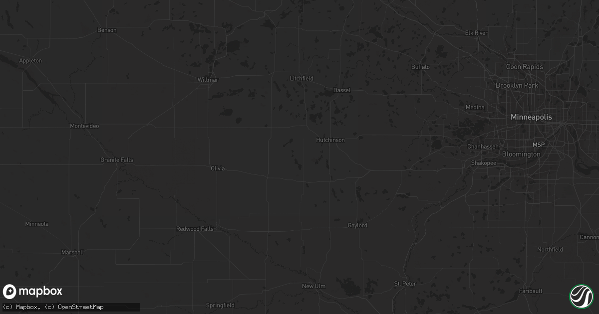
Hail Map in Brainerd, MN on May 9, 2011
Get this storm
May 9 map
$229
one time, instant access
Download today. No call, no setup
Keep the $229
Bought the map and want the full workflow? Apply the entire $229 to a subscription within 7 days. None of it is wasted.
Every map, not just this one
This buys you this map. Subscription and you get every map we run, in the markets you choose from a few cities to whole states to nationwide. Plus real-time alerts the moment a storm fires.
Contact data
Name, contact info, occupancy, even credit band for addresses in the footprint. You go from where it hit to who to call.
Become the source they trust
Unlimited branding weather history reports on demand. You already have the documented answer ready for the property owner, and you are the one who showed up with it.
Property data and RoofTrace estimates
Pull up any address you have got, its value and the exact code rules for that jurisdiction, straight from One Click Code. Then RoofTrace estimates the squares, pitch, and roof value, priced the way you price.
Storm reports in Brainerd, MN
Brainerd, MN
| Date | Description |
|---|---|
| 05/09/20115:38 AM CDT | Citizen brought some hail stones into the brainerd dispatch office...which were measured to be 2.5 inches in diameter after having been in a freezer in the morning. Ori |
| 05/09/20115:35 AM CDT | Golf ball size hail damaged a skylight and roofs near county road 130 in the daggett brook township. |
All States Impacted by Hail Map on May 9, 2011
All Cities Impacted by Hail Map on May 9, 2011
- Leonard, ND
- Douglas, WY
- Dawson, ND
- Tappen, ND
- Bowdon, ND
- Steele, ND
- Sterling, ND
- Woodworth, ND
- Pettibone, ND
- Sykeston, ND
- Robinson, ND
- Driscoll, ND
- Twin Valley, MN
- Mahnomen, MN
- Fort Yates, ND
- Linton, ND
- Solen, ND
- Rushville, NE
- Wakpala, SD
- Hazelton, ND
- Mandan, ND
- Wilton, ND
- McLaughlin, SD
- Trail City, SD
- Stephenson, MI
- Wausaukee, WI
- Marsland, NE
- Harrison, NE
- Chadron, NE
- Whitney, NE
- Crawford, NE
- Hemingford, NE
- Eau Claire, WI
- Bemidji, MN
- Shevlin, MN
- Bagley, MN
- Jay Em, WY
- Quinn, SD
- Hermosa, SD
- Mapleton, ND
- Harwood, ND
- Fargo, ND
- West Fargo, ND
- Buffalo Gap, SD
- Fort Ripley, MN
- Pierz, MN
- Brainerd, MN
- Union Center, SD
- Mud Butte, SD
- Lake Ozark, MO
- Eldon, MO
- Rocky Mount, MO
- Davenport, ND
- Felton, MN
- Moorhead, MN
- Waubun, MN
- Borup, MN
- Argusville, ND
- Georgetown, MN
- Ulen, MN
- Glyndon, MN
- Newcastle, WY
- Glendo, WY
- Wing, ND
- Oakes, ND
- Cogswell, ND
- Walker, SD
- Midland, SD
- New Auburn, WI
- Wellman, IA
- Parnell, IA
- Wheatland, WY
- Groton, SD
- Philip, SD
- Saint Thomas, MO
- Eugene, MO
- Tuscumbia, MO
- Saint Elizabeth, MO
- Jefferson City, MO
- Meta, MO
- Koeltztown, MO
- Westphalia, MO
- Henley, MO
- Freeburg, MO
- Newell, SD
- Gordon, NE
- New London, IA
- New Salem, ND
- Stanton, ND
- Hillman, MN
- Frederick, SD
- Lusk, WY
- Manville, WY
- Wall, SD
- Mountain, WI
- Shawnee, WY
- Hartville, WY
- Wheeler, WI
- Archbold, OH
- Wauseon, OH
- Hay Springs, NE
- Pine Ridge, SD
- Oglala, SD
- Bullhead, SD
- Selfridge, ND
- New Town, ND
- White Owl, SD
- Lance Creek, WY
- Fairburn, SD
- Torrington, WY
- Carey, OH
- Upper Sandusky, OH
- Royalton, MN
- Juda, WI
- Homer, MI
- Albion, MI
- Spring Arbor, MI
- Concord, MI
- Horton, MI
- Jackson, MI
- Watford City, ND
- Dupree, SD
- Waldron, MI
- Pittsford, MI
- Hudson, MI
- Morenci, MI
- Martin, SD
- Wilson, WI
- Knapp, WI
- Little Falls, MN
- Garrison, MN
- Faith, SD
- Howes, SD
- Wharton, OH
- Wanblee, SD
- Porcupine, SD
- Kyle, SD
- Manderson, SD
- Milesville, SD
- Braddock, ND
- Enning, SD
- Central City, IA
- Baldwin, ND
- Homestead, IA
- Oxford, IA
- Amana, IA
- New Underwood, SD
- Guernsey, WY
- Strasburg, ND
- Swisher, IA
- Chetek, WI
- Daggett, MI
- Carney, MI
- Morning Sun, IA
- Wapello, IA
- Winfield, IA
- Columbus Junction, IA
- Scenic, SD
- Woodville, WI
- Moffit, ND
- Timber Lake, SD
- Bismarck, ND
- Brodhead, WI
- Maddock, ND
- Carrington, ND
- Center, ND
- Meadow, SD
- Regan, ND
- Caputa, SD
- Bison, SD
- Kadoka, SD
- Isabel, SD
- Elk Mound, WI
- Menomonie, WI
- Cherry Creek, SD
- Napoleon, ND
- Menoken, ND
- Byron, MN
- Washington, IA
- Williamsburg, IA
- Naytahwaush, MN
- Oberon, ND
- Lake Mills, IA
- Scarville, IA
- Medina, ND
- Wayland, IA
- Danville, IA
- Ridgeland, WI
- Kaiser, MO
- Liberty Center, OH
- Napoleon, OH
- Mount Union, IA
- Yarmouth, IA
- Oelrichs, SD
- Interior, SD
- Van Tassell, WY
- Cannon Ball, ND
- Hill City, SD
- Sperry, IA
- Leland, IA
- Marion, IA
- Fosston, MN
- Blackduck, MN
- Hines, MN
- Mondovi, WI
- Laporte, MN


