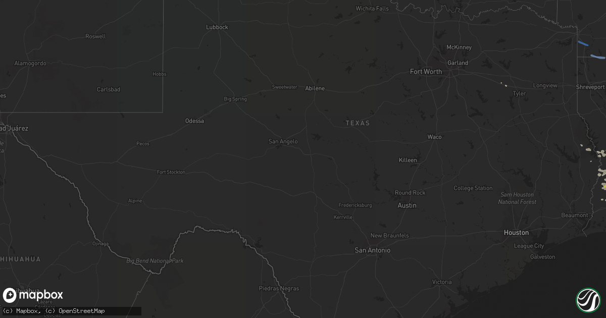
Hail Map in Texas on May 8, 2020
Get this storm
May 8 map
$229
one time, instant access
Download today. No call, no setup
Keep the $229
Bought the map and want the full workflow? Apply the entire $229 to a subscription within 7 days. None of it is wasted.
Every map, not just this one
This buys you this map. Subscription and you get every map we run, in the markets you choose from a few cities to whole states to nationwide. Plus real-time alerts the moment a storm fires.
Contact data
Name, contact info, occupancy, even credit band for addresses in the footprint. You go from where it hit to who to call.
Become the source they trust
Unlimited branding weather history reports on demand. You already have the documented answer ready for the property owner, and you are the one who showed up with it.
Property data and RoofTrace estimates
Pull up any address you have got, its value and the exact code rules for that jurisdiction, straight from One Click Code. Then RoofTrace estimates the squares, pitch, and roof value, priced the way you price.
Storm reports in Texas
Texas
| Date | Description |
|---|---|
| 05/08/20209:30 AM CDT | Trees reported down all over county on fm 225... Fm 1798... Co rd 4137... State hwy 43e... Fm 95... State hwy 315... Co rd 368e... Co rd 4255... Fm 2011... And 5081... |
| 05/08/20205:49 AM CDT | At 1047 PM CDT, a severe thunderstorm was located over Alamo, moving east at 40 mph. HAZARD...70 mph wind gusts and ping pong ball size hail. SOURCE...Radar indicated. IMPACT...People and animals outdoors will be injured. Expect hail damage to roofs, siding, windows, and vehicles. Expect considerable tree damage. Wind damage is also likely to mobile homes, roofs, and outbuildings. Locations impacted include... Edinburg, Mission, Pharr, Harlingen, Weslaco, San Juan, Alamo, Donna, Mercedes, Santa Rosa, McAllen, La Joya, Elsa, Edcouch, and Hidalgo.This includes the following highways... US Highway 83 between mile markers 846 and 850. Interstate Highway 69 E between mile markers 21 and 39. Interstate Highway 69 C between mile markers 1 and 11. US Highway 281 between mile markers 784 and 826. |
| 05/08/20205:41 AM CDT | At 1040 PM CDT, a severe thunderstorm was located 9 miles south of Santa Catarina, or 10 miles west of Mccook. This storm was nearly stationary. HAZARD...60 mph wind gusts and half dollar size hail. SOURCE...Radar indicated. IMPACT...Hail damage to vehicles is expected. Expect wind damage to roofs, siding, and trees. This severe thunderstorm will remain over mainly rural areas of east central Starr County. |
| 05/08/20205:35 AM CDT | At 1035 PM CDT, a severe thunderstorm was located near Citrus City, or near Mccook, moving east at 20 mph. HAZARD...Golf ball size hail and 60 mph wind gusts. SOURCE...Radar indicated. IMPACT...People and animals outdoors will be injured. Expect hail damage to roofs, siding, windows, and vehicles. Expect wind damage to roofs, siding, and trees. Locations impacted include... Mccook, Faysville, Edinburg South Texas International Airport Edinburg South Texas International Airport, Red Gate, Doolittle and Mcallen.This includes the following highways... Interstate Highway 69 C near mile marker 12. US Highway 281 between mile markers 762 and 764. |
| 05/08/20205:12 AM CDT | At 1011 PM CDT, a severe thunderstorm was located over Lorenzo De Zavala Middle School, or near La Joya, moving east at 40 mph. HAZARD...60 mph wind gusts. SOURCE...Radar indicated. IMPACT...Expect damage to roofs, siding, and trees. Locations impacted include... Edinburg, Mission, Pharr, San Juan, Alamo, Hidalgo, Palmview, Penitas, Sullivan City, McAllen, Pharr, and La Joya.This includes the following highways... US Highway 83 between mile markers 840 and 850. Interstate Highway 69 C between mile markers 1 and 12. US Highway 281 between mile markers 784 and 794. |
| 05/08/20205:00 AM CDT | At 1000 PM CDT, a severe thunderstorm was located over Santa Catarina, or 14 miles east of Viboras, moving south at 20 mph. HAZARD...Two inch hail and 60 mph wind gusts. SOURCE...Radar indicated. IMPACT...People and animals outdoors will be injured. Expect hail damage to roofs, siding, windows, and vehicles. Expect wind damage to roofs, siding, and trees. Locations impacted include... La Gloria, Santa Elena, Santa Catarina and Diamond O Ranch Airport. |
| 05/08/20204:34 AM CDT | At 934 PM CDT, a severe thunderstorm was located near Agua Nueva, moving southwest at 10 mph. HAZARD...60 mph wind gusts and quarter size hail. SOURCE...Radar indicated. IMPACT...Hail damage to vehicles is expected. Expect wind damage to roofs, siding, and trees. Locations impacted include... Viboras and Agua Nueva. |
| 05/08/20203:41 AM CDT | At 840 PM CDT, a severe thunderstorm was located near New Falcon, or 7 miles southeast of Lopeno, moving west at 20 mph. HAZARD...Golf ball size hail and 60 mph wind gusts. SOURCE...Radar indicated. IMPACT...People and animals outdoors will be injured. Expect hail damage to roofs, siding, windows, and vehicles. Expect wind damage to roofs, siding, and trees. Locations impacted include... Lopeno, Falcon Heights, New Falcon, Falcon State Park, Falcon Dam and Salineno.This includes US Highway 83 between mile markers 784 and 798. |
| 05/08/20203:36 AM CDT | At 836 PM CDT, a severe thunderstorm was located near Guerra, or 14 miles east of Bustamante, moving southwest at 10 mph. HAZARD...60 mph wind gusts and half dollar size hail. SOURCE...Radar indicated. IMPACT...Hail damage to vehicles is expected. Expect wind damage to roofs, siding, and trees. Locations impacted include... Guerra. |
| 05/08/20203:10 AM CDT | At 809 PM CDT, a severe thunderstorm was located near Viboras, moving southwest at 15 mph. HAZARD...60 mph wind gusts and half dollar size hail. SOURCE...Radar indicated. IMPACT...Hail damage to vehicles is expected. Expect wind damage to roofs, siding, and trees. Locations impacted include... Viboras and El Sauz. |
| 05/08/202012:53 AM CDT | At 553 PM CDT, a severe thunderstorm was located near Bruni, or 17 miles northwest of Hebbronville, moving south at 10 mph. HAZARD...60 mph wind gusts and quarter size hail. SOURCE...Radar indicated. IMPACT...Hail damage to vehicles is expected. Expect wind damage to roofs, siding, and trees. Locations impacted include... Oilton, Bruni and Mirando City. |
| 05/08/202012:46 AM CDT | At 545 AM CDT, severe thunderstorms were located along a line extending from near Macedonia to 6 miles southwest of Emerson to near Shongaloo to near Benton to near Blanchard to 6 miles southwest of Mooringsport, moving southeast at 55 mph. HAZARD...60 mph wind gusts and penny size hail. SOURCE...Radar indicated. IMPACT...Expect damage to roofs, siding, and trees. Locations impacted include... Shreveport, Bossier City, Minden, Homer, Junction City, Haughton, Greenwood, Arcadia, Blanchard, Haynesville, Benton, Stonewall, Bernice, Ringgold, Sibley, Cotton Valley, Gibsland, Doyline, Mooringsport and Emerson. |
| 05/08/202012:11 AM CDT | At 511 AM CDT, severe thunderstorms were located along a line extending from near Brightstar to near McLeod to near Lone Star, moving south at 35 mph. HAZARD...60 mph wind gusts and quarter size hail. SOURCE...Radar indicated. IMPACT...Hail damage to vehicles is expected. Expect wind damage to roofs, siding, and trees. Locations impacted include... Shreveport, Marshall, Springhill, Vivian, Blanchard, Waskom, Jefferson, Linden, Benton, Hughes Springs, Cullen, Plain Dealing, Oil City, Sarepta, Mooringsport, Bradley, Hosston, Rodessa, Belcher and Ida. |
| 05/07/202011:51 PM CDT | At 450 AM CDT, severe thunderstorms were located along a line extending from near Mount Vernon to near Mount Pleasant to Omaha, moving south at 55 mph. HAZARD...60 mph wind gusts and quarter size hail. SOURCE...Radar indicated. IMPACT...Hail damage to vehicles is expected. Expect wind damage to roofs, siding, and trees. Locations impacted include... Mount Pleasant, Gilmer, Pittsburg, Winnsboro, Leesburg, Mount Vernon, Daingerfield, Hughes Springs, Lone Star, Ore City, Omaha, Cason, Cookville, Scroggins, Rocky Branch, Diana, Rosewood, Jenkins, Newsome and Purley. |
| 05/07/202011:46 PM CDT | At 446 AM CDT, severe thunderstorms were located along a line extending from near Genoa to 8 miles south of Maud to near Naples, moving southeast at 70 mph. HAZARD...60 mph wind gusts and quarter size hail. SOURCE...Radar indicated. IMPACT...Hail damage to vehicles is expected. Expect wind damage to roofs, siding, and trees. Locations impacted include... Atlanta, Vivian, Linden, Hughes Springs, Queen City, Naples, Omaha, Plain Dealing, Fouke, Bradley, Hosston, Rodessa, Ida, Bivins, Rocky Branch, Ravanna, McLeod, Brightstar, Kildare and Fairview. |
| 05/07/202011:37 PM CDT | At 436 AM CDT, severe thunderstorms were located along a line extending from near Umpire to near Ben Lomond to near Ogden to near Redwater, moving east at 75 mph. HAZARD...60 mph wind gusts and quarter size hail. SOURCE...Radar indicated. IMPACT...Hail damage to vehicles is expected. Expect wind damage to roofs, siding, and trees. Locations impacted include... Texarkana, Magnolia, Hope, Wake Village, Ashdown, Nashville, Prescott, Stamps, Waldo, Lewisville, Mineral Springs, Dierks, McNeil, Umpire, Nash, Red Lick, Fouke, Taylor, Emmet and Wilton. |
| 05/07/202011:25 PM CDT | Power pole down near intersection of florida ave and morland dr in mercedes. |
| 05/07/202011:09 PM CDT | Downed power lines in pharr. |
| 05/07/202010:58 PM CDT | At 358 AM CDT, a severe thunderstorm was located near Clarksville, moving southeast at 60 mph. HAZARD...60 mph wind gusts and quarter size hail. SOURCE...Radar indicated. IMPACT...Hail damage to vehicles is expected. Expect wind damage to roofs, siding, and trees. Locations impacted include... Mount Pleasant, Pittsburg, Winnsboro, Clarksville, Leesburg, Hagansport, Boxelder, Mount Vernon, Daingerfield, Hughes Springs, Naples, Bogata, Omaha, Cason, Us 259 And I 30 Intersection, Cookville, Scroggins, Rocky Branch, Wilkerson and Jenkins. |
| 05/07/202010:55 PM CDT | Downed trees at lark ave and n 23rd st. Time estimated via radar. |
| 05/07/202010:49 PM CDT | Power lines/poles down. Time estimated via radar. |
| 05/07/202010:48 PM CDT | Down tree covering roadway. |
| 05/07/202010:46 PM CDT | Golf ball size hail reported to the northwest of mcallen via mping report and a social media report. |
| 05/07/202010:45 PM CDT | Quarter size hail east-northeast of mission. |
| 05/07/202010:43 PM CDT | Picture of estimated quarter size hail northwest of mcallen. Time estimated via radar. |
| 05/07/202010:39 PM CDT | Pictures received via social media. Time and location estimated based on radar. |
| 05/07/202010:31 PM CDT | Reported downed trees on house |
| 05/07/202010:30 PM CDT | Mission pd reports multiple trees and power lines down across the city of mission. |
| 05/07/202010:28 PM CDT | Downed powerlines. |
| 05/07/202010:02 PM CDT | Mesquite tree down blocking fm 755 near the intersection of fm 2294 in starr county. Time estimated via radar. |
| 05/07/202010:00 PM CDT | Portions of a tin roof peeled back on a newer model manufactured home near the intersection of fm 755 and fm 2294. |
| 05/07/20209:57 PM CDT | At 256 AM CDT, severe thunderstorms were located along a line extending from 5 miles north of Lone Grove to Healdton to 3 miles west of Wilson, moving southeast at 40 mph. HAZARD...60 mph wind gusts and quarter size hail. SOURCE...Radar indicated. IMPACT...Hail damage to vehicles is expected. Expect wind damage to roofs, siding, and trees. Locations impacted include... Ardmore, Madill, Marietta, Lone Grove, Healdton, Wilson, Kingston, Dickson, Springer, Thackerville, Overbrook, Rubottom, Woodville, Lake Murray, Burneyville, Lebanon, Willis, Lake Texoma and Oakland. |
| 05/07/20209:53 PM CDT | Tree blocking roadway to the north of la gloria near highway 755. Time estimated via radar. |
| 05/07/20209:17 PM CDT | At 217 PM CDT, a severe thunderstorm was located over Singer, moving southeast at 35 mph. HAZARD...60 mph wind gusts and quarter size hail. SOURCE...Radar indicated. IMPACT...Hail damage to vehicles is expected. Expect wind damage to roofs, siding, and trees. Locations impacted include... Singer, Fields, De Quincy, Ragley, Longville, Bivens, Bancroft and Oretta. |
Cities Impacted by Hail Map on May 8, 2020
- Leesville, LA
- Slagle, LA
- Hidalgo, TX
- Mcallen, TX
- Pharr, TX
- Rio Grande City, TX
- Reeves, LA
- Penitas, TX
- Mission, TX
- Edinburg, TX
- Garciasville, TX
- Grulla, TX
- Hebbronville, TX
- Santa Elena, TX
- Zapata, TX
- Roma, TX
- Dry Creek, LA
- Kinder, LA
- Mittie, LA
- Pitkin, LA
- Guerra, TX
- Glenmora, LA
- Oakdale, LA
- Fort Polk, LA
- New Llano, LA
- Opelousas, LA
- Linn, TX
- Wiergate, TX
- Longville, LA
- Ragley, LA
- Van, TX
- Merryville, LA
- Burkeville, TX
- San Juan, TX
- Alamo, TX
- Deridder, LA
- Hemphill, TX
- Anacoco, LA
- Iowa, LA
- Elizabeth, LA
- Ville Platte, LA
- Grand Chenier, LA
- Dequincy, LA
- Creole, LA
- Sulphur, LA
- La Joya, TX
- Lake Charles, LA
- Hornbeck, LA
- Evans, LA
- Westlake, LA
- Welsh, LA
- Jennings, LA
- Lindale, TX
- Singer, LA
- Washington, LA
- Sugartown, LA
- Florien, LA
- Sullivan City, TX
- Donna, TX
- Texarkana, AR
- Fouke, AR
- Springhill, LA
- Bradley, AR
- Plain Dealing, LA
- Minden, LA
- Dubberly, LA
- Sibley, LA
- Eros, LA
- Ruston, LA
- Choudrant, LA
- Simsboro, LA
- Quitman, LA
- Columbia, LA
- Chatham, LA
- Bell City, LA
- Cameron, LA
- Lake Arthur, LA
- Gueydan, LA
- Kaplan, LA


