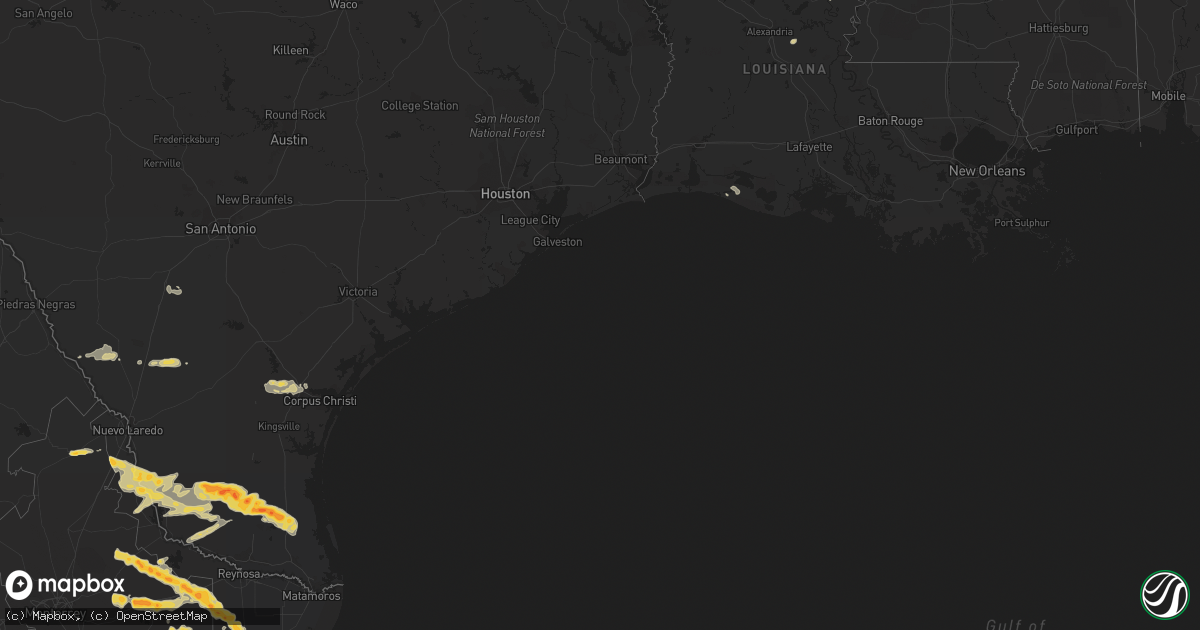
Hail Map on May 8, 2012
Get this storm
May 8 map
$229
one time, instant access
Download today. No call, no setup
Keep the $229
Bought the map and want the full workflow? Apply the entire $229 to a subscription within 7 days. None of it is wasted.
Every map, not just this one
This buys you this map. Subscription and you get every map we run, in the markets you choose from a few cities to whole states to nationwide. Plus real-time alerts the moment a storm fires.
Contact data
Name, contact info, occupancy, even credit band for addresses in the footprint. You go from where it hit to who to call.
Become the source they trust
Unlimited branding weather history reports on demand. You already have the documented answer ready for the property owner, and you are the one who showed up with it.
Property data and RoofTrace estimates
Pull up any address you have got, its value and the exact code rules for that jurisdiction, straight from One Click Code. Then RoofTrace estimates the squares, pitch, and roof value, priced the way you price.
States Impacted by Hail Map on May 8, 2012
Storm reports
Texas
| Date | Description |
|---|---|
| 05/08/20126:05 PM CDT | Willacy county emergency manager reports 50 to 60 mph winds occurred in raymondville. |
| 05/08/20125:10 PM CDT | *** 1 inj *** semi trailer blown over on us 281 6 miles north of tx hwy 186. |
| 05/08/20125:10 PM CDT | Constable reported home lost numerous shigles... One window blown out... Large mesquite and ebony tree branches snapped |
| 05/08/20123:26 PM CDT | Wind gusts estimated 60 to 65 mph at lincoln and 5th street. |
| 05/08/20123:23 PM CDT | Quarter size hail reported at lincoln and 5th street. |
| 05/08/20122:52 PM CDT | A local report indicates 1.00 inch wind near 4 N ROBSTOWN |
| 05/08/20122:22 PM CDT | Trees down at west lake subdivision. |
| 05/08/20122:19 PM CDT | 20 ft tall well secured tv antenna blown down. |
| 05/08/20121:56 PM CDT | Telephone poles snapped along with trees down in orange grove. Also poles and trees down near orange grove high school. |
| 05/08/20121:56 PM CDT | Nws survey concluded that a downburst of straight-line occurred just south of orange grove near intersection of hwy 359 and cr 374. Winds were estimated at 70-80 mph. D |
| 05/08/20121:03 PM CDT | Several trees down around 4 inches in diameter at 4th and flores streets in zapata. |
| 05/08/201212:38 PM CDT | Three to four homes with roof damage in san ygnacio as well as one mobile home destroyed. |
| 05/08/201212:35 PM CDT | A local report indicates 62 MPH wind near ZAPATA |
Mississippi
| Date | Description |
|---|---|
| 05/08/20124:15 PM CDT | Quarter to half dollar size hail south of duck hill |
| 05/08/20123:55 PM CDT | Trees were blown down along two county roads near the county border |
New Mexico
| Date | Description |
|---|---|
| 05/08/20122:50 PM CDT | A local report indicates 1.75 inch wind near CABALLO |
Alabama
| Date | Description |
|---|---|
| 05/08/20121:15 PM CDT | A couple trees and power lines down near intersection of cr 209 and cr 210. |
| 05/07/20128:30 PM CDT | Tree down at the 3900 block of mcgee rd. Winds estimated at 40 to 50 mph. |
| 05/07/20128:30 PM CDT | Tree down at martin rd and union chapel rd. Winds estimated at 40 to 50 mph. |
Florida
| Date | Description |
|---|---|
| 05/08/20126:25 PM CDT | The interlachen fire department reported wind gusts estimated at 50 to 60 mph. The time given was based on radar. |
| 05/08/20126:05 PM CDT | A convenient store along u.s. Highway 315 reported that there were numerous tree limbs down. The time given was based on radar. |
| 05/08/20121:45 PM CDT | Media reported several tree branches were snapped and two light poles were bent/knocked down...near the intersection of indian creek parkway and maplewood drive. Damage |
| 05/08/20121:05 PM CDT | A wind gust of 59 kts...or 68 mph...was reported by a mesonet site at sun life stadium. This mesonet site is located on top of the stadium...at an esimated height of ab |
Cities Impacted by Hail Map on May 8, 2012
- Rincon, NM
- Las Cruces, NM
- Encinal, TX
- Armstrong, TX
- Linn, TX
- Stewart, MS
- Eupora, MS
- Zapata, TX
- Garciasville, TX
- Lyford, TX
- Rio Grande City, TX
- San Ygnacio, TX
- Edinburg, TX
- San Perlita, TX
- San Isidro, TX
- Santa Elena, TX
- Hebbronville, TX
- Encino, TX
- Guerra, TX
- Roma, TX
- Raymondville, TX
- Orange Grove, TX
- Robstown, TX
- Sandia, TX
- Mathis, TX
- Salem, NM
- Hatch, NM
- Garfield, NM
- Amory, MS
- Cotulla, TX
- Winnsboro, LA
- Corpus Christi, TX
- Marathon, TX
- Caballo, NM
- Odem, TX
- Balmorhea, TX
- Fort Stockton, TX
- McCool, MS
- Ethel, MS
- McCarley, MS
- Williamsburg, NM
- Asherton, TX
- Deming, NM
- Charleston, MS
- Oakland, MS
- Greenwood, MS
- Winter Garden, FL
- Socorro, NM
- Hawthorne, FL
- Fort McCoy, FL
- Interlachen, FL
- Citra, FL
- Jonesville, LA
- Port Saint Lucie, FL
- Datil, NM
- Dryden, TX
- Holloman Air Force Base, NM
- Pineville, LA
- Laredo, TX
- Winona, MS
- Pearsall, TX
- Carrollton, MS
- Homestead, FL
- Miami, FL
- Houston, MS
- North Palm Beach, FL
- Fort Davis, TX
- Alamogordo, NM
- Effie, LA
- Sallis, MS
- Jupiter, FL
- Palm Beach Gardens, FL
- Alice, TX
- Duck Hill, MS
- Port Gibson, MS
- Hermanville, MS
- Grand Chenier, LA
- Hollywood, FL