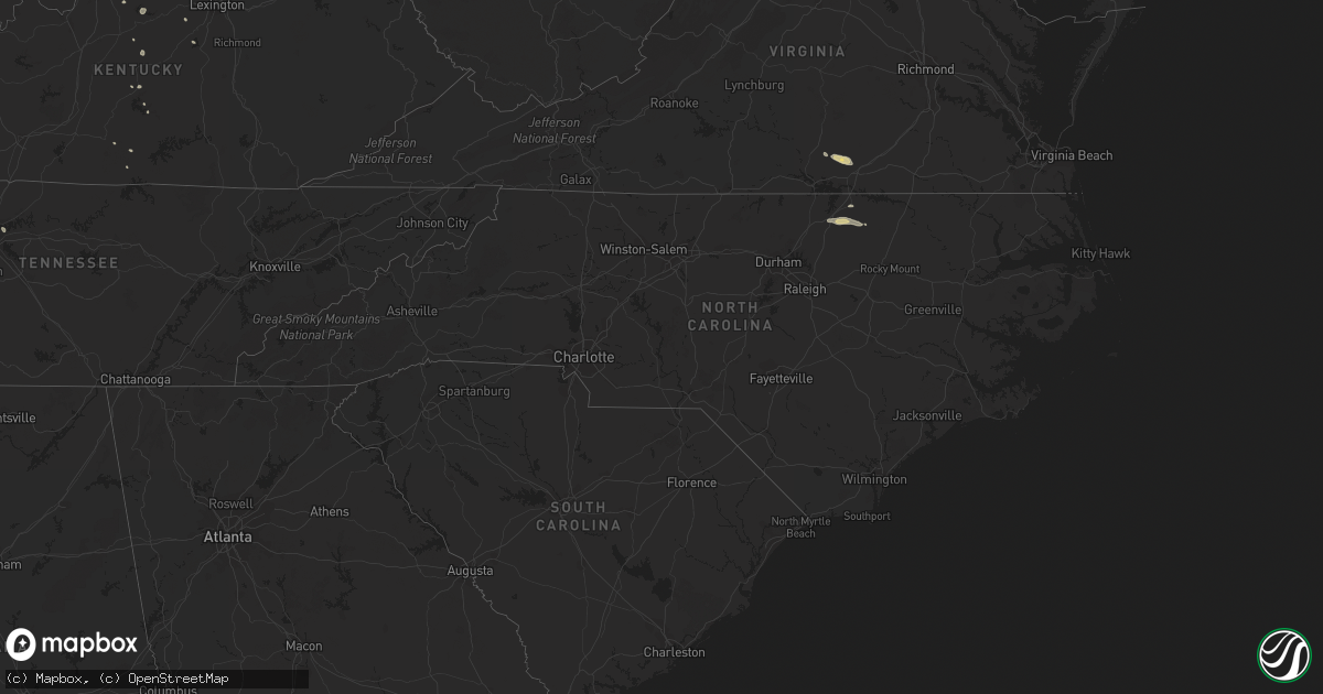
Hail Map in North Carolina on May 6, 2018
Get this storm
May 6 map
$229
one time, instant access
Download today. No call, no setup
Keep the $229
Bought the map and want the full workflow? Apply the entire $229 to a subscription within 7 days. None of it is wasted.
Every map, not just this one
This buys you this map. Subscription and you get every map we run, in the markets you choose from a few cities to whole states to nationwide. Plus real-time alerts the moment a storm fires.
Contact data
Name, contact info, occupancy, even credit band for addresses in the footprint. You go from where it hit to who to call.
Become the source they trust
Unlimited branding weather history reports on demand. You already have the documented answer ready for the property owner, and you are the one who showed up with it.
Property data and RoofTrace estimates
Pull up any address you have got, its value and the exact code rules for that jurisdiction, straight from One Click Code. Then RoofTrace estimates the squares, pitch, and roof value, priced the way you price.
Storm reports in North Carolina
North Carolina
| Date | Description |
|---|---|
| 05/06/20186:35 PM CDT | Large tree and power lines down at 2600 lawson chapel church rd.... Near dirgie mine rd. |
| 05/06/20184:33 PM CDT | Tree down across gainey dr. |
| 05/06/20184:18 PM CDT | Tree down on intersection of sand pit rd and bynums bridge rd. |
| 05/06/20184:15 PM CDT | One tree down at sand pit rd. And bynums bridge rd. |
| 05/06/20183:59 PM CDT | Tree and power lines down. |
| 05/06/20183:32 PM CDT | At least a couple of trees reported down in the 700 and 800 blocks of old school rd.... Including one on a house at 777 old school rd. |
| 05/06/20183:27 PM CDT | One tree reported down in the 800 block of old school rd. |
| 05/06/20183:19 PM CDT | One tree down on highway 43 in essex. |
| 05/06/20183:19 PM CDT | Tree down on the intersection of justice branch rd and roper springs rd. |
| 05/06/20182:49 PM CDT | Two trees down on sulphur springs road. |
| 05/06/20182:47 PM CDT | Tree down across vicksboro road. |
| 05/06/20182:44 PM CDT | Tree down on branch lane. |
| 05/06/20182:39 PM CDT | Tree down near the intersection of faulkner town rd and weldons mill rd. |
| 05/06/20182:36 PM CDT | Tree down at the intersection of granite st and hargrove st in henderson. |
| 05/06/20182:34 PM CDT | Two trees down in yards on coleman place in henderson. |
| 05/06/20182:26 PM CDT | Tree down on parrott rd. |
| 05/06/20184:36 AM CDT | At 935 PM EDT, severe thunderstorms were located along a line extending from near Purdy to Barley, moving east at 25 mph. HAZARD...60 mph wind gusts and penny size hail. SOURCE...Radar indicated. IMPACT...Expect damage to trees and powerlines. Severe thunderstorms will be near, Radium around 940 PM EDT. Purdy around 945 PM EDT. Jarratt around 1000 PM EDT. Dahlia around 1005 PM EDT. Claresville and Green Plain around 1015 PM EDT. Other locations impacted by these severe thunderstorms include AdamsGrove, Grizzard, Bufford Crossroads, Lanes Corner, Yale, PleasantShade, Slates Corner, Bryants Corner, Emporia Reservoir and Hilda. |
| 05/06/20183:05 AM CDT | At 804 PM EDT, severe thunderstorms were located along a line extending from near Lunenburg to near Clarksville, moving east at 20 mph. HAZARD...60 mph wind gusts and quarter size hail. SOURCE...Radar indicated. IMPACT...Minor damage to vehicles is possible. Expect wind damage to trees and powerlines. Locations impacted include... South Hill, Lawrenceville, Brodnax, La Crosse, Boydton, Alberta, Gasburg, Ebony, Dundas, Bacons Fork, Cochran, Wilburn, Beechwood, Gills Corner, Bowens Corner, Finchley, Meredithville, Forksville, Rogers Corner and Bracey. |
| 05/06/201812:47 AM CDT | At 546 PM EDT, a severe thunderstorm was located near Goldsboro, moving east at 25 mph. HAZARD...60 mph wind gusts and quarter size hail. SOURCE...Radar indicated. IMPACT...Hail damage to vehicles is expected. Expect wind damage to roofs, siding, and trees. Locations impacted include... Goldsboro, Walnut Creek, Pikeville, Seven Springs, Mar-Mac, Brogden, Cliffs Of The Neuse State Park and Elroy. |
| 05/05/201811:59 PM CDT | At 458 PM EDT, a severe thunderstorm was located 10 miles south of Smithfield, moving east at 35 mph. HAZARD...Quarter size hail. SOURCE...Radar indicated. IMPACT...Damage to crops and possibly vehicles is expected. Locations impacted include... Goldsboro, Walnut Creek, Princeton, Pikeville, Mar-Mac, Brogden, Elroy and Grantham. |
| 05/05/201811:24 PM CDT | At 424 PM EDT, severe thunderstorms were located along a line extending from near Littleton to 14 miles west of Halifax to 10 miles east of Louisburg, moving east at 35 mph. HAZARD...60 mph wind gusts and quarter size hail. SOURCE...Radar indicated. IMPACT...Hail damage to vehicles is expected. Expect wind damage to roofs, siding, and trees. Locations impacted include... Roanoke Rapids, Halifax, Scotland Neck, Dortches, Littleton, Red Oak, Enfield, Weldon, Whitakers and Hobgood. |
| 05/05/20188:54 PM CDT | At 153 PM EDT, a severe thunderstorm was located near Kernersville, or 7 miles west of Greensboro, moving east at 20 mph. HAZARD...60 mph wind gusts and quarter size hail. SOURCE...Radar indicated. IMPACT...Hail damage to vehicles is expected. Expect wind damage to roofs, siding, and trees. Locations impacted include... Greensboro, McLeansville, Forest Oaks, Lake Townsend Marina, Lake Townsend, Lake Jeanette Marina, Monticello and Lake Brandt. |
All States Impacted by Hail Map on May 6, 2018
Cities Impacted by Hail Map on May 6, 2018
- Dickson, TN
- Charlotte, TN
- Vanleer, TN
- Cumberland Furnace, TN
- Augusta, IL
- Huntsville, IL
- La Prairie, IL
- Van Buren, MO
- Clinton, AR
- Trenton, KY
- Guthrie, KY
- Fairview, TN
- Springfield, TN
- Shirley, AR
- Loveland, OH
- Milford, OH
- Goshen, OH
- Rochester, IL
- Buckner, KY
- Crestwood, KY
- Lawrenceburg, IN
- Burlington, KY
- Petersburg, KY
- Warrenton, NC
- Norlina, NC
- Beebe, AR
- Simpsonville, KY
- Louisville, KY
- Finchville, KY
- Fisherville, KY
- Adairville, KY
- Olmstead, KY
- Leslie, AR
- Pembroke, KY
- Conway, AR
- Cedar Hill, TN
- Ward, AR
- Garner, AR
- Des Arc, AR
- Carlisle, AR
- McRae, AR
- Searcy, AR
- Hickory Plains, AR
- Hazen, AR
- Columbia, TN
- Lewisburg, TN
- Allensville, KY
- La Grange, KY
- Wilburn, AR
- Pangburn, AR
- Nokomis, IL
- Baskerville, VA
- Chase City, VA
- South Hill, VA
- Cincinnati, OH
- Burkesville, KY
- Warrenton, MO
- Paducah, KY
- Chrisney, IN
- Rockport, IN
- Saint Jacob, IL
- Campbellsville, KY
- Cascade, ID
- Riverton, IL
- Dawson, IL
- Waddy, KY
- Goreville, IL
- Mount Vernon, AR
- Saint James, MO
- Shelbyville, KY
- Kuttawa, KY
- Marion, KY
- Tiline, KY
- Quitman, AR
- Damascus, AR
- Greenbrier, AR
- Stonington, IL
- Vilonia, AR
- Jacksonville, AR
- Humboldt, IL
- Sparta, IL
- Kenbridge, VA
- Chesterfield, MO
- Bonner, MT
- Sturgeon, MO
- Clark, MO
- Sherwood, AR
- Britton, MI
- Columbus Grove, OH
- Henderson, NC
- Golden, IL
- Bowen, IL
- Timewell, IL
- Puxico, MO
- Bluffton, OH
- Pandora, OH
- Raymond, IL
- Butler, IL
- Brookport, IL
- Moscow Mills, MO
- Troy, MO
- Old Monroe, MO
- Madison, TN
- Goodlettsville, TN
- Taylor, MI
- Taylorsville, KY
- Tecumseh, MI
- Hopkinsville, KY
- Elkton, KY
- Crofton, KY
- Cerulean, KY
- Wyandotte, MI
- Detroit, MI
- Lincoln Park, MI
- Ecorse, MI
- Drasco, AR
- Concord, AR
- Madison, MO
- Old Hickory, TN
- Hendersonville, TN
- Scotland, AR
- Prospect, KY
- Goshen, KY
- Mill Spring, MO
- Staunton, IL
- New Douglas, IL
- Livingston, IL
- Alhambra, IL
- Saint Louis, MO
- Ballwin, MO
- Belle, MO
- Springfield, KY
- Nunnelly, TN
- Tuscola, IL
- Cleveland, AR
- Findlay, OH
- Hettick, IL
- Cuba, MO
- Paris, KY
- Cadiz, KY
- Williamsville, MO
- Richland, IN
- Truxton, MO
- Asbury, MO
- Ft Mitchell, KY
- Erlanger, KY
- Bloomfield, KY
- Russellville, KY
- Oakland City, IN
- Lynnville, IN
- Theodosia, MO
- Victoria, VA
- Pegram, TN
- Eddyville, KY
- Fredonia, KY
- Falmouth, KY
- Marshall, AR
- Judsonia, AR
- Kensett, AR
- Boonville, IN
- Harrodsburg, KY
- Boulder, MT
- Virden, IL
- Corvallis, MT
- Waverly, TN
- Westport, KY
- Metropolis, IL
- Columbia, IL
- Columbia, KY
- Bumpus Mills, TN
- Vichy, MO
- Du Quoin, IL
- Pulaski, TN
- Milan, MI
- Hillsboro, IL
- Dawson Springs, KY
- Princeton, KY
- Doniphan, MO
- Grandin, MO
- Versailles, KY
- Salvisa, KY
- Farmersville, IL
- Baldwin, IL
- Knifley, KY
- Joplin, MO
- Wappapello, MO
- New Boston, MI
- Flat Rock, MI
- Trenton, IL
- Highland, IL
- Ottawa Lake, MI
- Riga, MI
- Murray, KY
- Kirksey, KY
- Rose Bud, AR
- Adams, TN
- Palmer, IL
- Taylorville, IL
- Oronogo, MO
- Webb City, MO
- Romance, AR
- Hornersville, MO
- Morrisonville, IL
- Mechanicsburg, IL
- Greenbrier, TN
- Alberton, MT
- Carbondale, IL
- Dittmer, MO
- Edmonton, KY
- Guy, AR
- Kingston Springs, TN
- Winfield, MO
- Carl Junction, MO
- Carterville, MO


