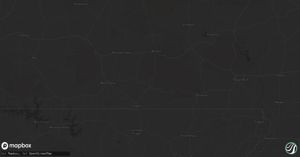
Hail Map in Olathe, KS on May 6, 2012
Get this storm
May 6 map
$229
one time, instant access
Download today. No call, no setup
Keep the $229
Bought the map and want the full workflow? Apply the entire $229 to a subscription within 7 days. None of it is wasted.
Every map, not just this one
This buys you this map. Subscription and you get every map we run, in the markets you choose from a few cities to whole states to nationwide. Plus real-time alerts the moment a storm fires.
Contact data
Name, contact info, occupancy, even credit band for addresses in the footprint. You go from where it hit to who to call.
Become the source they trust
Unlimited branding weather history reports on demand. You already have the documented answer ready for the property owner, and you are the one who showed up with it.
Property data and RoofTrace estimates
Pull up any address you have got, its value and the exact code rules for that jurisdiction, straight from One Click Code. Then RoofTrace estimates the squares, pitch, and roof value, priced the way you price.
Storm reports in Olathe, KS
Olathe, KS
| Date | Description |
|---|---|
| 05/06/20126:39 PM CDT | Reported near the intersection of 139th street and interstate 35. |
| 05/06/20126:36 PM CDT | Reported at santa fe and merlin. |
| 05/06/20126:22 PM CDT | Tornado reported near interstate 35 and highway 169. |
| 05/06/20126:10 PM CDT | A tornado was reported at santa fe and highway 7. |
| 05/05/20127:38 PM CDT | A local report indicates 1.75 inch wind near OLATHE |
| 05/05/20127:22 PM CDT | A local report indicates 1.75 inch wind near OLATHE |
| 05/05/20127:20 PM CDT | A local report indicates 1.50 inch wind near OLATHE |
| 05/05/20127:02 PM CDT | A local report indicates 1.00 inch wind near 2 W OLATHE |
All States Impacted by Hail Map on May 6, 2012
All Cities Impacted by Hail Map on May 6, 2012
- Cambridge, IL
- Stephenville, TX
- Desdemona, TX
- Dublin, TX
- Hico, TX
- Eufaula, AL
- Sage, AR
- Melbourne, AR
- Franklin, AR
- Concord, GA
- Gay, GA
- Nevada, MO
- Gorman, TX
- Maysville, MO
- Turney, MO
- Osborn, MO
- Cameron, MO
- Winston, MO
- Weatherby, MO
- Plattsburg, MO
- Gower, MO
- Edgerton, MO
- Stewartsville, MO
- Thomasville, AL
- Eudora, KS
- De Soto, KS
- Greenville, AL
- Forest Home, AL
- Otley, IA
- Monroe, IA
- Knoxville, IA
- Swan, IA
- Pleasantville, IA
- Center, TX
- Ariton, AL
- Brundidge, AL
- Blakely, GA
- Blairsville, GA
- Christiana, TN
- Woodhull, IL
- Lynn Center, IL
- Meridian, MS
- Bailey, MS
- Excelsior Springs, MO
- Liberty, MO
- Counce, TN
- Butler, AL
- Jachin, AL
- Lisman, AL
- Quitman, MS
- Buena Vista, GA
- Ellaville, GA
- Fort Atkinson, WI
- Burlington, KS
- Waverly, KS
- Le Roy, KS
- Westphalia, KS
- Hahira, GA
- Quitman, GA
- Valdosta, GA
- Hopkinsville, KY
- Newcastle, TX
- Woodson, TX
- Graham, TX
- Mayview, MO
- De Leon, TX
- Henning, TN
- Seneca, MO
- Neosho, MO
- Vaiden, MS
- West, MS
- Gravity, IA
- Sharpsburg, IA
- Lenox, IA
- Lettsworth, LA
- Enterprise, AL
- S Coffeyville, OK
- Lenapah, OK
- Woodstock, GA
- Milton, WI
- Galva, IL
- Altona, IL
- Bishop Hill, IL
- Ashland City, TN
- Portage, WI
- Pardeeville, WI
- Rector, AR
- Amity, MO
- Clarksdale, MO
- Glasgow, MO
- Champaign, IL
- Marietta, GA
- Kennesaw, GA
- Diagonal, IA
- Benton, IA
- Virden, IL
- Girard, IL
- Peculiar, MO
- Greenwood, MO
- Kansas City, MO
- Harrisonville, MO
- Lees Summit, MO
- Grandview, MO
- Pleasant Hill, MO
- Cleveland, MO
- Raymore, MO
- Belton, MO
- Homerville, GA
- Dawson, GA
- Quincy, FL
- Chattahoochee, FL
- Tow, TX
- Fort Payne, AL
- Lake City, FL
- Picher, OK
- Miami, OK
- Commerce, OK
- North Miami, OK
- Gridley, IL
- Chenoa, IL
- Saunemin, IL
- Griffithville, AR
- Llano, TX
- Callahan, FL
- Jacksonville, FL
- Yulee, FL
- Moultrie, GA
- Hartsfield, GA
- Welch, OK
- Willacoochee, GA
- Morris, GA
- Carbon, TX
- Eastland, TX
- Cisco, TX
- Headland, AL
- Tifton, GA
- Ty Ty, GA
- Fountain, FL
- Chipley, FL
- Aurora, MO
- Crane, MO
- Memphis, TN
- Chatsworth, IL
- Melvin, IL
- Roberts, IL
- Hoopeston, IL
- Beatrice, AL
- Butler, MO
- Adrian, MO
- Utica, KY
- Calhoun, KY
- Hinckley, IL
- Somonauk, IL
- Douglasville, GA
- Ludlow, IL
- Carlton, TX
- Camilla, GA
- Dozier, AL
- Brantley, AL
- Wenona, IL
- Elkhorn, WI
- Delavan, WI
- Rankin, IL
- Rossville, IL
- Florence, MO
- Syracuse, MO
- Otterville, MO
- Bunceton, MO
- Vernon, AL
- Edgerton, WI
- Janesville, WI
- Sibley, IL
- Strawn, IL
- Savannah, MO
- Rosendale, MO
- Rea, MO
- Redfield, IA
- Poulan, GA
- Sumner, GA
- Sylvester, GA
- Whigham, GA
- Cullom, IL
- Ozark, AL
- Pittsview, AL
- Omaha, GA
- Joiner, AR
- Tyronza, AR
- Brockwell, AR
- Violet Hill, AR
- Pine Apple, AL
- Liberal, MO
- Jerico Springs, MO
- Moundville, MO
- Sheldon, MO
- Milo, MO
- Harwood, MO
- Bronaugh, MO
- Lamar, MO
- Stockton, MO
- El Dorado Springs, MO
- Walker, MO
- Kansas City, KS
- Fort Rucker, AL
- Crofton, KY
- Archie, MO
- Amory, MS
- Meigs, GA
- Jackson, AL
- Coffeeville, AL
- Columbus, KS
- Washburn, MO
- Rocky Comfort, MO
- Wheaton, MO
- Eagle Rock, MO
- Seligman, MO
- Purdy, MO
- Cassville, MO
- Exeter, MO
- Leesburg, GA
- Smithville, GA
- Ellerslie, GA
- Midland, GA
- Columbus, GA
- Vardaman, MS
- Molena, GA
- Woodbury, GA
- Scheller, IL
- Eolia, MO
- Silex, MO
- Bowling Green, MO
- Covington, IN
- Attica, IN
- Veedersburg, IN
- La Cygne, KS
- Amsterdam, MO
- Pearson, GA
- Douglas, GA
- Rewey, WI
- Livingston, WI
- Platteville, WI
- Muscadine, AL
- Tallapoosa, GA
- Piedmont, AL
- Fruithurst, AL
- Cedartown, GA
- Buchanan, GA
- Cairo, MO
- Salisbury, MO
- Clifton Hill, MO
- Moberly, MO
- Huntsville, MO
- Rockport, IL
- Ashkum, IL
- Clifton, IL
- Emden, IL
- Hartsburg, IL
- Nashville, GA
- Alapaha, GA
- Dalton, MO
- Slater, MO
- Pierce City, MO
- Wiggins, MS
- Spring Hill, KS
- Edgerton, KS
- Murfreesboro, TN
- Gridley, KS
- Yates Center, KS
- Lenexa, KS
- Overland Park, KS
- Stilwell, KS
- New Century, KS
- Gardner, KS
- Olathe, KS
- Leawood, KS
- Roselle, IL
- Carol Stream, IL
- Hanover Park, IL
- Bloomingdale, IL
- Bartlett, IL
- Fredonia, KS
- Lakeland, GA
- Baldwin City, KS
- Fontanelle, IA
- Adair, IA
- Casey, IA
- Neosho Rapids, KS
- Palmyra, IL
- Modesto, IL
- Paola, KS
- Louisburg, KS
- Bucyrus, KS
- Jack, AL
- Dyess, AR
- Thebes, IL
- Scott City, MO
- Olive Branch, IL
- Tamms, IL
- Berryville, AR
- Keokuk, IA
- Nauvoo, IL
- Wayland, MO
- Anderson, TX
- Osceola, AR
- Etowah, AR
- Waltonville, IL
- Lawrence, KS
- Hughesville, MO
- Sedalia, MO
- La Monte, MO
- Sheridan, IL
- Millbrook, IL
- Newark, IL
- Yorkville, IL
- Plano, IL
- Millington, IL
- Bristol, IL
- Bremen, IN
- Sallis, MS
- Durant, MS
- Bloomingdale, IN
- Marshall, IN
- Henagar, AL
- Sylvania, AL
- Pisgah, AL
- Rose Bud, AR
- Mount Vernon, AR
- Cuthbert, GA
- Canton, GA
- New Brockton, AL
- McCool, MS
- Richland, GA
- Lumpkin, GA
- Albany, TX
- Wellsville, KS
- Minter, AL
- Henrietta, MO
- Richmond, MO
- Ohio, IL
- Sublette, IL
- Amboy, IL
- Cadiz, KY
- Gracey, KY
- Cerulean, KY
- Cherry Valley, IL
- Kirkland, IL
- Belvidere, IL
- Mercer, MO
- Oxford, AR
- Jacksboro, TX
- Fitzpatrick, AL
- Mathews, AL
- Fall River, KS
- Toronto, KS
- Batesville, AR
- Hampshire, IL
- Huntley, IL
- Rantoul, KS
- Osawatomie, KS
- Lane, KS
- Madison, KS
- Matfield Green, KS
- Eureka, KS
- Hamilton, KS
- McLouth, KS
- Crete, IL
- Monee, IL
- University Park, IL
- Hamilton, MO
- Monett, MO
- Fairview, MO
- Stark City, MO
- Minonk, IL
- Dana, IL
- Lake Geneva, WI
- Genoa City, WI
- Wellsville, MO
- Nashville, TN
- Greenbrier, TN
- Pleasant View, TN
- Pegram, TN
- Franklin, TN
- Springfield, TN
- Joelton, TN
- Bates City, MO
- Odessa, MO
- Young Harris, GA
- Goodman, MO
- Anderson, MO
- Hilliard, FL
- Kingsland, GA
- De Land, IL
- Cisco, IL
- Weldon, IL
- Mansfield, IL
- Latham, IL
- Argenta, IL
- Illiopolis, IL
- Lane, IL
- Mount Pulaski, IL
- Clinton, IL
- Monticello, IL
- Niantic, IL
- Maroa, IL
- Warrensburg, IL
- Scottsboro, AL
- Dutton, AL
- Tinley Park, IL
- Mokena, IL
- New Lenox, IL
- Williamsport, IN
- Boston, GA
- Thomaston, GA
- Galena, MO
- Reeds Spring, MO
- Fayette, MO
- Damascus, GA
- Colquitt, GA
- Independence, MO
- Newnan, GA
- Carrollton, GA
- Christopher, IL
- Mulkeytown, IL
- Benton, IL
- Ambia, IN
- Jonesboro, TX
- Gatesville, TX
- Leon, KS
- Latham, KS
- Moline, KS
- Cedar Vale, KS
- Sedan, KS
- Jasper, MO
- Searcy, AR
- Newton, GA
- Perkinston, MS
- Marshall, MO
- Blackburn, MO
- Osceola, IA
- Holly Grove, AR
- Cherokee, AL
- Somerville, TN
- Grove Hill, AL
- Fort Benning, GA
- Poplar Grove, IL
- Lucedale, MS
- Milford, IL
- Wellington, IL
- Dwight, IL
- Odell, IL
- Oak Grove, KY
- Golden, MO
- Covington, TN
- Rio, WI
- Fall River, WI
- Columbus, WI
- Kewanee, IL
- Leary, GA
- Louisiana, MO
- Frankford, MO
- New London, MO
- Alberta, AL
- Camden, AL
- Hamilton, TX
- Ackerman, MS
- Pontiac, IL
- Herscher, IL
- Mason, TX
- Powder Springs, GA
- Clarkdale, GA
- Austell, GA
- Bruce, MS
- Pittsboro, MS
- Corning, AR
- Rainsville, AL
- Nauvoo, AL
- Jasper, AL
- Double Springs, AL
- Denmark, TN
- Jackson, TN
- Coffeyville, KS
- Edna, KS
- Kingsville, MO
- Madison, FL
- Malta Bend, MO
- Aberdeen, MS
- Morris, IL
- Mazon, IL
- Jasper, GA
- Waleska, GA
- Midland City, AL
- Smithshire, IL
- Defiance, MO
- Wentzville, MO
- Edison, GA
- San Saba, TX
- Hillsboro, TN
- Weston, GA
- Dixie, GA
- Du Pont, GA
- Dexter, IA
- Linden, IA
- Stuart, IA
- Guion, AR
- Mount Pleasant, AR
- Mountain View, AR
- Edgemont, AR
- Albany, GA
- Benton, MO
- Kahoka, MO
- Luray, MO
- Wyaconda, MO
- Lawson, MO
- Polo, MO
- Rayville, MO
- Galena, KS
- Bassett, AR
- Frenchmans Bayou, AR
- Dell, AR
- Watseka, IL
- Emporia, KS
- Cottonwood Falls, KS
- Barney, GA
- Morven, GA
- Butler, IN
- Waterloo, IN
- New Glarus, WI
- Monticello, WI
- Kankakee, IL
- Bonfield, IL
- Blytheville, AR
- Skipperville, AL
- Neponset, IL
- Bradford, IL
- Buda, IL
- East Lynne, MO
- Bay Minette, AL
- Jay, FL
- Altamont, KS
- Oswego, KS
- Piedmont, KS
- Sidney, TX
- London, TX
- Hext, TX
- Menard, TX
- Richards, MO
- Rich Hill, MO
- Spruce Pine, AL
- Phil Campbell, AL
- Franklin, GA
- Holden, MO
- Lone Jack, MO
- Sweet Water, AL
- Stanberry, MO
- Guilford, MO
- Maquon, IL
- Emington, IL
- Greenville, GA
- Luthersville, GA
- East Troy, WI
- Whitewater, WI
- Burlington, WI
- Orfordville, WI
- Beloit, WI
- Jefferson, WI
- Ransom, IL
- Marseilles, IL
- Seneca, IL
- Keytesville, MO
- Stover, MO
- Fargo, GA
- Cabery, IL
- Chebanse, IL
- Danforth, IL
- Buckingham, IL
- Pembroke, KY
- La Fayette, IL
- Pavo, GA
- River Forest, IL
- Maywood, IL
- Forest Park, IL
- Linwood, KS
- Bonner Springs, KS
- Tonganoxie, KS
- Severy, KS
- Scammon, KS
- Weir, KS
- Amoret, MO
- Cornell, IL
- Rutland, IL
- Ancona, IL
- Streator, IL
- Channahon, IL
- Minooka, IL
- Ludowici, GA
- Jesup, GA
- Elba, AL
- Manchester, TN
- Westfield, WI
- Oxford, WI
- Wisconsin Dells, WI
- Lyndon Station, WI
- Endeavor, WI
- Briggsville, WI
- Clinton, WI
- Sharon, WI
- Capron, IL
- Caledonia, IL
- Dallas, GA
- Troy, AL
- Freeman, MO
- Columbus City, IA
- Columbus Junction, IA
- Coffeeville, MS
- Morganton, GA
- Garden City, MO
- Reading, KS
- Admire, KS
- Erin, TN
- Cumberland City, TN
- Caraway, AR
- Lepanto, AR
- Alvin, IL
- Luverne, AL
- Wilmington, IL
- Manteno, IL
- Groveland, IL
- Pekin, IL
- Blue Ridge, GA
- Richards, TX
- Miami, MO
- Ligonier, IN
- Princeton, IL
- Wyanet, IL
- Manlius, IL
- Annawan, IL
- Walnut, IL
- Sheffield, IL
- Mineral, IL
- Navasota, TX
- Molino, FL
- Crestview, FL
- Monroe City, MO
- Clarendon, AR
- Hollywood, AL
- Leona, TX
- Pella, IA
- Mertzon, TX
- Maceo, KY
- Wawaka, IN
- Rome City, IN
- Topeka, IN
- Kendallville, IN
- Wolcottville, IN
- Clayton, AL
- Midway, AL
- Goodlettsville, TN
- Chautauqua, KS
- Peru, KS
- Pawhuska, OK
- Bement, IL
- Milmine, IL
- Howard, KS
- Murphy, NC
- Enigma, GA
- Loda, IL
- North Aurora, IL
- Aurora, IL
- Sugar Grove, IL
- Clarksville, TN
- Section, AL
- Five Points, AL
- Roanoke, AL
- Mount Vernon, IL
- Malone, FL
- Bascom, FL
- Gordon, AL
- White Castle, LA
- Horseshoe Bend, AR
- Ash Flat, AR
- Kingman, IN
- Perrysville, IN
- Pollard, AR
- Qulin, MO
- Palos Park, IL
- Lemont, IL
- Autaugaville, AL
- Speer, IL
- Wyoming, IL
- Pelham, GA
- Coolidge, GA
- Kincaid, KS
- Haysville, KS
- Derby, KS
- Peck, KS
- Mulvane, KS
- Bessemer, AL
- Lafe, AR
- Marmaduke, AR
- Ashley, IL
- Dallas Center, IA
- Adel, IA
- Ottawa, KS
- Pomona, KS
- Jasper, FL
- Elwood, IL
- Plainfield, IL
- Coal City, IL
- Peotone, IL
- Shorewood, IL
- Manhattan, IL
- Joliet, IL
- Platte City, MO
- Old Hickory, TN
- Dalton, WI
- Nacogdoches, TX
- Wheatfield, IN
- Jennings, FL
- Garnett, KS
- Greeley, KS
- Cosby, MO
- Parrott, GA
- Preston, GA
- Des Arc, AR
- Franklin Grove, IL
- Mound City, KS
- Centerville, KS
- Parker, KS
- Pleasanton, KS
- Kingston, MO
- Goshen, AL
- Luxora, AR
- Williamsfield, IL
- Victoria, IL
- Drasco, AR
- Beecher, IL
- Grant Park, IL
- Axson, GA
- Hillsboro, KS
- Oronogo, MO
- Hamilton, GA
- Pine Mountain Valley, GA
- Olmstead, KY
- Cedar Hill, TN
- Allensville, KY
- Adairville, KY
- Adams, TN
- Higginson, AR
- Kensett, AR
- Blackstone, IL
- Sulligent, AL
- Higden, AR
- Perry, KS
- Lakeland, LA
- Potosi, MO
- Big Creek, MS
- Shawnee, KS
- Trenton, MO
- Citronelle, AL
- Higginsville, MO
- Warrensburg, MO
- Ider, AL
- Putnam, IL
- Cambria, WI
- Odum, GA
- Cordova, TN
- Arlington, TN
- Center, MO
- Magnolia, IL
- Hennepin, IL
- Campus, IL
- Toluca, IL
- Tiskilwa, IL
- Lacon, IL
- Varna, IL
- Henry, IL
- Lostant, IL
- McNabb, IL
- Toulon, IL
- Kinsman, IL
- Greenfield, IA
- Menlo, IA
- Smyrna, TN
- Arrington, TN
- Nolensville, TN
- Urbandale, IA
- Grimes, IA
- Waukee, IA
- Piqua, KS
- Neosho Falls, KS
- Throckmorton, TX
- Iola, TX
- Knob Noster, MO
- Sweet Springs, MO
- Trementina, NM
- Bondville, IL
- Garfield, AR
- San Angelo, TX
- Seymour, TX
- Gilmer, TX
- Valley Spring, TX
- Galesburg, IL
- Buchanan Dam, TX
- Bluffton, TX
- Wapello, IA
- Bankston, AL
- Farmer City, IL
- Stantonville, TN
- Shiloh, TN
- Michie, TN
- Morgan, GA
- Arlington, GA
- Whitesburg, GA
- Olpe, KS
- Fyffe, AL
- Loving, TX
- Olney, TX
- Foster, MO
- Manila, AR
- Gilmore, AR
- Turrell, AR
- Marked Tree, AR
- Earlville, IL
- Mendota, IL
- Georgiana, AL
- Versailles, MO
- Fortuna, MO
- Poynette, WI
- Wyocena, WI
- Grand Marsh, WI
- Merrimac, WI
- Baraboo, WI
- Montello, WI
- Drexel, MO
- Darlington, WI
- Blanchardville, WI
- Hartford, KS
- Saint Patrick, MO
- Montrose, IA
- Alexandria, MO
- Argyle, IA
- Dallas City, IL
- Carthage, IL
- Syracuse, IN
- New Paris, IN
- Goshen, IN
- Dewitt, IL
- Willowbrook, IL
- Lathrop, MO
- Tuscumbia, AL
- Milton, FL
- Breckenridge, TX
- Alford, FL
- Marianna, FL
- Wolcott, IN
- Brookston, IN
- Oneida, IL
- Argyle, WI
- Bowdon, GA
- Greenwood Springs, MS
- Hazen, AR
- Martinton, IL
- Coila, MS
- Pleasant Hill, IA
- Des Moines, IA
- Huntland, TN
- Kouts, IN
- La Crosse, IN
- Monmouth, IL
- Woodland, AL
- Elk City, KS
- Ottawa, IL
- Daleville, MS
- De Kalb, MS
- Donalsonville, GA
- Houstonia, MO
- Pierre Part, LA
- Haleyville, AL
- Triplett, MO
- Brunswick, MO
- Hayesville, NC
- Marengo, IL
- Garden Prairie, IL
- Hartford, IA
- Carlisle, IA
- Runnells, IA
- Prairie City, IA
- Melrose Park, IL
- Wapella, IL
- West Lebanon, IN
- Riverton, KS
- Baxter Springs, KS
- Saint Augustine, IL
- Miller, MO
- Ray City, GA
- Stonewall, MS
- Roopville, GA
- Pea Ridge, AR
- Powell, MO
- Pineville, MO
- Eureka Springs, AR
- Shell Knob, MO
- Redding, IA
- Blockton, IA
- Mount Ayr, IA
- Lecompton, KS
- Jemison, AL
- Saint Francisville, LA
- Richland Center, WI
- Arrow Rock, MO
- Concordia, MO
- Jacksonville, MO
- Gilliam, MO
- Clarence, MO
- Blackwater, MO
- Madison, MO
- Nelson, MO
- Franklin, MO
- Mayville, WI
- Iron Ridge, WI
- Theresa, WI
- Paragould, AR
- El Paso, IL
- Clio, AL
- Newville, AL
- Banks, AL
- Newton, AL
- Glenwood, AL
- Dothan, AL
- Grantville, GA
- Prescott, IA
- Beaver Dam, KY
- Arlington, AL
- Pine Hill, AL
- Thomaston, AL
- Fort Mitchell, AL
- Adams, WI
- Matthews, MO
- Decatur, IL
- Kempton, IL
- Abbeville, AL
- Nettleton, MS
- Morning Sun, IA
- Friendship, WI
- Knoxville, IL
- Maple Park, IL
- Acworth, GA
- Evansville, WI
- Clearfield, IA
- Trimble, MO
- Fontana, KS
- Mauston, WI
- New Canton, IL
- Philpot, KY
- Edgerton, OH
- West York, IL
- Lafayette, IN
- Martinsburg, MO
- Saint Anne, IL
- Hartford, KY
- Farmington, IL
- Union, IL
- Cowgill, MO
- Chunchula, AL
- Wilmer, AL
- Talladega, AL
- Brentwood, TN
- Boswell, IN
- Piper City, IL
- Long Point, IL
- Goodland, IN
- Cissna Park, IL
- Gilman, IL
- Kentland, IN
- Paxton, IL
- Sheldon, IL
- Buckley, IL
- Onarga, IL
- Penfield, IL
- Reddick, IL
- Bismarck, IL
- Thawville, IL
- Rantoul, IL
- Gifford, IL
- Grand Ridge, IL
- Crescent City, IL
- Potomac, IL
- Earl Park, IN
- Bedford, IA
- Dearborn, MO
- Moody Afb, GA
- Smiths Station, AL
- Phenix City, AL
- Bryceville, FL
- Spring Valley, IL
- Bono, AR
- Walnut Ridge, AR
- West Chicago, IL
- Addison, IL
- Medinah, IL
- Itasca, IL
- Glendale Heights, IL
- Wayne, IL
- Wood Dale, IL
- Iola, KS
- Leeton, MO
- Corning, IA
- Atwood, IL
- Doylestown, WI
- Brook, IN
- Morocco, IN
- Dekalb, IL
- Bellflower, MO
- Middletown, MO
- Russellville, AL
- Saint Marys, GA
- Livermore, KY
- Saybrook, IL
- Green Ridge, MO
- Americus, GA
- Lipan, TX
- Santo, TX
- Bluff Dale, TX
- Cape Girardeau, MO
- Schell City, MO
- Golden City, MO
- Hogansville, GA
- Oak Grove, AR
- Omaha, AR
- Green Forest, AR
- Hamilton, IL
- Warsaw, IL
- Niota, IL
- Van Meter, IA
- West Des Moines, IA
- Booneville, IA
- Bartlett, KS
- Parsons, KS
- Santa Rosa, NM
- Catherine, AL
- Albany, MO
- Waverly, MO
- Alma, MO
- Houlka, MS
- Forrest, IL
- Fairbury, IL
- Gretna, FL
- Dennison, IL
- Paris, IL
- Marshall, IL
- West Terre Haute, IN
- Millington, TN
- Paris, MO
- Sulphur Rock, AR
- Blue Grass, IA
- Muscatine, IA
- Montpelier, IA
- Valley Head, AL
- Otterbein, IN
- West Lafayette, IN
- Kings Bay, GA
- Belleville, WI
- Fowler, IN
- Gilbertown, AL
- Houston, MS
- Centralia, MO
- Elkville, IL
- Folkston, GA
- White Oak, GA
- Parrish, AL
- Oakman, AL
- Lagrange, GA
- Cape Fair, MO
- Pangburn, AR
- Elkton, KY
- Lewisburg, KY
- Lancaster, WI
- Stitzer, WI
- Hendersonville, TN
- Madison, TN
- Shellman, GA
- Marshall, WI
- Lewisport, KY
- Sarcoxie, MO
- Wentworth, MO
- Cuba City, WI
- Doss, TX
- Gibson City, IL
- De Valls Bluff, AR
- South Beloit, IL
- Winona, MS
- Footville, WI
- Brodhead, WI
- Columbia, AL
- Murphysboro, IL
- Mineral Point, WI
- Corunna, IN
- Plaquemine, LA
- Ranger, TX
- Weir, MS
- New Franklin, MO
- Bronwood, GA
- Vinita, OK
- Germantown, TN
- Salem, AR
- Gibson, LA
- Pike Road, AL
- Whitesville, KY
- McRae, AR
- Judsonia, AR
- Jamesport, MO
- Gallatin, MO
- Danville, IL
- Serena, IL
- State Line, IN
- Sandwich, IL
- Bellflower, IL
- Leland, IL
- Lexington, IL
- Foosland, IL
- Elliott, IL
- Flanagan, IL
- Sparland, IL
- Washburn, IL
- Hillsboro, IN
- Big Rock, IL
- Lexington, MS
- Sycamore, IL
- Hardy, AR
- De Witt, AR
- Marion, MS
- Reedsburg, WI
- Steelville, MO
- Bald Knob, AR
- Rogers, AR
- Batchelor, LA
- Union Hill, IL
- Ashford, AL
- Mission, KS
- Lake Park, GA
- Wilson, AR
- Edina, MO
- Richmond, KS
- Pittsburg, TX
- Darien, IL
- Willow Springs, IL
- Mchenry, IL
- Woodstock, IL
- Crystal Lake, IL
- Deerfield, MO
- Grant City, MO
- Oxford, IN
- Verona, IL
- Princeville, IL
- Oskaloosa, KS
- McDavid, FL
- Floral, AR
- Cairo, GA
- Sale City, GA
- Ridgeway, WI
- Dodgeville, WI
- Lometa, TX
- Morton, IL
- Washington, IL
- Blue Mounds, WI
- Barneveld, WI
- Woodlawn, TN
- Halls, TN
- Spring Green, WI
- Arena, WI
- Norwalk, IA
- Prole, IA
- Indianola, IA
- Kenney, IL
- Fillmore, MO
- Union Star, MO
- Galt, MO
- Bluejacket, OK
- Garland, KS
- Arcadia, KS
- New Holland, IL
- Cartersville, GA
- White Heath, IL
- Ivesdale, IL
- Seymour, IL
- Bradley, IL
- Bourbonnais, IL
- Oswego, IL
- Montgomery, IL
- Auburn, IL
- Moran, TX
- Wedowee, AL
- Graham, AL
- Readyville, TN
- Woodlawn, IL
- Vredenburgh, AL
- Earlham, IA
- Grenola, KS
- Corder, MO
- Foristell, MO
- Lomax, IL
- White House, TN
- Allen, KS
- Buffalo, IL
- Mahomet, IL
- Bureau, IL
- Guthrie Center, IA
- Thompson, MO
- Horicon, WI
- Kearney, MO
- Augusta, AR
- Lithia Springs, GA
- Lonedell, MO
- Remington, IN
- Chalmers, IN
- Toxey, AL
- Homer Glen, IL
- Avalon, WI
- Steward, IL
- Port Edwards, WI
- Wisconsin Rapids, WI
- Quitman, AR
- Heber Springs, AR
- Norborne, MO
- Bethany, IL
- Moweaqua, IL
- Sully, IA
- Reasnor, IA
- Ackworth, IA
- Elsberry, MO
- Annada, MO
- Uniontown, KS
- Vergennes, IL
- De Soto, IL
- Avon, IL
- Floresville, TX
- Stoutsville, MO
- Moreland, GA
- Sharpsburg, GA
- Pennington, AL
- Ward, AL
- Stotts City, MO
- Oregon, MO
- Talking Rock, GA
- Doerun, GA
- Clyde, MO
- Ravenwood, MO
- Bedias, TX
- College Station, TX
- Falls City, TX
- McKenzie, AL
- Coloma, WI
- Weston, MO
- Zebulon, GA
- Oglesby, IL
- Tonica, IL
- Magnolia, AL
- Opp, AL
- Pine Mountain, GA
- Windermere, FL
- Panora, IA
- Mulga, AL
- Quinton, AL
- Owensboro, KY
- Warne, NC
- Union Springs, AL
- Pleasant Plains, AR
- Easton, MO
- Saint Joseph, MO
- Ashburn, MO
- Curryville, MO
- Greenup, IL
- New Roads, LA
- Millersburg, IN
- Comanche, TX
- Knox City, MO
- Dongola, IL
- Douglass, KS
- Lenox, GA
- Cambridge, WI
- Lovington, IL
- Cerro Gordo, IL
- Hammond, IL
- Murray, IA
- Joy, IL
- Treece, KS
- Mercer, TN
- Brownsville, TN
- Cragford, AL
- Lineville, AL
- Virgil, KS
- Neal, KS
- Mount Juliet, TN
- Higbee, MO
- Harrisburg, MO
- Clark, MO
- Herndon, KY
- Shorterville, AL
- Cumming, IA
- Adel, GA
- Glennville, GA
- Drummonds, TN
- Mcfarland, WI
- Madison, WI
- Oregon, WI
- Plains, GA
- Carrollton, MO
- Riverside, MO
- Saint Clair, MO
- Holliday, TX
- Rockford, IL
- Dexter, KS
- Greenville, FL
- Livonia, LA
- Fordoche, LA
- Castalia, IA
- Steele, MO
- Marceline, MO
- Mendon, MO
- De Witt, MO
- Danville, IA
- Gustine, TX
- Jermyn, TX
- Bryson, TX
- Ada, OK
- Berryton, KS
- Longton, KS
- Orion, IL
- Senoia, GA
- Hornersville, MO
- Walnut, MS
- Corinth, MS
- Callao, MO
- New Cambria, MO
- Elk Falls, KS
- Finley, TN
- Perry, MO
- Central City, KY
- Pinetta, FL
- Kimberling City, MO
- Lampe, MO
- Waucoma, IA
- Fort Atkinson, IA
- Sherrard, IL
- Carl Junction, MO
- Florissant, MO
- Montgomery, TX
- Steger, IL
- Marionville, MO
- Cherokee, KS
- Berry, AL
- Carbon Hill, AL
- Townley, AL
- Waterman, IL
- Billings, MO
- Cedar Hill, MO
- Grosse Tete, LA
- Paw Paw, IL
- Shabbona, IL
- Greentop, MO
- Kirksville, MO
- Morgan City, LA
- Conception Junction, MO
- Barnard, MO
- Gentry, MO
- Conception, MO
- Darlington, MO
- Princeton, KS
- Oak Grove, MO
- Grain Valley, MO
- Blue Springs, MO
- Novinger, MO
- Asbury, MO
- Dixon, IL
- Mount Vernon, MO
- Holt, MO
- Redfield, KS
- Donovan, IL
- Rock Falls, IL
- Deer Grove, IL
- Harmon, IL


