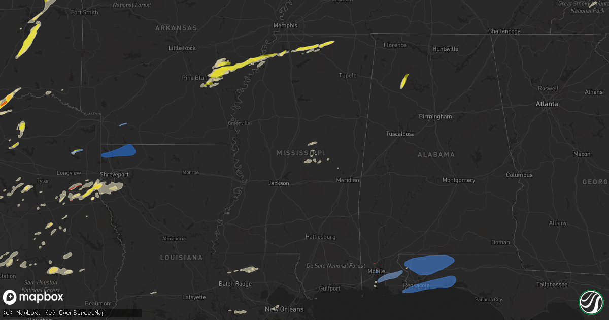
Hail Map in Mississippi on May 5, 2022
Get this storm
May 5 map
$229
one time, instant access
Download today. No call, no setup
Keep the $229
Bought the map and want the full workflow? Apply the entire $229 to a subscription within 7 days. None of it is wasted.
Every map, not just this one
This buys you this map. Subscription and you get every map we run, in the markets you choose from a few cities to whole states to nationwide. Plus real-time alerts the moment a storm fires.
Contact data
Name, contact info, occupancy, even credit band for addresses in the footprint. You go from where it hit to who to call.
Become the source they trust
Unlimited branding weather history reports on demand. You already have the documented answer ready for the property owner, and you are the one who showed up with it.
Property data and RoofTrace estimates
Pull up any address you have got, its value and the exact code rules for that jurisdiction, straight from One Click Code. Then RoofTrace estimates the squares, pitch, and roof value, priced the way you price.
Storm reports in Mississippi
Mississippi
| Date | Description |
|---|---|
| 05/05/20224:55 PM CDT | A local report indicates 1.25 inch wind near ASHLAND |
| 05/05/20224:30 PM CDT | A local report indicates 1.25 inch wind near HOLLY SPRINGS |
| 05/05/20224:11 PM CDT | A local report indicates 1.00 inch wind near 1 SW MARIANNA |
| 05/05/20223:00 PM CDT | Powerlines down and a few trees snapped near hwy 61 and clayton rd. |
| 05/05/20222:55 PM CDT | Multiple power poles and trees damaged. 1 home and a detached 3 car garage damaged. |
| 05/05/20223:51 AM CDT | At 851 PM CDT, a severe thunderstorm was located over Herbert Springs, or 15 miles west of Meridian Station, moving east at 30 mph. HAZARD...60 mph wind gusts and penny size hail. SOURCE...Radar indicated. IMPACT...Expect damage to roofs, siding, and trees. This severe thunderstorm will be near... Damascus around 900 PM CDT. Liberty and Prismatic around 905 PM CDT. Daleville around 910 PM CDT. Blackwater around 915 PM CDT. De Kalb around 925 PM CDT. Porterville around 940 PM CDT. Electric Mills around 945 PM CDT.Other locations impacted by this severe thunderstorm include Scooba. |
| 05/05/20222:22 AM CDT | At 722 PM CDT, a severe thunderstorm was located near Carthage, moving northeast at 30 mph. HAZARD...60 mph wind gusts and quarter size hail. SOURCE...Radar indicated. IMPACT...Hail damage to vehicles is expected. Expect wind damage to roofs, siding, and trees. This severe thunderstorm will be near... Edinburg and Dowdville around 735 PM CDT. Pearl River around 745 PM CDT. Philadelphia around 750 PM CDT.Other locations impacted by this severe thunderstorm include StandingPine and Redwater. |
| 05/05/20221:56 AM CDT | At 655 PM CDT, a severe thunderstorm was located near Smyrna, or 8 miles east of Kosciusko, moving northeast at 30 mph. HAZARD...60 mph wind gusts and quarter size hail. SOURCE...Radar indicated. IMPACT...Hail damage to vehicles is expected. Expect wind damage to roofs, siding, and trees. This severe thunderstorm will remain over mainly rural areas of southeastern Choctaw, southeastern Attala and west central Winston Counties, including the following locations... Ethel. |
| 05/04/202211:00 PM CDT | At 359 PM CDT, a severe thunderstorm was located near Marianna, or 13 miles west of Wall Doxey State Park, moving east at 35 mph. HAZARD...60 mph wind gusts and quarter size hail. SOURCE...Radar indicated. IMPACT...Hail damage to vehicles is expected. Expect wind damage to roofs, siding, and trees. Locations impacted include... Holly Springs, Wall Doxey State Park, Red Banks, Marianna, Potts Camp, Wakefield, Waterford, Aiken, Higdon, Watson, Gilton, Chulahoma, Lake Center, Galena, Victoria, Hudsonville, Wyatte, New Garden, Thyatira and Atway. |
| 05/04/20229:59 PM CDT | At 258 PM CDT, a severe thunderstorm was located over Dubbs, or 15 miles east of St Francis National Park, moving northeast at 40 mph. HAZARD...60 mph wind gusts and quarter size hail. SOURCE...Radar indicated. IMPACT...Hail damage to vehicles is expected. Expect wind damage to roofs, siding, and trees. Locations impacted include... Southaven, Olive Branch, Hernando, Senatobia, Coldwater, Tunica, Phillipp, Strayhorn, Eudora, Dubbs, North Tunica, Arkabutla, Little Texas, Trinity, Savage, Frees Corners, Crossroad, Bright, Nesbit and Prichard. |
| 05/04/20229:06 PM CDT | Several trees were reported down north of collinsville. Time and location estimated by radar. |
| 05/04/20227:47 PM CDT | Tree down on hwy 488 in madden near dr. Brantley rd. |
| 05/04/20227:25 PM CDT | Tree down on highway 488 near galilee road. |
| 05/04/20227:00 PM CDT | Tree down on highway 14 between kosciusko and louisville. |
All States Impacted by Hail Map on May 5, 2022
Cities Impacted by Hail Map on May 5, 2022
- Monticello, KY
- Shawnee, OK
- Unionville, TN
- Shelbyville, TN
- Walling, TN
- Crossville, TN
- Doyle, TN
- Sparta, TN
- Smithville, TN
- Alvarado, TX
- Midlothian, TX
- Venus, TX
- Maypearl, TX
- Waxahachie, TX
- Grandview, TX
- Cleburne, TX
- Rio Vista, TX
- Woodbury, TN
- Murfreesboro, TN
- Readyville, TN
- Christiana, TN
- Klondike, TX
- Commerce, TX
- Cumby, TX
- Sulphur Springs, TX
- Cooper, TX
- Pecan Gap, TX
- Huntsville, TX
- Normangee, TX
- Tahlequah, OK
- Proctor, OK
- De Berry, TX
- Carthage, TX
- Beckville, TX
- Hillsboro, TX
- Abbott, TX
- Aquilla, TX
- Lynn, AL
- Double Springs, AL
- Haleyville, AL
- Nauvoo, AL
- San Saba, TX
- Lampasas, TX
- Milford, TX
- Italy, TX
- Trinidad, TX
- Murchison, TX
- Malakoff, TX
- Athens, TX
- Dickson, TN
- Lovelady, TX
- Grapeland, TX
- Wells, TX
- Alto, TX
- Georgetown, TX
- Kennard, TX
- Bullard, TX
- Llano, TX
- Johnson City, TX
- Fredericksburg, TX
- Stonewall, TX
- Round Mountain, TX
- Hye, TX
- Willow City, TX
- Napoleonville, LA
- Metairie, LA
- Kenner, LA
- Maxwell, TX
- Lockhart, TX
- Martindale, TX
- San Marcos, TX
- Henderson, TX
- Lorena, TX
- Seguin, TX
- Tenaha, TX
- Broken Bow, OK
- Kingsbury, TX
- Wimberley, TX
- Fischer, TX
- Blanco, TX
- Spring Branch, TX
- Rockvale, TN
- New Braunfels, TX
- Marion, TX
- Edmond, OK
- Oklahoma City, OK
- Ravenna, TX
- Ashland, MS
- Broken Arrow, OK
- Tulsa, OK
- Bixby, OK
- Mount Enterprise, TX
- Gloster, LA
- Long Branch, TX
- Stonewall, LA
- Grand Cane, LA
- Gary, TX
- Logansport, LA
- Keatchie, LA
- Shreveport, LA
- Keithville, LA
- Frierson, LA
- Valliant, OK
- Fort Towson, OK
- Detroit, TX
- Bagwell, TX
- Carthage, MS
- Molino, FL
- Savoy, TX
- Hendrix, OK
- Hinton, OK
- Coyle, OK
- Guthrie, OK
- Minco, OK
- Mulhall, OK
- Yukon, OK
- Binger, OK
- Piedmont, OK
- El Reno, OK
- Medford, OK
- Chelsea, OK
- Big Cabin, OK
- Lena, MS
- McGregor, TX
- Moody, TX
- Corsicana, TX
- Barry, TX
- Smiths Grove, KY
- Alvaton, KY
- Oakland, KY
- Woodburn, KY
- Scottsville, KY
- Bowling Green, KY
- Harrah, OK
- Newalla, OK
- Choctaw, OK
- Hutto, TX
- Taylor, TX
- Claremore, OK
- Catoosa, OK
- Owasso, OK
- Perkins, OK
- Collinsville, MS
- Lexington, OK
- Coden, AL
- Antioch, TN
- Nashville, TN
- Kosciusko, MS
- Lebanon, TN
- Hartsville, TN
- Moss, TN
- Lafayette, TN
- Pleasant Shade, TN
- Riddleton, TN
- Dixon Springs, TN
- Castalian Springs, TN
- Whitleyville, TN
- Red Boiling Springs, TN
- Macomb, OK
- Wanette, OK
- Dundee, MS
- Helena, AR
- Gatesville, TX
- Oglesby, TX
- Grady, AR
- Stuttgart, AR
- Gould, AR
- Jacksonville, TX
- Rusk, TX
- Laneville, TX
- Red Rock, OK
- Allons, TN
- Hilham, TN
- Celina, TN
- Eagleville, TN
- College Grove, TN
- Chapel Hill, TN
- Fort Hood, TX
- Copperas Cove, TX
- Kempner, TX
- Waco, TX
- Crawford, TX
- Woodway, TX
- Cushing, TX
- Agra, OK
- Cushing, OK
- Mounds, OK
- Dawson, TX
- Center, TX
- Waverly, TN
- McEwen, TN
- Nacogdoches, TX
- Douglass, TX
- Clifton, TX
- Bynum, TX
- Mertens, TX
- Penelope, TX
- Frost, TX
- Malone, TX
- Briggs, TX
- Cherokee, NC
- Boswell, OK
- Pine Grove, LA
- Denham Springs, LA
- Moscow, TX
- Corrigan, TX
- Mustang, OK
- Hearne, TX
- Blanco, OK
- Mcalester, OK
- Hartshorne, OK
- Pittsburg, OK
- Quinton, OK
- Wilburton, OK
- Haileyville, OK
- Mart, TX
- Canadian, OK
- Park Hill, OK
- Eufaula, OK
- Fort Gibson, OK
- Webbers Falls, OK
- Checotah, OK
- Stigler, OK
- Cookson, OK
- Warner, OK
- Gore, OK
- Porum, OK
- Vian, OK
- Braggs, OK
- Muskogee, OK
- Thornton, TX
- Okmulgee, OK
- Manvel, TX
- Pearland, TX
- Alvin, TX
- Arcadia, OK
- Ector, TX
- Luther, OK
- Jones, OK
- Bonham, TX
- Dodd City, TX
- Walnut Grove, MS
- Philadelphia, MS
- Casscoe, AR
- Almyra, AR
- Holly Springs, MS
- Onalaska, TX
- Crockett, TX
- Pollok, TX
- Luling, TX
- Harwood, TX
- Dale, TX
- Tonkawa, OK
- Stillwater, OK
- Liberty Hill, TX
- Bertram, TX
- Leander, TX
- Porter, OK
- Morris, OK
- Coweta, OK
- Wagoner, OK
- Beggs, OK
- Redbird, OK
- Haskell, OK
- Spencer, TN
- Rock Island, TN
- Quebeck, TN
- Tecumseh, OK
- Avinger, TX
- Lone Star, TX
- Mason, TX
- Lone Oak, TX
- Quinlan, TX
- Point, TX
- Kansas, OK
- Braman, OK
- Newkirk, OK
- Blackwell, OK
- Billings, OK
- Calumet, OK
- Elm Mott, TX
- Greenville, TX
- Ethel, MS
- Slaughter, LA
- Zachary, LA
- Montalba, TX
- Palestine, TX
- Harker Heights, TX
- Killeen, TX
- Groesbeck, TX
- Stephenville, TX
- Bryan, TX
- Iowa, LA
- Welsh, LA
- Bluff Dale, TX
- Yorktown, AR
- Pine Bluff, AR
- Star City, AR
- Coldwater, MS
- Byhalia, MS
- Carmine, TX
- Burton, TX
- Senatobia, MS
- Sarah, MS
- Altheimer, AR
- Holly Grove, AR
- West Helena, AR
- Wellston, OK
- Ennis, TX
- Purdon, TX
- West, TX
- Burnet, TX
- Kerens, TX
- Round Rock, TX
- Axtell, TX
- Hubbard, TX
- Mount Calm, TX
- Falkner, MS
- Potts Camp, MS
- Amite, LA
- Bennington, OK
- Ivanhoe, TX
- Bells, TX
- Bokchito, OK
- Whitewright, TX
- Telephone, TX
- Marshall, TX
- Saint Rose, LA
- Valley Mills, TX
- Whitney, TX
- Temple, TX
- Belton, TX
- Castell, TX
- Tuttle, OK
- Pocasset, OK
- Amber, OK
- Bryson City, NC
- Poplar Grove, AR
- Lexa, AR
- Tunica, MS
- Marvell, AR
- Humphrey, AR
- Clarendon, AR
- Saint Charles, AR
- De Witt, AR
- Windom, TX
- Pointblank, TX
- Coldspring, TX
- Livingston, TX
- Pierre Part, LA
- Morgan City, LA
- Coolidge, TX
- Mexia, TX
- Prairie Hill, TX
- Paden, OK
- North Zulch, TX
- Iola, TX
- Midway, TX
- Madisonville, TX
- Bedias, TX
- Kingsland, TX
- Eustace, TX
- Ben Wheeler, TX
- Troy, TX
- Tatum, TX
- Bruceville, TX
- Eddy, TX
- Houston, TX
- Holden, LA
- Clinton, LA
- Greenwell Springs, LA
- Greensburg, LA
- Pride, LA
- Chandler, TX
- Larue, TX
- Brownsboro, TX
- Nardin, OK
- Glencoe, OK
- Meridian, OK
- Spencer, OK
- Stringtown, OK
- Kosse, TX
- Lufkin, TX
- Chilton, TX
- Lott, TX
- Theodore, AL
- Woodville, TX
- Warren, TX
- Goodrich, TX
- Florence, TX
- Bartlett, TX
- Granger, TX
- Troup, TX
- Ponca City, OK
- Bradyville, TN
- Friendswood, TX
- China Spring, TX
- Linden, TX
- Benton, LA
- Springhill, LA
- Belcher, LA
- Oil City, LA
- Cotton Valley, LA
- Sarepta, LA
- Shongaloo, LA
- Minden, LA
- Hosston, LA
- Plain Dealing, LA
- Gilliam, LA
- Vivian, LA
- Canyon Lake, TX
- Loxley, AL
- Silverhill, AL
- Robertsdale, AL
- Fairhope, AL
- Daphne, AL
- Jay, FL
- Laurel Hill, FL
- McDavid, FL
- Baker, FL
- Milton, FL
- Crestview, FL
- Holt, FL
- Century, FL
- Niceville, FL
- Pensacola, FL
- Destin, FL
- Orange Beach, AL
- Gulf Breeze, FL
- Navarre, FL
- Mary Esther, FL
- Fort Walton Beach, FL
- Shalimar, FL
- Hurlburt Field, FL
- Valparaiso, FL
- Eglin Afb, FL
- Mobile, AL
- Boynton, OK
- Crocketts Bluff, AR
- Lewisville, AR
- Stamps, AR
- Saraland, AL


