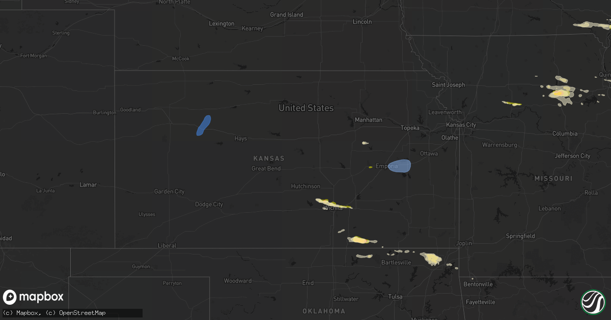
Hail Map in Kansas on May 4, 2026
Get this storm
May 4 map
$229
one time, instant access
Download today. No call, no setup
Keep the $229
Bought the map and want the full workflow? Apply the entire $229 to a subscription within 7 days. None of it is wasted.
Every map, not just this one
This buys you this map. Subscription and you get every map we run, in the markets you choose from a few cities to whole states to nationwide. Plus real-time alerts the moment a storm fires.
Contact data
Name, contact info, occupancy, even credit band for addresses in the footprint. You go from where it hit to who to call.
Become the source they trust
Unlimited branding weather history reports on demand. You already have the documented answer ready for the property owner, and you are the one who showed up with it.
Property data and RoofTrace estimates
Pull up any address you have got, its value and the exact code rules for that jurisdiction, straight from One Click Code. Then RoofTrace estimates the squares, pitch, and roof value, priced the way you price.
Storm reports in Kansas
Kansas
| Date | Description |
|---|---|
| 05/04/20264:53 PM CDT | Werth; awn measured near gove s and gove 80 intersection. |
| 05/04/20264:35 AM CDT | Delayed report. Time estimated by radar. Mostly dimes... But a few quarters fell in cottonwood falls. |
| 05/04/20262:29 AM CDT | A local report indicates 1.25 inch wind near 1 NE Augusta |
| 05/04/20262:27 AM CDT | A local report indicates 1.00 inch wind near Augusta |
| 05/04/20261:52 AM CDT | A local report indicates 1.00 inch wind near 2 SW Bel Aire |
| 05/04/20261:02 AM CDT | A local report indicates 1.00 inch wind near Andale |
| 05/04/202612:51 AM CDT | Personal weather station. |
| 05/04/202612:40 AM CDT | Personal weather station. |
| 05/04/202612:20 AM CDT | *delayed report from spotter* pictures sent of several downed power poles... One snapped near the middle. Estimated time was 0000-0030am. |
| 05/03/202611:42 PM CDT | Report from mping: quarter |
All States Impacted by Hail Map on May 4, 2026
Cities Impacted by Hail Map on May 4, 2026
- Belleville, IL
- Millstadt, IL
- Freeburg, IL
- Mascoutah, IL
- Okawville, IL
- Addieville, IL
- New Baden, IL
- Termo, CA
- Aledo, IL
- Seaton, IL
- Alexis, IL
- Sherrard, IL
- New Windsor, IL
- Mediapolis, IA
- Burlington, IA
- Lynn Center, IL
- Oquawka, IL
- Hazel Crest, IL
- Homewood, IL
- Oakville, IA
- Sperry, IA
- Keithsburg, IL
- Dorsey, IL
- Moro, IL
- Bethalto, IL
- Edwardsville, IL
- Little York, IL
- Godfrey, IL
- Cottage Hills, IL
- Alton, IL
- Keosauqua, IA
- Andover, IL
- Cambridge, IL
- Hartford, IL
- Birmingham, IA
- Stockport, IA
- North Henderson, IL
- Peru, IL
- La Salle, IL
- Worden, IL
- Wyanet, IL
- Buda, IL
- Annawan, IL
- Tiskilwa, IL
- Osco, IL
- Toulon, IL
- Bradford, IL
- Galva, IL
- Neponset, IL
- Mineral, IL
- Sheffield, IL
- Geneseo, IL
- Atkinson, IL
- Kewanee, IL
- Princeton, IL
- Orion, IL
- Morris, IL
- Gillespie, IL
- Bonaparte, IA
- Stevensville, MI
- Litchfield, IL
- Carlinville, IL
- Staunton, IL
- Alhambra, IL
- New Douglas, IL
- Livingston, IL
- Sorento, IL
- Mark, IL
- Hennepin, IL
- Putnam, IL
- Spring Valley, IL
- Bureau, IL
- Depue, IL
- Granville, IL
- Hillsboro, IL
- Butler, IL
- Mount Olive, IL
- Winfield, IA
- Hillsboro, IA
- Douds, IA
- Utica, IL
- Bunker Hill, IL
- Wilsonville, IL
- Morning Sun, IA
- Saint Joseph, MI
- Sodus, MI
- Benton Harbor, MI
- Greenville, IL
- Pocahontas, IL
- McNabb, IL
- Oglesby, IL
- Tonica, IL
- Standard, IL
- Ottawa, IL
- Cedar Point, IL
- Lostant, IL
- Dalzell, IL
- Channahon, IL
- Fillmore, IL
- Irving, IL
- Taylor Springs, IL
- Coffeen, IL
- Minooka, IL
- Highland, IL
- Milton, IA
- Yarmouth, IA
- Grand Ridge, IL
- Wedron, IL
- Serena, IL
- Leonore, IL
- Streator, IL
- Marseilles, IL
- Sheridan, IL
- Bingham, IL
- Elwood, IL
- Wilmington, IL
- Ramsey, IL
- Farmington, IA
- Lewis, KS
- West Point, IA
- Donnellson, IA
- Smithboro, IL
- Mulberry Grove, IL
- Saint Paul, IA
- Monmouth, IL
- Gerlaw, IL
- Galesburg, IL
- Carrollton, MO
- Seneca, IL
- Newark, IL
- Verona, IL
- Kinsman, IL
- Mazon, IL
- Ransom, IL
- Vandalia, IL
- Shobonier, IL
- Bogard, MO
- Danville, IA
- Manhattan, IL
- Fort Madison, IA
- Denmark, IA
- Wever, IA
- Bosworth, MO
- West Burlington, IA
- Saint Peter, IL
- Kinmundy, IL
- Lomax, IL
- Alma, IL
- Roseville, IL
- Dallas City, IL
- La Harpe, IL
- Blandinsville, IL
- Farina, IL
- Louisville, IL
- Edgewood, IL
- Blackstone, IL
- Carthage, IL
- Middletown, IA
- Mason, IL
- Niota, IL
- Sciota, IL
- Tennessee, IL
- Plymouth, IL
- Dwight, IL
- Ingraham, IL
- Bethany, IL
- Lovington, IL
- Dalton City, IL
- Sullivan, IL
- Atlanta, MO
- Macomb, IL
- Minonk, IL
- Moweaqua, IL
- Buffalo, IL
- Colchester, IL
- Odell, IL
- Mechanicsburg, IL
- Macon, MO
- Anabel, MO
- Clarence, MO
- Findlay, IL
- Cornell, IL
- Forrest, IL
- Mount Auburn, IL
- Blue Mound, IL
- Chenoa, IL
- Flanagan, IL
- Decatur, IL
- Niantic, IL
- Pontiac, IL
- Adair, IL
- Fairbury, IL
- Maywood, MO
- Macon, IL
- Palmyra, MO
- Industry, IL
- Littleton, IL
- Chatsworth, IL
- Vermont, IL
- Rushville, IL
- New Cambria, MO
- Topeka, IL
- Havana, IL
- Ipava, IL
- Table Grove, IL
- Callao, MO
- Payson, IL
- Quincy, IL
- Forest City, IL
- Bevier, MO
- Mason City, IL
- Easton, IL
- Shidler, OK
- Camp Point, IL
- Winfield, KS
- Kaw City, OK
- Brookfield, MO
- Bath, IL
- Astoria, IL
- Bucklin, MO
- Shelbina, MO
- Mount Sterling, IL
- San Jose, IL
- Excello, MO
- Arkansas City, KS
- Clayton, IL
- Manito, IL
- Timewell, IL
- Lentner, MO
- Emden, IL
- New Holland, IL
- Lincoln, IL
- Hartsburg, IL
- Oxford, KS
- Kilbourne, IL
- Virginia, IL
- Beardstown, IL
- Frederick, IL
- Huntsville, MO
- Versailles, IL
- Dexter, KS
- Jacksonville, MO
- Clifton Hill, MO
- Hunnewell, MO
- Paris, MO
- Chandlerville, IL
- Cairo, MO
- Oakford, IL
- Petersburg, IL
- Monroe City, MO
- Udall, KS
- Meredosia, IL
- Arenzville, IL
- Maple City, KS
- Atlanta, IL
- Greenview, IL
- White City, KS
- Madison, MO
- Salisbury, MO
- Cedar Vale, KS
- Athens, IL
- Beason, IL
- Jacksonville, IL
- Ashland, IL
- Concord, IL
- Chestnut, IL
- Kenney, IL
- Pleasant Plains, IL
- Chapin, IL
- Council Grove, KS
- Holliday, MO
- Griggsville, IL
- New Salem, IL
- Sedan, KS
- Pawhuska, OK
- Dwight, KS
- Cantrall, IL
- Sherman, IL
- Springfield, IL
- Alexander, IL
- Pittsfield, IL
- Williamsville, IL
- Clinton, IL
- New London, MO
- Center, MO
- Hannibal, MO
- Pleasant Hill, IL
- New Berlin, IL
- Moberly, MO
- Winchester, IL
- New Ross, IN
- Pearl, IL
- Perry, MO
- Riverton, IL
- Waverly, IL
- Franklin, IL
- Lenapah, OK
- Wann, OK
- Nebo, IL
- Copan, OK
- Kampsville, IL
- Lebanon, IN
- Pittsboro, IN
- Boody, IL
- Virden, IL
- White Hall, IL
- Vinita, OK
- Modesto, IL
- Brownsburg, IN
- Zionsville, IN
- Whitestown, IN
- Indianapolis, IN
- Girard, IL
- Welch, OK
- Delaware, OK
- Bluejacket, OK
- Park, KS
- Quinter, KS
- Morland, KS
- Wakeeney, KS
- Collyer, KS
- Penokee, KS
- Emporia, KS
- Neosho Rapids, KS
- Hartford, KS
- Reading, KS
- Osage City, KS
- Lebo, KS
- Mount Hope, KS
- Nokomis, IL
- Afton, OK
- Fairland, OK
- Burlington, KS
- Melvern, KS
- Waverly, KS
- Maize, KS
- Valley Center, KS
- Colwich, KS
- Shelbyville, IL
- Andale, KS
- Pana, IL
- Goddard, KS
- Mode, IL
- Wichita, KS
- Stewardson, IL
- Grove, OK
- Wyandotte, OK
- Walshville, IL
- Andover, KS
- Augusta, KS
- Bella Vista, AR
- Eureka, KS
- Pelsor, AR
- De Witt, MO
- Atalissa, IA
- West Liberty, IA
- West Branch, IA
- Strong City, KS
- Cottonwood Falls, KS


