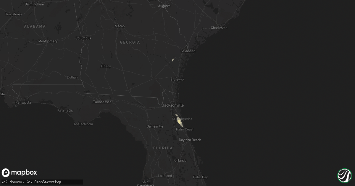
Hail Map in Florida on May 4, 2013
Get this storm
May 4 map
$229
one time, instant access
Download today. No call, no setup
Keep the $229
Bought the map and want the full workflow? Apply the entire $229 to a subscription within 7 days. None of it is wasted.
Every map, not just this one
This buys you this map. Subscription and you get every map we run, in the markets you choose from a few cities to whole states to nationwide. Plus real-time alerts the moment a storm fires.
Contact data
Name, contact info, occupancy, even credit band for addresses in the footprint. You go from where it hit to who to call.
Become the source they trust
Unlimited branding weather history reports on demand. You already have the documented answer ready for the property owner, and you are the one who showed up with it.
Property data and RoofTrace estimates
Pull up any address you have got, its value and the exact code rules for that jurisdiction, straight from One Click Code. Then RoofTrace estimates the squares, pitch, and roof value, priced the way you price.
Storm reports in Florida
Florida
| Date | Description |
|---|---|
| 05/03/20138:40 PM CDT | The sheriffs office received over 60 reports of powerlines down in the southwest portion of the county. The time given was based on radar. |
| 05/03/20138:23 PM CDT | The sheriffs office reported that a large tree fell on a house and split it in half. There were no reports of injuries. The time given was based on radar. |
| 05/03/20138:20 PM CDT | St johns county emergency management reported downed trees and powerlines along state route 207. Time estimated from radar. |
| 05/03/20138:18 PM CDT | The sheriffs office reported that there was major roof damage to a warehouse on county road 305 from a possible tornado.there was also reports of powerlines down. The t |
| 05/03/20138:15 PM CDT | Multiple trees were uprooted and fell on a boat. |
| 05/03/20138:15 PM CDT | A large tree was snapped at base and fell on mobile home causing significant damage. |
| 05/03/20138:15 PM CDT | A barn was severely damaged at jen-sar farms and produce. |
| 05/03/20138:14 PM CDT | A large barn was destroyed with noticeable debris lofted into nearby structures. |
| 05/03/20138:14 PM CDT | A barn was severely damaged at jen-sar farms and produce. |
| 05/03/20137:50 PM CDT | St johns county emergency management reported downed trees and powerlines along state route 16. Time estimated from radar. |
| 05/03/20137:25 PM CDT | Public reported tree down on powerline at state route 16 and state route 16a. Time estimated from radar. |


