Hail Map in Texas on May 4, 2012
Get this storm
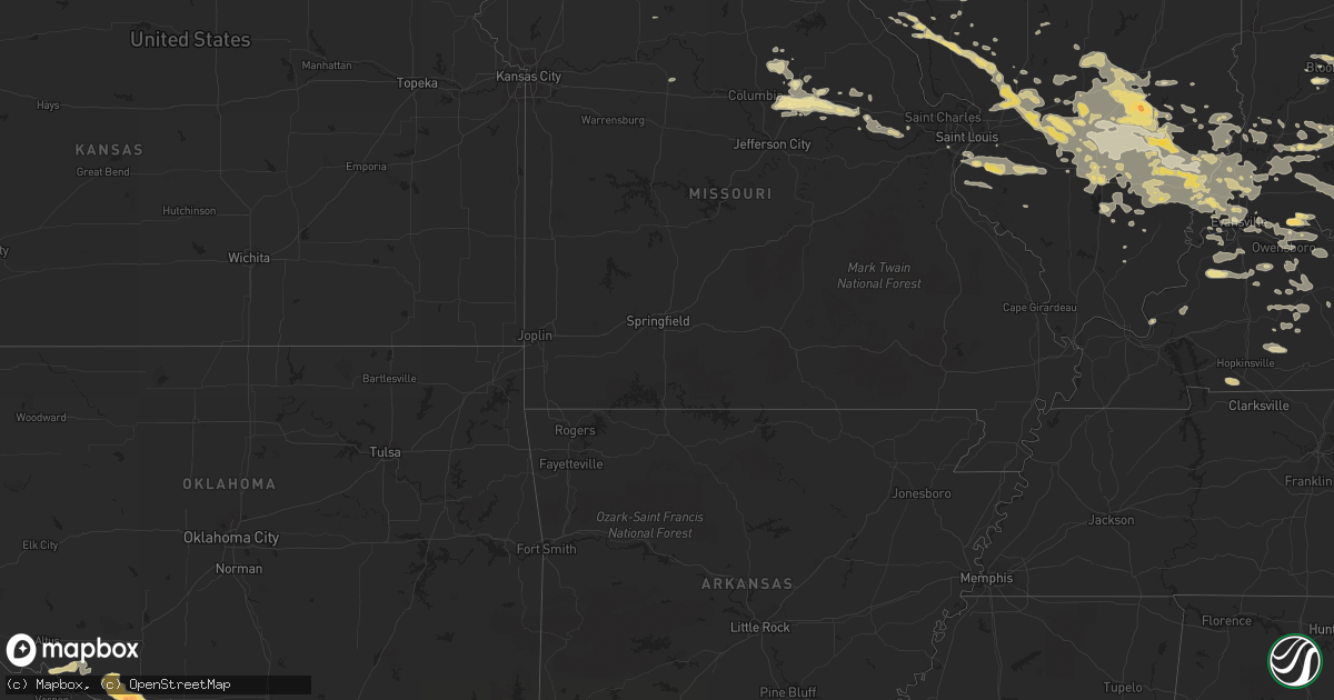
May 4 map
$229
one time, instant access
Download today. No call, no setup
Keep the $229
Bought the map and want the full workflow? Apply the entire $229 to a subscription within 7 days. None of it is wasted.
Every map, not just this one
This buys you this map. Subscription and you get every map we run, in the markets you choose from a few cities to whole states to nationwide. Plus real-time alerts the moment a storm fires.
Contact data
Name, contact info, occupancy, even credit band for addresses in the footprint. You go from where it hit to who to call.
Become the source they trust
Unlimited branding weather history reports on demand. You already have the documented answer ready for the property owner, and you are the one who showed up with it.
Property data and RoofTrace estimates
Pull up any address you have got, its value and the exact code rules for that jurisdiction, straight from One Click Code. Then RoofTrace estimates the squares, pitch, and roof value, priced the way you price.
Storm reports in Texas
Texas
| Date | Description |
|---|---|
| 05/04/20126:55 PM CDT | A local report indicates 1.75 inch wind near 1 S THORNBERRY |
| 05/04/20126:41 PM CDT | The hail was reported on i-44 at burkburnett. |
| 05/04/20126:40 PM CDT | A local report indicates 3.00 inch wind near 2 ENE BURKBURNETT |
| 05/04/20126:34 PM CDT | Sheriff office reported winds that almost blew a vehicle off the road |
| 05/04/20126:29 PM CDT | And 50 mph wind. |
| 05/04/20126:15 PM CDT | Quarter hail in graford |
| 05/04/20125:31 PM CDT | Pea to quarter size hail along highway 283. Hail is increasing in size. |
| 05/04/20125:05 PM CDT | A local report indicates 1.50 inch wind near ALBANY |
| 05/04/20125:00 PM CDT | Power line down in the community of albany. Time estimated from radar. |
| 05/04/20124:50 PM CDT | Nickel to quarter sized hail reported in south olney |
| 05/03/20129:37 PM CDT | 4 inch tree limb down in valley view |
| 05/03/20129:30 PM CDT | Possible heat burst or down burst |
| 05/03/20129:30 PM CDT | 1 foot diameter tree uprooted 4 miles north of little elm along highway 380 |
| 05/03/20129:20 PM CDT | 1 house damaged...may have been under construction. |
| 05/03/20129:15 PM CDT | 70 mph wind reported just south of whitewright |
| 05/03/20129:15 PM CDT | Report was south of whitesboro. This is a correction to the whitewright report. |
| 05/03/20129:07 PM CDT | 60 mph wind gusts and power lines blown down 2 southwest of midlothian |
| 05/03/20128:58 PM CDT | Fire department reported 60 mph wind gust in gainesville |
| 05/03/20128:47 PM CDT | A local report indicates 60 MPH wind near ALVARADO |
| 05/03/20128:45 PM CDT | A local report indicates 63 MPH wind near LINDSAY |
| 05/03/20128:42 PM CDT | Several trees down...size unknown. Damage to tin roof. |
| 05/03/20128:37 PM CDT | A local report indicates 60 MPH wind near CLEBURNE |
| 05/03/20128:30 PM CDT | 12 inch diameter tree snapped in half |
| 05/03/20128:28 PM CDT | With pea hail |
| 05/03/20128:25 PM CDT | A local report indicates 1.00 inch wind near MONTAGUE |
| 05/03/20128:22 PM CDT | Large tree limbs down in crowley |
| 05/03/20127:56 PM CDT | A local report indicates 1.00 inch wind near CRESSON |
| 05/03/20127:48 PM CDT | Palo pinto/parker county line |
| 05/03/20127:47 PM CDT | Mwl airport |
| 05/03/20127:45 PM CDT | Quarter sized hail in mineral wells |
| 05/03/20127:20 PM CDT | A local report indicates 1.75 inch wind near CARBON |
| 05/03/20127:20 PM CDT | Public reported golfball size hail in cross plains which produced extensive damage to vehicles |
| 05/03/20127:18 PM CDT | Power poles downed in lipan |
| 05/03/20127:18 PM CDT | 50 mph winds also |
| 05/03/20127:16 PM CDT | Pea to ping pong ball size hail reported in cross plains. |
| 05/03/20127:15 PM CDT | Tree damage |
| 05/03/20127:15 PM CDT | A local report indicates 1.75 inch wind near 2 E LIPAN |
| 05/03/20127:10 PM CDT | A local report indicates 1.00 inch wind near PETROLIA |
| 05/03/20127:06 PM CDT | Plus lots of dime sized hail |
| 05/03/20127:05 PM CDT | A local report indicates 60 MPH wind near 8 SW PETROLIA |
| 05/03/20127:00 PM CDT | On i-20 between cisco and eastland |
All States Impacted by Hail Map on May 4, 2012
Cities Impacted by Hail Map on May 4, 2012
- Canton, SD
- Worthing, SD
- Lennox, SD
- Covington, OH
- Bradford, OH
- Kinmundy, IL
- Vandalia, IL
- Vernon, IL
- Salem, IL
- Alma, IL
- Patoka, IL
- Shobonier, IL
- Sandoval, IL
- Odin, IL
- Lamar, IN
- Chrisney, IN
- Rockport, IN
- Grandview, IN
- Evanston, IN
- Nebo, IL
- Pearl, IL
- Branchville, VA
- Boykins, VA
- Waynesfield, OH
- Geddes, SD
- Aledo, TX
- Fort Worth, TX
- Wood, SD
- Center, NE
- Niobrara, NE
- North Bend, NE
- Scribner, NE
- Warrenton, MO
- Mineral Wells, TX
- Graford, TX
- Battle Creek, NE
- Madison, NE
- Meadow Grove, NE
- Albany, TX
- Petrolia, TX
- Devol, OK
- Grandfield, OK
- Loveland, OK
- Randlett, OK
- Burkburnett, TX
- Wichita Falls, TX
- Hanover, IN
- Bedford, KY
- Milton, KY
- Princeton, IN
- Bee Spring, KY
- Leitchfield, KY
- Oneill, NE
- Lynch, NE
- New Haven, KY
- Ruthven, IA
- Graettinger, IA
- Falls Of Rough, KY
- Hardinsburg, KY
- Glasgow, KY
- Cave City, KY
- Bloomfield, KY
- Springfield, KY
- Bardstown, KY
- Clyde, TX
- Tuscola, TX
- Lawn, TX
- Ovalo, TX
- Dryden, TX
- Hanlontown, IA
- Fertile, IA
- Joice, IA
- Havelock, IA
- Louisville, IL
- Saint Paul, NE
- Albion, NE
- Monroe, NE
- Newman Grove, NE
- Saint Edward, NE
- Lindsay, NE
- Genoa, NE
- Humphrey, NE
- Platte Center, NE
- Hodgenville, KY
- Abilene, TX
- Grandview, TX
- Stephenville, TX
- Eastland, TX
- Cisco, TX
- Gorman, TX
- Carbon, TX
- Hot Springs, SD
- Custer, SD
- Fairburn, SD
- Buffalo Gap, SD
- Mount Hermon, KY
- Cross Plains, TX
- White River, SD
- Winner, SD
- Burt, IA
- Welcome, MN
- Ledyard, IA
- Emmetsburg, IA
- Wilmont, MN
- Round Lake, MN
- Swea City, IA
- Armstrong, IA
- Estherville, IA
- Granada, MN
- Fulda, MN
- Buffalo Center, IA
- Ceylon, MN
- Lakota, IA
- Wallingford, IA
- Fairmont, MN
- Titonka, IA
- Woden, IA
- Worthington, MN
- Okabena, MN
- Elmore, MN
- Lone Rock, IA
- Cylinder, IA
- Adrian, MN
- Lismore, MN
- Alpha, MN
- Rushmore, MN
- Bancroft, IA
- Reading, MN
- Dunnell, MN
- Sherburn, MN
- Brewster, MN
- Whittemore, IA
- Lakefield, MN
- Algona, IA
- Fenton, IA
- Ringsted, IA
- Dolliver, IA
- Jackson, MN
- Rockwell, IA
- Colon, NE
- Cedar Bluffs, NE
- Fremont, NE
- Xenia, OH
- Jamestown, OH
- Maineville, OH
- West Chester, OH
- Cincinnati, OH
- Mason, OH
- Loveland, OH
- Hooper, NE
- Gamaliel, KY
- Muenster, TX
- Saint Jo, TX
- Dodge, NE
- Rising Star, TX
- Goldthwaite, TX
- Evant, TX
- Comanche, TX
- Zephyr, TX
- Mullin, TX
- Pottsville, TX
- Blanket, TX
- Sidney, TX
- Hamilton, TX
- Jonesboro, TX
- Purmela, TX
- May, TX
- Gatesville, TX
- Golden Gate, IL
- Rinard, IL
- Cisne, IL
- Flora, IL
- Noble, IL
- Mount Erie, IL
- Clay City, IL
- Talpa, TX
- Alcester, SD
- Hawarden, IA
- Mount Vernon, IL
- Crossville, IL
- New Harmony, IN
- Griffin, IN
- Benton, IL
- Whittington, IL
- Ewing, IL
- George, IA
- Cleburne, TX
- Sanborn, IA
- Wells, MN
- Kiester, MN
- Scarville, IA
- Thompson, IA
- Bricelyn, MN
- Bluff Dale, TX
- Meridian, TX
- Glen Rose, TX
- Hico, TX
- Walnut Springs, TX
- Iredell, TX
- Dublin, TX
- Emporia, VA
- Garysburg, NC
- Gaston, NC
- Skippers, VA
- Clay, KY
- Morganfield, KY
- Dixon, KY
- Moran, TX
- Greenville, IA
- Webb, IA
- Spencer, IA
- Ayrshire, IA
- Dickens, IA
- Clearwater, NE
- Elgin, NE
- Ewing, NE
- Boston, KY
- Lebanon Junction, KY
- Elizabethtown, KY
- Owensboro, KY
- Calhoun, KY
- Utica, KY
- Peebles, OH
- Scotia, NE
- North Loup, NE
- Deadwood, SD
- Auxvasse, MO
- Cresco, IA
- Elma, IA
- Battletown, KY
- Scottsburg, IN
- New Athens, IL
- Freeburg, IL
- Smithton, IL
- Freedom, IN
- Bloomington, IN
- Ellettsville, IN
- Nashville, IN
- Gosport, IN
- Spencer, IN
- Albany, OH
- Wilkesville, OH
- Wellston, OH
- Hamden, OH
- Mackville, KY
- Harrodsburg, KY
- Gravel Switch, KY
- Willisburg, KY
- Perryville, KY
- Walnut Hill, IL
- Centralia, IL
- Dix, IL
- Fulton, MO
- Vivian, SD
- Draper, SD
- Presho, SD
- Laurel, NE
- Wayne, NE
- Wakefield, NE
- Primrose, NE
- Cedar Rapids, NE
- Ord, NE
- Platte, SD
- Pukwana, SD
- Fairland, OK
- Ansley, NE
- Broken Bow, NE
- Baird, TX
- Burkett, TX
- Coleman, TX
- London, OH
- Jeffersonville, OH
- Mount Sterling, OH
- Bloomingburg, OH
- South Solon, OH
- Allen, NE
- Kyle, SD
- Santo, TX
- Granbury, TX
- Lipan, TX
- Weatherford, TX
- Tolar, TX
- Millsap, TX
- De Leon, TX
- Palo Pinto, TX
- Thorntown, IN
- Nickerson, NE
- Ames, NE
- Arlington, NE
- Millersburg, PA
- Halifax, PA
- New Hampton, IA
- Alta Vista, IA
- Chester, IA
- Riceville, IA
- Saint Ansgar, IA
- Stacyville, IA
- McIntire, IA
- Little Cedar, IA
- Osage, IA
- Lime Springs, IA
- Bassett, NE
- Burwell, NE
- Fairfield, IL
- Geff, IL
- Bloomfield, IN
- Solsberry, IN
- Mitchell, IN
- Holliday, TX
- Vine Grove, KY
- Sumner, IL
- Waverly, KY
- Henderson, KY
- Corydon, KY
- Robards, KY
- Mount Carmel, IL
- Grayville, IL
- Browns, IL
- Ellery, IL
- Owensville, IN
- Poseyville, IN
- Albion, IL
- Saint Elmo, IL
- Edgewood, IL
- Xenia, IL
- Farina, IL
- Mason, IL
- Palmer, IA
- Manson, IA
- Frederick, OK
- Hollister, OK
- Herndon, KY
- Mount Olive, IL
- Kennebec, SD
- Kadoka, SD
- Scenic, SD
- Murdo, SD
- Okaton, SD
- Long Valley, SD
- Wanblee, SD
- Interior, SD
- Belvidere, SD
- Wall, SD
- Gilmore City, IA
- Sedley, VA
- Courtland, VA
- San Angelo, TX
- Verdigre, NE
- Callaway, NE
- Liverpool, PA
- Centralia, MO
- Hallsville, MO
- Thompson, MO
- Pleasanton, NE
- Arcadia, NE
- Hazard, NE
- Litchfield, NE
- Mason City, NE
- Marengo, OH
- Halifax, NC
- Scotland Neck, NC
- Melvin, IA
- Sheldon, IA
- Hartley, IA
- Williamsburg, MO
- Montgomery City, MO
- Wolbach, NE
- Greeley, NE
- Elba, NE
- Ericson, NE
- Floyd, IA
- Rudd, IA
- Orchard, IA
- Germantown, OH
- Millstadt, IL
- Columbia, IL
- Newcastle, WY
- Hoskins, NE
- Pierce, NE
- Dundas, IL
- Newton, IL
- Ingraham, IL
- Hubbard, TX
- Dawson, TX
- Keystone, SD
- Orleans, IN
- Salem, IN
- Vallonia, IN
- Brownstown, IN
- Austin, IN
- Campbellsburg, IN
- West Liberty, IL
- Olney, IL
- Willow Hill, IL
- Loogootee, IN
- Cannelburg, IN
- Shoals, IN
- Newcastle, TX
- Kingdom City, MO
- New Florence, MO
- Park City, KY
- Sturgis, SD
- Wisner, NE
- Pender, NE
- Waterbury, NE
- Hubbard, NE
- Jackson, NE
- Waynesboro, GA
- Loup City, NE
- Ideal, SD
- Witten, SD
- Marble Rock, IA
- Rockford, IA
- Greensburg, KY
- Hardyville, KY
- Canmer, KY
- Bowman, SC
- Branchville, SC
- Harleyville, SC
- Saint George, SC
- Rowesville, SC
- Breckenridge, TX
- Central City, KY
- Enfield, NC
- Edgemont, SD
- Clare, IA
- Barnum, IA
- Fort Dodge, IA
- Rapid City, SD
- Providence Forge, VA
- Charles City, VA
- Woodson, TX
- Mascoutah, IL
- Addieville, IL
- Marissa, IL
- Saint Libory, IL
- Gregory, SD
- Colton, SD
- Claremont, IL
- Francisco, IN
- Oakland City, IN
- Bartlett, NE
- Freeman, SD
- Altamont, IL
- Effingham, IL
- Pine Ridge, SD
- Winside, NE
- Randolph, NE
- Ennis, TX
- Hull, IA
- Boyden, IA
- Rock Valley, IA
- Sioux Center, IA
- Hospers, IA
- Orange City, IA
- Newport, PA
- Millerstown, PA
- Hamill, SD
- New Albany, IN
- Floyds Knobs, IN
- Thackerville, OK
- Gainesville, TX
- Burke, SD
- Brownwood, TX
- Pocahontas, IA
- Laurens, IA
- Hillsboro, OH
- Lima, OH
- Shipman, IL
- Bunker Hill, IL
- Gillespie, IL
- Collinsville, TX
- Valley View, TX
- Tioga, TX
- Waxahachie, TX
- Forreston, TX
- Nocona, TX
- Bowie, TX
- Montague, TX
- Walton, KY
- Morning View, KY
- Independence, KY
- Beaver Dam, KY
- Rogers, NE
- Hardwick, MN
- Luverne, MN
- Jasper, MN
- Alexandria, SD
- Zanesville, OH
- Dresden, OH
- Ashton, NE
- Littleton, NC
- Roanoke Rapids, NC
- Evansville, IN
- Webster, KY
- Vincennes, IN
- Santa Anna, TX
- Belleville, IL
- Wadesville, IN
- Humboldt, IA
- Rutland, IA
- Lu Verne, IA
- Corwith, IA
- Clear Lake, IA
- Forest City, IA
- Lead, SD
- Heron Lake, MN
- Emmons, MN
- Saint Louis, MO
- Ringling, OK
- Schuyler, NE
- Linwood, NE
- Howells, NE
- Haubstadt, IN
- Elberfeld, IN
- Fort Branch, IN
- Black Hawk, SD
- Hill City, SD
- Piedmont, SD
- Lake Park, IA
- Shelby, OH
- Seneca, NE
- Valentine, NE
- Nabb, IN
- Lexington, IN
- Conesville, OH
- Duncannon, PA
- Shermans Dale, PA
- New Bloomfield, PA
- Marysville, PA
- Jacksonville, IL
- Henrico, NC
- Middletown, OH
- Springboro, OH
- Lebanon, OH
- Franklin, OH
- Marthasville, MO
- Whitesboro, TX
- Borden, IN
- Pekin, IN
- Moyock, NC
- Plankinton, SD
- Mount Vernon, SD
- Ireton, IA
- Primghar, IA
- Ashton, IA
- Winters, TX
- Norton, TX
- Paullina, IA
- Granville, IA
- Dahlgren, IL
- McLeansboro, IL
- Wayne City, IL
- Burnt Prairie, IL
- Enfield, IL
- Carmi, IL
- Springerton, IL
- Mill Shoals, IL
- Barnhill, IL
- Dell Rapids, SD
- Garretson, SD
- Taylor, NE
- Brewster, NE
- Cedar Grove, IN
- Brookville, IN
- Lafayette, TN
- Peterson, IA
- Coxs Creek, KY
- Shepherdsville, KY
- Marietta, OK
- Comstock, NE
- Dallas, SD
- Delmont, SD
- Armour, SD
- Smiths Grove, KY
- Selma, NC
- Clayton, NC
- Smithfield, NC
- Virginia Beach, VA
- Inman, NE
- Norris, SD
- Blue Earth, MN
- Hale, MO
- Valley Springs, SD
- Beaver Creek, MN
- Brandon, SD
- Sioux City, IA
- West Point, KY
- Albert City, IA
- Plover, IA
- Mallard, IA
- Curlew, IA
- Rolfe, IA
- Carlinville, IL
- Lewisport, KY
- Tell City, IN
- Troy, IN
- Baltic, SD
- Maceo, KY
- Carlyle, IL
- Pocahontas, IL
- Keyesport, IL
- Greenville, IL
- Clarkson, KY
- Munfordville, KY
- Quinn, SD
- Bridgewater, SD
- Bridgeport, IL
- Flat Rock, IL
- Lawrenceville, IL
- Byers, TX
- Chattanooga, OK
- Henrietta, TX
- Walters, OK
- Okawville, IL
- Belton, KY
- Beechmont, KY
- Beech Creek, KY
- Greenville, KY
- Olney, TX
- Varnville, SC
- Bluford, IL
- Keenes, IL
- Tompkinsville, KY
- Pleasant Hill, NC
- Jefferson, SD
- Coatesville, PA
- Allendale, IL
- Saint Francisville, IL
- Fountain Run, KY
- Etoile, KY
- Summer Shade, KY
- Archer, IA
- Spalding, NE
- Hillsboro, IL
- Donnellson, IL
- Walshville, IL
- Alhambra, IL
- Worden, IL
- New Douglas, IL
- Hamel, IL
- Highland, IL
- Edwardsville, IL
- Staunton, IL
- Breese, IL
- Clifton, TX
- Vernon, TX
- Elmer, OK
- Saint Paris, OH
- Urbana, OH
- Pittsfield, IL
- White Hall, IL
- Rockbridge, IL
- Eldred, IL
- Carrollton, IL
- Kampsville, IL
- Medora, IL
- Chesterfield, IL
- Franklin, VA
- Upton, WY
- Westside, IA
- Vail, IA
- Fonda, IA
- Hamilton, OH
- Crowley, TX
- Akron, IA
- Le Mars, IA
- Montgomery, IN
- Sorento, IL
- Gap, PA
- Narvon, PA
- Oconee, IL
- Dorsey, IL
- Dieterich, IL
- Chandler, IN
- Saint Peter, IL
- Johnsonville, IL
- Mount Vernon, IN
- Marine, IL
- Hoffman, IL
- Woodlawn, IL
- Tower Hill, IL
- Lynnville, IN
- Bone Gap, IL
- Ramsey, IL
- Petersburg, IN
- Decker, IN
- Hoyleton, IL
- Shumway, IL
- Texico, IL
- West Salem, IL
- Patoka, IN
- Winslow, IN
- Watson, IL
- Cowden, IL
- Kell, IL
- Beckemeyer, IL
- Irvington, IL
- Herrick, IL
- Waltonville, IL
- Livingston, IL
- Ashley, IL
- Iuka, IL
- Belle Rive, IL
- Bellmont, IL
- Cynthiana, IN
- Brownstown, IL
- Lakewood, IL
- Mulberry Grove, IL
- Richview, IL
- Sims, IL
- Sailor Springs, IL
- Aviston, IL
- Opdyke, IL
- Teutopolis, IL
- Beecher City, IL
- Hazleton, IN
- Lebanon, KY
- Sharon Grove, KY
- Elkton, KY
- White Lake, SD
- Clarkson, NE
- Morse Bluff, NE
- Leigh, NE
- Renwick, IA
- Livermore, IA
- Farwell, NE
- Rockville, NE
- Bancroft, NE
- Rosalie, NE
- Lyons, NE
- Petersburg, NE
- Hartford, SD
- Trent, SD
- Foristell, MO
- Augusta, MO
- Hinton, IA
- Newell, IA
- Sac City, IA
- Milford, IA
- Spirit Lake, IA
- Portland, MO
- Rhineland, MO
- Big Clifty, KY
- Kenneth, MN
- Doon, IA
- Island, KY
- Union Star, KY
- Ionia, IA
- Charles City, IA
- Foster, KY
- Felicity, OH
- Brooksville, KY
- Georgetown, OH
- Augusta, KY
- Lake Mills, IA
- Stendal, IN
- Bode, IA
- Ottosen, IA
- Hermosa, SD
- Huntingburg, IN
- Saint Anthony, IN
- Henryville, IN
- Caneyville, KY
- Ballinger, TX
- Macedonia, IL
- Broughton, IL
- Burna, KY
- Smithland, KY
- Jonesburg, MO
- Hermann, MO
- Sheffield, IA
- Brandenburg, KY
- Payneville, KY
- Dougherty, IA
- Somerville, OH
- Camden, OH
- Pomeroy, IA
- Varina, IA
- New Riegel, OH
- McCutchenville, OH
- Carey, OH
- Steedman, MO
- High Hill, MO
- Yemassee, SC
- Pilger, NE
- Stanton, NE
- Calumet, IA
- Alton, IA
- Sioux Rapids, IA
- Royal, IA
- Linn Grove, IA
- Sutherland, IA
- Litchfield, IL
- Yukon, OK
- Millwood, KY
- Brownsville, KY
- Centertown, KY
- East Carondelet, IL
- Dupo, IL
- Creston, NE
- Lawler, IA
- Mason City, IA
- Nora Springs, IA
- Plymouth, IA
- Novice, TX
- Dalmatia, PA
- Wheeler, IL
- Desdemona, TX
- Newburgh, IN
- Thompsonville, IL
- Galatia, IL
- Willow Spring, NC
- Fuquay Varina, NC
- Caputa, SD
- Cub Run, KY
- Bicknell, IN
- Rosamond, IL
- Pana, IL
- Vinton, OH
- Pattonville, TX
- Paris, TX
- Mount Washington, KY
- Branchville, IN
- Leopold, IN
- Elizabeth, IN
- Adams, TN
- Raleigh, NC
- Little Rock, IA
- Crothersville, IN
- Alden, MN
- Parkston, SD
- Emery, SD
- Heltonville, IN
- Bedford, IN
- Ethan, SD
- Tipton, OK
- Lindsay, TX
- Waynesville, OH
- Horse Cave, KY
- West Union, OH
- Perrin, TX
- Emerson, NE
- Dixon, NE
- Concord, NE
- Brooks, KY
- Ivor, VA
- Zuni, VA
- Morgantown, KY
- Norman, IN
- Hudson, KY
- Lenzburg, IL
- Nashville, IL
- Waterloo, IL
- Hudson, SD
- Leavenworth, IN
- West Baden Springs, IN
- Upton, KY
- Bonnieville, KY
- Eastview, KY
- Twin Lakes, MN
- Hardy, IA
- Harris, IA
- Ocheyedan, IA
- Edmonton, KY
- Montrose, SD
- Kanawha, IA
- Britt, IA
- Dimock, SD
- Newsoms, VA
- Drewryville, VA
- Roodhouse, IL
- Winchester, IL
- Joshua, TX
- La Fayette, KY
- Chambers, NE
- Elyria, NE
- Westerville, NE
- Marion, SD
- Canistota, SD
- Hawk Point, MO
- Manly, IA
- Garner, IA
- Kensett, IA
- Northwood, IA
- Palmyra, IN
- Cannelton, IN
- English, IN
- Saint Croix, IN
- Greenville, IN
- Abbott, TX
- Mount Calm, TX
- Coolidge, TX
- Penelope, TX
- Whitney, TX
- Aquilla, TX
- Morrisonville, IL
- Palmyra, IL
- Holstein, IA
- Sonora, KY
- White Mills, KY
- Sebree, KY
- Merrill, IA
- Mexico, MO
- Benton City, MO
- Oakland, KY
- Richland, IN
- Italy, TX
- Maypearl, TX
- Beresford, SD
- Rock Rapids, IA
- Bronte, TX
- Columbus, IN
- Seymour, IN
- Seaboard, NC
- Sycamore, OH
- Amelia, NE
- Bremen, KY
- Burleson, TX
- Bellflower, MO
- Truxton, MO
- Spring Valley, OH
- Freetown, IN
- Brunsville, IA
- Pilot Point, TX
- Gunter, TX
- Crawfordsville, IN
- Glendale, KY
- Rineyville, KY
- Cecilia, KY
- Guston, KY
- Central, IN
- Fort Knox, KY
- Garfield, KY
- Rhodelia, KY
- Mauckport, IN
- Stephensport, KY
- Laconia, IN
- Muldraugh, KY
- Taylorsville, KY
- Derby, IN
- Irvington, KY
- Fairdale, KY
- Bristow, IN
- Ekron, KY
- Louisville, KY
- Corydon, IN
- Birdseye, IN
- Harned, KY
- Clermont, KY
- Radcliff, KY
- Jasper, IN
- Custer, KY
- Ferdinand, IN
- Hampton, IA
- Bloomfield, NE
- Norlina, NC
- Warrenton, NC
- Wapakoneta, OH
- Fort Stockton, TX
- Tiline, KY
- Rockport, IL
- Livermore, KY
- Hartford, KY
- Cope, SC
- Bamberg, SC
- Valley Mills, TX
- West, TX
- Canaan, IN
- Marion, KY
- Fredonia, KY
- Red Bud, IL
- Alvarado, TX
- Keene, TX
- Venus, TX
- Godley, TX
- Harvel, IL
- Windthorst, TX
- Wesley, IA
- Dunmor, KY
- West Bend, IA
- Murrayville, IL
- Dayton, OH
- Greenfield, IL
- Hettick, IL
- Itasca, TX
- Gustine, TX
- Carlton, TX
- Rake, IA
- Carpenter, IA
- Glenville, MN
- Adams, MN
- Calmar, IA
- Grafton, IA
- Leland, IA
- Lyle, MN
- Albert Lea, MN
- Waucoma, IA
- Frost, MN
- Ventura, IA
- Spencer, SD
- Decatur, NE
- Inwood, IA
- Seaman, OH
- Washington, IN
- Otwell, IN
- French Lick, IN
- Westview, KY
- Farmersville, OH
- Pleasant Hill, IL
- Morrow, OH
- Marshall, MO
- Medora, IN
- Corning, OH
- New Lexington, OH
- Crooksville, OH
- Jacksboro, TX
- Kopperl, TX
- Whitesville, KY
- Reynolds Station, KY
- Philpot, KY
- Hawesville, KY
- Fordsville, KY
- Wingate, TX
- Humboldt, SD
- West Point, NE
- Ainsworth, NE
- Bowling Green, KY
- Poolville, TX
- Whitt, TX
- Underwood, IN
- Dubois, IN
- Colfax, IN
- Jackson, OH
- Eldorado, IL
- Waco, TX
- Beachwood, NJ
- Bayville, NJ
- Toms River, NJ
- Pine Beach, NJ
- Carroll, NE
- Pitman, PA
- Leck Kill, PA
- Klingerstown, PA
- Velpen, IN
- Kimball, SD
- Boonville, IN
- Winnebago, MN
- Clarion, IA
- Goldfield, IA
- Lynx, OH
- McDaniels, KY
- Drakesboro, KY
- Browder, KY
- Lyons, SD
- Knob Lick, KY
- Wheatland, IN
- Monroe City, IN
- Lewisburg, KY
- Hopkinsville, KY
- Stonefort, IL
- Overbrook, OK
- Burneyville, OK
- Manson, NC
- Henderson, NC
- Sparta, IL
- Goldsboro, TX
- Early, TX
- Brookston, TX
- Petty, TX
- Roxton, TX
- Badger, IA
- Lebanon, PA
- Coffeen, IL
- Bingham, IL
- Fillmore, IL
- Slaughters, KY
- Hollister, NC
- Rumsey, KY
- Sacramento, KY
- Hanson, KY
- Howe, TX
- Celina, TX
- Williams, IN
- Tunnelton, IN
- Smithboro, IL
- Springfield, OH
- Magnolia, KY
- Columbia, MO
- Wellsville, MO
- Martinsburg, MO
- Defiance, MO
- Clarksville, IN
- Sellersburg, IN
- Memphis, IN
- Coshocton, OH
- Waveland, IN
- Midlothian, TX
- Center, KY
- Maysville, KY
- Reed, KY
- Page, NE
- Plainville, IN
- Windsor, VA
- Suffolk, VA
- Osmond, NE
- Mclean, NE
- Ranger, TX
- Bridgeport, TX
- Forestburg, TX
- Mingus, TX
- Strawn, TX
- Gordon, TX
- Sunset, TX
- Chico, TX
- Decatur, TX
- Springtown, TX
- Paradise, TX
- Alvord, TX


