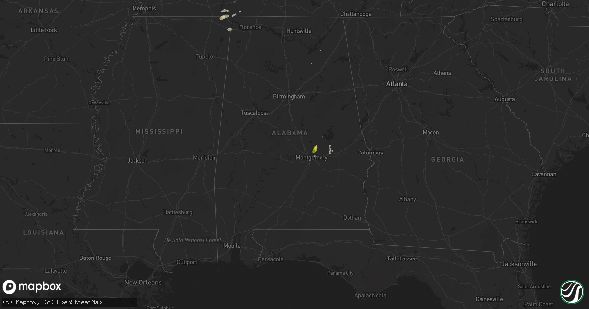
Hail Map in Alabama on May 1, 2019
Get this storm
May 1 map
$229
one time, instant access
Download today. No call, no setup
Keep the $229
Bought the map and want the full workflow? Apply the entire $229 to a subscription within 7 days. None of it is wasted.
Every map, not just this one
This buys you this map. Subscription and you get every map we run, in the markets you choose from a few cities to whole states to nationwide. Plus real-time alerts the moment a storm fires.
Contact data
Name, contact info, occupancy, even credit band for addresses in the footprint. You go from where it hit to who to call.
Become the source they trust
Unlimited branding weather history reports on demand. You already have the documented answer ready for the property owner, and you are the one who showed up with it.
Property data and RoofTrace estimates
Pull up any address you have got, its value and the exact code rules for that jurisdiction, straight from One Click Code. Then RoofTrace estimates the squares, pitch, and roof value, priced the way you price.
Storm reports in Alabama
Alabama
| Date | Description |
|---|---|
| 05/01/20194:48 PM CDT | Quarter size hail at the winn dixie on highway 231. |
| 05/01/20194:46 PM CDT | Quarter size hail near walmart on highway 231. |
| 04/30/201911:50 PM CDT | At 449 PM CDT, a severe thunderstorm was located near Walnut Grove, or 14 miles northeast of J P Coleman State Park, moving northeast at 30 mph. HAZARD...60 mph wind gusts and penny size hail. SOURCE...Radar indicated. IMPACT...Expect damage to roofs, siding, and trees. Locations impacted include... Collinwood, Cypress Inn and Lutts. |
| 04/30/201911:48 PM CDT | At 447 PM CDT, a severe thunderstorm was located over Wetumpka, moving north at 15 mph. HAZARD...60 mph wind gusts and quarter size hail. SOURCE...Radar indicated. IMPACT...Hail damage to vehicles is expected. Expect wind damage to roofs, siding, and trees. Locations impacted include... Wetumpka, Eclectic, Santuck, Ten Cedar Estates, Blue Ridge, Dexter, Jordan Lake, Western Lake Martin, Wallsboro, Central, Jordan Dam and Claud. |
All States Impacted by Hail Map on May 1, 2019
Cities Impacted by Hail Map on May 1, 2019
- Clifton, TN
- Ben Wheeler, TX
- Scroggins, TX
- Winnsboro, TX
- Pampa, TX
- Breckenridge, TX
- Bagwell, TX
- Detroit, TX
- Blossom, TX
- Clarksville, TX
- Kingston, OK
- Seymour, TX
- Mount Vernon, TX
- Jonesboro, TX
- Purmela, TX
- Graham, TX
- Loving, TX
- Olney, TX
- Newcastle, TX
- Allen, TX
- Durant, OK
- Bennington, OK
- Bokchito, OK
- Macon, MO
- Miami, TX
- Weatherford, TX
- Throckmorton, TX
- Mill Creek, OK
- Albany, TX
- Wolfe City, TX
- Ladonia, TX
- Skellytown, TX
- Bourbon, MO
- Kiowa, OK
- Blanco, OK
- Wetumpka, AL
- Roscoe, TX
- Sulphur Bluff, TX
- Greenville, TX
- Lone Oak, TX
- Caddo Mills, TX
- Quinlan, TX
- Grapeland, TX
- Bowie, TX
- McCaulley, TX
- Blanchard, OK
- Wilson, OK
- Healdton, OK
- Windthorst, TX
- Jacksboro, TX
- Cumby, TX
- Campbell, TX
- Ivanhoe, TX
- Telephone, TX
- Como, TX
- Yantis, TX
- Pickton, TX
- Pottsboro, TX
- Valley View, TX
- Gainesville, TX
- Wister, OK
- Clayton, IL
- Liberty, IL
- Puxico, MO
- Haworth, OK
- Lindsay, OK
- Quanah, TX
- Gould, OK
- Mclean, TX
- Nevada, TX
- Royse City, TX
- Farmersville, TX
- Lavon, TX
- Sylvester, TX
- Saint Jo, TX
- Chickasha, OK
- Pattonville, TX
- Deport, TX
- Mena, AR
- Overbrook, OK
- Avery, TX
- Neelyville, MO
- Purcell, OK
- Holliday, TX
- Calera, OK
- Denison, TX
- Hendrix, OK
- Colbert, OK
- Cape Girardeau, MO
- Scotland, TX
- Washington, OK
- Clifton, TX
- Gatesville, TX
- Cranfills Gap, TX
- Nocona, TX
- Springer, OK
- Anson, TX
- Amber, OK
- Fremont, MO
- Van Buren, MO
- Mobeetie, TX
- Wheeler, TX
- Rule, TX
- Stamford, TX
- Clinton, MO
- Woodson, TX
- Waurika, OK
- Sulphur Springs, TX
- Marceline, MO
- New Cambria, MO
- Sunset, TX
- Lowry City, MO
- Deepwater, MO
- Avoca, TX
- Old Glory, TX
- Lueders, TX
- Aspermont, TX
- Haskell, TX
- Hamlin, TX
- Wichita Falls, TX
- Bellevue, TX
- Kaufman, TX
- Terrell, TX
- Fort Stockton, TX
- Odessa, MO
- Holly, CO
- Athens, TN
- Comanche, OK
- Burfordville, MO
- Jackson, MO
- Whitewater, MO
- Pritchett, CO
- Graham, OK
- Ringling, OK
- Ardmore, OK
- Counce, TN
- Savannah, TN
- Mead, OK
- Madill, OK
- Cartwright, OK
- Decatur, TX
- Chico, TX
- Alvord, TX
- Fort Worth, TX
- Abilene, TX
- Duncan, OK
- Lake Creek, TX
- Cooper, TX
- Tuttle, OK
- Newcastle, OK
- Alex, OK
- Ninnekah, OK
- Windom, TX
- Rush Springs, OK
- Marlow, OK
- Rotan, TX
- Hawley, TX
- Merkel, TX
- Henrietta, TX
- Bonham, TX
- Ravenna, TX
- Talco, TX
- Paris, TX
- Lipan, TX
- Granbury, TX
- Camp Point, IL
- Altus, AR
- Ozark, AR
- Montague, TX
- New Burnside, IL
- Stonefort, IL
- Ozark, IL
- Forestburg, TX
- Bogata, TX
- Eldorado, OK
- Umpire, AR
- Quitman, TX
- Springfield, CO
- Emden, MO
- Shelbyville, MO
- Salisbury, MO
- Ector, TX
- Whitewright, TX
- Philadelphia, TN
- Loudon, TN
- Las Animas, CO
- Cairo, IL
- Pomona, MO
- Pauls Valley, OK
- Maysville, OK
- Paoli, OK
- Weinert, TX
- Wells, TX
- Alto, TX
- Troup, TX
- Roby, TX
- Jermyn, TX
- Archer City, TX
- Kennard, TX
- Rusk, TX
- Dryden, TX
- Jacksonville, TX
- Niota, TN
- Shamrock, TX
- Iuka, MS
- Burnsville, MS
- Waterloo, AL
- Birch Tree, MO
- Alton, MO
- Celeste, TX
- Waldron, AR
- Broken Bow, OK
- Loco, OK
- Hillsboro, TX
- Fisk, MO
- Harrold, TX
- Oklaunion, TX
- Granada, CO
- Walsh, CO
- Saint James, MO
- Cuba, MO
- Holladay, TN
- Poolville, TX
- Klondike, TX
- Commerce, TX
- Burneyville, OK
- Leon, OK
- Albertville, AL
- Muenster, TX
- Marietta, OK
- White Deer, TX
- Clarksville, AR
- Ryan, OK
- Foster, OK
- Elmore City, OK
- Hennepin, OK
- Ratliff City, OK
- Cook Sta, MO
- Salem, MO
- Cherryville, MO
- Johnson, KS
- Milburn, OK
- Kenefic, OK
- Coleman, OK
- Whitesboro, TX
- Gordonville, TX
- Wylie, TX
- Tallassee, AL
- Shorter, AL
- Leona, TX
- Centerville, TX
- Sugar City, CO
- Arlington, CO
- Clyde, TX
- Idabel, OK
- Rattan, OK
- Antlers, OK
- Savoy, TX
- Bells, TX
- Trenton, TX
- Equality, AL
- Eclectic, AL
- Lutts, TN
- Era, TX
- Ringgold, TX
- Emory, TX
- Brashear, TX
- Gardner, KS
- Olathe, KS
- Wynnewood, OK
- Davis, OK
- Cement, OK
- Cairo, MO
- Moberly, MO
- Huntsville, MO
- Stonewall, OK
- Roff, OK
- Willow Springs, MO
- Bryson, TX
- Muse, OK
- Hodgen, OK
- Whitesboro, OK
- Electra, TX
- Leonard, TX
- Eustace, TX
- Canton, TX
- Heavener, OK
- Tuskegee, AL
- Athens, TX
- Mayview, MO
- Sumner, TX
- Roxton, TX
- Brookston, TX
- Rothville, MO
- Bridgeport, TX
- Fort Scott, KS
- Charleston, MO
- Guston, KY
- Irvington, KY
- Olivehill, TN
- Henderson, TX
- Powderly, TX
- Arthur City, TX
- Point, TX
- Caddo, TX
- Mabank, TX
- Ranger, TX
- Honey Grove, TX
- Madisonville, TX
- Longview, TX
- West Plains, MO
- Mountain View, MO
- Chickamauga, GA
- Palo Pinto, TX
- Groom, TX
- Calhoun, TN
- Decatur, TN
- Cresson, TX
- Moran, TX
- Strawn, TX
- Vernon, TX
- Corning, AR
- Lone Grove, OK
- Lebanon, OK
- Thebes, IL
- Olive Branch, IL
- Talihina, OK
- Kilgore, TX
- Boaz, AL
- Iowa Park, TX
- Tishomingo, OK
- Anabel, MO
- La Fayette, GA
- Charleston, AR
- Waynesville, MO
- Laquey, MO
- Howe, OK
- Tuskahoma, OK
- Montgomery, AL
- Elkhart, TX
- Palestine, TX
- Branch, AR
- Ratcliff, AR
- Marble Hill, MO
- Leopold, MO
- Omaha, TX
- Owensboro, KY
- Henderson, KY
- Greenwood, AR
- Sherman, TX
- Grandview, TX
- Fletcher, OK
- Cyril, OK
- Loraine, TX
- Higbee, MO
- Blackwell, TX
- Garvin, OK
- Callao, MO
- Bevier, MO
- Childress, TX
- Wellington, TX
- Boswell, OK
- Dallas, TX
- Mesquite, TX
- Ulysses, KS
- Tupelo, OK
- Centrahoma, OK
- Millsap, TX
- Broseley, MO
- Qulin, MO
- Carmi, IL
- Norris City, IL
- Hugo, OK
- Wickliffe, KY
- Dodson, TX
- Wickes, AR
- Grannis, AR
- Copperas Cove, TX
- Kempner, TX
- Ewing, MO
- Philadelphia, MO
- Atoka, OK
- Coalgate, OK
- Seagoville, TX
- Bradley, OK
- Mannsville, OK
- Briscoe, TX
- Cherokee, AL
- Eldorado, IL
- Harrisburg, IL
- Bethel, MO
- Beckville, TX
- Huntington, AR
- Mansfield, AR
- Bloomfield, MO
- Dexter, MO
- Omaha, IL
- Princeton, TX
- Rockwall, TX
- Rowlett, TX
- Uniontown, KS
- Shelbina, MO
- Sanger, TX
- Hume, MO
- Rich Hill, MO
- Richards, MO
- Randolph, TX
- Annona, TX
- Wayne, OK
- Oklahoma City, OK
- Pocasset, OK
- San Augustine, TX
- Converse, LA
- Nacogdoches, TX
- Huntington, TX
- Crockett, TX
- Lufkin, TX
- Chireno, TX
- Milam, TX
- Noble, LA
- Shelbyville, TX
- Pollok, TX
- Zwolle, LA
- Center, TX
- Logansport, LA
- Joaquin, TX
- Mansfield, LA
- Grand Cane, LA
- Brandenburg, KY
- Ekron, KY
- Louisville, KY
- West Point, KY
- Laconia, IN
- Muldraugh, KY
- Elizabeth, IN


