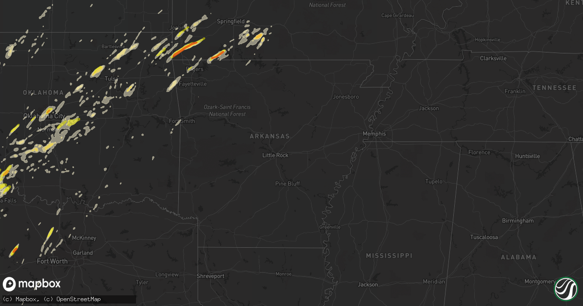
Hail Map in Arkansas on April 30, 2019
Get this storm
April 30 map
$229
one time, instant access
Download today. No call, no setup
Keep the $229
Bought the map and want the full workflow? Apply the entire $229 to a subscription within 7 days. None of it is wasted.
Every map, not just this one
This buys you this map. Subscription and you get every map we run, in the markets you choose from a few cities to whole states to nationwide. Plus real-time alerts the moment a storm fires.
Contact data
Name, contact info, occupancy, even credit band for addresses in the footprint. You go from where it hit to who to call.
Become the source they trust
Unlimited branding weather history reports on demand. You already have the documented answer ready for the property owner, and you are the one who showed up with it.
Property data and RoofTrace estimates
Pull up any address you have got, its value and the exact code rules for that jurisdiction, straight from One Click Code. Then RoofTrace estimates the squares, pitch, and roof value, priced the way you price.
Storm reports in Arkansas
Arkansas
| Date | Description |
|---|---|
| 04/30/20195:46 PM CDT | Trees were blown down. Debris was in the road on highway 65... About a mile north of tower road. |
| 04/30/20194:39 PM CDT | A local report indicates 1.00 inch wind near BENTONVILLE |
| 04/30/20194:02 PM CDT | A local report indicates 1.00 inch wind near SILOAM SPRINGS |
| 04/30/20193:20 PM CDT | The roof was blown off of a house. Trees and power lines were blown down. This occurred southwest of the highway 7 and highway 14 junctions. At least 12 homes between b |
| 04/30/20193:10 PM CDT | Trees were blown down and blocking sugar road |
| 04/30/20193:08 PM CDT | The tornado first hit just south of zinc road. Along the path... There were trees uprooted and snapped... And power lines down. Several homes were damaged and a couple |
| 04/30/20193:07 PM CDT | Several trees were blown down and possible damage to homes near zinc and daniels roads southeast of bergman. |
| 04/30/20193:05 PM CDT | A local report indicates a tornado near BERGMAN |
| 04/30/20196:19 AM CDT | Trees were down on roads and homes. Chicken houses and outbuildings were also damaged. |
| 04/30/20192:47 AM CDT | A metal roof was blown off a shop just north of damascus. |
| 04/30/20192:12 AM CDT | Trees were down countywide and about 10 homes were damaged. |
| 04/30/20192:05 AM CDT | Trees were downed at atkins. A home was heavily damaged by a fallen tree. |
| 04/30/20191:45 AM CDT | Trees were blown down. A roof was damaged... And a garage door blown in. |
| 04/30/20191:40 AM CDT | Trees were down along hwy. 27 north. |
| 04/30/20191:40 AM CDT | Trees and power lines were downed around hagarville. Highway 123 was temporarily blocked as a result. |
| 04/30/20191:40 AM CDT | Several trees were blown down. The roof of a building was damaged... And a garage door was blown in. |
| 04/30/20191:35 AM CDT | Numerous trees were downed... With at least one tree on a house. |
| 04/30/20191:19 AM CDT | Trees were down on roads and homes. Chicken houses and outbuildings were also damaged. |
| 04/30/201912:40 AM CDT | Several trees were blown down. The roof of a building was damaged... And a garage door was blown in. |
| 04/30/201912:35 AM CDT | Emergency management reported tree damage in the huntington area with one tree falling on a roof and causing structural damage to a house. No injuries. Corrected time v |
| 04/29/20199:41 PM CDT | At 241 PM CDT, a severe thunderstorm was located near Walnut, or 20 miles southwest of Jasper, moving northeast at 20 mph. HAZARD...60 mph wind gusts and quarter size hail. SOURCE...Radar indicated. IMPACT...Hail damage to vehicles is expected. Expect wind damage to roofs, siding, and trees. Locations impacted include... Walnut... Upper Buffalo Wilderness Area... Wayton... Mossville... Nail... Fallsville... Crossroad... Parthenon... Swain... Dixon Ridge... |
All States Impacted by Hail Map on April 30, 2019
Cities Impacted by Hail Map on April 30, 2019
- Wewoka, OK
- Wanette, OK
- Duncan, OK
- Walters, OK
- Comanche, OK
- Tulia, TX
- Davidson, OK
- Rocky Comfort, MO
- Anderson, MO
- Goodman, MO
- Stella, MO
- Fluvanna, TX
- Gail, TX
- Lockney, TX
- Norman, OK
- Paoli, OK
- Rush Springs, OK
- Prague, OK
- Meeker, OK
- Newalla, OK
- Mcloud, OK
- Pauls Valley, OK
- Macomb, OK
- Shawnee, OK
- Lexington, OK
- Bradley, OK
- Lindsay, OK
- Wayne, OK
- Oklahoma City, OK
- Earlsboro, OK
- Alex, OK
- Purcell, OK
- Marlow, OK
- Tecumseh, OK
- Noble, OK
- Maysville, OK
- Lawton, OK
- Wichita Falls, TX
- Harrold, TX
- Grandfield, OK
- Devol, OK
- Geronimo, OK
- Iowa Park, TX
- Electra, TX
- Randlett, OK
- Siloam Springs, AR
- Summers, AR
- Westville, OK
- Watts, OK
- Wheeler, TX
- Sweetwater, OK
- Yale, IL
- Floydada, TX
- Dickens, TX
- Lorenzo, TX
- Ralls, TX
- Post, TX
- Seligman, MO
- Pea Ridge, AR
- Pineville, MO
- Washburn, MO
- Seminole, OK
- Frederick, OK
- Indiahoma, OK
- Amarillo, TX
- Hale Center, TX
- Grove, OK
- Plainview, TX
- Dittmer, MO
- Cedar Hill, MO
- Macomb, MO
- Ava, MO
- Squires, MO
- Norwood, MO
- Thornfield, MO
- Bradleyville, MO
- Windthorst, TX
- Breckenridge, TX
- Petersburg, TX
- Littlefield, TX
- Hendrix, OK
- Haslet, TX
- Justin, TX
- Eldorado, OK
- Haskell, OK
- Okmulgee, OK
- Afton, OK
- Canyon, TX
- Ozona, TX
- Aspermont, TX
- Old Glory, TX
- Cheyenne, OK
- Theodosia, MO
- Neosho, MO
- Diamond, MO
- Joplin, MO
- Reydon, OK
- Arnett, OK
- Silverton, TX
- Claude, TX
- Highland, IL
- Trenton, IL
- Belleville, IL
- Scott Air Force Base, IL
- Lebanon, IL
- Summerfield, IL
- Mascoutah, IL
- Wellington, KS
- Belle Plaine, KS
- Peck, KS
- Garden City, TX
- Midland, TX
- Stanton, TX
- Mounds, OK
- Durant, OK
- Bokchito, OK
- Green Valley, IL
- Throckmorton, TX
- Newcastle, TX
- Haskell, TX
- Jayton, TX
- Delaware, OK
- Nowata, OK
- Vinita, OK
- Altus, OK
- Sarcoxie, MO
- La Russell, MO
- Reeds, MO
- Iraan, TX
- Sheffield, TX
- Sonora, TX
- Graford, TX
- Perrin, TX
- Medford, OK
- Elmore City, OK
- Rule, TX
- Rochester, TX
- Hico, TX
- Porter, OK
- Inola, OK
- Wagoner, OK
- Coweta, OK
- Seymour, TX
- Knox City, TX
- S Coffeyville, OK
- Pond Creek, OK
- Sherman, TX
- Palo Pinto, TX
- Louisburg, MO
- Antlers, OK
- Decatur, TX
- Krum, TX
- Ponder, TX
- Seymour, MO
- Oldfield, MO
- Justiceburg, TX
- Snyder, TX
- Rotan, TX
- Miller, MO
- Lockwood, MO
- Stotts City, MO
- South Greenfield, MO
- Carthage, MO
- Yukon, OK
- Fairview, OK
- Fletcher, OK
- Elgin, OK
- Olton, TX
- Wasola, MO
- Big Spring, TX
- Pawnee, OK
- Shamrock, TX
- Golden, MO
- Eagle Rock, MO
- Shell Knob, MO
- Worden, IL
- Alhambra, IL
- Sudan, TX
- Salisbury, MO
- Clifton Hill, MO
- Chico, TX
- Ackerly, TX
- Mangum, OK
- Duke, OK
- Ninnekah, OK
- Cement, OK
- Chickasha, OK
- Pampa, TX
- Cushing, OK
- Stillwater, OK
- Ripley, OK
- Fort Stockton, TX
- Everton, MO
- Coleman, TX
- Seiling, OK
- Colcord, OK
- Amber, OK
- Quinton, OK
- Spokane, MO
- Reeds Spring, MO
- Chestnutridge, MO
- Cherokee, OK
- Helena, OK
- Enochs, TX
- Freeburg, IL
- Broken Arrow, OK
- Okemah, OK
- O'Fallon, IL
- New Athens, IL
- Waterloo, IL
- Burkburnett, TX
- Rhome, TX
- Briscoe, TX
- Holliday, TX
- Fairland, OK
- Wakita, OK
- Manchester, OK
- Collinsville, IL
- Troy, IL
- Quanah, TX
- Roanoke, TX
- Keller, TX
- Fort Worth, TX
- Beggs, OK
- Mannford, OK
- Prue, OK
- Hominy, OK
- Cleveland, OK
- Terlton, OK
- Osage, OK
- Skiatook, OK
- Gracemont, OK
- Noel, MO
- South West City, MO
- Purdy, MO
- Fairview, MO
- Spencer, OK
- Edmond, OK
- Jones, OK
- Quincy, IL
- Payson, IL
- Hull, IL
- Taloga, OK
- Union City, OK
- El Reno, OK
- Anadarko, OK
- Minco, OK
- Tulsa, OK
- Bixby, OK
- Miami, OK
- Wann, OK
- Luther, OK
- Arcadia, OK
- Mulvane, KS
- Glen Rose, TX
- Rainbow, TX
- Nemo, TX
- Granite City, IL
- Marine, IL
- Pocahontas, IL
- Caseyville, IL
- New Douglas, IL
- Fairview Heights, IL
- Glen Carbon, IL
- Saint Jacob, IL
- Maryville, IL
- Edwardsville, IL
- Talala, OK
- Ramona, OK
- Donnellson, IL
- Greenville, IL
- Arkoma, OK
- Okarche, OK
- Cordell, OK
- Paducah, TX
- Davis, OK
- Wynnewood, OK
- Hennepin, OK
- Sorento, IL
- Bluejacket, OK
- Bristow, OK
- Dewey, OK
- Springlake, TX
- Cassville, MO
- Lampe, MO
- Eureka Springs, AR
- Blue Eye, MO
- Kimberling City, MO
- Galena, MO
- Berryville, AR
- Barnsdall, OK
- Holdenville, OK
- Wetumka, OK
- Bruner, MO
- Sparta, MO
- Marthasville, MO
- Tower Hill, IL
- Fordland, MO
- Atoka, OK
- Azle, TX
- Boyd, TX
- Sanger, TX
- Newark, TX
- Chester, OK
- Mustang, OK
- Tipton, OK
- Spiro, OK
- Byers, TX
- Petrolia, TX
- Temple, OK
- Talihina, OK
- Nashoba, OK
- Honobia, OK
- Garrison, MO
- Branson, MO
- Chadwick, MO
- Deer Creek, OK
- Quitaque, TX
- Boley, OK
- Milan, KS
- Mayfield, KS
- Bath, IL
- Garfield, AR
- Blanchard, OK
- Newcastle, OK
- Davisville, MO
- Cherryville, MO
- Big Cabin, OK
- Rogers, AR
- Cave Springs, AR
- Bentonville, AR
- Coffeen, IL
- Seneca, MO
- Castle, OK
- Perrysburg, OH
- Eastland, TX
- Madison, MO
- Kingston, OK
- Foster, OK
- House Springs, MO
- Godley, TX
- Cleburne, TX
- Granbury, TX
- Borger, TX
- Hollister, OK
- Drumright, OK
- O'Brien, TX
- Weinert, TX
- Goree, TX
- Munday, TX
- Aviston, IL
- Drury, MO
- Eucha, OK
- Spavinaw, OK
- Paden, OK
- Clark, MO
- East Saint Louis, IL
- Paris, MO
- Ochelata, OK
- Bluff City, KS
- Amherst, TX
- Yale, OK
- Elmer, OK
- Headrick, OK
- Olustee, OK
- Grenola, KS
- Howard, KS
- Fort Sill, OK
- Cameron, OK
- Mona, UT
- Grubville, MO
- Welch, OK
- Caddo, OK
- Caney, OK
- Asher, OK
- Maud, OK
- Kinta, OK
- Fort Smith, AR
- Loco, OK
- Strang, OK
- Ratliff City, OK
- Madill, OK
- Wellston, OK
- Springer, OK
- Texola, OK
- Sentinel, OK
- Kress, TX
- Bartlesville, OK
- Camden, IL
- Plymouth, IL
- Littleton, IL
- McCune, KS
- Cherokee, KS
- Edna, KS
- Breese, IL
- Crawford, OK
- Leedey, OK
- Sunset, TX
- Forestburg, TX
- Wildorado, TX
- Hereford, TX
- Choctaw, OK
- Harrah, OK
- Sulphur, OK
- Jennings, OK
- Gainesville, TX
- Glenpool, OK
- Jenks, OK
- Hamel, IL
- Stroud, OK
- Depew, OK
- Higbee, MO
- Bloomingdale, IN
- Kingman, IN
- Cape Fair, MO
- Sheppard Afb, TX
- Roff, OK
- Collinsville, OK
- Vici, OK
- Caldwell, KS
- Walshville, IL
- Pawhuska, OK
- Peel, AR
- Yellville, AR
- Lead Hill, AR
- Cleo Springs, OK
- Mill Creek, OK
- Sweet Springs, MO
- Fair Play, MO
- Stilwell, OK
- Proctor, OK
- Tremont, IL
- Pekin, IL
- Jay, OK
- Monett, MO
- Wheaton, MO
- Lanagan, MO
- La Monte, MO
- Houstonia, MO
- Taneyville, MO
- Forsyth, MO
- Sand Springs, OK
- Tuttle, OK
- Agra, OK
- Carney, OK
- Tryon, OK
- Coahoma, TX
- Eureka, UT
- Mineral Wells, TX
- Maramec, OK
- Saint Louis, MO
- Konawa, OK
- Fillmore, IL
- Panama, IL
- Hillsboro, IL
- New Baden, IL
- Madison, IL
- Venice, IL
- Lovejoy, IL
- Smithton, IL
- Apache, OK
- Cyril, OK
- Bingham, IL
- Hastings, OK
- Jet, OK
- Carmen, OK
- Monroe City, MO
- Pierce City, MO
- Wentworth, MO
- Wyandotte, OK
- Winslow, AR
- Veedersburg, IN
- Hillsboro, IN
- Little Elm, TX
- Aubrey, TX
- Nardin, OK
- Kremlin, OK
- Lamont, OK
- Mcalester, OK
- Hobart, OK
- Stark City, MO
- Granby, MO
- Lindsay, TX
- Thackerville, OK
- Chandler, OK
- Kingfisher, OK
- Chattanooga, OK
- Faxon, OK
- Loveland, OK
- Celina, TX
- Pilot Point, TX
- Noble, MO
- Owasso, OK
- Sperry, OK
- Sapulpa, OK
- Wellington, TX
- Shidler, OK
- Meridian, OK
- Stoutsville, MO
- Redbird, OK
- Bartlett, KS
- Olney, TX
- New London, MO
- Hannibal, MO
- Henrietta, TX
- Casey, IL
- Gilman, IL
- Hedley, TX
- Memphis, TX
- Cache, OK
- Plainville, IL
- Palmyra, MO
- Stratford, OK
- Bells, TX
- Denison, TX
- Brownfield, TX
- Roland, OK
- Lenapah, OK
- Mansfield, MO
- Mountain Grove, MO
- Burlington, OK
- Matador, TX
- Chelsea, OK
- Adair, OK
- Lone Wolf, OK
- Stuart, OK
- Denton, TX
- Flower Mound, TX
- Argyle, TX
- Nash, OK
- Childress, TX
- Millsap, TX
- Fieldton, TX
- Eldorado, TX


