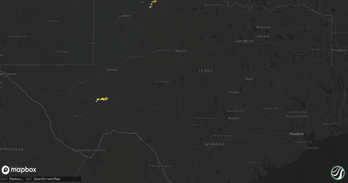
Hail Map in Texas on April 30, 2018
Get this storm
April 30 map
$229
one time, instant access
Download today. No call, no setup
Keep the $229
Bought the map and want the full workflow? Apply the entire $229 to a subscription within 7 days. None of it is wasted.
Every map, not just this one
This buys you this map. Subscription and you get every map we run, in the markets you choose from a few cities to whole states to nationwide. Plus real-time alerts the moment a storm fires.
Contact data
Name, contact info, occupancy, even credit band for addresses in the footprint. You go from where it hit to who to call.
Become the source they trust
Unlimited branding weather history reports on demand. You already have the documented answer ready for the property owner, and you are the one who showed up with it.
Property data and RoofTrace estimates
Pull up any address you have got, its value and the exact code rules for that jurisdiction, straight from One Click Code. Then RoofTrace estimates the squares, pitch, and roof value, priced the way you price.
Storm reports in Texas
Texas
| Date | Description |
|---|---|
| 04/30/20186:50 PM CDT | A local report indicates 1.00 inch wind near MATADOR |
| 04/30/20186:19 PM CDT | Ending as of report time |
| 04/30/20186:13 PM CDT | A local report indicates 1.50 inch wind near 8 W ESTELLINE |
| 04/30/20186:08 PM CDT | A local report indicates 1.00 inch wind near 3 SSE ROARING SPRINGS |
| 04/30/20185:21 PM CDT | A local report indicates 1.00 inch wind near FORT STOCKTON |
| 04/30/20184:19 AM CDT | At 918 PM CDT, a severe thunderstorm was located near Groom, or 15 miles southeast of Panhandle, moving northeast at 30 mph. Additional development was noted southeast of Groom. HAZARD...60 mph wind gusts and quarter size hail. SOURCE...Radar indicated. IMPACT...Minor damage to roofs, siding, and trees is possible. Hail damage to vehicles is expected. Locations impacted include... Pampa, Mclean, Groom, Lefors, Alanreed and Lake Mcclellan. |
| 04/30/20181:45 AM CDT | At 645 PM CDT, a severe thunderstorm was located 17 miles east of Fort Stockton, moving east at 15 mph. HAZARD...Quarter size hail. SOURCE...Radar indicated. IMPACT...Damage to vehicles is expected. Locations impacted include... Bakersfield and Girvin. This includes Interstate 10 between mile markers 273 and 301. |
| 04/30/20181:18 AM CDT | At 618 PM CDT, a severe thunderstorm was located near Matador, moving northeast at 35 mph. HAZARD...60 mph wind gusts and quarter size hail. SOURCE...Trained weather spotters. IMPACT...Hail damage to vehicles is expected. Expect wind damage to roofs, siding, and trees. Locations impacted include... Matador, Northfield, Cee Vee and Roaring Springs. |
| 04/30/201812:10 AM CDT | At 510 PM CDT, a severe thunderstorm was located over Fort Stockton, moving northeast at 30 mph. HAZARD...60 mph wind gusts and quarter size hail. SOURCE...Radar indicated. IMPACT...Hail damage to vehicles is expected. Expect wind damage to roofs, siding, and trees. Locations impacted include... Fort Stockton, Fort Stockton-Pecos County Airport and Imperial. This includes Interstate 10 between mile markers 254 and 269. |
All States Impacted by Hail Map on April 30, 2018
Cities Impacted by Hail Map on April 30, 2018
- Manning, IA
- Manilla, IA
- West Point, NE
- Childress, TX
- Harlan, IA
- Portsmouth, IA
- Persia, IA
- Shelby, IA
- Neola, IA
- Taylor, NE
- Guthrie Center, IA
- Coon Rapids, IA
- Fort Lupton, CO
- Underwood, IA
- Callaway, NE
- Merna, NE
- Ericson, NE
- Broken Bow, NE
- Elyria, NE
- Westerville, NE
- Comstock, NE
- Burwell, NE
- Ord, NE
- Ansley, NE
- Pampa, TX
- Sargent, NE
- Amelia, NE
- Luverne, ND
- Oneill, NE
- Grover, CO
- Turkey, TX
- Westboro, MO
- Wagner, SD
- Ramona, SD
- Madison, SD
- Anselmo, NE
- Winfred, SD
- Galeton, CO
- Ottertail, MN
- New York Mills, MN
- Dedham, IA
- Canova, SD
- Hamlin, IA
- Audubon, IA
- Exira, IA
- Templeton, IA
- Fontanelle, IA
- Oakland, IA
- Groom, TX
- Clarendon, TX
- Howard, SD
- Rosalie, NE
- Ashby, MN
- Dalton, MN
- Battle Lake, MN
- Elbow Lake, MN
- Fort Stockton, TX
- Lynch, NE
- Griswold, IA
- Roaring Springs, TX
- Matador, TX
- Stuart, NE
- Atkinson, NE
- Earling, IA
- Defiance, IA
- Irwin, IA
- Kirkman, IA
- Gray, IA
- Avoca, IA
- Ault, CO
- Eaton, CO
- Gill, CO
- Briggsdale, CO
- Cheyenne, WY
- Carroll, IA
- Minden, IA
- Spencer, NE
- Brady, NE
- Gothenburg, NE
- Brewster, NE
- Dunning, NE
- Arnold, NE
- Maxwell, NE
- Niobrara, NE
- Emmet, NE
- Lenox, IA
- Creston, IA
- Cromwell, IA
- Winside, NE
- Dodge, NE
- Emery, SD
- Alexandria, SD
- Spencer, SD
- Beemer, NE
- Orient, IA
- Bayard, IA
- Brayton, IA
- Walnut, IA
- Marne, IA
- Elk Horn, IA
- Atlantic, IA
- Stuart, IA
- Salem, SD
- Stanton, NE
- Mclean, TX
- Berthoud, CO
- Akeley, MN
- Tripp, SD
- Lockney, TX
- Dante, SD
- Casey, IA
- Verdigre, NE
- Chambers, NE
- Greenfield, IA
- Bancroft, NE
- Miami, TX
- Garden City, KS
- Avon, SD
- Hopkins, MO
- Pickering, MO
- Stanton, IA
- Memphis, TX
- Canadian, TX
- Morris, MN
- Appleton, MN
- Pierce, CO
- Wisner, NE
- Howells, NE
- Mitchell, SD
- Menlo, IA
- Adair, IA
- Floydada, TX
- Mcadoo, TX
- Council Bluffs, IA
- McClelland, IA
- Red Oak, IA
- Villisca, IA
- Graham, MO
- Skidmore, MO
- Norfolk, NE
- Prescott, IA
- Underwood, MN
- Menahga, MN
- Ravenwood, MO
- Big Stone City, SD
- Bartlett, NE
- Oconto, NE
- Hancock, IA
- Moorefield, NE
- Panora, IA
- Walker, MN
- Park Rapids, MN
- Gravity, IA
- Dexter, IA
- Curtis, NE
- Overbrook, KS
- Carbondale, KS
- Wellington, CO
- Nunn, CO
- Inman, NE
- Page, NE
- Mobeetie, TX


