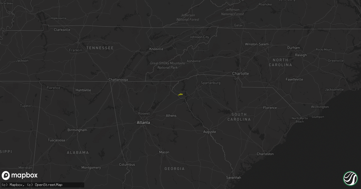
Hail Map on April 27, 2018
Get this storm
April 27 map
$229
one time, instant access
Download today. No call, no setup
Keep the $229
Bought the map and want the full workflow? Apply the entire $229 to a subscription within 7 days. None of it is wasted.
Every map, not just this one
This buys you this map. Subscription and you get every map we run, in the markets you choose from a few cities to whole states to nationwide. Plus real-time alerts the moment a storm fires.
Contact data
Name, contact info, occupancy, even credit band for addresses in the footprint. You go from where it hit to who to call.
Become the source they trust
Unlimited branding weather history reports on demand. You already have the documented answer ready for the property owner, and you are the one who showed up with it.
Property data and RoofTrace estimates
Pull up any address you have got, its value and the exact code rules for that jurisdiction, straight from One Click Code. Then RoofTrace estimates the squares, pitch, and roof value, priced the way you price.
States Impacted by Hail Map on April 27, 2018
Storm reports
Florida
| Date | Description |
|---|---|
| 04/27/20181:38 PM CDT | This is a preliminary report... A trained spotter called to reported a tornado in the coral springs/ margate area near university drive and wiles road. Once again this |
| 04/27/20181:37 PM CDT | Update to previously reported tornado... The nws conducted a storm survey and can confirm an ef0 tornado touched down in coral sprins this afternoon. Damage was mostly |
| 04/26/201811:08 PM CDT | At 408 PM EDT, a severe thunderstorm was located over Loxahatchee Groves, or near Wellington, moving northeast at 10 mph. HAZARD...60 mph wind gusts and nickel size hail. SOURCE...Radar indicated. IMPACT...Expect damage to roofs, siding, and trees. Locations impacted include... West Palm Beach, Wellington, Palm Beach Gardens, Riviera Beach and Palm Beach. |
| 04/26/20189:55 PM CDT | At 255 PM EDT, a severe thunderstorm was located over Coconut Creek, or near Margate, moving east at 10 mph. HAZARD...60 mph wind gusts and quarter size hail. SOURCE...Radar indicated. IMPACT...Hail damage to vehicles is expected. Expect wind damage to roofs, siding, and trees. Locations impacted include... Coral Springs, Pompano Beach, Boca Raton, Deerfield Beach and Delray Beach. |
Pennsylvania
| Date | Description |
|---|---|
| 04/27/20186:05 PM CDT | Resident west of hermitage reported house damage from wind gust. |
| 04/27/20184:02 AM CDT | At 902 PM EDT, a severe thunderstorm was located over Milesburg, moving east at 30 mph. HAZARD...60 mph wind gusts. SOURCE...Radar indicated. IMPACT...Expect damage to trees and power lines. Locations impacted include... Bellefonte, Lock Haven, Zion, Madisonburg, Rebersburg, Milesburg, Bald Eagle State Park, Aaronsburg, Blanchard and Mackeyville.For those driving on Interstate 80, this includes areas between theSnow Shoe and Mile Run exits, specifically from mile markers 150 to195.This includes Interstate 99 from mile markers 77 to 85. |
| 04/27/20183:26 AM CDT | At 826 PM EDT, a severe thunderstorm was located over North Philipsburg, moving east at 35 mph. HAZARD...60 mph wind gusts. SOURCE...Radar indicated. IMPACT...Expect damage to trees and power lines. Locations impacted include... Bellefonte, Black Moshannon State Park, Milesburg, North Philipsburg, Osceola Mills, Moshannon, Clarence, South Philipsburg, Snow Shoe and Philipsburg.For those driving on Interstate 80, this includes areas between theKylertown and Bellefonte exits, specifically from mile markers 134 to160.This includes Interstate 99 near mile marker 85. |
Ohio
| Date | Description |
|---|---|
| 04/27/20186:02 PM CDT | Tree down on route 88 west of route 7. |
| 04/27/20185:53 PM CDT | Numerous branches and trees down from cortland to kinsman area. |
| 04/27/20185:48 PM CDT | Tree down on southbound lane of route 11. |
| 04/27/20185:32 PM CDT | Tree down on house. |
| 04/27/20185:32 PM CDT | Tree down on car. |
| 04/27/20185:12 PM CDT | Several trees down from mantua to garrettsville. |
| 04/27/20181:39 AM CDT | At 639 PM EDT, a severe thunderstorm was located near Bristolville, or 10 miles north of Warren, moving east at 35 mph. HAZARD...60 mph wind gusts. SOURCE...Radar indicated. IMPACT...Expect damage to trees and power lines. Locations impacted include... Warren, Niles, Hubbard, Cortland, Kinsman, North Bloomfield, Orwell, Andover, Vienna Center, Hilltop, Maplewood Park, Bristolville, Girard, Vienna, McDonald, Mecca, Johnston, Cherry Valley, Orangeville and Yankee Lake. |
Nevada
| Date | Description |
|---|---|
| 04/27/201812:51 AM CDT | At 549 PM PDT, a severe thunderstorm was located 14 miles southwest of Mountain City, moving north at 25 mph. HAZARD...70 mph wind gusts from dry micro-bursts. SOURCE...Radar indicated. IMPACT...Expect considerable tree damage. Damage is likely to mobile homes, roofs, and outbuildings. Locations impacted include... Mountain City and Owyhee. |
| 04/26/20187:20 PM CDT | Rsois wind sensor measured a wind gust of 57 kt. This was a dry micro-burst which caused the office to switch briefly to generator back up power. |
Idaho
| Date | Description |
|---|---|
| 04/27/20181:32 AM CDT | At 631 PM PDT, a severe thunderstorm was located near Mountain City, moving north at 25 mph. HAZARD...70 mph wind gusts from dry micro-bursts. SOURCE...Radar indicated. IMPACT...Expect considerable tree damage. Damage is likely to mobile homes, roofs, and outbuildings. Locations impacted include... Mountain City and Owyhee. |