Hail Map in Kentucky on April 25, 2011
Get this storm
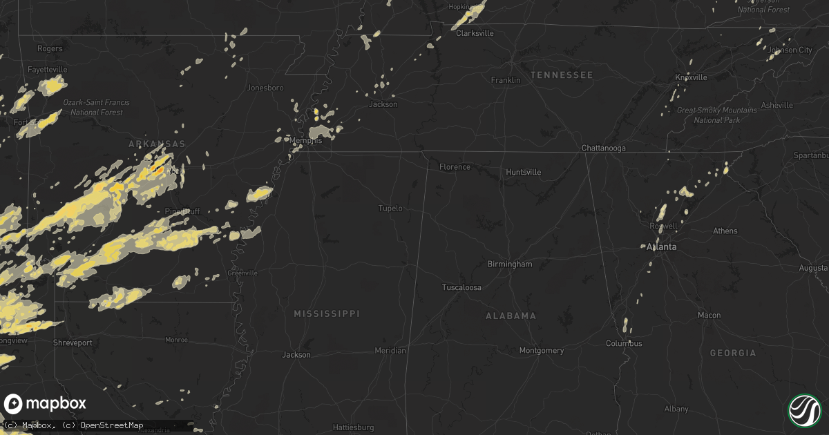
April 25 map
$229
one time, instant access
Download today. No call, no setup
Keep the $229
Bought the map and want the full workflow? Apply the entire $229 to a subscription within 7 days. None of it is wasted.
Every map, not just this one
This buys you this map. Subscription and you get every map we run, in the markets you choose from a few cities to whole states to nationwide. Plus real-time alerts the moment a storm fires.
Contact data
Name, contact info, occupancy, even credit band for addresses in the footprint. You go from where it hit to who to call.
Become the source they trust
Unlimited branding weather history reports on demand. You already have the documented answer ready for the property owner, and you are the one who showed up with it.
Property data and RoofTrace estimates
Pull up any address you have got, its value and the exact code rules for that jurisdiction, straight from One Click Code. Then RoofTrace estimates the squares, pitch, and roof value, priced the way you price.
Storm reports in Kentucky
Kentucky
| Date | Description |
|---|---|
| 04/25/20116:45 PM CDT | Corrected time of event. Trees were blown down along ky hwy 987 one mile off of us 119 on brownies creek road 3 miles southwest of miracle. |
| 04/25/20116:36 PM CDT | Trees were blown down and onto power lines at the bella gardens apt complex on old pineville pike in middlesboro. |
| 04/25/20114:35 PM CDT | A local report indicates 1.00 inch wind near 4 NW ELKTON |
| 04/25/20114:25 PM CDT | A local report indicates 1.00 inch wind near 3 S HOPKINSVILLE |
| 04/25/20114:23 PM CDT | Ef1 tornado from 4 miles west southwest of pembroke to 2.5 west southwest of pembroke. Peak wind 90 mph. Trees uprooted or broken. Barns or sheds destroyed. Average pat |
| 04/25/20114:50 AM CDT | A tree was blocking the road at clay hill. |
| 04/25/20114:45 AM CDT | A tree was blocking langdon street. A tree was blocking grand ave. A tree was blocking rosewood ave. A tree was blocking sagasser road. |
| 04/25/20114:20 AM CDT | A local report indicates 62 MPH wind near 7 W LEXINGTON |
| 04/25/20113:37 AM CDT | A well built tobacco barn was destroyed at the 4 mile marker on ky 1795. |
| 04/25/20113:33 AM CDT | Taylor county depart of highways had to remove a tree from highway 55 near the adair county line. |
| 04/25/20113:28 AM CDT | Telephone pole about to come down... A power line down |
| 04/25/20113:17 AM CDT | A few electrical outages and a couple trees down in bardstown city limits |
| 04/25/20112:45 AM CDT | Multiple trees down in glasgow |
| 04/25/20112:21 AM CDT | A local report indicates 58 MPH wind near LEITCHFIELD |
| 04/25/20112:08 AM CDT | Couple of trees down |
| 04/25/20111:58 AM CDT | Trees down all over town |
| 04/25/20111:54 AM CDT | Tree down on morgantown road |
| 04/25/20111:50 AM CDT | A local report indicates 71 MPH wind near 2 W SPOTTSVILLE |
| 04/25/20111:48 AM CDT | Trailer blown off foundation and destroyed on bowling green road |
| 04/25/20111:37 AM CDT | Roof damage |
| 04/25/20111:36 AM CDT | Barns and outbuildings destroyed |
| 04/25/20111:31 AM CDT | An nws storm survey confirmed straight line wind damage in chandlers chapel. Several small outbuildings including a car port and a barn were severely damaged. Numerous |
| 04/25/20111:27 AM CDT | Tree on a house in russellville. Tree on a tractor trailer as it was traveling on concord road. |
| 04/25/20111:22 AM CDT | An nws storm survey confirmed straight line wind damage in olmstead. Numerous large trees were broken off with several falling onto homes. A grain silo was punctured an |
| 04/25/20111:20 AM CDT | Some damage to homes. Trees and power poles down between trenton and guthrie. |
| 04/25/20111:04 AM CDT | A local report indicates 63 MPH wind near HOPKINSVILLE |
| 04/25/20111:00 AM CDT | A local report indicates 63 MPH wind near 4 NE MARION |
| 04/25/201112:40 AM CDT | Nws storm damage survey. See pnspah for details. Tornado was rated ef1 |
| 04/25/201112:40 AM CDT | ...late report... Ef1 tornado with intermittent damage along 26 mile path. Mainly tree damage and damage to barns. Shingle damage to houses. |
| 04/25/201112:37 AM CDT | ...late report... Microburst uprooted trees and snapped branches. House roof damaged. 5 mile path. Winds estimated 90 mph. |
| 04/25/201112:37 AM CDT | Nws storm damage survey determined a microburst about 30 yards wide and a path length of about 5 miles. Peak winds were estimated at 90 mph. See pnspah for details. |
| 04/25/201112:30 AM CDT | Brief ef0 touchdown in rural area. Peak wind 70 mph. Path width 150 yard. Path length 0.75 miles. Large trees uprooted 12-18 inches in diameter. Power lines down and po |
| 04/25/201112:30 AM CDT | Large trees uprooted 12-18 inches in diameter. Power lines down and power outage. |
| 04/25/201112:25 AM CDT | A local report indicates 60 MPH wind near SW MURRAY |
| 04/25/201112:25 AM CDT | Ky mesonet measured 101 mph wind gust. |
| 04/24/20119:15 PM CDT | Trees were blown down on meade house road in pilgrim. |
| 04/24/20119:15 PM CDT | Trees were blown down on route 292 hode road in warfield. |
| 04/24/20119:15 PM CDT | Trees down in louisa. Timed on radar |
| 04/24/20118:50 PM CDT | Trees were blown down on ky rt 2040. |
| 04/24/20118:50 PM CDT | Trees were blown down on ky rt 581. |
| 04/24/20118:45 PM CDT | Trees were blow donw and blocking portions of ky route 993 and ky route 581. Repoted by wr castle vfd. |
| 04/24/20118:35 PM CDT | The johnson county dispatch office reported that trees had been blown down at numerous locations around the county. Power outages were also occurring all around the cou |
| 04/24/20117:53 PM CDT | Trees were reported down along ky highway 7 near cornettsville. Reported relayed by tv media. |
| 04/24/20117:45 PM CDT | Numerous trees and power lines were blown down in the hyden area. Sporadic power outages were also occurring in northern leslie county. |
| 04/24/20117:45 PM CDT | Trees were blown down along ky hwy 987 one mile off of us 119 on brownies creek road 3 miles southwest of miracle. |
| 04/24/20117:36 PM CDT | Trees and power lines were blown down on thousandsticks road in thousandsticks. |
| 04/24/20117:25 PM CDT | Trees were reported down along ky 522 in harlan county. |
All States Impacted by Hail Map on April 25, 2011
Cities Impacted by Hail Map on April 25, 2011
- Wheeler, TX
- Shamrock, TX
- Montalba, TX
- Palestine, TX
- Checotah, OK
- Council Hill, OK
- Kaplan, LA
- Grand Chenier, LA
- Gueydan, LA
- Montrose, PA
- New Milford, PA
- Hallstead, PA
- New Boston, TX
- Wickes, AR
- Lakemont, GA
- Livingston, TX
- Woodville, TX
- Pollock, LA
- Trout, LA
- Jasper, TX
- Hot Springs Village, AR
- Hot Springs National Park, AR
- Lonsdale, AR
- Benton, AR
- Binghamton, NY
- Conklin, NY
- Franklin, AR
- Melbourne, AR
- Cataula, GA
- Midland, GA
- Ravenden, AR
- Williford, AR
- Hardy, AR
- Sulphur, OK
- Princeton, TX
- Wylie, TX
- White Sulphur Springs, WV
- Axtell, TX
- Sadler, TX
- Whitesboro, TX
- Gainesville, TX
- Washington, LA
- Morrow, LA
- Plaucheville, LA
- Penfield, PA
- Weedville, PA
- Force, PA
- Nashoba, OK
- Trinity, TX
- Lovelady, TX
- Cartersville, GA
- Prairie Grove, AR
- Sallisaw, OK
- Stilwell, OK
- West Fork, AR
- Evansville, AR
- Canehill, AR
- Natural Dam, AR
- Muldrow, OK
- Uniontown, AR
- Pine Bluff, AR
- Star City, AR
- Walls, MS
- Lake Cormorant, MS
- Buffalo, TX
- Oakwood, TX
- Bon Wier, TX
- Sulphur Bluff, TX
- Dike, TX
- Sulphur Springs, TX
- Starks, LA
- Rison, AR
- New Edinburg, AR
- Ocala, FL
- Dunnellon, FL
- Blue Ridge, TX
- Melissa, TX
- Anna, TX
- Susquehanna, PA
- Ville Platte, LA
- Glenmora, LA
- Oakdale, LA
- Durant, OK
- Hubbard, TX
- Dawson, TX
- Broken Bow, OK
- Paris, TX
- Garvin, OK
- Pattonville, TX
- Valliant, OK
- Detroit, TX
- Wright City, OK
- Powderly, TX
- Blossom, TX
- Bagwell, TX
- Eagletown, OK
- Thackerville, OK
- Marietta, OK
- Dawsonville, GA
- Blossburg, PA
- Morris Run, PA
- Cowansville, PA
- Fenelton, PA
- Worthington, PA
- Kingston, OK
- Willis, TX
- New Waverly, TX
- Shepherd, TX
- Coldspring, TX
- Cleveland, TX
- Drew, MS
- Gilmer, TX
- Harleton, TX
- Diana, TX
- Crockett, TX
- Oak Grove, KY
- Herndon, KY
- Saint Jo, TX
- Forestburg, TX
- Muenster, TX
- Boswell, OK
- Bennington, OK
- Larue, TX
- Frankston, TX
- Athens, TX
- New Straitsville, OH
- Shawnee, OH
- New Lexington, OH
- Junction City, OH
- Pilot Point, TX
- De Kalb, TX
- Haworth, OK
- Tupelo, OK
- Dallas, TX
- Wetumka, OK
- Holdenville, OK
- Kirby, AR
- Eufaula, OK
- Burlison, TN
- Drummonds, TN
- Teague, TX
- Fairfield, TX
- Decatur, TX
- Sanger, TX
- Hanna, OK
- Cross Fork, PA
- Renovo, PA
- Stevensville, PA
- Le Raysville, PA
- Wyalusing, PA
- Wysox, PA
- Hope, AR
- Lake Creek, TX
- Lindsay, TX
- Traskwood, AR
- Mabelvale, AR
- Bauxite, AR
- Sheridan, AR
- Hensley, AR
- Cleburne, TX
- Nemo, TX
- Towanda, PA
- Prescott, AR
- Alexander, AR
- Delight, AR
- Leonard, TX
- Enloe, TX
- Karnack, TX
- Nashville, AR
- Big Sandy, TX
- Carthage, AR
- Ravenna, TX
- Emory, TX
- Oil City, LA
- Daingerfield, TX
- Ozan, AR
- Marshall, TX
- Stephens, AR
- Kingsland, AR
- Bivins, TX
- Cookville, TX
- Newhope, AR
- Lindale, TX
- Gladewater, TX
- Savoy, TX
- Glenwood, AR
- Longview, TX
- Van Alstyne, TX
- Jessieville, AR
- Brashear, TX
- Little Rock Air Force Base, AR
- Chidester, AR
- Fouke, AR
- Ogden, AR
- Mineola, TX
- Nash, TX
- Watson, OK
- Buckner, AR
- Celeste, TX
- Roland, AR
- North Little Rock, AR
- Fordyce, AR
- Norman, AR
- Scroggins, TX
- Lewisville, AR
- Pearcy, AR
- Mooringsport, LA
- Mount Ida, AR
- Lockesburg, AR
- Denison, TX
- Conway, AR
- Jefferson, TX
- Sumner, TX
- Gurdon, AR
- Texarkana, TX
- Mount Vernon, TX
- Stamps, AR
- Avery, TX
- Randolph, TX
- Quitman, TX
- Hawkins, TX
- Caddo Gap, AR
- Fulton, AR
- Bonham, TX
- England, AR
- Leesburg, TX
- Klondike, TX
- Cumby, TX
- Texarkana, AR
- Quinlan, TX
- Naples, TX
- Wolfe City, TX
- Dumas, AR
- Greenville, TX
- Talco, TX
- Whitewright, TX
- Murfreesboro, AR
- Gould, AR
- Bigelow, AR
- Mount Pleasant, TX
- Trenton, TX
- Grady, AR
- Poyen, AR
- Waldo, AR
- Windom, TX
- Okolona, AR
- Camden, AR
- Point, TX
- Deport, TX
- Roxton, TX
- Commerce, TX
- Jacksonville, AR
- Bearden, AR
- Donaldson, AR
- Maud, TX
- Friendship, AR
- Pittsburg, TX
- Fort Towson, OK
- Ivanhoe, TX
- Wilmar, AR
- Cabot, AR
- Horatio, AR
- Maumelle, AR
- Simms, TX
- Bonnerdale, AR
- Farmersville, TX
- Bryant, AR
- Ivan, AR
- Omaha, TX
- Hughes Springs, TX
- Hampton, AR
- Petty, TX
- Lone Star, TX
- Langley, AR
- Ashdown, AR
- Ladonia, TX
- Campbell, TX
- De Queen, AR
- Emmet, AR
- Como, TX
- Redfield, AR
- Lone Oak, TX
- Mountain Pine, AR
- Arkadelphia, AR
- Antoine, AR
- Malvern, AR
- Idabel, OK
- Hooks, TX
- Telephone, TX
- Arthur City, TX
- Vivian, LA
- Brookston, TX
- Sparkman, AR
- Royal, AR
- Garland City, AR
- Bailey, TX
- Sherwood, AR
- Clarksville, TX
- Hendrix, OK
- Mckinney, TX
- Dodd City, TX
- Winnsboro, TX
- Bogata, TX
- Hallsville, TX
- Dierks, AR
- Pickton, TX
- Marietta, TX
- Little Rock, AR
- Ben Franklin, TX
- Yantis, TX
- Pecan Gap, TX
- Grapevine, AR
- Bismarck, AR
- Willisville, AR
- Mayflower, AR
- Amity, AR
- Doddridge, AR
- Bluff City, AR
- Saltillo, TX
- Thornton, AR
- Foreman, AR
- Warren, AR
- Paron, AR
- McCaskill, AR
- Winfield, TX
- Prattsville, AR
- Ore City, TX
- Scott, AR
- Monticello, AR
- Rosston, AR
- Cooper, TX
- Avinger, TX
- Winthrop, AR
- Ector, TX
- Honey Grove, TX
- Linden, TX
- Mainesburg, PA
- Troy, PA
- Morris, PA
- Waterville, PA
- Trout Run, PA
- Steubenville, OH
- Weirton, WV
- Colliers, WV
- Watson, AR
- Mason, TN
- Brighton, TN
- Atoka, TN
- Covington, TN
- Munford, TN
- Oakhurst, TX
- Pointblank, TX
- Onalaska, TX
- Goodrich, TX
- Huntsville, TX
- Atlanta, GA
- Abbeville, LA
- Proctor, AR
- Madill, OK
- Lufkin, TX
- Groveton, TX
- Apple Springs, TX
- Driftwood, PA
- Cookson, OK
- Vian, OK
- Park Hill, OK
- Bunch, OK
- Gore, OK
- Pittsburg, OK
- Blanco, OK
- Kiowa, OK
- Kingsport, TN
- Mobeetie, TX
- Wyoming, PA
- Dallas, PA
- Gate City, VA
- Surgoinsville, TN
- Tampa, FL
- Morriston, FL
- Erick, OK
- Mount Calm, TX
- Jewett, TX
- Groesbeck, TX
- Troup, TX
- Lexington, TN
- Jackson, TN
- Corsicana, TX
- Hernando, FL
- Montgomery, LA
- Colfax, LA
- Bells, TX
- Okmulgee, OK
- Beggs, OK
- Oran, MO
- Bell City, MO
- Caddo, OK
- Caney, OK
- Kenefic, OK
- Coleman, OK
- Church Hill, TN
- Rogersville, TN
- Greeneville, TN
- Pryor, OK
- Adair, OK
- Big Cabin, OK
- Pottsboro, TX
- West Paducah, KY
- Atoka, OK
- Wardville, OK
- Dequincy, LA
- Singer, LA
- Pocahontas, AR
- Imboden, AR
- Hiltons, VA
- Webbers Falls, OK
- Porum, OK
- Coweta, OK
- Broken Arrow, OK
- Quaker City, OH
- Barnesville, OH
- Lecanto, FL
- Inverness, FL
- Streetman, TX
- Humboldt, TN
- Tazewell, TN
- Grapeland, TX
- Olustee, OK
- Altus, OK
- Doniphan, MO
- Gatewood, MO
- Warm Springs, AR
- Trenton, KY
- Hopkinsville, KY
- Pembroke, KY
- Elkton, KY
- Sayre, OK
- Ball Ground, GA
- Canton, GA
- Lore City, OH
- Salesville, OH
- Bells, TN
- Johnson City, TN
- Vinson, OK
- Dahlonega, GA
- Union Dale, PA
- Greenville, GA
- Ponder, TX
- Hackberry, LA
- Orange, TX
- Sulphur, LA
- Vinton, LA
- Bunkie, LA
- Flowery Branch, GA
- Antlers, OK
- Overbrook, OK
- Ardmore, OK
- Brookeland, TX
- Zavalla, TX
- Shongaloo, LA
- Emerson, AR
- Magnolia, AR
- Haynesville, LA
- Junction City, AR
- Kinder, LA
- Odessa, FL
- Lutz, FL
- Riverview, FL
- Stinnett, TX
- Justin, TX
- Westport, PA
- Stringtown, OK
- Tuskahoma, OK
- Daisy, OK
- Clayton, OK
- Strawberry, AR
- Denton, TX
- Krum, TX
- Aubrey, TX
- Barling, AR
- Alma, AR
- Charleston, AR
- Mulberry, AR
- Fort Smith, AR
- Lavaca, AR
- Van Buren, AR
- Sherman, TX
- Howe, TX
- Granbury, TX
- Duke, OK
- Ben Wheeler, TX
- Van, TX
- Canton, TX
- Grand Saline, TX
- Plano, TX
- Garland, TX
- Richardson, TX
- Clearfield, PA
- Deville, LA
- Williamsport, PA
- Cogan Station, PA
- Spiro, OK
- Monterey, LA
- Acme, LA
- Mangum, OK
- Ada, OK
- Boyd, TX
- Rhome, TX
- Newark, TX
- Soper, OK
- Snow, OK
- Rattan, OK
- Finley, OK
- Clayton, GA
- Parkin, AR
- Earle, AR
- Coalgate, OK
- Centrahoma, OK
- Whiteville, TN
- Cove, AR
- Hatfield, AR
- Chandlersville, OH
- Evans, LA
- Ralston, PA
- Roaring Branch, PA
- Grandview, TX
- Godley, TX
- Rio Vista, TX
- Friendsville, PA
- Mcalester, OK
- Indianola, OK
- Mexia, TX
- Fort Campbell, KY
- Douglasville, GA
- Lithia Springs, GA
- Tiger, GA
- Pitkin, LA
- Metropolis, IL
- Stuart, OK
- Waco, TX
- Elm Mott, TX
- Dustin, OK
- Granville Summit, PA
- Canton, PA
- Miami, TX
- Bedias, TX
- Emporium, PA
- Alamo, TN
- New Concord, OH
- Coshocton, OH
- Adamsville, OH
- El Dorado, AR
- Taylor, AR
- Sarepta, LA
- Springhill, LA
- Homer, LA
- Mamou, LA
- Tolar, TX
- Ravenden Springs, AR
- Chuckey, TN
- Limestone, TN
- Lake Panasoffkee, FL
- Call, TX
- Hugo, OK
- Richland, TX
- Tennessee Colony, TX
- Wortham, TX
- Kennard, TX
- Elkhart, TX
- Chipley, FL
- Kirbyville, TX
- Barry, TX
- Kerens, TX
- Blooming Grove, TX
- Widener, AR
- Heth, AR
- Telford, TN
- Moscow, TX
- Morris, OK
- Henryetta, OK
- East Brady, PA
- Butler, PA
- Adrian, PA
- Chicora, PA
- Templeton, PA
- Welda, KS
- Kincaid, KS
- Colony, KS
- Douglassville, TX
- Oakland, TN
- Forksville, PA
- Vidor, TX
- Lane, OK
- Jennings, LA
- Welsh, LA
- Big Rock, TN
- Columbia Cross Roads, PA
- Umpire, AR
- Kountze, TX
- Italy, TX
- Milford, TX
- Newton, TX
- Burkeville, TX
- Kirkwood, NY
- Cameron, LA
- Lake Charles, LA
- Texola, OK
- Deridder, LA
- Sugartown, LA
- Huntington, TX
- Celina, TX
- Bridgeport, TX
- Azle, TX
- Poolville, TX
- Paradise, TX
- Argyle, TX
- Gunter, TX
- Atkins, VA
- Rockton, PA
- Alpharetta, GA
- Ashford, AL
- Mineral Bluff, GA
- Bokchito, OK
- Wayne, WV
- Barboursville, WV
- Lavalette, WV
- Huntington, WV
- Keo, AR
- Lonoke, AR
- Headrick, OK
- Duncan, MS
- Terrell, TX
- Mena, AR
- Arlington, TN
- Somerville, TN
- Overton, TX
- Rosston, TX
- Era, TX
- Woodstock, GA
- South Fulton, TN
- Fulton, KY
- Milan, PA
- Almyra, AR
- De Witt, AR
- Helena, AR
- Elaine, AR
- Marvell, AR
- Lexa, AR
- Broaddus, TX
- Penelope, TX
- Nickelsville, VA
- Paducah, KY
- Valley View, TX
- Collinsville, TX
- Dresden, OH
- Coolidge, TX
- Prairie Hill, TX
- Melber, KY
- Boaz, KY
- Milburn, OK
- Boynton, OK
- Oktaha, OK
- Haskell, OK
- Kaufman, TX
- Centerville, TX
- Calera, OK
- Colbert, OK
- Arcadia, FL
- Mansfield, PA
- Wellsboro, PA
- Milan, TN
- Elk City, OK
- Blair, OK
- Westminster, SC
- Fair Play, SC
- Davis, OK
- Tionesta, PA
- Kansas, OK
- Rose, OK
- Whitehouse, TX
- Hermitage, AR
- Clarkesville, GA
- Zachary, LA
- Stuttgart, AR
- Jacksonville, TX
- Purdon, TX
- McKenzie, TN
- Trezevant, TN
- Atwood, TN
- Frenchville, PA
- Kane, PA
- Pleasantville, PA
- Sheffield, PA
- Marienville, PA
- Clarendon, PA
- Osceola, AR
- Lepanto, AR
- Crawfordsville, AR
- Pocola, OK
- Bullard, TX
- Montrose, AR
- Allen, OK
- Sautee Nacoochee, GA
- Poplar Grove, AR
- Dundee, MS
- West Helena, AR
- Friendsville, TN
- Knoxville, TN
- Sinnamahoning, PA
- Philo, OH
- Blue Rock, OH
- Hazen, AR
- Cambridge, OH
- Byesville, OH
- Millington, TN
- Eads, TN
- Collierville, TN
- Memphis, TN
- Cordova, TN
- Mesquite, TX
- Fort Worth, TX
- Maynardville, TN
- Logan, OH
- Moyers, OK
- Mead, OK
- Romance, AR
- Mount Vernon, AR
- Madisonville, TN
- Murrayville, GA
- Gainesville, GA
- Delphia, KY
- Winslow, AR
- Price, TX
- Waxahachie, TX
- Malakoff, TX
- Henderson, TX
- Blum, TX
- Corrigan, TX
- Selman City, TX
- Covington, TX
- Colmesneil, TX
- Glen Rose, TX
- Rainbow, TX
- Montgomery, TX
- Malone, TX
- Kilgore, TX
- Conroe, TX
- Itasca, TX
- Diboll, TX
- Rice, TX
- Frost, TX
- Mart, TX
- Wells, TX
- Alto, TX
- Pennington, TX
- Tyler, TX
- Forreston, TX
- Warren, TX
- Arp, TX
- Hillsboro, TX
- Ennis, TX
- Bluff Dale, TX
- Midway, TX
- Powell, TX
- Trinidad, TX
- Pollok, TX
- Stephenville, TX
- Alvarado, TX
- Chester, TX
- Flint, TX
- Des Arc, AR
- Cumberland, KY
- Greenback, TN
- Whitefield, OK
- Stigler, OK
- Crossett, AR
- Big Sandy, TN
- Jasper, GA
- Marble Hill, GA
- Piedmont, OH
- Hamburg, AR
- Fountain Hill, AR
- Holly Grove, AR
- Wilcox, PA
- Houston, AR
- Dodson, TX
- Wills Point, TX
- Piney Flats, TN
- Elton, LA
- Chaffee, MO
- Fred, TX
- Spurger, TX
- Silsbee, TX
- Leesville, LA
- Wiergate, TX
- Athens, PA
- East Smithfield, PA
- Rockwall, TX
- Harveys Lake, PA
- Sweet Valley, PA
- Etoile, TX
- San Augustine, TX
- Chireno, TX
- Eustace, TX
- Weleetka, OK
- Silver Springs, FL
- Story, AR
- Spencerville, OK
- Perryville, AR
- Hulbert, OK
- Fort Gibson, OK
- Muskogee, OK
- Cleveland, GA
- Granite, OK
- Tichnor, AR
- Iowa, LA
- Caddo Mills, TX
- Saint Landry, LA
- Fayetteville, AR
- Elkins, AR
- Mountainburg, AR
- Afton, TN
- Cedar Bluff, VA
- Ethel, AR
- Saint Charles, AR
- Ewing, VA
- Union City, TN
- Rives, TN
- Coeburn, VA
- Lone Wolf, OK
- Covington, PA
- Hamilton, GA
- Fortson, GA
- Ragley, LA
- Merryville, LA
- Longville, LA
- Buna, TX
- Hillister, TX
- Vidalia, LA
- Lincoln, AR
- Bokoshe, OK
- Alcoa, TN
- Louisville, TN
- Maryville, TN
- Mountain Park, OK
- Gould, OK
- Tioga, TX
- Gordonville, TX
- Cartwright, OK
- Harrisonburg, LA
- Wise, VA
- Brookport, IL
- Crooksville, OH
- Roseville, OH
- New Bethlehem, PA
- Fairmount City, PA
- Mayport, PA
- Jonesville, LA
- Pickens, AR
- Tillar, AR
- Mansfield, TN
- Buford, GA
- Quail, TX
- Bell City, LA
- Lamar, OK
- Atwood, OK
- Calvin, OK
- Sasakwa, OK
- Fittstown, OK
- Wewoka, OK
- Fitzhugh, OK
- Benezett, PA
- Hackett, AR
- Greenwood, AR
- Arkoma, OK
- Cecil, AR
- Cameron, OK
- Ozark, AR
- Glade Spring, VA
- Turrell, AR
- Altus Afb, OK
- Renick, WV
- Meadowview, VA
- Rural Retreat, VA
- Hollis, OK
- Red Oak, OK
- Rose Bud, AR
- Abbeville, AL
- Shorterville, AL
- Ona, WV
- Talihina, OK
- Mineral Springs, AR
- Hodgen, OK
- Roswell, GA
- Porter, OK
- Fort Gay, WV
- Genoa, WV
- Myrtle, MO
- Hartshorne, OK
- Little Meadows, PA
- Howard, PA
- Pleasant Mount, PA
- College Station, TX
- Old Washington, OH
- Kipling, OH
- Senecaville, OH
- Gaines, PA
- Powhatan, AR
- Smithville, AR
- Black Rock, AR
- Ferris, TX
- Palmer, TX
- Lenoir City, TN
- Vonore, TN
- Helton, KY
- Trenton, TN
- Forney, TX
- Medina, TN
- Hickman, KY
- Wapanucka, OK
- Stonewall, OK
- Alto Pass, IL
- Gillett, AR
- Corning, OH
- Sims, AR
- Spring Hill, FL
- Brooksville, FL
- Tom Bean, TX
- Lake Arthur, LA
- Honobia, OK
- Columbus, AR
- Okemah, OK
- Hays, NC
- McGrady, NC
- Weber City, VA
- Duluth, GA
- Norcross, GA
- Bandy, VA
- Fort Polk, LA
- Crawford, TX
- Combs, AR
- Roxie, MS
- Olla, LA
- Wytheville, VA
- Prosper, TX
- Columbus, GA
- Paris, TN
- Locust Grove, OK
- Salina, OK
- Hineston, LA
- Iola, KS
- Roff, OK
- Fayetteville, GA
- Fairburn, GA
- Tyrone, GA
- Mountain View, AR
- Gunnison, MS
- Rosedale, MS
- Shelby, MS
- Mound Bayou, MS
- Rowlett, TX
- Jonesborough, TN
- Annona, TX
- Donie, TX
- Murphy, NC
- Liberty, PA
- Grannis, AR
- Hughes, AR
- Anderson, TX
- Iola, TX
- Peachtree City, GA
- Clintwood, VA
- Chester, AR
- Myakka City, FL
- Allen, TX
- Vilonia, AR
- Dover, TN
- Hickory, KY
- Mount Carmel, TN
- Joiner, AR
- Dyess, AR
- Loranger, LA
- Suwanee, GA
- Plumerville, AR
- Putney, KY
- Bledsoe, KY
- Canadian, OK
- Crowder, OK
- Kettle Island, KY
- Stoney Fork, KY
- Royse City, TX
- Nevada, TX
- Horseshoe Bend, AR
- Ash Flat, AR
- Rufe, OK
- Demorest, GA
- Natchez, MS
- Stinnett, KY
- Essie, KY
- Campti, LA
- Goldonna, LA
- Natchitoches, LA
- Richards, TX
- Dry Creek, LA
- Elizabeth, LA
- Grant, LA
- Basile, LA
- Altheimer, AR
- Mccurtain, OK
- Hammond, LA
- Tickfaw, LA
- Ulster, PA
- Robeline, LA
- Austin, AR
- Marietta, GA
- Naples, FL
- Thornton, TX
- Orlando, FL


