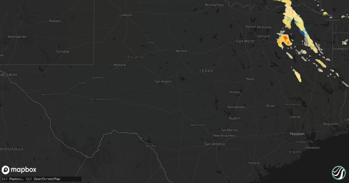
Hail Map in Texas on April 24, 2026
Get this storm
April 24 map
$229
one time, instant access
Download today. No call, no setup
Keep the $229
Bought the map and want the full workflow? Apply the entire $229 to a subscription within 7 days. None of it is wasted.
Every map, not just this one
This buys you this map. Subscription and you get every map we run, in the markets you choose from a few cities to whole states to nationwide. Plus real-time alerts the moment a storm fires.
Contact data
Name, contact info, occupancy, even credit band for addresses in the footprint. You go from where it hit to who to call.
Become the source they trust
Unlimited branding weather history reports on demand. You already have the documented answer ready for the property owner, and you are the one who showed up with it.
Property data and RoofTrace estimates
Pull up any address you have got, its value and the exact code rules for that jurisdiction, straight from One Click Code. Then RoofTrace estimates the squares, pitch, and roof value, priced the way you price.
Storm reports in Texas
Texas
| Date | Description |
|---|---|
| 04/24/20264:05 AM CDT | Social media report of multiple downed trees blocking the road near fm1817 and fm323 north of slocum. |
| 04/24/20261:10 AM CDT | Picture of hail along i-20 near canton on facebook. |
| 04/24/202612:33 AM CDT | Social media report of quarter sized hail with a few golf balls mixed in on fm 47 near wills point. |
| 04/24/202612:30 AM CDT | Reported on facebook in grand saline. |
| 04/24/202612:30 AM CDT | Reported on facebook. |
| 04/24/202612:15 AM CDT | Delayed report. Emergency manager reported trees down on vzcr 3805. |
| 04/23/202611:54 PM CDT | Reported on facebook along vzcr 1110 south of hwy 280. |
| 04/23/202611:40 PM CDT | A local report indicates 1.00 inch wind near 2 W Fruitvale |
| 04/23/202611:20 PM CDT | Multiple social media reports of 1.5 to 2 inch hail near fruitvale. |
| 04/23/202611:10 PM CDT | Hail ranging from dime to half dollar in the judson community near the intersection of us highway 259 and fm road 1844. |
| 04/23/202611:05 PM CDT | Quarter size hail reported in north longview. |
| 04/23/202610:50 PM CDT | Social media photo. |
| 04/23/202610:40 PM CDT | Photo of approximately tennis ball size hail. |
| 04/23/202610:40 PM CDT | Social media reports of quarter size hail. |
| 04/23/202610:37 PM CDT | Media partner reported small trees downed along fm 2088... West of us 271... North of gilmer. |
| 04/23/202610:30 PM CDT | Roof blown off a storage building about 6 miles north of the town of gilmer. Time estimated by radar. |
| 04/23/202610:25 PM CDT | Delayed report. Social media photo of 2.75 to 3 inch hailstone in emory. Time estimated by radar. |
| 04/23/202610:17 PM CDT | A local report indicates 1.75 inch wind near Emory |
| 04/23/202610:17 PM CDT | A local report indicates 2.00 inch wind near 3 W Emory |
| 04/23/202610:10 PM CDT | Large snapped tree fell on home... Resulting in minor damage in the city of pittsburg. |
| 04/23/202610:09 PM CDT | A local report indicates 1.00 inch wind near Emory |
| 04/23/202610:07 PM CDT | A local report indicates 1.75 inch wind near Point |
| 04/23/20269:58 PM CDT | A local report indicates 1.25 inch wind near Point |
| 04/23/20269:55 PM CDT | Sheriff reports large tree down near fm 3236 and cr 4508. |
| 04/23/20269:50 PM CDT | Lots of hail ranging from dime to quarter size. |
| 04/23/20269:50 PM CDT | Structural damage reported at a truck stop in the town of winfield. |
| 04/23/20269:27 PM CDT | Sheriff reports large trees down near cr 3563 and cr 3562 north of dike. |
| 04/23/20269:22 PM CDT | Sheriff reports a large tree down near hwy 19 near fm 1536 just west of tira. |
| 04/23/20268:55 PM CDT | Law enforcement reports downed trees limbs and related power outages in the town of bogata. |
| 04/23/20268:20 PM CDT | Social media report of 2 inch hail in between reno and paris. |
| 04/23/20268:10 PM CDT | Report from mping. |
| 04/23/20268:10 PM CDT | Numerous trees down and damage to power lines in paris. Time estimated. |
| 04/23/20268:00 PM CDT | A local report indicates 1.75 inch wind near 7 NNW Toco |
| 04/23/20267:55 PM CDT | A local report indicates 1.00 inch wind near 2 NW Paris |
All States Impacted by Hail Map on April 24, 2026
Cities Impacted by Hail Map on April 24, 2026
- Konawa, OK
- Lexington, OK
- Wanette, OK
- Lindsay, OK
- Byars, OK
- Elmore City, OK
- Pauls Valley, OK
- Maysville, OK
- Foster, OK
- Sasakwa, OK
- Ada, OK
- Asher, OK
- Stratford, OK
- Whitefield, OK
- Stigler, OK
- Clayton, IN
- Mooresville, IN
- Monrovia, IN
- Plainfield, IN
- Camby, IN
- Indianapolis, IN
- Allen, OK
- Holdenville, OK
- Wynnewood, OK
- Davis, OK
- Yazoo City, MS
- Kinta, OK
- Calvin, OK
- Mccurtain, OK
- McCarley, MS
- Winona, MS
- Keota, OK
- Stonewall, OK
- Stuart, OK
- Centrahoma, OK
- Bokoshe, OK
- Duck Hill, MS
- Kilmichael, MS
- Sterlington, LA
- Hartshorne, OK
- Sulphur, OK
- Webbers Falls, OK
- Porum, OK
- Vian, OK
- Wister, OK
- Fitzhugh, OK
- Coalgate, OK
- Tupelo, OK
- Roff, OK
- Shady Point, OK
- Stewart, MS
- Redwood, MS
- Tinsley, MS
- Mcalester, OK
- Sallisaw, OK
- Haileyville, OK
- Wilkinson, IN
- Greenfield, IN
- Wilburton, OK
- Charlottesville, IN
- Knightstown, IN
- Shirley, IN
- New Castle, IN
- Kennard, IN
- Flowood, MS
- Pearl, MS
- Jackson, MS
- Mill Creek, OK
- Eupora, MS
- Richland, MS
- Satartia, MS
- Wardville, OK
- Smithville, OK
- Tuskahoma, OK
- Bentonia, MS
- Kiowa, OK
- Talihina, OK
- Seminole, OK
- Tishomingo, OK
- Pittsburg, OK
- Blanco, OK
- Howe, OK
- Poteau, OK
- Muldrow, OK
- Gans, OK
- Watson, OK
- Cameron, OK
- Vicksburg, MS
- Earlsboro, OK
- Spiro, OK
- Heavener, OK
- Brandon, MS
- Milburn, OK
- Stringtown, OK
- Daisy, OK
- Wapanucka, OK
- Wewoka, OK
- Bolton, MS
- Flora, MS
- Terry, MS
- Crystal Springs, MS
- Lena, MS
- Hodgen, OK
- Pelahatchie, MS
- Clayton, OK
- Coleman, OK
- Atoka, OK
- Pocola, OK
- Fort Smith, AR
- Arkoma, OK
- Greenwood, AR
- Antlers, OK
- Emerson, AR
- Florence, MS
- Madison, MS
- Snow, OK
- Caney, OK
- Caddo, OK
- Kenefic, OK
- Hatfield, AR
- Mena, AR
- Morton, MS
- Waldron, AR
- Hope, AR
- Forest, MS
- Hartford, AR
- Edwards, MS
- Union, MS
- Carthage, MS
- Philadelphia, MS
- Walnut Grove, MS
- Sebastopol, MS
- Conehatta, MS
- Nashoba, OK
- Bennington, OK
- Lane, OK
- Ridgeland, MS
- Tougaloo, MS
- Rattan, OK
- Braxton, MS
- Mendenhall, MS
- Pulaski, MS
- Durant, OK
- Finley, OK
- Boswell, OK
- Lake, MS
- Broken Bow, OK
- Honobia, OK
- Bogue Chitto, MS
- Bokchito, OK
- Lawrence, MS
- Ringold, OK
- Soper, OK
- Hugo, OK
- Newton, MS
- Raleigh, MS
- Clinton, MS
- Brookhaven, MS
- Ruth, MS
- Rosston, AR
- Emmet, AR
- Buckner, AR
- Arthur City, TX
- Sumner, TX
- Collinsville, MS
- De Kalb, MS
- Preston, MS
- Willisville, AR
- Waldo, AR
- Bethel, OK
- Decatur, MS
- Newellton, LA
- Cache, OK
- Utica, MS
- Monticello, MS
- Valliant, OK
- Powderly, TX
- Paris, TX
- Lawton, OK
- Jayess, MS
- Faxon, OK
- Brookston, TX
- Louin, MS
- Sontag, MS
- Saint Joseph, LA
- Geronimo, OK
- Grannis, AR
- Wickes, AR
- Rose Hill, MS
- Silver Creek, MS
- Bay Springs, MS
- Taylorsville, MS
- Scooba, MS
- Pachuta, MS
- Petty, TX
- Blossom, TX
- Pattonville, TX
- Deport, TX
- Roxton, TX
- Walters, OK
- Paulding, MS
- Prentiss, MS
- Honey Grove, TX
- Newhebron, MS
- Hickory, MS
- Mount Olive, MS
- Bogata, TX
- Vossburg, MS
- Quitman, MS
- Enterprise, MS
- Magee, MS
- Port Gibson, MS
- Harrisville, MS
- Hazlehurst, MS
- Meridian, MS
- Haworth, OK
- Oak Vale, MS
- Shubuta, MS
- Stonewall, MS
- Mize, MS
- Eagletown, OK
- Detroit, TX
- Wesson, MS
- Georgetown, MS
- Cooper, TX
- Lake Creek, TX
- Ben Franklin, TX
- Enloe, TX
- Clayton, LA
- Waterproof, LA
- Ferriday, LA
- Pinola, MS
- Pattison, MS
- Liberty, MS
- Smithdale, MS
- Natchez, MS
- Sulphur Bluff, TX
- Talco, TX
- Melvin, AL
- Gilbertown, AL
- Waynesboro, MS
- Butler, AL
- Needham, AL
- Fayette, MS
- Ladonia, TX
- Pecan Gap, TX
- Commerce, TX
- Klondike, TX
- Stringer, MS
- Lorman, MS
- Foreman, AR
- Mount Vernon, TX
- Cumby, TX
- Sulphur Springs, TX
- Toxey, AL
- Ashdown, AR
- Lisman, AL
- Dike, TX
- Saltillo, TX
- Laurel, MS
- Heidelberg, MS
- Greenville, TX
- Mount Pleasant, TX
- Benton, LA
- Quinlan, TX
- Lone Oak, TX
- Campbell, TX
- Haughton, LA
- Cotton Valley, LA
- Thomasville, AL
- Campbell, AL
- Sweet Water, AL
- Jachin, AL
- York, AL
- Cuba, AL
- Toomsuba, MS
- Lauderdale, MS
- Ward, AL
- Pennington, AL
- Linden, AL
- Demopolis, AL
- Bellamy, AL
- Livingston, AL
- Winfield, TX
- Dixons Mills, AL
- Magnolia, AL
- Gallion, AL
- Thomaston, AL
- Texarkana, TX
- Point, TX
- Emory, TX
- Pittsburg, TX
- Brashear, TX
- Leesburg, TX
- Scroggins, TX
- Alba, TX
- Carson, MS
- Gilmer, TX
- Union Church, MS
- Bassfield, MS
- Yantis, TX
- Greenville, MS
- Magnolia, AR
- Edgewood, TX
- Columbia, MS
- Ore City, TX
- Big Sandy, TX
- Winnsboro, TX
- Hawkins, TX
- El Dorado, AR
- Sumrall, MS
- Longview, TX
- Gladewater, TX
- White Oak, TX
- Leland, MS
- Wills Point, TX
- Fruitvale, TX
- Quitman, TX
- Mineola, TX
- Grand Saline, TX
- Diana, TX
- Plain Dealing, LA
- Hallsville, TX
- Terrell, TX
- Winona, TX
- Tyler, TX
- Marion, LA
- Hattiesburg, MS
- Purvis, MS
- Princeton, LA
- Tatum, TX
- Marshall, TX
- Beckville, TX
- Bastrop, LA
- Kilgore, TX
- Overton, TX
- Glen Allan, MS
- Carthage, TX
- Monroe, LA
- Lindale, TX
- Van, TX
- Collinston, LA
- De Berry, TX
- Rayville, LA
- Oak Ridge, LA
- Whitehouse, TX
- Pioneer, LA
- Epps, LA
- Selman City, TX
- Troup, TX
- Rolling Fork, MS
- Canton, TX
- Mayersville, MS
- Henderson, TX
- Long Branch, TX
- Tallulah, LA
- Mount Enterprise, TX
- Gary, TX
- Garrison, TX
- Murchison, TX
- Ben Wheeler, TX
- Athens, TX
- Timpson, TX
- Brownsboro, TX
- Center, TX
- Tenaha, TX
- Larue, TX
- Chandler, TX
- Shelbyville, TX
- Canton, MS
- Palestine, TX
- Frankston, TX
- Zwolle, LA
- Many, LA
- Jacksonville, TX
- Florien, LA
- Elkhart, TX
- Seminary, MS
- Anacoco, LA
- Grapeland, TX
- Norwood, LA
- Saint Francisville, LA
- Leesville, LA
- Rusk, TX
- Crockett, TX
- Welsh, LA
- Jennings, LA
- Roanoke, LA
- Poplarville, MS
- Opelousas, LA
- Arnaudville, LA
- Sunset, LA
- Morse, LA
- Mermentau, LA
- Darrow, LA
- Gonzales, LA
- Estherwood, LA
- Saint Martinville, LA
- Saucier, MS
- Perkinston, MS
- Gulfport, MS
- Long Beach, MS
- Kenner, LA
- Destrehan, LA
- Westwego, LA
- Norco, LA
- Ama, LA
- Marrero, LA
- Saint Rose, LA
- New Orleans, LA
- Harleton, TX
- Jonesboro, AR
- State University, AR
- Beaverton, MI


