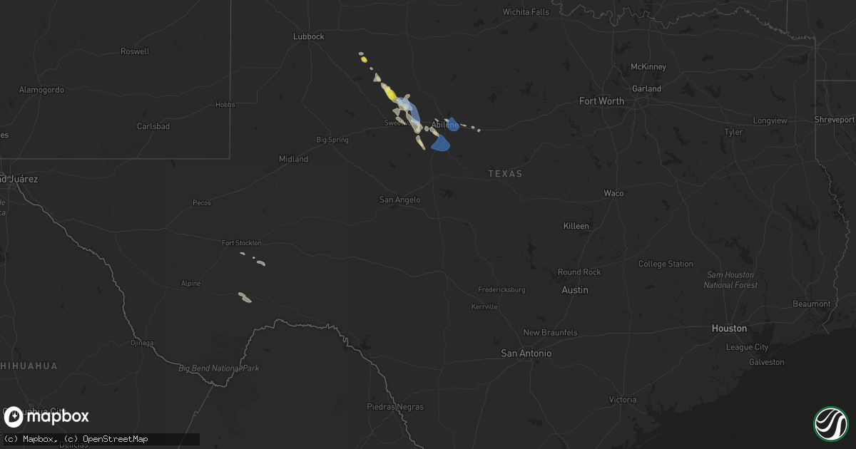
Hail Map in Texas on April 23, 2024
Get this storm
April 23 map
$229
one time, instant access
Download today. No call, no setup
Keep the $229
Bought the map and want the full workflow? Apply the entire $229 to a subscription within 7 days. None of it is wasted.
Every map, not just this one
This buys you this map. Subscription and you get every map we run, in the markets you choose from a few cities to whole states to nationwide. Plus real-time alerts the moment a storm fires.
Contact data
Name, contact info, occupancy, even credit band for addresses in the footprint. You go from where it hit to who to call.
Become the source they trust
Unlimited branding weather history reports on demand. You already have the documented answer ready for the property owner, and you are the one who showed up with it.
Property data and RoofTrace estimates
Pull up any address you have got, its value and the exact code rules for that jurisdiction, straight from One Click Code. Then RoofTrace estimates the squares, pitch, and roof value, priced the way you price.
Storm reports in Texas
Texas
| Date | Description |
|---|---|
| 04/23/20246:51 PM CDT | A local report indicates 61 MPH wind near Roby |
| 04/23/20246:30 PM CDT | Storm chaser reported 60 to 65 mph winds 1 mile south of roby... Tx measured by instrumentation from 6:30pm to 7pm. |
| 04/23/20243:18 PM CDT | Mesonet station 18 lamesa 2se. |
| 04/22/20248:26 PM CDT | 58 mph wind gust measured at the abilene airport. |
| 04/22/20248:20 PM CDT | Picture on social media of medium sized tree limbs down in downtown tuscola. |
| 04/22/20248:20 PM CDT | A local report indicates 1.00 inch wind near 3 NE Abilene |
| 04/22/20247:45 PM CDT | A partial train derailment was caused by very strong straight line winds. There were 20 to 25 train cars blown over. The estimated wind speed was 80 mph. The estimated |
All States Impacted by Hail Map on April 23, 2024
Cities Impacted by Hail Map on April 23, 2024
- Crystal Falls, MI
- Kinross, MI
- Brimley, MI
- Fort Stockton, TX
- Burnt Ranch, CA
- Hayfork, CA
- Justiceburg, TX
- Snyder, TX
- Marathon, TX
- Rotan, TX
- Roby, TX
- Belmont, MI
- Ada, MI
- Lowell, MI
- Saranac, MI
- Sylvester, TX
- McCaulley, TX
- Belding, MI
- Ionia, MI
- Sweetwater, TX
- Trent, TX
- Byron Center, MI
- Caledonia, MI
- Merkel, TX
- Nolan, TX
- Wayland, MI
- Abilene, TX
- Middleville, MI
- Tuscola, TX
- Clyde, TX
- Wingate, TX
- Buffalo Gap, TX
- Baird, TX
- Ovalo, TX
- Lawn, TX
- Goldsboro, TX


