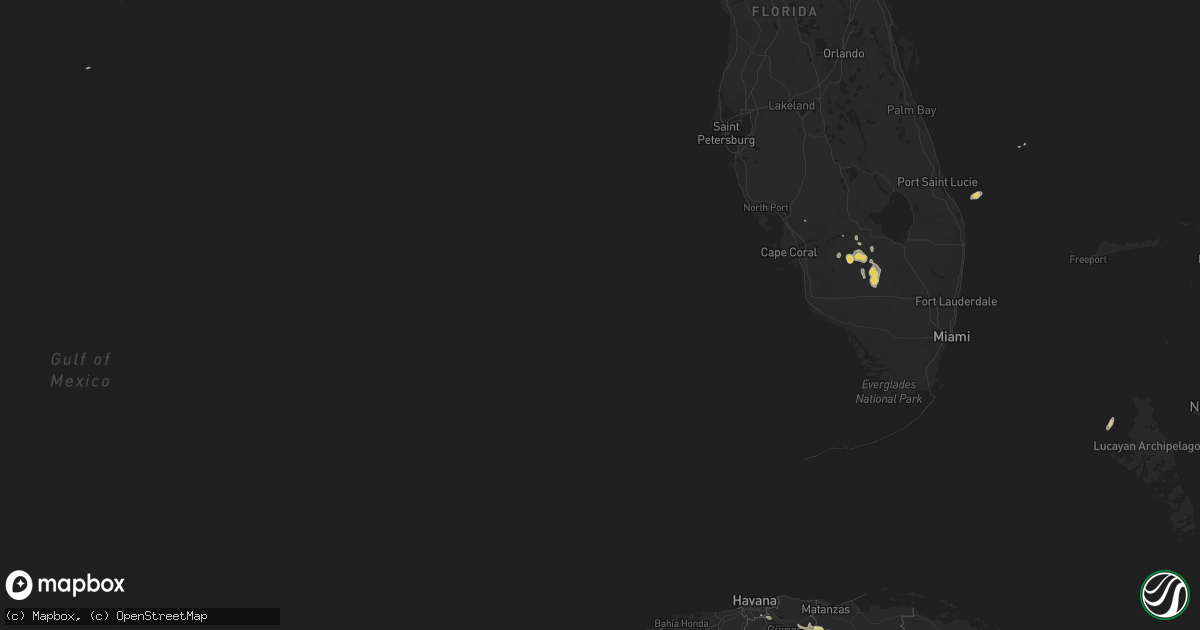
Hail Map on April 22, 2018
Get this storm
April 22 map
$229
one time, instant access
Download today. No call, no setup
Keep the $229
Bought the map and want the full workflow? Apply the entire $229 to a subscription within 7 days. None of it is wasted.
Every map, not just this one
This buys you this map. Subscription and you get every map we run, in the markets you choose from a few cities to whole states to nationwide. Plus real-time alerts the moment a storm fires.
Contact data
Name, contact info, occupancy, even credit band for addresses in the footprint. You go from where it hit to who to call.
Become the source they trust
Unlimited branding weather history reports on demand. You already have the documented answer ready for the property owner, and you are the one who showed up with it.
Property data and RoofTrace estimates
Pull up any address you have got, its value and the exact code rules for that jurisdiction, straight from One Click Code. Then RoofTrace estimates the squares, pitch, and roof value, priced the way you price.
Storm reports
Georgia
| Date | Description |
|---|---|
| 04/21/20188:35 PM CDT | One tree down on boyette road. |
Alabama
| Date | Description |
|---|---|
| 04/22/20186:40 PM CDT | Several trees downed on raven road. |
| 04/22/20186:20 PM CDT | Trees were blown down and blocking roads in akron. |
| 04/22/20186:15 PM CDT | Trees were blown down and blocking roads. |
| 04/22/20186:15 PM CDT | Trees were blown down and blocking roads. |
| 04/22/20183:38 PM CDT | A couple of trees were blown down along with a street sign in western houston county. |
| 04/22/20183:38 PM CDT | An ef-0 tornado touched down near the intersection of chatelaine dr and cr-87. A few homes experienced shingle damage. Some trees uprooted. The tornado continued moving |
| 04/22/20183:36 PM CDT | Trees and branches down along hwy 87 north of hwy 98 near elberta. Time estimated from radar. |
| 04/22/20183:25 PM CDT | Seven over turned trailers at anchors rv park. Minor damage to a lowes parking lot. |
| 04/22/20183:25 PM CDT | *** 3 inj *** an ef-0 tornado touched down at the anchors aweigh rv resort where 5 rvs were overturned. 3 people inside the rvs were injured. The tornado continued nort |
| 04/22/20183:09 PM CDT | Minor damage to a building and powerlines down along west beach blvd. |
| 04/22/20182:30 PM CDT | Trees down on naftel-ramer road. Possible tornado. |
| 04/22/20182:25 PM CDT | Nws meteorologists surveyed damage in southwest montgomery county and determined that the damage was consistent with an ef0 tornado. The tornado touched down just east |
| 04/22/20182:14 PM CDT | Pictures of trees snapped and numerous large branches down near a home in the area of highland home and magnolia springs. |
| 04/22/20182:11 PM CDT | A tornado touched down near daniel mill rd causing minor tree damage... Then strengthened to an ef-1 before reaching oliver myers rd. Several large trees were uprooted |
| 04/22/20182:01 PM CDT | Reports of damage to a mobile home and along yellow creek road near the community of roberts... Alabama. |
| 04/22/20181:54 PM CDT | Tree blown onto a house with numerous trees down in the surrounding areas. |
| 04/22/20181:49 PM CDT | Metal roof blown off a home and tree branches down in the bethel community southeast of brewton... Al. |
| 04/22/20181:49 PM CDT | Nws survey determined that a severe thunderstorm produced sporadic straight line wind damage. Several large trees were uprooted along raintree rd and yellow creek rd. S |
| 04/22/20181:45 PM CDT | Siding and roof damage to a house on fuqua rd with damage to a nearby barn. Pictures via social media. |
| 04/22/20181:44 PM CDT | Several trees snapped and uprooted in the sellersville community. Pictures via social media. |
| 04/22/20181:43 PM CDT | An ef-1 tornado touched down near jeffcoat rd. One mobile home and a shed were destroyed. Several large trees were uprooted or snapped... One of which fell on a vehicle |
| 04/22/20181:11 PM CDT | Ef0 tornado touched touched at fort rucker. Large tree limbs and small trees were broken or uprooted along the path. A wooden dugout structure at a baseball field was a |
| 04/22/20181:08 PM CDT | Trees down. Possible tornado. |
| 04/22/20182:57 AM CDT | At 756 PM CDT, severe thunderstorms were located along a line extending from Lake View to near Ashby to 6 miles southwest of Paul M Grist State Park, moving northeast at 35 mph. HAZARD...60 mph wind gusts. SOURCE...Emergency management. IMPACT...Expect damage to roofs, siding, and trees. Locations impacted include... Birmingham, Hoover, Vestavia Hills, Alabaster, Bessemer, Homewood, Pelham, Mountain Brook, Trussville, Helena, Hueytown, Gardendale, Irondale, Leeds, Moody, Calera, Fairfield, Chelsea, Clanton and Fultondale. |
| 04/22/20181:55 AM CDT | At 654 PM CDT, severe thunderstorms were located along a line extending from 9 miles northeast of Greensboro Municipal Airport to near Greensboro to near Faunsdale, moving east at 30 mph. HAZARD...60 mph wind gusts. SOURCE...Trained weather spotters. IMPACT...Expect damage to roofs, siding, and trees. Locations impacted include... Brent, Marion, Centreville, Newbern, West Centreville, Heiberger, Lawley, Ashby, Brierfield Ironworks Park, Low Gap, Mertz, Talladega National Forest, Eoline, Randolph, Radford, Folsom, Six Mile, Bibb County Airport, Harmon and Trio. |
| 04/22/20181:38 AM CDT | At 637 PM CDT, severe thunderstorms were located along a line extending from near Moundville to 7 miles northeast of Sawyerville to near Arcola, moving northeast at 35 mph. HAZARD...60 mph wind gusts. SOURCE...Trained weather spotters. IMPACT...Expect damage to roofs, siding, and trees. Locations impacted include... Greensboro, Moundville, Newbern, Greensboro Municipal Airport, Gallion, Moundville Airport, Phipps, Mound State Park, Elliots Creek, Harper Hill, Wateroak, Cedarville, Laneville and Havana. |
| 04/22/20181:00 AM CDT | At 559 PM CDT, severe thunderstorms were located along a line extending from 6 miles southwest of Putnam to 5 miles north of Coffeeville, moving east at 35 mph. HAZARD...60 mph wind gusts. SOURCE...Radar indicated. IMPACT...Expect damage to roofs, siding, and trees. Locations impacted include... Thomasville. |
| 04/21/201811:52 PM CDT | At 452 PM CDT, a severe thunderstorm was located near Crandall, or 7 miles southeast of Quitman, moving northeast at 40 mph. HAZARD...60 mph wind gusts. SOURCE...Radar indicated. IMPACT...Expect damage to roofs, siding, and trees. This severe thunderstorm will be near... Crandall and Sykes around 500 PM CDT. |
| 04/21/201810:00 PM CDT | Several trees and limbs were knocked down across limestone county. |
| 04/21/20188:53 PM CDT | At 152 PM CDT, a severe thunderstorm was located 9 miles east of Riverview, or 10 miles southeast of Brewton, moving northeast at 30 mph. HAZARD...60 mph wind gusts. SOURCE...Radar indicated. IMPACT...Expect damage to roofs, siding, and trees. This severe thunderstorm will remain over mainly rural areas of eastern Escambia County. |
| 04/21/20188:50 PM CDT | Tree blown down onto a house in the meadowbrook area. |
| 04/21/20188:50 PM CDT | Trees down at 12000 block of old highway 280 in chelsea. |
| 04/21/20188:50 PM CDT | Trees down at buttewoods drive and caldwell mill road... In north shelby county. |
| 04/21/20188:50 PM CDT | Trees down at honeysuckle road and honeysuckle circle... In helena. |
| 04/21/20188:15 PM CDT | A few calls of trees down around mccalla. |
Louisiana
| Date | Description |
|---|---|
| 04/22/20189:46 AM CDT | A tornado caused roof damage to several homes and buildings from la highway 3235 to south lafourche high school. Vehicles were pushed into a field and power lines were |
| 04/22/20189:46 AM CDT | Several homes received roof damage and vehicles were tossed into a pasture. Power lines were knocked down. Possible tornado. |
Florida
| Date | Description |
|---|---|
| 04/22/20184:21 PM CDT | Image of a large tree snapped and numerous branches down near a home ocean city. |
| 04/22/20184:17 PM CDT | Roofing damage to the charlie hill terrace. Okaloosa sheriff office reports numerous downed trees and powerlines with minor damage to buildings across southern okaloosa |
| 04/22/20184:11 PM CDT | Video of a waterspout moving onshore along fort walton beach. |
| 04/22/20184:00 PM CDT | Large branches snapped and a fence blown over in the brookside hills subdivison. |
| 04/22/20181:10 PM CDT | At least 5 structures with damage and several downed trees and power lines along crabtree church road. Reports and pictures via northescambia online newspaper and socia |
| 04/22/20181:02 PM CDT | Fire chief reports a home with missing shingles with downed powerlines and tree debris over the road in molino... Fl. |
| 04/22/20181:02 PM CDT | A brief ef-0 tornado occurred on crabtree church rd. One home experienced shingle damage and a broken window and a mobile home was shifted on its foundation. There were |
| 04/21/201811:24 PM CDT | At 424 PM CDT, a severe thunderstorm was located 6 miles northwest of Point Baker, or 10 miles northwest of Milton, moving northeast at 30 mph. HAZARD...60 mph wind gusts. SOURCE...Radar indicated. IMPACT...Expect damage to roofs, siding, and trees. This severe thunderstorm will remain over mainly rural areas of northern Santa Rosa County. |
| 04/21/201810:49 PM CDT | At 349 PM CDT, a severe thunderstorm was located over Ensley, moving north at 25 mph. HAZARD...60 mph wind gusts. SOURCE...Radar indicated. IMPACT...Expect damage to roofs, siding, and trees. Locations impacted include... Pensacola, Ferry Pass, Brent, Ensley, Gonzalez, Pace and Molino. |
Mississippi
| Date | Description |
|---|---|
| 04/22/20185:25 AM CDT | At 1024 AM CDT, a severe thunderstorm was located over Bogue Chitto, or 10 miles north of Mccomb, moving northeast at 20 mph. HAZARD...60 mph wind gusts. SOURCE...Radar indicated. IMPACT...Expect damage to roofs, siding, and trees. Locations impacted include... Enterprise, Bogue Chitto and East Lincoln. |
| 04/22/20185:11 AM CDT | At 1011 AM CDT, a severe thunderstorm was located near Center Point, or 11 miles northwest of Mccomb, moving northeast at 25 mph. HAZARD...60 mph wind gusts. SOURCE...Radar indicated. IMPACT...Expect damage to roofs, siding, and trees. Locations impacted include... Brookhaven, Enterprise, Center Point, Bogue Chitto and East Lincoln. |
| 04/22/20184:42 AM CDT | At 942 AM CDT, a severe thunderstorm was located near Progress, or 17 miles south of Pinola, moving northeast at 25 mph. HAZARD...60 mph wind gusts. SOURCE...Radar indicated. IMPACT...Expect damage to roofs, siding, and trees. Locations impacted include... Clem, New Hebron and Silver Creek. |