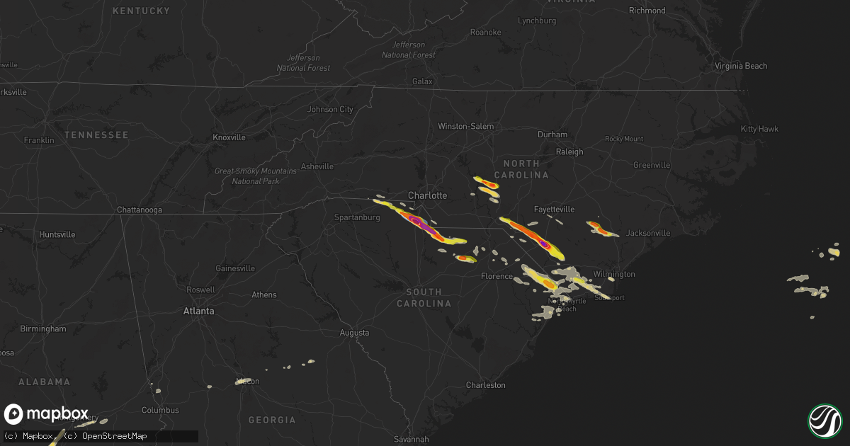
Hail Map on April 20, 2024
Get this storm
April 20 map
$229
one time, instant access
Download today. No call, no setup
Keep the $229
Bought the map and want the full workflow? Apply the entire $229 to a subscription within 7 days. None of it is wasted.
Every map, not just this one
This buys you this map. Subscription and you get every map we run, in the markets you choose from a few cities to whole states to nationwide. Plus real-time alerts the moment a storm fires.
Contact data
Name, contact info, occupancy, even credit band for addresses in the footprint. You go from where it hit to who to call.
Become the source they trust
Unlimited branding weather history reports on demand. You already have the documented answer ready for the property owner, and you are the one who showed up with it.
Property data and RoofTrace estimates
Pull up any address you have got, its value and the exact code rules for that jurisdiction, straight from One Click Code. Then RoofTrace estimates the squares, pitch, and roof value, priced the way you price.
States Impacted by Hail Map on April 20, 2024
Storm reports
South Carolina
| Date | Description |
|---|---|
| 04/20/20246:30 PM CDT | Power outages affecting most of nichols... Sc due to fallen trees. |
| 04/20/20245:55 PM CDT | Quarter sized hail reported at intersection of sc 34 and hwy 38 |
| 04/20/20245:46 PM CDT | Emergency manager reported several trees down around the brownsville community. Time estimated via radar. |
| 04/20/20245:27 PM CDT | Trees and power lines down near hwy 52 and burlington dr. |
| 04/20/20245:17 PM CDT | Quarter-sized hail observed in hartsville... Sc. Time estimated via radar. |
| 04/20/20245:00 PM CDT | Scdps website reported a tree in the road at this location. Time estimated by radar. |
| 04/20/20244:41 PM CDT | Trained spotter relayed pictures of multiple power poles snapped at long branch ch. Rd. And sandhills vfd rd. Intersection in jefferson via social media. Time estimated |
| 04/20/20244:41 PM CDT | Trained spotter relayed pictures of powerlines in roadway on sc265 near the c. P. Simpson rd intersection via social media. Time estimated by radar. |
| 04/20/20244:37 PM CDT | Trained spotter relayed a report of a large oak down on mt. Pisgah church rd. In jefferson approx. 0.5 mile before the lynches river bridge. |
| 04/20/20244:10 PM CDT | Public reported quarter sized to ping pong sized hail near the intersection of potter rd and beacon rd. |
| 04/20/20243:57 PM CDT | Trained spotter relayed 2 inch hail report via twitter. Hail lasted about 10 minutes. |
| 04/20/20243:57 PM CDT | Large trees down as well. |
| 04/20/20243:54 PM CDT | Report from mping of quarter sized hail north of lancaster. |
| 04/20/20243:35 PM CDT | A local report indicates 1.00 inch wind near 3 W Catawba |
| 04/20/20243:35 PM CDT | A local report indicates 1.00 inch wind near Catawba |
| 04/20/20243:30 PM CDT | A local report indicates 2.00 inch wind near 1 SSE Rock Hill |
| 04/20/20243:30 PM CDT | A local report indicates 1.00 inch wind near 4 NW Catawba |
| 04/20/20243:30 PM CDT | A local report indicates 1.50 inch wind near 1 SSE Rock Hill |
| 04/20/20243:25 PM CDT | Corrects previous tstm wnd dmg report from 3 ne mcconnells. Considerable tree damage along mcconnells highway. Several large trees fell on the highway. |
| 04/20/20243:25 PM CDT | Two 100 ft towers destroyed. Large trees snapped. |
| 04/20/20243:25 PM CDT | Considerable tree damage along mcconnells highway. Several large trees fell on the highway. |
| 04/20/20243:25 PM CDT | Trees blocking roadway. |
| 04/20/20243:21 PM CDT | Public reported softball size hail near the intersection of highway 901 and saluda st in rock hill. Widespread hail damage reported throughout the city. |
| 04/20/20243:21 PM CDT | Multiple sources report widespread tree damage throughout rock hill... With some trees down on structures. The awning of a gas station was also collapsed. Damage is mos |
| 04/20/20243:20 PM CDT | Several large downed trees on madeline dr. |
| 04/20/20243:15 PM CDT | A local report indicates 1.00 inch wind near 6 W Rock Hill |
| 04/20/20243:03 PM CDT | An intense severe thunderstorm impacted portions of york county on the afternoon of saturday... April 20th. This storm produced a swath of extensive wind damage extendi |
| 04/20/20243:03 PM CDT | A local report indicates 1.00 inch wind near 4 NNW York |
| 04/20/20243:00 PM CDT | Multiple power lines down in the city of york. |
| 04/20/20242:28 PM CDT | A local report indicates 1.25 inch wind near 1 E Blacksburg |
| 04/19/20247:08 PM CDT | A local report indicates 0 MPH wind near 1 ENE Green Sea |
| 04/19/20247:08 PM CDT | Public reported quarter-sized hail near loris... Sc. Time estimated via radar. |
| 04/19/20247:08 PM CDT | Public reported large hail of unknown size that damaged vehicle windows. |
| 04/19/20247:07 PM CDT | Quarter and ping-pong sized hail observed in downtown loris... Sc. Large limbs were also reported down. |
Texas
| Date | Description |
|---|---|
| 04/20/20242:00 AM CDT | Exact time and location is approximate. |
| 04/20/20241:10 AM CDT | Social media report of hail up to 1 inch in diameter at intersection of rattler rd and state highway 123 in hays county; time estimated via radar. |
| 04/20/202412:59 AM CDT | Social media report of 1 inch hail at intersection of goodwin ln and conrads rd; time estimated via radar. |
| 04/20/202412:52 AM CDT | A local report indicates 1.00 inch wind near 5 WNW New Braunfels |
| 04/20/202412:32 AM CDT | A local report indicates 2.00 inch wind near 3 ESE Bulverde |
| 04/20/202412:31 AM CDT | A local report indicates 1.50 inch wind near 3 WNW New Braunfels |
| 04/20/202412:30 AM CDT | A local report indicates 1.75 inch wind near 1 SW Timberwood Park |
| 04/20/202412:29 AM CDT | A local report indicates 1.25 inch wind near 2 SE Timberwood Park |
| 04/20/202412:29 AM CDT | A local report indicates 1.00 inch wind near 5 WNW New Braunfels |
| 04/20/202412:29 AM CDT | Updated report from first severe storm. 1252 am report from same location still valid. |
| 04/20/202412:28 AM CDT | Intersection of sparrow ridge and trinity ct; time estimated via radar. |
| 04/20/202412:25 AM CDT | Intersection of hardy oak blvd and stone oak pkwy; time estimated via radar. |
| 04/20/202412:25 AM CDT | A local report indicates 1.00 inch wind near 3 SE Timberwood Park |
| 04/20/202412:23 AM CDT | Up to 2 inch hail estimated at intersection of blanco rd and specht rd; time estimated via radar. |
| 04/20/202412:22 AM CDT | Intersection of winspirit and bobbins ridge; time estimated via radar. |
| 04/20/202412:18 AM CDT | Time estimated via radar. |
| 04/19/202410:15 PM CDT | Social media video of hail with videographer estimating quarter size hail near freer high school. Time estimated by radar. |
| 04/19/20247:01 PM CDT | Broadcast media relayed a photo of at least quarter sized hail near camp wood. |
Georgia
| Date | Description |
|---|---|
| 04/20/20244:38 PM CDT | Tree down at state route 18 and mote rd. |
| 04/20/20244:10 PM CDT | Tree down along hwy 219 north of maddox rd. |
Alabama
| Date | Description |
|---|---|
| 04/20/20246:33 PM CDT | Quarter to golf ball sized hail reported by public to media. |
North Carolina
| Date | Description |
|---|---|
| 04/20/20246:21 PM CDT | Small dents on car hoods in dairy queen parking lot. |
| 04/20/20245:42 PM CDT | Tree and large limb down on myrtle head rd nw just north of the intersection with exum rd nw. |
| 04/20/20245:28 PM CDT | Public report of hail up to golf ball size along hwy 701 near prospect rd. |
| 04/20/20244:50 PM CDT | Large tree limbs down. |
| 04/20/20244:35 PM CDT | Half-dollar sized hail reported near lumberton. |
| 04/20/20244:22 PM CDT | Ping pong ball sized hail reported in lumberton near the intersection of w 21st street and floyd avenue. |
| 04/20/20244:22 PM CDT | Very large hail fell along w. 5th st... Some stones the size of softballs. |
| 04/20/20244:02 PM CDT | Quarter sized hail fell for about 5 minutes. |
| 04/20/20243:58 PM CDT | Golf ball sized hail reported near the intersection of highway 72 and union chapel road near pembroke... Nc. |
| 04/20/20243:57 PM CDT | Golf ball sized hail near pembroke... Nc. |
| 04/20/20243:50 PM CDT | Hail began at 4:50 pm and continued for about 10 minutes. Size ranged from marbles to quarters. |
| 04/20/20243:42 PM CDT | Mping report from mccaskill rd. |
| 04/20/20243:39 PM CDT | Ping pong ball sized hail reported at county line store |
| 04/20/20243:39 PM CDT | Ping pong ball sized hail reported at county line store on nc-71. |
| 04/20/20243:31 PM CDT | Mping report of ping pong ball sized hail. |
| 04/20/20243:30 PM CDT | Received via fox8. |
| 04/20/20243:27 PM CDT | Lemon-sized hail... Between the size of an egg and tennis ball... Observed at the montgomery county eoc. |
| 04/20/20243:27 PM CDT | Lemon-sized h |
| 04/20/20243:25 PM CDT | Reported at nc 109 and shiloh rd. |
| 04/20/20243:21 PM CDT | Downed trees were reported to down power lines northeast of laurel hill... Along mcfarland rd... Old wire rd... And traders rd. |
| 04/20/20243:17 PM CDT | Quarter sized hail covered the ground on camp monroe rd. |
| 04/20/20242:40 PM CDT | Tree on structure on dallas spencer mountain rd. |
| 04/19/202411:20 PM CDT | Delayed report. Public submitted pictures of half dollar size hail in wallace... Nc. |
| 04/19/202411:17 PM CDT | Delayed report. Public reported nickel and quarter size hail. |
| 04/19/202411:01 PM CDT | Delayed report. Duplin county 911 center called to report numerous trees down... Including some on roads and on houses. Most of the tree damage occurred in the vicinity |
| 04/19/202411:01 PM CDT | Em reported multiple trees down... Tops of pines snapped... And roof damage to a small structure. |
| 04/19/202410:50 PM CDT | Multiple trees down along us 421. |
Cities Impacted by Hail Map on April 20, 2024
- Sanger, TX
- Aubrey, TX
- Valley View, TX
- Pilot Point, TX
- Gunter, TX
- Tioga, TX
- Celina, TX
- Delhi, LA
- Midlothian, TX
- Stanton, TX
- Tallulah, LA
- Waxahachie, TX
- Robert Lee, TX
- Newellton, LA
- Big Spring, TX
- Coahoma, TX
- Vicksburg, MS
- Welch, TX
- Wingate, TX
- Winters, TX
- Hobbs, NM
- Lamesa, TX
- Naples, TX
- Anson, TX
- Doddridge, AR
- Post, TX
- Tuscola, TX
- Merkel, TX
- Hamlin, TX
- Abilene, TX
- Buffalo Gap, TX
- Sweetwater, TX
- Pyote, TX
- Barstow, TX
- Tye, TX
- Clyde, TX
- Ovalo, TX
- Goldsboro, TX
- Baird, TX
- Lawn, TX
- Honoraville, AL
- Greenville, AL
- Luverne, AL
- Highland Home, AL
- Gaffney, SC
- Mooresboro, NC
- Blacksburg, SC
- Grady, AL
- Lapine, AL
- Clover, SC
- York, SC
- Rockingham, NC
- Hamlet, NC
- Marston, NC
- Mount Gilead, NC
- Smyrna, SC
- Goshen, AL
- Laurel Hill, NC
- New London, NC
- Troy, NC
- Rock Hill, SC
- Laurinburg, NC
- Candor, NC
- Canton, MS
- Madison, MS
- Maxton, NC
- Wagram, NC
- Biscoe, NC
- Star, NC
- Catawba, SC
- Lancaster, SC
- Red Springs, NC
- Pembroke, NC
- Bellville, TX
- Edgemoor, SC
- Norwood, NC
- Ellerbe, NC
- Shelby, NC
- Waxhaw, NC
- Lumberton, NC
- Fortson, GA
- Hamilton, GA
- Mullin, TX
- Fayetteville, NC
- Heath Springs, SC
- Hempstead, TX
- Cataula, GA
- Rochelle, GA
- Rebecca, GA
- Kershaw, SC
- Hope Mills, NC
- Fitzgerald, GA
- Jefferson, SC
- Pageland, SC
- Mount Croghan, SC
- Evergreen, NC
- Bladenboro, NC
- Bethune, SC
- Andrews, TX
- Fitzpatrick, AL
- Culloden, GA
- Kentwood, LA
- Whiteville, NC
- Clarkton, NC
- McBee, SC
- Greensburg, LA
- Grover, NC
- Chadbourn, NC
- Clarendon, NC
- Hardaway, AL
- Hartsville, SC
- Winnabow, NC
- Leland, NC
- McColl, SC
- Patrick, SC
- Roseland, LA
- Lumberton, MS
- Hallsboro, NC
- Mount Vernon, AL
- Montgomery, AL
- Lizella, GA
- Society Hill, SC
- Shannon, NC
- Atmore, AL
- Copperas Cove, TX
- Kempner, TX
- Ash, NC
- Pike Road, AL
- Mathews, AL
- Fort Hood, TX
- Macon, GA
- West Point, GA
- Nakina, NC
- Lake Waccamaw, NC
- Ovett, MS
- Rowland, NC
- Darlington, SC
- Richton, MS
- Laurel, MS
- Cecil, AL
- Sandersville, GA
- Supply, NC
- Bolivia, NC
- Waynesboro, MS
- Dillon, SC
- Latta, SC
- Milledgeville, GA
- Frisco City, AL
- Brewton, AL
- Marion, SC
- Buckatunna, MS
- State Line, MS
- Fork, SC
- Mullins, SC
- Ledbetter, TX
- Barksdale, TX
- Nichols, SC
- Warthen, GA
- Davisboro, GA
- Carmine, TX
- Rocksprings, TX
- Castleberry, AL
- Southport, NC
- Junction, TX
- Oak Island, NC
- Loris, SC
- Green Sea, SC
- Fruitdale, AL
- Chatom, AL
- Galivants Ferry, SC
- Camp Wood, TX
- Leakey, TX
- Deer Park, AL
- Aynor, SC
- Louisville, GA
- Avera, GA
- Longs, SC
- Tabor City, NC
- Conway, SC
- Little River, SC
- Rio Frio, TX
- Blenheim, SC
- McKenzie, AL
- Evergreen, AL
- Georgiana, AL
- Franklin, AL
- Whatley, AL
- Bolton, NC
- Cotulla, TX
- Forest Home, AL
- Myrtle Beach, SC
- Pine Apple, AL
- Encinal, TX
- Cerro Gordo, NC
- D Hanis, TX
- Hondo, TX
- Fort Deposit, AL
- Letohatchee, AL
- Hope Hull, AL
- Hayneville, AL
- Laredo, TX
- Freer, TX
- Rutledge, AL
- Dozier, AL
- Bandera, TX
- Mico, TX
- Troy, AL
- San Antonio, TX
- Brantley, AL
- Clinton, NC
- Elba, AL
- Rose Hill, NC
- Turkey, NC
- Magnolia, NC
- Jbsa Lackland, TX
- Georgetown, SC
- Teachey, NC
- Wallace, NC
- Willard, NC
- Gonzales, TX
- Helotes, TX
- New Braunfels, TX
- Pleasanton, TX
- Bulverde, TX
- Canyon Lake, TX
- Marion, TX
- Seguin, TX
- San Marcos, TX
- Cibolo, TX
- Schertz, TX
- Garland, NC
- Yoakum, TX
- Hallettsville, TX
- Hobson, TX
- Karnes City, TX
- Runge, TX
- Kingsbury, TX
- Harrells, NC
- Kenedy, TX
- Martindale, TX
- Nordheim, TX
- Edna, TX
- Yorktown, TX
- Goliad, TX
- Rosanky, TX
- Lockhart, TX
- Refugio, TX
- Victoria, TX
- Tivoli, TX
- Port Lavaca, TX
- Seadrift, TX
- Port O'Connor, TX
- Hemingway, SC
- Amite, LA