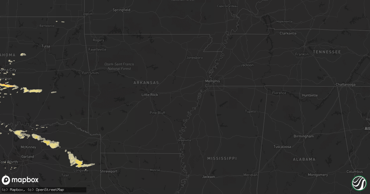
Hail Map in Oklahoma on April 19, 2012
Get this storm
April 19 map
$229
one time, instant access
Download today. No call, no setup
Keep the $229
Bought the map and want the full workflow? Apply the entire $229 to a subscription within 7 days. None of it is wasted.
Every map, not just this one
This buys you this map. Subscription and you get every map we run, in the markets you choose from a few cities to whole states to nationwide. Plus real-time alerts the moment a storm fires.
Contact data
Name, contact info, occupancy, even credit band for addresses in the footprint. You go from where it hit to who to call.
Become the source they trust
Unlimited branding weather history reports on demand. You already have the documented answer ready for the property owner, and you are the one who showed up with it.
Property data and RoofTrace estimates
Pull up any address you have got, its value and the exact code rules for that jurisdiction, straight from One Click Code. Then RoofTrace estimates the squares, pitch, and roof value, priced the way you price.
Storm reports in Oklahoma
Oklahoma
| Date | Description |
|---|---|
| 04/18/201211:32 PM CDT | Pea to quarter hail covering ground |
| 04/18/20129:58 PM CDT | Near county line |
| 04/18/20129:40 PM CDT | A local report indicates 1.25 inch wind near PURCELL |
| 04/18/20129:39 PM CDT | A local report indicates 1.75 inch wind near PURCELL |
| 04/18/20129:34 PM CDT | A local report indicates 1.00 inch wind near 3 W PURCELL |
| 04/18/20129:29 PM CDT | Half-dollar to ping pong size hail |
| 04/18/20129:22 PM CDT | A local report indicates 1.25 inch wind near WASHINGTON |
| 04/18/20129:09 PM CDT | Nearly covering road |
| 04/18/20128:39 PM CDT | A local report indicates 1.75 inch wind near MARLOW |
| 04/18/20128:29 PM CDT | North side of marlow |
| 04/18/20128:25 PM CDT | Hail covering roadway |
| 04/18/20128:24 PM CDT | 4w of hwy 81 on cr 1290 |
| 04/18/20128:10 PM CDT | Nickel to quarter hail |
| 04/18/20128:05 PM CDT | A local report indicates 2.50 inch wind near 11 N GRACEMONT |
| 04/18/20127:52 PM CDT | A local report indicates 65 MPH wind near 9 NNW GRACEMONT |
| 04/18/20127:52 PM CDT | A local report indicates 1.75 inch wind near 9 NNW GRACEMONT |
| 04/18/20127:45 PM CDT | Quarter to golfball hail |
Cities Impacted by Hail Map on April 19, 2012
- Roosevelt, OK
- Graham, TX
- Bryson, TX
- Sulphur Springs, TX
- Keystone Heights, FL
- Starke, FL
- Tipton, OK
- Mcloud, OK
- Shawnee, OK
- Newalla, OK
- Purcell, OK
- Maysville, OK
- Wayne, OK
- Lindsay, OK
- Indiahoma, OK
- Frederick, OK
- Chattanooga, OK
- Mountain Park, OK
- Headrick, OK
- Snyder, OK
- Loveland, OK
- Cache, OK
- Floydada, TX
- Konawa, OK
- Ada, OK
- Chickasha, OK
- Verden, OK
- Throckmorton, TX
- Newcastle, TX
- Woodson, TX
- Byars, OK
- Fort Worth, TX
- Vernon, TX
- Diana, TX
- Harleton, TX
- Longview, TX
- Hallsville, TX
- Seymour, TX
- Gracemont, OK
- Washington, OK
- Blanchard, OK
- Binger, OK
- Fort Cobb, OK
- Pocasset, OK
- Wanette, OK
- Anadarko, OK
- Amber, OK
- Lexington, OK
- Minco, OK
- Alex, OK
- Pahokee, FL
- Canal Point, FL
- Rising Star, TX
- Cisco, TX
- Cross Plains, TX
- Cumby, TX
- Commerce, TX
- Pecan Gap, TX
- Klondike, TX
- Wolfe City, TX
- Ladonia, TX
- Marlow, OK
- Cyril, OK
- Ninnekah, OK
- Cement, OK
- Apache, OK
- Henrietta, TX
- Petrolia, TX
- Lawton, OK
- Fletcher, OK
- Duncan, OK
- Rush Springs, OK
- Mountain View, OK
- Carnegie, OK
- Elgin, OK
- Howe, TX
- Tioga, TX
- Pilot Point, TX
- Collinsville, TX
- Gunter, TX
- Lockney, TX
- Matador, TX
- Luther, OK
- Arcadia, OK
- Jones, OK
- Whitesboro, TX
- Sadler, TX
- Sherman, TX
- Gainesville, TX
- Mansfield, TX
- Roaring Springs, TX
- Cushing, OK
- Agra, OK
- Calvin, OK
- Allen, OK
- Davidson, OK
- Stuart, OK
- Van Alstyne, TX
- Oklahoma City, OK
- Saint Jo, TX
- Forestburg, TX
- Montague, TX
- Bowie, TX
- Bellevue, TX
- Nocona, TX
- Guthrie, OK
- Meridian, OK
- Fort Sill, OK
- Gilmer, TX
- Pittsburg, TX
- Winnsboro, TX
- Leesburg, TX
- Big Sandy, TX
- Faxon, OK
- Palatka, FL
- Florahome, FL
- Wellston, OK
- Pauls Valley, OK
- Foster, OK
- Olney, TX
- Haskell, TX
- Muenster, TX
- Gotebo, OK
- Marshall, TX
- Ore City, TX
- Jefferson, TX
- Gladewater, TX
- Scroggins, TX
- Karnack, TX
- Blanco, OK
- Mcalester, OK
- Hartshorne, OK
- Asher, OK
- Dike, TX
- Trenton, TX
- Whitewright, TX
- Breckenridge, TX
- Ryan, OK
- Wichita Falls, TX
- Geronimo, OK
- Burleson, TX
- Mount Vernon, TX
- Ector, TX
- Bells, TX
- Randolph, TX
- Leonard, TX
- Bonham, TX
- Grand Prairie, TX
- Sasakwa, OK
- Yukon, OK
- Guthrie Center, IA
- Panora, IA
- Vinita, OK
- Welch, OK
- Perry, IA
- Dawson, IA
- Yale, IA
- Cushing, IA
- Holstein, IA
- Mustang, OK
- Savoy, TX
- Green Cove Springs, FL
- Elmore City, OK
- Creston, IA
- Norman, OK
- Glen Rose, TX
- Noble, OK
- Telephone, TX
- Ivanhoe, TX
- Chillicothe, TX
- Lenapah, OK
- Bailey, TX
- Cooper, TX
- Bradley, OK
- Durant, OK
- Bokchito, OK
- Cleburne, TX
- Stratford, OK
- Kiowa, OK
- Newcastle, OK
- Tuttle, OK
- Weinert, TX
- Hendrix, OK
- Ravenna, TX
- Jacksboro, TX
- Windthorst, TX
- Denison, TX
- Crowley, TX
- Comanche, OK
- Glen Saint Mary, FL
- Kopperl, TX


