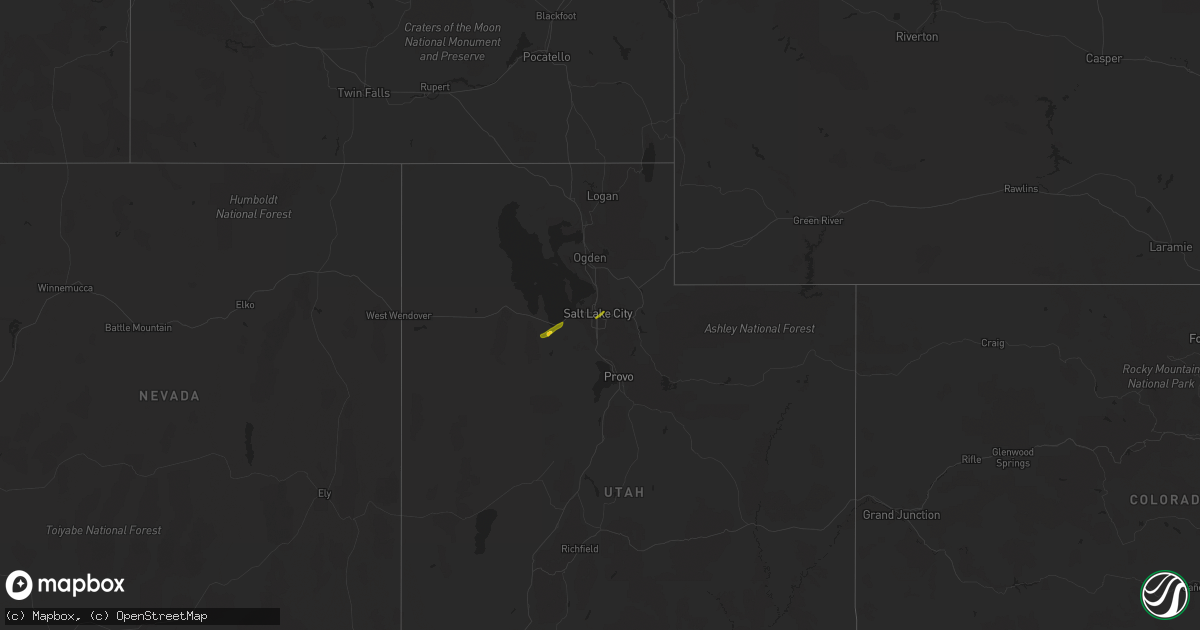
Hail Map on April 18, 2023
Get this storm
April 18 map
$229
one time, instant access
Download today. No call, no setup
Keep the $229
Bought the map and want the full workflow? Apply the entire $229 to a subscription within 7 days. None of it is wasted.
Every map, not just this one
This buys you this map. Subscription and you get every map we run, in the markets you choose from a few cities to whole states to nationwide. Plus real-time alerts the moment a storm fires.
Contact data
Name, contact info, occupancy, even credit band for addresses in the footprint. You go from where it hit to who to call.
Become the source they trust
Unlimited branding weather history reports on demand. You already have the documented answer ready for the property owner, and you are the one who showed up with it.
Property data and RoofTrace estimates
Pull up any address you have got, its value and the exact code rules for that jurisdiction, straight from One Click Code. Then RoofTrace estimates the squares, pitch, and roof value, priced the way you price.
Storm reports
Kansas
| Date | Description |
|---|---|
| 04/18/20235:58 PM CDT | Power poles blown down... Started a grass fire. |
Iowa
| Date | Description |
|---|---|
| 04/18/20235:40 AM CDT | Dime to quarter sized hail received via social media. |
South Dakota
| Date | Description |
|---|---|
| 04/18/20236:45 PM CDT | A local report indicates 61 MPH wind near 10 W EDGEMONT |
| 04/18/20232:35 AM CDT | Pierpont 5 sse pws. |
| 04/18/20232:29 AM CDT | Pierpont 4 nw pws. |
| 04/18/20232:21 AM CDT | Groton 4 ese pws. |
| 04/17/20239:38 PM CDT | A local report indicates 60 MPH wind near 7 E WANBLEE |
| 04/17/20238:17 PM CDT | A local report indicates 66 MPH wind near 3 ESE PINE RIDGE |
| 04/17/20237:56 PM CDT | A local report indicates 59 MPH wind near 12 E OELRICHS |
| 04/17/20237:06 PM CDT | A local report indicates 63 MPH wind near 8 W JEWEL CAVE |
| 04/17/20237:05 PM CDT | A local report indicates 59 MPH wind near 7 W ARDMORE |
Nebraska
| Date | Description |
|---|---|
| 04/18/20231:00 AM CDT | Report from mping: quarter |
| 04/18/202312:48 AM CDT | Relayed via social media. Time estimated from radar. |
| 04/18/202312:43 AM CDT | Uprooted trees and some shore stations and docks tipped over into the lake. Report from social media. |
| 04/18/202312:41 AM CDT | Report from mping: quarter |
| 04/18/202312:35 AM CDT | A local report indicates 1.00 inch wind near 6 S FOSTER |
| 04/17/202311:31 PM CDT | A local report indicates 1.25 inch wind near 6 NE GARLAND |
| 04/17/202311:30 PM CDT | Nickel to quarter sized hail. |
| 04/17/202311:17 PM CDT | Nickel to quarter sized hail. |
| 04/17/202311:12 PM CDT | Report from mping. |
| 04/17/202310:52 PM CDT | A local report indicates 1.00 inch wind near 4 W GRESHAM |
| 04/17/202310:49 PM CDT | A local report indicates 1.00 inch wind near UTICA |
| 04/17/202310:46 PM CDT | A few stones larger than quarter sized. Time estimated from radar. |
| 04/17/202310:06 PM CDT | Nickel to quarter size hail. Time est from radar. |
| 04/17/202310:00 PM CDT | Report via facebook. |
| 04/17/20239:48 PM CDT | A local report indicates 1.00 inch wind near SUTTON |
| 04/17/20239:47 PM CDT | Report from mping: quarter |
| 04/17/20239:45 PM CDT | A local report indicates 1.75 inch wind near SUTTON |
| 04/17/20239:45 PM CDT | A local report indicates 1.00 inch wind near STOCKHAM |
| 04/17/20239:44 PM CDT | Public report with photo on social media. Time estimated from radar. |
| 04/17/20239:31 PM CDT | Via nws chat. |
| 04/17/20239:30 PM CDT | Hail was reported from 930-935. |
| 04/17/20239:24 PM CDT | Picture via facebook with ruler. |
| 04/17/20239:16 PM CDT | A local report indicates 1.25 inch wind near 3 W CLAY CENTER |
| 04/17/20239:16 PM CDT | A local report indicates 1.00 inch wind near 3 N OAK |
| 04/17/20239:15 PM CDT | Motorist on 4400 road reported quarter size hail that cracked the windshield of his vehicle. |
| 04/17/20239:13 PM CDT | Picture via facebook. Time estimated from radar. |
| 04/17/20239:13 PM CDT | Delayed report via facebook. |
| 04/17/20239:04 PM CDT | A local report indicates 1.00 inch wind near 2 E DEWEESE |
| 04/17/20239:03 PM CDT | A local report indicates 1.00 inch wind near DEWEESE |
| 04/17/20238:57 PM CDT | A local report indicates 1.00 inch wind near 4 ESE LAWRENCE |
| 04/17/20238:46 PM CDT | Report from mping: half dollar |
| 04/17/20238:41 PM CDT | Report from mping: golf ball |
| 04/17/20238:41 PM CDT | Report from mping: golf ball |
| 04/17/20238:32 PM CDT | A local report indicates 1.75 inch wind near BLUE HILL |
| 04/17/20238:28 PM CDT | A local report indicates 1.00 inch wind near BLUE HILL |
| 04/17/20238:28 PM CDT | Photo via twitter. |
| 04/17/20238:19 PM CDT | Time estimated from radar data. |
| 04/17/20238:17 PM CDT | Delayed report. Mesonet station knerushv9. |
| 04/17/20238:12 PM CDT | Delayed report. |
| 04/17/20238:10 PM CDT | A local report indicates 1.50 inch wind near 5 N INAVALE |
| 04/17/20238:06 PM CDT | Half dollar and ping pong size hail also fell. Public report relayed via to nws from emergency manager. |
| 04/17/20238:05 PM CDT | Almost enough hail to cover the ground. |
| 04/17/20237:54 PM CDT | Time est from radar. |
| 04/17/20237:38 PM CDT | Report via spotter network. |
| 04/17/20237:36 PM CDT | A local report indicates 1.00 inch wind near FRANKLIN |
| 04/17/20237:24 PM CDT | A local report indicates 1.00 inch wind near 2 W FRANKLIN |
Utah
| Date | Description |
|---|---|
| 04/18/202312:58 PM CDT | Photo of quarter size hail in sugarhouse. |
| 04/18/202312:41 PM CDT | A local report indicates 1.00 inch wind near STANSBURY PARK |
| 04/18/202312:35 PM CDT | A local report indicates 1.25 inch wind near GRANTSVILLE |
| 04/18/202312:35 PM CDT | A local report indicates 1.50 inch wind near GRANTSVILLE |
Cities Impacted by Hail Map on April 18, 2023
- Grantsville, UT
- Tooele, UT
- Salt Lake City, UT
- Eldon, MO
- Riverton, NE
- Bloomington, NE
- Franklin, NE
- Naponee, NE
- Phillipsburg, KS
- Alma, NE
- Republican City, NE
- Bladen, NE
- Campbell, NE
- Agra, KS
- Kensington, KS
- Inavale, NE
- Holstein, NE
- Roseland, NE
- Red Cloud, NE
- Blue Hill, NE
- Ayr, NE
- Guide Rock, NE
- Lawrence, NE
- Glenvil, NE
- Fairfield, NE
- Deweese, NE
- Nelson, NE
- Edgar, NE
- Ong, NE
- Clay Center, NE
- Harvard, NE
- Sutton, NE
- Aurora, NE
- Henderson, NE
- Grafton, NE
- Fairmont, NE
- McCool Junction, NE
- Saronville, NE
- Minden, NE
- Giltner, NE
- Upland, NE
- Trumbull, NE
- Seward, NE
- Milford, NE
- Inland, NE
- Hastings, NE
- Saint Paul, NE
- Garland, NE
- Hampton, NE
- York, NE
- Geneva, NE
- Waco, NE
- Exeter, NE
- Benedict, NE
- Utica, NE
- Beaver Crossing, NE
- Gresham, NE
- Staplehurst, NE
- Ulysses, NE
- Stromsburg, NE
- Shelby, NE
- Surprise, NE
- Rising City, NE
- Goehner, NE
- Bee, NE
- Valparaiso, NE
- Dwight, NE
- Raymond, NE
- Ceresco, NE
- Pleasant Dale, NE
- Malcolm, NE
- Lincoln, NE
- Wahoo, NE
- Ithaca, NE
- Vincent, IA
- Thor, IA
- Fort Dodge, IA
- Badger, IA
- Eagle Grove, IA
- Humboldt, IA
- Rogers, NE
- Waterloo, NE
- Albion, NE
- Cedar Rapids, NE
- Duncombe, IA
- Graettinger, IA
- Wallingford, IA
- Avoca, MN
- Clearwater, NE
- Bartlett, NE
- Spalding, NE
- Wanblee, SD
- Omaha, NE
- Brainard, NE
- Newman Grove, NE
- Meadow Grove, NE
- Petersburg, NE
- Tilden, NE
- Farwell, NE
- Fullerton, NE
- Saint Edward, NE
- Hooper, NE
- Wolbach, NE
- Yutan, NE
- Spirit Lake, IA
- Marathon, IA
- Okoboji, IA
- Weston, NE
- Bradshaw, NE
- Waverly, NE
- Malmo, NE
- David City, NE
- Davey, NE
- Prague, NE
- Mead, NE
- Ashland, NE
- Mitchellville, IA
- Gretna, NE
- Winslow, NE
- Herman, NE
- Craig, NE
- Tekamah, NE
- Arlington, NE
- Breda, IA
- Fulda, MN
- Algona, IA
- Royal, NE
- Orchard, NE
- Brunswick, NE
- Clarks, NE
- Ashton, SD
- Plainview, NE
- Creighton, NE
- Orient, SD
- Bloomfield, NE
- Arcadia, IA
- Van Meter, IA
- Webb, IA
- Des Moines, IA