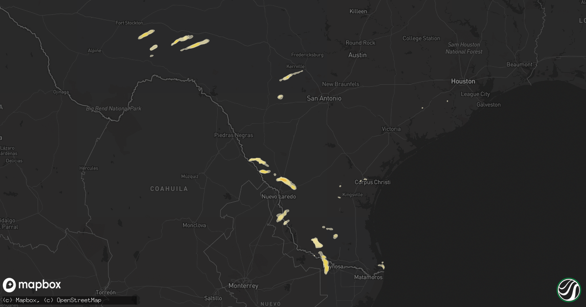
Hail Map in Texas on April 18, 2016
Get this storm
April 18 map
$229
one time, instant access
Download today. No call, no setup
Keep the $229
Bought the map and want the full workflow? Apply the entire $229 to a subscription within 7 days. None of it is wasted.
Every map, not just this one
This buys you this map. Subscription and you get every map we run, in the markets you choose from a few cities to whole states to nationwide. Plus real-time alerts the moment a storm fires.
Contact data
Name, contact info, occupancy, even credit band for addresses in the footprint. You go from where it hit to who to call.
Become the source they trust
Unlimited branding weather history reports on demand. You already have the documented answer ready for the property owner, and you are the one who showed up with it.
Property data and RoofTrace estimates
Pull up any address you have got, its value and the exact code rules for that jurisdiction, straight from One Click Code. Then RoofTrace estimates the squares, pitch, and roof value, priced the way you price.
Storm reports in Texas
Texas
| Date | Description |
|---|---|
| 04/18/201612:28 AM CDT | Nws employee reports 8 inch diameter tree limb partially blocking the road near the intersection of jaime j zapata and ray david drive. |
| 04/17/201610:56 PM CDT | Brownsville police reported three electical poles down along u.s. Hwy 281. |
| 04/17/201610:23 PM CDT | Harlingen police department reports powerlines down at 809 west hanson...1307 north ann street...1506 south g street...629 north 13th street...the intersections of tyle |
| 04/17/201610:16 PM CDT | A local report indicates 58 MPH wind near HARLINGEN |
All States Impacted by Hail Map on April 18, 2016
Cities Impacted by Hail Map on April 18, 2016
- Sabinal, TX
- Ozona, TX
- San Ygnacio, TX
- Laredo, TX
- Rio Grande City, TX
- Garciasville, TX
- Grulla, TX
- Medina, TX
- Zapata, TX
- Fort Stockton, TX
- Hebbronville, TX
- Dryden, TX
- Asherton, TX
- Carrizo Springs, TX
- Eagle Pass, TX
- Robstown, TX
- Port Isabel, TX
- South Padre Island, TX
- La Joya, TX
- Premont, TX
- Linn, TX
- Sullivan City, TX
- Penitas, TX
- Mission, TX
- Alice, TX
- Encino, TX
- El Campo, TX
- Kerrville, TX
- Needville, TX
- Center Point, TX
- Comfort, TX
- Vanderpool, TX
- Corpus Christi, TX


