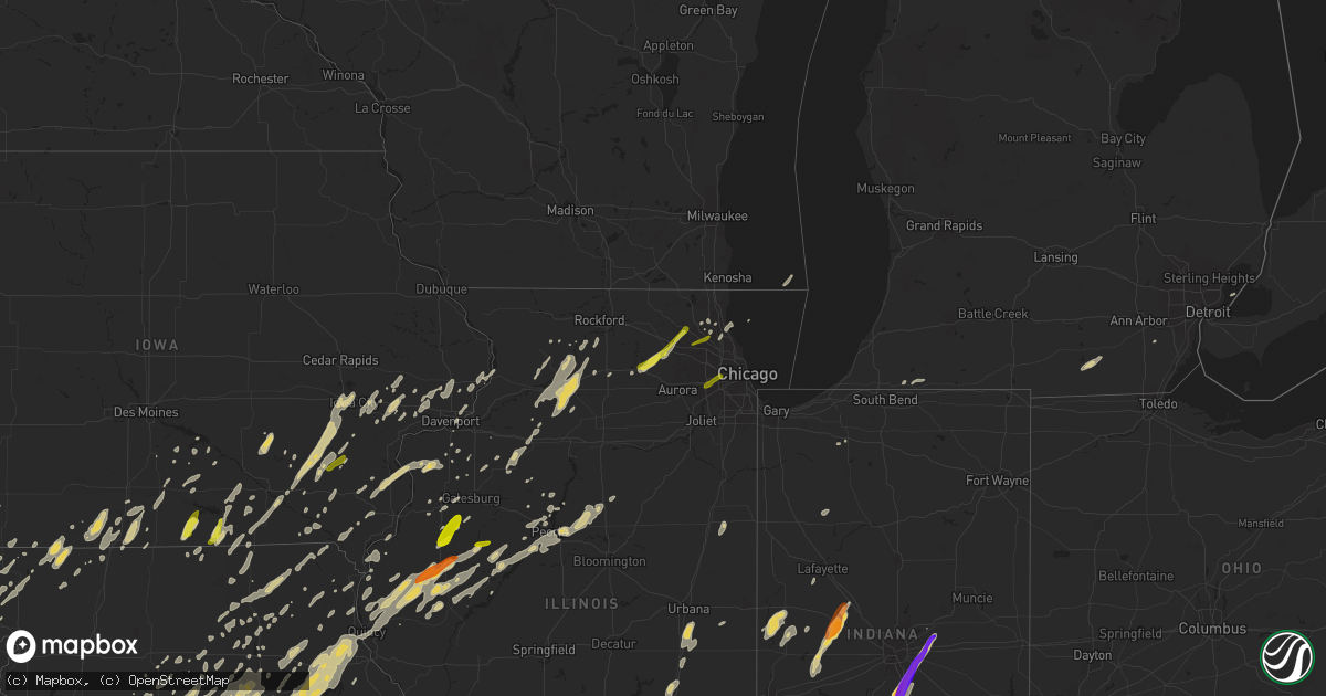
Hail Map on April 17, 2013
Get this storm
April 17 map
$229
one time, instant access
Download today. No call, no setup
Keep the $229
Bought the map and want the full workflow? Apply the entire $229 to a subscription within 7 days. None of it is wasted.
Every map, not just this one
This buys you this map. Subscription and you get every map we run, in the markets you choose from a few cities to whole states to nationwide. Plus real-time alerts the moment a storm fires.
Contact data
Name, contact info, occupancy, even credit band for addresses in the footprint. You go from where it hit to who to call.
Become the source they trust
Unlimited branding weather history reports on demand. You already have the documented answer ready for the property owner, and you are the one who showed up with it.
Property data and RoofTrace estimates
Pull up any address you have got, its value and the exact code rules for that jurisdiction, straight from One Click Code. Then RoofTrace estimates the squares, pitch, and roof value, priced the way you price.
States Impacted by Hail Map on April 17, 2013
Storm reports
Indiana
| Date | Description |
|---|---|
| 04/17/20136:56 PM CDT | Ongoing. |
| 04/17/20136:48 PM CDT | Also estimated 50 mph winds. |
| 04/17/20135:24 PM CDT | Occurred in pleasant view. |
| 04/17/20135:09 PM CDT | Fallen over the last five minutes. Just northwest of downtown franklin. |
| 04/17/20135:07 PM CDT | Over the last 5-10 minutes. |
| 04/17/20135:06 PM CDT | A local report indicates 1.50 inch wind near FRANKLIN |
| 04/17/20135:04 PM CDT | Coop observer reported hail for a duration of about 3 minutes. |
| 04/17/20134:46 PM CDT | A local report indicates 1.00 inch wind near 3 S PRINCES LAKES |
| 04/17/20134:45 PM CDT | A local report indicates 1.75 inch wind near 6 S SPEARSVILLE |
| 04/17/20134:34 PM CDT | Hail stones ranging in size from one inch to two inches. |
| 04/17/20134:25 PM CDT | Occurred at the west entrance to brown county state park. |
| 04/17/20133:05 PM CDT | A local report indicates 1.00 inch wind near ENGLISH |
| 04/17/20132:40 PM CDT | A local report indicates 1.00 inch wind near GEORGETOWN |
| 04/16/20137:10 PM CDT | A local report indicates 1.00 inch wind near THORNTOWN |
| 04/16/20137:00 PM CDT | North of i-74 and just west of 1000 e |
Missouri
| Date | Description |
|---|---|
| 04/17/20136:35 PM CDT | Strong winds blew a wooden swing set approx 100 yards |
| 04/17/20136:30 PM CDT | 3 semi trucks blown over on highway 36 near west ely |
| 04/17/20136:21 PM CDT | A local report indicates 1.00 inch wind near 3 SW HARRISBURG |
| 04/17/20136:15 PM CDT | Amateur radio tower blown down...roof damage...and 8 inch diameter 25 foot tall tree blown down |
| 04/17/20136:15 PM CDT | 2 large grain bins totally destroyed by high winds...grain elevator damaged as well. |
| 04/17/20136:12 PM CDT | Power poles damaged and snapped along us 24 between paris and monroe city. Roof damage to the ben franklin building in monroe city. Damage to a tornado siren was also r |
| 04/17/20136:10 PM CDT | Large trees down and power out in downtown monroe city |
| 04/17/20136:10 PM CDT | A local report indicates 1.25 inch wind near 8 S HARRISBURG |
| 04/17/20136:09 PM CDT | Mobile home roof blown off |
| 04/17/20136:06 PM CDT | A local report indicates 1.75 inch wind near COLUMBIA |
| 04/17/20136:02 PM CDT | Central columbia...hail ranged in size from peas to ping pong ball |
| 04/17/20136:00 PM CDT | A local report indicates 1.25 inch wind near 7 ESE NEW FRANKLIN |
| 04/17/20136:00 PM CDT | A local report indicates 2.00 inch wind near COLUMBIA |
| 04/17/20135:59 PM CDT | On university of missouri campus |
| 04/17/20135:56 PM CDT | A local report indicates 1.00 inch wind near COLUMBIA |
| 04/17/20135:54 PM CDT | A local report indicates 1.00 inch wind near COLUMBIA |
| 04/17/20135:53 PM CDT | 1 mile south of mizzou campus |
| 04/17/20135:52 PM CDT | A local report indicates 1.00 inch wind near PARIS |
| 04/17/20135:50 PM CDT | Sydow farms reporting lots of quarter size hailstone |
| 04/17/20135:50 PM CDT | Power lines down across highway c |
| 04/17/20135:50 PM CDT | South side of town |
| 04/17/20135:48 PM CDT | A local report indicates 1.75 inch wind near COLUMBIA |
| 04/17/20135:45 PM CDT | Damage to a house and several barns 1 to 2 miles west of hwy 15 just south of hwy aa |
| 04/17/20135:40 PM CDT | Hail lasted 20 minutes. Up to baseball size. |
| 04/17/20135:35 PM CDT | Roof blown off mobile home. |
| 04/17/20135:30 PM CDT | Delayed report relayed by wfo eax. Spotter was 4 miles south of prairie home in moniteau county. |
| 04/17/20135:15 PM CDT | A local report indicates 1.75 inch wind near CLARKSBURG |
| 04/17/20134:36 PM CDT | Reported by public through broadcast media |
| 04/17/20134:34 PM CDT | Delayed report |
| 04/17/20134:32 PM CDT | A local report indicates 1.00 inch wind near STOVER |
| 04/17/20134:20 PM CDT | A local report indicates 1.00 inch wind near 6 SW STOVER |
| 04/17/20133:56 PM CDT | A local report indicates 1.00 inch wind near SEDALIA |
| 04/17/20133:51 PM CDT | A local report indicates 1.00 inch wind near SEDALIA |
| 04/17/20133:33 PM CDT | A local report indicates 1.00 inch wind near 4 S WARSAW |
| 04/17/20133:30 PM CDT | Time of event estimated. |
| 04/17/20133:25 PM CDT | A local report indicates 1.00 inch wind near 8 S WARSAW |
| 04/17/20133:02 PM CDT | A local report indicates 1.00 inch wind near 5 SE OSCEOLA |
| 04/17/20131:37 PM CDT | A local report indicates 1.00 inch wind near KIRKSVILLE |
| 04/17/20134:18 AM CDT | Tree down across highway t near the intersection with highway j. |
| 04/17/20132:06 AM CDT | Tree and power poles down in the saginaw area. |
| 04/17/20132:06 AM CDT | Tree reported across the road at county road 180 and sumac rd. Time estimated from radar. |
| 04/17/20131:50 AM CDT | A local report indicates 1.00 inch wind near SENECA |
| 04/16/20137:40 PM CDT | Pea to quarter size hail |
| 04/16/20137:05 PM CDT | 6 inch limbs down and pea size hail |
Alabama
| Date | Description |
|---|---|
| 04/17/20135:13 PM CDT | Golf ball size hail was reported. |
| 04/17/20133:42 PM CDT | Quarter size hail south of fourney. |
| 04/17/20133:38 PM CDT | Quarter size hail in spring garden. |
Kentucky
| Date | Description |
|---|---|
| 04/17/20134:15 PM CDT | Relayed report...time estimated based on radar. |
| 04/17/20134:02 PM CDT | A local report indicates 1.00 inch wind near 4 SSW IRVINGTON |
| 04/17/20133:55 PM CDT | Another relayed report. Ping pong to golfball size hail in hensley...time estimated based on radar. |
| 04/17/20132:20 PM CDT | Correction....it was determined that this was not a weather event.... Event caused by vehicle accident. Four power poles snapped. |
| 04/17/201312:30 PM CDT | A local report indicates 1.00 inch wind near MAGNOLIA |
| 04/17/201312:30 PM CDT | A local report indicates 1.00 inch wind near 3 SSW TONNIEVILLE |
Tennessee
| Date | Description |
|---|---|
| 04/17/20132:54 PM CDT | Several trees down in pikeville and surrounding areas. |
| 04/17/20132:11 PM CDT | Cowan police department reports golf ball sized hail on hawkins cove road. |
| 04/17/20131:30 PM CDT | Couple of trees down. |
| 04/17/20131:00 PM CDT | Half dollar size hail reported...along with shredded leaves and damaged shingles. |
| 04/17/201312:45 PM CDT | Golfball size hail and roof damage reported. |
Iowa
| Date | Description |
|---|---|
| 04/17/20136:15 PM CDT | Delayed report from last night. One inch hail along with strong winds damaged house roofs and vehicles. |
| 04/17/20134:00 PM CDT | Observed at augusta post office. Estimated time. Relayed by coop observer. |
| 04/17/201310:48 AM CDT | Time estimated from radar. |
| 04/17/201310:44 AM CDT | Began at 1044 am |
| 04/17/201310:30 AM CDT | Marble to a few quarter size hail. Time based on radar estimate. Delayed report. |
| 04/17/201310:22 AM CDT | Mostly nickel size with a handfull of quarter size. |
| 04/17/20138:00 AM CDT | Hail fell from centerville to 6n of centerville |
| 04/17/20137:33 AM CDT | A local report indicates 1.00 inch wind near 3 N PROMISE CITY |
| 04/16/20139:10 PM CDT | A local report indicates 70 MPH wind near RICHLAND |
Illinois
| Date | Description |
|---|---|
| 04/17/20136:58 PM CDT | A local report indicates 77 MPH wind near 4 NE BURTON |
| 04/17/20136:45 PM CDT | Roof of bank blown off at 24th and kochs lane. |
| 04/17/20136:45 PM CDT | 16 to 18 foot long contstruction trailer blown south through the front wall of a staples store. |
| 04/17/20136:12 PM CDT | Significant roof damage to several homes on the south side of town. |
| 04/17/20134:17 PM CDT | A local report indicates 1.00 inch wind near CUBA |
| 04/17/20134:00 PM CDT | Observed at augusta post office. Estimated time. Relayed by coop observer. Corrected location. |
| 04/17/20133:45 PM CDT | A local report indicates 1.25 inch wind near 4 NW BROOKLYN |
| 04/17/20133:40 PM CDT | Pea to quarter size |
| 04/17/20133:26 PM CDT | A local report indicates 1.00 inch wind near ESE BOWEN |
| 04/17/20133:24 PM CDT | A local report indicates 1.00 inch wind near 6 NW CUBA |
| 04/17/20132:55 PM CDT | A local report indicates 1.00 inch wind near 4 WSW MACOMB |
| 04/17/20132:45 PM CDT | Pea to quarter. May be up to half dollar. |
| 04/17/20132:42 PM CDT | A local report indicates 1.00 inch wind near ESE BOWEN |
| 04/17/20131:12 PM CDT | A local report indicates 1.00 inch wind near CRYSTAL LAKE |
| 04/17/201312:14 PM CDT | Time estimated based on radar data. |
| 04/17/201311:35 AM CDT | A local report indicates 1.00 inch wind near 3 NNE HAMPSHIRE |
| 04/17/20137:12 AM CDT | Reported mostly quarters with storm...time estimated from radar. |
| 04/16/20138:46 PM CDT | Relayed via adams county eoc...power out to at least a portion of golden |
| 04/16/20137:53 PM CDT | Carport collapse...reported by clayton fire chief and relayed by adams county ema. |
| 04/16/20137:41 PM CDT | No damage |
| 04/16/20137:41 PM CDT | No damage |
| 04/16/20137:38 PM CDT | Roof collapsed on a 25 foot shed. |
| 04/16/20137:30 PM CDT | Tree damage at quincy airport. |
| 04/16/20137:30 PM CDT | Restaurant damage...details unknown at this time. |
| 04/16/20137:23 PM CDT | Relayed via adams county eoc...est 75-80 mph winds |
| 04/16/20137:15 PM CDT | Near intersection of east 1850th road and illinois route 61. |
| 04/16/20137:14 PM CDT | Street lights blown down at the intersection of 48th and broadway. |
| 04/16/20137:10 PM CDT | A local report indicates 1.00 inch wind near WASHINGTON |
| 04/16/20137:06 PM CDT | A local report indicates 85 MPH wind near COATSBURG |
Kansas
| Date | Description |
|---|---|
| 04/17/20133:55 PM CDT | A local report indicates 1.00 inch wind near 3 SW INMAN |
| 04/17/20131:30 PM CDT | A local report indicates 1.00 inch wind near 9 SSW ST. JOHN |
| 04/17/201312:40 PM CDT | A local report indicates 1.00 inch wind near 3 S BUTTERMILK |
| 04/17/20137:15 AM CDT | A local report indicates 1.00 inch wind near FORT RILEY AIRFIELD |
| 04/16/20138:48 PM CDT | A local report indicates 1.00 inch wind near LYONS |
| 04/16/20138:30 PM CDT | A local report indicates 1.50 inch wind near RAYMOND |
South Carolina
| Date | Description |
|---|---|
| 04/17/20133:15 PM CDT | A tree and a powerline fell on a vehicle at main street. One occupant had been rescued with no injury reported. |
Texas
| Date | Description |
|---|---|
| 04/17/20136:50 PM CDT | A local report indicates 1.00 inch wind near 2 SE RAYLAND |
| 04/17/20136:15 PM CDT | A local report indicates 1.00 inch wind near 1 E QUANAH |
| 04/17/20132:45 AM CDT | Carport and metal roof was damaged by high winds. |
| 04/17/20132:35 AM CDT | A local report indicates 1.00 inch wind near HARRIET |
| 04/17/20132:30 AM CDT | A local report indicates 60 MPH wind near 2 NE WALL |
| 04/17/20132:25 AM CDT | Power lines down and a large tree limb down in san angelo |
| 04/17/20131:46 AM CDT | Several large limbs down. 6 inch diameter by 20 feet long. Limbs were healthy pecan tree limbs. |
| 04/17/20131:20 AM CDT | 4 to 6 inch diameter by 12 foot limb down. Metal roof peeled off building. |
| 04/16/20138:11 PM CDT | A storm chaser reported a tornado that lasted for about 30 seconds. |
| 04/16/20138:03 PM CDT | Multiple reports of a tornado north-northeast of harrold. This tornado lasted one to two minutes. |
Oklahoma
| Date | Description |
|---|---|
| 04/17/20136:50 PM CDT | Tornado reported on the west side of lawton. Damage reported at the goodyear plant. |
| 04/17/20136:36 PM CDT | A local report indicates 2.00 inch wind near 2 SSW SNYDER |
| 04/17/20136:35 PM CDT | A local report indicates 1.75 inch wind near SNYDER |
| 04/17/20136:33 PM CDT | A local report indicates 2.00 inch wind near 2 SSW SNYDER |
| 04/17/20136:33 PM CDT | A local report indicates 1.75 inch wind near 2 WNW CACHE |
| 04/17/20136:31 PM CDT | A local report indicates 2.25 inch wind near 2 S CACHE |
| 04/17/20136:31 PM CDT | A local report indicates 1.75 inch wind near 2 WNW CACHE |
| 04/17/20136:29 PM CDT | A local report indicates 2.75 inch wind near CACHE |
| 04/17/20136:25 PM CDT | A local report indicates 60 MPH wind near CYRIL |
| 04/17/20136:24 PM CDT | A local report indicates 1.25 inch wind near 2 W CYRIL |
| 04/17/20135:59 PM CDT | A local report indicates 1.00 inch wind near ELK CITY |
| 04/17/20135:49 PM CDT | A local report indicates 1.75 inch wind near 9 S ALTUS |
| 04/17/20135:46 PM CDT | Rfd wind |
| 04/17/20135:46 PM CDT | A local report indicates 1.75 inch wind near ELGIN |
| 04/17/20135:30 PM CDT | A local report indicates 1.75 inch wind near 3 NW LAKE LAWTONKA |
| 04/17/20135:26 PM CDT | A local report indicates 1.75 inch wind near 9 SW LAWTON |
| 04/17/20135:25 PM CDT | A local report indicates 1.00 inch wind near RICHLAND |
| 04/17/20135:15 PM CDT | A local report indicates 1.75 inch wind near CACHE |
| 04/17/20135:12 PM CDT | A local report indicates 1.25 inch wind near 5 E HOLLIS |
| 04/17/20134:10 PM CDT | A local report indicates 1.00 inch wind near MANITOU |
| 04/17/20133:42 PM CDT | A local report indicates 1.50 inch wind near 7 S TIPTON |
| 04/17/20133:38 PM CDT | A local report indicates 1.25 inch wind near 7 WSW FREDERICK |
| 04/17/20133:28 PM CDT | A local report indicates 1.00 inch wind near COWDEN |
| 04/17/20133:15 PM CDT | A local report indicates 1.00 inch wind near 7 NW MOUNTAIN VIEW |
| 04/17/20134:05 AM CDT | Roof damage to a house. |
| 04/17/20131:44 AM CDT | Several large trees uprooted and a poultry house damaged. |
| 04/17/20131:34 AM CDT | Several homes destroyed and power poles snapped. |
| 04/17/20131:27 AM CDT | Tornado confirmed by an nws survey team. Preliminary rating ef2. Additional details...including path length and width...as well as details on the specific damage ...are |
| 04/17/20131:10 AM CDT | Emergency manager reports tornado touchdown in spavinaw...no details at this time. |
| 04/17/201312:48 AM CDT | A tornado rated ef-1 tore much of the roof off an industrial building...destroyed a barn...snapped numerous large tree limbs...and uprooted a couple trees. |
| 04/17/201312:33 AM CDT | Rated ef1 with winds between 90 and 95 mph. Path length 1.9 miles. Path width 180 yards. Damaged the roofs of several homes. Badly damaged a metal framed building. Dest |
| 04/17/201312:31 AM CDT | Preliminary rating is ef-0. Additional details will be included as data is reviewed. |
| 04/17/201312:30 AM CDT | Roof blown off a metal barn. Social media. |
| 04/17/201312:29 AM CDT | Rated ef1 with winds between 100 to 110 mph. Path length 1.8 miles. Path width 140 yards. Overturned several empty rail cars. Destroyed a mobile home. Damaged several h |
| 04/17/201312:28 AM CDT | Rated ef0 with winds between 70 and 75 mph. Path length 0.9 miles. Path width 125 yards. Badly damaged a barn. Downed several trees. Did minor damage to the roof of a h |
| 04/17/201312:05 AM CDT | Roof damage to a home...tree damage and a barn damaged. This damage was near a radar signature suggesting a tornado. An nws team will investigate the area tomorrow. |
| 04/17/201312:05 AM CDT | 4 inch diameter limbs on south 145th. |
| 04/17/201312:05 AM CDT | Siding blown off a house. Large tree blown down. Social media |
| 04/17/201312:05 AM CDT | Ef1 damage at 131st and garnett. Multiple trees downed... Considerable damage to second story of home. |
| 04/16/201311:55 PM CDT | 151 st and lewis area in tulsa |
| 04/16/201311:50 PM CDT | Rated ef0 with winds between 65-75 mph. Path length 0.5 miles. Path width 50 yards. Kotv meteorologist observed this tornado crossing highway 75 just north of 201st str |
| 04/16/201311:39 PM CDT | A local report indicates 60 MPH wind near LEXINGTON |
| 04/16/201311:36 PM CDT | Tree limbs down. |
| 04/16/201311:18 PM CDT | Several trees down in the haydenville area. |
| 04/16/201311:05 PM CDT | A local report indicates 1.00 inch wind near LINDSAY |
| 04/16/201310:44 PM CDT | Fence damaged by wind and very large tree limb broken. Social media |
| 04/16/201310:30 PM CDT | A local report indicates 1.00 inch wind near 5 SSW MARLOW |
| 04/16/201310:12 PM CDT | A local report indicates 1.50 inch wind near 2 WNW PURCELL |
| 04/16/201310:09 PM CDT | A local report indicates 1.00 inch wind near 6 N MEEKER |
| 04/16/20139:29 PM CDT | A local report indicates 1.75 inch wind near WALTERS |
| 04/16/20139:26 PM CDT | A local report indicates 1.00 inch wind near 6 N COOKIETOWN |
| 04/16/20139:25 PM CDT | A local report indicates 1.00 inch wind near 1 N ALEX |
| 04/16/20139:18 PM CDT | A local report indicates 1.25 inch wind near 1 E COOKIETOWN |
| 04/16/20139:01 PM CDT | A local report indicates 1.75 inch wind near 5 S NINNEKAH |
| 04/16/20138:53 PM CDT | A local report indicates 2.50 inch wind near 3 N RUSH SPRINGS |
| 04/16/20138:52 PM CDT | A local report indicates 1.00 inch wind near 3 N RUSH SPRINGS |
| 04/16/20138:50 PM CDT | A local report indicates 2.00 inch wind near 3 E GRANDFIELD |
| 04/16/20138:50 PM CDT | A local report indicates 64 MPH wind near 3 W GRANDFIELD |
| 04/16/20138:45 PM CDT | A local report indicates 73 MPH wind near 3 W GRANDFIELD |
| 04/16/20138:37 PM CDT | A local report indicates 60 MPH wind near 7 S CHOCTAW |
| 04/16/20138:37 PM CDT | A local report indicates 79 MPH wind near 4 SSW LOVELAND |
| 04/16/20138:35 PM CDT | A local report indicates 68 MPH wind near 2 SSE CHICKASHA |
| 04/16/20138:35 PM CDT | A local report indicates 60 MPH wind near 3 W GRANDFIELD |
| 04/16/20138:35 PM CDT | A local report indicates 61 MPH wind near 4 WNW RUSH SPRINGS |
| 04/16/20138:35 PM CDT | Multiple reports of a tornado. Preliminary estimate of path was from 7 miles wnw of grandfield to 2 miles northwest of grandfield between 835 pm and 845 pm. Damage was |
| 04/16/20138:20 PM CDT | A local report indicates 1.00 inch wind near TINKER AIR FORCE BASE |
| 04/16/20138:18 PM CDT | A local report indicates 1.00 inch wind near 4 NNE DAVIDSON |
| 04/16/20138:09 PM CDT | A local report indicates 1.25 inch wind near 1 SE FLETCHER |
| 04/16/20138:05 PM CDT | A local report indicates 70 MPH wind near 2 S ELGIN |
| 04/16/20138:05 PM CDT | A local report indicates 1.00 inch wind near 2 S ELGIN |
| 04/16/20138:00 PM CDT | A local report indicates 1.00 inch wind near 4 NW NORMAN |
| 04/16/20137:45 PM CDT | A local report indicates 1.00 inch wind near 2 W CYRIL |
| 04/16/20137:37 PM CDT | Numerous reports of a tornado crossing highway 17 between sterling and elgin. |
| 04/16/20137:32 PM CDT | A local report indicates 1.25 inch wind near 2 S ELGIN |
| 04/16/20137:16 PM CDT | A local report indicates 1.75 inch wind near 5 E CHICKASHA |
| 04/16/20137:16 PM CDT | A local report indicates 1.75 inch wind near 1 W ELGIN |
Georgia
| Date | Description |
|---|---|
| 04/17/20135:13 PM CDT | Golf ball size hail was reported. |
Cities Impacted by Hail Map on April 17, 2013
- Hale, MO
- Bosworth, MO
- Bogard, MO
- Tina, MO
- West Liberty, IA
- Nichols, IA
- Voss, TX
- Stafford, KS
- Washington, IA
- Crawfordsville, IA
- Lucas, KS
- Tipton, OK
- Snyder, OK
- Frederick, OK
- Camden, IL
- Rushville, IL
- Ipava, IL
- Holliday, MO
- Paloma, IL
- Paris, MO
- Fowler, IL
- Columbia, MO
- Otterville, MO
- Bushnell, IL
- Timewell, IL
- Table Grove, IL
- Colchester, IL
- Hunnewell, MO
- Madison, MO
- Harrisburg, MO
- Philadelphia, MO
- Carthage, IL
- Taylor, MO
- Adair, IL
- Hallsville, MO
- Marietta, IL
- Hannibal, MO
- Cole Camp, MO
- Sturgeon, MO
- Smithton, MO
- Macomb, IL
- Avon, IL
- Thompson, MO
- Ellisville, IL
- Golden, IL
- Bowen, IL
- Boonville, MO
- Palmyra, MO
- Centralia, MO
- Smithfield, IL
- Maywood, MO
- Littleton, IL
- West Point, IL
- Ursa, IL
- Tipton, MO
- Prairie Home, MO
- Stoutsville, MO
- Shelbina, MO
- New Franklin, MO
- Loraine, IL
- Mendon, IL
- Monroe City, MO
- Industry, IL
- Wooldridge, MO
- La Prairie, IL
- Rocheport, MO
- Tennessee, IL
- Huntsville, IL
- Quincy, IL
- Stover, MO
- Clark, MO
- Augusta, IL
- Florence, MO
- Camp Point, IL
- Vermont, IL
- Mora, MO
- Coatsburg, IL
- Fayette, MO
- Bunceton, MO
- Plymouth, IL
- Santa Fe, MO
- Higbee, MO
- Emden, MO
- Syracuse, MO
- La Grange, MO
- Canton, MO
- Unionville, MO
- Blackwater, MO
- Hughesville, MO
- Marshall, MO
- Sedalia, MO
- Nelson, MO
- Irvington, KY
- Guston, KY
- Garfield, KY
- Hudson, KY
- Harned, KY
- Westview, KY
- Rotan, TX
- Hermleigh, TX
- Aspermont, TX
- Lanesville, IN
- Corydon, IN
- Georgetown, IN
- White City, KS
- North Henderson, IL
- Humboldt, NE
- Shawnee, OK
- Clearmont, MO
- Burlington Junction, MO
- Benson, IL
- Minonk, IL
- Carney, OK
- Cresson, TX
- Crowell, TX
- Glen Elder, KS
- Nashville, KS
- Medicine Lodge, KS
- Clifton, KS
- Linn, KS
- Blanchard, OK
- Mattoon, IL
- Humboldt, IL
- Trilla, IL
- Odell, NE
- Luther, OK
- Wellston, OK
- Garden Grove, IA
- Leon, IA
- Davis City, IA
- Oklahoma City, OK
- Norman, OK
- Horton, KS
- Hiawatha, KS
- Clarksville, TN
- Franklin, IN
- Hollis, OK
- Quanah, TX
- Gould, OK
- Mangum, OK
- Maple Park, IL
- Hampshire, IL
- Oakville, IA
- Wapello, IA
- Yarmouth, IA
- Morning Sun, IA
- New Boston, IL
- Joy, IL
- Mediapolis, IA
- Purcell, OK
- Hulbert, OK
- New Palestine, IN
- Fairland, IN
- Greenwood, IN
- Greenfield, IN
- Trafalgar, IN
- Nineveh, IN
- Nashville, IN
- Whiteland, IN
- Bargersville, IN
- Morgantown, IN
- Indianapolis, IN
- Chillicothe, TX
- Minco, OK
- Union City, OK
- Camanche, IA
- Decherd, TN
- Cowan, TN
- Winchester, TN
- Monteagle, TN
- Sewanee, TN
- Prague, OK
- Sparks, OK
- Bartlesville, OK
- Pawhuska, OK
- Cayuga, IN
- Webster, KY
- Comanche, TX
- Mullin, TX
- Armstrong, MO
- California, MO
- Clarksburg, MO
- Auxvasse, MO
- Versailles, MO
- Fortuna, MO
- Lincoln, MO
- Jamestown, MO
- Grant City, MO
- Sheridan, MO
- Worth, MO
- Ravenwood, MO
- Rush Springs, OK
- Ninnekah, OK
- Bevier, MO
- Dawson, NE
- Raymond, KS
- Hudson, KS
- Sylvia, KS
- Russell, KS
- Olmitz, KS
- Hoisington, KS
- Devol, OK
- Grandfield, OK
- Loveland, OK
- Walters, OK
- Ladoga, IN
- Jamestown, IN
- Crawfordsville, IN
- Roachdale, IN
- New Ross, IN
- Centerville, IA
- Cincinnati, IA
- Elgin, OK
- Fletcher, OK
- Apache, OK
- Cyril, OK
- Lawton, OK
- Hopkins, MO
- Dacoma, OK
- Yukon, OK
- El Reno, OK
- La Pryor, TX
- Boggstown, IN
- Columbus, IN
- Needham, IN
- Maxwell, IN
- Norman, IN
- Fountaintown, IN
- Fortville, IN
- Higdon, AL
- Trenton, GA
- Bryant, AL
- Ozona, TX
- Davidson, OK
- Melrose, IA
- Russell, IA
- Lovilia, IA
- Chariton, IA
- Cleveland, OK
- Wellman, IA
- Kalona, IA
- Estill Springs, TN
- Hillsboro, TN
- Mertzon, TX
- Weatherford, TX
- San Angelo, TX
- Robert Lee, TX
- Carlsbad, TX
- Napoleon, MO
- Wellington, MO
- Tecumseh, NE
- Sterling, NE
- Tulsa, OK
- Haviland, KS
- Aurora, KS
- Lindsay, OK
- Eldorado, OK
- Birmingham, IA
- Coldwater, KS
- Indiahoma, OK
- Minneapolis, KS
- Comanche, OK
- Duncan, OK
- Temple, OK
- Randlett, OK
- Huntsville, MO
- Clifton Hill, MO
- Pawnee, OK
- Paden, OK
- Tracy City, TN
- Malta Bend, MO
- Tolono, IL
- Pesotum, IL
- Medicine Park, OK
- Amber, OK
- Anadarko, OK
- Cement, OK
- Verden, OK
- Pocasset, OK
- Tuttle, OK
- Cache, OK
- Chickasha, OK
- Hamilton, IL
- Green Ridge, MO
- Windsor, MO
- Greenleaf, KS
- Barnes, KS
- Monmouth, IL
- Oquawka, IL
- Fort Scott, KS
- Fulton, KS
- Coleman, TX
- Edina, MO
- Novelty, MO
- Clarence, IA
- Tipton, IA
- Villa Grove, IL
- Philo, IL
- Santa Anna, TX
- McKenzie, TN
- Wagoner, OK
- Chouteau, OK
- Wewoka, OK
- Lancing, TN
- Bloomfield, IA
- Eldon, IA
- Ottumwa, IA
- Floris, IA
- Milan, IL
- Haskell, OK
- Riverside, IA
- Mount Sterling, IL
- Center, MO
- New London, MO
- Tell City, IN
- Cannelton, IN
- Watonga, OK
- Kansas, OK
- Rose, OK
- Westville, OK
- Tahlequah, OK
- Proctor, OK
- Locust Grove, OK
- Watts, OK
- Peggs, OK
- Highwood, IL
- Lake Forest, IL
- Highland Park, IL
- Gustine, TX
- Seaton, IL
- Aledo, IL
- Choctaw, OK
- Stillman Valley, IL
- Davis Junction, IL
- Fox River Grove, IL
- Elgin, IL
- Algonquin, IL
- Barrington, IL
- Gilberts, IL
- Dundee, IL
- Carpentersville, IL
- Dekalb, IL
- Saint Charles, IL
- Sycamore, IL
- Cortland, IL
- Gypsum, KS
- Coats, KS
- Depew, OK
- Stroud, OK
- Childress, TX
- Colony, OK
- Carnegie, OK
- Hydro, OK
- Neosho, MO
- Seneca, MO
- Solomon, KS
- Harrah, OK
- Atalissa, IA
- Moscow, IA
- Wilton, IA
- Marquette, KS
- Mcpherson, KS
- Bradley, OK
- Mountain Park, OK
- Alex, OK
- Miami, MO
- Slater, MO
- Cleburne, TX
- Albia, IA
- Moravia, IA
- Sheffield, IL
- Newkirk, OK
- Arkansas City, KS
- Preston, MO
- Cross Timbers, MO
- Menlo, GA
- Chickamauga, GA
- Rising Fawn, GA
- Lenapah, OK
- Delaware, OK
- Flat Rock, AL
- Leaf River, IL
- Mount Morris, IL
- Carter, OK
- Elk City, OK
- Forest City, MO
- Oregon, MO
- White Cloud, KS
- Craig, MO
- Mound City, MO
- Cloverport, KY
- Falls Of Rough, KY
- Gentry, MO
- Stanberry, MO
- Albany, MO
- Pilot Grove, MO
- Lowpoint, IL
- Exline, IA
- Amorita, OK
- Lexington, OK
- Thorntown, IN
- Belvidere, NE
- Bruning, NE
- Flintville, TN
- Elora, TN
- Huntland, TN
- Salisbury, MO
- Porter, OK
- Turon, KS
- Pratt, KS
- Ovalo, TX
- Tuscola, TX
- Wingate, TX
- Towanda, KS
- Franklin Grove, IL
- Dixon, IL
- Amboy, IL
- Spencer, TN
- Table Rock, NE
- Knoxville, IA
- Wayland, IA
- Pickrell, NE
- De Witt, NE
- Eagleville, MO
- Coweta, OK
- Redbird, OK
- Sand Springs, OK
- Sapulpa, OK
- Kellyville, OK
- Hamburg, IA
- Mount Vernon, IL
- Macon, MO
- St John, KS
- Chase, KS
- Lyons, KS
- Sterling, KS
- Plevna, KS
- Alden, KS
- Blakesburg, IA
- Hestand, KY
- Butler, OK
- Canute, OK
- Kellerton, IA
- Morris, OK
- Henryetta, OK
- Okmulgee, OK
- Taloga, OK
- Seymour, TX
- Luray, KS
- Ellsworth, KS
- Kanopolis, KS
- Mauckport, IN
- Central, IN
- Battletown, KY
- Eldena, IL
- Bedford, IA
- New Market, IA
- Braddyville, IA
- Veedersburg, IN
- Covington, IN
- Kingman, IN
- Clarinda, IA
- Great Bend, KS
- Vici, OK
- Oktaha, OK
- Muskogee, OK
- Pikeville, TN
- Sterling City, TX
- Danville, KS
- Alpha, IL
- Ophiem, IL
- Drakesville, IA
- Unionville, IA
- Washington, IL
- Neponset, IL
- Kewanee, IL
- Ruskin, NE
- Hardy, NE
- Mooreland, OK
- Mundelein, IL
- Chillicothe, IL
- Dunlap, IL
- Osceola, MO
- Okemah, OK
- Bristow, OK
- Castle, OK
- Ponca City, OK
- Piggott, AR
- Chattanooga, OK
- Faxon, OK
- Fort Sill, OK
- Geronimo, OK
- Hollister, OK
- Marlow, OK
- Ellinwood, KS
- Bushton, KS
- Lorraine, KS
- Holyrood, KS
- Claflin, KS
- Dover, MO
- Waverly, MO
- Baring, MO
- Brashear, MO
- Greentop, MO
- Kirksville, MO
- Memphis, MO
- Huntingdon, TN
- Noble, OK
- Washington, OK
- Warsaw, MO
- Crescent, OK
- Hitchcock, OK
- Kingfisher, OK
- Maitland, MO
- Graham, MO
- Skidmore, MO
- Chetopa, KS
- Deer Lodge, TN
- Keosauqua, IA
- Palmer, KS
- Protection, KS
- Piedmont, AL
- Henrietta, MO
- Hardin, MO
- Norborne, MO
- Heltonville, IN
- Montrose, MO
- Clinton, MO
- Deepwater, MO
- Appleton City, MO
- Nolan, TX
- Merkel, TX
- Abilene, TX
- Blackwell, TX
- Brighton, IA
- Seminole, OK
- Maud, OK
- Lentner, MO
- Shelbyville, MO
- Mustang, OK
- Luray, MO
- Kahoka, MO
- Powhattan, KS
- Collinsville, AL
- Hanna City, IL
- Peoria, IL
- Edwards, IL
- Brimfield, IL
- Council Hill, OK
- Boynton, OK
- Ohiowa, NE
- Edwardsburg, MI
- Vandalia, MI
- Jones, MI
- Cassopolis, MI
- El Dorado, KS
- Dunbar, NE
- Talmage, NE
- Foss, OK
- Sentinel, OK
- Dill City, OK
- Mereta, TX
- Vernon, TX
- Quincy, MO
- Barnsdall, OK
- Burchard, NE
- Pawnee City, NE
- Lowry City, MO
- Junction City, KS
- Stockport, IA
- Grain Valley, MO
- Blue Springs, MO
- Oak Grove, MO
- Oak, NE
- Nelson, NE
- Edgar, NE
- Fort Cobb, OK
- Maysville, OK
- Pauls Valley, OK
- West Branch, IA
- Iowa City, IA
- Sutter, IL
- Warsaw, IL
- Abingdon, IL
- What Cheer, IA
- Lewisport, KY
- Hawesville, KY
- Martinsville, MO
- Duke, OK
- Northboro, IA
- Decatur, IA
- Lamoni, IA
- Wynona, OK
- Rockville, MO
- Lewistown, IL
- Canton, IL
- Superior, NE
- Epworth, GA
- Long Grove, IA
- De Witt, IA
- Grand Mound, IA
- Donahue, IA
- Fairfield, IA
- Lockridge, IA
- Mount Pleasant, IA
- Maryville, MO
- Barnard, MO
- Bettendorf, IA
- Moline, IL
- Rock Island, IL
- Norwich, KS
- Oregon, IL
- Meriden, KS
- Hoyt, KS
- Topeka, KS
- Talala, OK
- La Plata, MO
- Onaga, KS
- Chelsea, OK
- Claremore, OK
- Brandenburg, KY
- Byers, TX
- Petrolia, TX
- Wichita Falls, TX
- Wayne, OK
- Crossville, TN
- Wickliffe, KY
- La Center, KY
- Signal Mountain, TN
- Whitwell, TN
- Chattanooga, TN
- Ballinger, TX
- Odessa, MO
- Polo, IL
- Rock Falls, IL
- Ashton, IL
- Deer Grove, IL
- Walnut, IL
- Harmon, IL
- Tampico, IL
- Chana, IL
- Ohio, IL
- Wamego, KS
- Saint George, KS
- Westmoreland, KS
- Eureka, IL
- Roanoke, IL
- Leavenworth, IN
- English, IN
- Abilene, KS
- Durant, IA
- Walcott, IA
- Stockton, IA
- Vernon Hills, IL
- Libertyville, IL
- Delphos, KS
- Miltonvale, KS
- Clyde, KS
- Cuba, IL
- Parsons, KS
- Geneseo, KS
- Urich, MO
- Derby, IA
- Humeston, IA
- Brackettville, TX
- Tryon, OK
- Agra, OK
- Chandler, OK
- Buffalo Grove, IL
- Lake Zurich, IL
- Bernie, MO
- Dexter, MO
- Fairfax, OK
- Hominy, OK
- Rhodelia, KY
- Payneville, KY
- Milltown, IN
- Union Star, KY
- Depauw, IN
- Hardinsburg, KY
- Strong City, KS
- Rose Hill, IA
- Delta, IA
- Inman, KS
- Hutchinson, KS
- Lipan, TX
- Carrollton, MO
- West Point, IA
- Promise City, IA
- Seymour, IA
- Blythedale, MO
- Moberly, MO
- Franklin, MO
- Glasgow, MO
- Gilliam, MO
- Cairo, MO
- Lamont, OK
- Enid, OK
- Greencastle, IN
- Bainbridge, IN
- Jay, OK
- Freedom, OK
- Forreston, IL
- Redfield, KS
- Upton, KY
- Sonora, KY
- Magnolia, KY
- Moundridge, KS
- Houstonia, MO
- Burns, KS
- Harper, KS
- Ionia, MO
- Maryneal, TX
- Loraine, TX
- Morganton, GA
- Blue Ridge, GA
- Roseville, IL
- Good Hope, IL
- Sciota, IL
- Derby, IN
- Redding, IA
- Blockton, IA
- Edmond, OK
- Cordell, OK
- Nebraska City, NE
- Collins, MO
- Wheatland, MO
- Edwards, MO
- Mexico, MO
- Marshall, IN
- Bloomingdale, IN
- Lewistown, MO
- Rock Port, MO
- Hurdland, MO
- Lincolnville, KS
- Marion, KS
- Tiffin, IA
- Keota, IA
- Coralville, IA
- Packwood, IA
- Solon, IA
- West Chester, IA
- Batavia, IA
- Oxford, IA
- Richland, IA
- Maramec, OK
- Elmer, OK
- Twin Oaks, OK
- Colcord, OK
- Oaks, OK
- Quemado, TX
- Winters, TX
- Hollenberg, KS
- Belpre, KS
- Alva, OK
- Brownwood, TX
- Marysville, KS
- Albert, KS
- Bunker Hill, KS
- Talmage, KS
- Clinton, IA
- Parnell, MO
- Paint Rock, TX
- Concordia, MO
- Miles, TX
- Sterling, IL
- Jones, OK
- Plano, IA
- Corydon, IA
- Lafayette, IN
- Ripley, OK
- Yale, OK
- Cushing, OK
- Galva, IL
- Buffalo Gap, TX
- Westboro, MO
- Tarkio, MO
- Winfield, KS
- Burden, KS
- Rector, AR
- Glasford, IL
- Kingston Mines, IL
- Mapleton, IL
- Manito, IL
- Adams, NE
- Wann, OK
- Elk Creek, NE
- Peru, NE
- Altus, OK
- Olustee, OK
- Baileyville, KS
- Seneca, KS
- Rowena, TX
- Mannford, OK
- Drumright, OK
- Jennings, OK
- Assaria, KS
- Steinauer, NE
- Lynn Center, IL
- Hillsdale, IN
- Ollie, IA
- Sigourney, IA
- Knob Noster, MO
- Beggs, OK
- Mounds, OK
- Beverly, KS
- Lincoln, KS
- Washington, KS
- Orleans, IN
- Arcola, IL
- Gotebo, OK
- Fairview, KS
- Falls City, NE
- Rulo, NE
- Frankfort, KS
- Liberty, NE
- Manitou Beach, MI
- Adrian, MI
- Clayton, MI
- Onsted, MI
- Mossville, IL
- Mercer, MO
- Lineville, IA
- East Peoria, IL
- Blair, OK
- Lone Wolf, OK
- Higginsville, MO
- Odell, TX
- Rome, IN
- Uniontown, KS
- Sherrard, IL
- Tescott, KS
- Liverpool, IL
- Warrensburg, MO
- Salina, KS
- Brookville, KS
- Creve Coeur, IL
- Morton, IL
- Pekin, IL
- Groveland, IL
- Elmdale, KS
- Denver, MO
- Salina, OK
- Windom, KS
- Weleetka, OK
- Bronte, TX
- Bremen, KS
- Waterville, KS
- Hanover, KS
- Mankato, KS
- Meeker, OK
- Mayetta, KS
- Syracuse, NE
- Hunter, OK
- Hamilton, IA
- Bussey, IA
- Otoe, NE
- Nehawka, NE
- Union, NE
- Lindsborg, KS
- Sulphur, IN
- Wymore, NE
- Oketo, KS
- Whiting, KS
- Atlanta, MO
- Mcloud, OK
- Newalla, OK
- Macomb, OK
- Headrick, OK
- Oklaunion, TX
- Newcastle, OK
- Harrold, TX
- Tecumseh, OK
- Bethany, OK
- Perkins, OK
- Pickering, MO
- Wanette, OK
- Filley, NE
- Orrick, MO
- Larned, KS
- Centerview, MO
- Crescent City, IL
- Milford, IL
- Onarga, IL
- Gilman, IL
- Kirkwood, IL
- Smithshire, IL
- Biggsville, IL
- Brunswick, MO
- De Witt, MO
- Williamstown, MO
- Knox City, MO
- La Belle, MO
- Buffalo, OK
- Dallas City, IL
- Calhoun, MO
- Johnson, NE
- Rothville, MO
- Marceline, MO
- Geneva, NE
- Fairfax, MO
- Wetmore, KS
- Brownville, NE
- Auburn, NE
- Nemaha, NE
- Dawn, MO
- Muscotah, KS
- Laconia, IN
- Ekron, KY
- Ooltewah, TN
- Branchville, IN
- Leopold, IN
- Leeton, MO
- Whiteman Air Force Base, MO
- Chilhowee, MO
- Meadville, MO
- Chillicothe, MO
- Danville, IA
- Weldon, IA
- Van Wert, IA
- Lebanon, IN
- Cherokee, OK
- Arbela, MO
- Santo, TX
- Tipton, MI
- Hudson, MI
- Rock Island, TN
- Mount Ayr, IA
- Ellston, IA
- Grand River, IA
- Valera, TX
- Belleview, MO
- Bixby, MO
- Stella, NE
- Morrowville, KS
- Lewis, KS
- Coffeyville, KS
- Lexington, MO
- Bixby, OK
- Boley, OK
- Broken Arrow, OK
- Paducah, TX
- Byars, OK
- Earlsboro, OK
- Monticello, IN
- Monon, IN
- Beloit, KS
- Cook, NE
- Brock, NE
- Centre, AL
- Darlington, IN
- Brookfield, MO
- Bucklin, MO
- Mountain View, OK
- Blue Springs, NE
- Eldorado, TX
- Diller, NE
- Steele City, NE
- Asher, OK
- Clarence, MO
- Nickerson, KS
- Arcadia, OK
- Mendon, MO
- Wever, IA
- Callao, MO
- New Cambria, MO
- Ethel, MO
- Cambridge, IL
- Willis, MI
- Morganville, KS
- Reelsville, IN
- Colfax, IN
- Bardwell, KY
- Cunningham, KY
- Queen City, MO
- Lancaster, MO
- Glenwood, MO
- Anderson, MO
- Wyandotte, OK
- Cedar Point, KS
- El Dorado Springs, MO
- Stockton, MO
- Rutledge, MO
- Marmaduke, AR
- Lookout Mountain, GA
- Clay Center, KS
- Benton, IA
- Bangs, TX
- Elmer, MO
- Andover, KS
- Mulvane, KS
- Derby, KS
- Augusta, KS
- Rose Hill, KS
- Tonkawa, OK
- Princeville, IL
- Ralston, OK
- Camden, MO
- Winfield, IA
- Ong, NE
- Knox, IN
- Blanket, TX
- Zephyr, TX
- Oswego, KS
- Sperry, OK
- Libertyville, IA
- Manhattan, KS
- Wakefield, KS
- Galva, KS
- Canton, KS
- Arlington, KS
- Rochelle, IL
- Belknap, IL
- Vienna, IL
- Bates City, MO
- Bedford, IN
- Osceola, IA
- Tuscola, IL
- Moulton, IA
- Livonia, MO
- Coatsville, MO
- Toulon, IL
- Speer, IL
- Wyoming, IL
- Sutton, NE
- Shickley, NE
- Kevil, KY
- Terlton, OK
- Gracemont, OK
- New Liberty, IA
- Dixon, IA
- Calamus, IA
- Winigan, MO
- Green Castle, MO
- New Boston, MO
- Sunbright, TN
- Robbins, TN
- Morrison, OK
- Glencoe, OK
- Stillwater, OK
- Rio, IL
- Washburn, IL
- Secor, IL
- Wilmore, KS
- Le Claire, IA
- Centralia, KS
- Corning, KS
- Savonburg, KS
- Novinger, MO
- Saint Francis, AR
- Mineral, IL
- Ainsworth, IA
- Ellis, KS
- Waltonville, IL
- Valley Falls, KS
- Sequatchie, TN
- South Pittsburg, TN
- Astoria, IL
- Belvidere, TN
- Saint Croix, IN
- Benton, KS
- Fort Gibson, OK
- Hunter, KS
- Tipton, KS
- Guthrie, OK
- Little River, KS
- Blackburn, MO
- Alma, MO
- Geneseo, IL
- Hays, KS
- Ewing, MO
- Bethel, MO
- Jacksonville, MO
- Maysville, AR
- Decatur, AR
- Gravette, AR
- Gentry, AR
- Keithsburg, IL
- New London, IA
- Mount Union, IA
- Basco, IL
- Byron, IL
- Guild, TN
- Osage, OK
- Falun, KS
- Barnhart, TX
- Christoval, TX
- Byers, KS
- Matherville, IL
- Inola, OK
- Sweet Springs, MO
- Yates Center, KS
- Sublette, IL
- Kansas City, KS
- Lake City, KS
- Sun City, KS
- Viola, IL
- Goodman, MO
- Vermillion, KS
- Saint Jo, TX
- Forestburg, TX
- Cedartown, GA
- Geary, OK
- Monticello, MO
- Ringwood, OK
- Alexandria, MO
- Saint Patrick, MO
- Fulton, IL
- Berwick, IL
- Beatrice, NE
- Milford, NE
- Corder, MO
- Harvey, IA
- Fremont, IA
- Iuka, KS
- Axtell, KS
- Collinsville, OK
- Dwight, KS
- Sweetwater, TX
- Barneston, NE
- Sabetha, KS
- Morrill, KS
- Robinson, KS
- Highland, KS
- Roosevelt, OK
- Oologah, OK
- Mayview, MO
- Cameron, IL
- Galesburg, IL
- Sidney, IA
- Grove, OK
- Lorton, NE
- Edelstein, IL
- Dana, IL
- Meridian, OK
- McCool Junction, NE
- Goff, KS
- Lacona, IA
- Early, TX
- Columbia, IA
- Donnellson, IA
- Farmington, IA
- Ramona, OK
- Skiatook, OK
- Ochelata, OK
- Altamont, KS
- Muldrow, OK
- Clinton, KY
- Fairmount, IL
- Sparland, IL
- Hennessey, OK
- Du Bois, NE
- Pelham, TN
- Macksville, KS
- Cunningham, KS
- Oneida, TN
- Jamestown, TN
- Ashland, MO
- Camargo, IL
- Virginia, NE
- Hamlin, TX
- Calumet, OK
- Okarche, OK
- Arlington, KY
- Saint Paul, KS
- Wilson, KS
- Havana, KS
- Caney, KS
- Douglas, OK
- Bison, OK
- Reading, KS
- Emporia, KS
- Admire, KS
- Eureka, KS
- Keokuk, IA
- Nauvoo, IL
- Montrose, IA
- Niota, IL
- Paxico, KS
- Prue, OK
- Pleasantville, IA
- Perry, OK
- Hebron, NE
- Madison, KS
- Altona, IL
- Woodhull, IL
- Steward, IL
- Roscoe, TX
- S Coffeyville, OK
- Oxford, KS
- Agency, IA
- Nardin, OK
- Olpe, KS
- Blackwell, OK
- Buhler, KS
- South Hutchinson, KS
- Clarksville, MO
- Wilsey, KS
- Belvue, KS
- Bennett, IA
- Triplett, MO
- Arrow Rock, MO
- Excello, MO
- Dalton, MO
- La Monte, MO
- Keytesville, MO
- Hobart, OK
- La Fayette, IL
- Waveland, IN
- Goldsboro, TX
- Villisca, IA
- Walnut, KS
- Milo, IA
- Northbrook, IL
- Wheeling, IL
- Deerfield, IL
- Glasco, KS
- Essex, IA
- Bennington, KS
- Blanchard, IA
- Elmo, MO
- Lake Village, AR
- Parkdale, AR
- Eudora, AR
- Wilmot, AR
- Bardolph, IL
- Fairview, IL
- Hodgenville, KY
- Cary, IL
- Hoffman Estates, IL
- Arlington Heights, IL
- Palatine, IL
- Oak Brook, IL
- Woodridge, IL
- Hinsdale, IL
- Clarendon Hills, IL
- Broadview, IL
- Hillside, IL
- Westmont, IL
- Downers Grove, IL
- Westchester, IL
- La Grange Park, IL
- Spring City, TN
- Hillsboro, KS
- Kenbridge, VA
- Chase City, VA
- Boydton, VA
- Baskerville, VA
- Dundas, VA
- Rawlings, VA
- Dewitt, VA
- South Hill, VA
- Alberta, VA
- McKenney, VA
- Clarksville, VA
- Charles City, VA
- Prince George, VA
- Henrico, VA
- Petersburg, VA
- Colonial Heights, VA
- Chester, VA
- Hopewell, VA
- Sutherland, VA