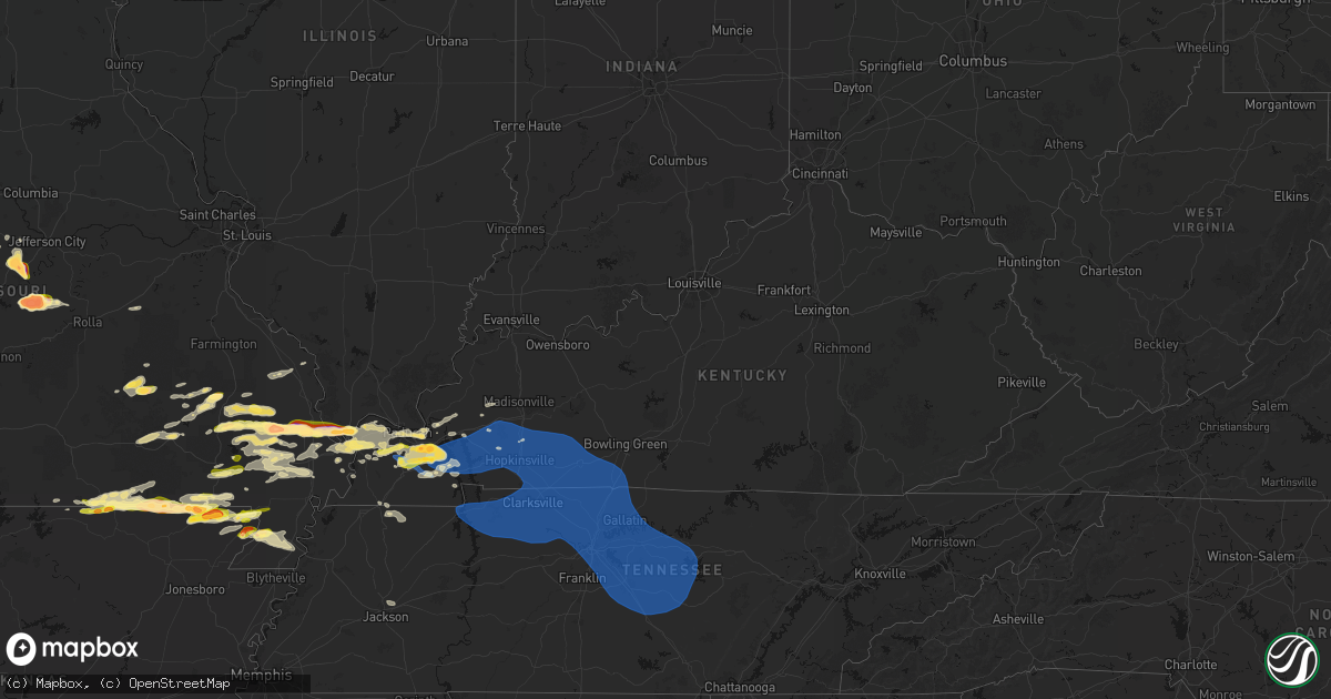
Hail Map in Kentucky on April 16, 2026
Get this storm
April 16 map
$229
one time, instant access
Download today. No call, no setup
Keep the $229
Bought the map and want the full workflow? Apply the entire $229 to a subscription within 7 days. None of it is wasted.
Every map, not just this one
This buys you this map. Subscription and you get every map we run, in the markets you choose from a few cities to whole states to nationwide. Plus real-time alerts the moment a storm fires.
Contact data
Name, contact info, occupancy, even credit band for addresses in the footprint. You go from where it hit to who to call.
Become the source they trust
Unlimited branding weather history reports on demand. You already have the documented answer ready for the property owner, and you are the one who showed up with it.
Property data and RoofTrace estimates
Pull up any address you have got, its value and the exact code rules for that jurisdiction, straight from One Click Code. Then RoofTrace estimates the squares, pitch, and roof value, priced the way you price.
Storm reports in Kentucky
Kentucky
| Date | Description |
|---|---|
| 04/16/20266:56 PM CDT | Roof ripped off a barn. Time estimated from radar. |
| 04/16/20266:47 PM CDT | Downed trees reported off newtown road. |
| 04/16/20266:45 PM CDT | Multiple trees and power lines down throughout southeast logan county. |
| 04/16/20266:30 PM CDT | Kentucky mesonet measured 59 mph gust. |
| 04/16/20266:20 PM CDT | Tree uprooted on silvey rd in hopkinsville ky. |
| 04/16/20266:08 PM CDT | *** 1 inj *** a tree was blown down onto a house on the 800 block of e 12th st. |
| 04/16/20266:08 PM CDT | Shingles blown off roof in hopkinsville. Winds on the bypass observed at 50-55 mph. Power poles knocked down in hopkinsville. |
| 04/16/20266:05 PM CDT | Roof blown off a garage. |
| 04/16/20265:45 PM CDT | Late report. Several trees reported down throughout trigg county. |
| 04/16/20265:45 PM CDT | Late report. Trees down in city of murray. |
| 04/16/20265:45 PM CDT | Late report. Tree down on sugar creek road. |
| 04/16/20265:37 PM CDT | Tree downed blocking the parking lot of hematite lake picnic area... With at least one vehicle trapped in the parking lot. |
| 04/16/20265:35 PM CDT | Tree down on grooms lane. |
| 04/16/20265:25 PM CDT | Tree down on friendship road. |
| 04/16/20265:25 PM CDT | Late report. Tree down in almo. |
| 04/16/20265:24 PM CDT | Downed tree at ky-303 and martin rd. |
| 04/16/20265:17 PM CDT | Trees down... Spotter estimated 60 mph wind. |
| 04/16/20265:13 PM CDT | A local report indicates 1.00 inch wind near 1 ENE Benton |
| 04/16/20265:10 PM CDT | A local report indicates 1.00 inch wind near 6 S Calvert City |
| 04/16/20265:05 PM CDT | Trees down on briensburg tatumsville road northeast of benton. |
| 04/16/20265:03 PM CDT | Late report. Some stones were egg size in palma community. |
| 04/16/20265:03 PM CDT | Late report. Tree down blocking road in grand rivers area. |
| 04/16/20265:02 PM CDT | Trees and power lines down in mayfield. |
| 04/16/20264:56 PM CDT | A local report indicates 1.00 inch wind near 5 SSW Calvert City |
| 04/16/20264:56 PM CDT | Tree in the roadway blocking part of ky-849. |
| 04/16/20264:55 PM CDT | Damage to siding and broken windows in sharpe. |
| 04/16/20264:53 PM CDT | A local report indicates 1.00 inch wind near Hickory |
| 04/16/20264:51 PM CDT | Powerlines down. |
| 04/16/20264:51 PM CDT | Very large tree downed... Completely blocking the road at ky-534 and carman rd. |
| 04/16/20264:50 PM CDT | A local report indicates 1.50 inch wind near 5 SE Reidland |
| 04/16/20264:46 PM CDT | A local report indicates 1.00 inch wind near 2 S Folsomdale |
| 04/16/20264:46 PM CDT | Tree down blocking part of the road. |
| 04/16/20264:43 PM CDT | A large tree was downed partially blocking the road at herman and sturgill. A second tree on sturgill rd was fully blocking the road. |
| 04/16/20264:31 PM CDT | Downed power lines blocked ky-339 between ky-121 and ky-1213. |
| 04/16/20264:31 PM CDT | Trees down. |
| 04/16/20264:26 PM CDT | Trees and powerlines down. |
| 04/16/20264:16 PM CDT | Hail dented the back porch wood. |
| 04/16/20264:11 PM CDT | A local report indicates 1.00 inch wind near Wickliffe |
| 04/16/20264:01 PM CDT | Powerlines down. |
| 04/16/20263:56 PM CDT | A local report indicates 1.00 inch wind near 3 WSW Melber |
| 04/15/20267:30 PM CDT | Tree down on power line on gayle way. |
| 04/15/20267:25 PM CDT | Large tree down over the 3000 block of sportsman lake road. |
| 04/15/20267:19 PM CDT | Tree down at the intersection of rapids road and grace road. Tree is blocking all lanes of traffic. |
| 04/15/20267:13 PM CDT | Very large tree down over the 900 block of rapids road. The tree is blocking all lanes of traffic. |
All States Impacted by Hail Map on April 16, 2026
Cities Impacted by Hail Map on April 16, 2026
- Salem, MO
- Bunker, MO
- Ellington, MO
- Bixby, MO
- Boss, MO
- Greenville, MO
- Caulfield, MO
- Bakersfield, MO
- Lesterville, MO
- Lowndes, MO
- West Plains, MO
- Koshkonong, MO
- Thayer, MO
- Gipsy, MO
- Zalma, MO
- Des Arc, MO
- Patterson, MO
- Mammoth Spring, AR
- Salem, AR
- Sturkie, AR
- Macks Creek, MO
- Couch, MO
- Iberia, MO
- Camp, AR
- Viola, AR
- Marble Hill, MO
- Ravenden, AR
- Myrtle, MO
- Advance, MO
- Warren, OH
- Cortland, OH
- Sturdivant, MO
- Crocker, MO
- Clubb, MO
- Marquand, MO
- Oran, MO
- Pocahontas, AR
- Warm Springs, AR
- Chaffee, MO
- Glenallen, MO
- Brownwood, MO
- Dixon, MO
- Ulman, MO
- Brumley, MO
- Winona, MO
- Patton, MO
- Sedgewickville, MO
- Vienna, OH
- Fowler, OH
- Gatewood, MO
- Fremont, MO
- Doniphan, MO
- Leopold, MO
- Daisy, MO
- Friedheim, MO
- Van Buren, MO
- Perryville, MO
- Benton, MO
- Scott City, MO
- Oak Ridge, MO
- Piedmont, MO
- Altenburg, MO
- Frohna, MO
- Kalamazoo, MI
- Galesburg, MI
- Portage, MI
- Brinktown, MO
- Charleston, MO
- Cairo, IL
- Miller City, IL
- Thebes, IL
- Olive Branch, IL
- Vulcan, MO
- Maynard, AR
- Success, AR
- Ellsinore, MO
- Silva, MO
- Wappapello, MO
- Naylor, MO
- Oxly, MO
- Leasburg, MO
- Cuba, MO
- Corning, AR
- Neelyville, MO
- Bloomfield, MO
- Dexter, MO
- Olean, MO
- Russellville, MO
- McGee, MO
- Vienna, MO
- Datto, AR
- Biggers, AR
- Sikeston, MO
- Bertrand, MO
- Mounds, IL
- Puxico, MO
- Essex, MO
- Barlow, KY
- La Center, KY
- Mound City, IL
- Knobel, AR
- Cunningham, KY
- Bardwell, KY
- Kevil, KY
- Pollard, AR
- Latham, MO
- Qulin, MO
- Annapolis, MO
- Wickliffe, KY
- Paducah, KY
- Melber, KY
- Eldon, MO
- Bell City, MO
- Boaz, KY
- Villa Ridge, IL
- California, MO
- Broseley, MO
- Poplar Bluff, MO
- Hickory, KY
- East Prairie, MO
- Piggott, AR
- West Paducah, KY
- Rector, AR
- Symsonia, KY
- Smithland, KY
- Mill Spring, MO
- Fredericktown, MO
- Calvert City, KY
- Centerville, MO
- Arlington, KY
- Benton, KY
- Mayfield, KY
- Campbell, MO
- Grand Rivers, KY
- Tiline, KY
- Redford, MO
- Fisk, MO
- Clinton, KY
- Brookport, IL
- Ledbetter, KY
- Eugene, MO
- Gilbertsville, KY
- Princeton, KY
- Marion, KY
- Salem, KY
- Kuttawa, KY
- Williamsville, MO
- Marathon, TX
- South Fulton, TN
- Martin, TN
- Fulton, KY
- Providence, KY
- Dawson Springs, KY
- Henley, MO
- Hardin, KY
- Dexter, KY
- Murray, KY
- Almo, KY
- Kirksey, KY
- Dudley, MO
- Fredonia, KY
- Nebo, KY
- Centertown, MO
- Lohman, MO
- Eddyville, KY
- Dresden, TN
- Palmersville, TN
- Woodgate, NY
- Forestport, NY
- Boonville, NY
- Fort Stockton, TX
- Cerulean, KY
- Snyder, TX
- Dryden, TX
- Crofton, KY
- Cadiz, KY
- Lafe, AR
- Hopkinsville, KY
- Gracey, KY
- Saint Charles, KY
- Nortonville, KY
- Pembroke, KY
- Trenton, KY
- Elkton, KY
- Cold Brook, NY
- Hoffmeister, NY
- Sanderson, TX
- Greenway, AR
- Matthews, MO
- Bernie, MO
- Oak Grove, KY
- Clarksville, TN
- Greenville, KY
- Lewisburg, KY
- Belton, KY
- Dunmor, KY
- White Plains, KY
- Guthrie, KY
- Russellville, KY
- Sharon Grove, KY
- Olmstead, KY
- Allensville, KY
- Springfield, TN
- Cedar Hill, TN
- Ashland City, TN
- Pleasant View, TN
- Adairville, KY
- Chapmansboro, TN
- Adams, TN
- Charlotte, TN
- Camden, TN
- Cumberland Furnace, TN
- Westport, TN
- Erin, TN
- Cumberland City, TN
- Holladay, TN
- McEwen, TN
- Cunningham, TN
- Hurricane Mills, TN
- White Bluff, TN
- Southside, TN
- New Johnsonville, TN
- Waverly, TN
- Dickson, TN
- Vanleer, TN
- Indian Mound, TN
- Dover, TN
- Woodlawn, TN
- Palmyra, TN
- Stewart, TN
- Buchanan, TN
- Tennessee Ridge, TN
- Big Rock, TN
- Fort Campbell, KY
- Big Sandy, TN
- Joelton, TN
- Auburn, KY
- Piseco, NY
- Lake Pleasant, NY
- Speculator, NY
- Canalou, MO
- Kennett, MO
- Holcomb, MO
- Franklin, KY
- Cross Plains, TN
- Greenbrier, TN
- Portland, TN
- Orlinda, TN
- Bragg City, MO
- White House, TN
- Goodlettsville, TN
- Parma, MO
- Gibson, MO
- Nashville, TN
- Hayti, MO
- Steele, MO
- Hermitage, TN
- Bethpage, TN
- Whites Creek, TN
- Franklin, TN
- Antioch, TN
- Smyrna, TN
- La Vergne, TN
- Mount Juliet, TN
- Madison, TN
- Castalian Springs, TN
- Hendersonville, TN
- Arrington, TN
- Nolensville, TN
- Lebanon, TN
- Old Hickory, TN
- Cottontown, TN
- Brentwood, TN
- Gallatin, TN
- Caruthersville, MO
- Warren, VT
- Granville, VT
- Bradyville, TN
- Beechgrove, TN
- Auburntown, TN
- Christiana, TN
- Milton, TN
- Gordonsville, TN
- Watertown, TN
- Alexandria, TN
- Readyville, TN
- Woodbury, TN
- Carthage, TN
- Rockvale, TN
- Brush Creek, TN
- Riddleton, TN
- Murfreesboro, TN
- Hickman, TN
- College Grove, TN
- Hartsville, TN
- Liberty, TN
- Lascassas, TN
- Bell Buckle, TN
- Eagleville, TN
- Randolph, VT
- Brookfield, VT
- Williamstown, VT
- Northfield, VT
- Roxbury, VT
- Johnstown, NY
- Gloversville, NY
- Mayfield, NY
- Waitsfield, VT
- Washington, VT
- West Topsham, VT
- Topsham, VT
- Barre, VT
- East Barre, VT
- Graniteville, VT
- Corinth, VT
- Chelsea, VT
- Mcminnville, TN
- Manchester, TN
- Buffalo Valley, TN
- Chestnut Mound, TN
- Lancaster, TN
- Smithville, TN
- Elmwood, TN
- Baxter, TN
- Morrison, TN
- Silver Point, TN
- Dowelltown, TN
- East Corinth, VT
- Newbury, VT
- Wells River, VT
- Bradford, VT
- Pike, NH
- Haverhill, NH
- North Haverhill, NH
- Oakfield, TN
- Jackson, TN
- Alton, MO
- Bath, NH
- South Ryegate, VT
- Woodsville, NH
- Groton, VT
- Milan, NH
- Cornish, NH
- Scotts, MI
- Lisbon, NH
- Caroga Lake, NY
- Broadalbin, NY
- Saint Francis, AR
- Clarkton, MO
- Woodburn, KY
- Westmoreland, TN
- Fancy Farm, KY
- North Stratford, NH
- Groveton, NH
- Northville, NY
- Warrenton, MO
- Troy, MO


