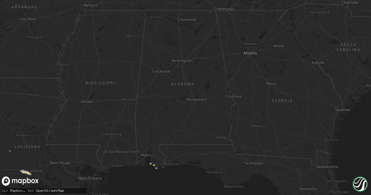
Hail Map in Alabama on April 15, 2021
Get this storm
April 15 map
$229
one time, instant access
Download today. No call, no setup
Keep the $229
Bought the map and want the full workflow? Apply the entire $229 to a subscription within 7 days. None of it is wasted.
Every map, not just this one
This buys you this map. Subscription and you get every map we run, in the markets you choose from a few cities to whole states to nationwide. Plus real-time alerts the moment a storm fires.
Contact data
Name, contact info, occupancy, even credit band for addresses in the footprint. You go from where it hit to who to call.
Become the source they trust
Unlimited branding weather history reports on demand. You already have the documented answer ready for the property owner, and you are the one who showed up with it.
Property data and RoofTrace estimates
Pull up any address you have got, its value and the exact code rules for that jurisdiction, straight from One Click Code. Then RoofTrace estimates the squares, pitch, and roof value, priced the way you price.
Storm reports in Alabama
Alabama
| Date | Description |
|---|---|
| 04/15/20217:56 AM CDT | Corrects previous hail report from 2 wsw foley. Report of quarter-size hail in southwest foley. Time and location given by local police. |
| 04/14/202111:44 PM CDT | At 444 AM CDT, severe thunderstorms were located along a line extending from near Hickory Hills to near Gautier to 13 miles southwest of Gulf Park Estates, moving east at 30 mph. HAZARD...60 mph wind gusts and quarter size hail. SOURCE...Radar indicated. IMPACT...Hail damage to vehicles is expected. Expect wind damage to roofs, siding, and trees. Locations impacted include... Ocean Springs, Moss Point, Escatawpa, Gautier, Helena, Vancleave, Hickory Hills and Gulf Park Estates. |
| 04/14/202110:48 PM CDT | At 347 AM CDT, a severe thunderstorm was located 6 miles south of Coden, or 7 miles south of Bayou La Batre, moving east at 30 mph. HAZARD...Quarter size hail. SOURCE...Radar indicated. IMPACT...Damage to vehicles is expected. Locations impacted include... Dauphin Island and Fort Morgan. |
Cities Impacted by Hail Map on April 15, 2021
- May, TX
- Brownwood, TX
- Early, TX
- Fluvanna, TX
- Snyder, TX
- Elgin, TX
- Leander, TX
- Round Rock, TX
- Georgetown, TX
- Cedar Park, TX
- Llano, TX
- Fredericksburg, TX
- Mason, TX
- Pflugerville, TX
- Manor, TX
- Coleman, TX
- Talpa, TX
- Santa Anna, TX
- Melvin, TX
- Lohn, TX
- Brady, TX
- Menard, TX
- Cherokee, TX
- Junction, TX
- Roosevelt, TX
- Sonora, TX
- Brenham, TX
- Albany, TX
- Taylor, TX
- Granger, TX
- Uvalde, TX
- Vancourt, TX
- San Angelo, TX
- Christoval, TX
- Miles, TX
- Mereta, TX
- Foley, AL
- Bertram, TX
- Liberty Hill, TX
- Eldorado, TX
- McDade, TX
- Austin, TX
- Coupland, TX
- Burnet, TX
- Salado, TX
- Dime Box, TX
- Brackettville, TX
- Jarrell, TX
- Comanche, TX
- Rising Star, TX
- Gouldbusk, TX
- Caldwell, TX
- Del Rio, TX
- Tomball, TX
- Porter, TX
- Waller, TX
- Hockley, TX
- Spring, TX
- Magnolia, TX
- Hempstead, TX
- Pinehurst, TX
- Conroe, TX
- Navasota, TX
- Ballinger, TX
- Santo, TX
- Rocksprings, TX
- Chappell Hill, TX
- Lampasas, TX
- Rayne, LA
- Estherwood, LA
- Crowley, LA
- Kaplan, LA
- Maurice, LA
- Morse, LA
- Marble Falls, TX
- Brookesmith, TX
- San Saba, TX
- Eola, TX
- Rochelle, TX
- Call, TX
- Livingston, TX
- Hillister, TX
- Warren, TX
- Woodville, TX
- Singer, LA
- Bon Wier, TX
- Kirbyville, TX
- Fred, TX
- Merryville, LA
- Spurger, TX
- Starks, LA
- Hutto, TX
- Tow, TX
- Kingsland, TX
- Bastrop, TX
- Richland Springs, TX
- Paige, TX
- Bluffton, TX
- Florence, TX
- Rockwood, TX
- Rockdale, TX
- Ledbetter, TX
- Burton, TX
- Carmine, TX
- Fairhope, AL
- Lueders, TX
- Breckenridge, TX
- Mullin, TX
- Priddy, TX
- Buchanan Dam, TX
- Thrall, TX
- Caddo, TX
- Avoca, TX
- Briggs, TX
- Killeen, TX
- Bartlett, TX
- Lincoln, TX
- Giddings, TX
- Zephyr, TX
- Egan, LA
- Stamford, TX
- Justiceburg, TX
- Thorndale, TX
- Gulf Shores, AL
- Bangs, TX
- Somerville, TX
- Gustine, TX
- Snook, TX
- Hamilton, TX
- Pottsville, TX
- Hext, TX
- Blanket, TX
- Lexington, TX
- Jayton, TX
- Colmesneil, TX
- Dequincy, LA
- Pitkin, LA
- Grant, LA
- Paint Rock, TX
- Goldthwaite, TX


